E-biking a bit of the historic Dawson Overland Trail
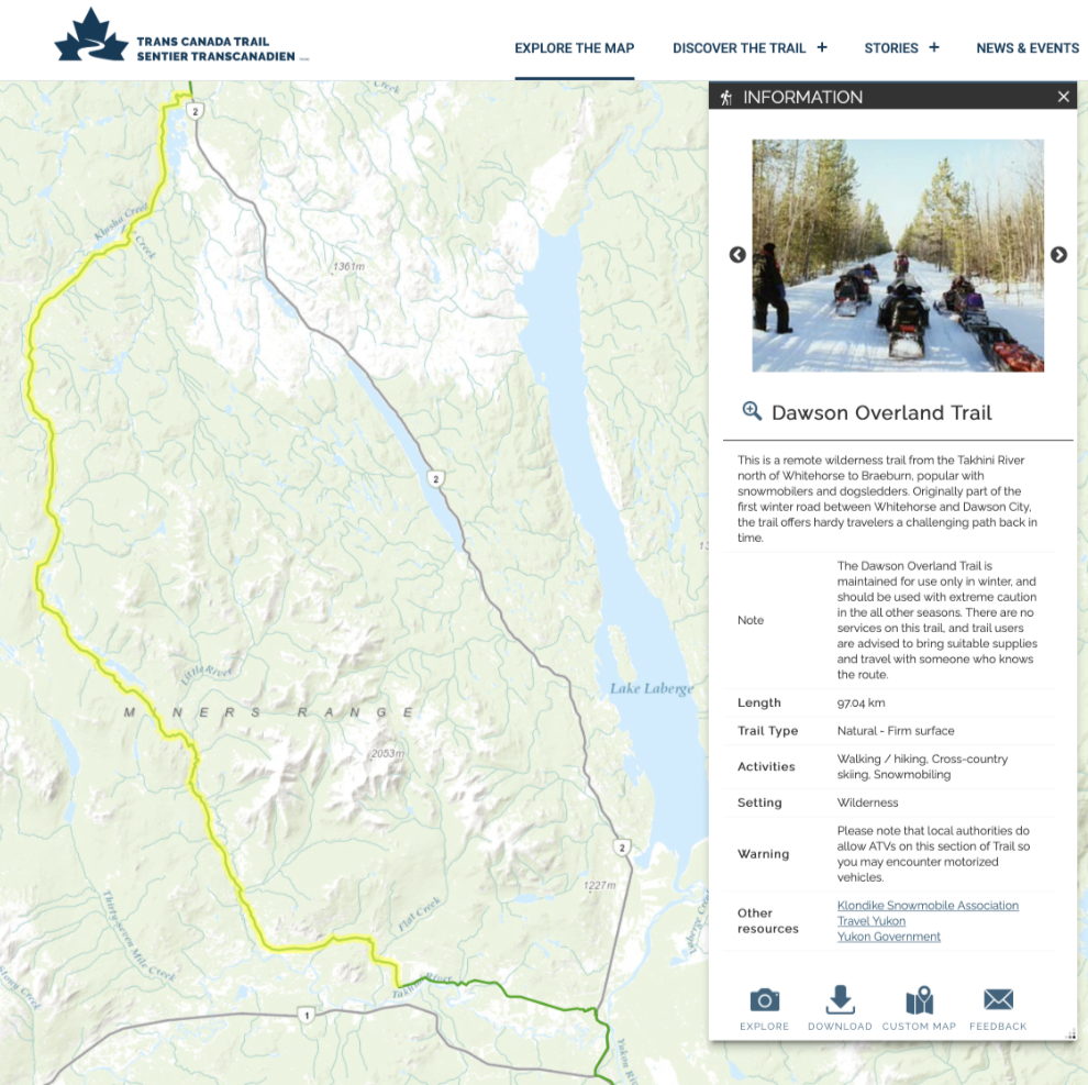
I did a fairly major adventure with the e-bike yesterday, riding 31.5 km on the historic Dawson Overland Trail north of Whitehorse. Built in 1902, this was the winter road to Dawson, used when the Yukon River froze – see “The Whitehorse to Dawson Overland Trail” by Ken Spotswood. It’s now part of the Trans Canada Trail, and despite the obvious attraction for someone like me, I don’t think I’ve ever seen a positive review on it from a summer trip. The Trans Canada Trail website offers these warnings: “This is a remote wilderness trail from the Takhini River north of Whitehorse to Braeburn, popular with snowmobilers and dogsledders. Originally part of the first winter road between Whitehorse and Dawson City, the trail offers hardy travelers a challenging path back in time. The Dawson Overtand Trail is maintained for use only in winter, and should be used with extreme caution in all other seasons. There are no services on this trail and trail users are advised to bring suitable supplies and travel with someone who knows the route.”
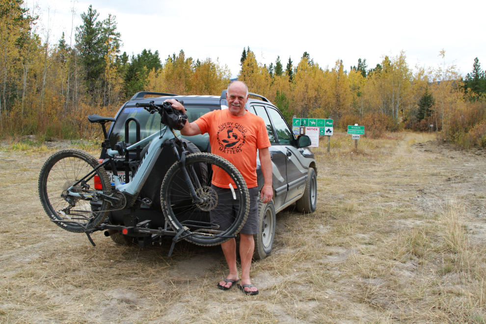
I had a nap after a good breakfast and then it took a while to get my gear together, the bike rack mounted on the Tracker, and the bike loaded, but by noon I was westbound on the Alaska Highway, with adventure ahead.
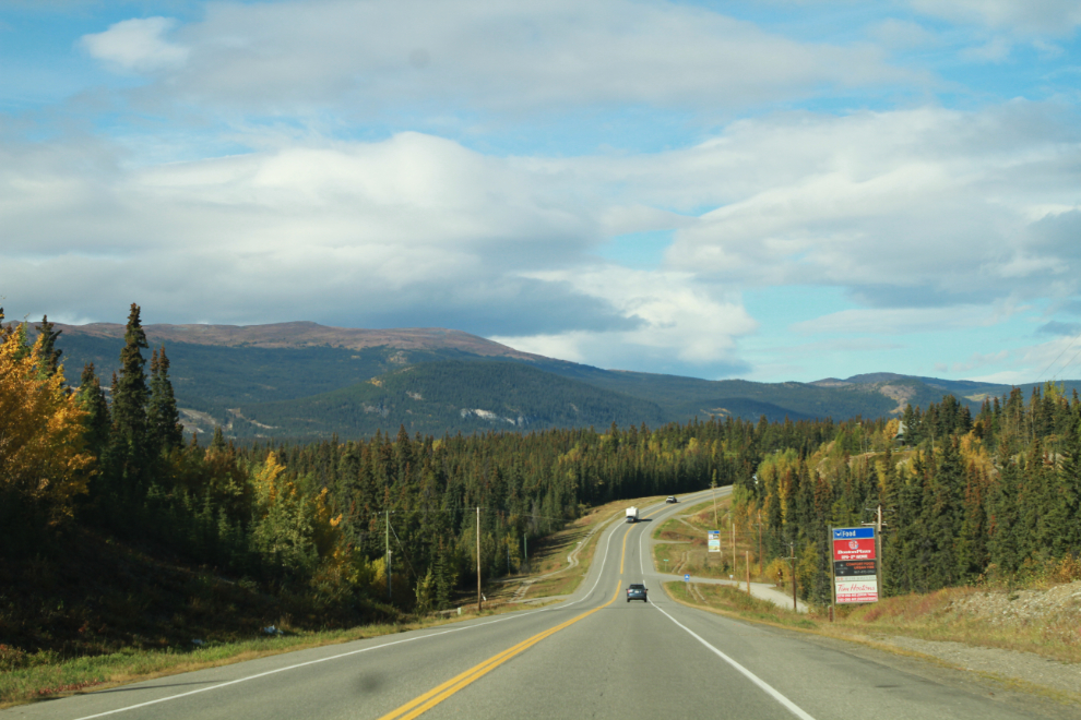
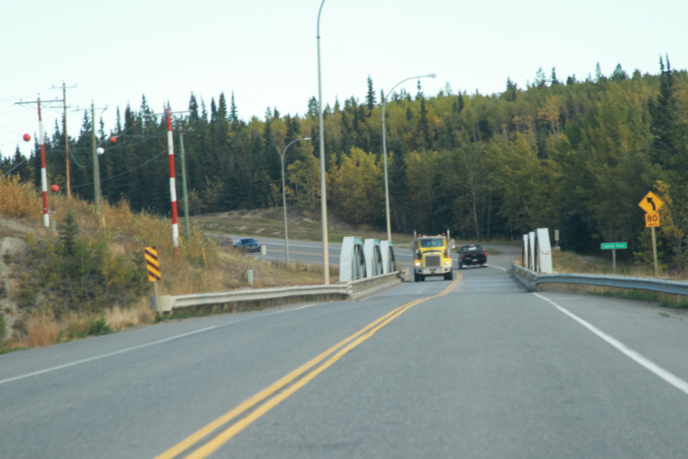
Less than 20 minutes later, I turned north on the North Klondike Highway, which is today’s equivalent of the Overland Trail. Originally the road only went to Mayo, and it’s still called the Mayo Road by many locals. It was completed through to Dawson in 1953, and officially became part of the Klondike Highway runing south from Whitehorse (eventually to Skagway) on April 19, 1966. The next photo shows the bridge over the Takhini River.
Next, the Takhini Hot Springs Road took me further west. The Yukon Wildlife Preserve is on this road, so we see it fairly regularly.
Finally, just before the hot springs, I turned onto the gravel Takhini River Road, and followed it along the river to the end.

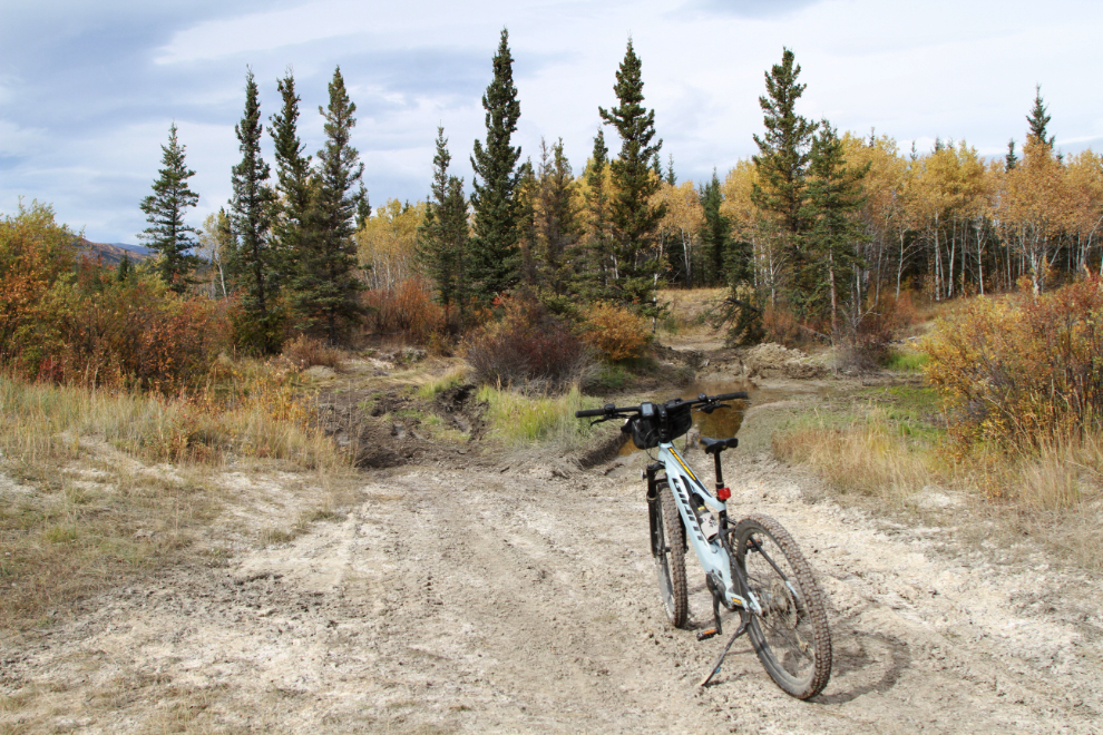
I drove past the start of the Dawson Overland Trail, and could see it paralleling the road, but kept going just for a quick look. It looked like a very pleasant ride whatever happened past that point, so went back and unloaded the bike.
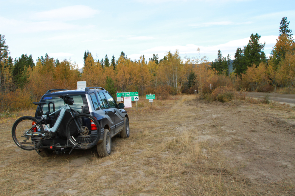
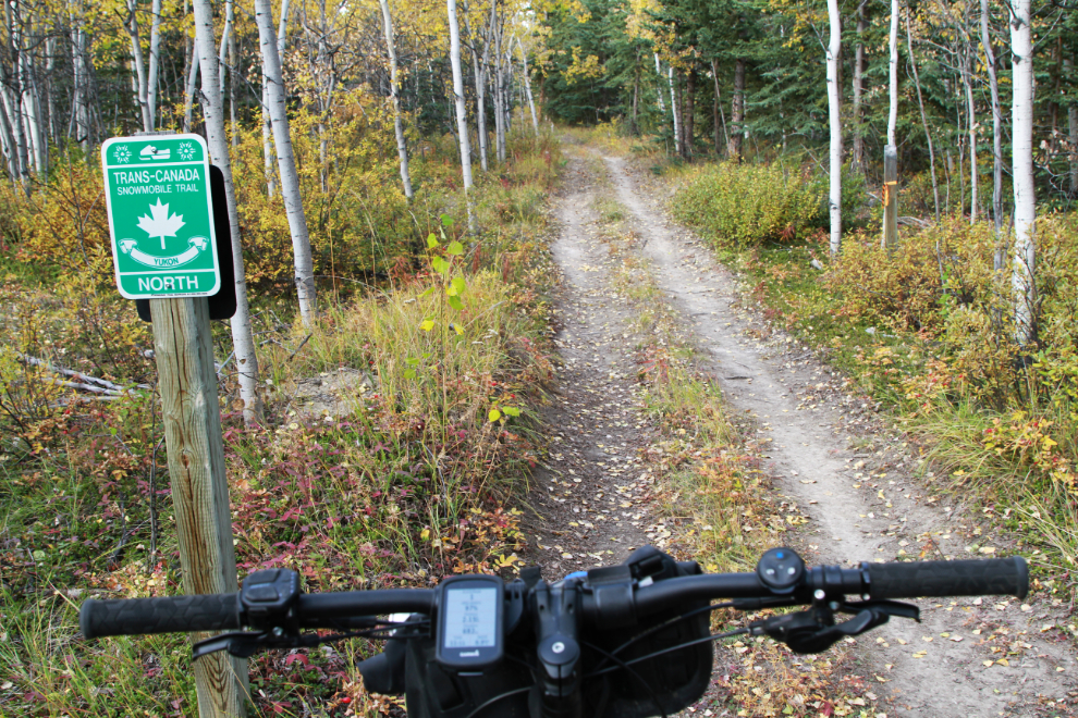
At 1:05, I was on my way north, with no particular destination or turn-around point in mind. This was very much a “let’s see what happens” outing.
Km 1.0.
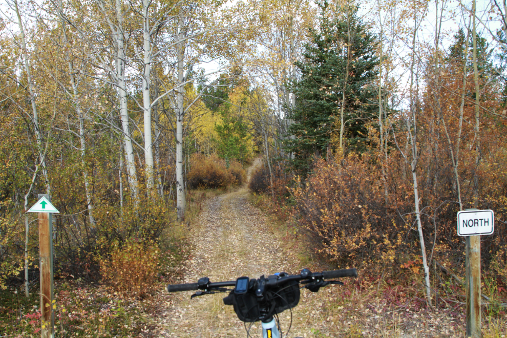
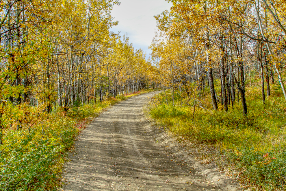
Km 2.0 – it was a very pleasant ride, as it had appeared it would be.
A minute later, this sign confirmed that the trail is intended primarily as a snowmobile trail.
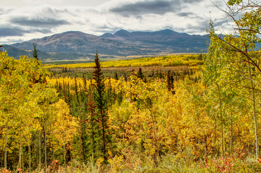
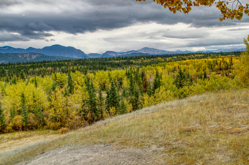
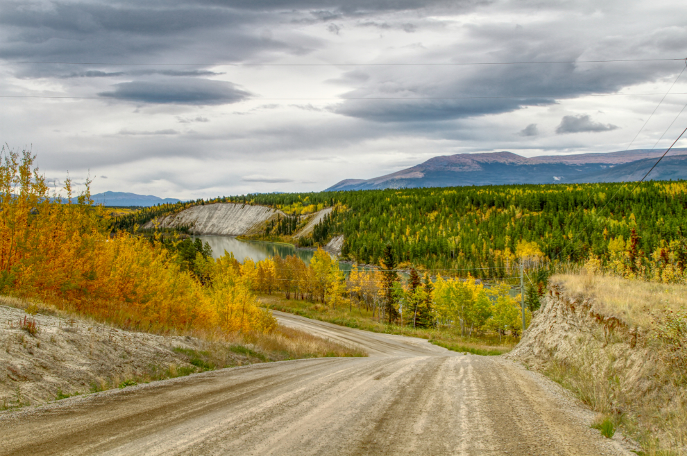
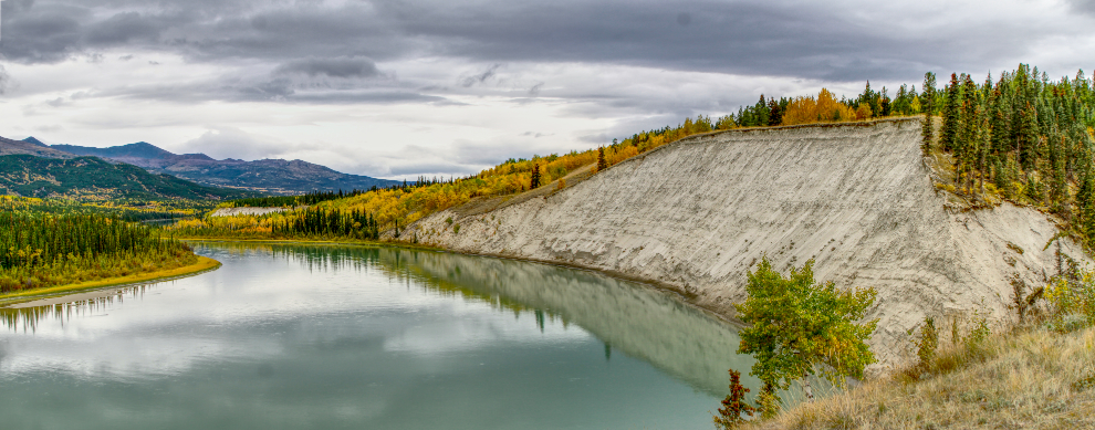
At Km 2.8 this view over the Takhini River Valley opened up to the west. Wow, what amazing colours!
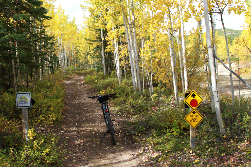
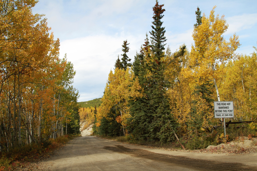
Fifteen minutes from the car I reached the end of the maintained part of Takhini River Road, and the trail moved over to the unmaintained part of the road.
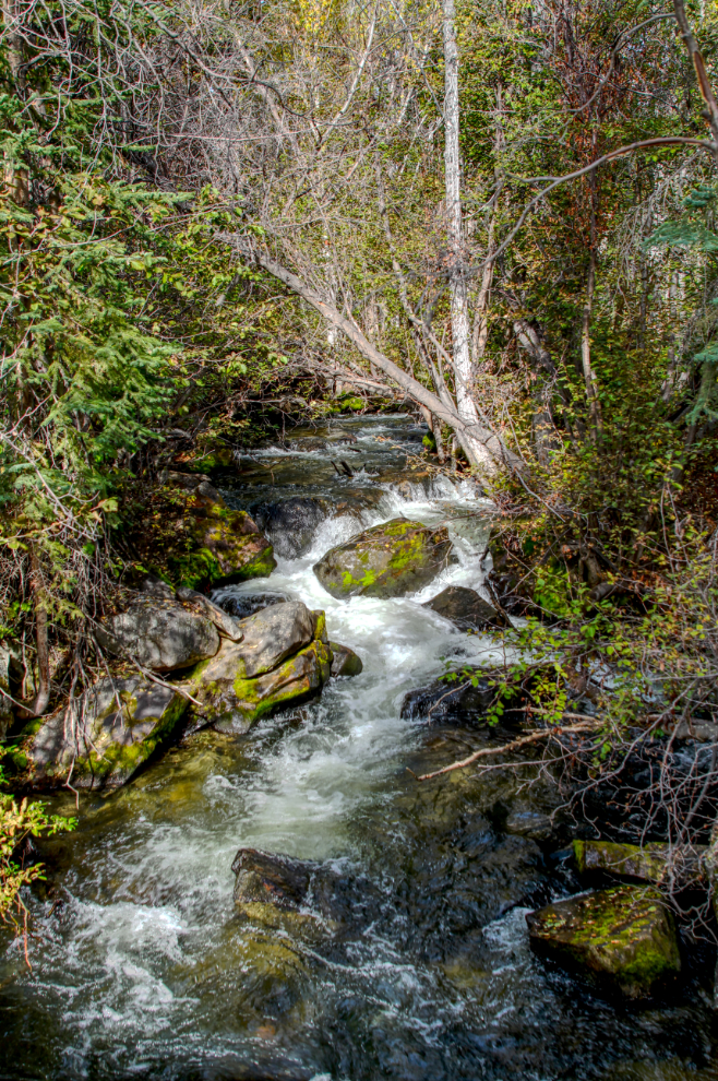
I don’t know what the name of this creek is (if it has one), but I was amused by the “narrow bridge” sign. Being narrow is one of the least of its issues 🙂
The creek itself is lovely, though.
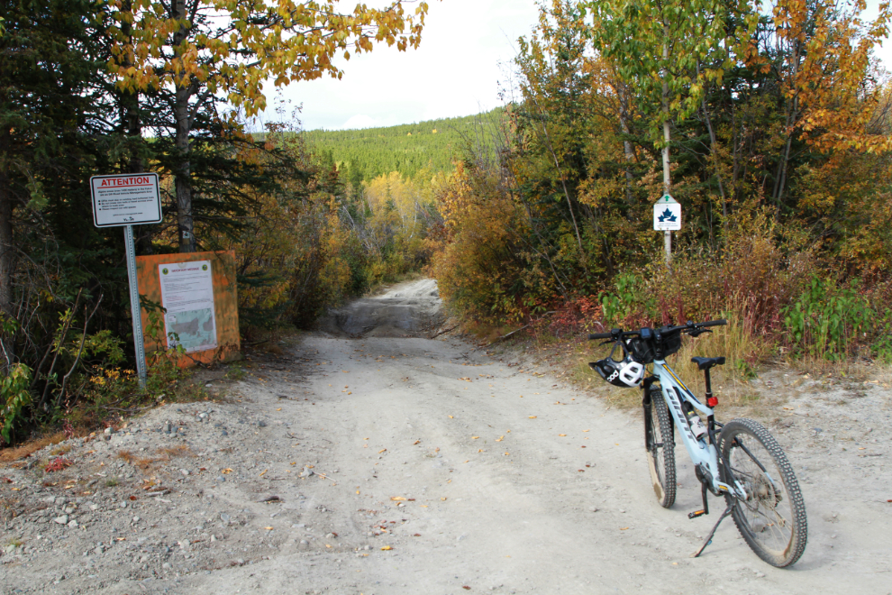
At 1:25 I came to a junction that seemed to indicate that the trail was now entering the real wilderness. The large sign begins “Dear Yukoner, Due to COVID-19 regulations, Ta’an Kwach’an Council (TKC) lands staff continue to record a significant increase in the number of people utilizing Settlement Lands for recreational purposes. Because Whitehorse serves as a busy hub for Yukoners, the First Nation government is concerned about the negative impacts further use will have on these important areas.” It goes on to identify issues including vandalism, habitat degradation, littering, etc. 🙁
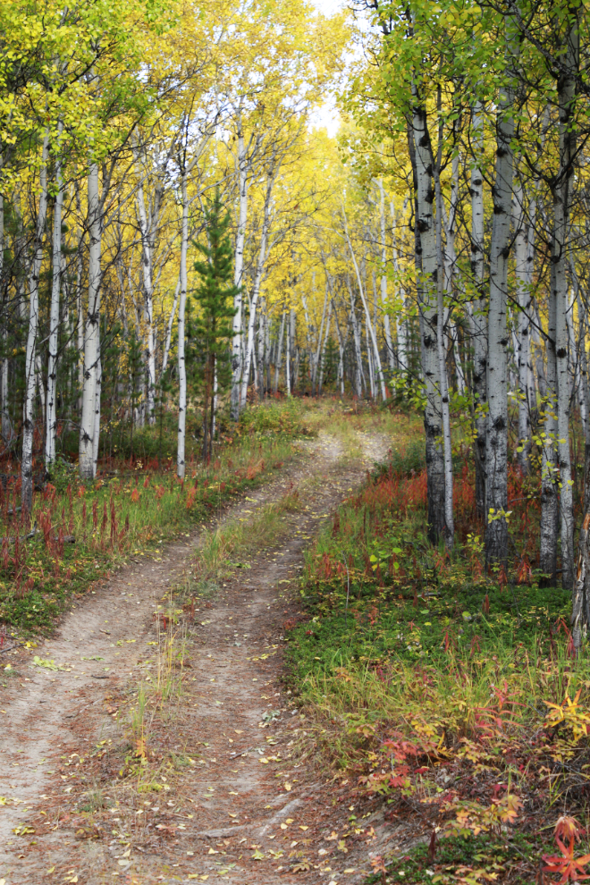
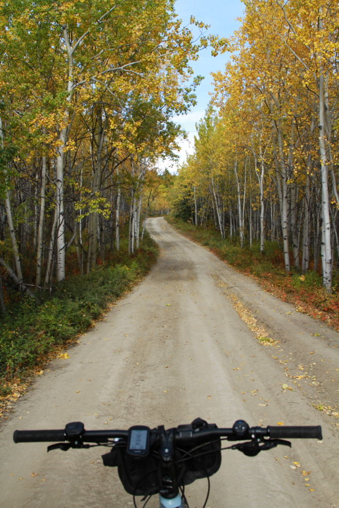
Most of the trail/road now offered extremely nice riding. At this point I was only 4.0 km from the car.
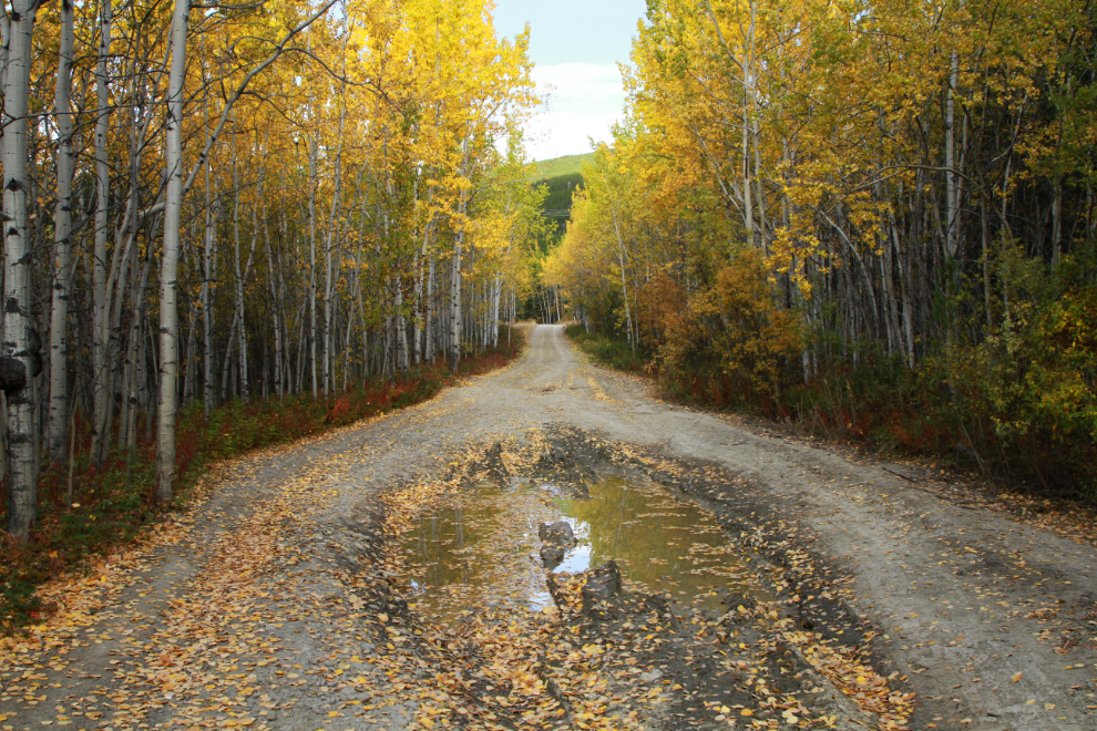
Occasional puddles littered with Fall leaves just added to the attractiveness of the road.
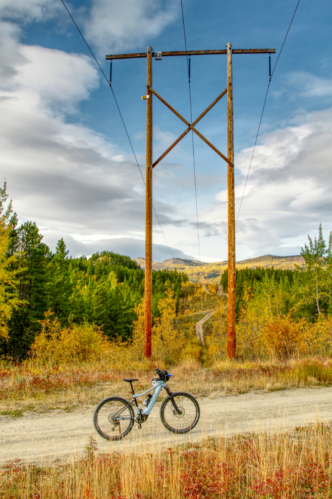
Right at Km 5 I crossed under a power line, and it became clear that there are a lot of roads cross-crossing the country. I expect that the majority of them were originally to access wood-cutting areas.
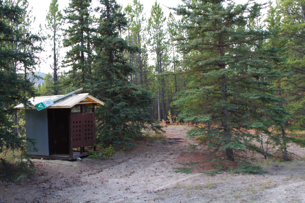
The Klondike Snowmobile Association built and maintains a very nice wilderness camping area at Km 5.85.
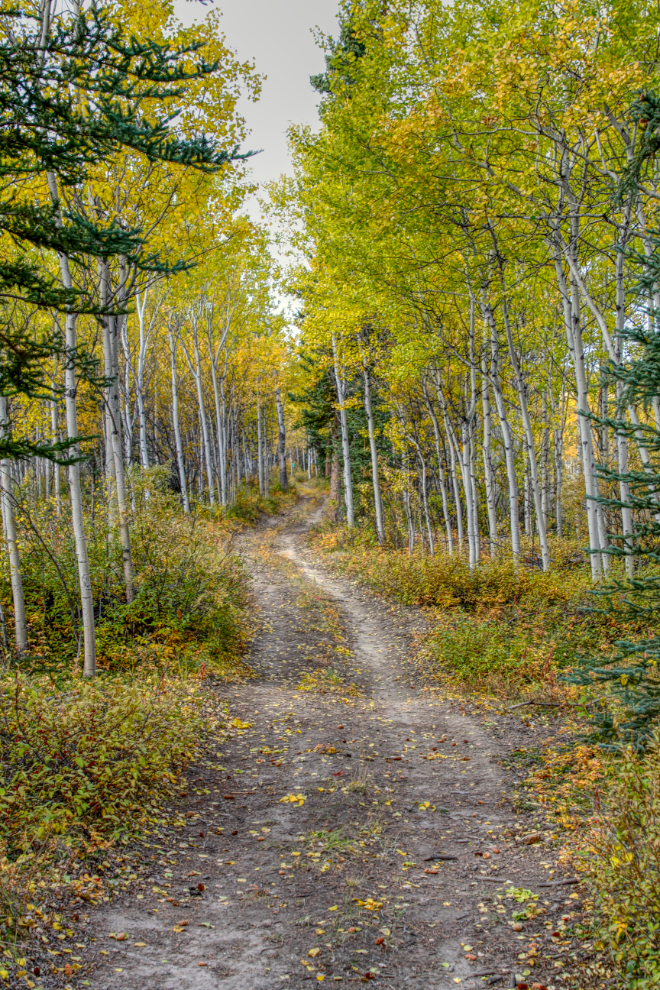
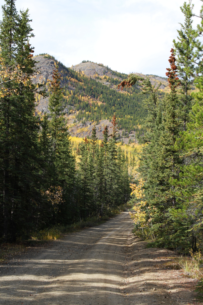
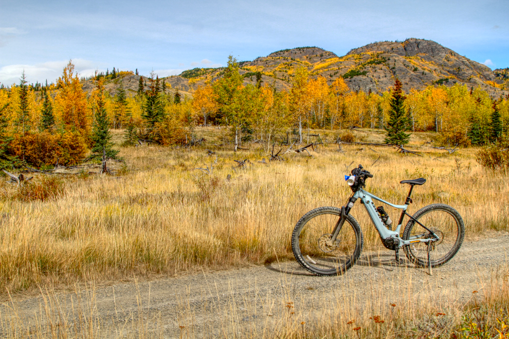
By the time I shot the next photo at Km 8.3 the trail was running through exceptionally nice country. I was still only 45 minutes from the car.
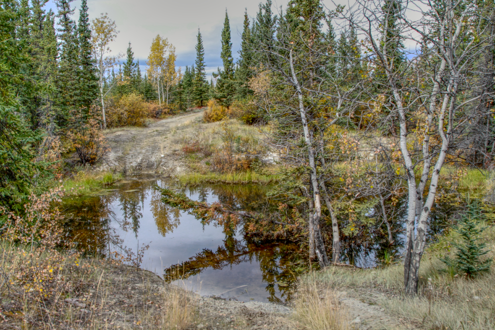
At Km 8.65 I came to a “water hazard.” I was wearing my usual sport sandals, so walking through a few inches of water was no problem.
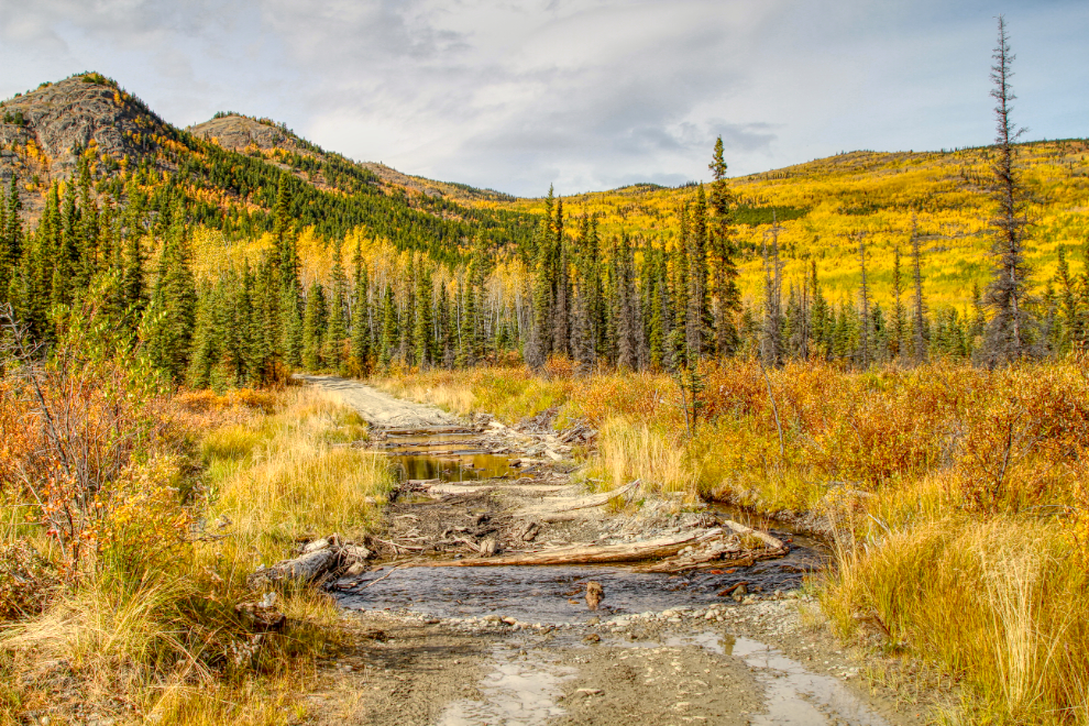
A beaver dam immediately to the right of the road held back a pond that provided very nice reflections of the Fall colours.
Fall riding really doesn’t get much better than this. With the temperature ranging from 12-14°C/54-57°F I was wearing a tshirt and shorts, having stuck my vest in my pack long ago.
At Km 13 I was well into the area burned by a massive wildfire in 1958 – now, 66 years later, it seems unlikely that the pine/spruce forest will ever return.
Five minutes later a very well-used trail off to the west led me to this view. I’m extremely careful with side trails now, as my brain issues make the danger of getting lost very real.
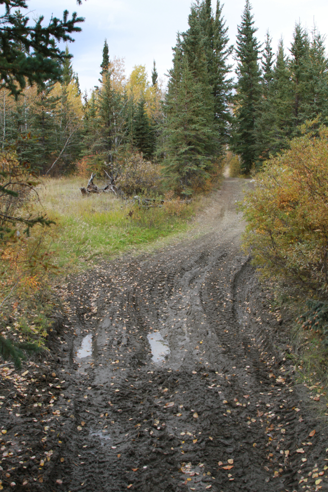
At about Km 15 the terrain started to change quite dramatically, with thermokarst ponds causing increasingly-common problems with the trail. While new trails have been cut around all the problems, some are quite rough and/or muddy.
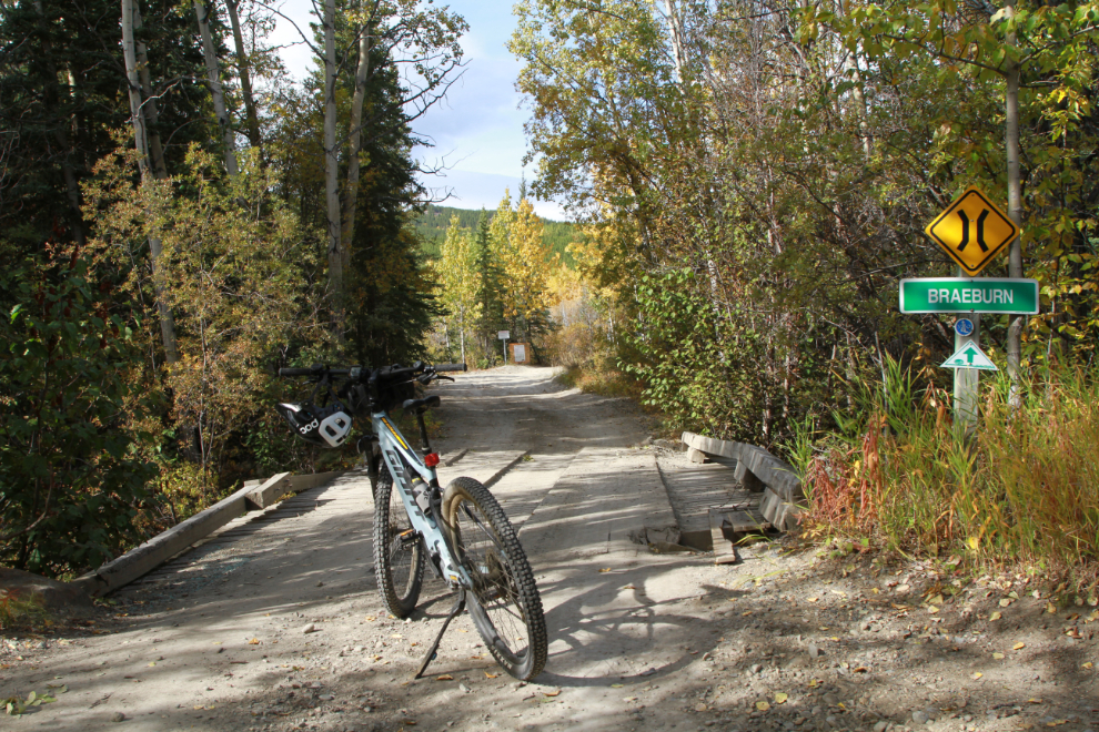
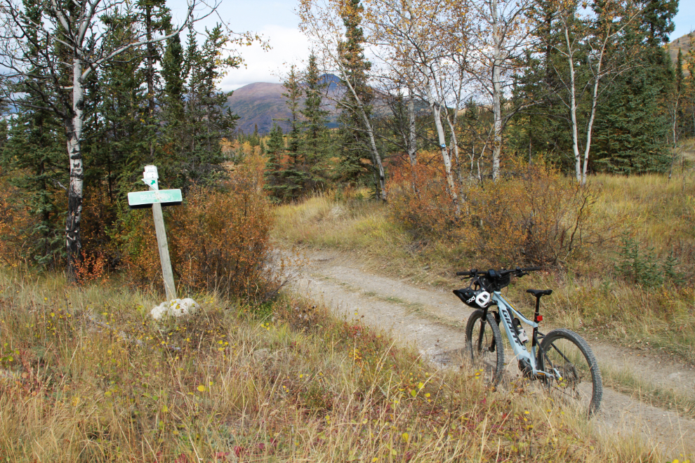
A fork in the trail at Km 15.6 – Braeburn Lodge on the North Klondike Highway is about 82 wilderness kilometers ahead.
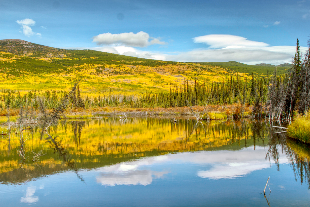
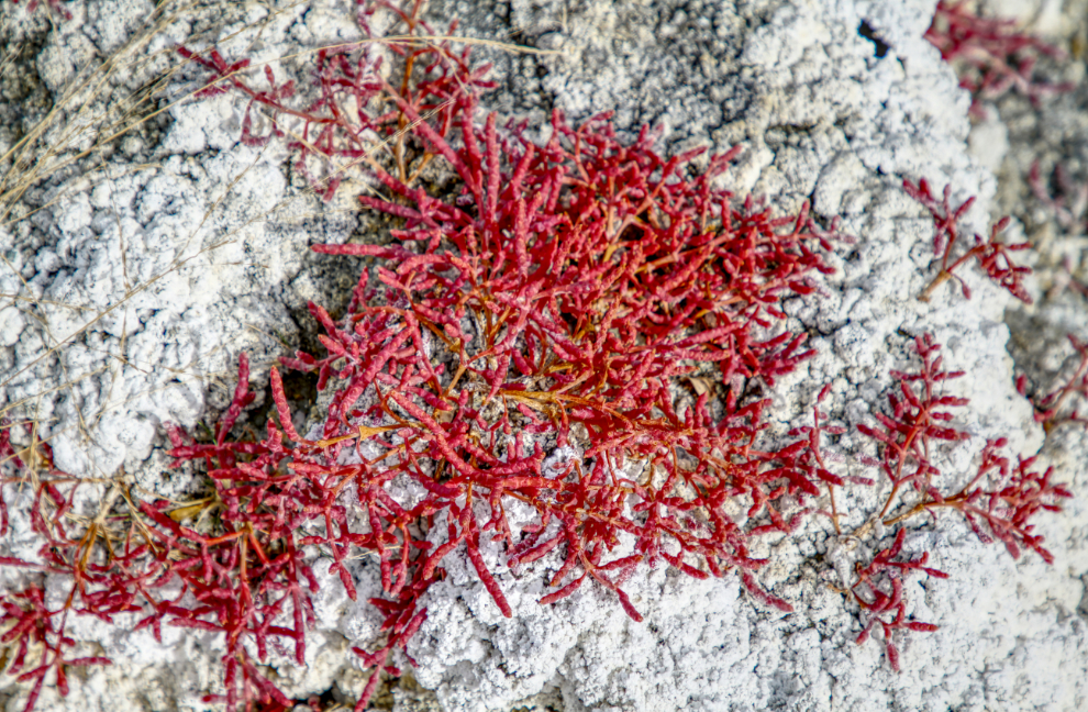
A couple of hundred meters past that last sign I came to a salt pond that added greatly to the colour of the scene. A similar one along the Alaska Highway, known as the Takhini Salt Flats, is well known to locals.
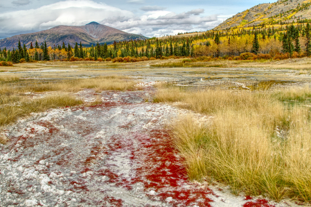
The sea asparagus or red samphire is an intriguing edible plant, though I haven’t tried it yet.
By 2:30 (Km 16.0) the trail was getting much tougher and I was thinking about turning around.
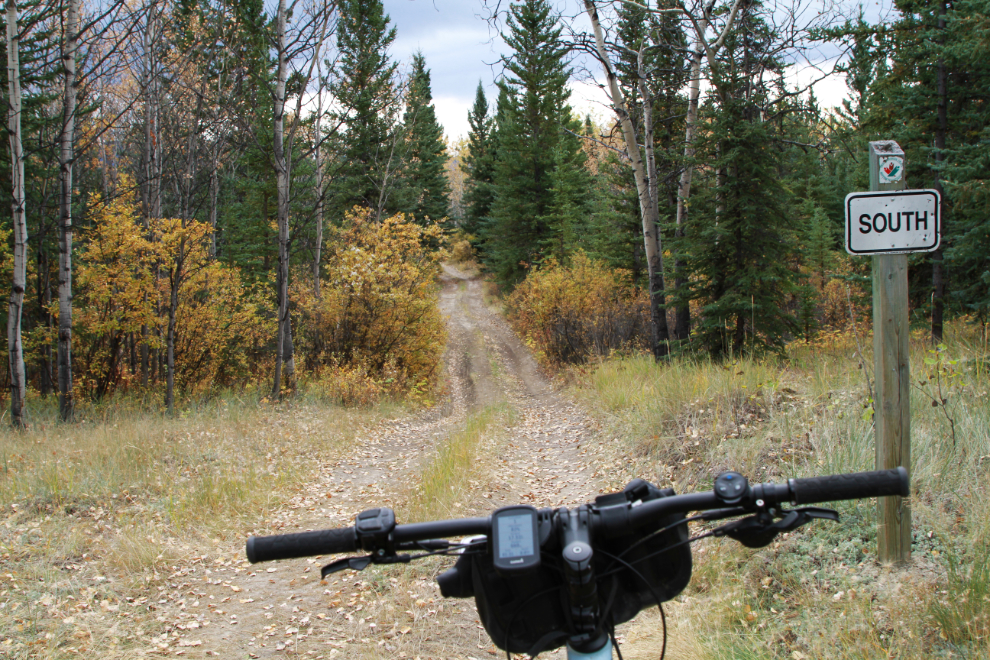
Just a couple of minutes later, it appeared that things would keep getting worse so this was the end of my exploration route.
Yes, I was tired, and South was a good direction to be going 🙂
I didn’t take any photos during the return ride. Seeing several piles of grizzly bear scat that I’m sure hadn’t been there an hour before may had sped up my ride a little as well!
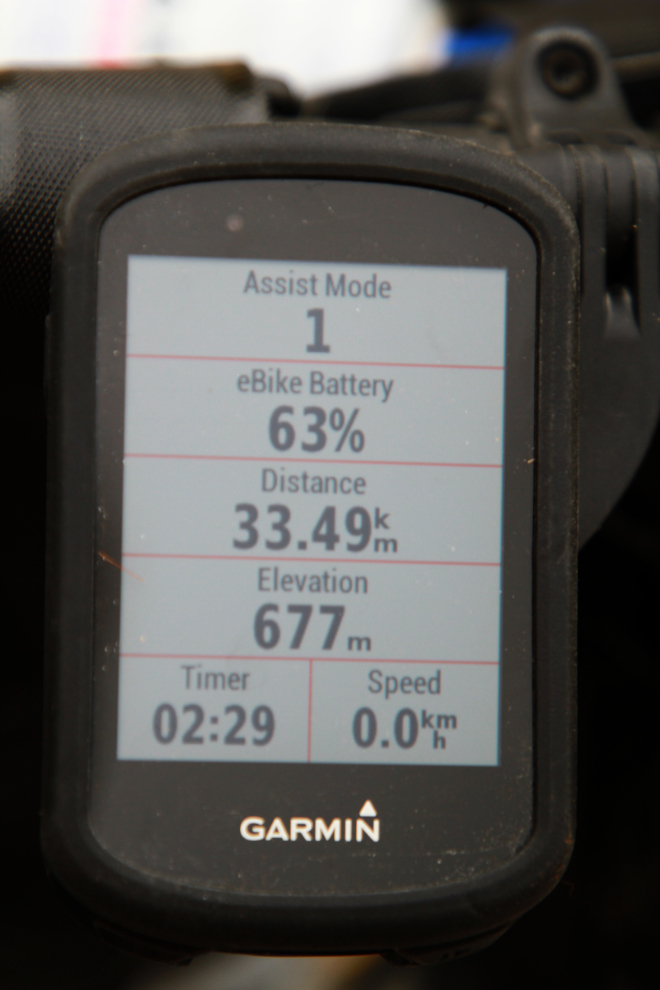
At 3:35 I was back at the car. My bike computer read 33.5 km when I finished, and I had 63% battery left. That means with careful power assist use as I did today (riding with only a level 1 power assist 99% of the time), the bike has a range of about 90 km – far more than I expected, so new opportunities have opened up.
A victory selfie – time to get home for a beer. For a trail that pretty much nobody talks about, I was very impressed. Although I’d love to see the whole thing, I know that will never happen. I may, though, come in from the Braeburn end and see what it looks like.
There were a couple of views along the Takhini River that I couldn’t resist, but I was home just after 4:00. I had a quick celebratory beer and was soon in bed.
Murry,
So pleased for you to be out on the trails in your backyard. Your photos have captured some stunning colours and beautiful fall scenes. Thank you for taking us along for the ride!
Hi Murray! The bridge at the south end of the trail is Flat Creek. I’ve biked this trail many times in the winter but only once in the fall and it was maybe 15 years ago. From what I remember the south end and the Little River area in particular was the worst for mud and water. The north end had some water crossings but was otherwise better riding for the most part.
Thanks very much, Anthony.
What a great little adventure, some wonderful photos… of course fall is far advanced for you lucky folks in the Yukon and beyond. That e-bike sure opens up a lot of possibilities for day trips, doesn’t it! Other than your new can of bear spray and some water, snacks, what all do you carry with you to get through any weather issues, or bike issues??
Loved the journey! Thanks for taking us along.
I always come here for my first glimpse of fall. I love those brilliant yellow aspens. Your header was especially good this time around (gone now). As always, thank you for this beautiful trip.
That looks like such a great ride! I have noticed with our batteries that they stay high for awhile but the last half drops faster than the first. Not sure why that is.
I’m going to do a much longer battery test as soon as we get another sunny day. I know the gas tank in the motorhome goes down dramatically faster on the bottom “half” (which clearly isn’t anywhere close to half).
Nice ride!
Comment thank yo7 for taking us on that trip, if it wa#nt for you we would never see that part.