Day 5: Wandering through Idaho and Montana
Travel excites me. Especially largely-unplanned travel – I love not knowing what’s around the next corner, and being able to take detours on a whim. Tuesday was one of those days – not spectacular, but very special.
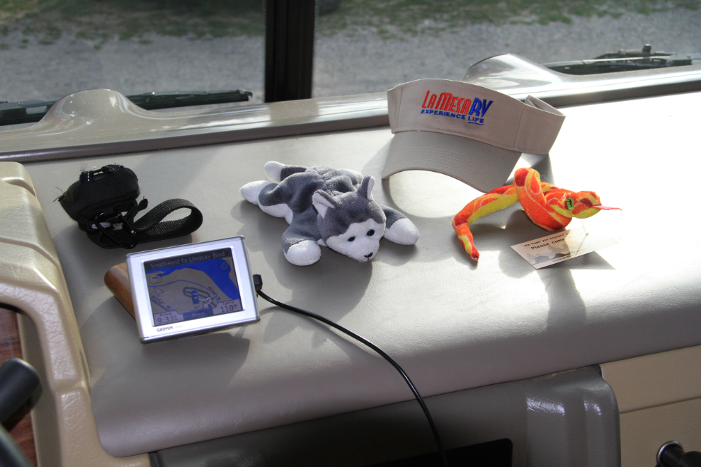
The well-equipped motorhome dash had an addition this morning, with a souvenir from the Snake River RV Park added to the Spot, the GPS, my faithful lead dog Nanook, and a visor 🙂 I slept like the dead the night before, and didn’t get back on the road until 07:30.
“Back on the road” had already gotten a change in meaning – rather than the fast way on I-15, I decided to go northeast on Route 20 for a peek at Yellowstone. Just a quick one, mind you 🙂
Yesterday it was an Alaska moving truck, today it was a Yukon sign (okay, they misspelled it but that’s okay) 🙂
I stopped a few times around Ashton to take photos.
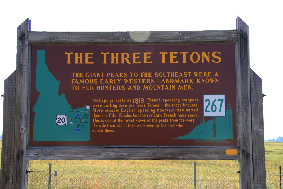
Barely visible through wildfire haze, the mountain range that includes The Three Tetons – originally Trois Tetons in French – meaning three breasts.
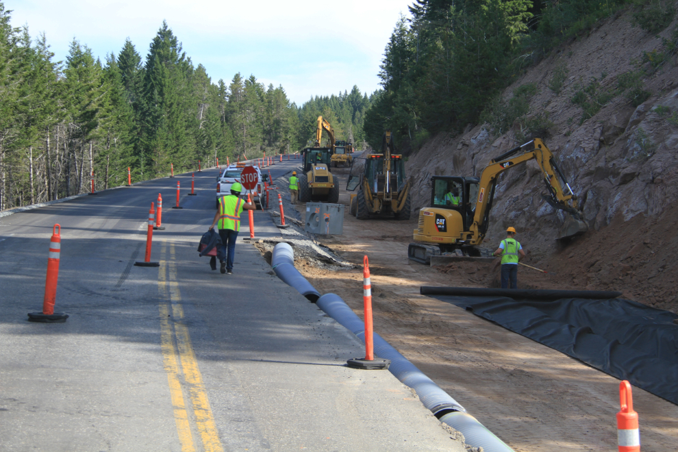
Just north of Ashton, I got delayed a bit by construction.
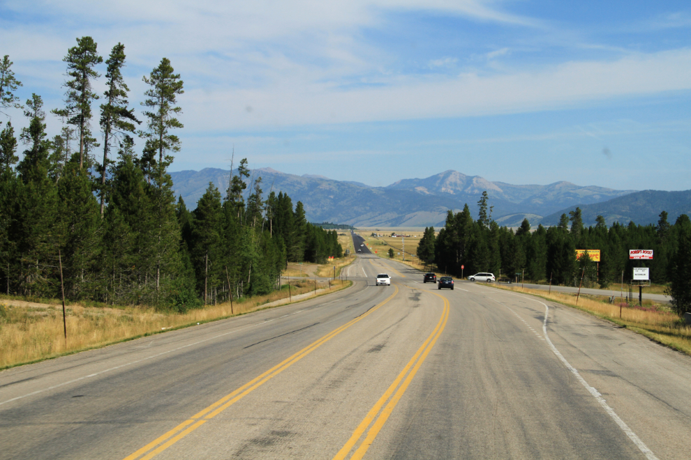
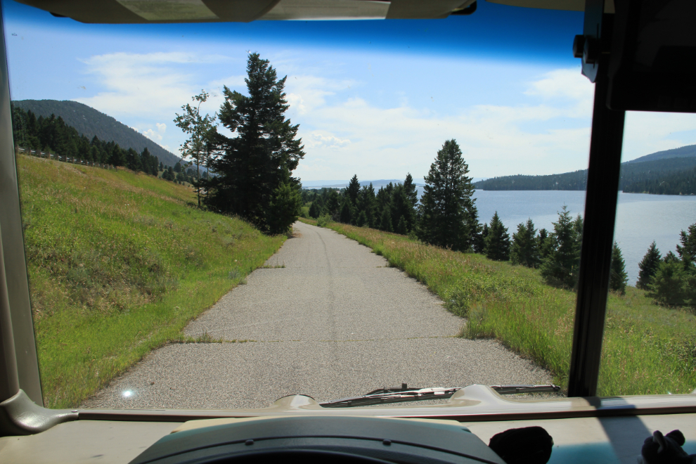
Looking north on Route 20 from Island Park. The Idaho/Montana border is about 20 minutes ahead, but I didn’t see a sign noting it.
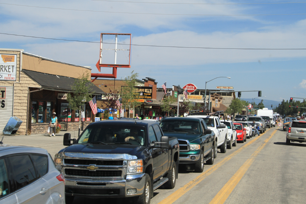
Reaching West Yellowstone at 10:00, I quickly gave up any thoughts of seeing any of the park. There were hundreds of vehicles sitting still, and the park gates are quite a ways in yet.
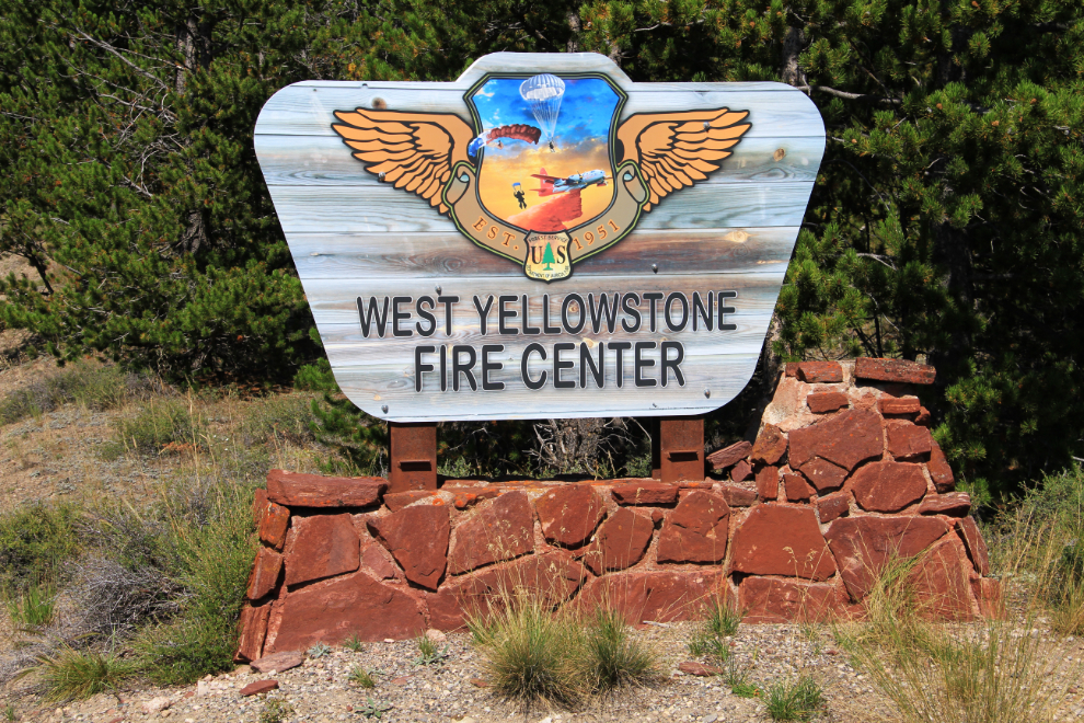
Heading north on Highway 191, I made a U-turn and went back to the Yellowstone Airport, but there was no indication that scenic flights are done here. I took the side road into the West Yellowstone water bomber base, but there were no planes – probably all off fighting the Oregon and Washington fires.
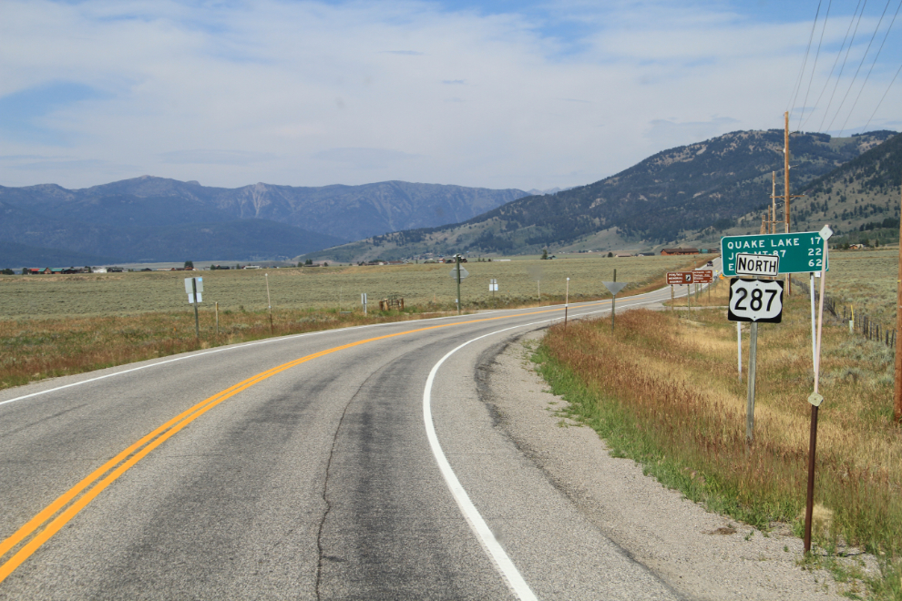
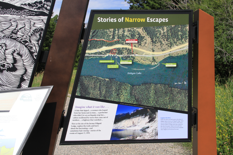
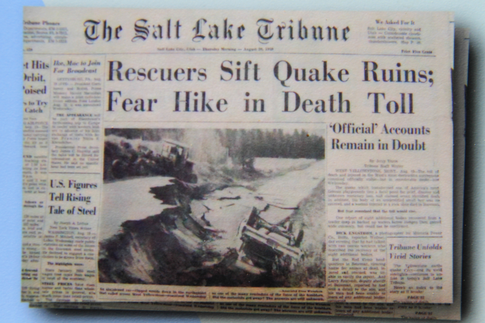
I turned west on the Hebgen Lake Road (U.S. Route 287), which turned out to be exceptionally interesting. I had stopped to read signs describing the largest earthquake ever recorded in the Rocky Mountains, which occurred on the night of August 17, 1959. A local stopped to show some people with him the information, and recommended that I take the self-guided auto tour and some of the walks, for which there were brochures available.
The Hebgen Lake Earthquake measured 7.5 on the Richter scale, and killed 28 people.
I was 8 years old when the earthquake happened, and I have vague memories of the story, I think because it was mostly campers who were killed by a huge landslide and floodwaters.
I went for a walk at a site called “The Lake That Tilted”, to the ruins of the Hilgard Lodge that was destroyed that night.
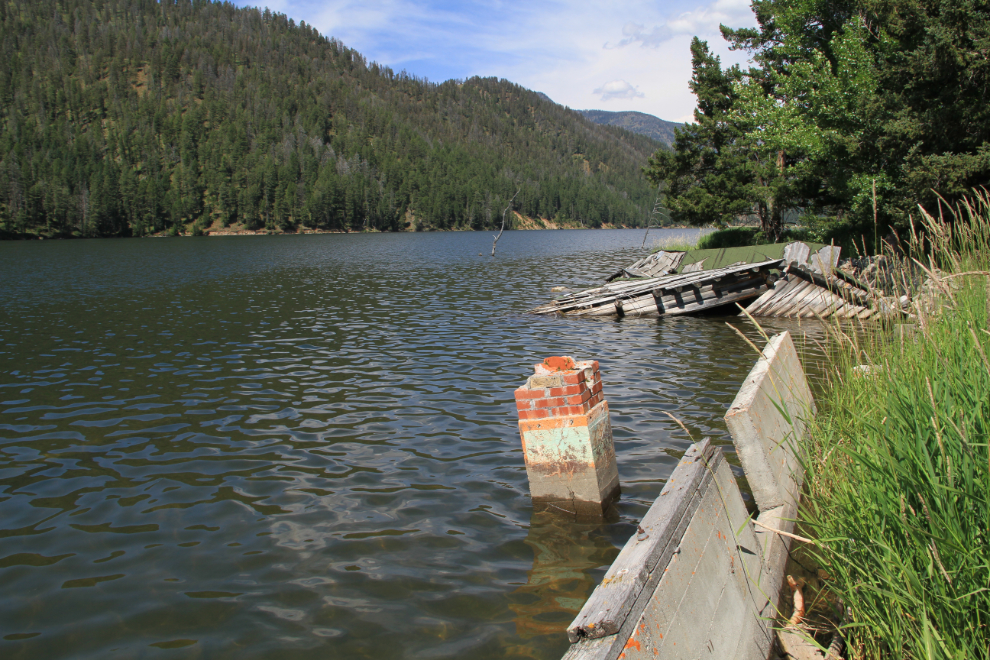
An old section of the highway, much of which was destroyed by the quake, landslides or floodwaters.
Just before noon, I went for a long walk above the Earthquake Lake Visitor Center, seen at the center right of the next photo. To the left in the photo is a boulder bearing a plaque with the names of all the victims of the slide that created the lake.
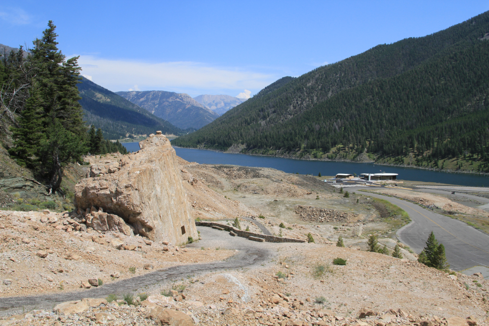
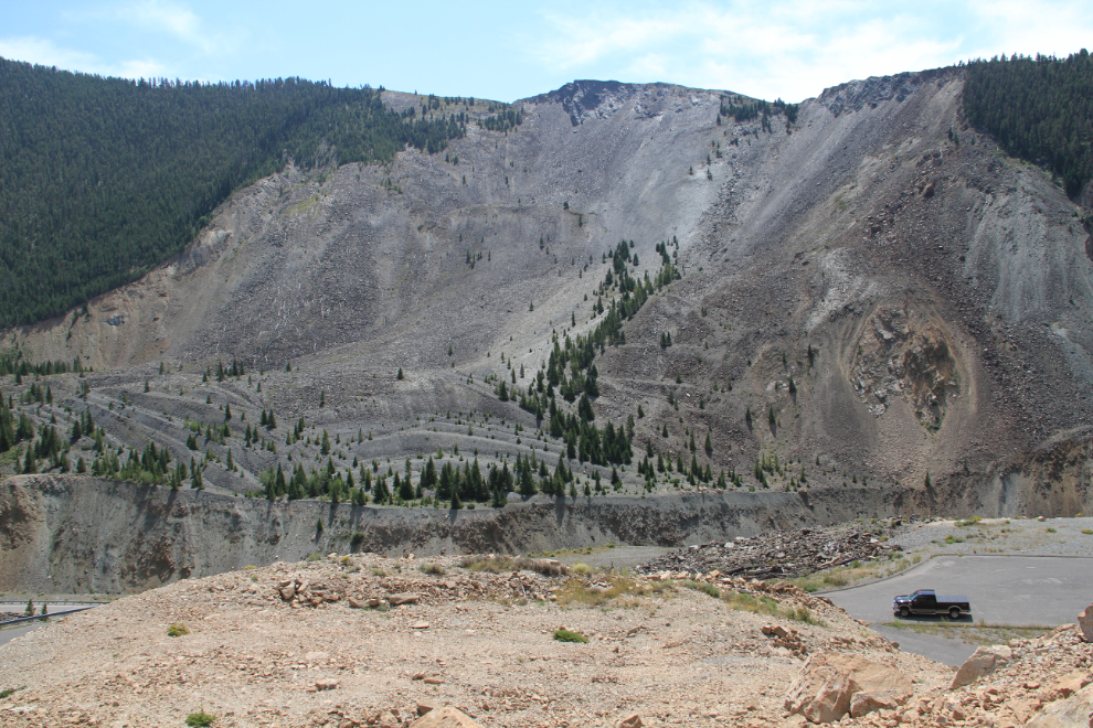
The earthquake-triggered slide, containing about 80 million tons or rock and gravel. Many of the victims’ bodies were never recovered.
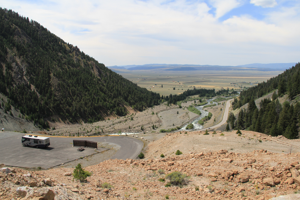
The view to the west (the West Portal).
By 12:30, I was northbound on 287, into a series of thunderstorms that produced some impressive lightning, though not a lot of rain.
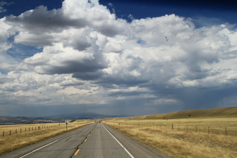
South of Harrison, Montana, looking to the west.
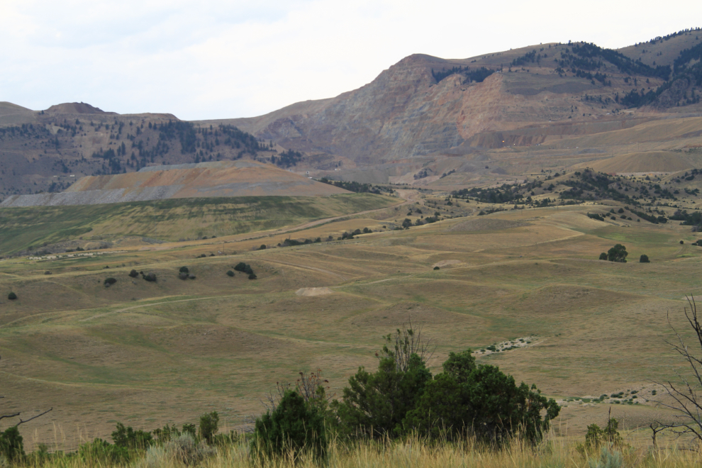
The huge Golden Sunlight Mine, seen from Montana Highway 69. Six weeks ago, the mine’s owner, Barrick Gold, hired the Canadian Imperial Bank of Commerce to help them sell the mine, which has been recovering gold since 1975 but reports only 192,000 ounces of reserves left (about 2 years’ production).
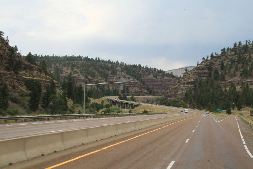
On I-15 north of Helena just after 4:00 pm. About a mile ahead, I saw the first serious car crash of the trip – a mid-sized American car had hit the median and was totalled, but the woman driver was standing beside a Trooper’s car talking to him. A few miles to the left of this pass is Glacier National Park, a few to the right is the Gates of the Mountains Wilderness.
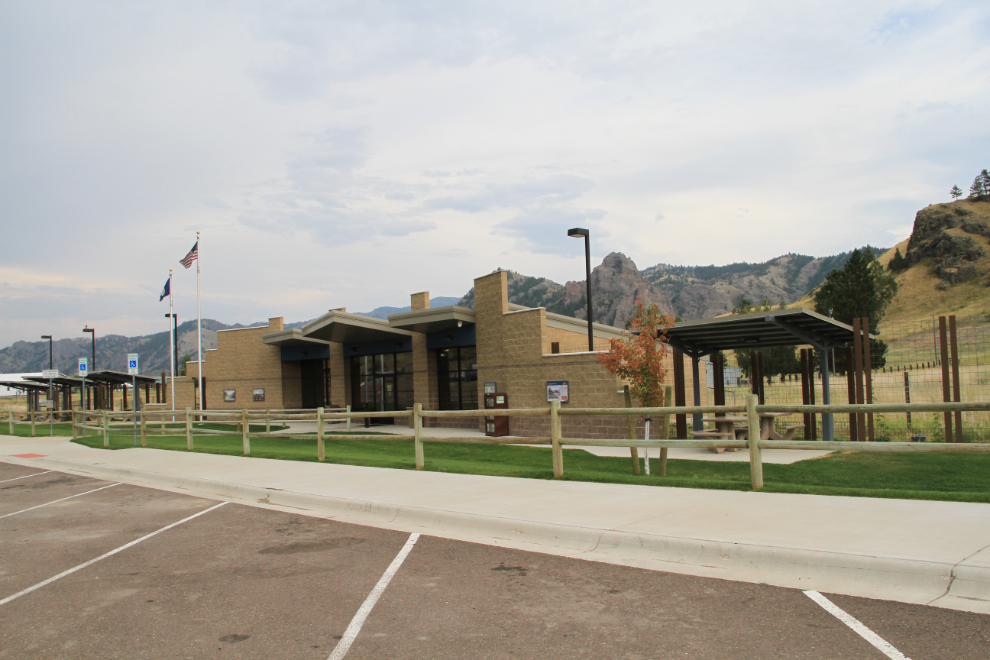
This rest area at Lyons Creek, just north of the pass seen above, is one of the nicest I’ve ever seen anywhere. Everything from washrooms to interpretive signage gets top marks. I made a short stop there at 4:30.
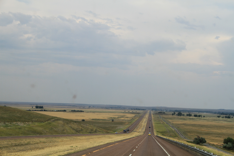
Northbound on I-15 between Cascade and Ulm at 5:00 pm.
I decided to spend Tuesday night at Dick’s RV Park in Great Falls, 4 blocks from I-15 and only 2 hours from the border. They didn’t have any power-only sites left, but a full hookup site only cost $36.59 for the night.