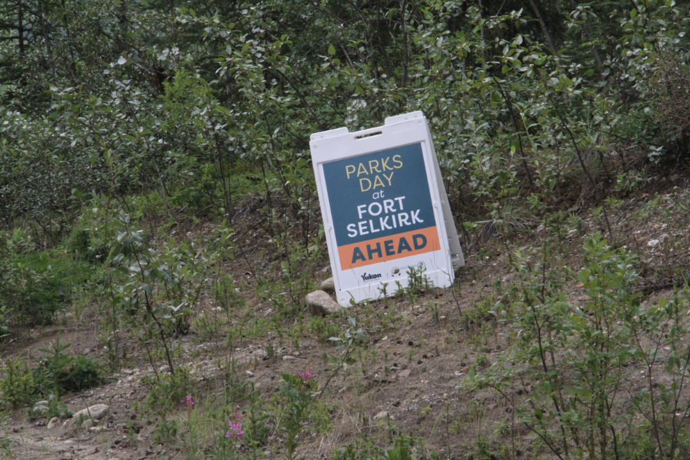
Back to Fort Selkirk on Canada’s Parks Day
Fort Selkirk is one of the most significant historic sites in the Yukon, and countless millions of dollars have been spent there in the past couple of decades. Few people will ever see the site, though, as you need to have a boat to get there. Each year on Canada’s Parks Day, Yukon Parks supplies those boats, and I returned to Fort Selkirk for my third visit last weekend.
The distance is a bit off and the time is way off on the map below, but you can still see the road part of the route by clicking here to open an interactive version in a new window.
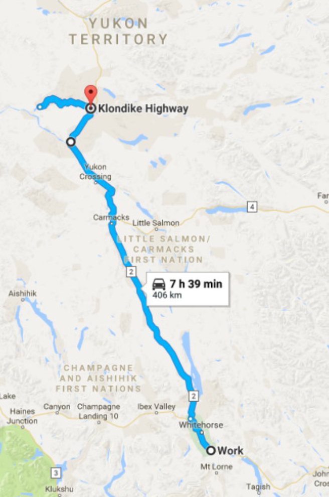
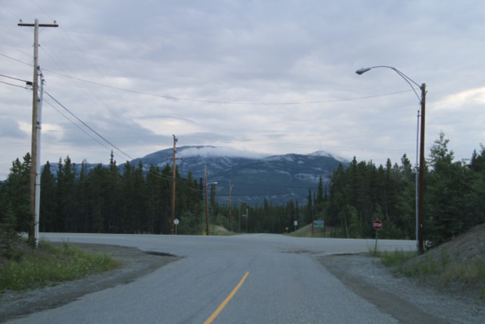
It takes well over 4 hours to drive the 394 km from my home to the boat launch on the Pelly River at the historic Pelly Farm. I wanted to get the first boat at 10:00, so I was about to turn onto the Alaska Highway when I shot the first photo at 05:40.
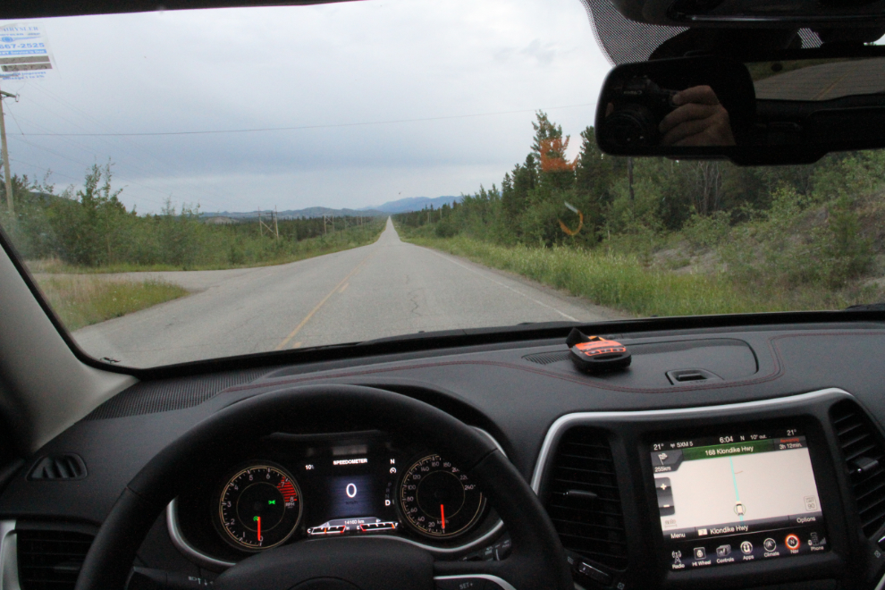
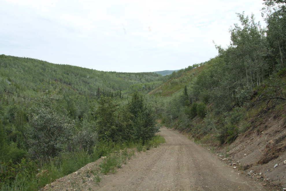
The last hour is 51 km on a dirt road that follows the Pelly River down from Pelly Crossing on the North Klondike Highway. I took my car the last time I drove in, in 2013, but asked to borrow Cathy’s Jeep this time. Sweet ride 🙂 As always, SPOT was on the dash so Cathy knows where I am, and I have the ability to call for help.
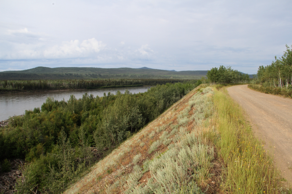
There are some lovely views over the Pelly River from the dirt road. I shot the next photo a few minutes before 09:00.
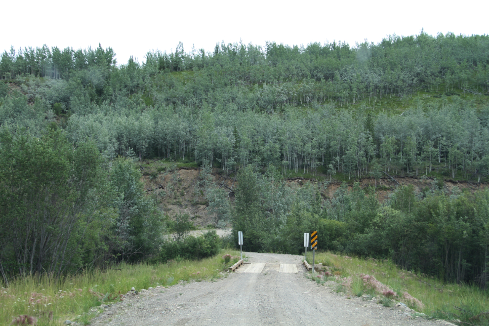
At the 26-km point, there’s a sign noting that you’re halfway, and Yukon Parks put up a sign confirming that this is the right road. The first time in, many people must wonder about that – I sure appreciated the confirmation four years ago.
We’ve had a great deal of rain this summer, and the road was much rougher than I remember it, but it was still not too bad. I had thought about taking the motorhome in, and I’m glad that I didn’t do that, though.
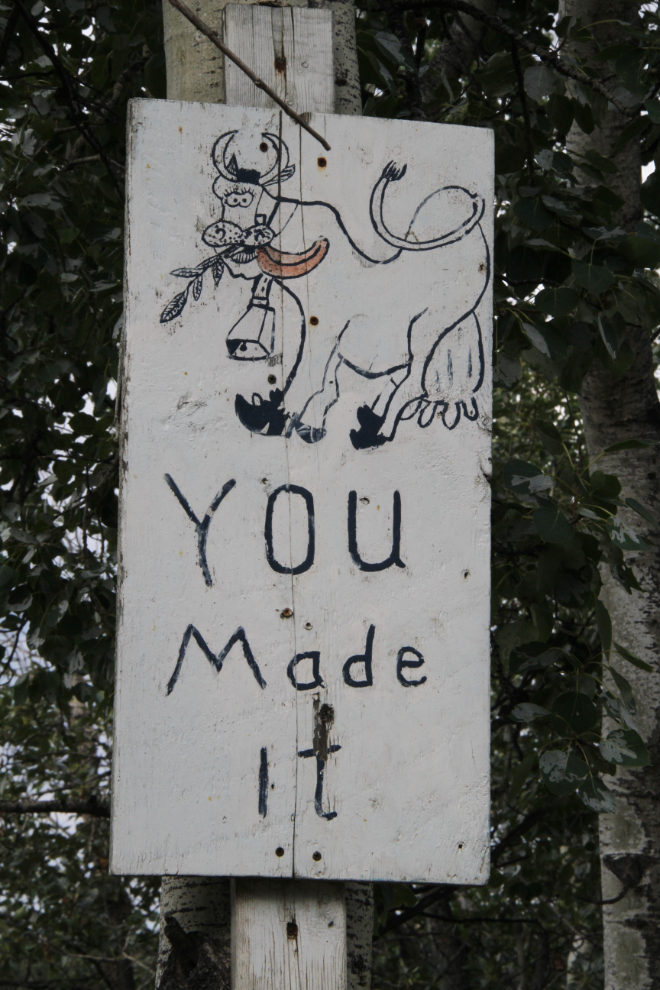
At 09:50, yes, We Made It! 🙂
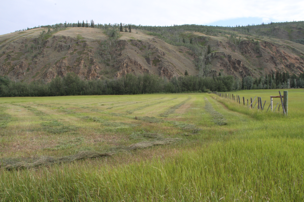
The Pelly Farm started during the Klondike Gold Rush, and as the Pelly River Ranch, Dale and Sue Bradley still grow vegetables, beef, chickens and eggs that sell in Dawson, Pelly Crossing, Carmacks, and Whitehorse.
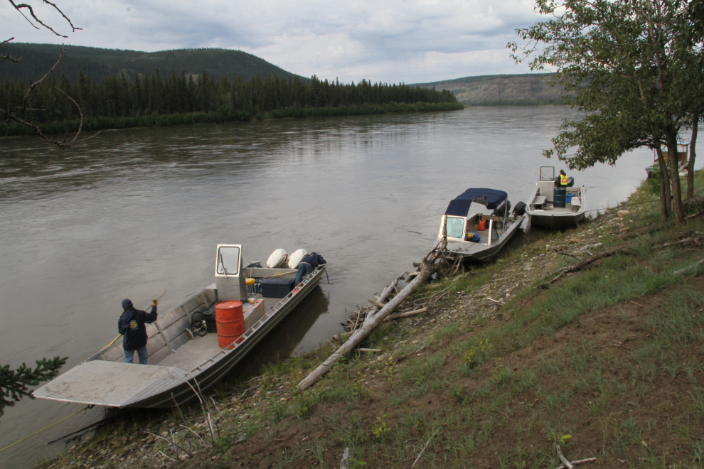
I had met friends from Whitehorse at Pelly Crossing, and they followed me in from there. A few photo stops, and staying out my dust, put them a bit behind me, but as soon as they arrived, we got signed in, and we were on the first boat as planned.
In 2013, there were 2 boats running and there were some lengthy delays. This year, 4 boats were available. We headed down the Pelly River at 10:15.
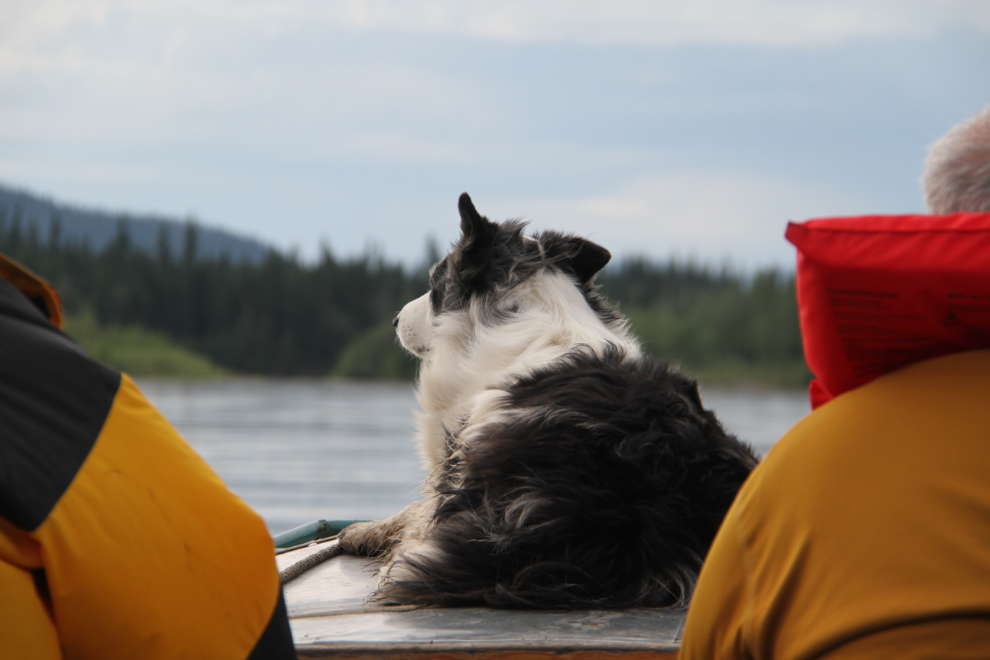
Boat driver Dale’s border collie, Snoopy, clearly knows his way around boats, and immediately took the command position so that everyone could be herded properly 🙂
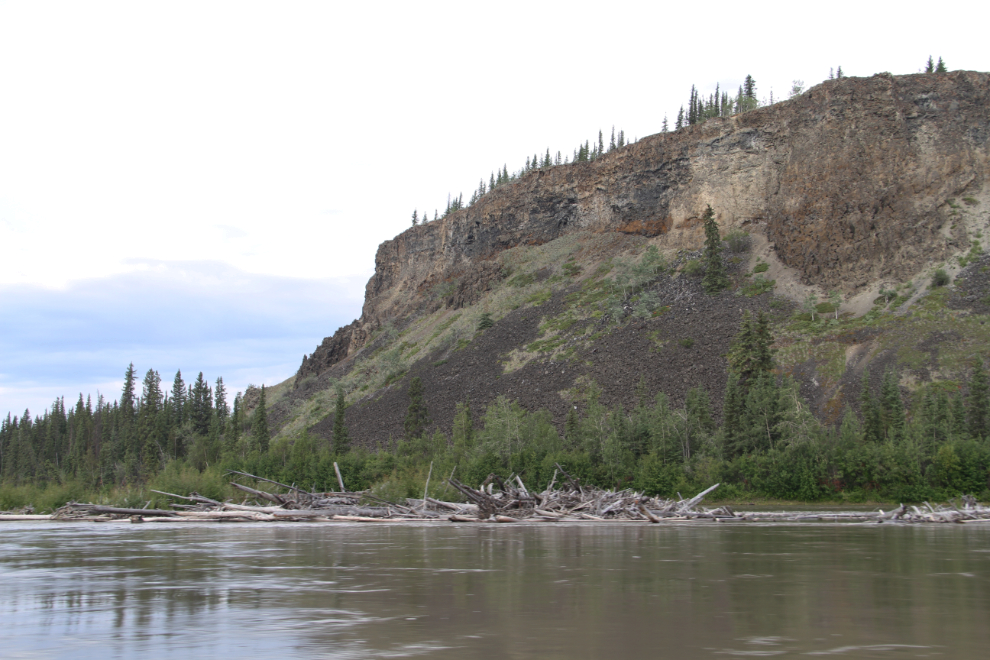
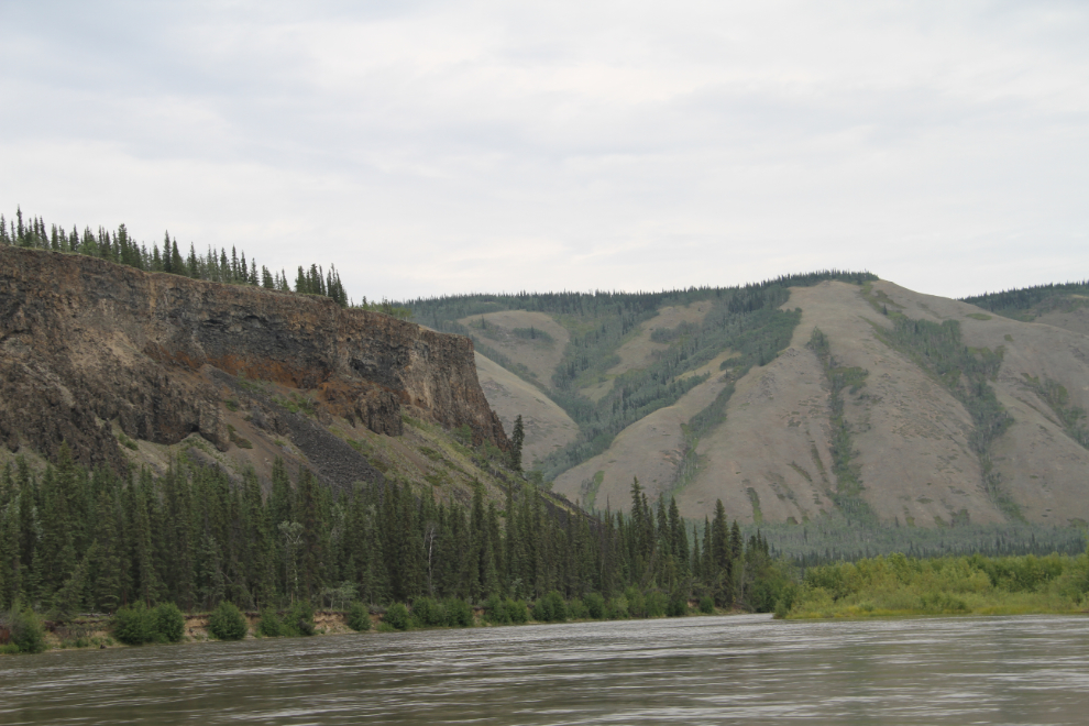
There are impressive basalt cliffs along the lower Pelly River, and when the cliffs turn north, you know that you’ve reached the Yukon River. With the many channels, it’s not otherwise clear for a couple of minutes yet.
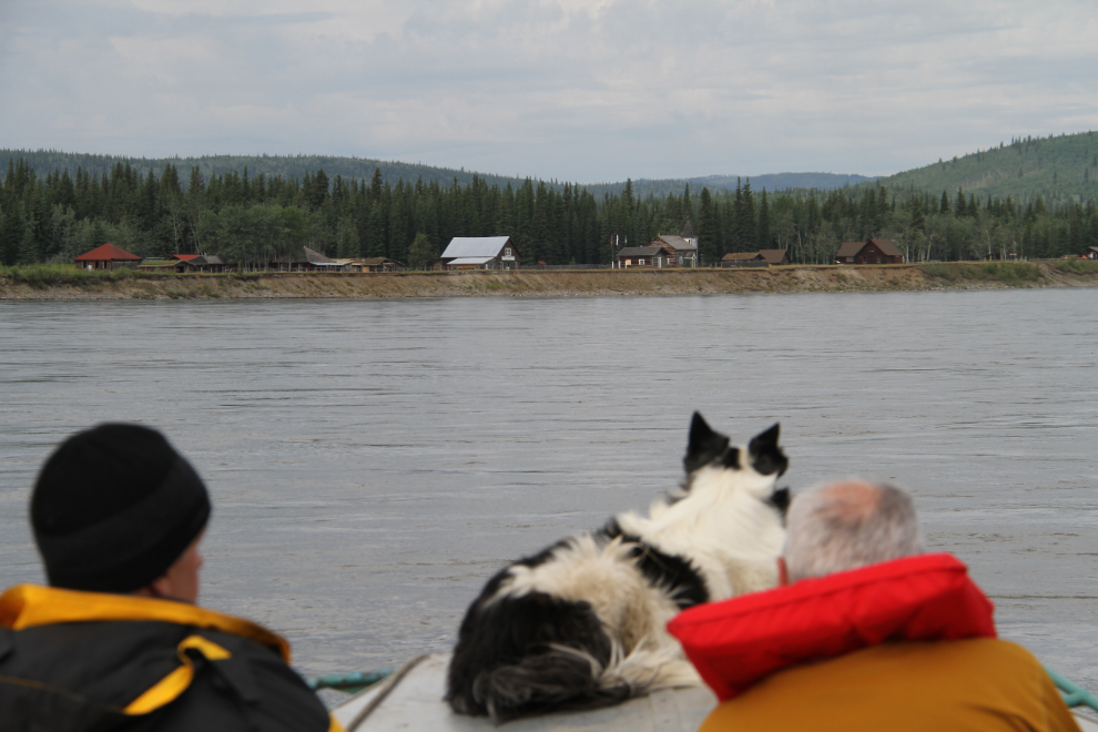
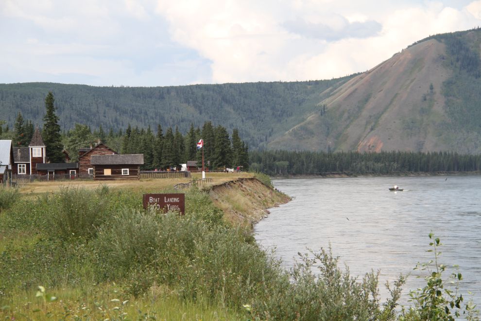
Nearing Fort Selkirk at 10:30.
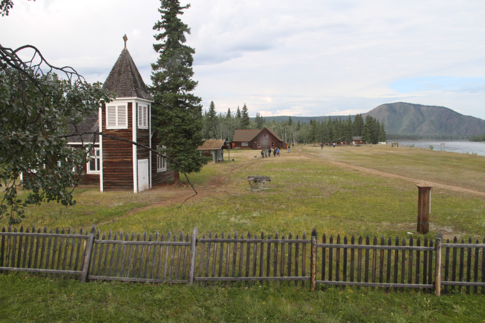
In the days when the Yukon River was the primary highway in the Yukon, Fort Selkirk was a vibrant trading community. When highways made the sternwheelers obsolete, though, Fort Selkirk was soon all but abandoned. The community is now a kilometre-long historic site that stretches along the bank of the Yukon River, with 2 cemeteries in the forest, one at each end of the townsite.
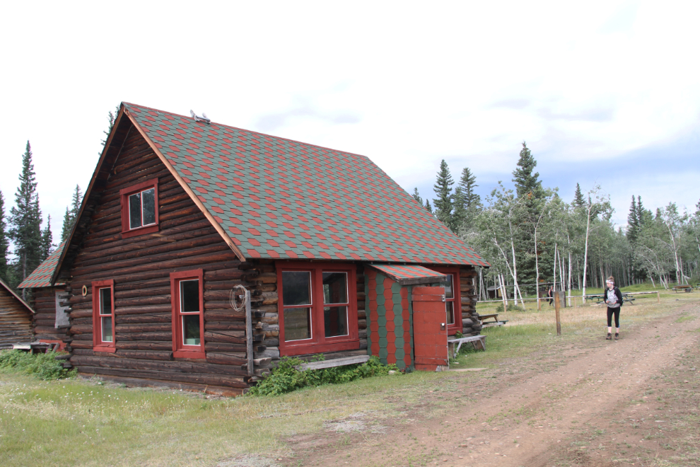
My main focusses for the day were the cemeteries, and the distant farm, which I had never seen. I also wanted to see what was new in the townsite, though, and to spend time with Karla and Emily. We started our tour at the interpretive centre in the Stone House, which was built by government telegraph operator Charlie Stone in 1935.
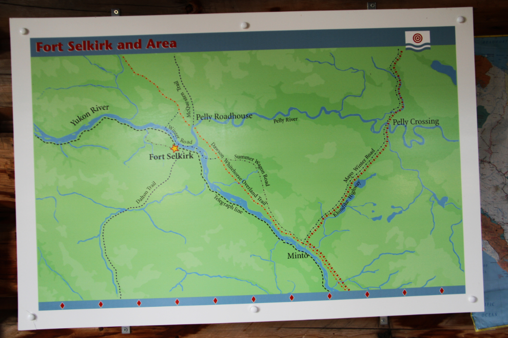
This map in the Stone house shows the different ways of reaching Fort Selkirk a century ago. They include the Dalton Trail from Haines coming in from the south, the Yukon Telegraph Line running through Fort Selkirk, and the Winter Road providing access from Dawson and Whitehorse.
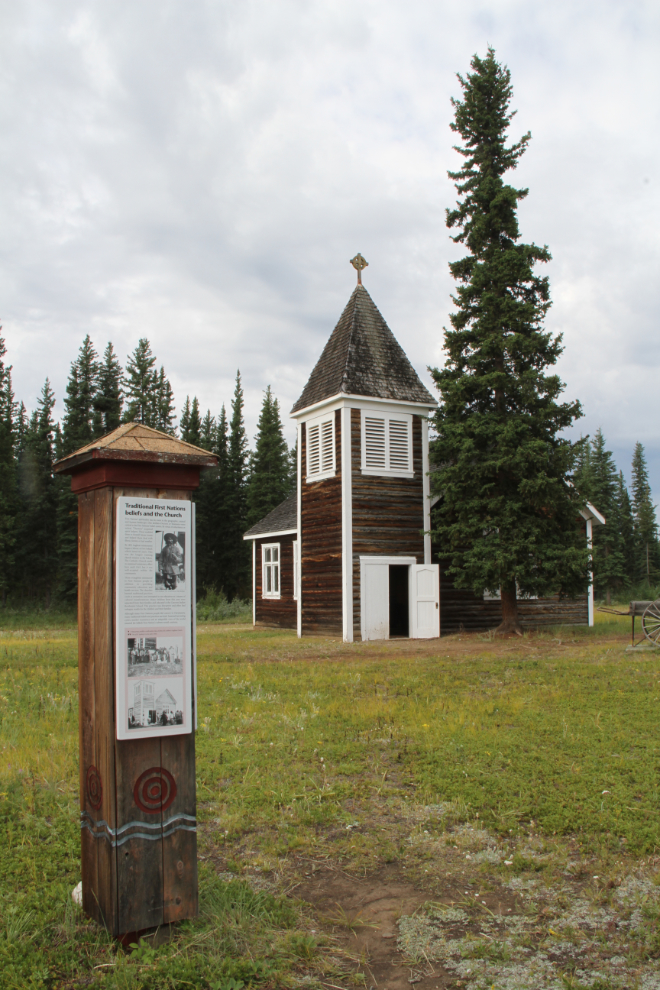
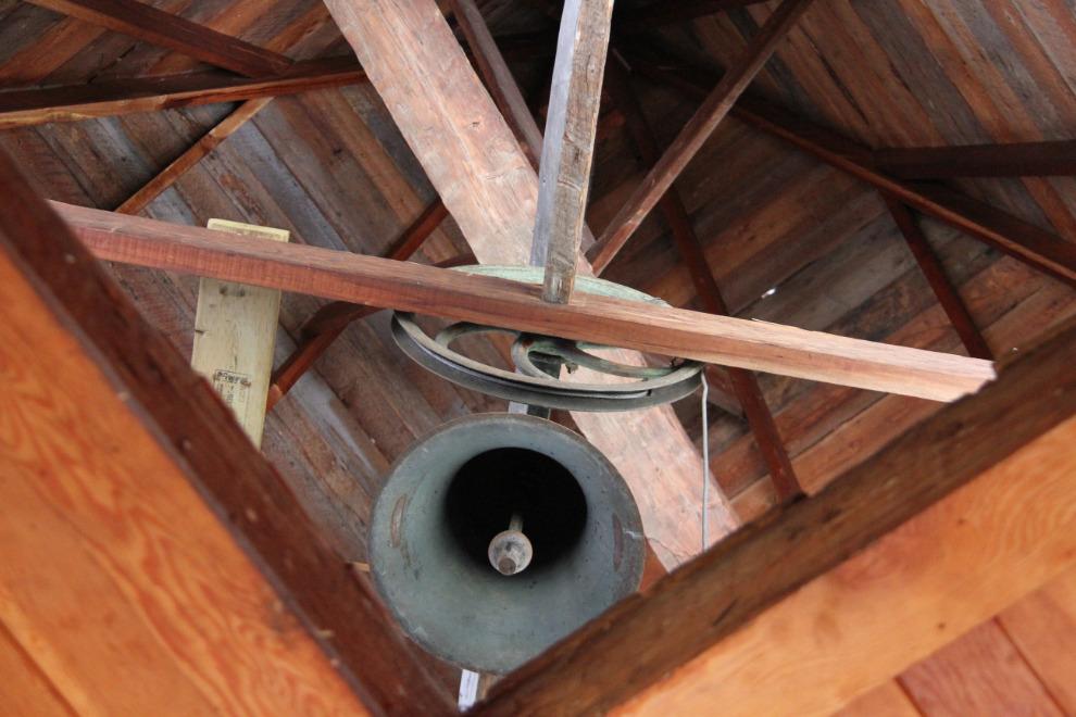
Following my visit to Fort Selkirk in 2013, I posted 52 photos on the blog, and I’m trying to minimize duplication as much as I can on this post. But some buildings like St. Andrews Anglican Church, need to be posted agin. Built in 1931 of materials from the Yukon Field Force barracks, it’s the most elaborate one at Fort Selkirk, and the only one which was designed by an architect. The last resident minister there, Kathleen Cowaret, moved to Minto in 1953.
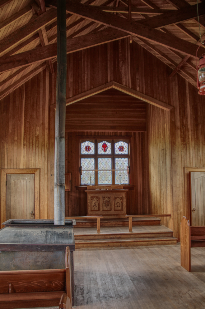
This is an HDR image of the interior of St. Andrews.
Emily asked if she could ring the church bell. The rope even had duct tape wrapped around it to make it more comfortable for bell-ringers, so sure. I loved hearing it – it added a lot to the town for a few seconds 🙂
The next view of St. Andrews is from the upper story of the Anglican rectory.
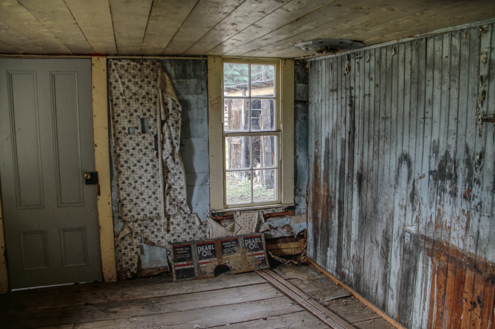
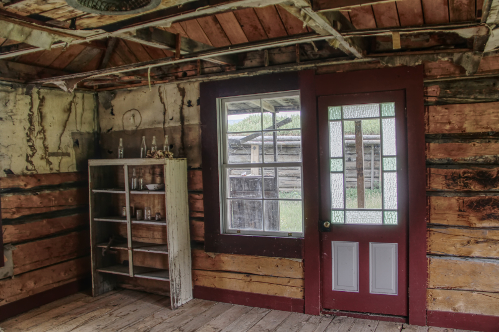
The kitchen in the Anglican rectory. There has been very little interior restoration done in any of the buildings.
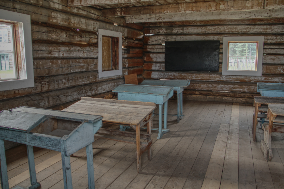
When I was here in 2013, the river was washing away the bank in front of the school, and it’s now about 40 feet back from its former position. Built in 1892, it’s the oldest known standing structure in the Yukon. I had started to notice that there are now fewer artifacts in the buildings than there used to be.
The Coward Cabin was built in 1898 as the Yukon Field Force officer’s residence and is one of only 3 remaining Yukon Field Force buildings. Moved from the Field Force complex and modified in the 1920s by Alex Coward, it’s a lovely home.
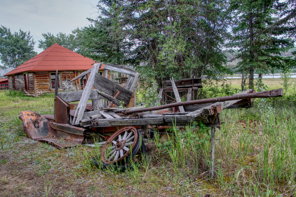
My favourite artifact is this old truck, which is pretty well hidden and I expect many visitors don’t see it.
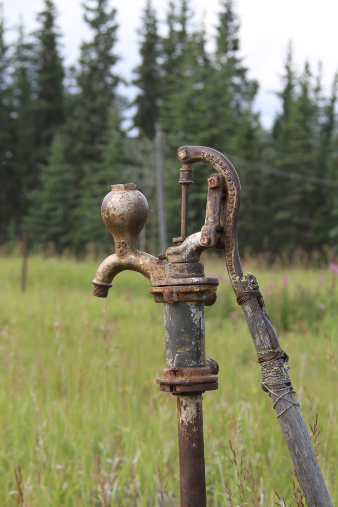
The Jas. Smart Mfg. Co. Ltd., of Brockville, Ontario, made all manner of metal products, but is best known for their well and cistern pumps like this very attractive one.
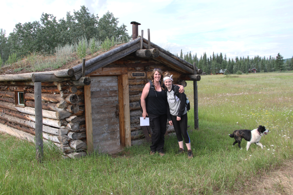
Fort Selkirk is a wonderful place to be able to share with friends 🙂
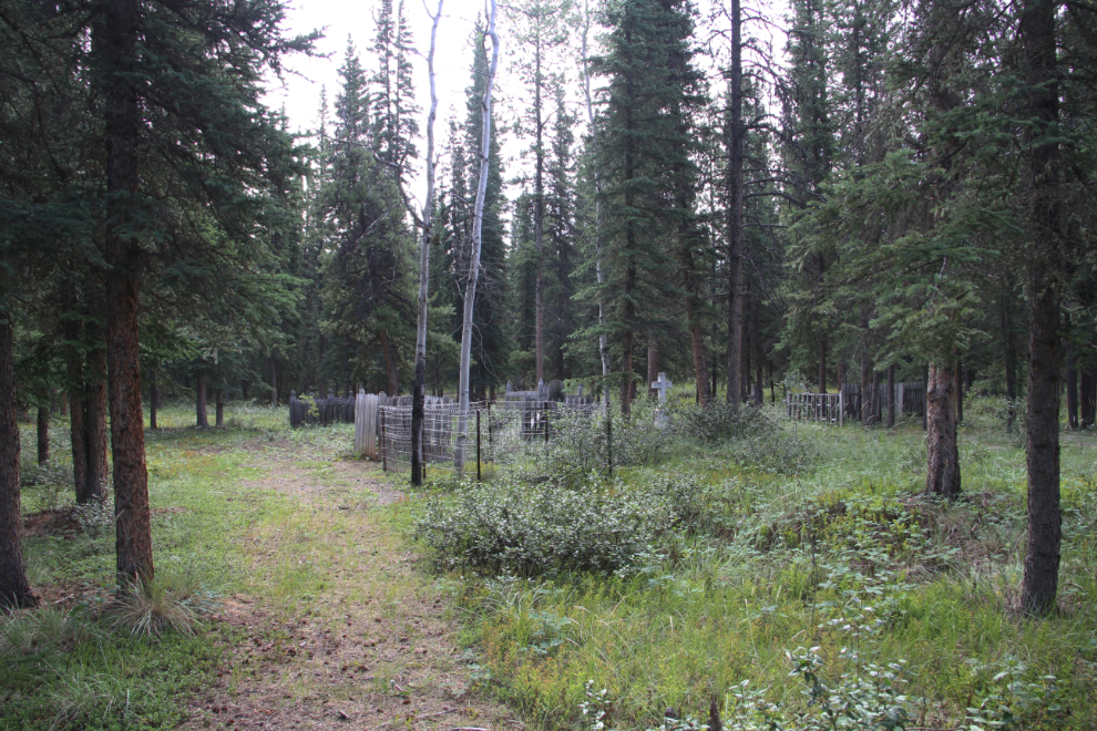
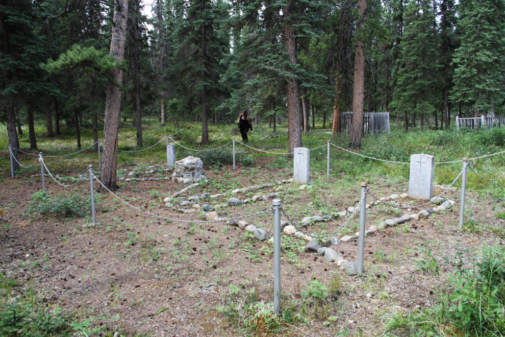
At the upriver end of Fort Selkirk now, we were in the are where the Yukon Field Force, a Canadian Army unit formed during the Klondike Gold Rush, were based. No buildings remain. Although the sign on the trail says “Field Force Cemetery“, that is just a plot with 3 graves, within the non-Native Fort Selkirk Cemetery.
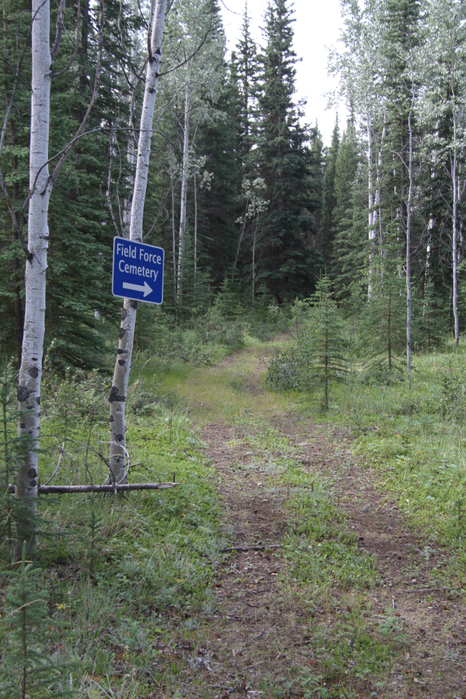
This is a visitor’s first view of the cemetery.
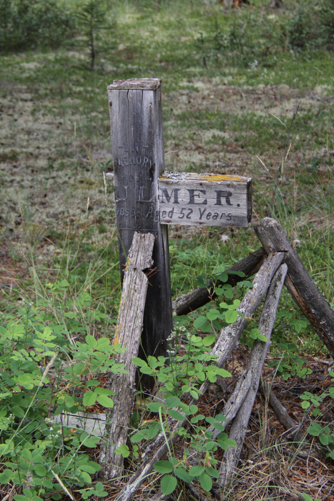
Only 6 of the graves have legible names on stone or wooden markers. Looking back to the 2013 photo of this marker, I found a couple more letters to the left of “…ulmer, aged 52 years”, and was able to quickly track down Henry Bulmer, Jr. – from Montreal, he was manager for the Canadian Yukon Lumber Company, and died of peritonitis on August 9th, 1899.
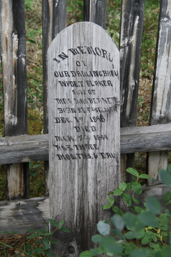
“In memory of our darling baby
Wade T. Blaker
Son of Mr. & Mrs. Blaker
Born at Ft. Selkirk Dec. 1st, 1898
Died Mch 7th, 1899
Age three months 6 days”
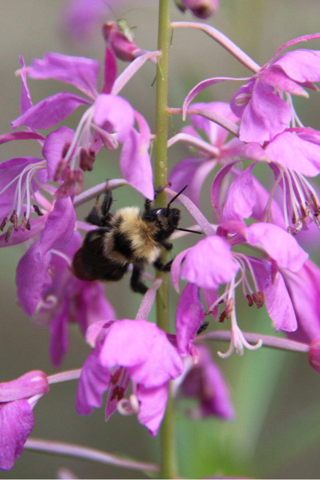
While I was documenting all of the grave markers, Karla found a big bumblebee slowly working through the fireweed.
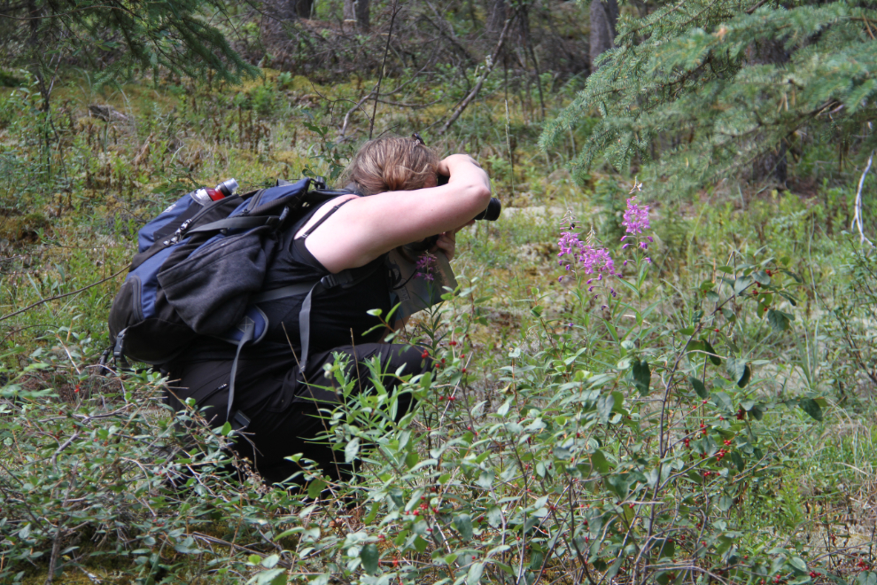
I got distracted by him for a couple of minutes, too 🙂
This is the Yukon Field Force Cemetery.
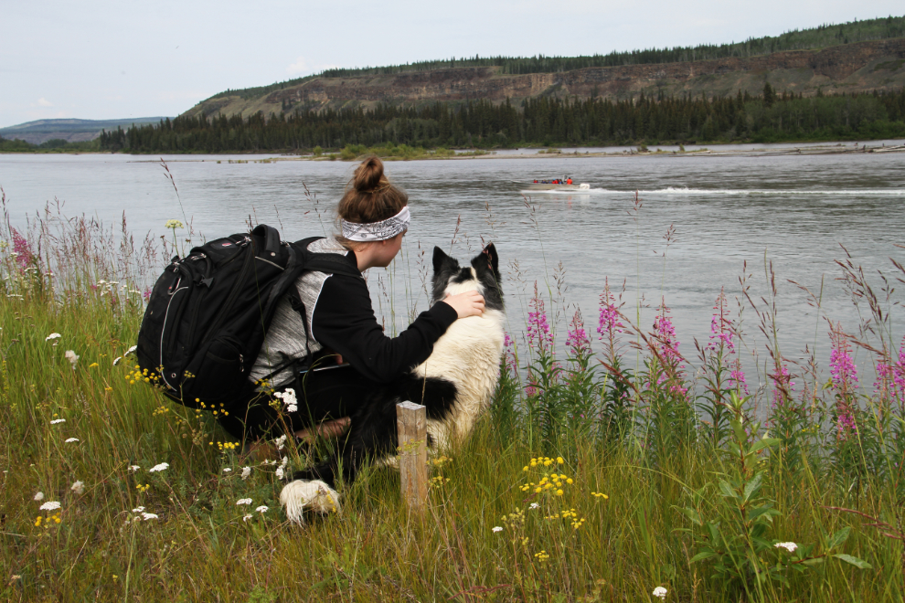
This may be my favourite photo from the day. It was that sort of day – just out enjoying our amazing world. And Snoopy was happy to join us 🙂
Time was passing quickly – it was well after 1:00 when we started walking back through the townsite.
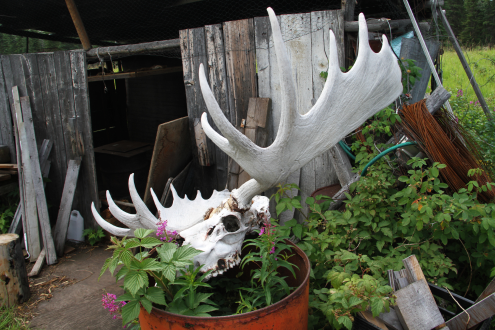
While poking around behind the old Danny Roberts cabin, Karla found this awesome moose skull.
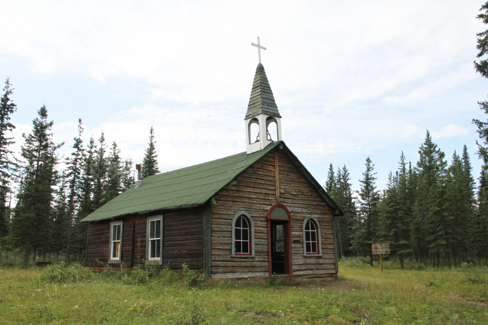
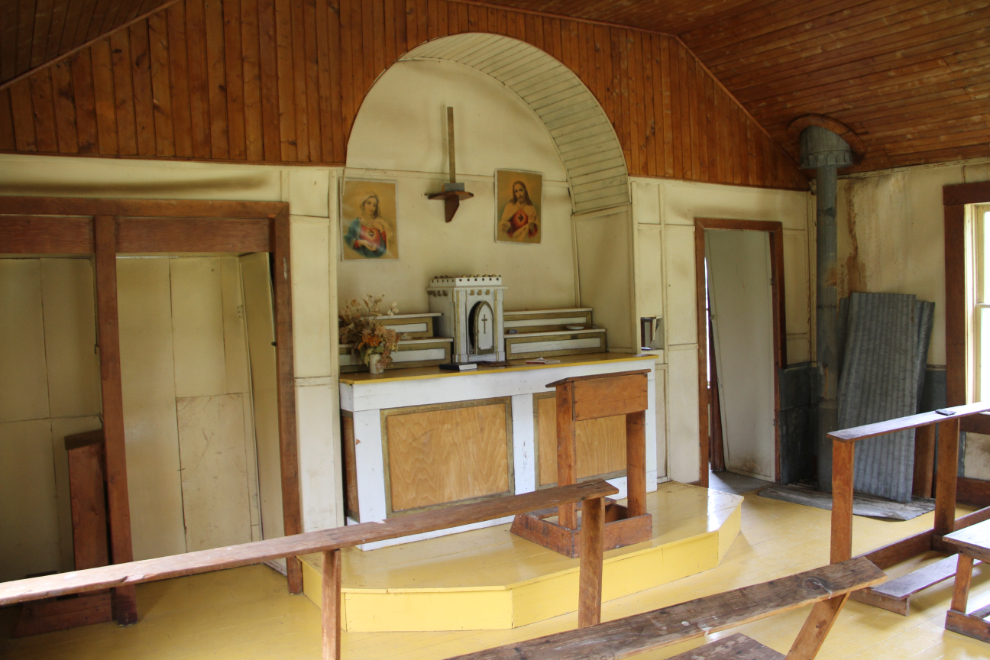
The final building we went to was the St. Francis Xavier Roman Catholic Church. Built along the waterfront in 1898, this was the second Catholic Church in the Yukon – the log building uses French style piece-en-piece construction, which is unusual in the territory. It was moved to this site in 1942 by Father Bobillier.
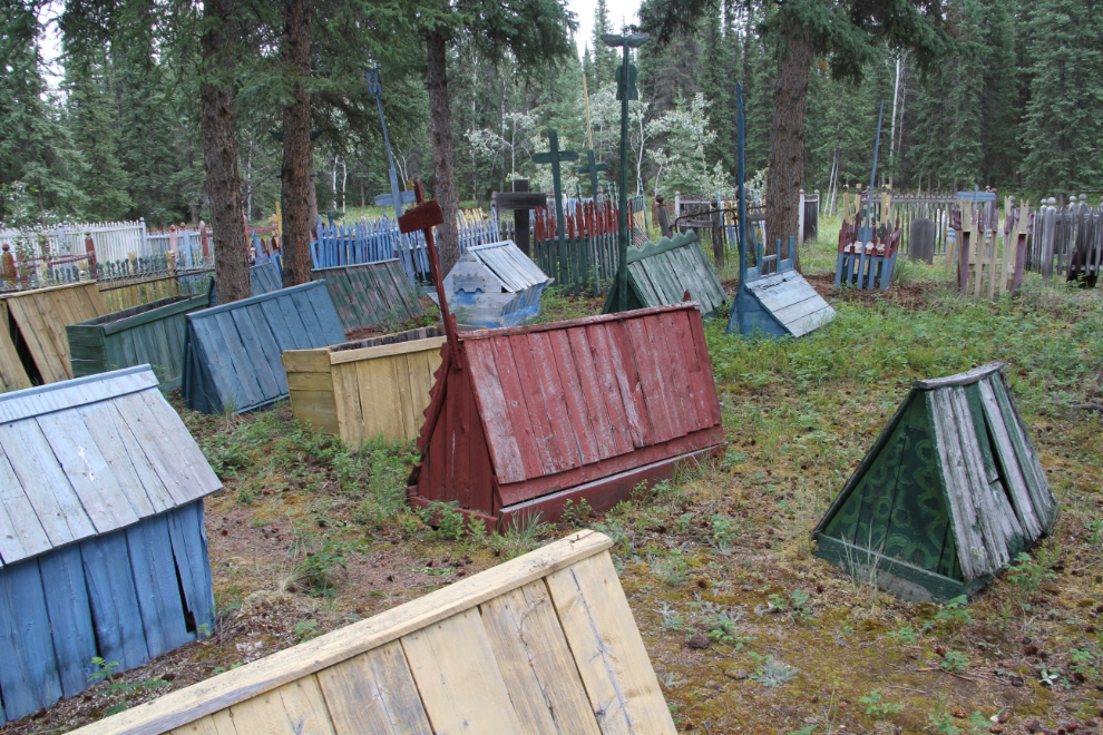
Beside St. Francis Xavier is the trail leading to the Fort Selkirk First Nation Cemetery.
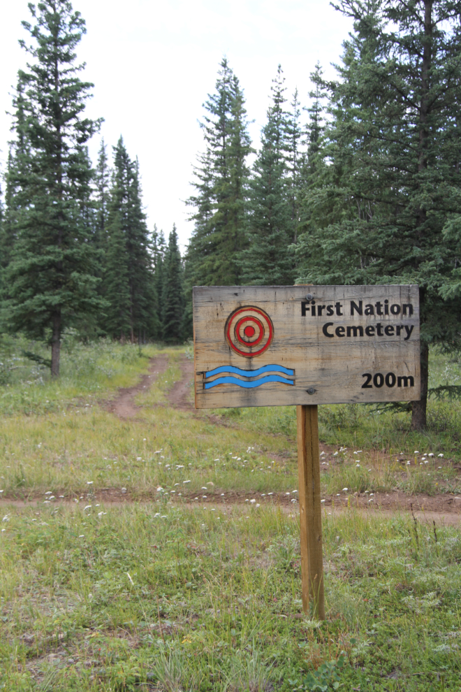
The first view of the cemetery, which has about 80 graves visible.
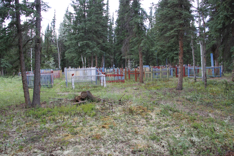
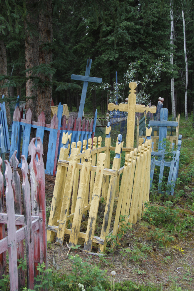
Many of the graves have been painted in recent years, but only about 5 have names visible.
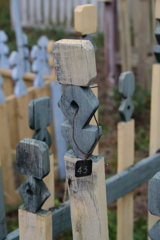
Most of the graves are tagged for identification. I expect the Selkirk First Nation can put names to those numbers.
A few of the graves have “spirit houses” on them.
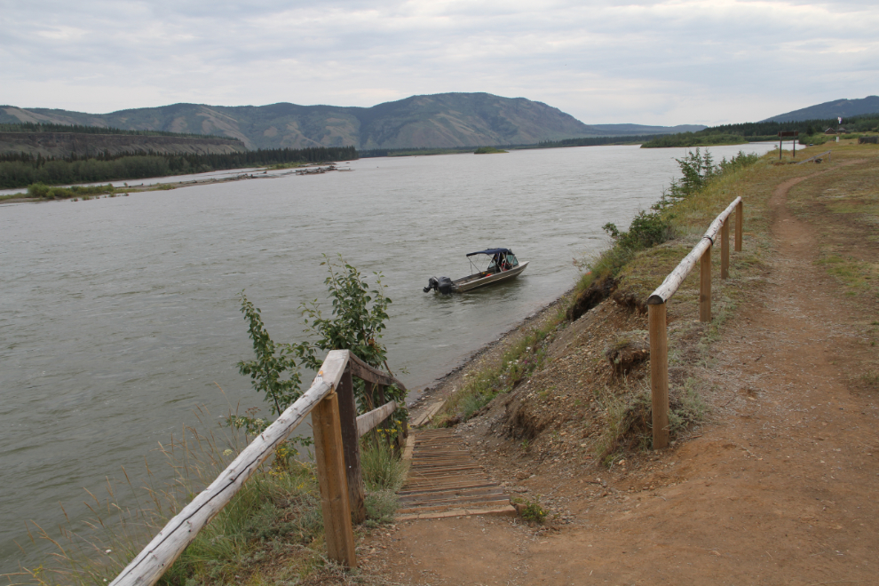
After visiting the First Nation Cemetery, Karla and Emily headed for the boat launch, to go home, while I went to see if I could find the farm. I got vague directions, but after a couple of kilometers walking away from the river, I decided that just didn’t make sense, and went back to the townsite. I met a woman from Historic Sites who said that there’s nothing at all to see at the farm, just an open field, but I had been on the right trail – the farm is 3.5 km from the townsite, far from the river.
At 2:15 I was the boat launch, but was in no hurry, so waited and talked to the boat driver for a while until other people showed up.
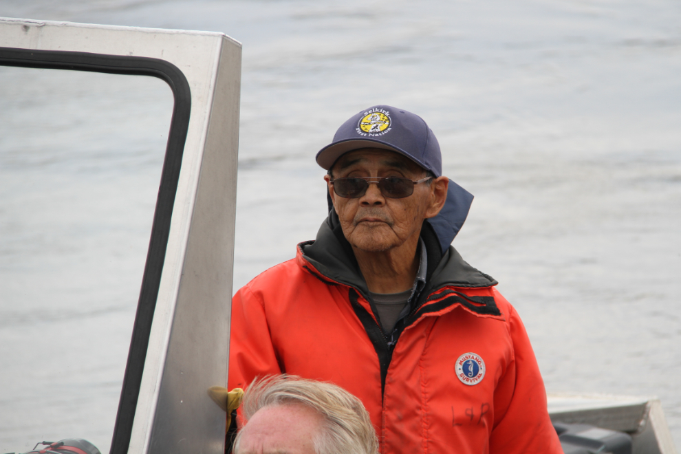
I didn’t catch my boat driver’s first name, but he’s a younger brother of famous Fort Selkirk guide Danny Roberts, who died in 2000. He was born in Fort Selkirk in 1941, and has no end of stories – a very interesting fellow, as was his brother, who I talked to in 1997.
Heading back into the Pelly River.
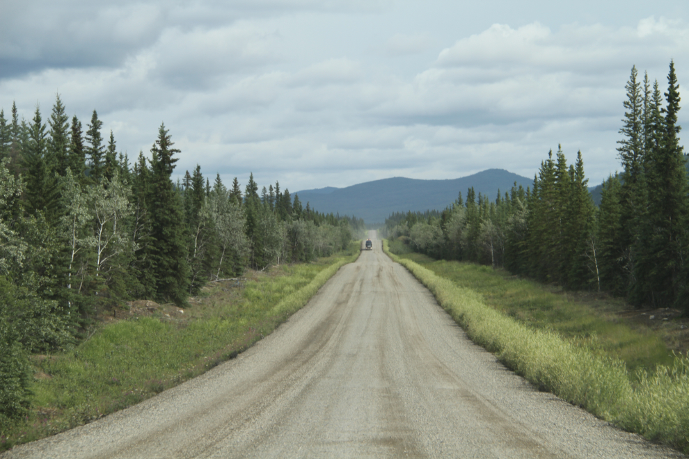
The drive back to the highway.
One final photo of one of the 2 stretches of re-surfacing
With a cinnamon bun stop at Braeburn Lodge, I got home at 7:30, 14 hours after leaving home. I was soon in bed – it had been a wonderful day exploring my Yukon!