An icy winter wander to Tutshi Lake, BC
I haven’t been out much lately, so when a friend called Monday and asked if I wanted to go for the drive to Tutshi Lake the next day, “YES!!” was the easy answer. The weather forecast when I said that was for sunshine, and I almost cancelled a few hours later when the forecast was changed to cloudy. I’m really glad I didn’t cancel, because we got the sunshine anyway 🙂
We had initially planned to be on the road early to catch the 10:06 sunrise south of Carcross, but that didn’t work out. It was 11:40 when I shot the first photo a few km down the South Klondike Highway.
We made a stop at Emerald Lake, even though it’s not as nice when it’s “White Lake.”. It’s rarely windy at my home, but the wind was screaming at Emerald Lake, and was it ever cold! The windchill was near -40C. We could see a lot of fog or low cloud ahead, signifying that Lake Bennett hadn’t frozen over yet.

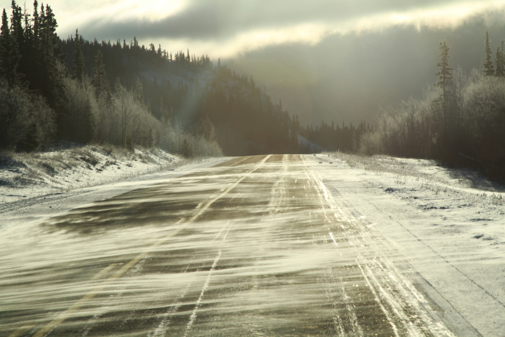
This sort of “ground blizzard” can be quite disorienting when they get heavy.
We made a loop through Carcross, stopping for a few photos at the Lake Bennett viewing deck. There was lots of open water as expected, but a skim of ice on a large area showed that might not be the case much longer.
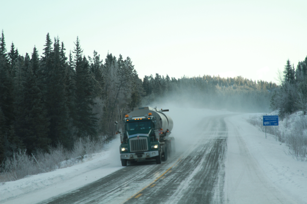
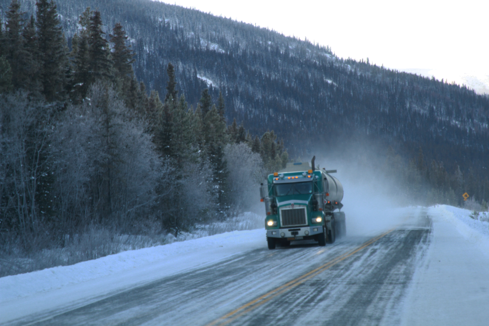
There was very little traffic on the road, as expected. B-train tanker trucks were hauling lots of fuel from the Skagway docks, though. Although oil for furnaces is rapidly falling out of favour due to ever-tighter storage tank regulations, I expect it’s still the major heat source, followed by electric then propane.
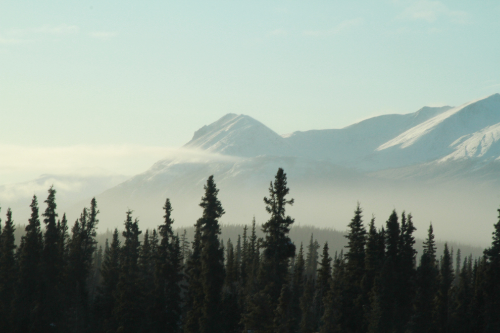
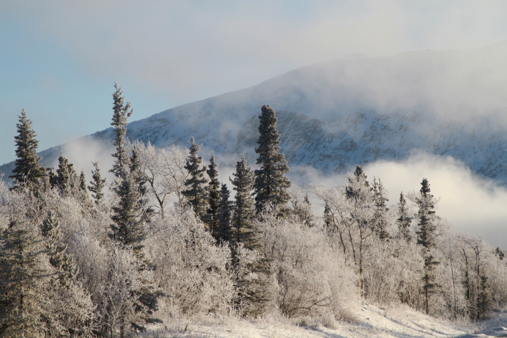
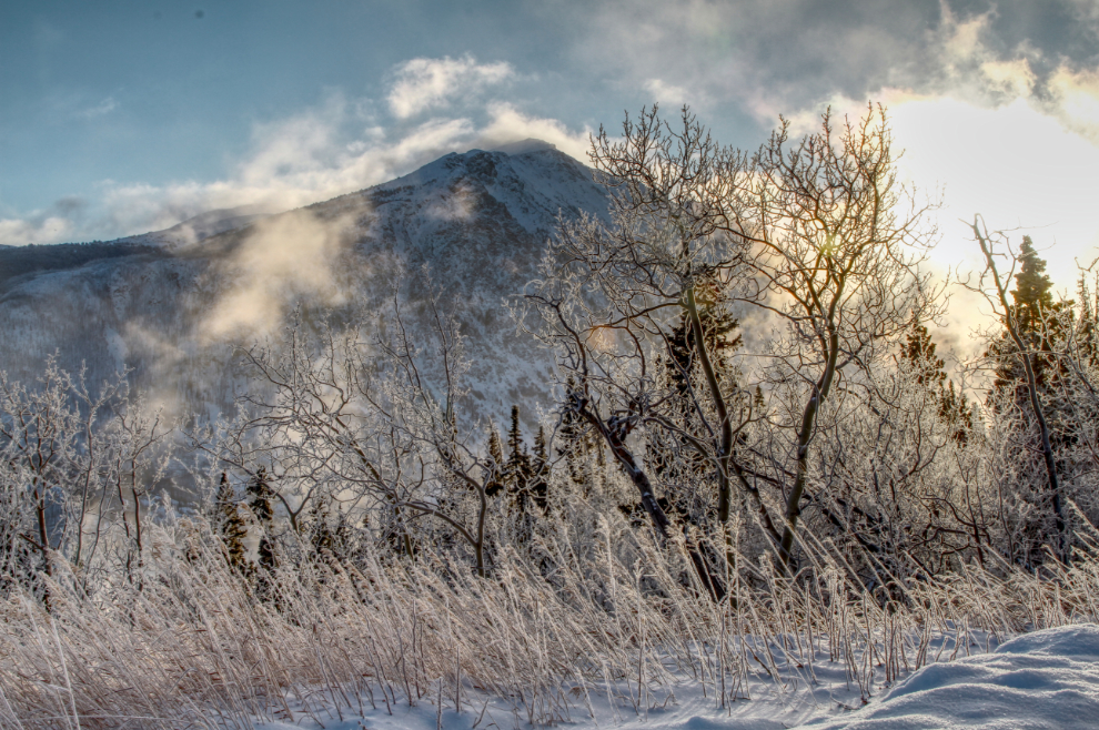
South of Carcross, the fog created by the open water had created fairly heavy hoar frost in many areas. When I lived in the Vancouver area (in a previous life, it seems now), a hoar frost morning would bring out everyone with a camera, trying to catch a few photos before it melted away. Here, the hoar frost will be there for months, so there’s no rush 🙂
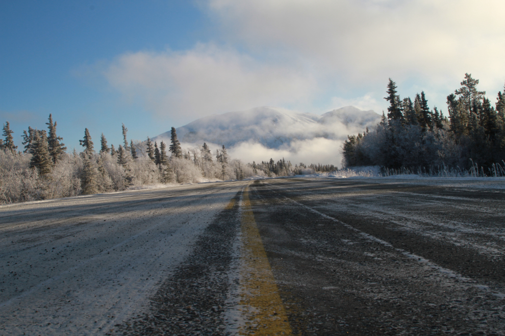
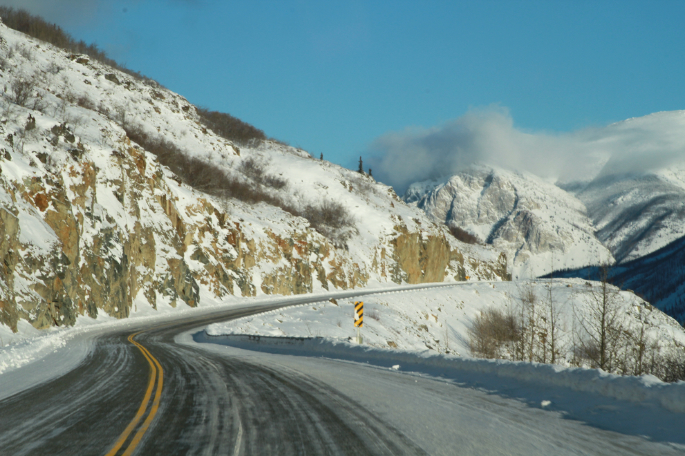
The road surface was in pretty good condition, though there were some very icy stretches.
The Bove Island viewpoint had been our planned sunrise-shooting location, but we got there at 12:30. I waded through some over-my-snowboots-deep snow and climbed up above the highway, mostly for a better view of the fog rising off the lake.
That high viewpoint also provides a far better view of Bove Island and Tagish Lake to the northeast.
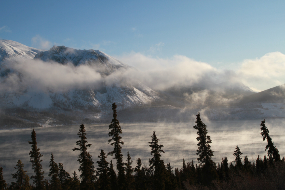
The hoar frost was particularly good down Windy Arm of Tagish Lake, and the grass in the foreground of the next photo was an addition that kept us there for a few minutes.
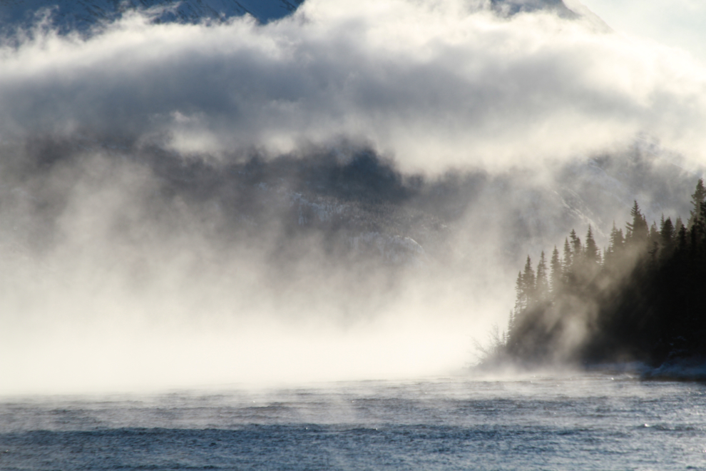
The north wind was piling up the fog and low cloud at the south end of Windy Arm, and that provided some extra drama for photos.
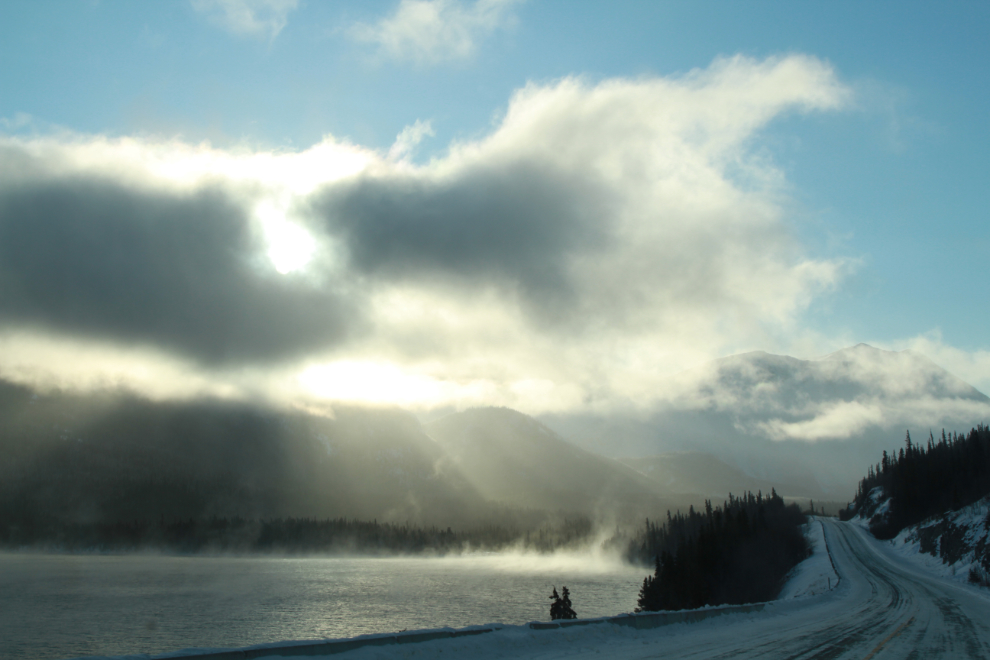
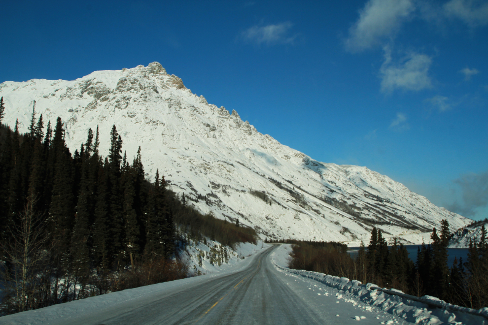
At the south end of Windy Arm the highway climbs a few hundred feet – in the next photo we’re dropping back down to Tutshi Lake.
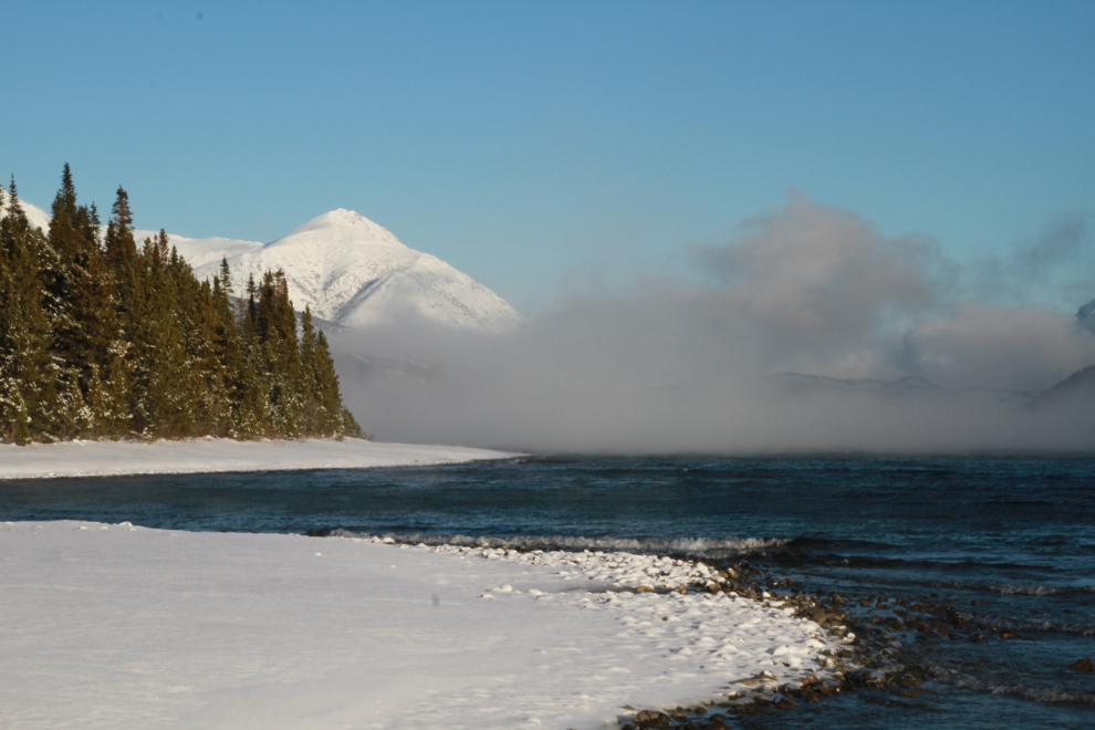
We reached our planned destination, a large pullout on the beach of Tutshi Lake, at 1:15. This is where I always stop to run the dogs when we’re going to the White Pass or Skagway, and I always stopped here when guiding tours. It’s hard to imagine how many hundred times I’ve been here, yet I still love it. It’s always spectacular, and every day is a bit different. The conditions this day were superb for photographers.
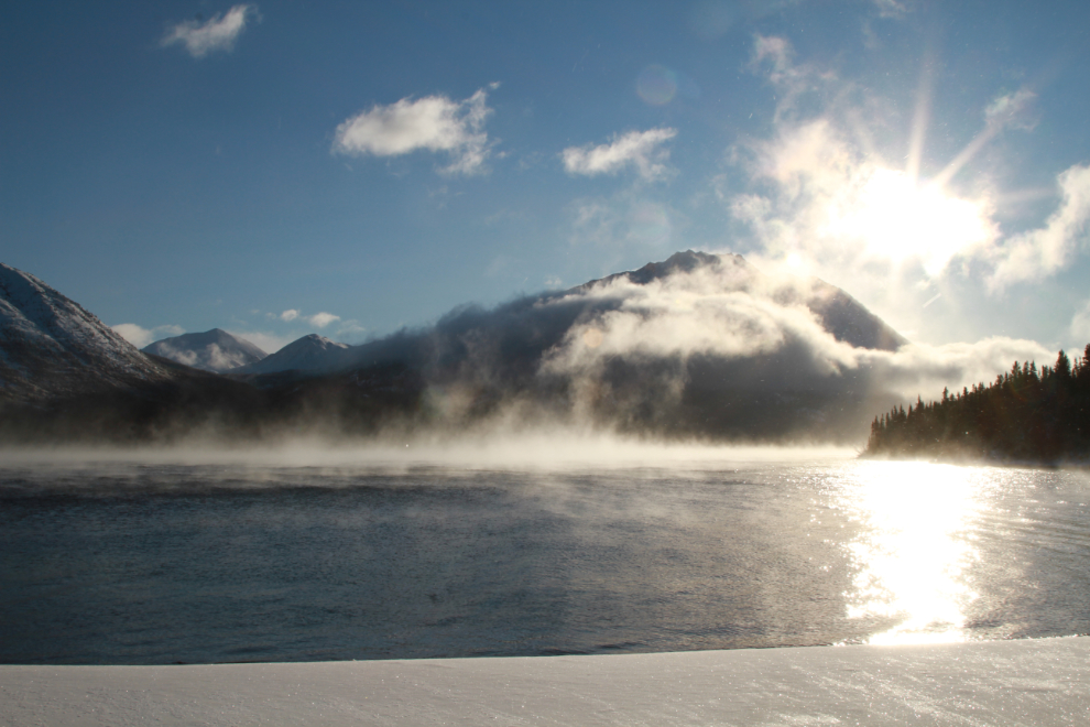
The pullout is in a shallow bay that’s somewhat protected from a north wind. I walked north up the beach a few hundred meters to get photos of the wall of fog that way, and the icy surf breaking on the shore.


The highway along Tutshi Lake is where I’ve had my best luck meeting lynx over the years. These tracks at the pullout were all we saw of the impressive cats this day, though.

“How many photos can you take of fog???”, some might say. “Lots” is my answer 🙂 – even looking in one specific direction, the view is constantly changing and some wonderful patterns emerge.
I shot a couple of 30-second videos of the fog and the waves. See them at Youtube – https://www.youtube.com/watch?v=91RdOTrQVLg
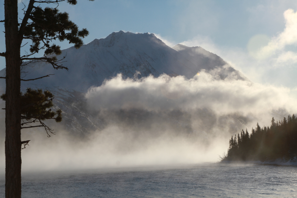
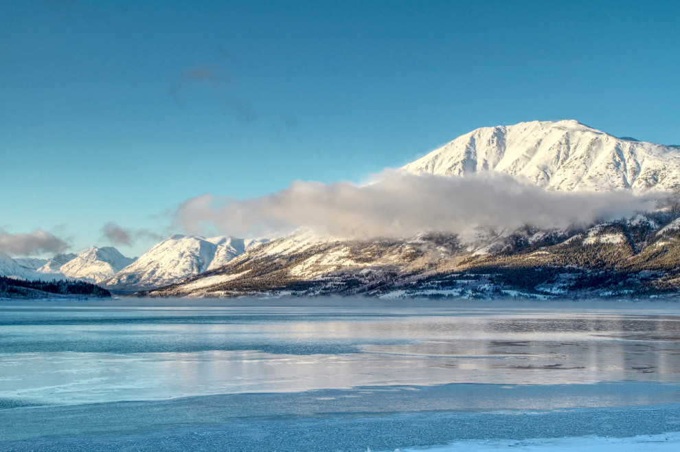
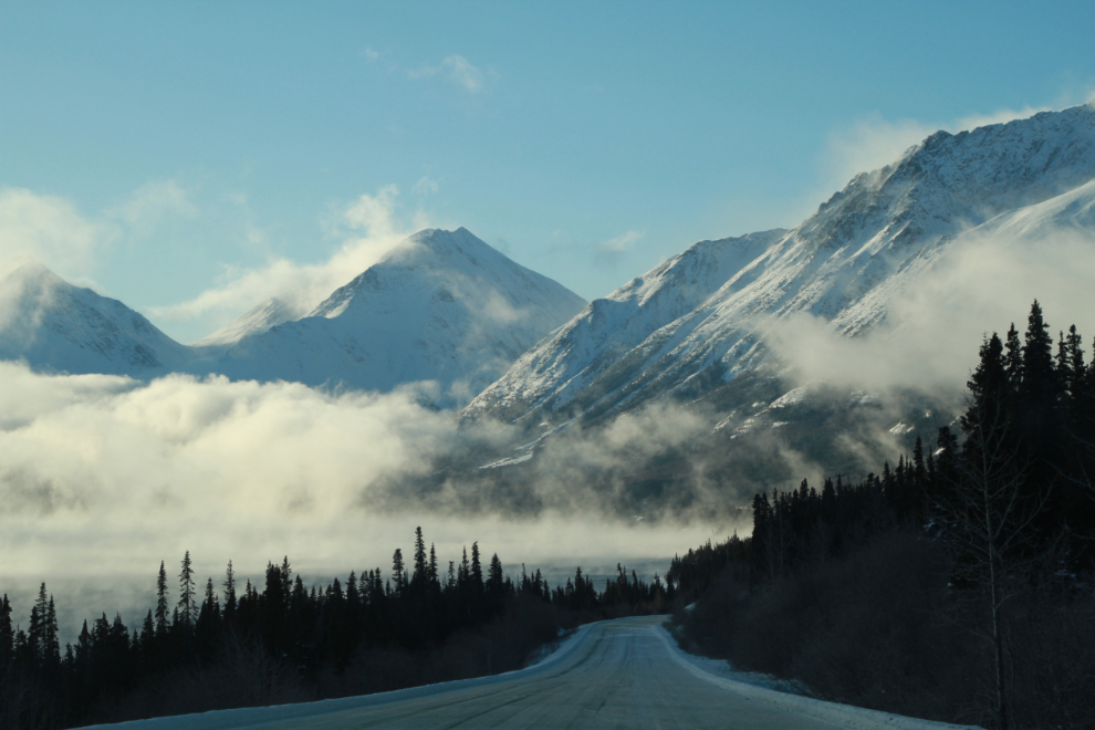
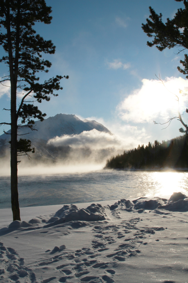
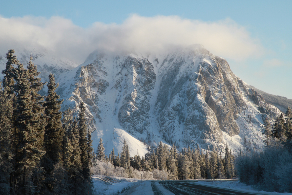
Heading north again, with Dail Peak, right on the BC/Yukon border, dominating our view. This is one of the specific views that make me deeply happy to live in the Yukon – the power of that mountain is so incredible. I climbed about half-way up many years ago while exploring old mines.
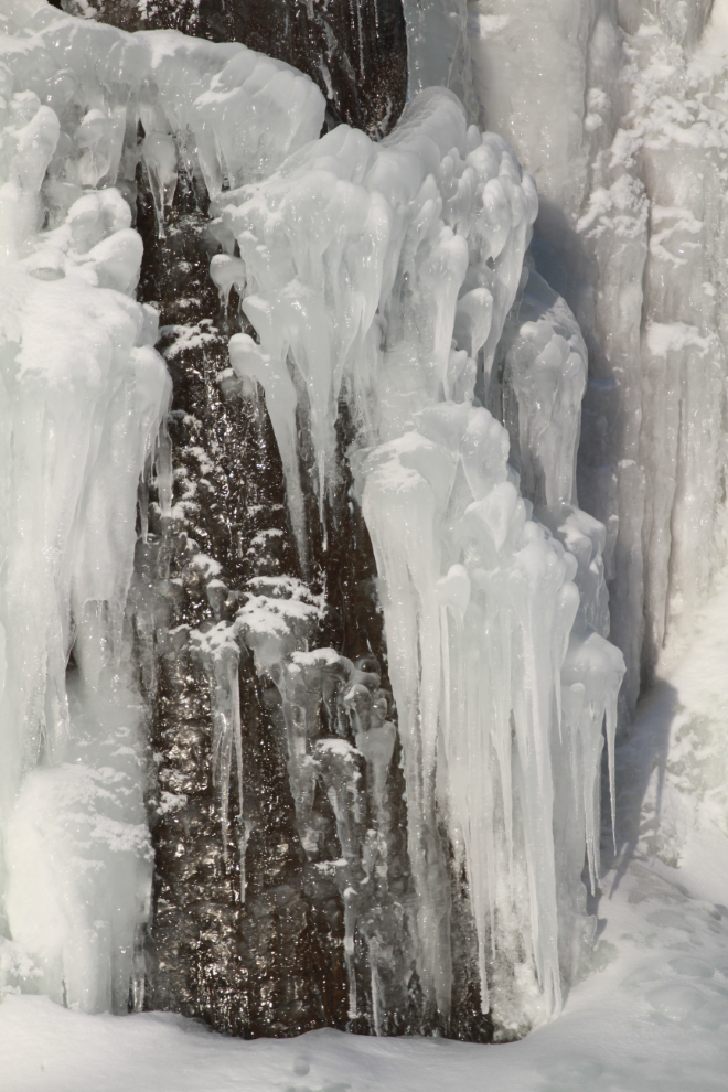
At the Venus silver mine, a spring above the highway produces a contant year-round flow of water, and in the winter the ice produced is wonderful for photographers and ice-climbers, and a pain for highway maintenance crews when it goes across the highway.
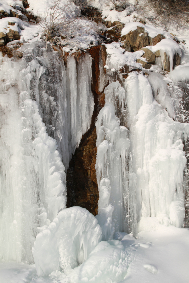
There’s no pulloff at the spring or we would have spent quite a while there. While there was no traffic, there’s a Murphy’s Law that covers such things, and a semi was bound to be coming along shortly.
Being a passenger instead of the driver makes some photography so much easier 🙂
It looked very cold down there on Windy Arm!

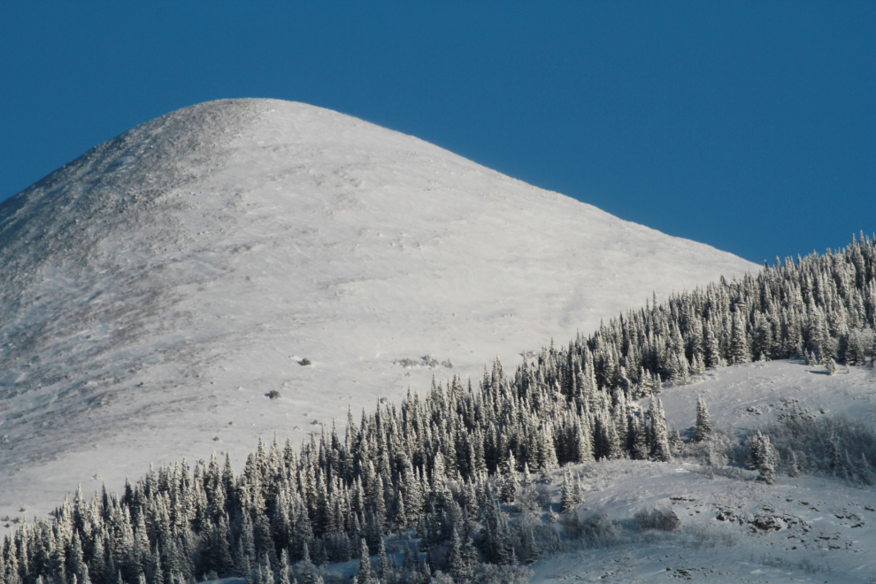
A look in the rear-view mirror prompted a stop for a few photos of White Mountain (which is at the Bove Island viewpoint).
South of Carcross, I think 3 fuel tankers were the only traffic we saw.
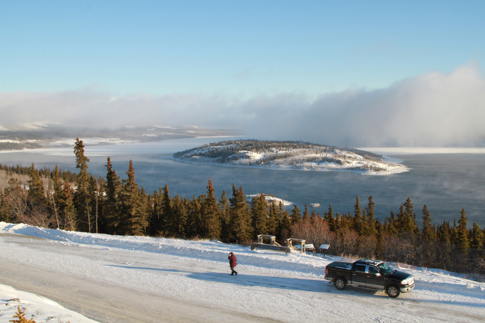
One final stop at Carcross for some photos of Nares Lake and Mountain. The trees in the next photo are on Nares Mountain, the bare peak is Fourth of July Mountain.
Outings like this are very important for my mental health. Ten days ago I got my car stuck in a snowbank I didn’t see – a few minutes digging it out made me quite sick (brain injury sick), and having a friend to get me out is huge.
We’re still in a pretty good situation in the Yukon with COVID-19, though a new case reported in Whitehorse prompted the Premier to announce late last night that as of Friday our borders are closed again to all but essential travel. I expect that the news conference scheduled for this morning will clarify that the new case came from BC. Please do whatever you can to stay safe, my friends, and help others stay safe.
As always fabulous photos of a drive you have documented for all of us to enjoy many times during the warmer weather… thanks for sharing. I failed to properly navigate the original web site and missed this posting when it was posted.
Comment
Murray, thank you so much for your beautiful photos, your interesting commentary, your blogs and historical research. And your dogs and cats. I have been following your blog for years; such enjoyment it brings. Once the border opens between the Yukon and Alaska, a road trip to Whitehorse, Carcross and Atlin are planned. Beautiful country. I wish you and your family good health and your improvement. Thank you again.
Wonderful pictures Murray
Stay safe & healthy dear friend
Comment
Looks like a great trip, Murray.