Alaska Highway RVing: Whitehorse to Liard River
I’m posting this from Dawson Creek, day 3 of what will be about a month-long trip. So far, we’ve had good weather, very good Fall colours, and decent wildlife sightings.
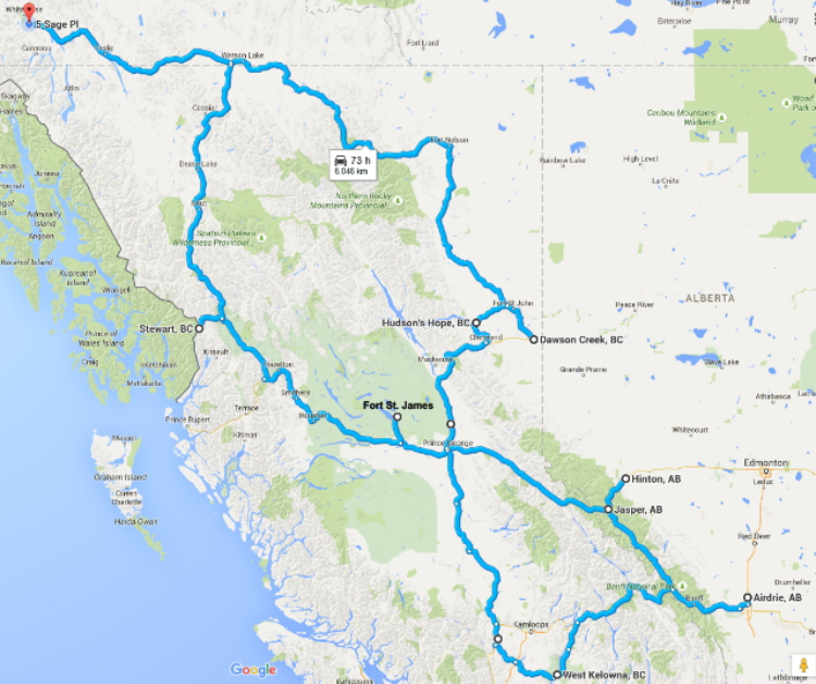
This will be my route – basically a figure-8 through much of BC, and a bit of the Alberta Rockies.
I took all the fur-kids to the vet on Tuesday to get flea/tick/heartworm protection, and for an assessment of Montys condition. Although he has some bad days, he has many more good days and he loves motorhome trips, so it looks good.
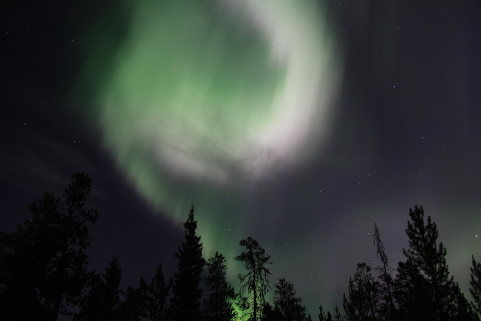
A few hours before I left Whitehorse on Wednesday (September 9th), we had a very good aurora display for several hours. At 04:35, we had about 5 minutes of the most incredible Northern Lights I’ve ever seen – a tight display directly overhead, mostly red and so fast-moving it made me think of fireworks. Late in the morning, the aurora was joined by a very large meteorite that split into 2 – although my camera’s shutter was open and I thought that I might have caught it, it was a couple of degrees outside the camera’s angle of view.
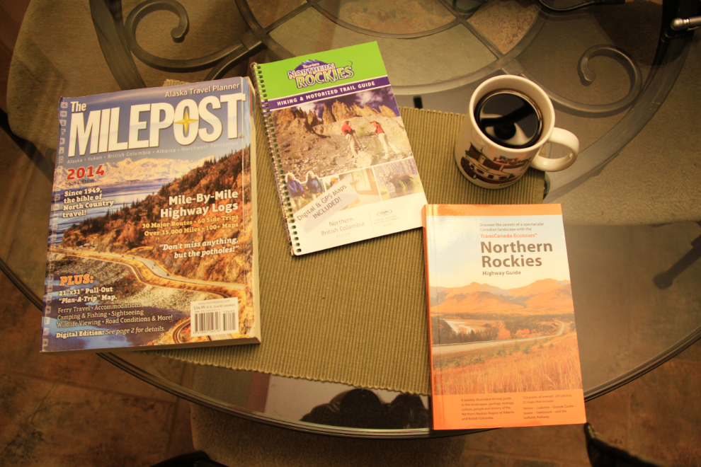
Well energized by the aurora, I did some reading – these will be my main research books for the first 10 days or so.
As the sun came up, more wonderful colours were added the the day’s palette (I shot this from the living room window at 07:02). Almost packed and ready to hit the road! After loading more groceries and attending to few other chores, we were away just before 09:00.
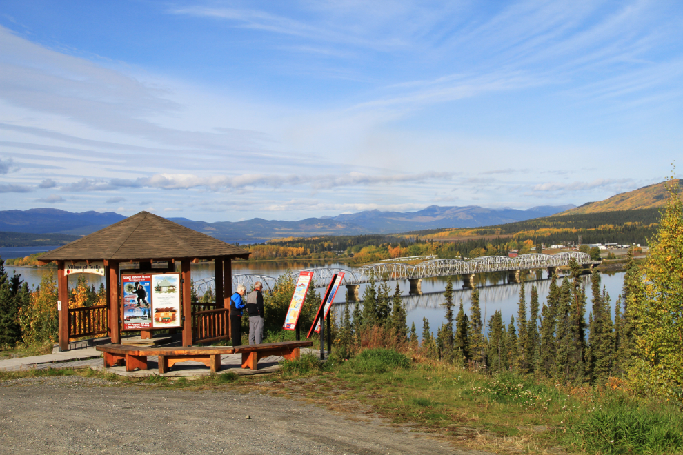
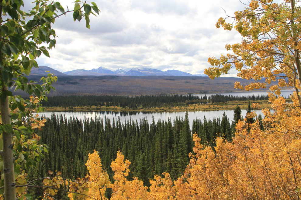
My draft itinerary called for us to be at Liard Hot Springs the first night, 630 km from home, but I wasn’t particularly focussed to do that, so we stopped often. I was surprised to find that the highway between Jake’s Corner at Teslin, normally in really good condition, had a lot of very large, very deep potholes, and I really needed to keep my eyes on the road. The viewpoint at Teslin, looking over the Nisutlin Bay Bridge, is a must-stop in any season – we got here a couple of minutes past 11:00.
The Swan Lake Rest Area at Km 1152 offered a scenic spot for lunch.
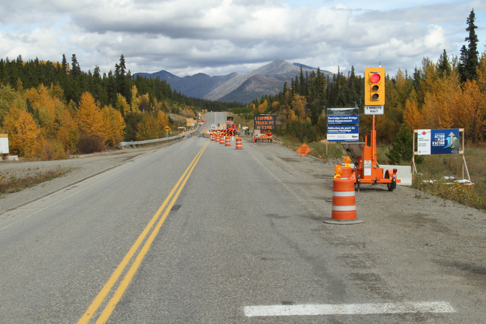
The deck on the bridge over Partridge Creek (Km 1140.9) is being replaced, and we were stopped for a few minutes. I see the economics of using an automated stop light, but a flag person would have let us go, as there was no oncoming traffic for the 5 minutes we sat there. The very narrow space left for traffic must have some people driving large RVs with little experience puckered right up! 🙂
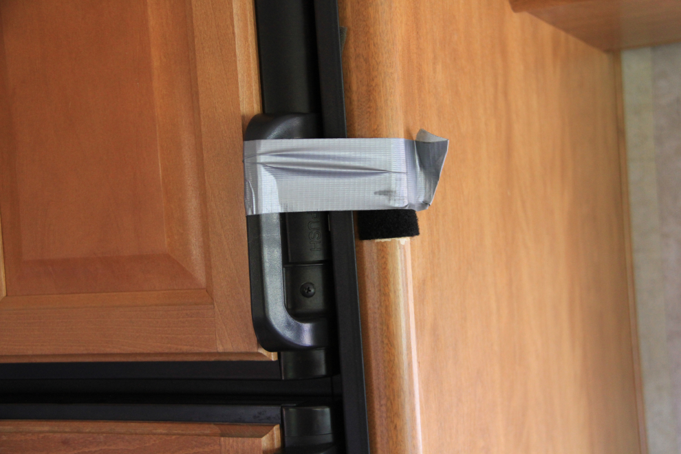
Not much of a MacGyver, but it was a quick way to stop the freezer door from flying open. It must need a new catch with more tension. I need to install a rear-view mirror so I can see what’s going on in the rig behind me.
There’s very little traffic, especially tourist traffic, on the Alaska Highway now. And very few of the type of bugs that make a mess of the windshield, either – perfect 🙂
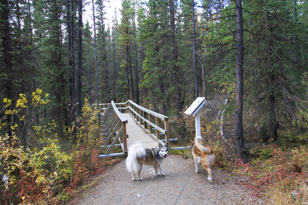
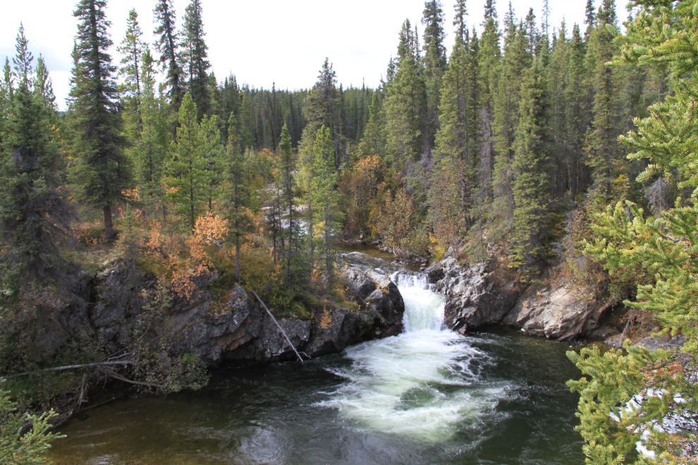
Rancheria Falls Recreation Site at Km 1112.8 seemed like a good spot to stretch our legs. A trail, about half of which is elevated boardwalk, runs 500 meters (1/3 of a mile) to a pair of lovely waterfalls. The highway crosses the Yukon/BC border 6 times in this area so it’s hard to keep track of where you are, but Yukon Parks is responsible for this excellent little site.
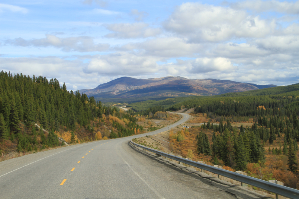
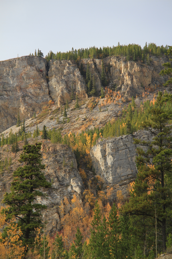
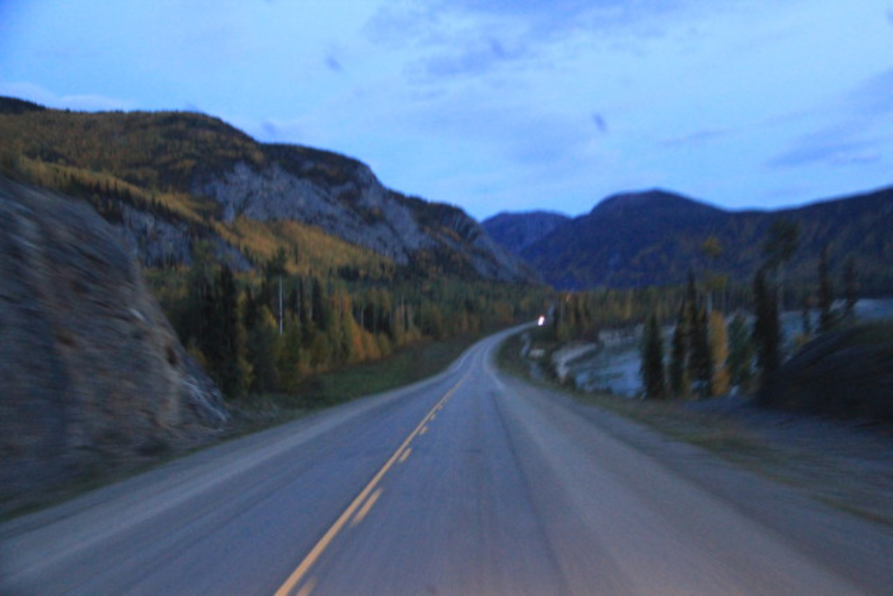
There are some really cool rock formations hanging over the highway in many places. This is the edge of a particularly impressive butte (unique in this area, too).
I decided at about 3:00 that we should have an afternoon nap – one of Monty’s favourite “activities”, and one that the girls both approve of as well 🙂 This was the view when we woke up an hour and a half later. I still marvel at how wonderful it is to be able to stop anywhere you want and have your home there to enjoy as you wish, whether that be a nap, a shower, a meal, or just a cozy place to read.
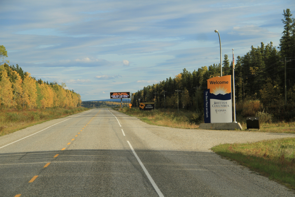
It was after 6:30 when we finally reached Watson Lake, where I stopped to fuel up. Right at 7:00, we made the “official” entry into British Columbia – meaning that the highway all in BC past this point.
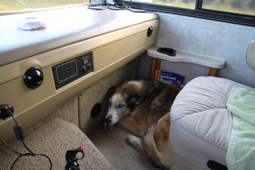
Monty was having a hard time getting comfortable – even tried squishing into this tiny spot a few times, then on the passenger seat, which didn’t work either. I may need to get another dog bed, since Bella keeps taking his.
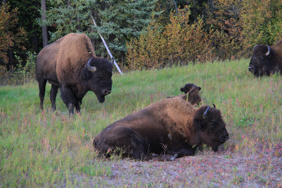
We’d seen 4 black bears during the afternoon, but even the dogs weren’t too interested in them. Bison are much better, perhaps because they’re bigger and closer. Within a few miles, we saw 60-70 of them.
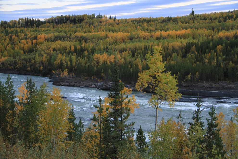
Cranberry Rapids on the Liard River, at Km 840.3 just north of Fireside, often stops me. One of these days, I need to hike down to the river’s edge. It would be a rough climb from here, but the Fireside RV park has a good trail to the river.
I misjudged my time a bit – it was 9:30 when I shot this and we were still a few miles from Liard River Hot Springs where I’d planned to spend the night.
It was pitch dark when we got to the hot springs, and for a few reasons, I decided to continue on a few miles. I parked on a high ridge that would give us great Northern Lights viewing if they returned! The plan for the next day was to disconnect the Tracker and drive it back to Smith River Falls, then return to the rig, re-hook, and continue on to Fort Nelson.