A winter drive down the Icefields Parkway in the Canadian Rockies
Day 3 of the trip (December 8th) got me to Airdrie, where both my kids and their families live. It was a fairly easy day with 635 km to cover, but having perfect weather on the Icefields Parkway made it a fairly slow drive with lots of photo stops. I tried to keep the number of photos in the post down to a reasonable number, but the day was so incredible, there are 47.
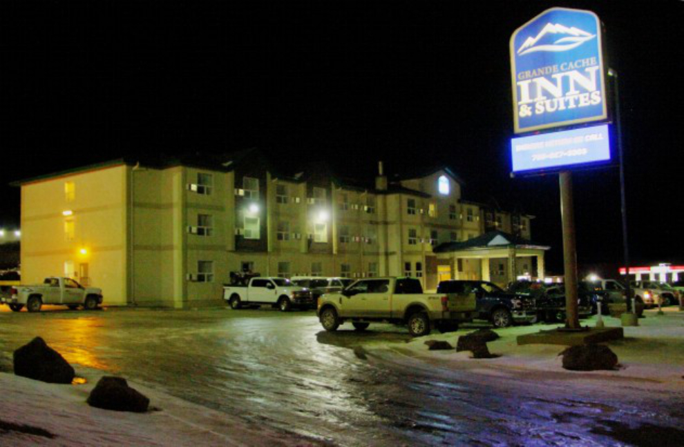
My stay at the Grande Cache Inn and Suites included a hot buffet breakfast, and it was quite good. I was the only tourist – the other 10 or so people were all workmen of some sort. Breakfast started at 06:00, and by 06:35 I was back on the road, headed south on Highway 40.
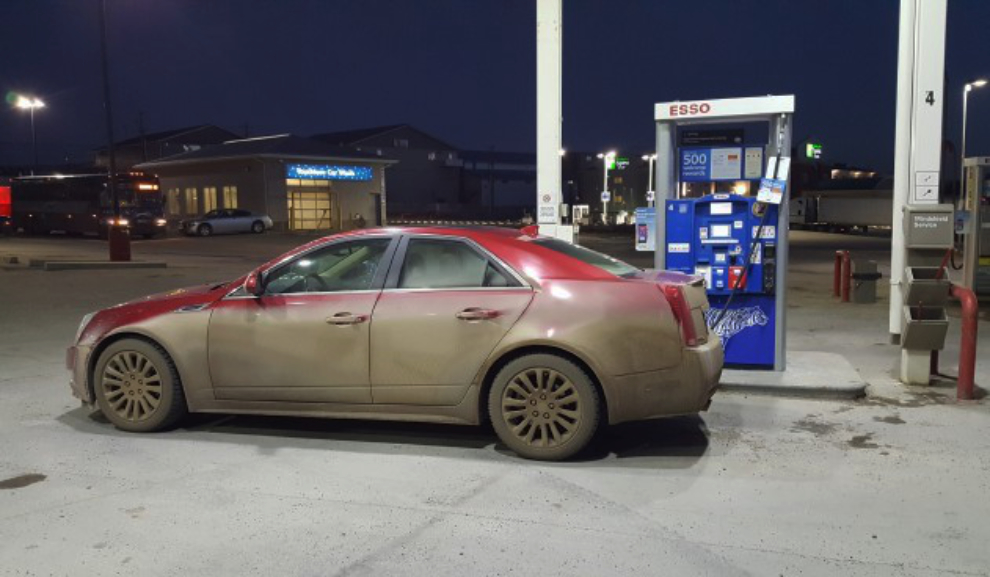
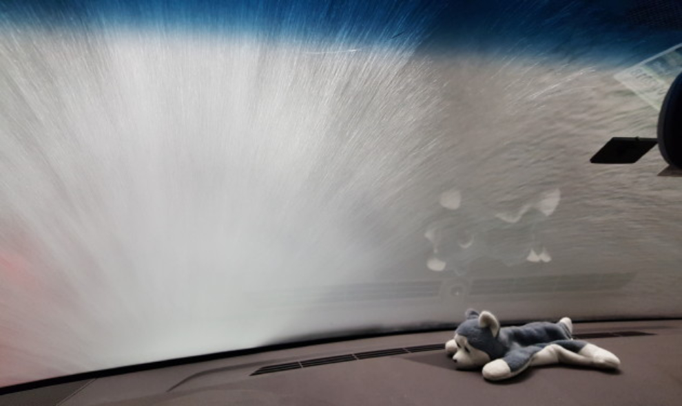
I decided to make a short detour up Highway 16 into Hinton to get gas, and then figured that I might as well run Ruby through the automatic car wash. For $14.99, the deluxe wash wasn’t a very good wash, but it was a fairly safe bet that it would be dirty again before I reached Airdrie anyway.
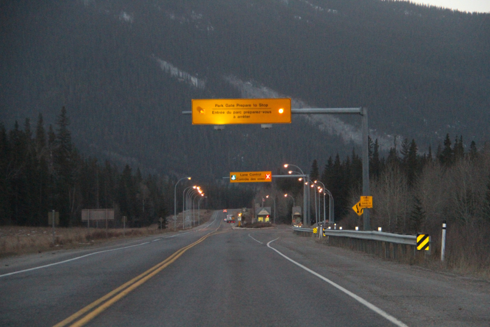
At 08:40, I reached the Jasper park gates on Highway 16. Luckily, I had remembered to take my Parks Canada annual pass out of the RV before leaving home, and a glance at that was all the ranger needed to wave me through.
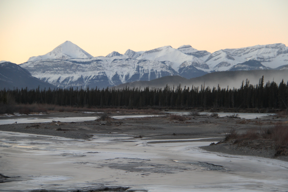
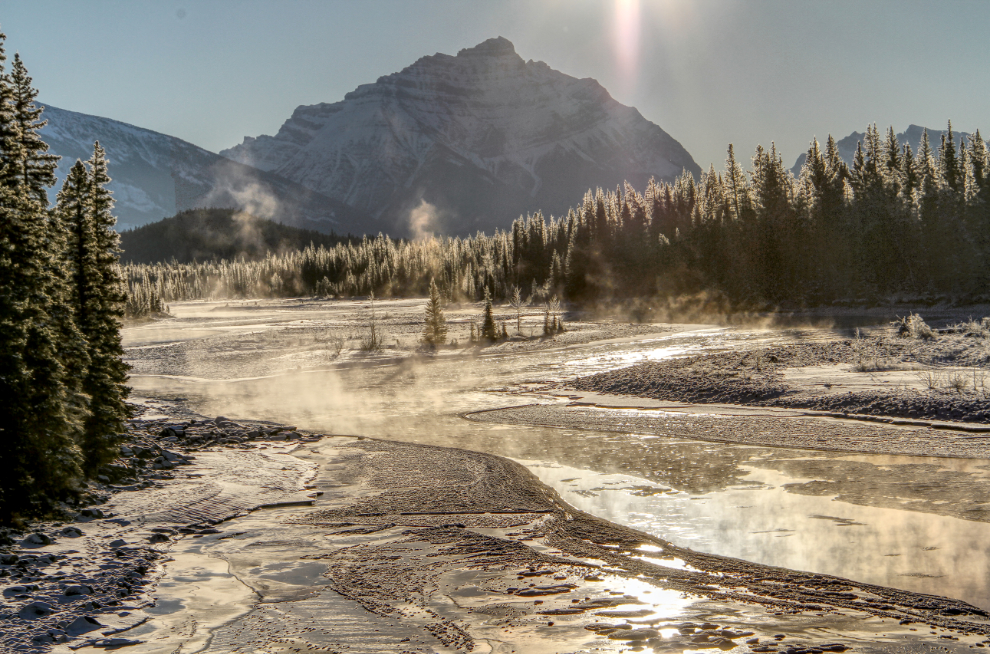
Sunrise was officially at 08:56, but it takes a very long time for the sun to peek over the high rocks near Jasper. This was shot along Jasper Lake, a widening of the Athabaska River. Very strong winds were raising a lot of dust off the sand flats.
I pulled off to the Jasper airport to wait for some better light to arrive, but didn’t stay long. I decided that I’d only have great light for a short period, and where exactly that was didn’t really matter.
The view from the short road from the airport back to the highway.
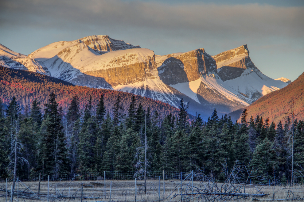
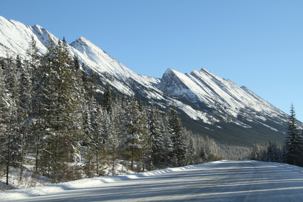
I stopped a long the highway a couple of times to photograph some of the more impressive mountains.
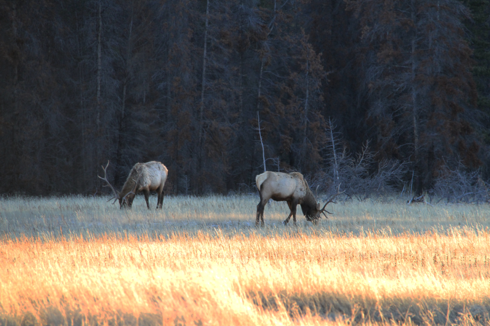
Four bull elk grazing in a meadow along the highway also stopped me a for a couple of minutes.
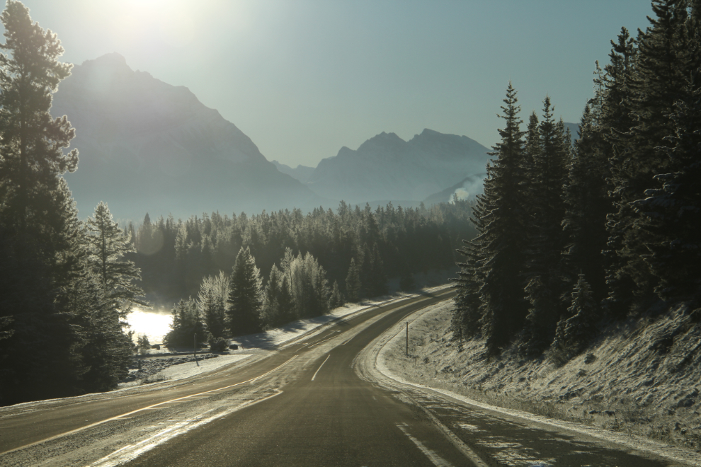
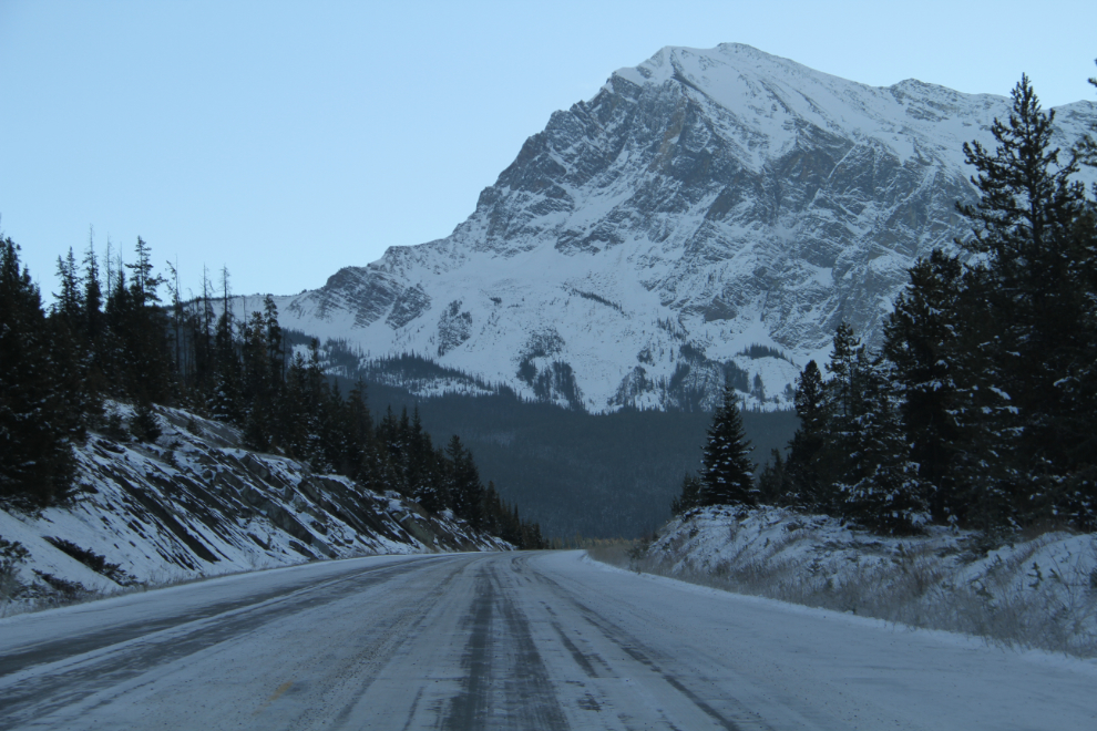
I detoured through the Jasper townsite, and right at 10:00 was on the Icefields Parkway, Highway 93. The light was stunning, if blinding in places.
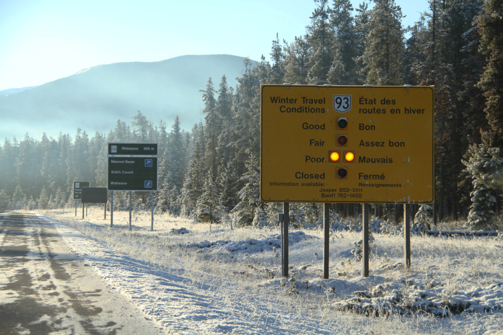
The Road Conditions sign at the Parks Canada gates, which were unmanned, reported “Poor” conditions. I’ve driven the Icefields Parkway when conditions were poor, and thought that was extremely unlikely today.
After driving across the North Saskatchewan River bridge, I parked on the wide shoulder and walked back for a few photos.
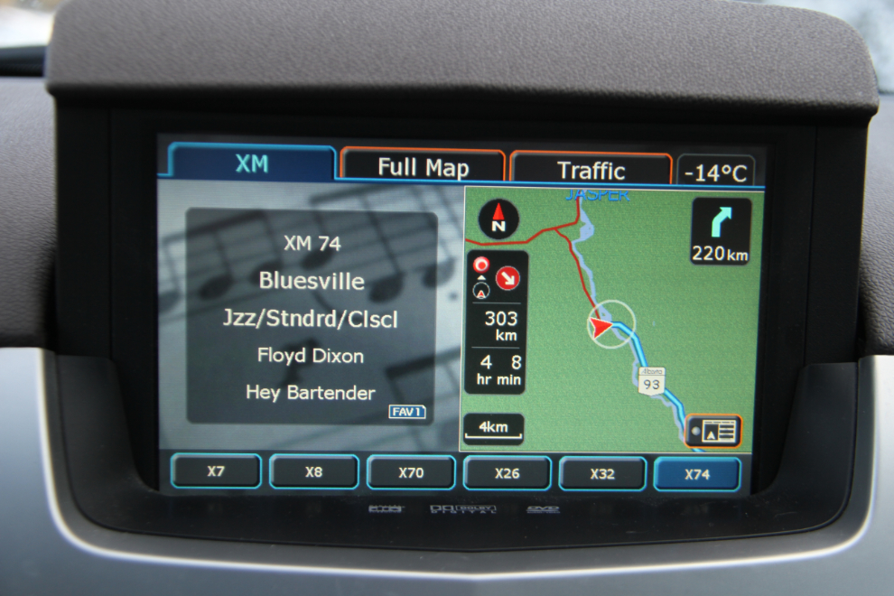
I tried a few Sirius stations that had the right mood for this day. Rock didn’t work, Blues lasted for a while, Jazz lasted even longer, but Silence is what I ended up with 🙂
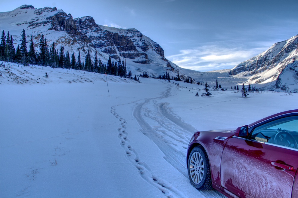
I’ve never posted a phone selfie before – now I have 🙂 This was shot with Mt. Hardisty in the background.
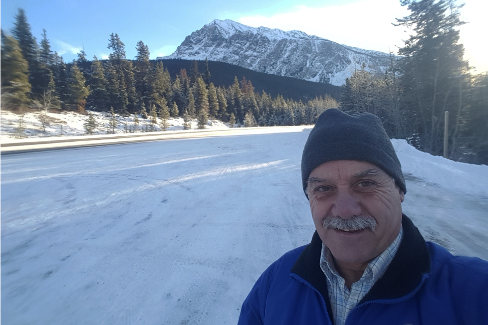
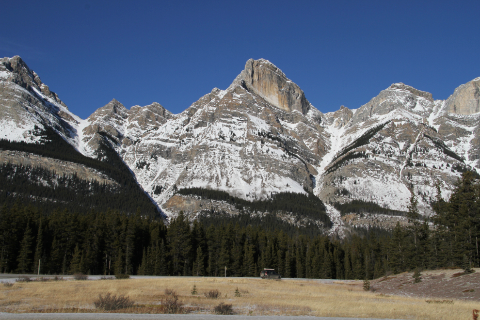
Mt. Hardisty is the first of the mountains that really dominates the view.
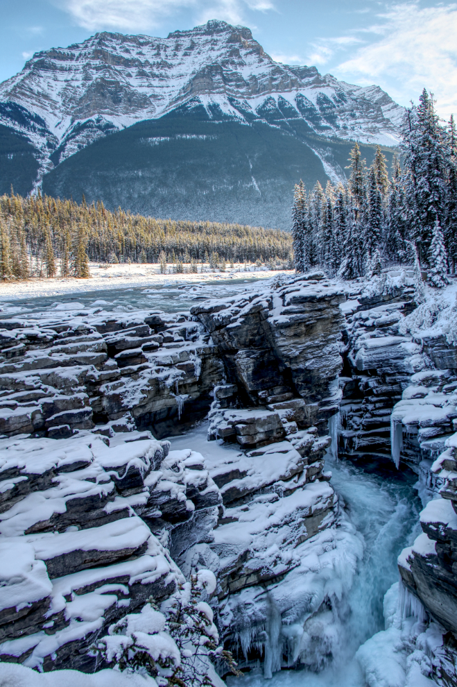
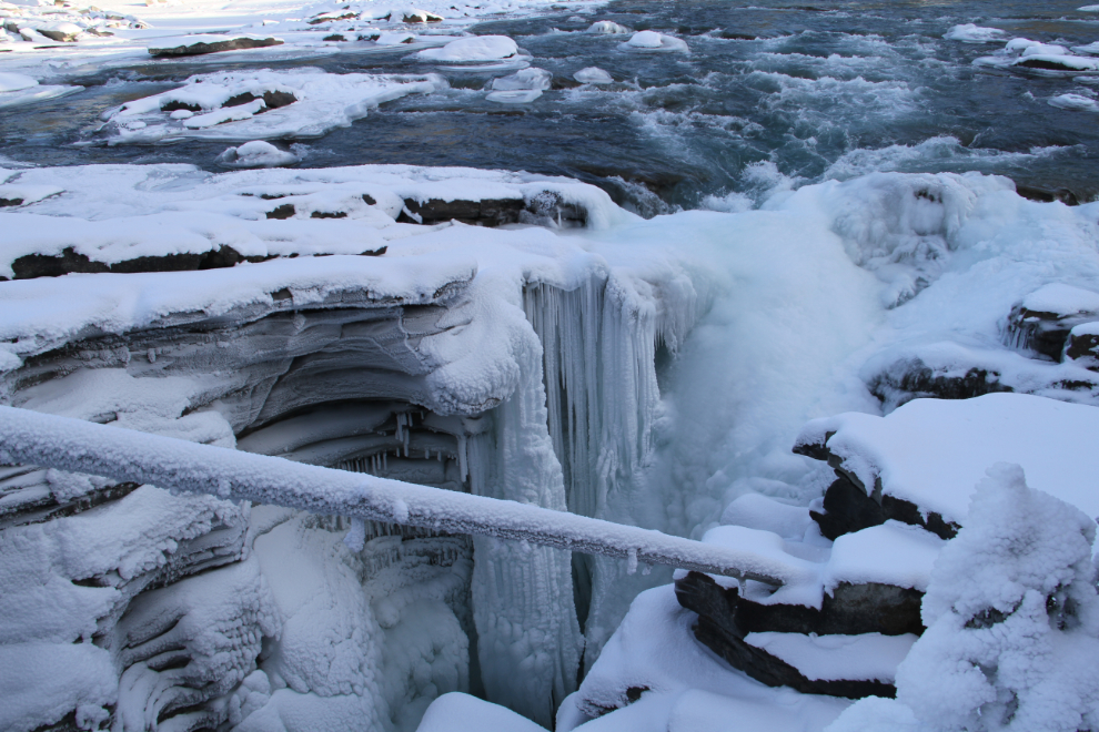
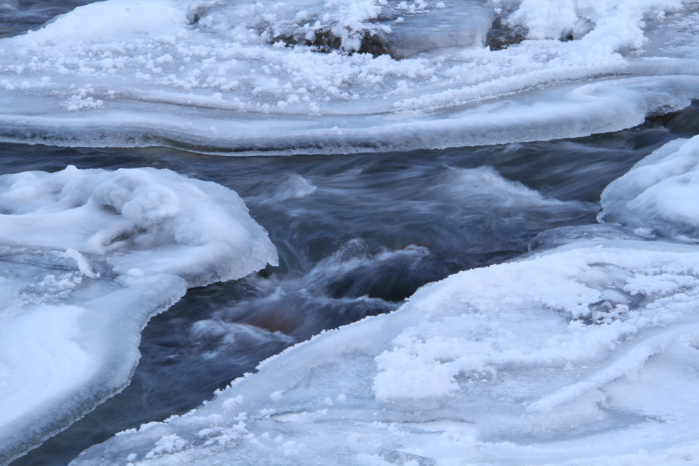
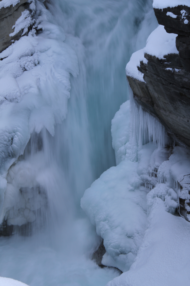
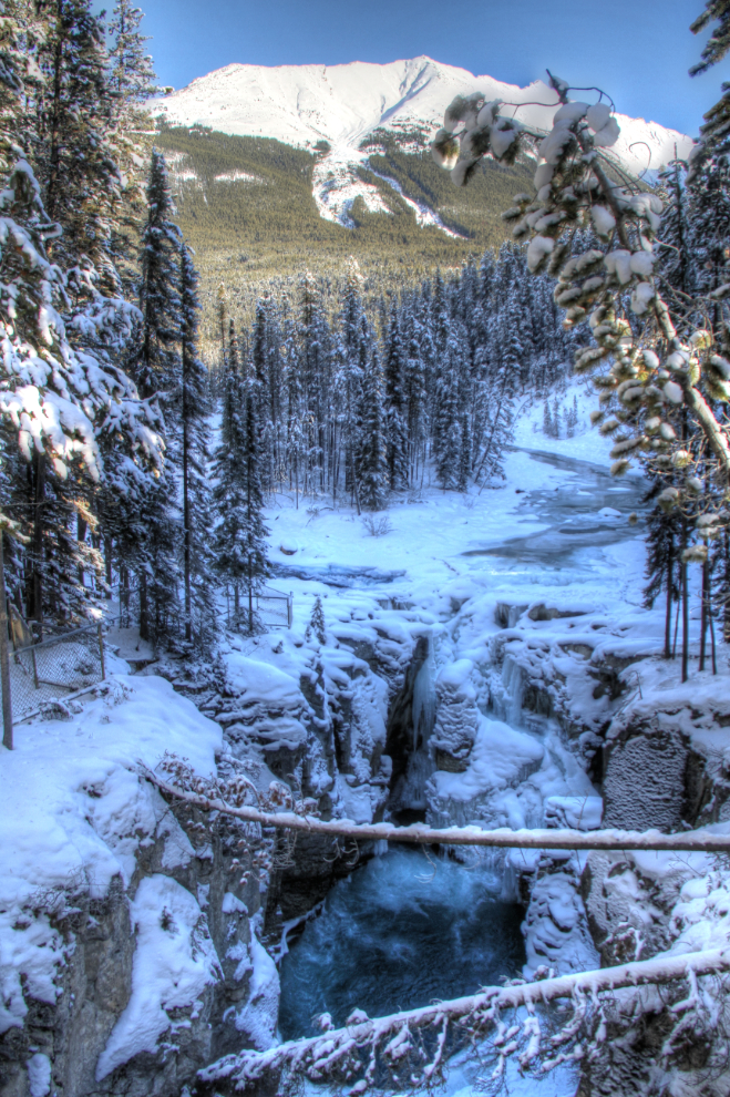
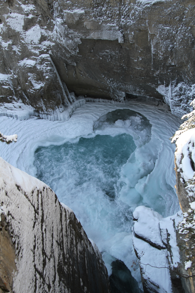
As many times as I’ve seen Athabaska Falls, I couldn’t resist taking the short side road to see them again.
Athabaska Falls may be best seen in the winter, with only 4 other people instead of hundreds, and the infinite wonderful shapes created in ice.
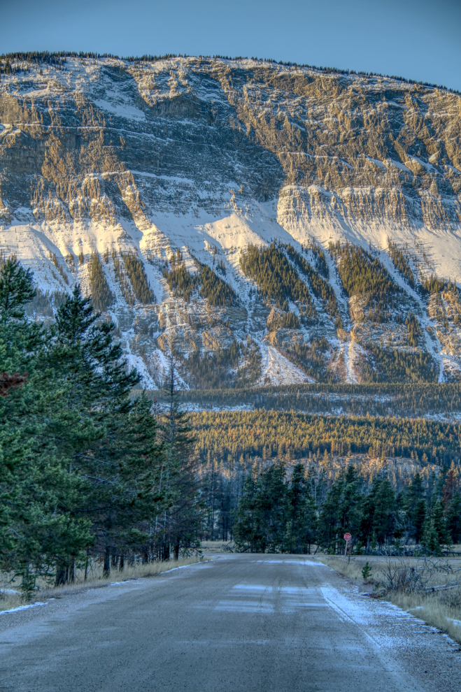
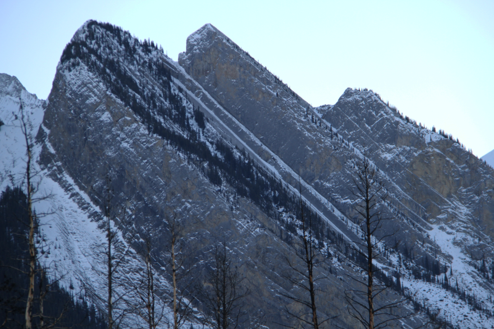
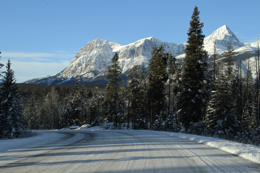
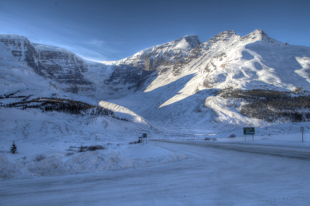
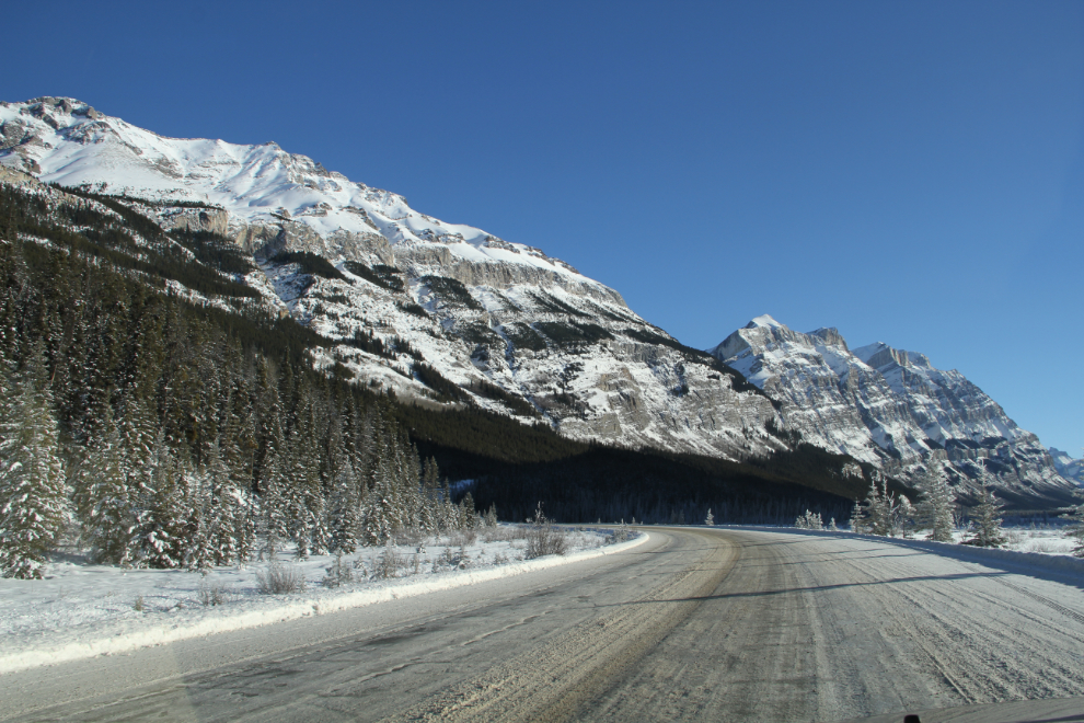
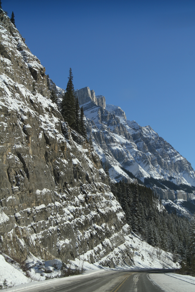
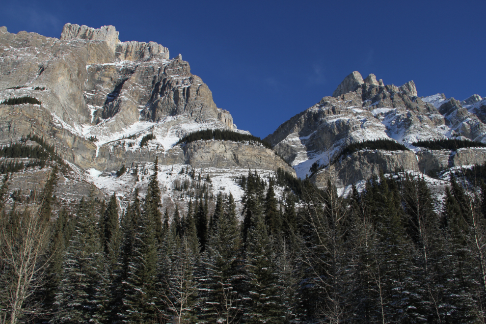
The variety of mountains along the Icefields Parkway is quite remarkable.
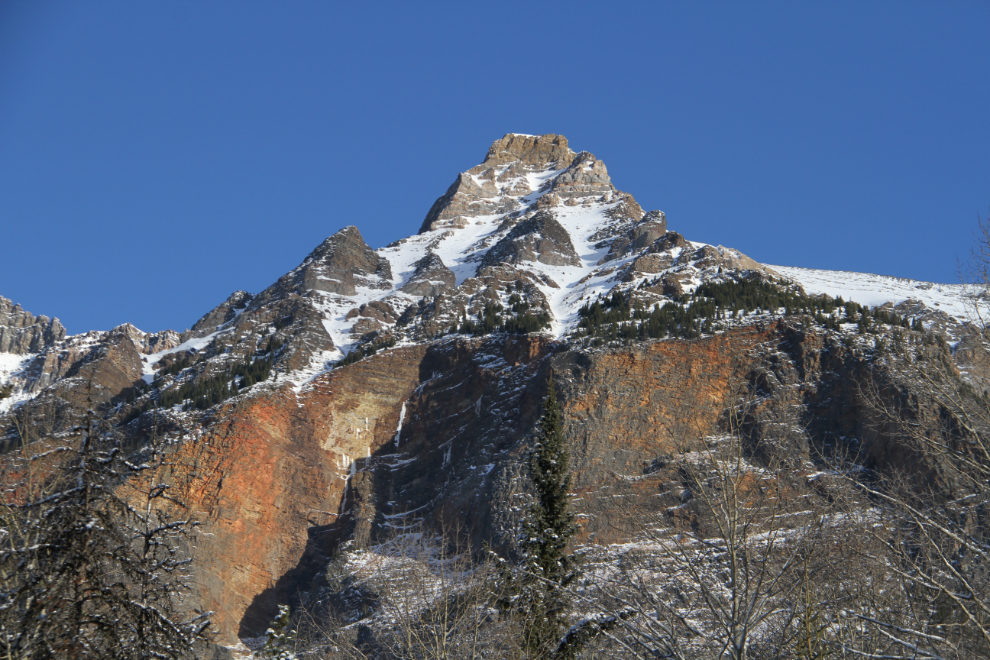
The way some of the mountains were created is clear – a break in the earth’s crust followed by an upthrust. We talk about the incredible forces of earthquakes and hurricanes, but what sort of force does this? Amazing.
I drove past Sunwapta Falls, and a few kilometers later did a U-turn and went back to the access road.
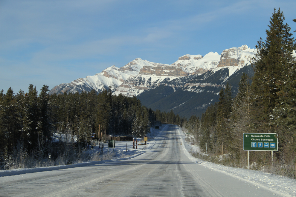
Even in the summer, Sunwapta Falls gets a tiny fraction of the number of visitors that Athabaska Falls does. I had the place all to myself. This is the upper falls – I didn’t hike down to the lower one.
It’s about 60 feet from the footbridge to the bottom of the canyon.
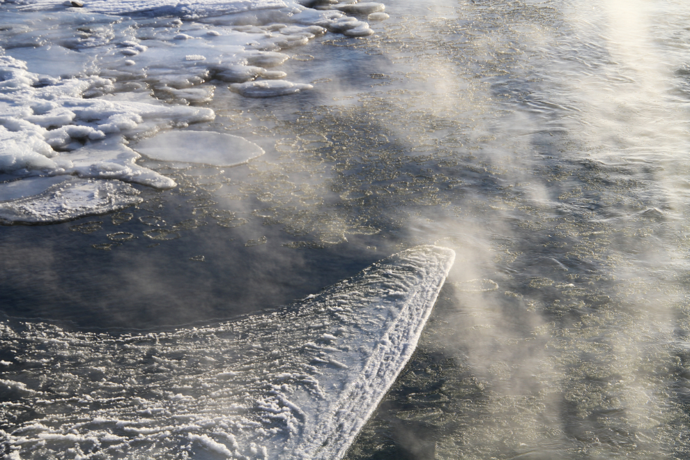
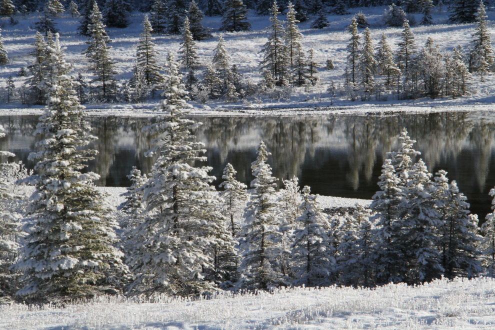
This pond stopped me for a few minutes to get some shots of hoar frost and reflections.
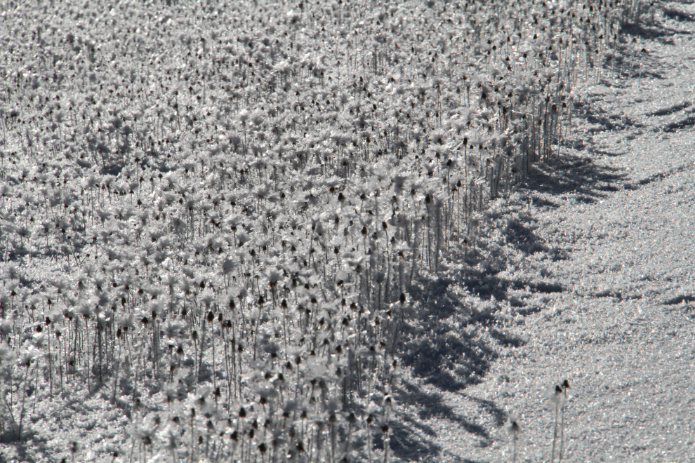
Thick hoar frost on flower seed-heads along the highway.
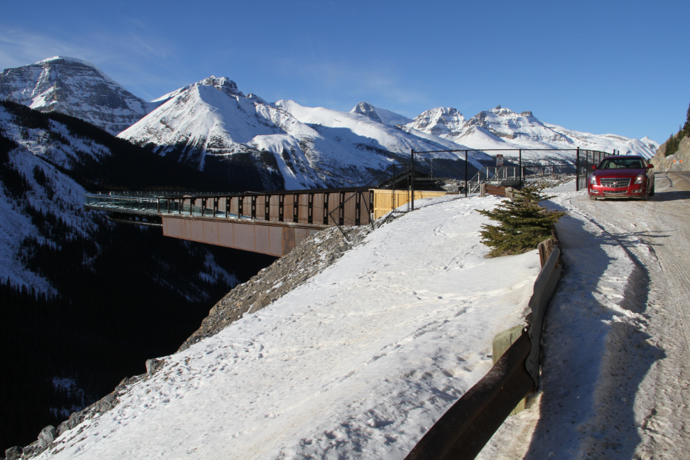
The Glacier Skywalk (a glass-floored walkway) is a popular attraction in the summer, but it’s wide open now and there are plenty of footprints on it. There are “No Trespassing” signs but that’s clearly just a legal thing – in the summer, fences make it all but impossible to trespass. I didn’t go on it – it doesn’t look all that impressive to me with snow covering the glass.
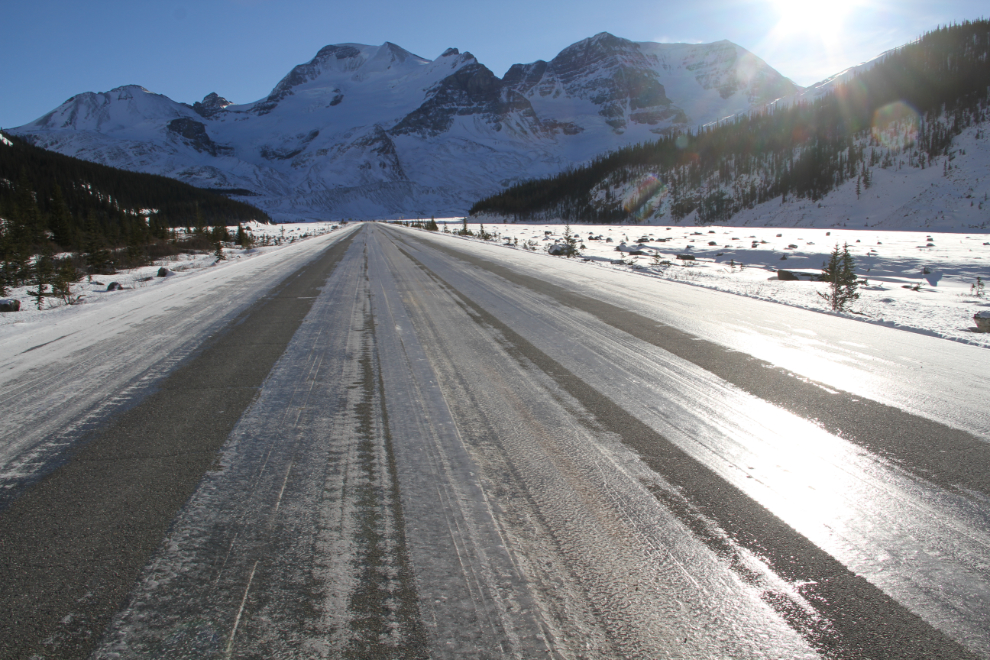
As I got close to the Columbia Icefield, the sun was at a good angle to show you the road surface. Yes, it is glare ice. It varies from about 60% of the road covered to 100%, but most of it is near the high end. I have all-wheel-drive and tires with a very high rating for gripping ice (Toyo Observe GSi-5), and to answer a question that I get fairly often, I drive at between 80 and 110 km/h (50-68 mph) depending on the condition of the specific section of road.
A road up the side of the glacier that’s locked in the summer was open, so I drove up it, but it wasn’t passable for very long.
Looking north on the Icefields Parkway from the glacier viewpoint road. There isn’t really a glacier viewpoint in the winter, though – it’s all just snow.
The shadows were so deep and dark that many of these photos are difficult even in HDR. The very popular viewpoint at the Big Hill and Big Bend gives visitors this perspective with the highway far below, but it wasn’t plowed, so I had to go a couple of miles past it, make a U-turn and come back to park on the safe(r) side of the highway.
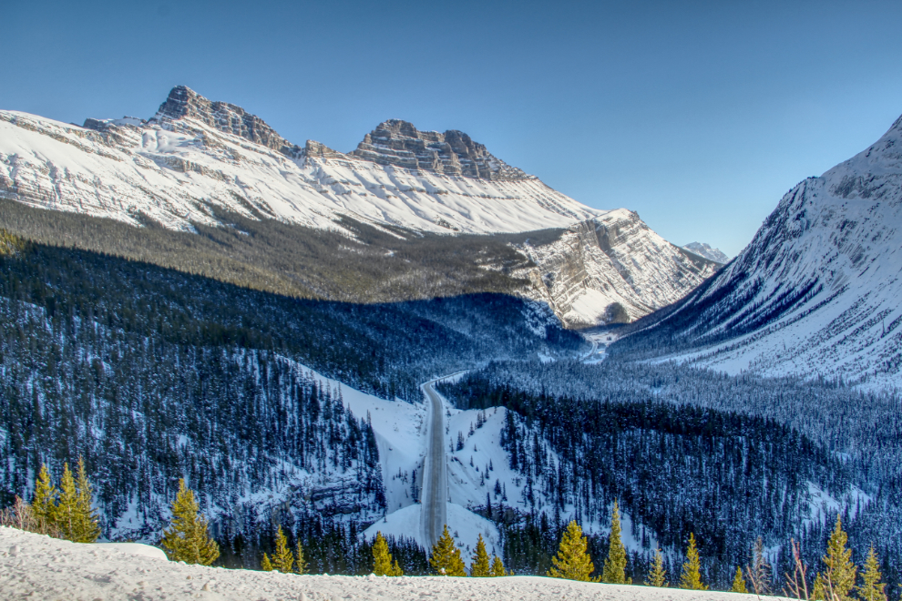
Cirrus Mountain.
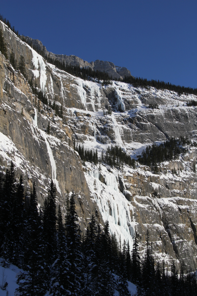
The Weeping Wall at Cirrus Mountain resembles a series of rivers of tears flowing down a wall some 100 meters high (330 feet). The main waterfall is called Teardrop.
On the Icefields Parkway, “spectacular” just goes on and on and on… 🙂
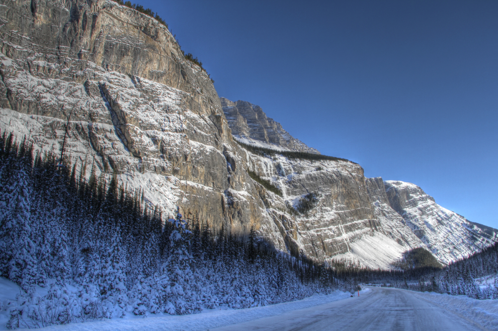
There seems to have little blasting done to build the highway – it just fit nicely into natural cuts.
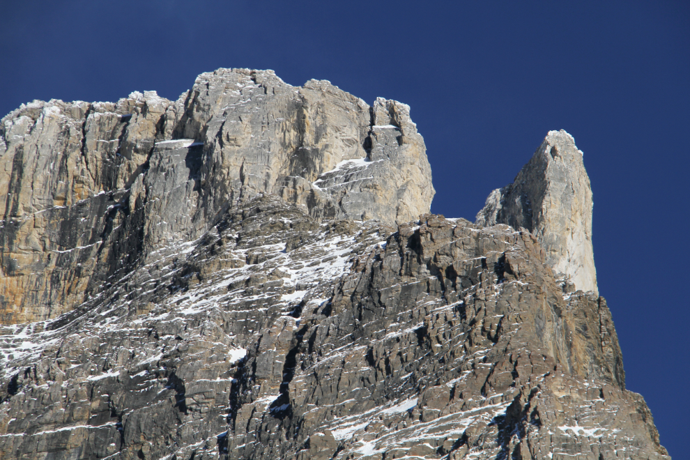
Some of the mountains are worth a close look – there are some incredible structures way up there.
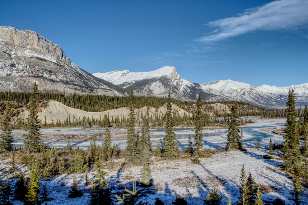
At Saskatchewan River Crossing, Alberta Highway 11 meets the Icefields Parkway. Highway 11 leads to Nordegg and Rocky Mountain House.
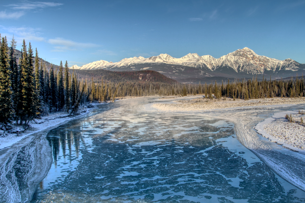
The North Saskatchewan River.
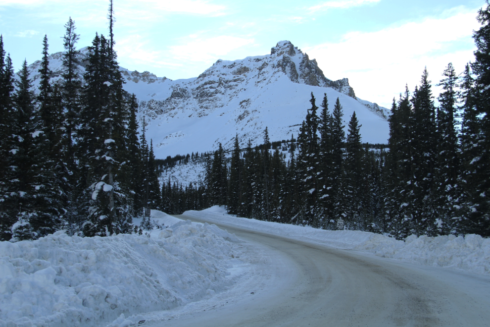
At Bow Summit, the snow all of a sudden got much deeper. I drove up the Peyto Lake parking lot, but when ice hides the lake’s incredible colour, the hike isn’t really worth it (unless you just want a walk in incredible surroundings).
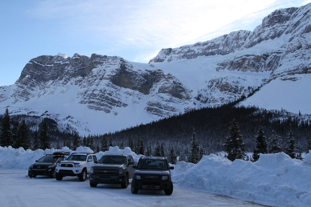
As I got towards the south end of the Icefields Parkway, there were more vehicles parked along the highway, and I saw a few people with snowshoes.
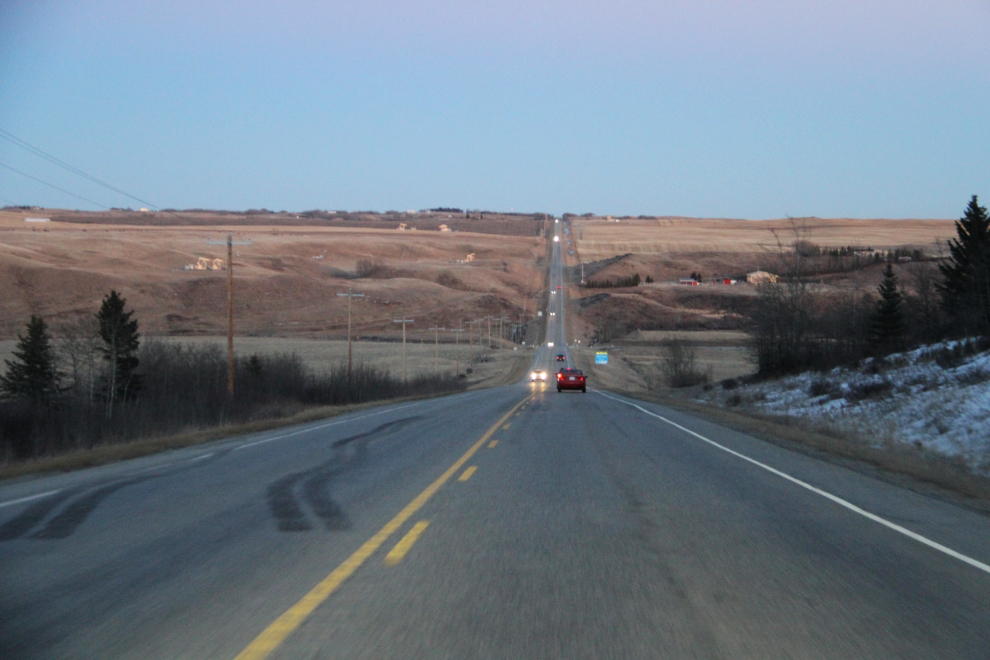
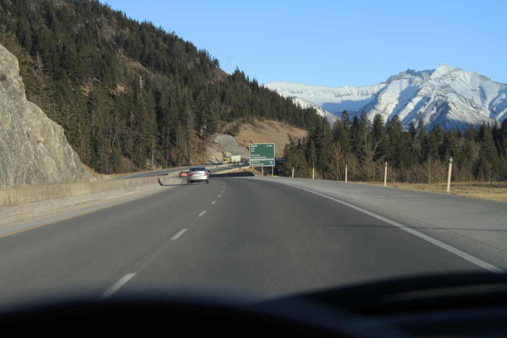
At about 4:00 pm, I turned off the Icefields Parkway onto Highway 1 near Lake Louise. I don’t like freeways. This photo was shot near Banff. I thought about turning off onto Highway 1A (the Bow Valley Parkway) when that became an option, but getting to Airdrie at a reasonable time was now more important, and that’s why freeways exist.
Out of the Rockies, east of Canmore.
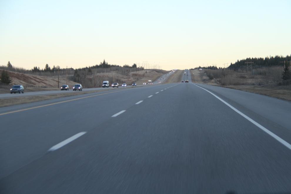
I lost daylight just after Big Hill Springs, so the timing was pretty much perfect. Now, I had 4 days in Airdrie with my kids and grandchildren.