Hiking Newfoundland’s Skerwink Trail
Friday, June 26th, Day 29 of our trip and the 22nd day in Newfoundland, involved a lot of walking. I started the day with 3.5 km on the Coastal Trail at Cape Bonavista, then drove south for the 5.9-km Skerwink Trail, then put in another 1.9 km wandering the historic district of Trinity. I use Strava to log the big stuff, then Sumsung Health records everything I do when I’m carrying my phone – this was a 20,172-steps day.
The weather prompted a one-day delay in our departure from Bonavista. Our draft itinerary called for us to leave on the 25th to hike the Skerwink, but the weather that day sucked. The forecast for the 26th was excellent, so that needed to be the Skerwink day.
The day started clear and chilly – 4°C and a breeze off the sea had me bundled up as I started south on the Coastal Trail, even wearing gloves.
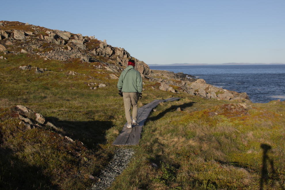
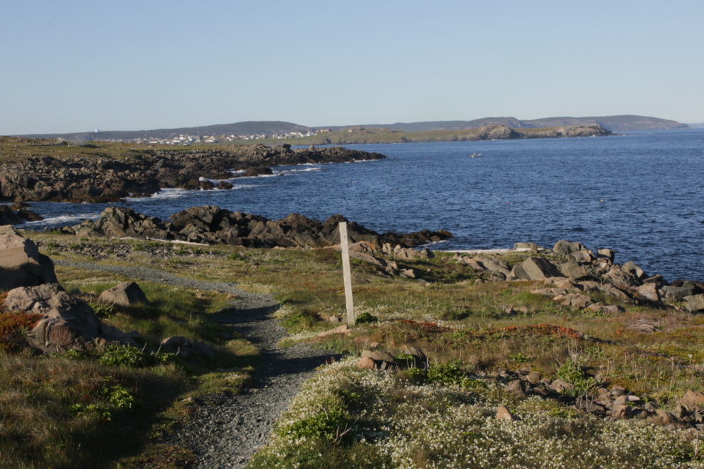
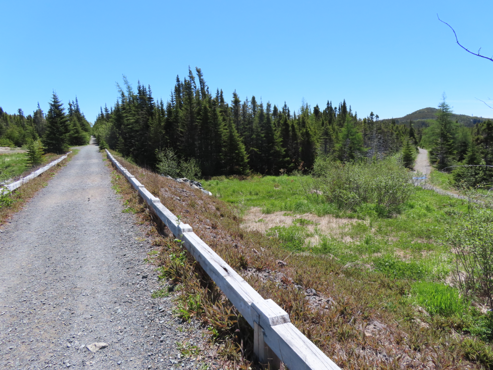
The 3-km-long trail is narrow but well built. Much of the ground here is very wet, and the surface is gravel laid over landscaping mat. In the next photo, Bonavista can be seen in the distance.
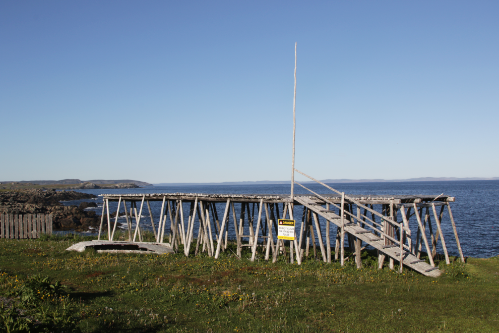
I walked as far as the Little Dairy KIng King restaurant, where they built a cod drying platform (called a “flake” in Newfoundland). The section that goes over the sea has been badly damaged (by storms, no doubt) but this main part gives a good look at the amount nof work required to build it, never mind to load it with fish.
I started walking back on the trail…
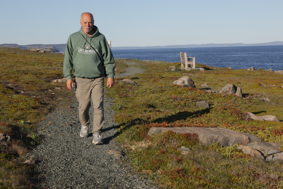
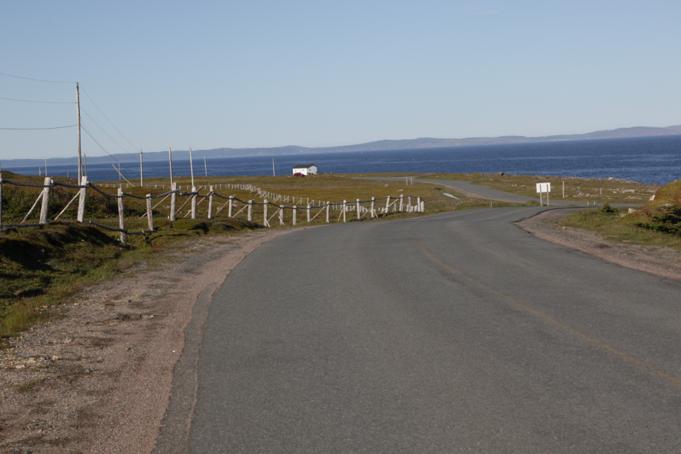
…but then crossed over to the road to get a record of it (that’s how I know how wet much of this country is). This is looking back to the south.
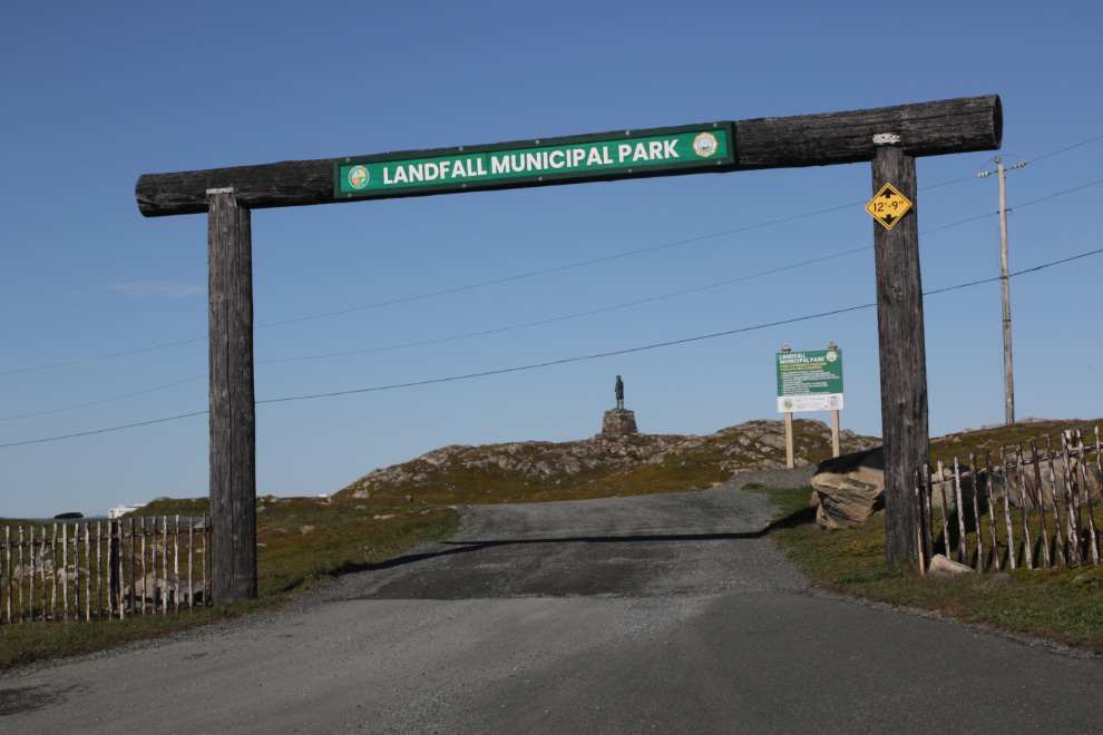
Back at the park where the RV was for 3 nights. The little yellow sign caused Cathy some consternation when we first arrived and I had to pull over and get the information sheet that showed that 12 feet 9 inches gave us lots of room to get under it.
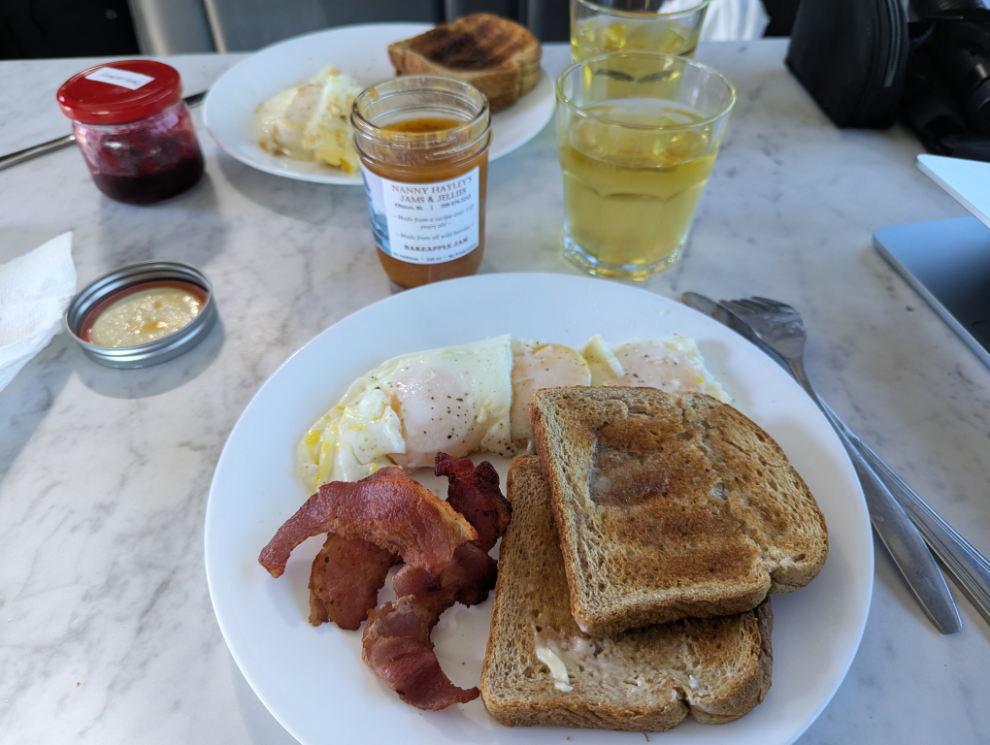
When I returned from that hike, Cathy suggested that a big breakfast was in order. We even had two Newfoundland jams for the toast – bakeapple and partridgeberry – YUUUM! Ready for a big day 🙂
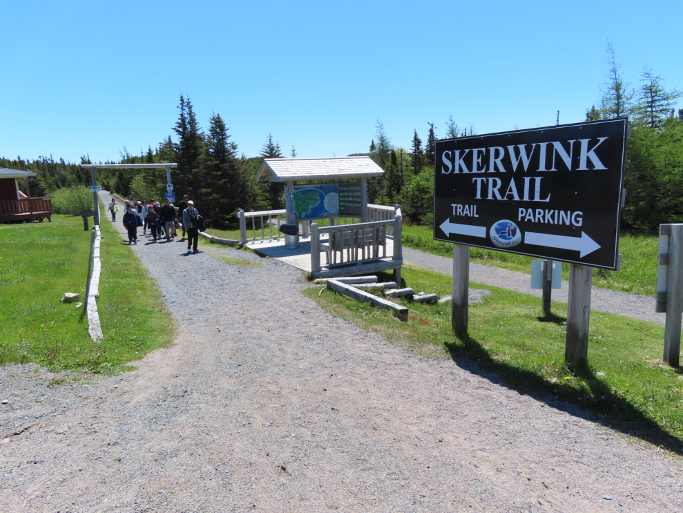
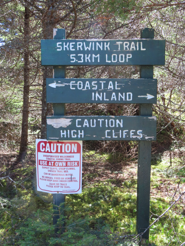
From the Cape to the start of the Skerwink Trail at the community of Trinity East is only 51 km. We were shocked by the number of vehicles and people at the trailhead! I eventually found a place to park on the shoulder of the main road, across from a church. It’s actually a former church – St. Andrews Anglican – and was recently put up for sale, for $169,900.
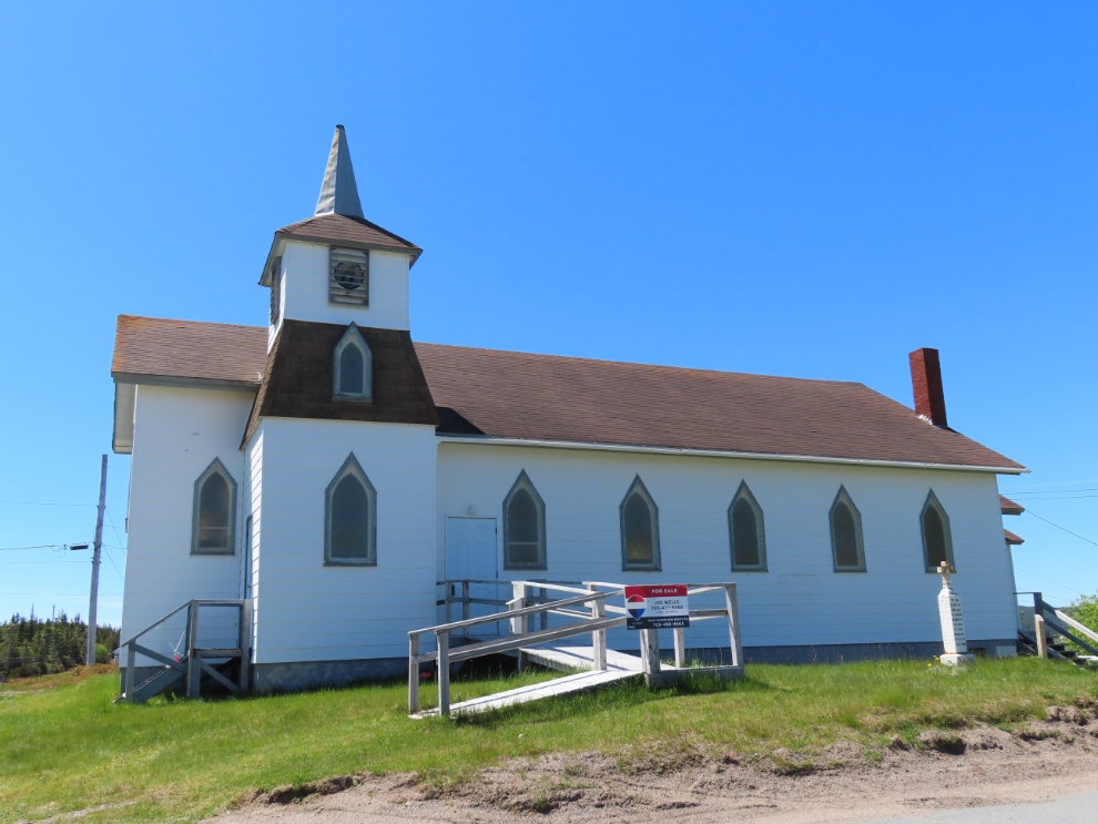
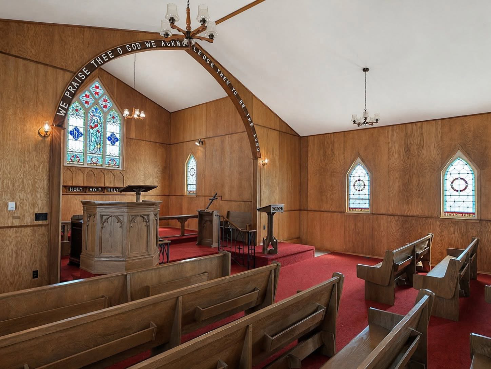
Here’s a photo of the interior, from the real estate listing.
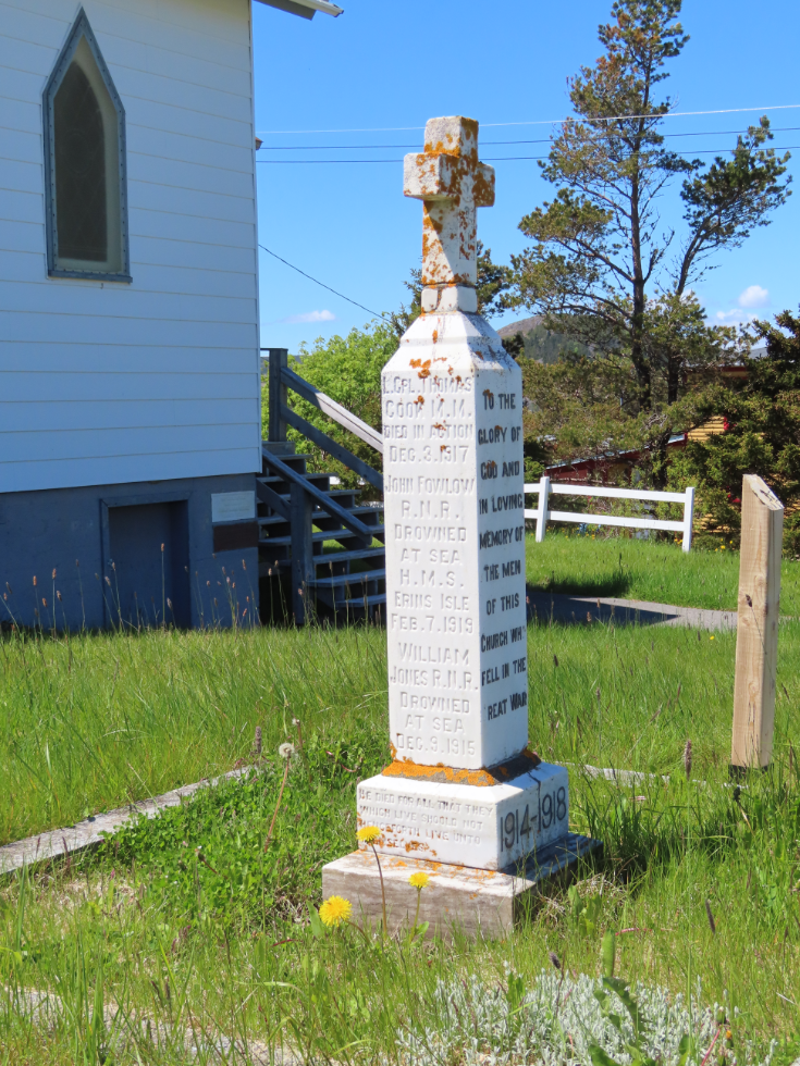
There’s even a little memorial in front, honouring three men who died during World War I, one killed in action and two Naval Reservists drowned at sea.
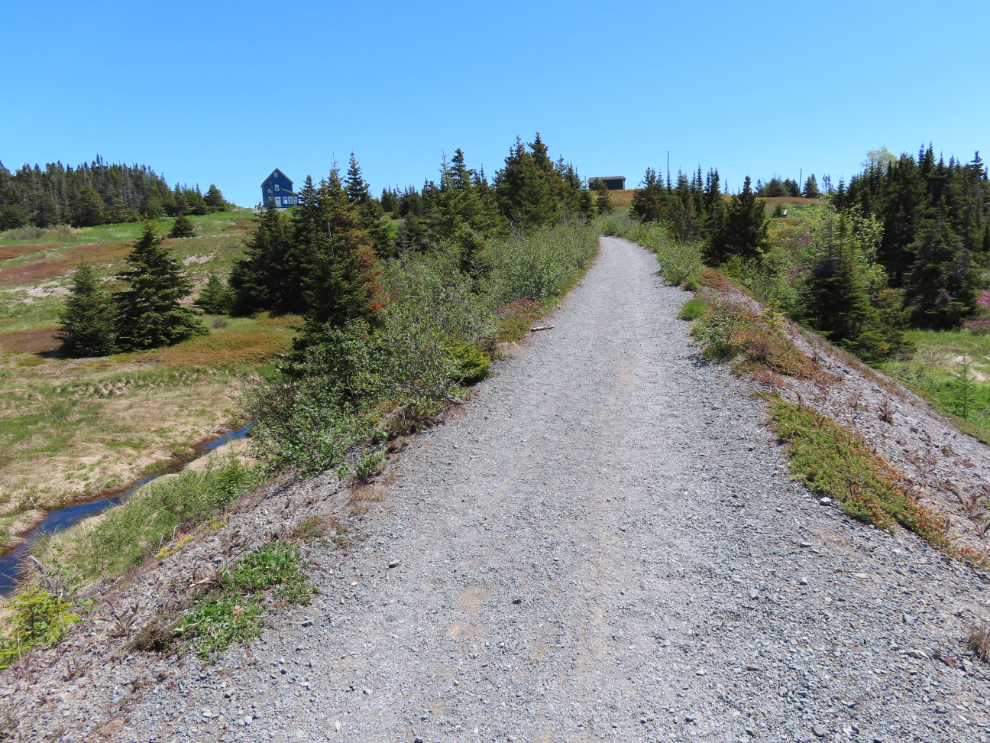
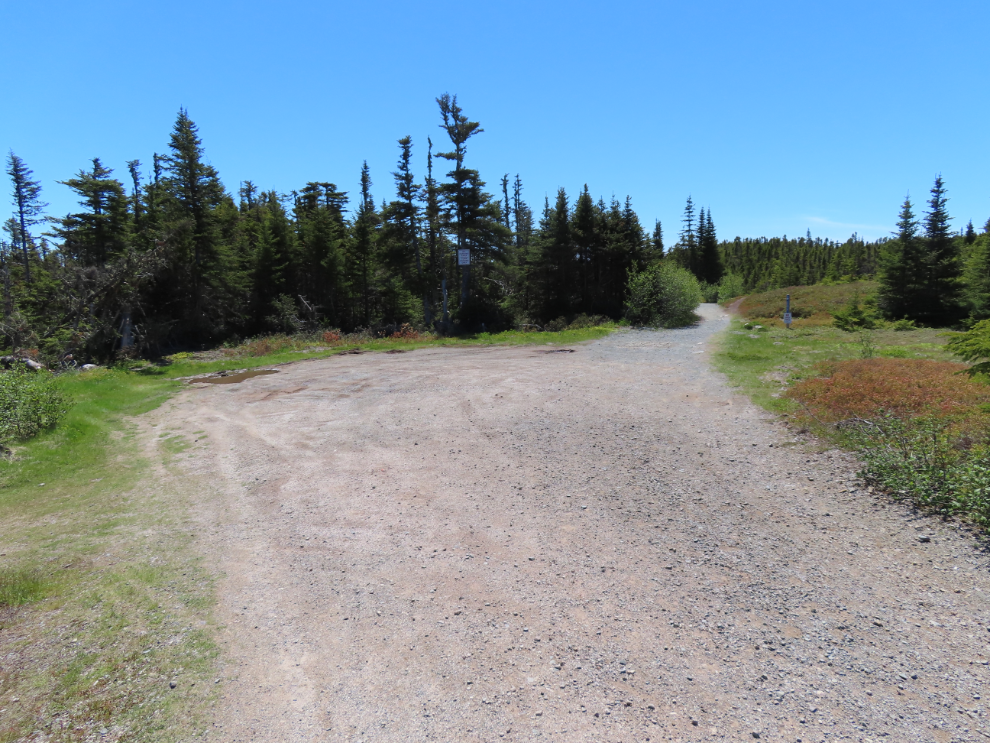
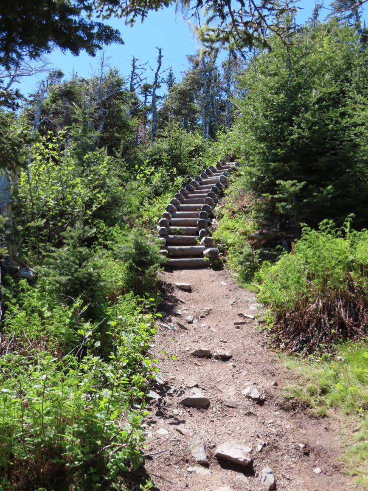
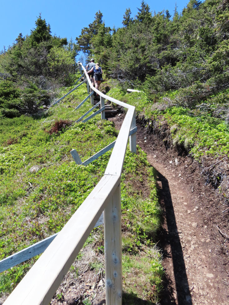
This is the start of the trail. Most people seem to hike it clockwise, starting on the old Newfoundland Railway grade to the left, and that was where I began, at 11:17.
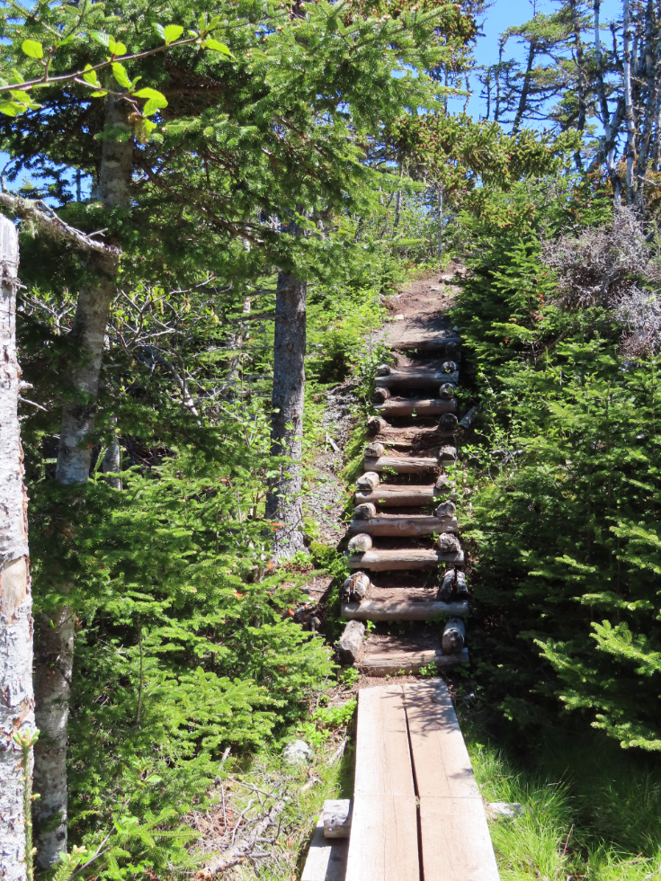
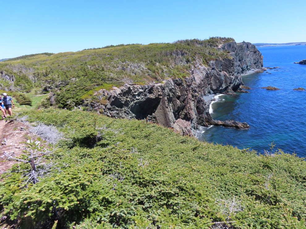
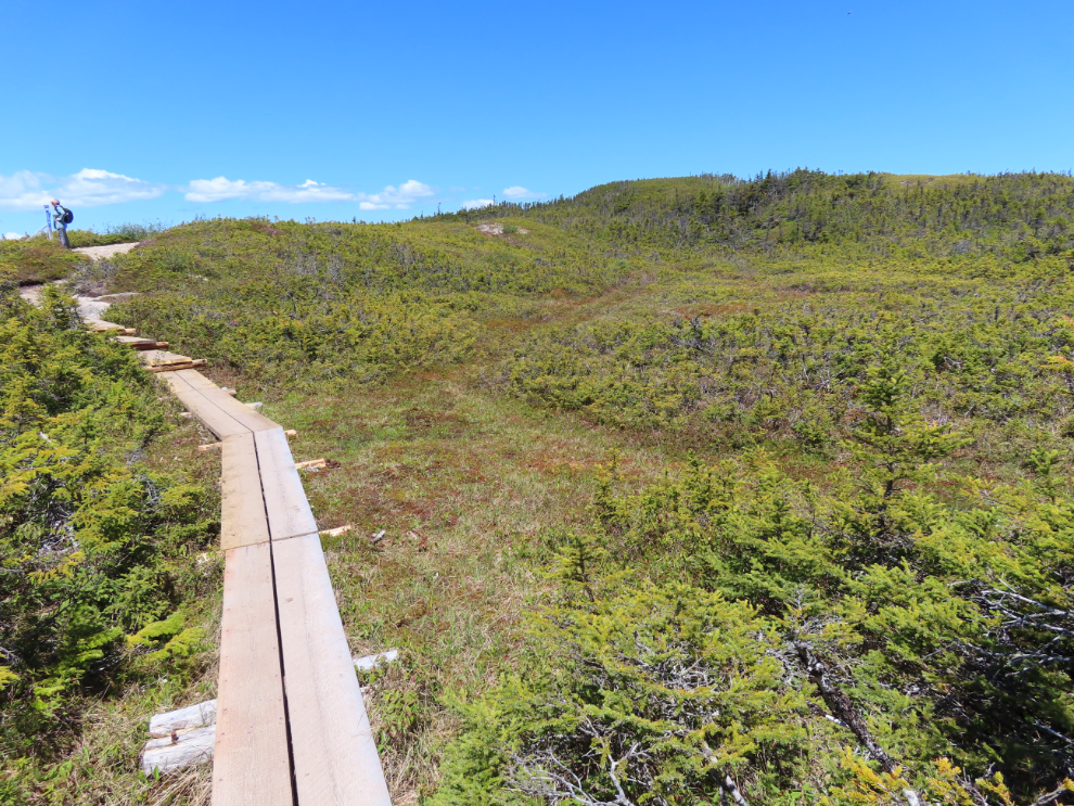
I tried to post as few photos of the 72 I shot on the trail as possible to show you how incredible the trail is, but there are still 24 of them. There’s not much I can say to add to what they show, though, so many have no caption. In the next one I was nearing the end of the railway grade – at the top of this climb the trail then goes off to the right, the railway to the left.
This is the view from that spot.
A local fellow who lost everything in a fire has walking sticks for sale or to borrow, with donations appreciated.
Local knowledge can get your car to this spot for easy parking and to save 10-15 minutes of walking – it was now 11:30
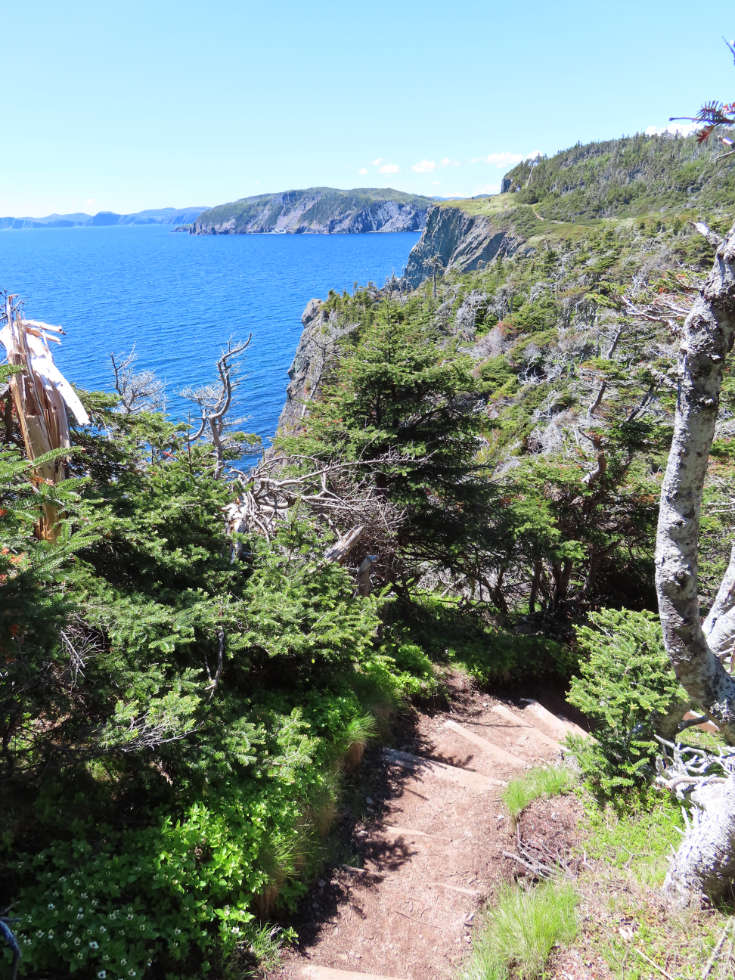
The drama begins quickly when you hike clockwise – this was shot 7 minutes after the last one.

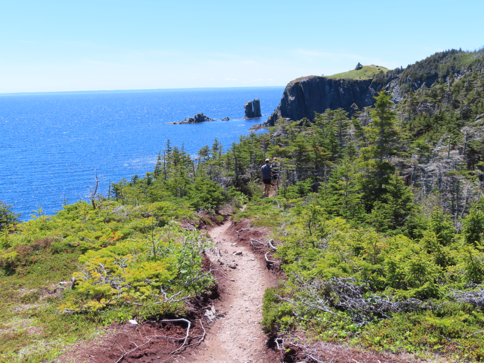
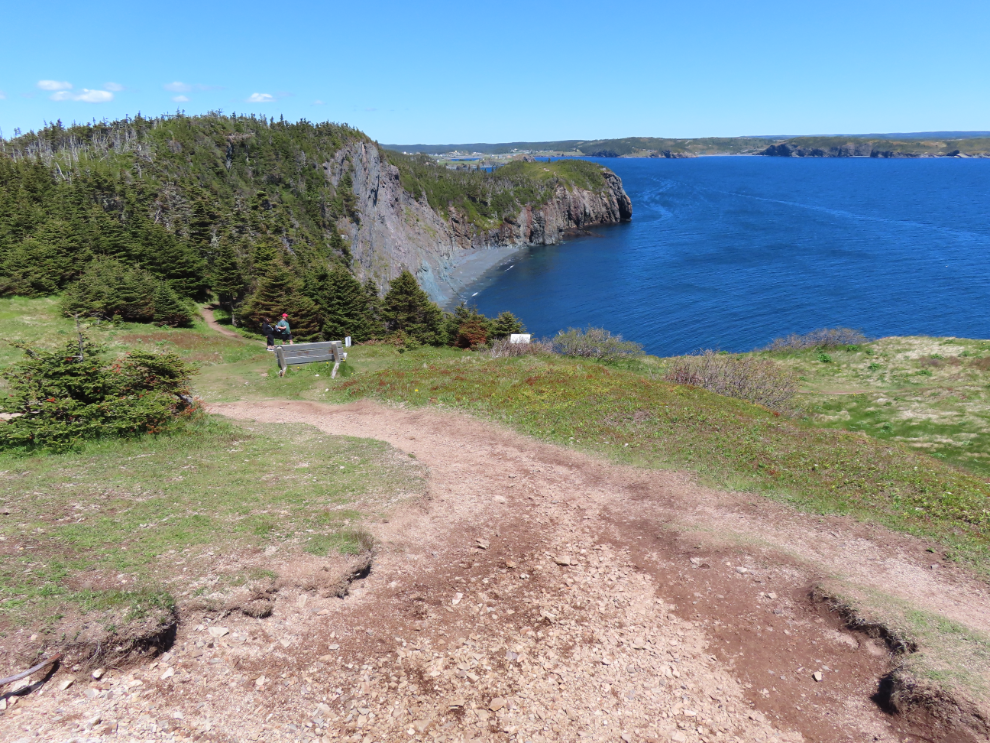
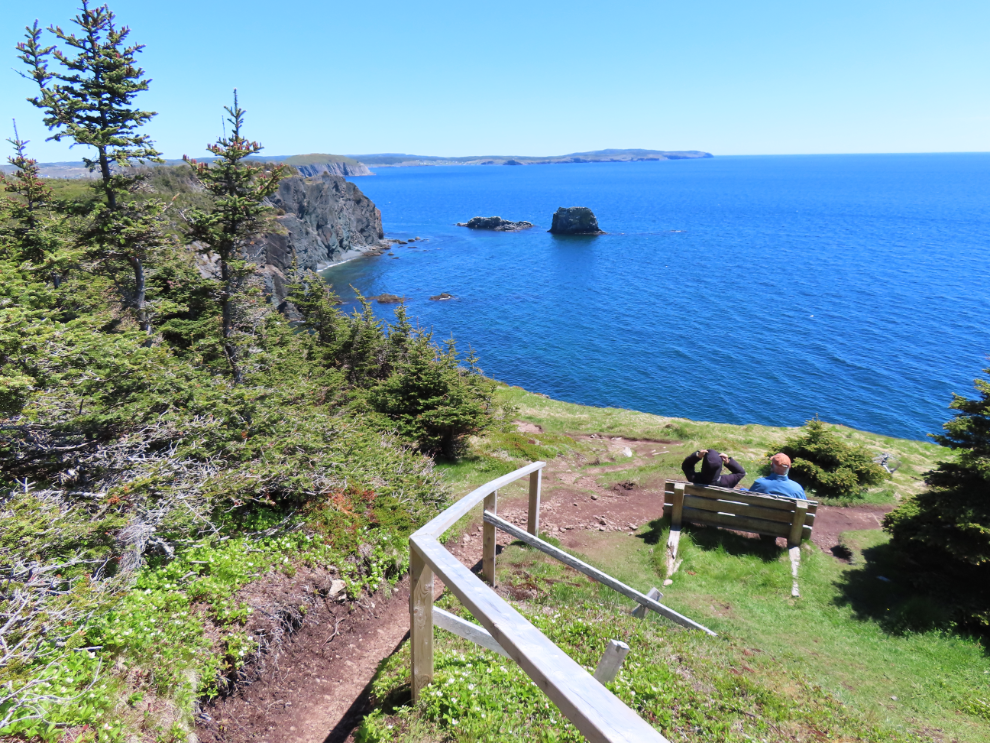
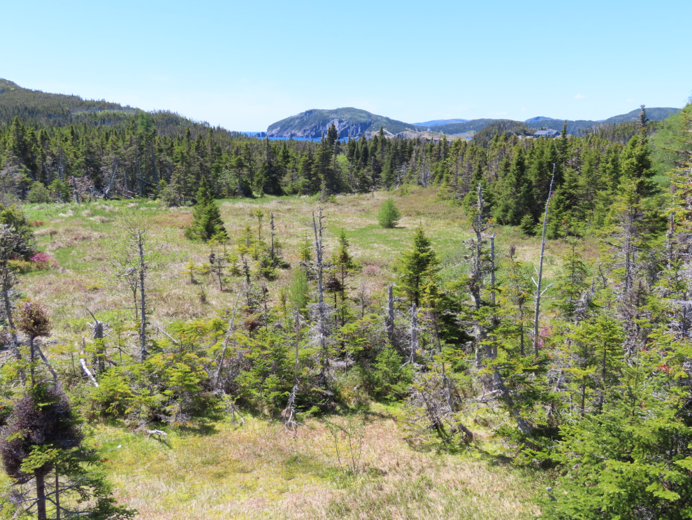
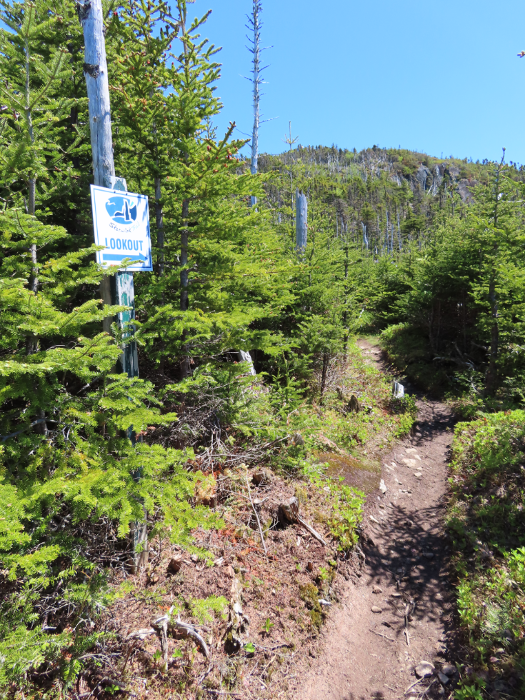
At 12:39 I came to a side trail to the “Lookout” – which of course I took on a day this this.
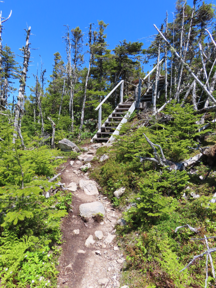
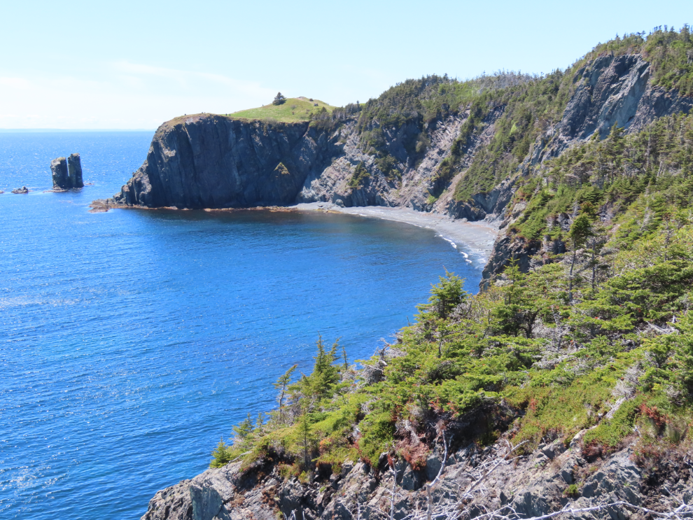
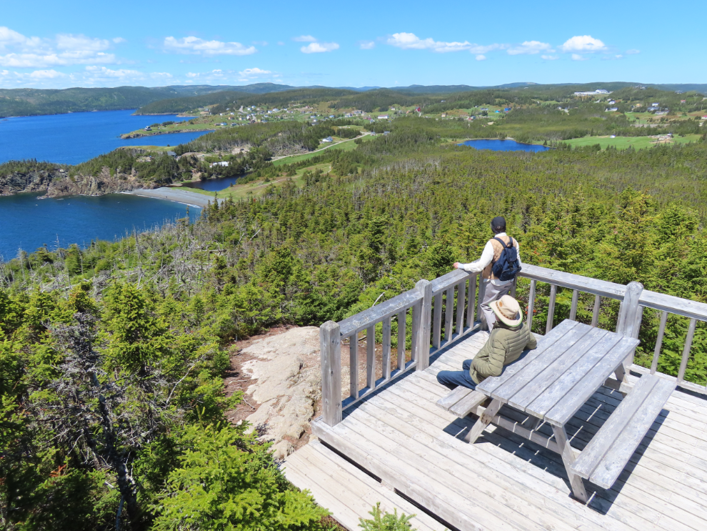
The Lookout has a two-level deck with a vast view. It was well worth the climb.
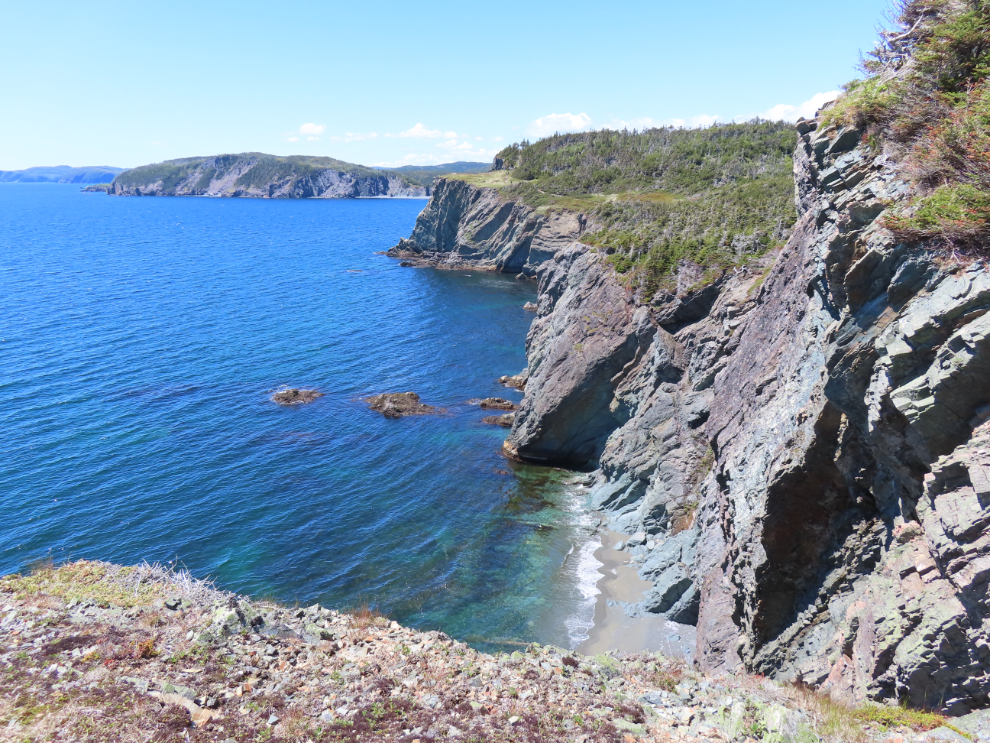
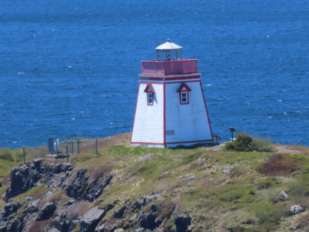
The Fox Point lighthouse way off in the distance.
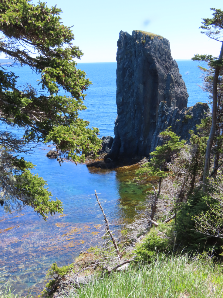
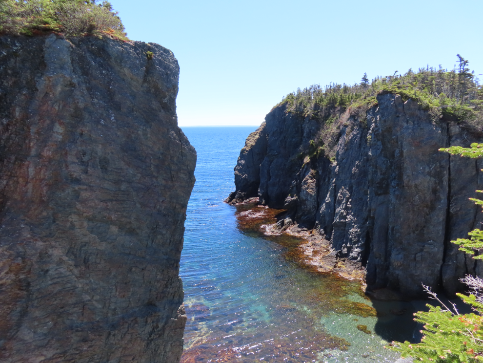
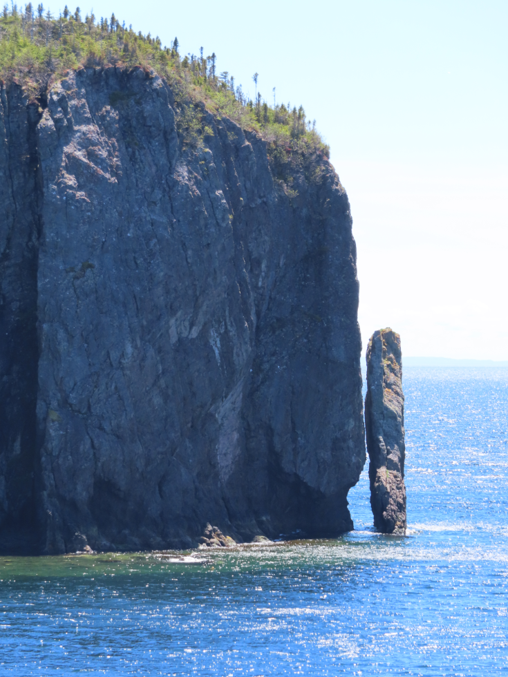
The space between the cliff and the rock is so narrow that it’s only visible for a few feet along the trail.
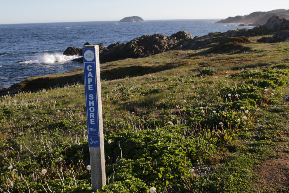
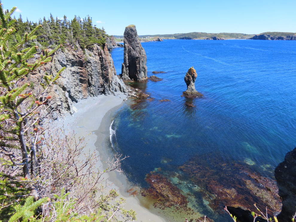
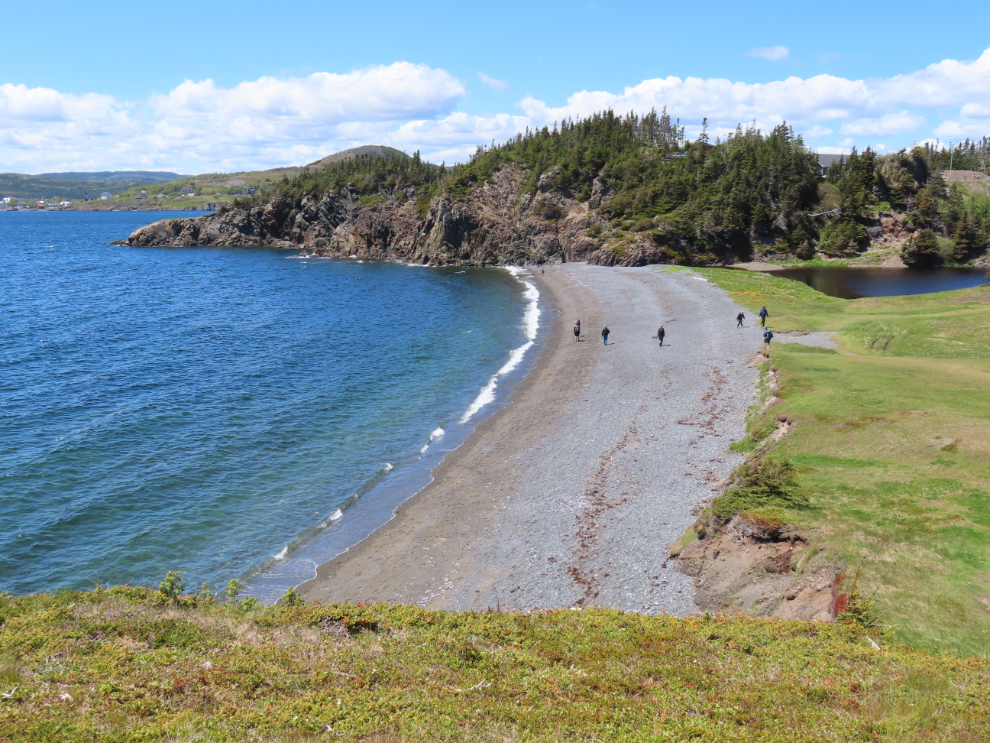
The final photo from the Skerwink shows the lovely beach at Sam White’s Cove, at 12:55. From there it was a fairly short, level walk back to the RV.
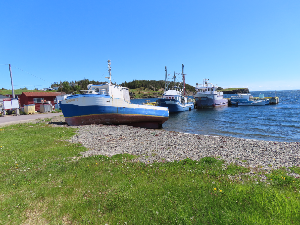
From there, Google Maps led us down a narrow, rutted, dead-end road. That did, though, take us by the picturesque little harbour of Goose Cove.
We did find our way to the next planned stop, Trinity. Cathy had read endless horror stories about Trinity – how crowded it would be, impossible to navigate an RV, etc, but it was a quiet day and I had no problem parking. Yes, it’s reputation as one of the most photogenic communities in Newfoundland is well earned.
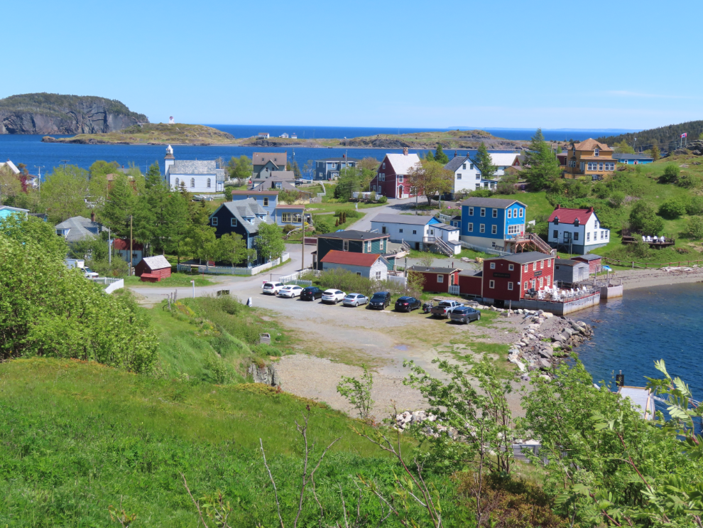
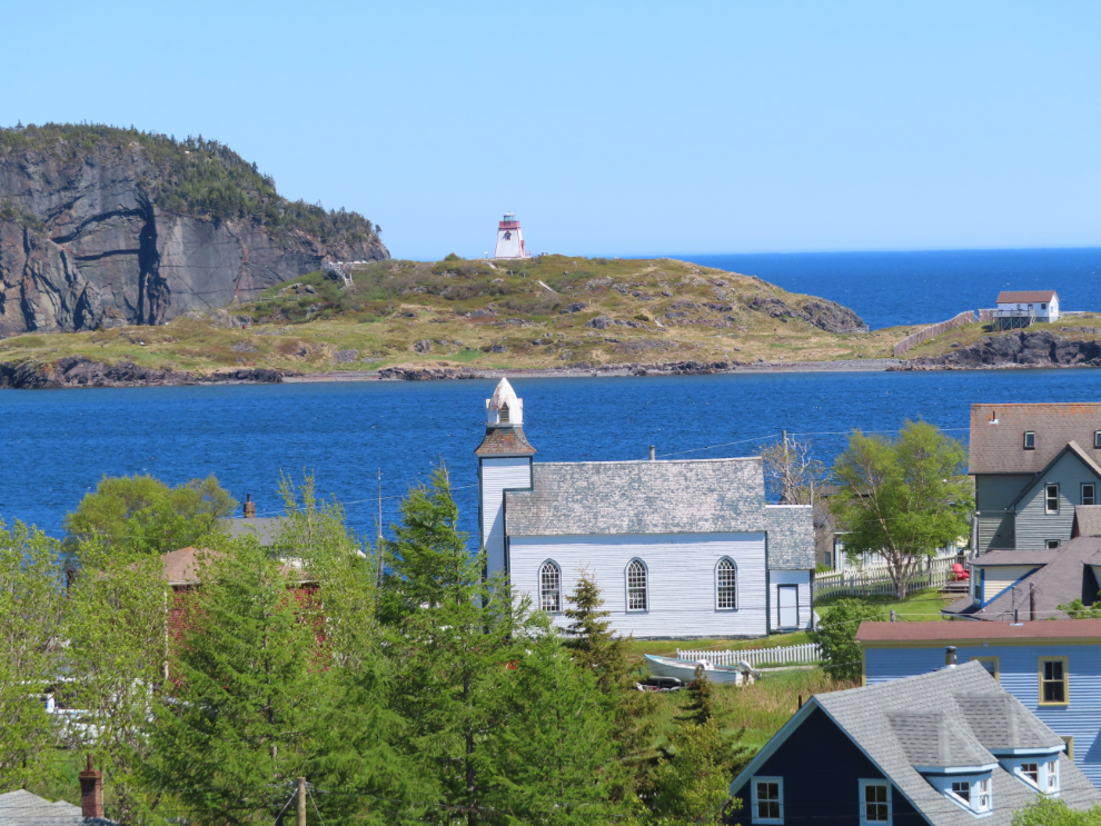
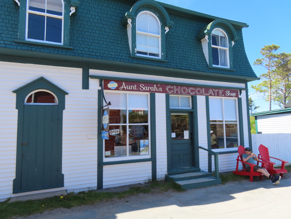
I think to engage with Trinity you need a full day, and a plan, and we had neither. We only made two notable stops in town – the first being an ice cream and fudge shop 🙂
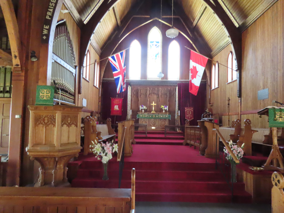
The other stop in Trinity was at Saint Paul’s Anglican Church, which was in the middle of getting a new $200,000 roof.
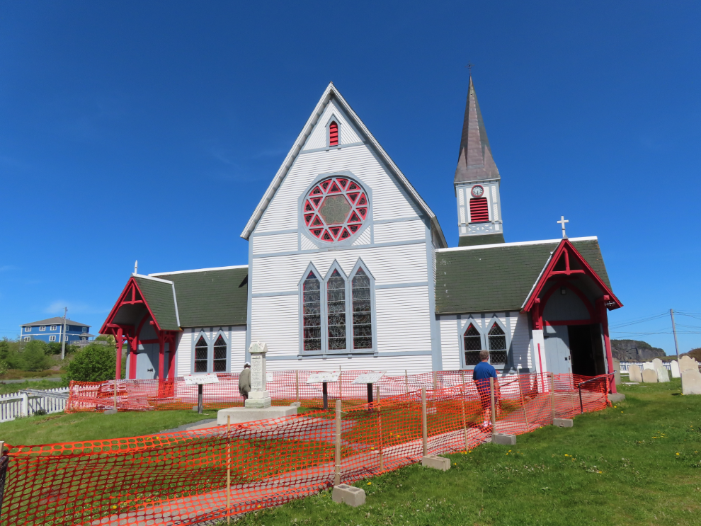
Cathy had already quit and found a bench while I explored, but I went back and told her she had to see the interior of this church. Spectacular.
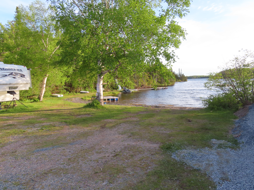
We had no plan for parking that night and expected to just find a pullout somewhere, but when we saw Cabot Hi-Way RV Park along Highway 230, stopped in, and they had two spots left. Perfect. Especially at $30 for full services.
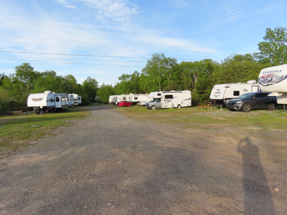
The RV park is on the arm of a fair-sized lake, and has a substantial number of permanent and seasonal renters who have developed quite a community, with lots of kids. It was really nice to see.
The next day we had a get-together planned an hour away in Sunnyside, but no real plans beyond that except general exploring, which was usually working very well for us (Trinity being the exception for some reason).