A winter drive from Jasper to Whitehorse via the Stewart-Cassiar
From Airdrie to Jasper on Wednesday December 13th, I had had superb weather, but I reached Jasper just after noon, stopped for fuel, and my luck with the weather ran out soon after. My rough-draft itinerary called for me to reach Vanderhoof that night – 990 km from my starting point in Airdrie.
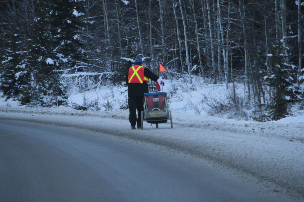
My fuel stop at Jasper was quick, and by 12:40 I was headed west on Hwy 16, with the temperature at -1°C (30°F). I was extremely surprised to see a cyclist struggling along the shoulder of the highway.
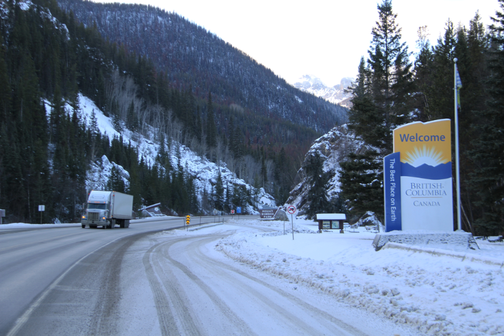
The gates of Jasper National Park for eastbound traffic.
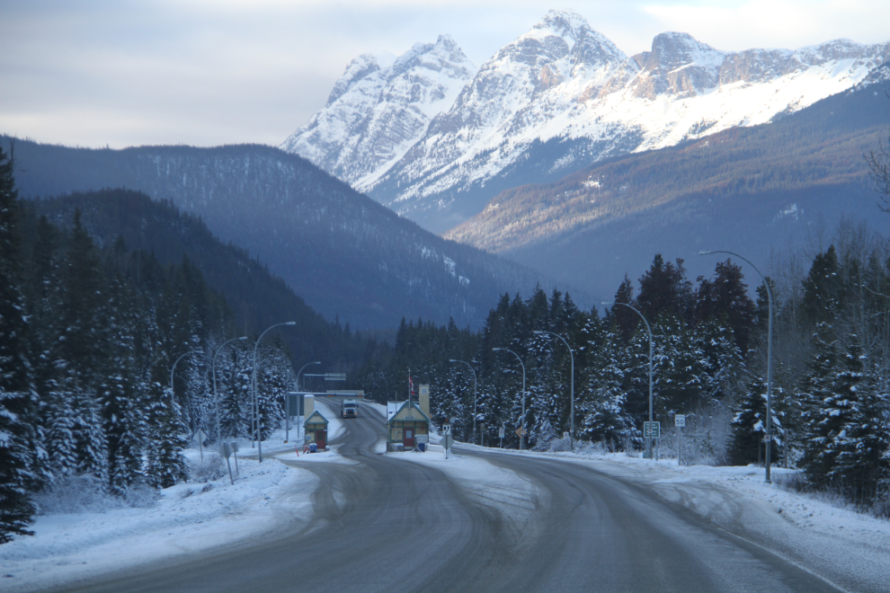
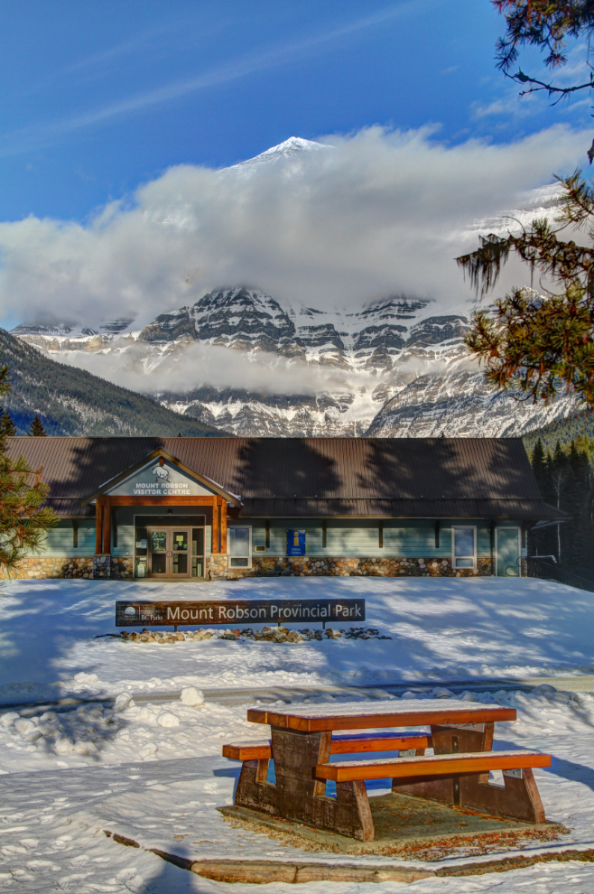
At 1:00 pm, I reached Yellowhead Pass and crossed back into British Columbia, and Mount Robson Provincial Park.
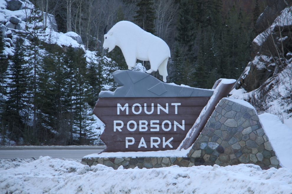
The mountain goat sign for Mount Robson Provincial Park has always been one of my favourites.
It’s quite unusual to see all of Mount Robson, and I was pleased to get this much of a view from the visitor centre parking lot.
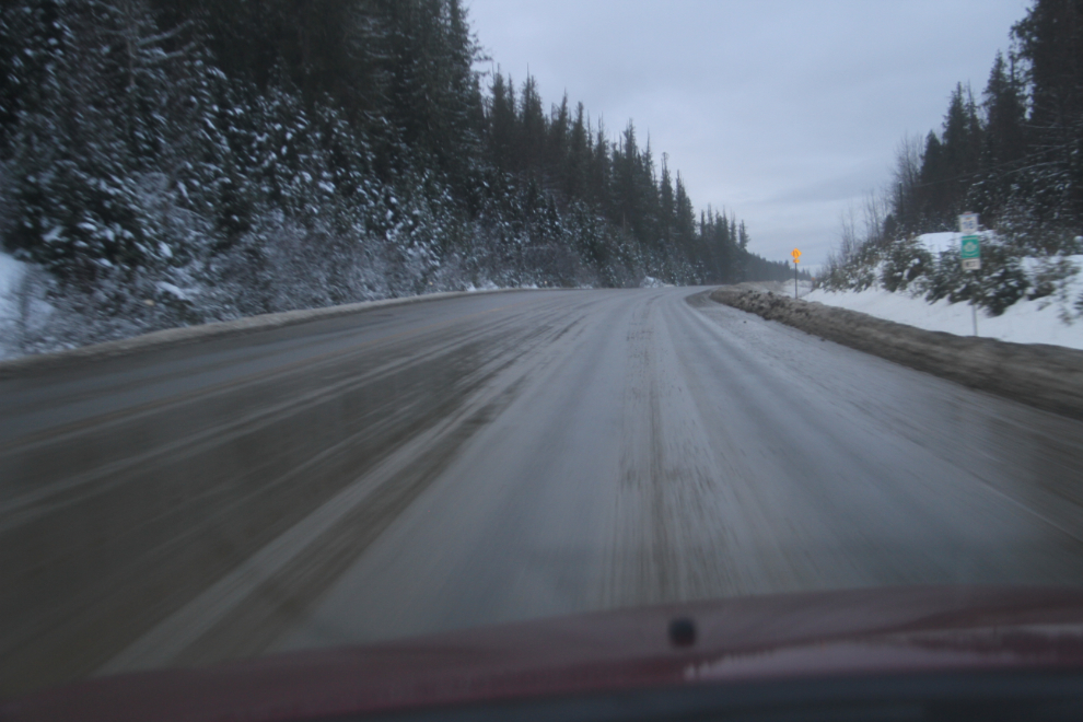
With the temperature up and down a degree from the freezing point, it spit rain for most of the 270 km (168 mi) from Tete Jaune Cache to Prince George. West of Prince George, I soon ran into fog, which at times was extremely thick. It was a slog, down to as slow as 30 km/h for long stretches. The fog was compounded by the dark – it became one of those nights (though it was only afternoon) when the dark absorbs every bit of light, and the lines on the road are mostly covered by gravel so they don’t help.
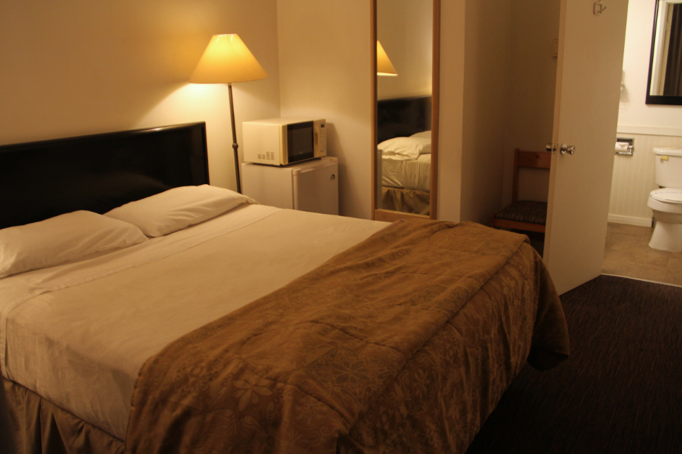
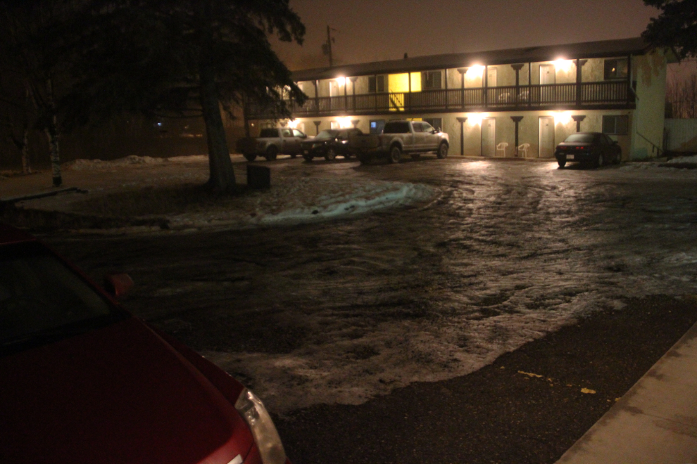
By 4:45, I had had all the fog and crap I could handle, and the Coach Light Motel in Vanderhoof looked like the refuge I needed. This was my third stay here over the years – I got Room #205 in the small block of 4 units this time. It has a fridge, microwave, a tiny coffee maker, and the free wifi was good. Although it’s showing its age, it’s very clean, and it offers great value at $69.
I was up very early on Thursday (December 14th). The weather forecast when I went to bed called for very thick fog (down to “zero visibility”) from Vanderhoof to at least Smithers, and when I peeked out and saw minimal fog, I got up, and hit the road at 04:15.
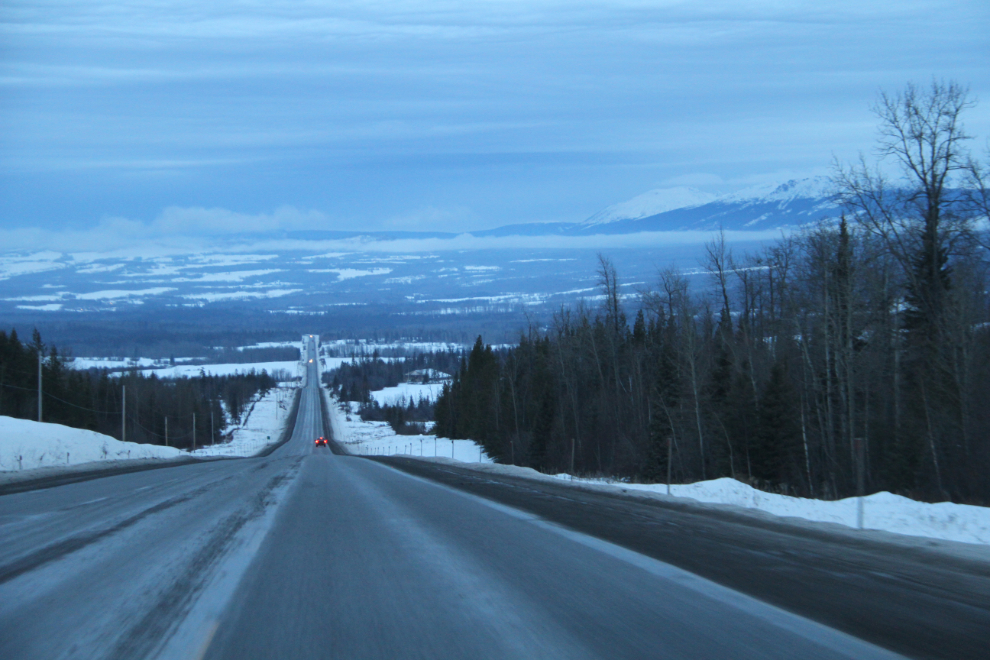
Although there were some fairly small stretches of fog, the road was far better than I expected from the forecast. I shot the next photo east of Smithers at 08:40, ten minutes before sunrise.
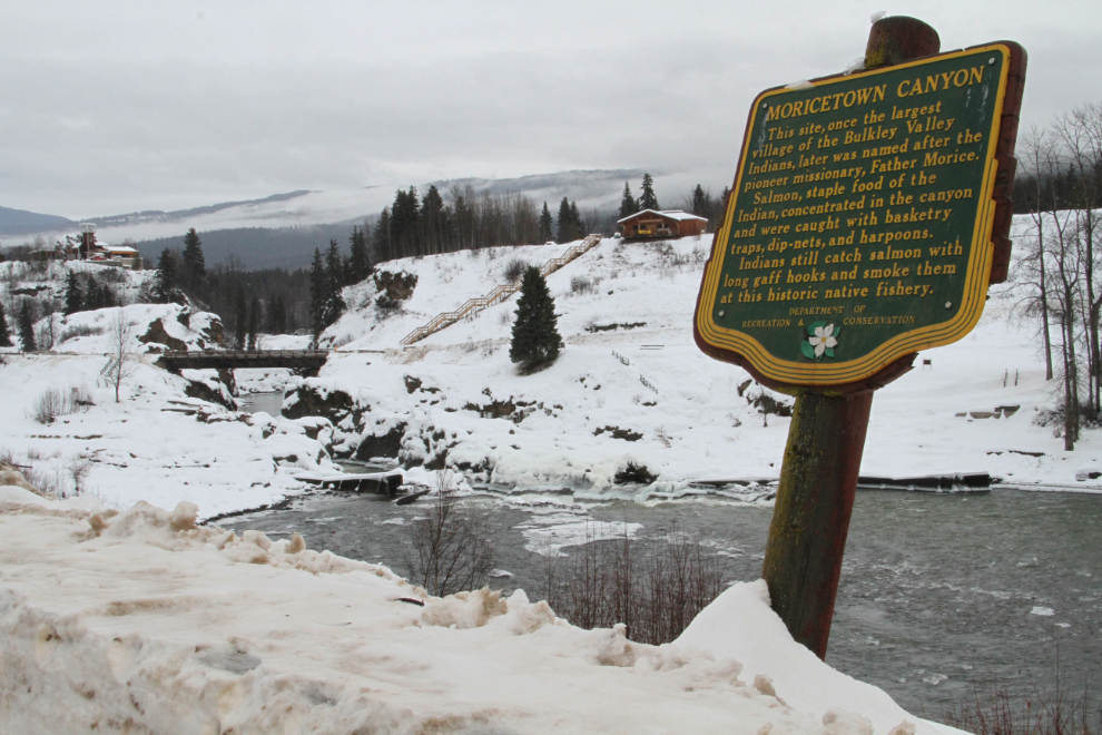
I usually stop for a minute or so at Moricetown Canyon, located 30 km west of Smithers. If nothing else, it’s a good spot to just get out and stretch.
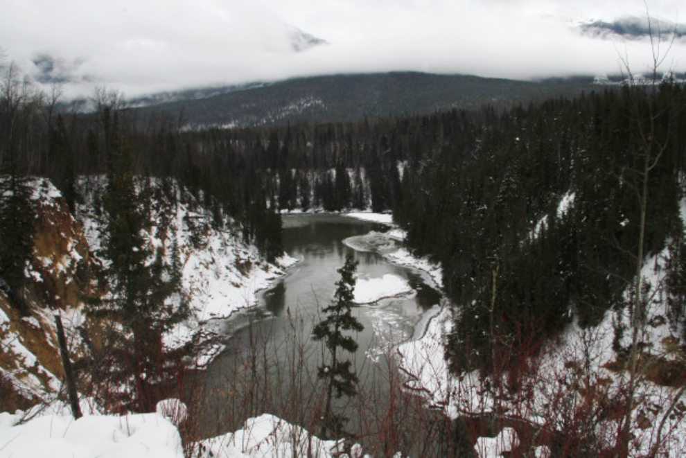
The Skeena River has always attracted me. Even on dull, dreary days like this, it just has a good vibe for me.
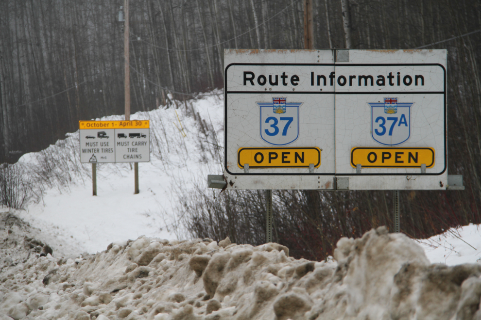
At 11:35, I reached the junction of Highway 16 and Highway 37, the Stewart-Cassiar. I had fueled up in Smithers at $1.149 per liter so only needed a small top-up here. Sometimes the fuel is quite pricey at the Petro-Canada station at the junction, but this day it was the same price as Smithers.
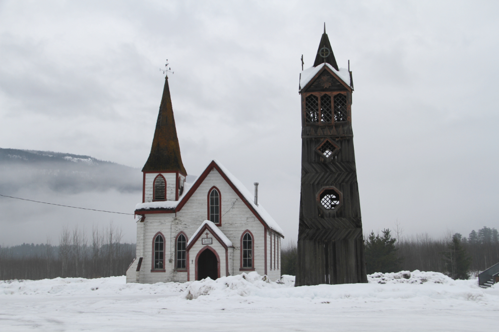
I hadn’t stopped at St. Paul’s Anglican Church (Episcopal) at Gitwangak (formerly Kitwanga) for a few years, and decided to have a look. It’s now abandoned.
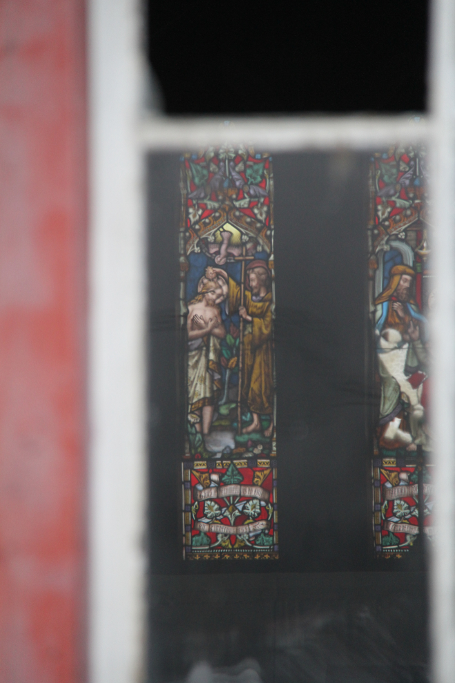
It’s sad to see such beautiful stained glass at the rear of the church, with some of the regular glass windows at the front broken.
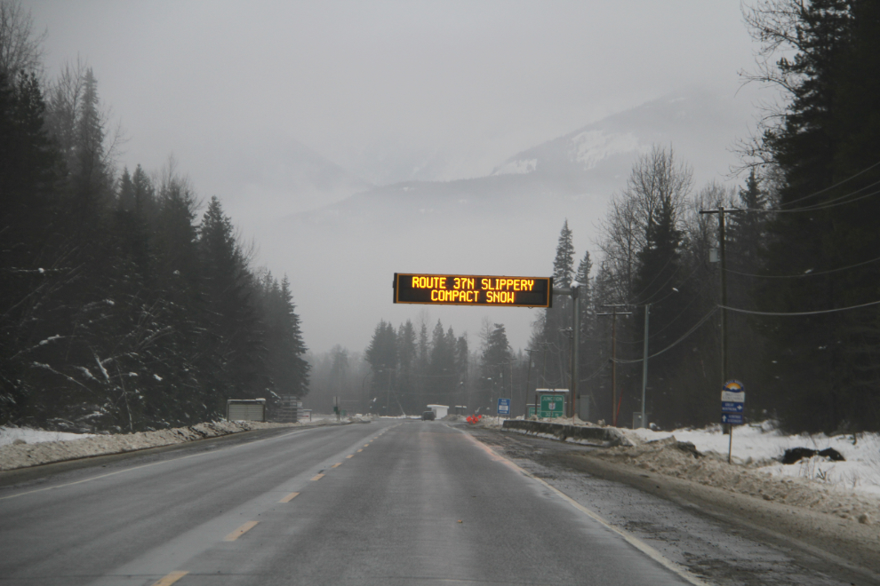
The “Highways Open” sign at Km 6.6 of the Stewart-Cassiar was reassuring. The temperature was 0°C and a light rain was falling.
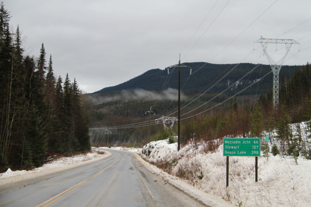
My draft plan was to reach Dease Lake to overnight. When I shot the next photo at the Km 90 post at 12:50, that was only 398 km away, so with these good road conditions, easily attainable.
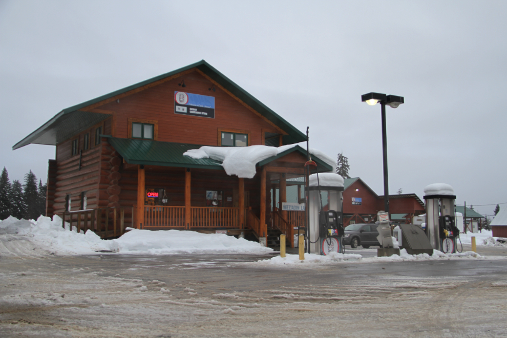
I pulled in to the Meziadin Junction Lodge just to check the fuel price – last summer it was very high. This day, not bad at all – $1.248.
I reached Bell II Crossing, the second crossing of the Bell-Irving River, at 2:50 pm. The bridge is at Km 249.3. I stopped in at the Bell 2 Lodge here for a second to check the fuel price – $1.40 per liter. From here northbound in the winter, the next fuel is at Iskut, 155 km away.
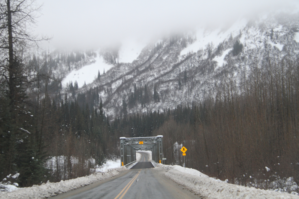
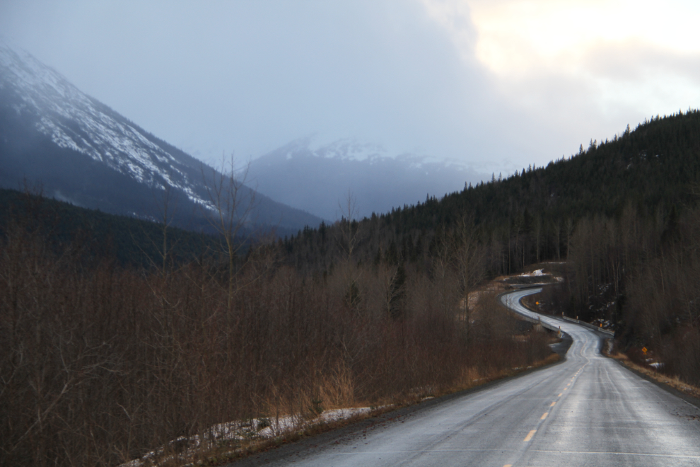
The next photo is a good example of why I love the Stewart-Cassiar – it still looks the way the Alaska Highway did 25 years ago. The little bridge ahead crosses Ogilvie Creek at Km 286.
About half an hour from Dease Lake, as I descended from Gnat Pass, I got hit by a wild (!!) snowstorm driven by high winds. I was down to about 50 km/h because I simply couldn’t see. I had been doing about 90 km/h, and a vehicle that had been steadily gaining on me from behind for a few minutes vanished – I never did see him again.
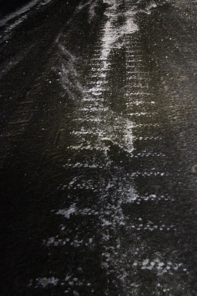
The snow only lasted for a few minutes, but when I got to the valley bottom where Dease Lake sits, I discovered that the storm had arrived here as freezing rain, and the whole world was a skating rink. For a few reasons (mostly, I wasn’t tired and really wanted to get home), I decided to continue on – I’d catch some sleep in the car when I needed it. I fueled up and headed north just before 4:00.
The highway was now in terrible condition, but my car handles this sort of crap really well as long as you’re careful. About an hour out of Dease Lake, though, things went sour in a big way – the all-wheel-drive and ABS systems died! This has happend twice before – large magnets on each rear axle control these systems, and can break.
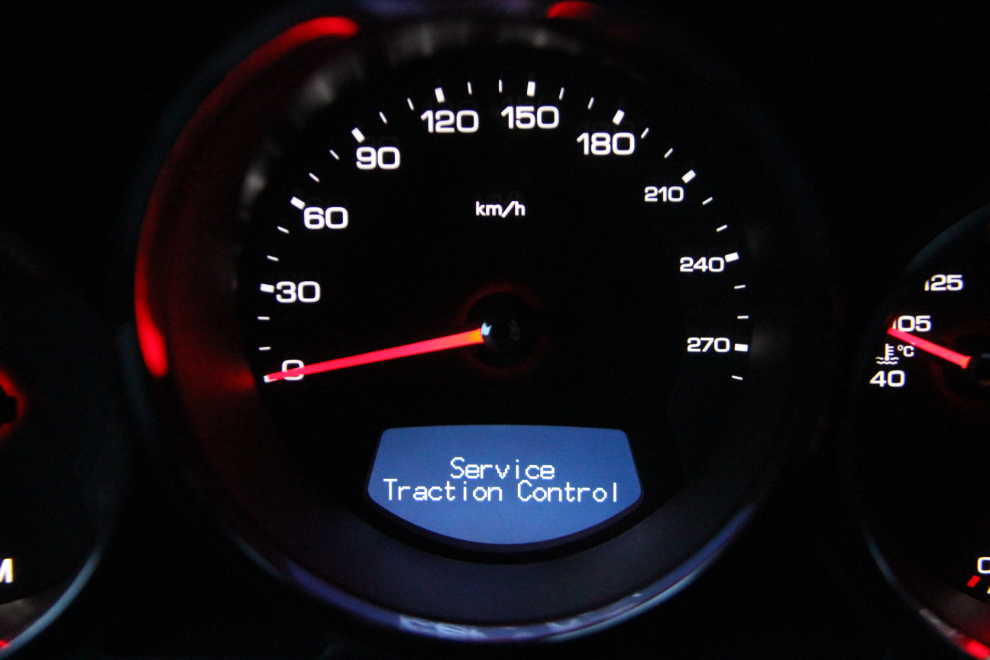
Testing how bad things were now, I totally lost control of the car on the ice, but managed to get it back. I drove another few miles, and when a large pullout appeared, I parked, pulled out my Arctic sleeping bag, and caught 2½ hours sleep. The skies had now cleared, and the stars were incredible – Dark Skies of the finest kind 🙂
I started driving again at about 8:00 pm, slowly making my way north. There was nobody else on the highway. I saw a semi running at Jade City, and then saw his tracks chipped in the ice – he had chained up to get that far and then gave up.
Conditions were so bad that I was surprised that the highway hadn’t been closed. I think that it was simply a case of nobody from the Department of Highways seeing it yet. I knew that most of the highways in the Yukon had been closed the day before because of freezing rain. Which of course didn’t bode well for the rest of the drive home.
Things improved slightly towards the north end of the Stewart-Cassiar, and I stopped and went to sleep for another 3½ hours.
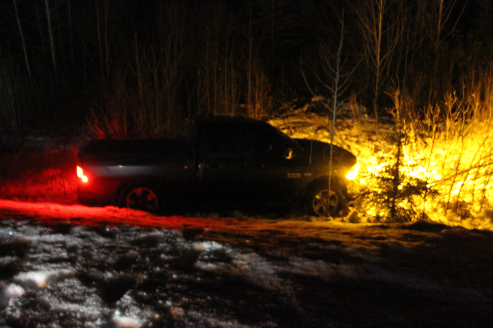
The Alaska Highway wasn’t bad, but there were stretches that hadn’t been sanded so drivers could never get cocky. There were many signs of vehicles having recently gone off the road, though they had all been recovered. Until I reached Km 1182 (east of Teslin). When I stopped to check on this pickup just before 06:00, there was nobody around even though the truck was running. A single set of footprints led to the road where a vehicle had clearly been sitting for a few minutes. Very odd.
I got home just after 08:30. This will certainly remain in my memory banks as the worst ice I’ve ever seen, and one of my worst drives ever. Thinking about it once I was safely at home, I wish that I had taken more photos of the ice, and a video of me skating on the road in the lights of the car would have been pretty awesome. During the drive, though, I wasn’t spending much time thinking about the possible entertainment value of it 🙂
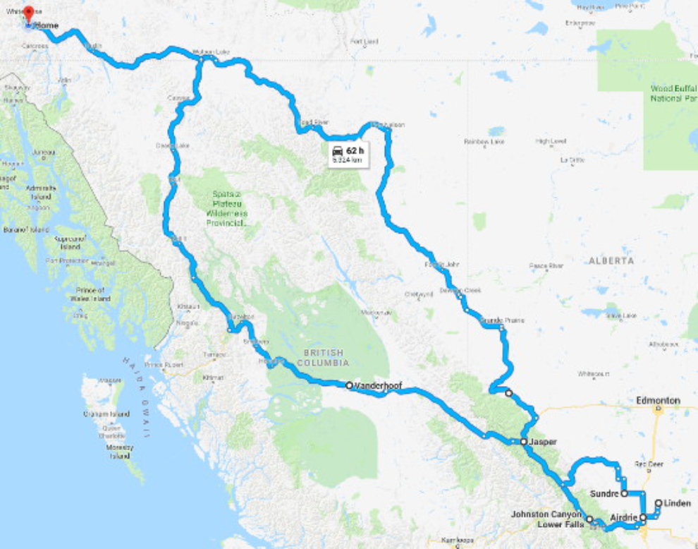
Despite the challenges of the road from Prince George on, though, it was a superb trip in every way. I had mostly glorious weather, and a wonderful visit with my kids and grandchildren. The map below shows the whole trip – about 5,400 km (3,355 mi). Click here to open an interactive version of the map in a new window.