Wildfires – our smoky world
Our good luck couldn’t last – I’m amazed that it lasted as long as it did. The negative side to the hot, dry summers I love is that the forests go up in flames. The Yukon, Alaska and British Columbia are all covered in smoke now.
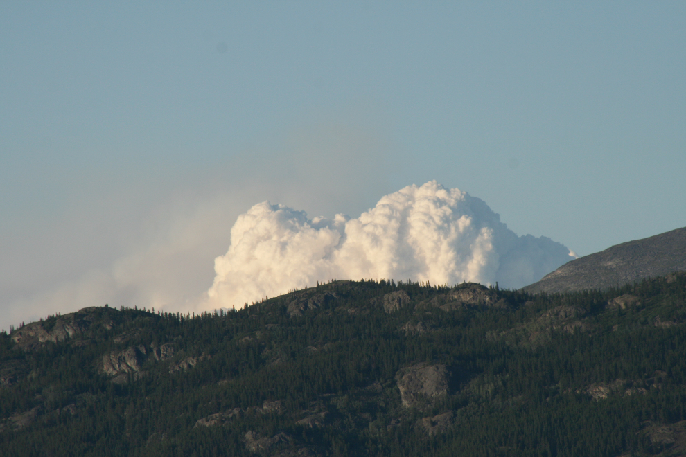
Until yesterday, we’d just get occasional strong reminders of what’s going on around Whitehorse, such as this thermal column from the large fire on the Teslin River about 60 km north of the city.
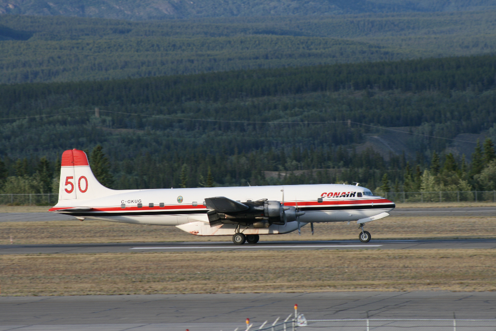
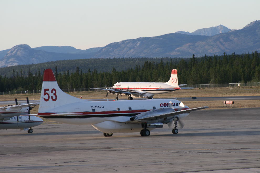
The large DC-6B aerial tanker has been very active the past few days, and the Convair 340 below it has been brought in to help with the 18 new fires lit by lightning near Watson Lake. These photos were shot on Friday – you can see the runway through the smoke now but the mountains are gone.
I had my scanner with me yesterday, and the Whitehorse airport tower was reporting to pilots that the smoke layer topped out at 9,300 feet – that’s one hell of a lot of smoke!
While Alaska and BC have Web sites and radio reports that update the fire situation several times a day, we’re in the dark in the Yukon, only getting updates every few days from Wildland Fire Management.. With some of the Watson Lake fires apparently doubling in size in a few minutes, that level of information is worse than useless. I can listen to real-time fire-department radio communications online at ScanBC.com but with throat-burning smoke here yesterday, there was no way to know whether the fire was 50 miles away or 5. Given the technology that’s available, that’s a very poor situation when I see thousands of people being evacuated with little notice even in Kelowna.
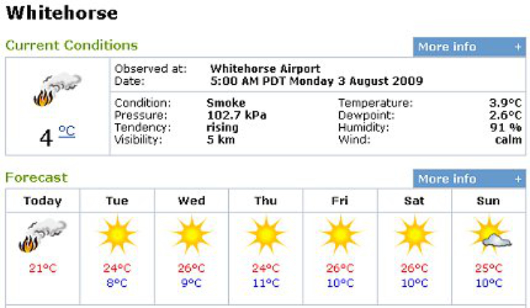
As you can see by this morning’s weather forecast, it could get a lot worse before it gets better.