A Whitehorse Copper Belt mine history hike
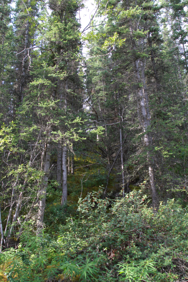
The number of historic mining sites in the Whitehorse Copper Belt is quite astonishing when you have a guide like Tim Green who is a fount of knowledge about it, and loves sharing what he has discovered. On Sunday we spent 4 hours in a very small part of it and visited 6 mines. There’s only a trail worthy of the name to one of them (the Grafter) – this is tough country, and it’s hard to imagine how these copper deposits were even found about 115 years ago.
This is a very long post – there are 48 photos. I thought that this hike was going to be a fun one to write up, but it’s turned out to be quite challenging. First, I have 93 photos after editing, and a great deal of information to distill. But also, I have to decide how much to tell people. Every artifact worth “collecting” was taken decades ago, but showing people how to get into easily accessible but potentially dangerous country has ethical issues. These mines show up a lot on eBay, though, so perhaps I’m not adding much in that way – at the end I’ll show you a couple of today’s eBay examples.
I’ll start off with a map. You can get an interactive version of the map and more details about the hike on my Strava page, and there’s a fun video recap and aerial look at it on my Relive page. As we go through this, keep in mind that this is all well within the boundaries of the City of Whitehorse – it’s called “The Wilderness City” for good reasons.
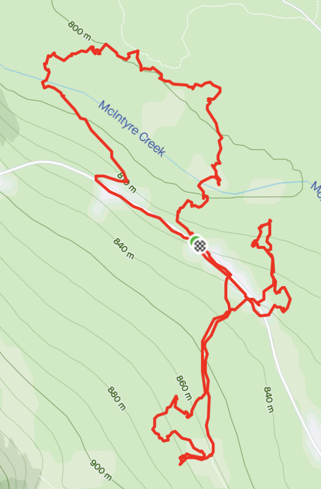
Tim Green’s research into the mining history of the Whitehorse Copper Belt is impeccable, using archives and online resources, and on the ground. He has compiled so much information that his website breaks the Copper Belt into 3 areas – this hike was in Copper Belt Centre. There are 9 mines in this area, of which we visited 6.
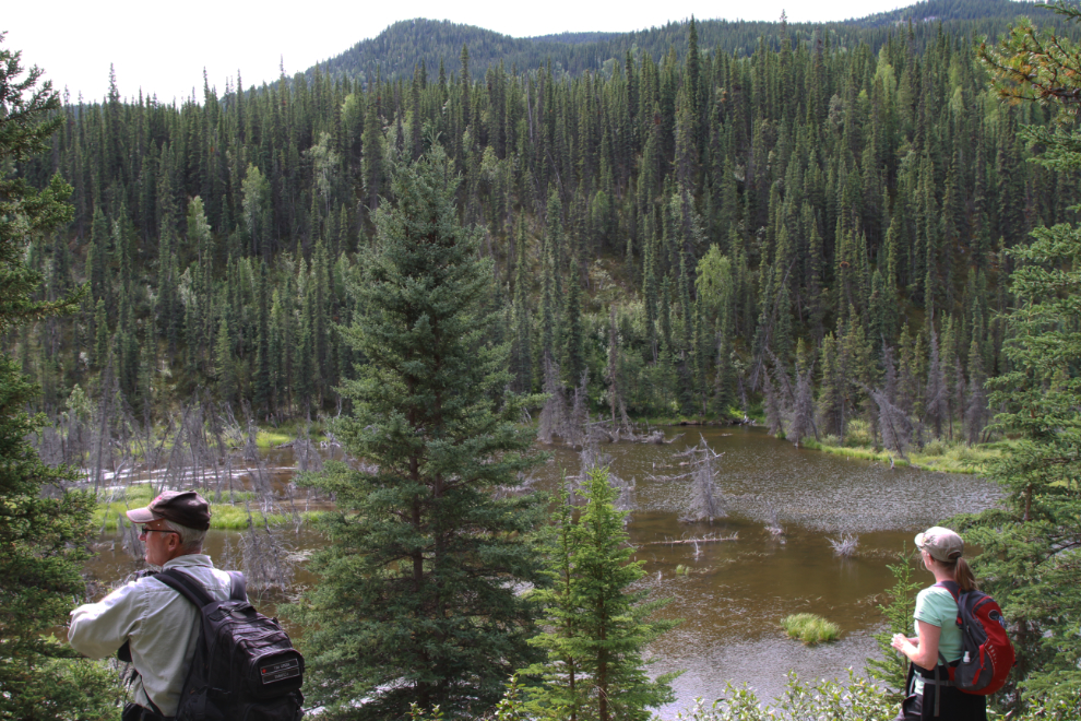
There are 3 access points into the Copper Belt, at Mary Lake, the McLean Lake quarries, and the Fish Lake Road. At 10:50 I was driving up the McLean Lake quarry road.
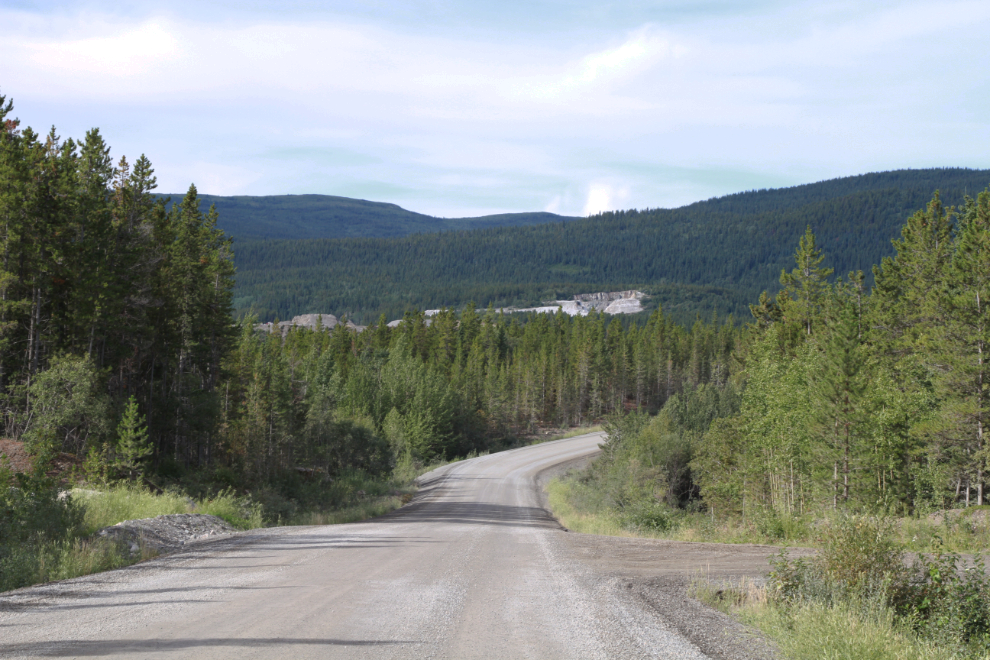
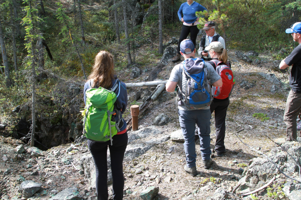
It’s a short drive to the Copper Haul Road, I soon saw our meeting point ahead. The Copper Haul Road is fairly heavily used for recreation year-round (well, heavy by Yukon standards), but very few people know more than the basic fact that there used to be copper mines along it somewhere.
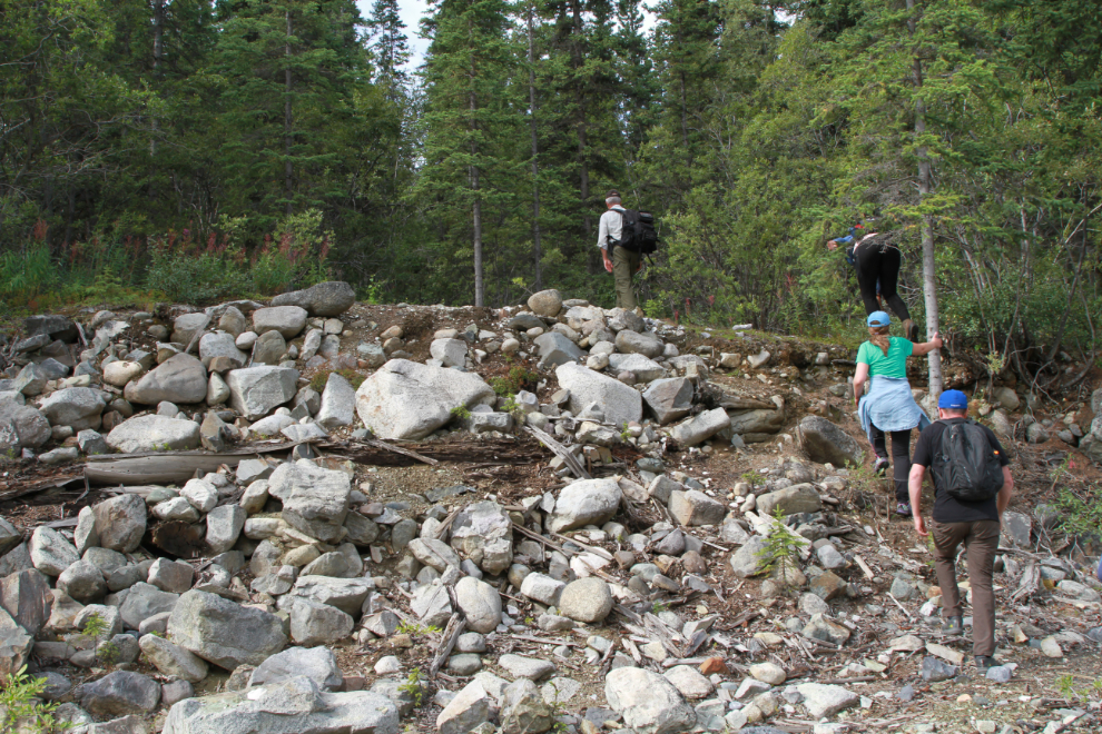
By 11:08, after introductions and a summary by Tim of what we were going to see, we were heading into the hills.
We soon reached the first mine of the day, the Best Chance. The board on the right in the next photo is the only “guardrail” we saw at any of the mines. The board warns of the presence of a shaft that’s very well hidden from that direction. Tim’s website gives this warning: “Old mine sites are former industrial areas that may contain dangerous features. There may be old machinery, sinkholes, vertical shafts, and crumbling edges of open pits that are not obvious until too late. Use extreme care when exploring these areas. You probably don’t want to go alone. Some areas may not be suitable for children or dogs that are not carefully supervised. You should never enter any old mine workings due to the possibility of cave-in or bad air.”
On February 12, 1902, The Semi-Weekly Star (still published 119 years later, as The Whitehorse Star) published a report by local businessman Patrick Martin on a visit to the Best Chance and Grafter mines.
EDITOR STAR: – Today, for the first time, I visited some of the copper mines in our vicinity; but before proceeding to record any of my impressions on the mines or development work in progress on the Best Chance and Grafter, which claims we visited, I wish to acknowledge the kindness of Mr. Steele, who provided transportation.
Hitherto I had been somewhat skeptical about the future of our town, depending as it does upon our mines. But now, having seen the above mentioned claims, the nature of the work being done and the character of the ore taken out, I feel satisfied that there is in sight a future of great prosperity.
Too much praise cannot be given to Messrs. McKinnon, Haymen and Cowan and, indeed, to all of the prospectors for the perseverance, energy and enterprise they are exhibiting in the development of their properties. Their reward is now in sight.
Messrs. Haymen and Cowan have already sacked two and a half tons of valuable ore for shipment to the smelter at Tacoma. Mr. Cowan informed me in the course of our remarks, however, that they did not intend to move any ore to White Horse until they had a car load ready.
Mr. McKinnon, of the Best Chance, is doing development work with splendid results. During the past week he has been working down through a cropping of iron which, however, was pierced on Friday, and Saturday’s work showed up (according to Mr. Matchett, an experienced miner in the employ of Mr. McKinnon) ore of a superior quality.
After being treated with the hospitality peculiar to gentlemen of nature, the rig being ready, I turned homeward with grateful feelings for our hospitable reception and greater confidence in the future of White Horse copper mines.
Yours truly
P. MARTIN.
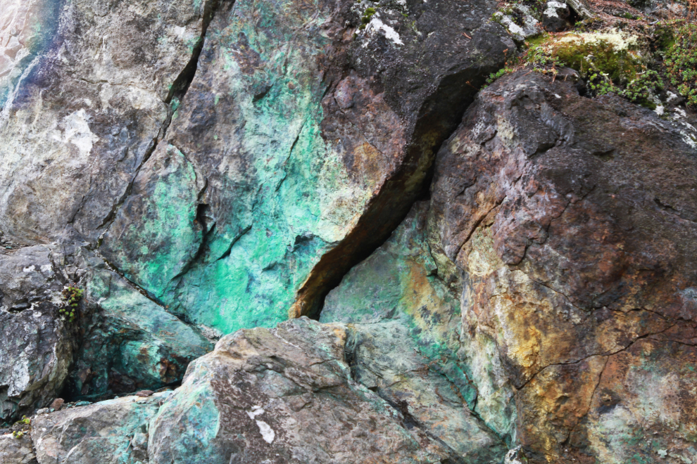
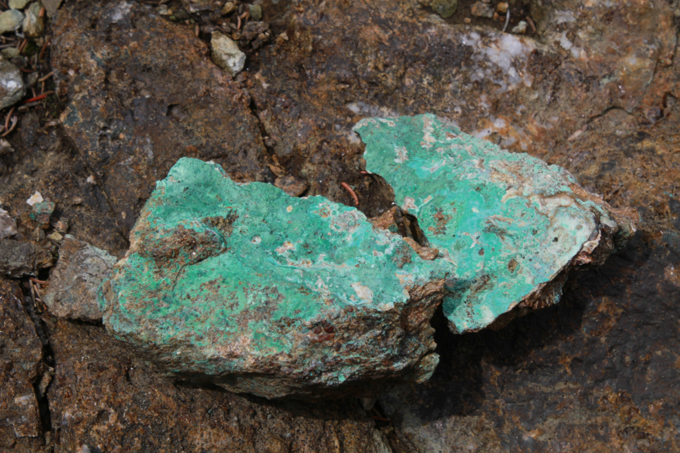
The presence of copper is pretty easy to see, as the lovely blueish-green oxidization of the mineral. What can’t be determined without hard work is the quality or extent of the copper deposit. Five of the six mines we visited were ultimately failures.
One of the Best Chance shafts. Records for these historic mines range from sparse to non-existent, and photos of any are rare.
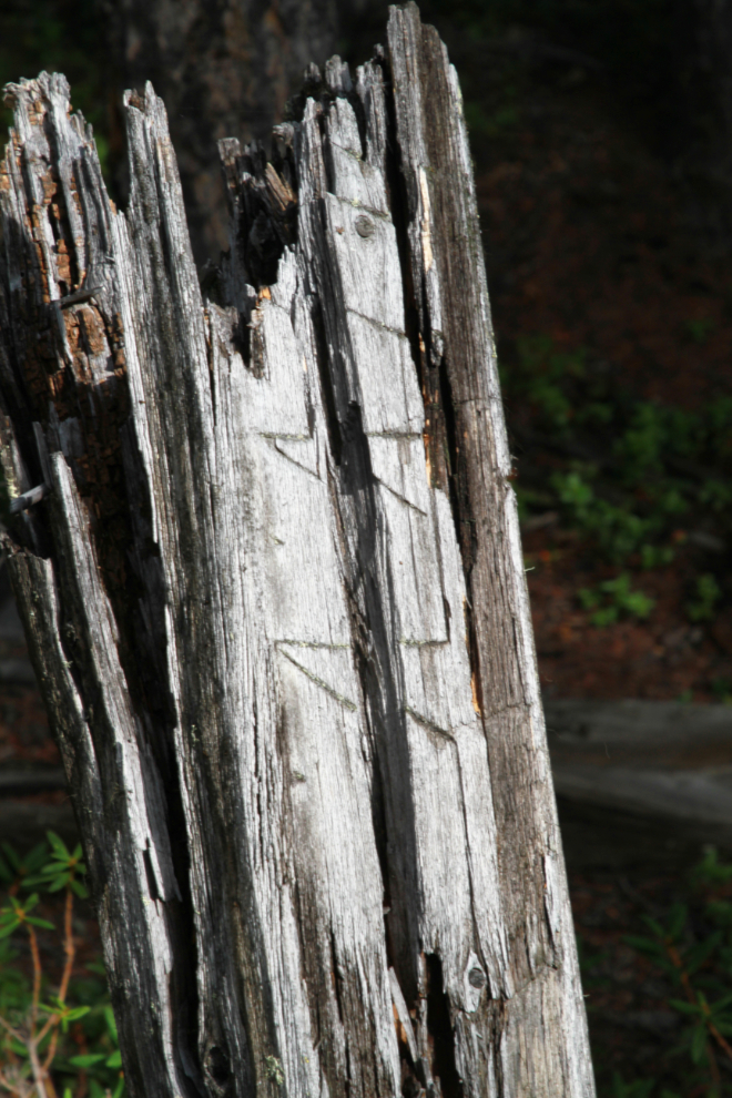
In the next photo, Tim is standing beside one of the claim posts for the Best Chance property.
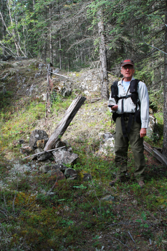
A closer look at that claim post shows the Roman numerals carved into the post when it was surveyed. For history nerds, being able to tie a post like this to a survey map is very exciting.
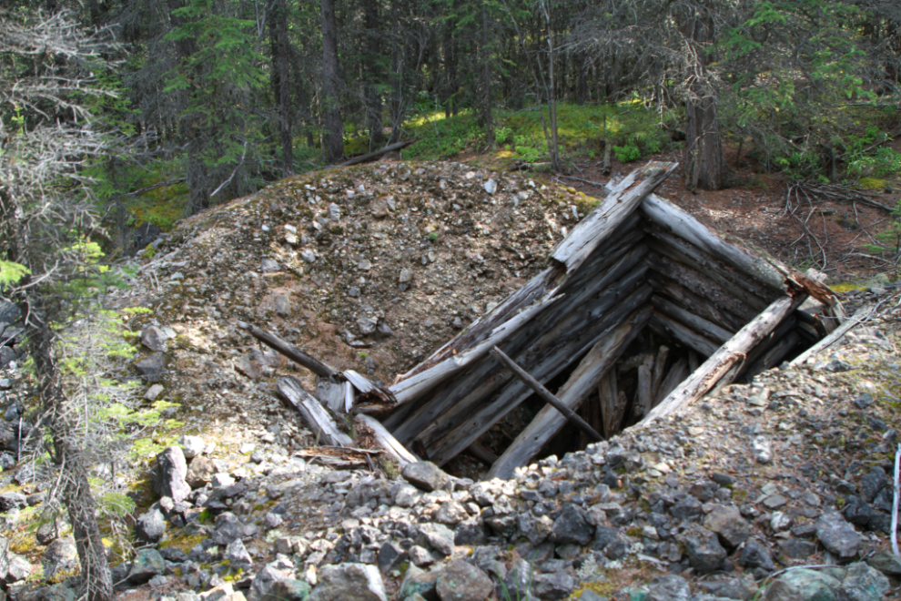
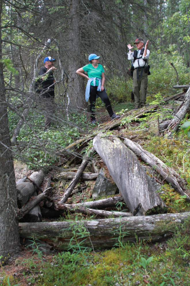
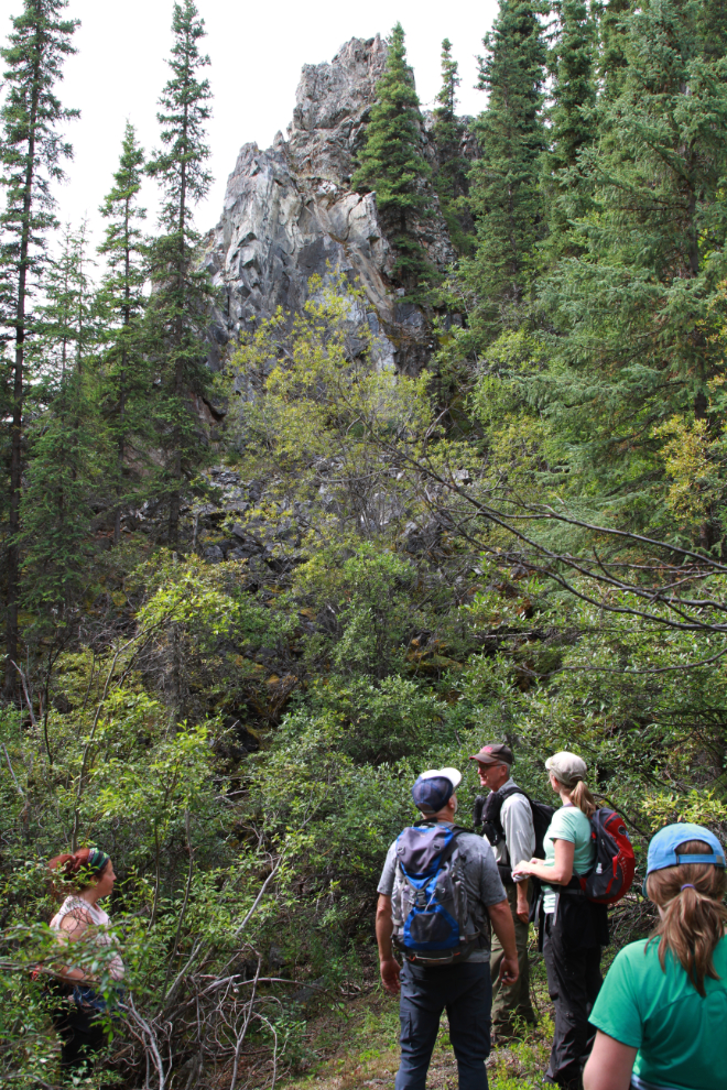
Our next mine was the Retribution, which was staked in 1902 but wasn’t worked until 1907, and then only in a small way. There was more exploration with a diamond drill at some much later period – a drill casing can be seen to the right of the pit.
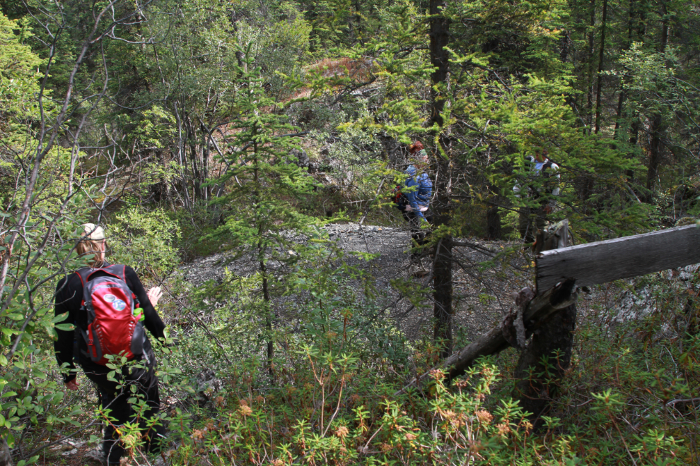
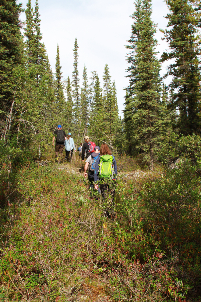
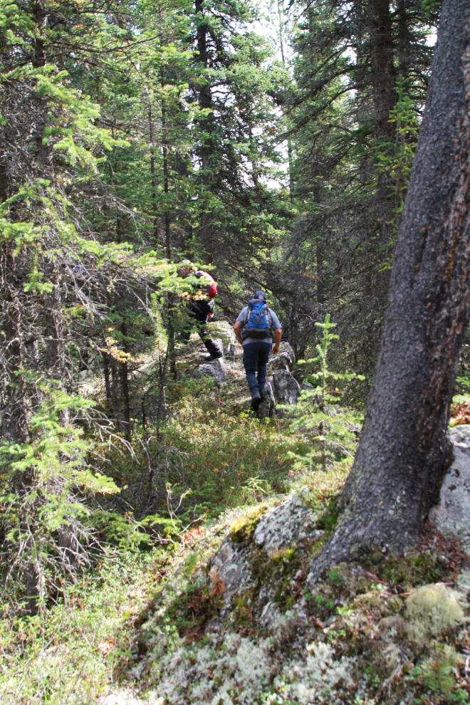
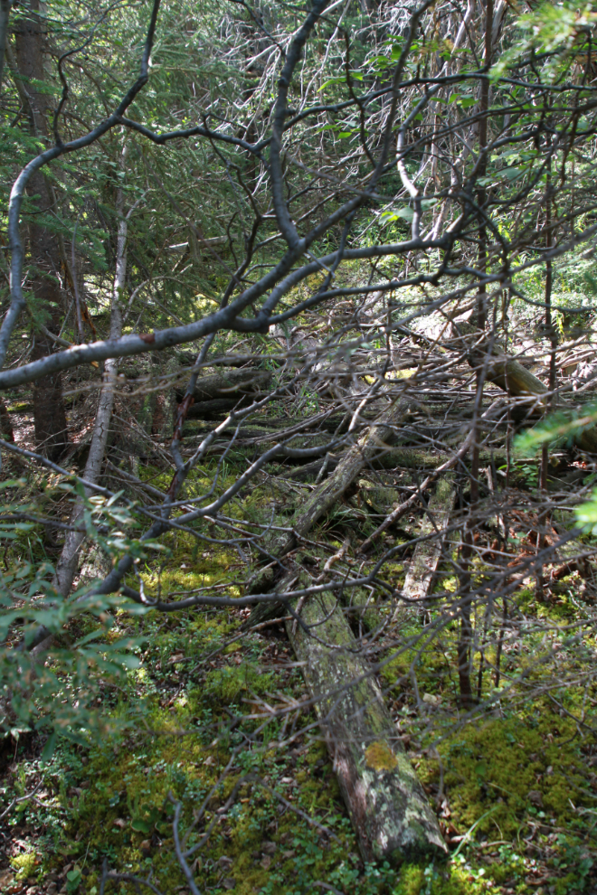
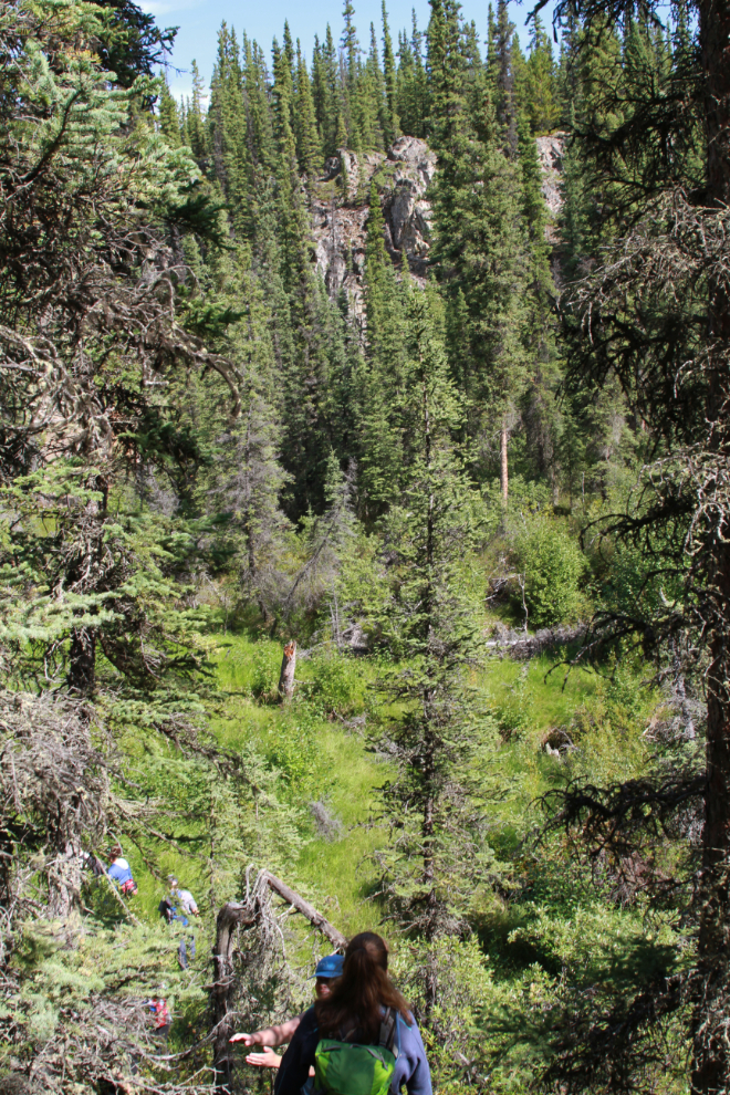
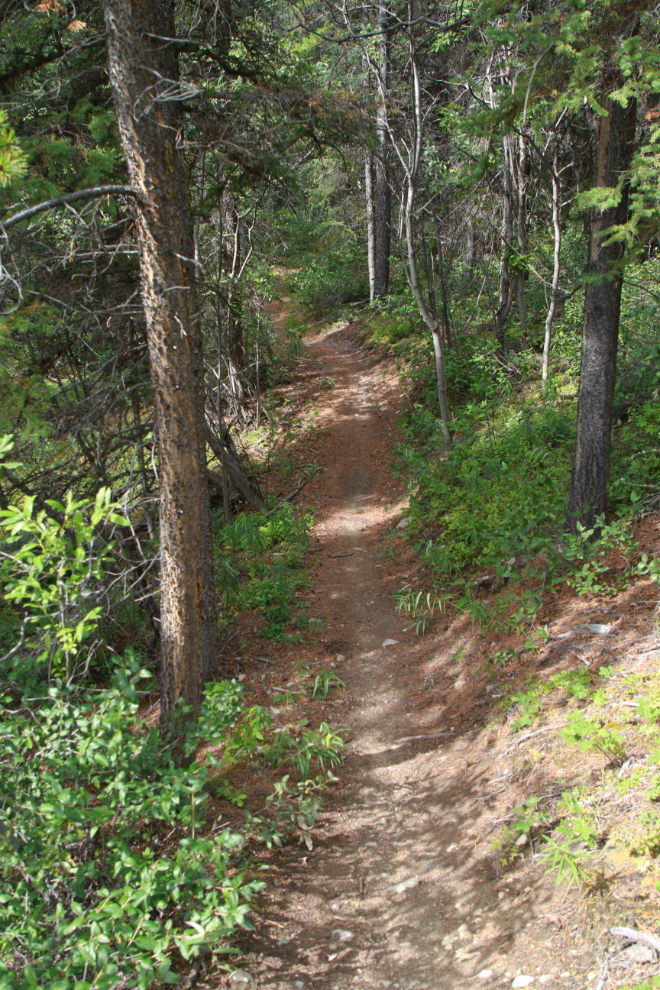
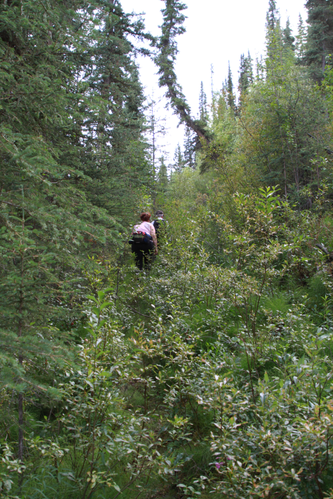
Tim seems to pretty much know every rock and tree in the Copper Belt, but he still has a GPS in one hand at all times. There are occasional hints of a trail, but not many. It was now 11:26.
There are mysteries here that will likely never be solved. Although this looks like just another survey cut-line through the forest, it doesn’t align with any survey Tim has found. The most likely other option is that some sort of transport – a tramline, either aerial or on the ground, perhaps – ran down this slope.
Hiking across the Retribution claim.
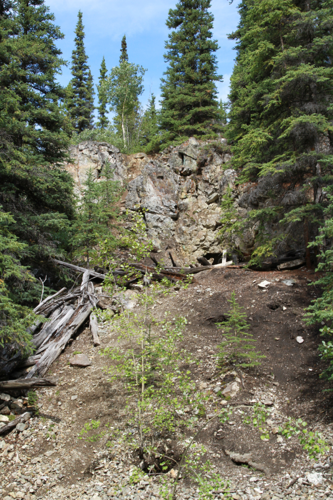
This pit on the Retribution claim, the most well-developed one we saw, is apparently post-1907, though still early.
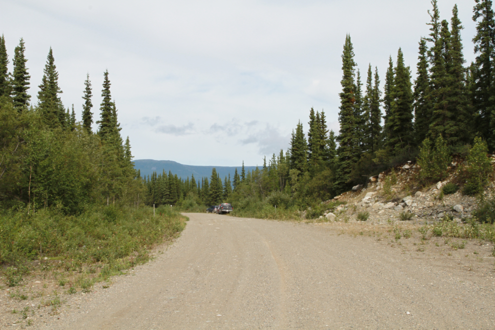
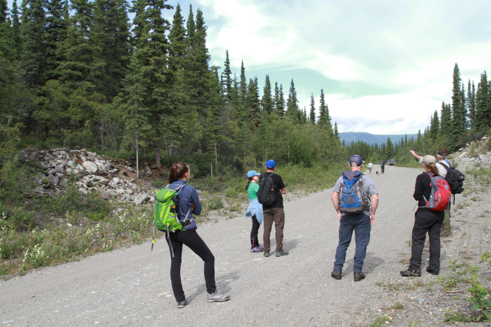
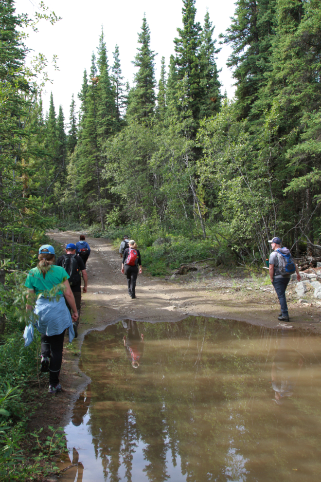
The hike was actually in 3 parts. Just before noon, we were back on the Copper Haul Road, most of which was originally a spur of the White Pass & Yukon Route railway, built to access the mines. Construction of the Copper Mines Branch began in 1907, and it was last used in 1918.
To the left in the photo above is the load-out (for loading rail cars) for the Grafter copper mine, one of the primary mines the railway hauled for. The load-out road was our access up to the main Grafter mine sites.
The next photo shows the ruins of some sort of raised trough for moving ore from the mine to the load-out. Tim is explaining a possible configuration of it, but so far we can only guess, as no description, diagrams, or photos of it have yet been found.
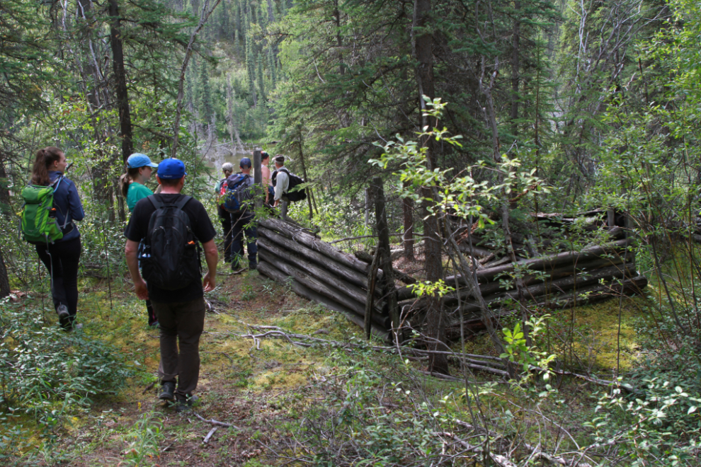
The road to the main mine site is well-used for recreational wandering. There is still a lot of water from monsoon-quality rains a few days ago.
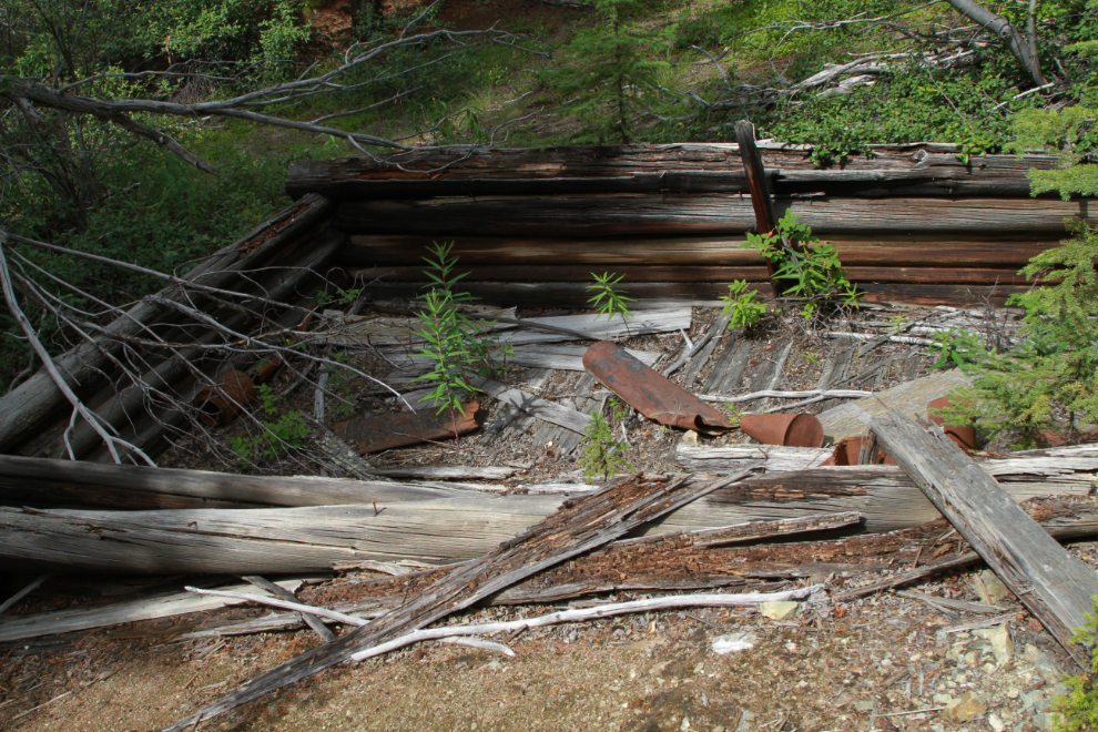
Perhaps the most interesting structure we saw this day – certainly the most unique – was the one below. I don’t undersand why it was built the way with all those odd angles, but it’s pretty cool 🙂
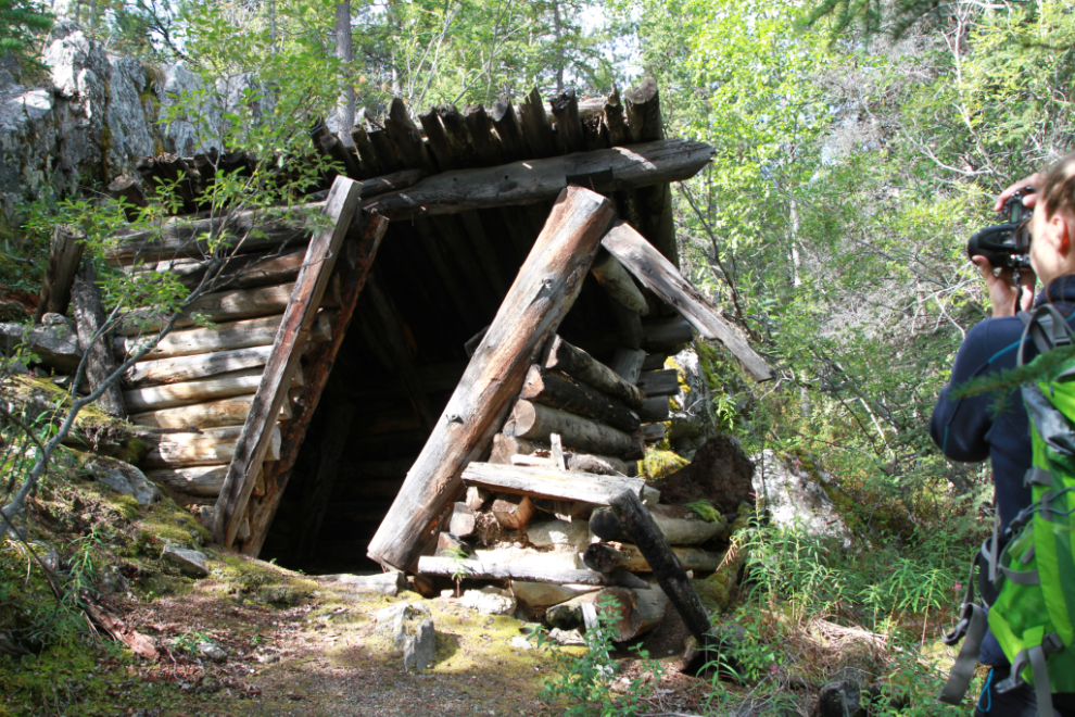
This may have been a stable for the mine, judging by the fencing around it. While ruins like this (ca. 113 years old) are still visible because of our dry and cold climate, the dramatic climate change here is no doubt causing much more rapid deterioration so they won’t be visible for many more years.
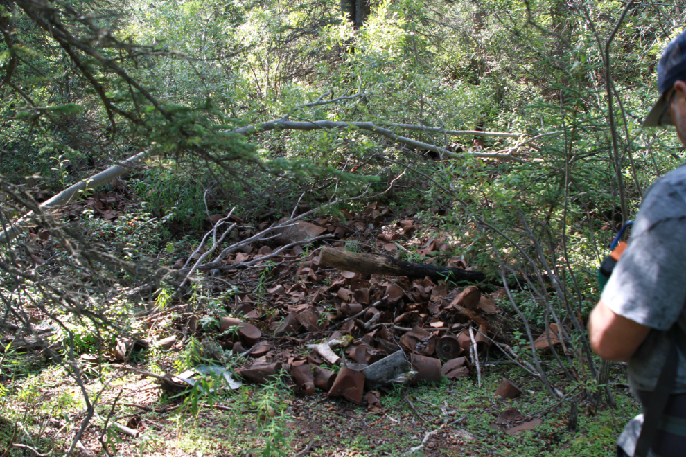
There was clearly a cookhouse near this large garbage dump – I mean artifact deposit 🙂 . There are some large bones around as well.
There are more building ruins along the main Grafter road but we didn’t go up it this day. That will be a great outing on my e-bike. Although this area is accessible from my home by bike, I’ll probably bring it out here with the Jeep so I have more time (and more battery) for exploring.
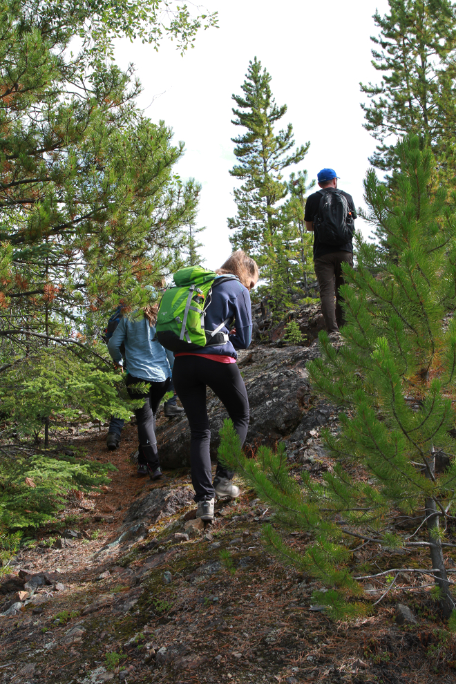
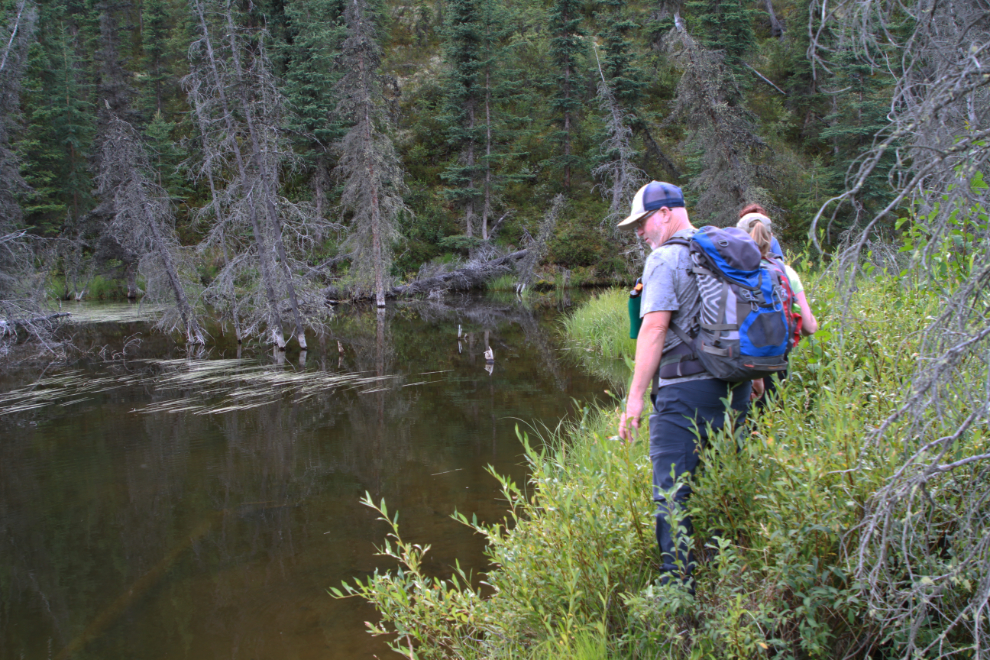
At 12:43 we were back on the Copper Haul Road, ready to start part 3 of the hike, the most challenging section by far.
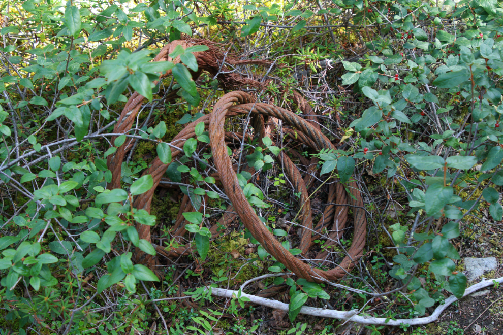
We started down the hill on a very faint trail. This very heavy wire cable was laying along it – it’s not yet known what it was used for specifically.
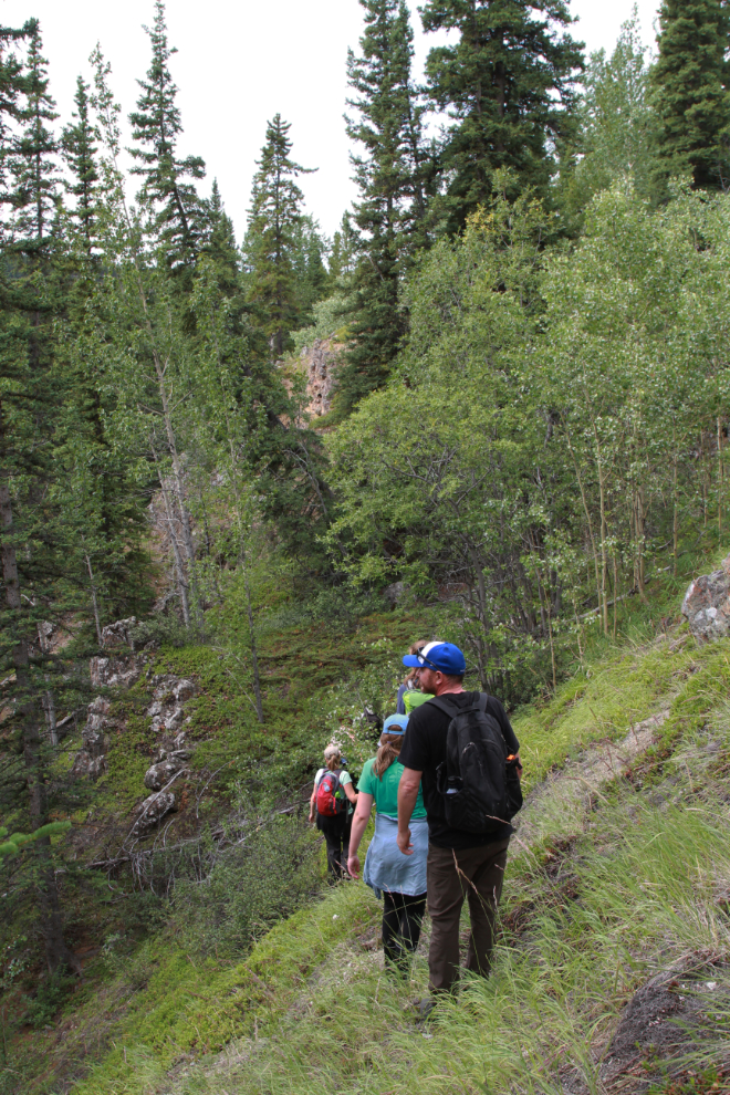
It took almost half an hour to reach the rugged valley of one of the branches of McIntyre Creek. On the far side of the valley is the Empress of India copper mine.
Before crossing the valley, most of the group scrambled up to the short adit of the Empress of Ireland, a very short-lived venture. I didn’t make the climb – I’m not 100% recovered from my injury yet and it was clear I needed to conserve energy where possible.
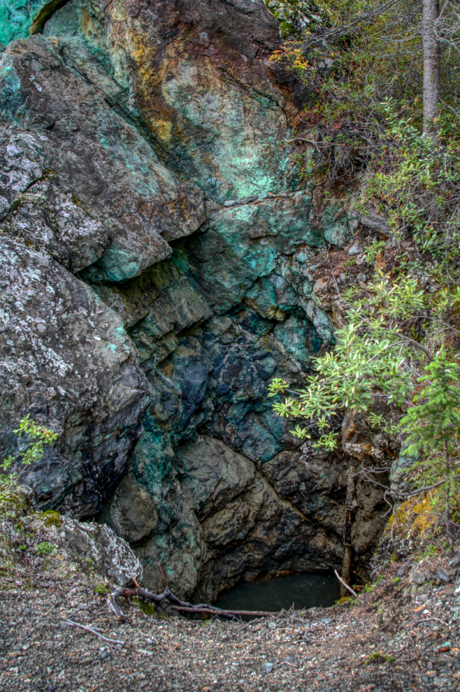
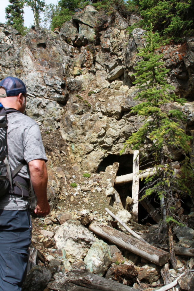
Looking way up to the main Empress of India adit. This was probably my favourite mine of the day because of its dramatic location.
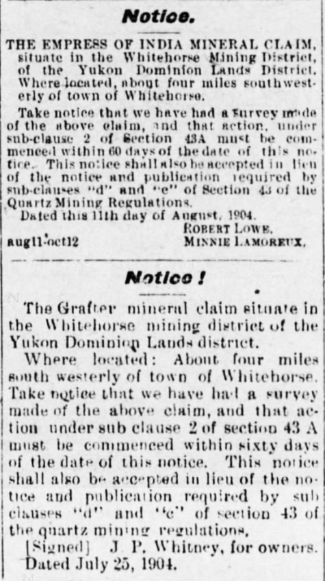
The Empress of India first showed up in what had become The Daily Evening Star on August 11, 1904, with the survey notice below – a Grafter mine survey notice is below it.
The wall of colour above the Empress of India is very impressive!
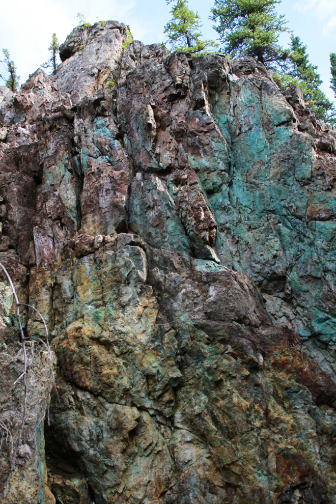
A closer look at the Empress of India adit.
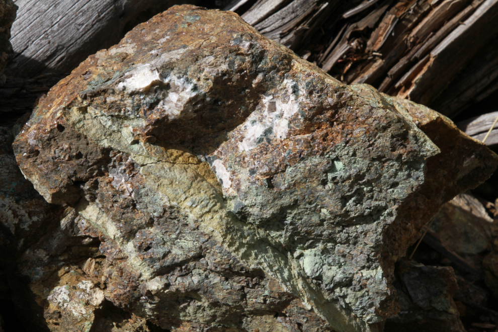
The Empress of India property would be a great place to explore with a geologist – some of the rocks are really complex.
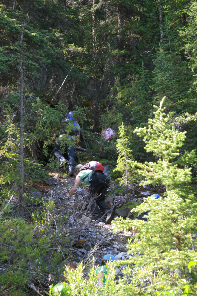
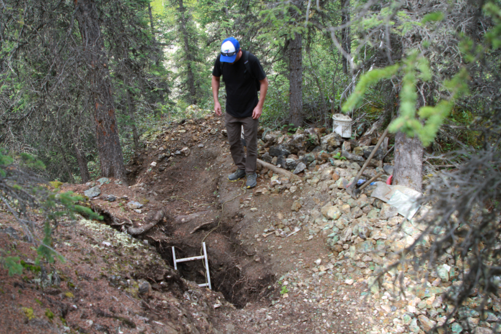
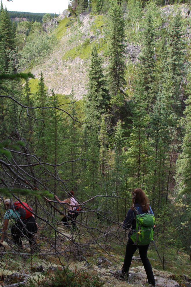
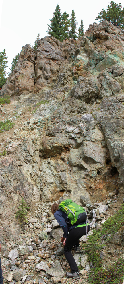
There are some hard-core rockhounds in Whitehorse! Up and down a few pretty extreme slopes, we came to an active exploration pit. By now I recognized that if I was suddenly alone here, trying to find a way back to a road would be a scary proposition. Even if I wanted to, I couldn’t find this place again.
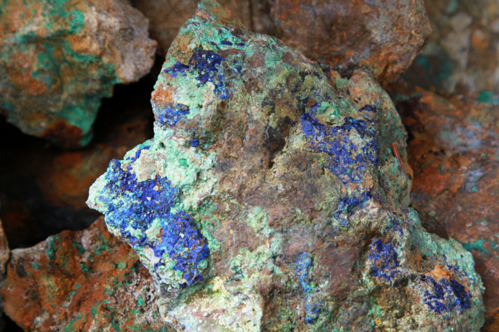
There were lots of pieces of malachite and azurite around – no doubt the best ones from the pit were carried out each day and these are of a quality not worth carrying. Low quality or not, some are very pretty 🙂
Just before 2:00 we came to a slope so steep and treacherous that Tim told us not to follow him but to find our own way down.
This is fascinating terrain in the extreme.
Our final mine was the Spring Creek. It’s a very interesting site because although it wasn’t successful, a great deal of work was done on the property over a period of at least 8 years (1907-1915). The next photo is a panorama created with two vertical photos.
A very faint trail leads across this steep slope to another part of the Spring Creek property.
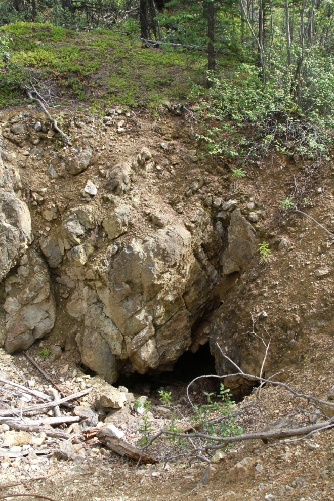
Spring Creek has several short adits and seemingly shallow pits.
There are a few building ruins – some probably full cabins, some just the base for wall tents. This one would have been topped with a wall tent.
The Hawk Ridge hiking/biking trail is just above the Spring Creek mine, but as it’s out of sight I expect few trail users know about it.
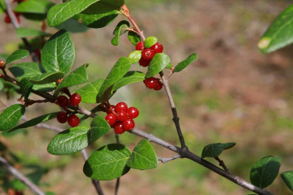
Soapberries are incredibly abundant this year in a few areas we passed through. They’re apparently an acquired taste – they taste like soap to me and I have no interest in acquiring the taste 🙂
One more Spring Creek mine building.
The remnants of a wagon road goes from the buildings down to this large beaver pond, then up the opposite slope. I expect that the beaver pond didn’t exist when that road crossed the valley bottom.
A series of beaver dams makes crossing the valley a fairly dry experience. Most members of our group got wet feet a ways back but I forget now where that was – I had my usual sport sandals on so didn’t really pay much attention.
At 2:45 we were well up the wagon road on the other slope, climbing towards the Copper Haul Road.
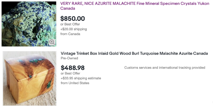
The final image shows a couple of the many Whitehorse Copper Belt pieces on eBay today. The upper listing, by somebody in Quebec, says: “You are bidding on very fine Azurite and Malachite Crystals from Empress of India mine, Yukon, Canada, collected in the summer of 2018. This beautiful miniature size specimen is about 90 mm x 90 mm x 60 mm. It is a very nice display piece of fine crystals.Important to note; unlike many copper rich places world wide Canada is almost totally devoid of any Copper secondary minerals and these Yukon mines were abandoned almost hundred years ago. So this is very rare. This is a serious quality specimen for the advanced collector. It may be your last chance to acquire beautiful specimen from this now depleted site.” I doubt they’ll get that sort of price, but I’ve never been a rockhound at that level, so perhaps.
I can’t imagine that anyone would consider that afternoon a pleasant hike, but it certainly reinforces the importance of the Copper Belt in Yukon history, and also the reason this is “The Wilderness City.” I hope you enjoyed coming along with me.