White Pass: 2 days canoeing and hiking to an un-named valley
Pretty much ever since I started driving the South Klondike Highway between Whitehorse and Skagway in 1990, a particular valley to the east of Summit Lake near the White Pass summit has intrigued me. Clearly carved out by a massive glacier, spectacular peaks loom behind a series of waterfalls. The valley has no name, and even the mountains don’t have names. It’s a fairly popular place to go in the winter, usually by snowmobile, but nobody seems to visit the valley in the summer. Last week, though, a friend and I reached it on our second attempt by canoe and off-trail hiking, and the valley was even more wonderful than I’d imagined.
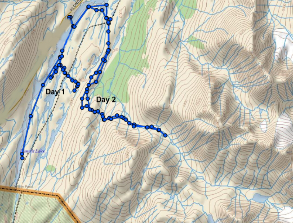
The map below is the feed from, my Garmin inReach – click here to go to an interactive map and trip report at Ramblr. Note that the routes on Day 1 and Day 2 are marked.
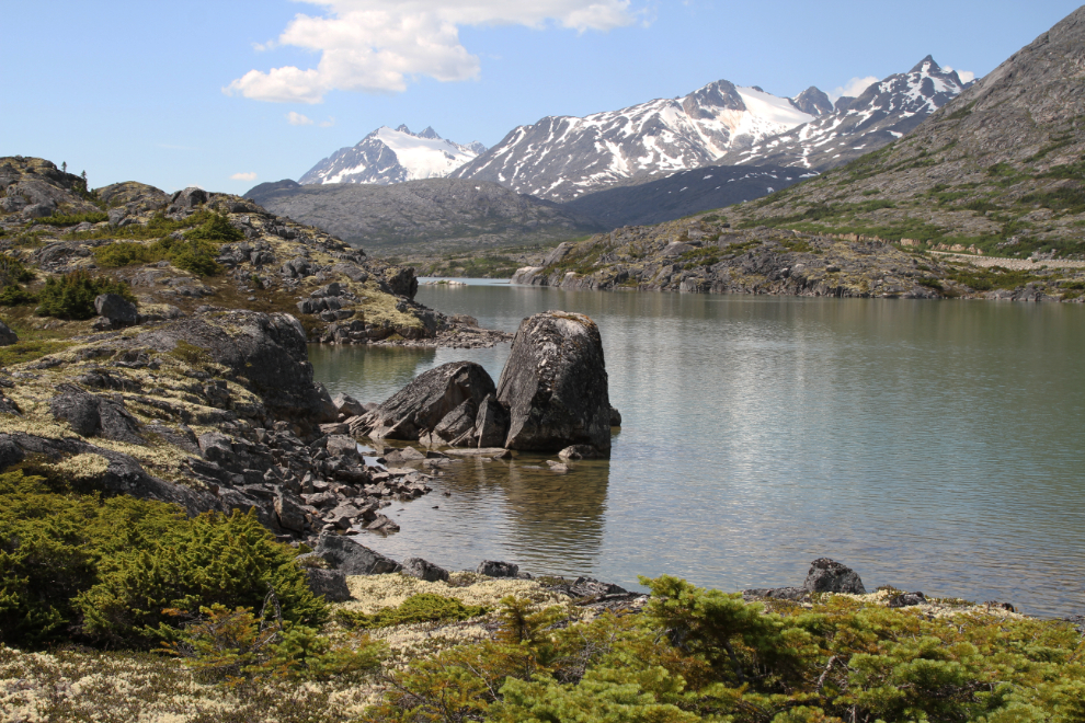
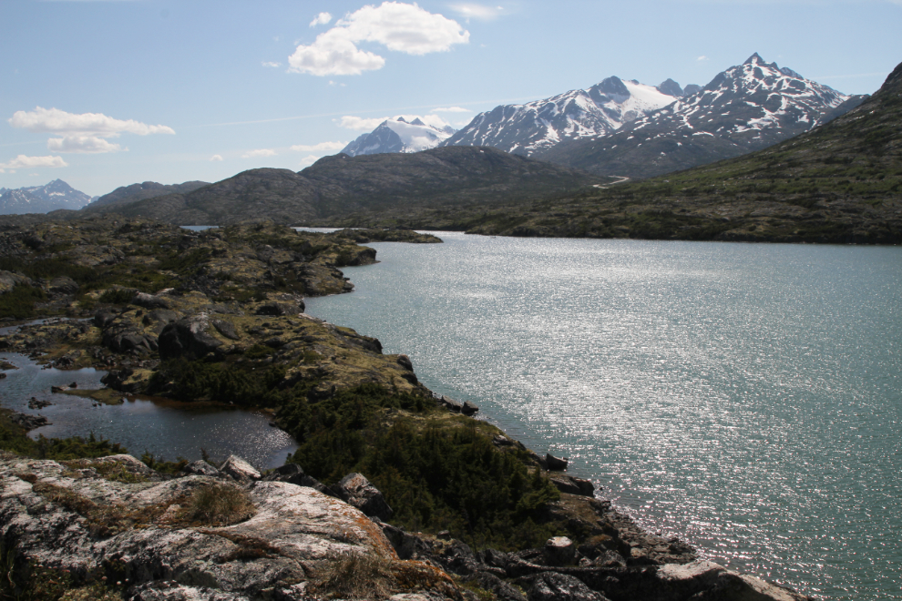
After leaving the World War II Canol pipeline pump station described in my last post at about noon, Greg and I canoed back down Summit Lake, landing in a cove at what appeared to be the shortest route to the valley. The first photo was shot right at 1:00 pm, looking back up Summit Lake from the ridge above the cove where we stashed the canoe.
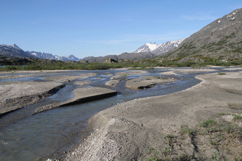
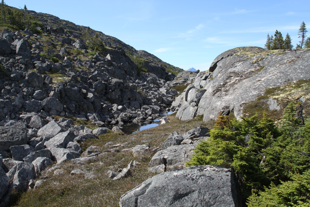
The large lake in the next photo has no name, and isn’t connected to Summit Lake. Finding a route around the countless lakes is part of the challenge, but navigating the granite ridges and cliffs is the biggest challenge.

It took us 50 minutes to hike from the canoe to the White Pass & Yukon Route railway.
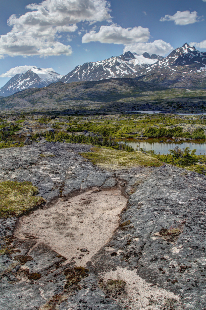
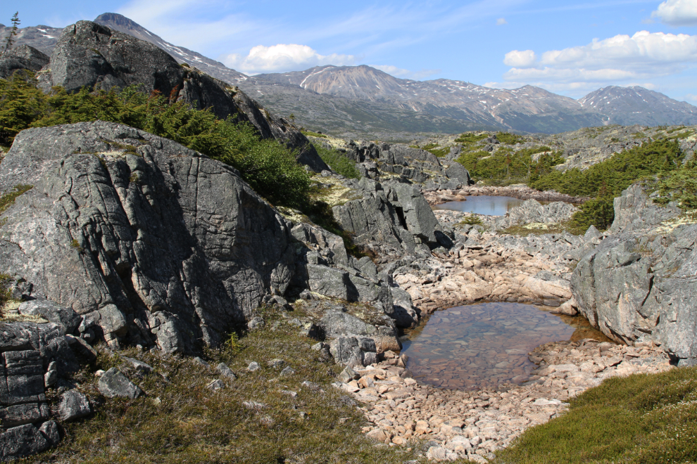
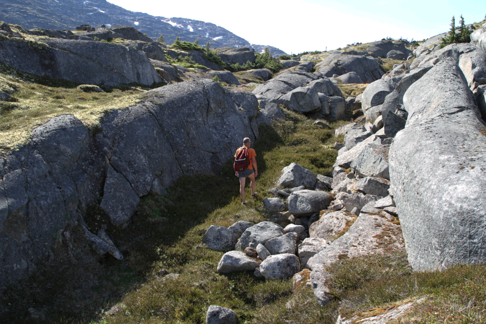
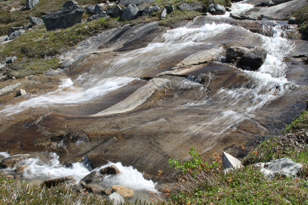
The bare granite provides wonderful hiking in places, and is incredibly varied. The little patches of sand may have been left thousands of years ago by the post-glacial lake that filled the valley. This is an HDR image to bring out the detail.
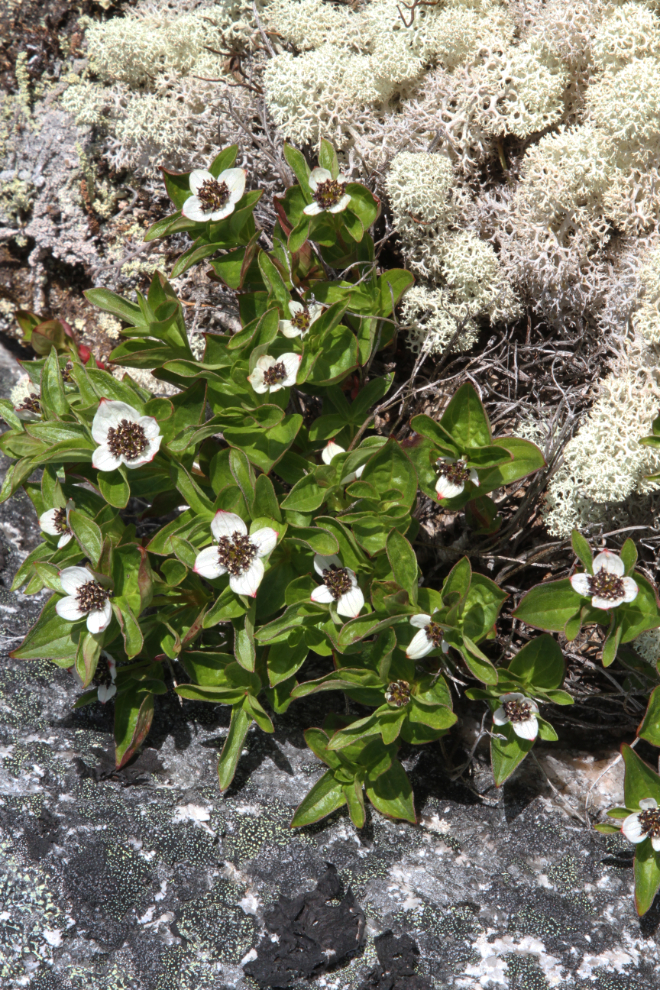
A rather surprising number of flower species thrive among the granite in this land of extreme weather.
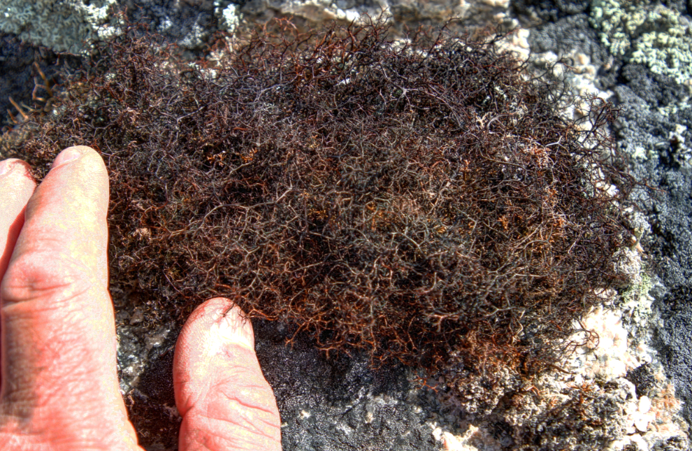
I found this very odd moss (?) in one very small area. It looks like rusted steel wool.
The temperature had climbed to about 24°C (75°F), and Greg and I both took advantage of a couple of the smaller lakes/ponds we came to.

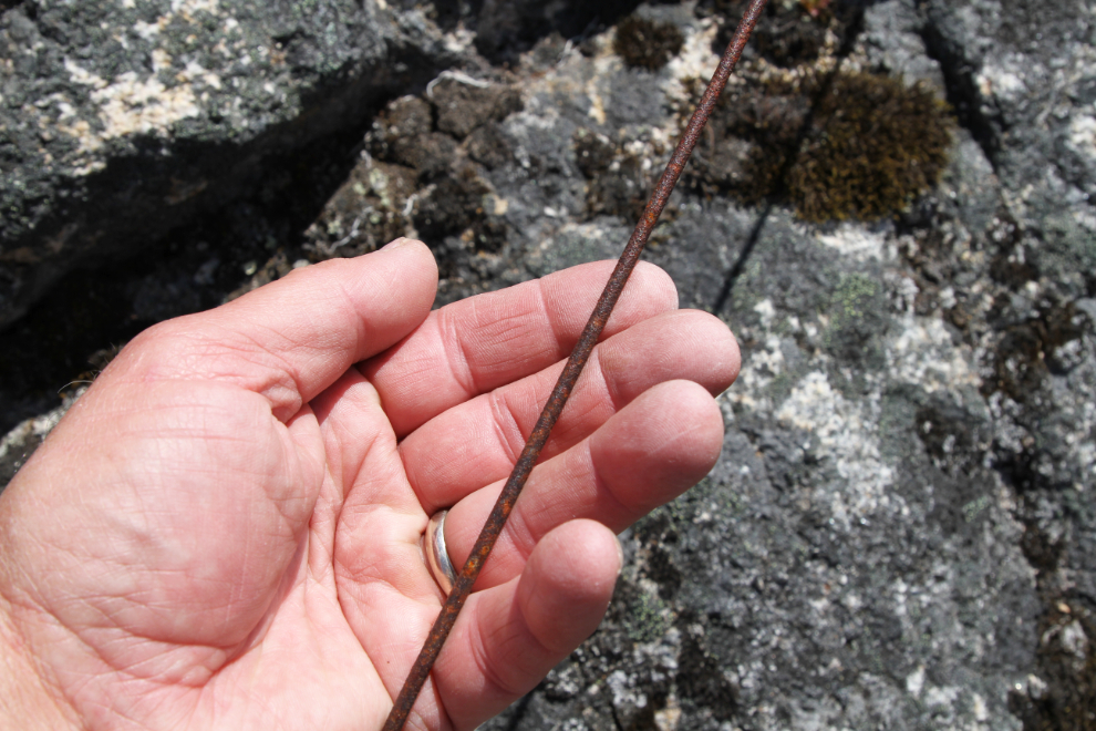
High above and far from the railway where such things are expected, I found a telegraph line. At this point I’m not sure what to make of that – was it laid by a company during the Klondike gold rush?
By about 2:30 we had reached a vast area of thick brush that stopped us. Some people don’t mind bushwhacking to reach their destination – Greg and I do mind. After much contemplation, I decided on another route to try the next day, and we started back.
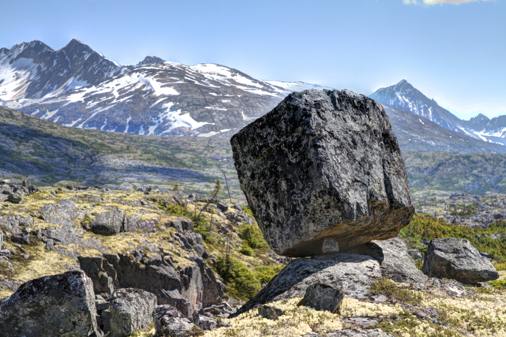
An oddity that we saw several of during the hike are balancing rocks left by the glaciers. Many of them had a single small rock supporting them as this one did – the main rock is almost 5 feet square.
Finding the canoe turned out to be a bit of a challenge – there are many little coves along Summit Lake, and none are very easy to get to. My inReach GPS would have made it easy if either one of us had brought our reading glasses so we could see the screen well. I had actually thought about bringing them that morning. Note to self… 🙂
We went on quite a tour in our search for the canoe-cove, but once I spotted the unique pair of rocks seen in the first photo above, I knew where it was. We went for another dip and felt much better.
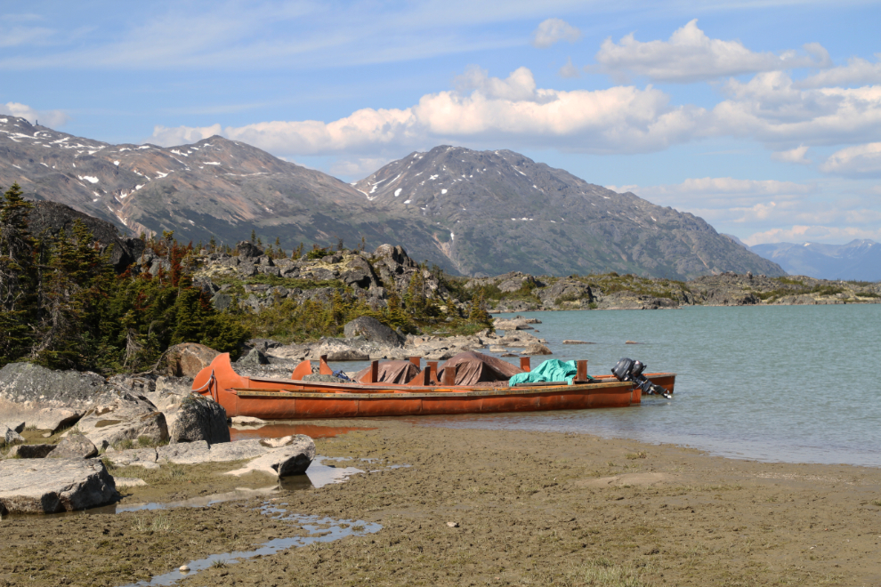
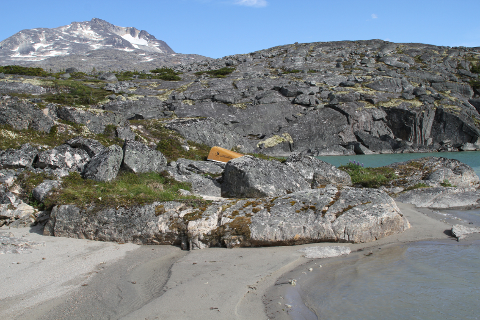
By 5:30 we had stashed the canoe in a tiny cove at the mouth of Summit Creek and were walking back to the car for the 2-minute drive back to the motorhome. The beach at Summit Creek is the base for a canoe excursion aimed at cruise ship passengers, but the canoes didn’t move during the 3 full and 2 part days we were there.
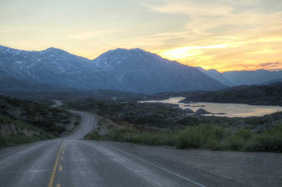
The sunrise on Thursday morning was spectacular, promising another amazing day to try for the un-named valley. The next photo was shot at 04:50 from “Outhouse Hill”.
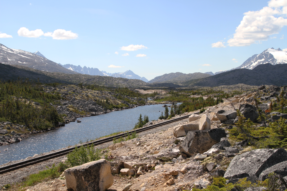
By 08:40 we were back at the mouth of Summit Creek (seen in the next photo), and a few minutes later were paddling down Summit Lake to a large bay on the east side.
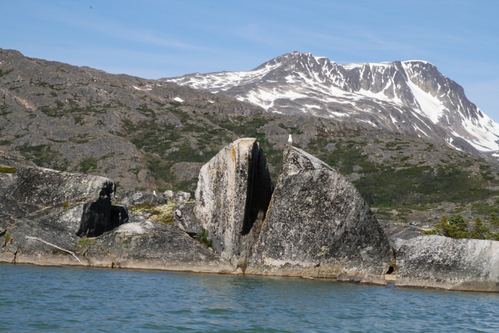
At the mouth of the bay, this 10-foot-high granite boulder made me wonder what sort of forces could split it wide open.
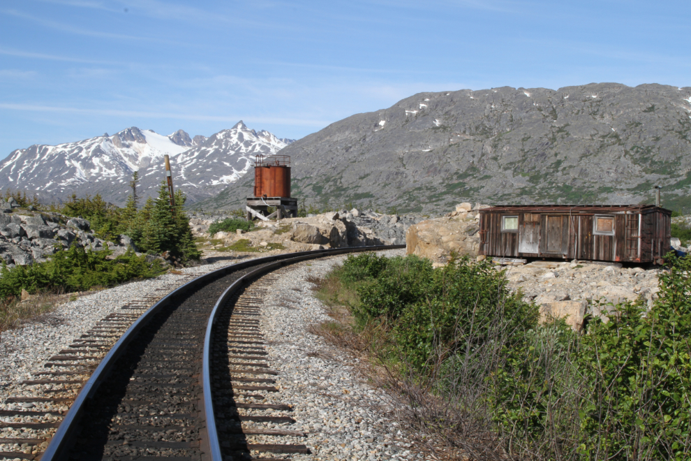
A few minutes after stashing the canoe, we were at MP 23.8 of the rail line, where a boxcar used as a shelter, and a fuel tank for the bulldozers used to clear the line of snow each spring, are notable.
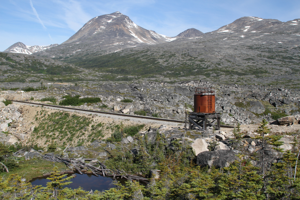
To the left of the fuel tank can be seen the wreckage of snow fences that used to give a small amount of protection to a couple of miles of the railway in this area. The gully to the left, at a spot called Gateway, is now filled but used to be crossed by a bridge.
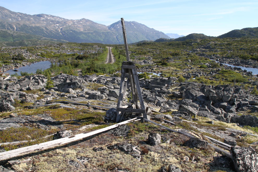
Above the railway is this structure that appears to me to have been used in surveying.
Our initial bearing from the rail line was almost due south, aiming for a high, bare ridge that wraps around the southern side of the mouth of the valley we wanted to reach. To say that there’s no direct line is an understatement. Up and down, up and down, around and around and around…

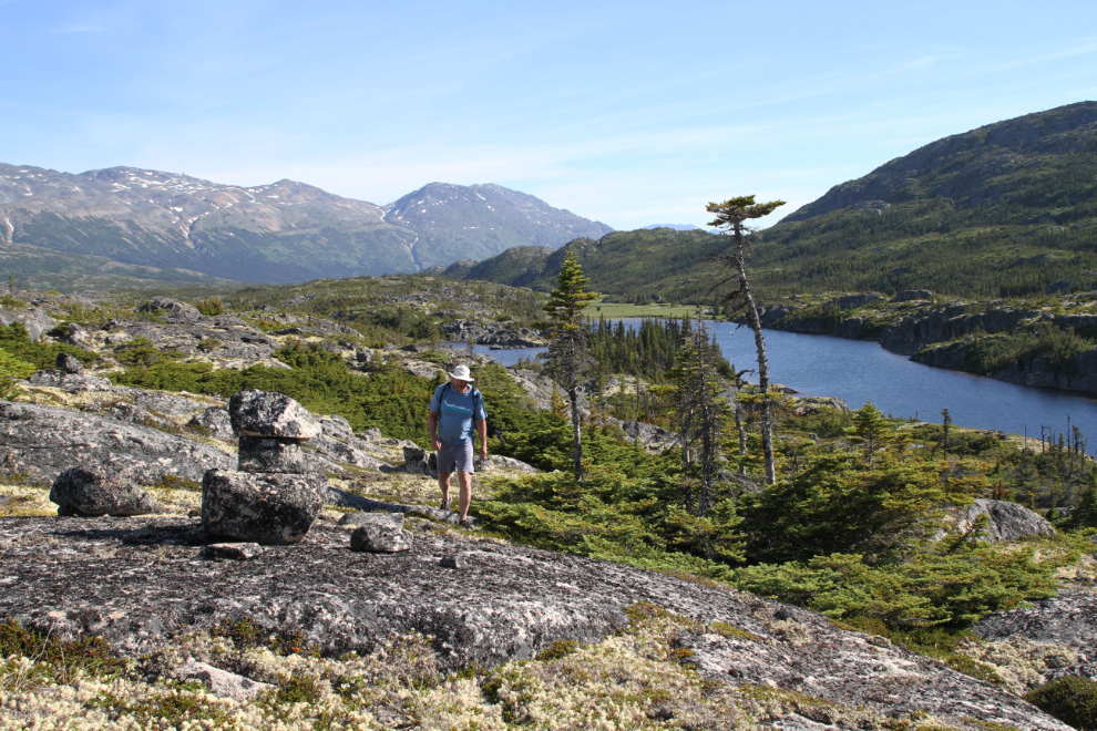
To the left of Greg is an extremely old cairn, I expect marking a Klondike-era trail. I didn’t find any others.
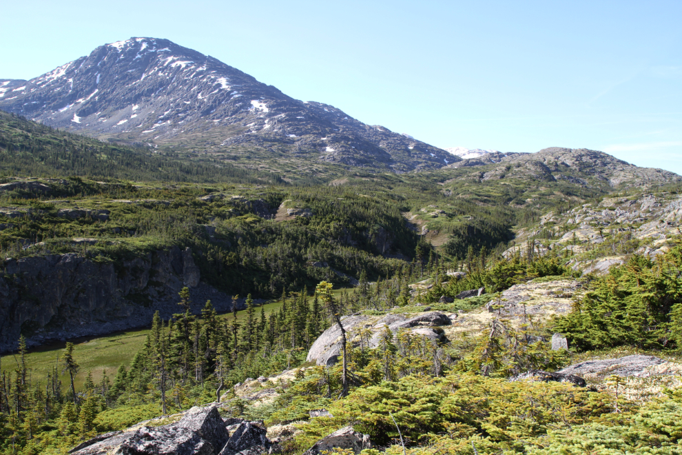
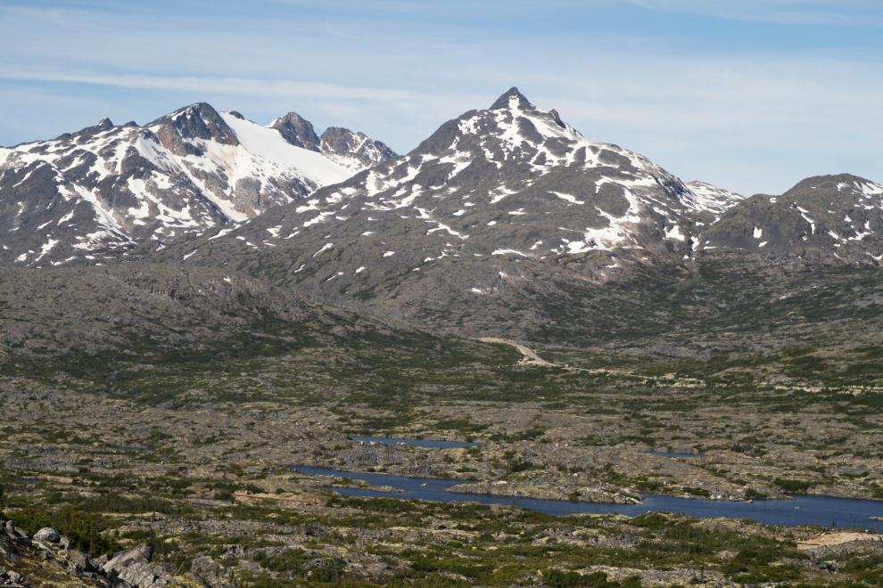
By 10:15 we were reasonably confident that the ridge we were aiming for was the route that would get us to the valley, to the upper left in the next photo.
The higher we got on the ridge, the better it looked, but navigating around cliffs, ponds, and brush was a constant challenge.
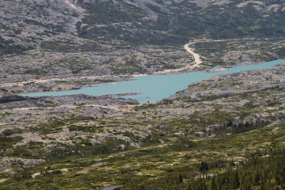
As remote as our location was, and as long as it had taken us to get there, the South Klondike Highway wasn’t all that far away as the raven flies.
High on the ridge, we came to what I thought was a moose kill site. This is definitely not normal moose habitat.
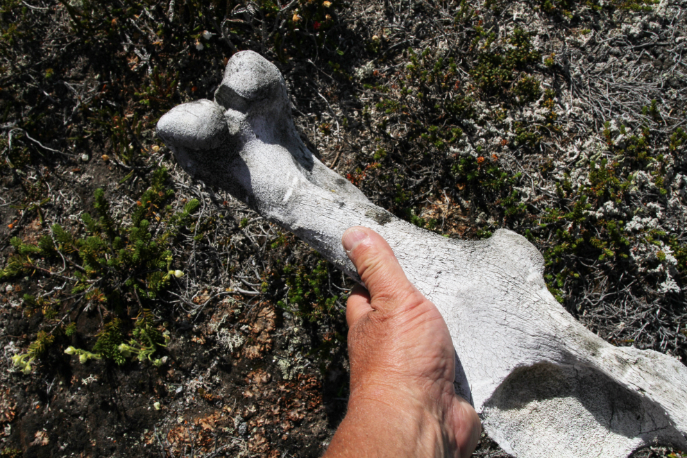
Judging by the amount of soil deposition around the ribcage, the skeleton has been there for a very long time – since the gold rush or perhaps even longer.
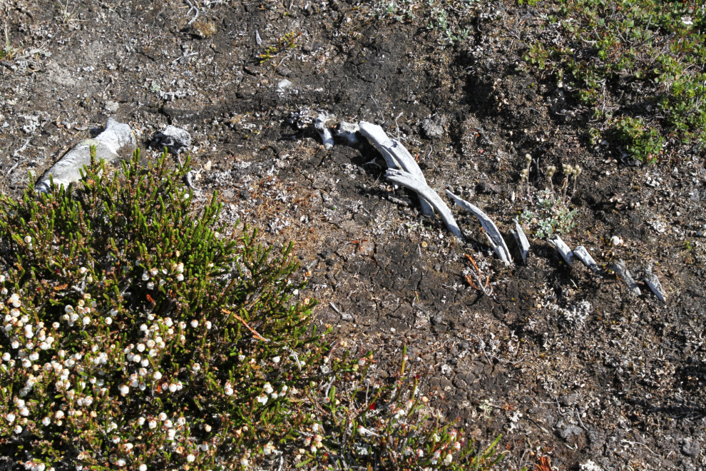
This is a broad view of the site. I posted these photos to the Yukon Wildlife Viewing site and to my Yukon History and Abandoned Places group, and it’s been suggested that they may be horse bones, but also that moose do occasionally venture into places like that. Horses would tie into our discoveries of both the telegraph line and the cairn.
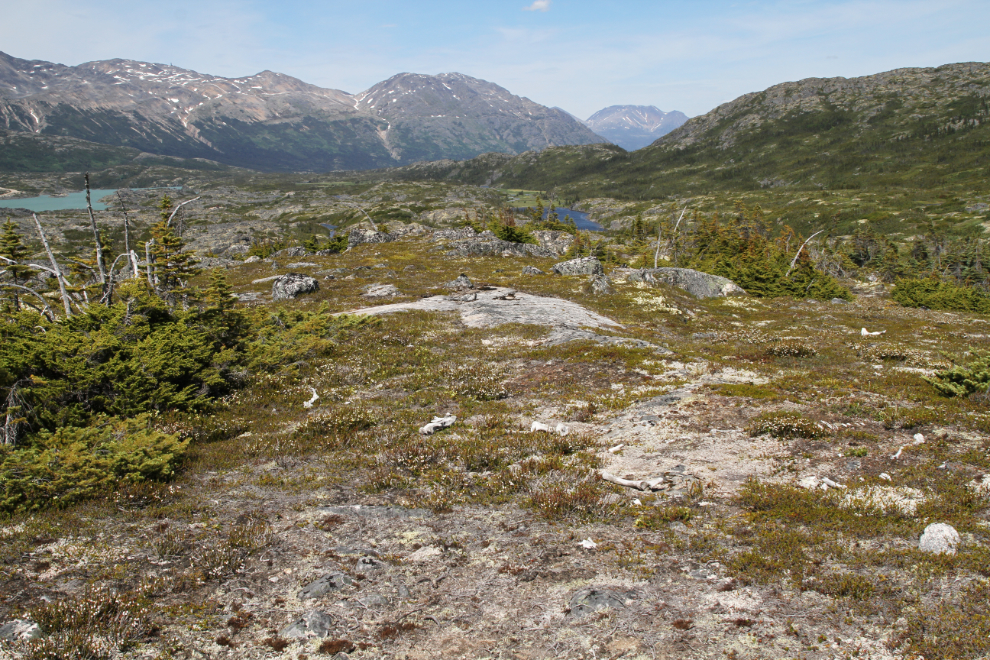
As we got higher on the ridge and closer to the valley, there are some very large gulleys full of brush that we hidden from lower elevations. Hiking up and around near their heads was always the best option.
The power of this country is incredible. You might expect that this sort of hiking is frustrating because of the complicated navigation, but I find it exciting. Greg said a few times “I’ll just follow wherever you lead” 🙂
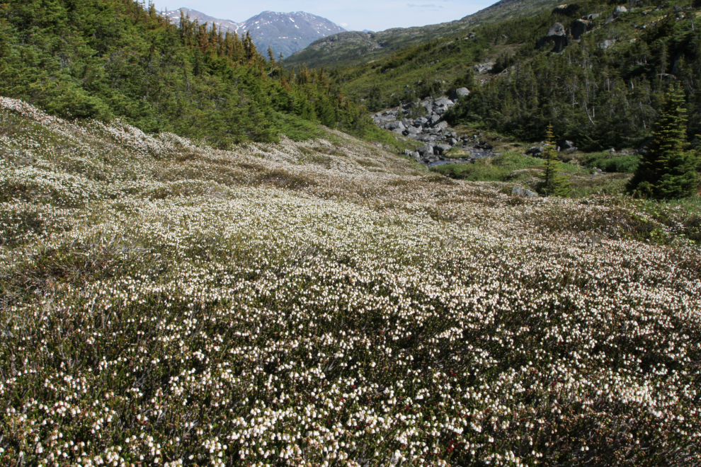
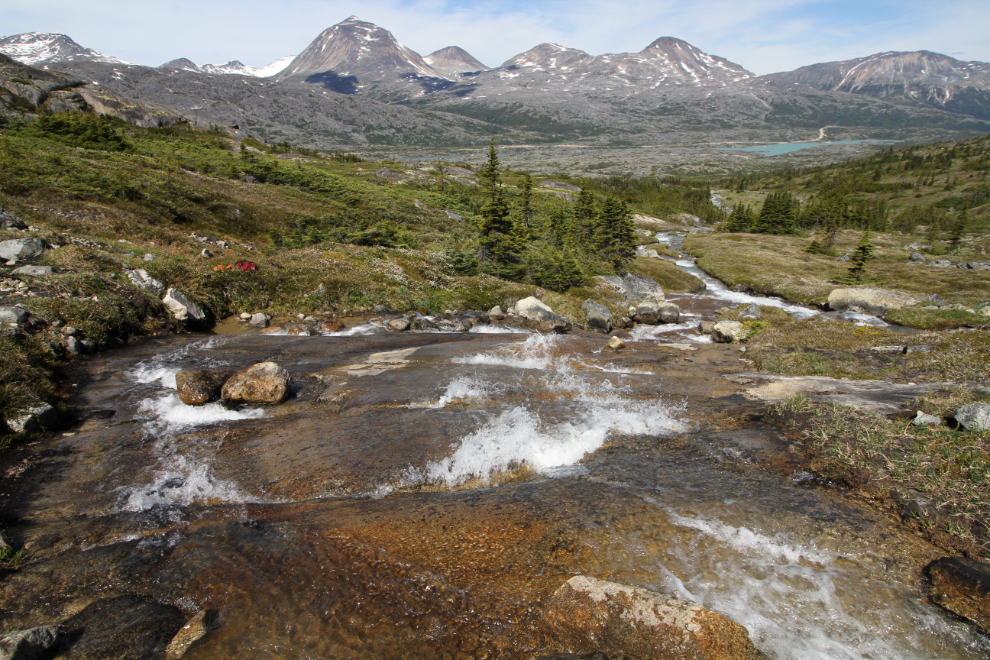
This gorgeous slope of white heather was near the head of a small valley. At the creek beside it, now confident that we would reach our goal, we took a long lunch break. At this point, we had been running into game trails quite often, created by sheep and caribou.
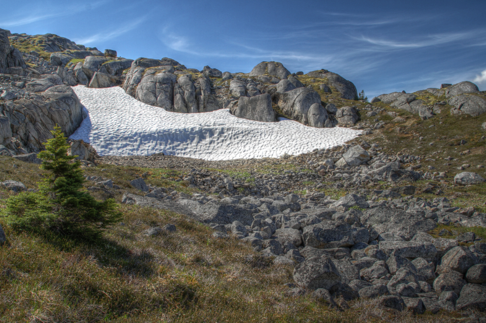
At an elevation of about 1,100 meters (3,600 feet), we began to run into large patches of snow. The one in the next photo was over 8 feet deep.
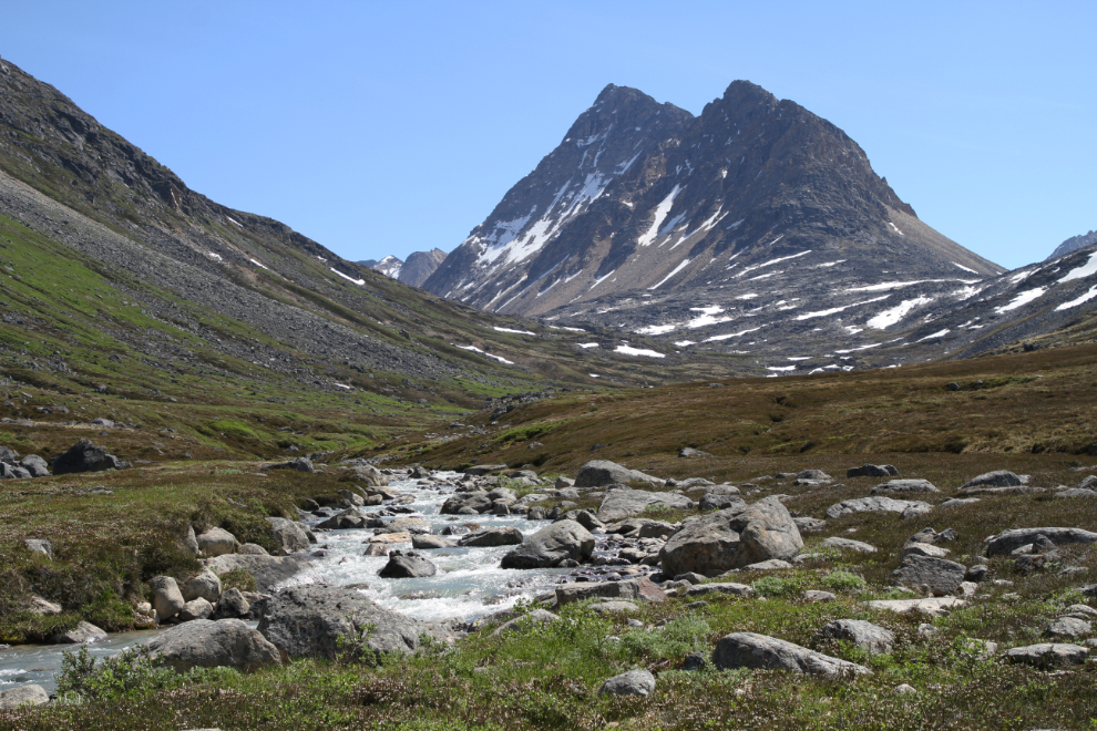
At the highest point of the ridge we were climbing, I came over a bluff and was stunned by what I saw. I yelled back to Greg “I don’t know when it happened, but we seem to have died and gone to heaven.” The photo doesn’t do it justice at all. From this point, reaching the valley was easy.
I’d been wanting to reach the creek that flows out of our destination valley, and that was finally reasonable. We dropped down a bit and spent a long time at this spectacular spot.
This was a wonderful spot to play in the water! 🙂
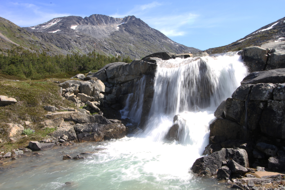
I had set a time of 2:00 as the deadline for starting the hike back to the canoe. Fifteen minutes after leaving our play spot on the creek, we reached this beautiful waterfall. It was now 1:35.
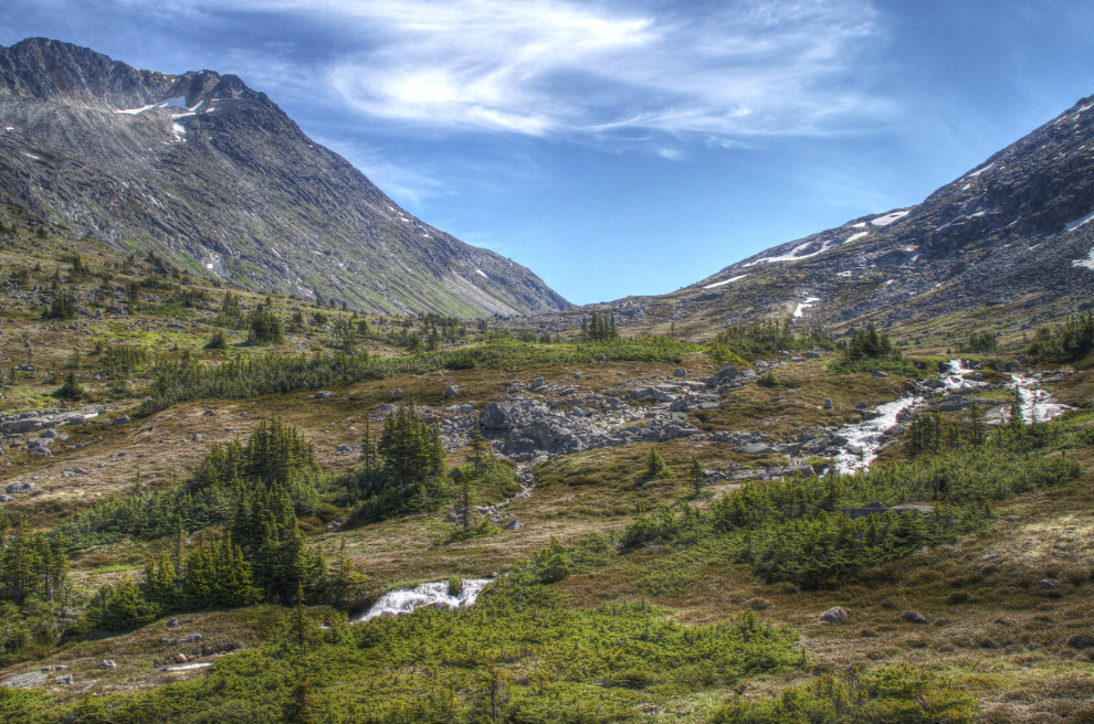
At 1:50, we reached the outer lip of the valley. We’d made it, and now we would just explore what we could. The valley steps up several times behind a series of glacial moraines.
High above us, the moraine of a glacier that has almost vanished was very impressive.
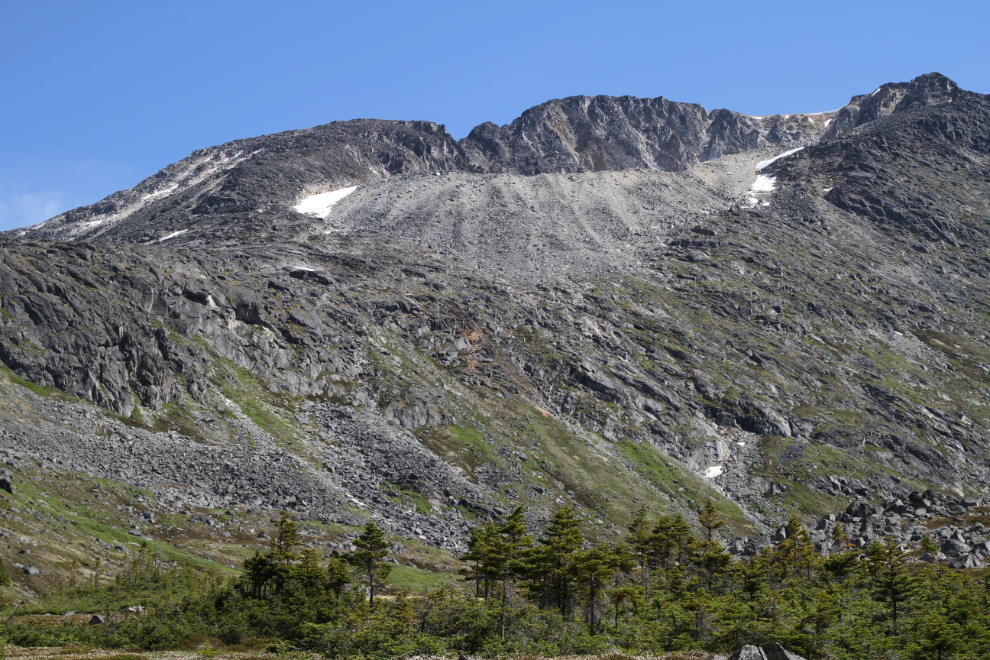
The valley will require an overnight hike to explore properly – it’s both large and complex. What I’ve confirmed so far is that neither the lake nor the glacier shown on the government topos exist anymore. At 2:15 pm, we started back down.
We could soon see our objective – the fuel tank on the railway can be seen in the next photo. The hike back was much quicker than the hike up because we made few stops, and none of them were lengthy, although we did go for a couple more dips in small lakes along the way. I was very pleased that in this vast country, I was able to stay very close to or right on the route we had taken going up, often stepping on footprints made a few hours before – in the dry lichen we often crossed, they show up well
At 6:05 pm, the canoe was once again stashed in the cove at the mouth of Summit Creek and we were walking back to the car. It had been 9 hours and 25 minutes since we started out from this point. Not bad for 2 guys in their 60s (Greg is 66, a little over a year younger than me).
We were already re-thinking our planned hike for the next day. Summit Creek Hill, a steep and challenging route, had been the plan, but an easier option was being discussed.