Paddling BC’s Bowron Lakes circuit in 1968
This post is something of an experiment. Due to my brain injury, I have no memory of this significant adventure of my youth, only photos. My final neurologist said 2-3 years ago that the memories are still here, I just can’t access them. Sometimes various things will trigger a brief memory, and on a good day that will happen often enough to have a relatively normal conversation about things that happened in the past. Although I’m starting off with almost nothing other than the knowledge that a friend and I shared this adventure, I’m hoping that the same sort of thing will occur here, by using current information as the prompts.
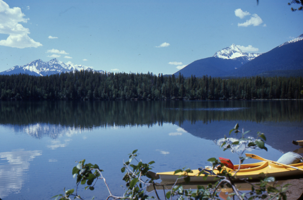
This trip took place in July 1968, when I was 17 years old and Randy a bit younger. We used two very heavy double kayaks built by Frontiersman in the Vancouver area, and I was shooting with a Pentax Spotmatic I had bought new in 1966, using Kodachrome slide film (probably K64). The boats had been bought for the family’s kayak rental business on the beach at White Rock, BC. I don’t know which vehicle we used for the 760-km drive from Surrey to the start of what was then a little-known route.
I’ll start with a map to orient you – click here to open an interactive map in a new window.
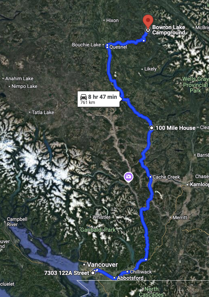
Today, the Bowron Lakes are extremely popular for paddlers. As with everything else in BC, there is a mind-numbing list of regulations, and reservations with high fees are necessary (today this trip would cost $156 for the two of us to reserve a spot among the crowd). In 1968, there was no staff, no campgrounds, and no communications – we were on our own, just two city kids in the wilderness. Look at today’s facilities! (full information is at this BC Parks page).
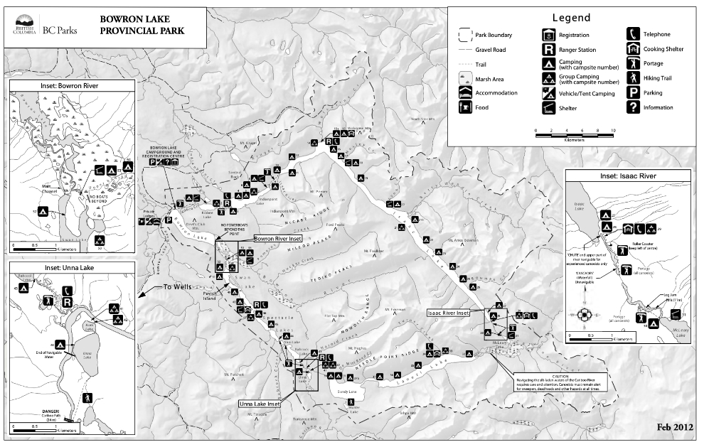
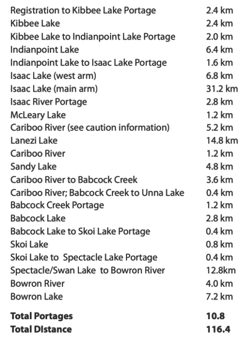
The complete circuit as we paddled it is 116.5 km (72.3 miles in those days), consisting of 23 legs, including 11 lakes, 3 rivers, and 7 portages totalling 10.8 km. There are a total of 54 authorized tenting sites, with from 1 to 7 tent spots each. In 1968 you could camp wherever you wanted, but that was always at places where many others had camped before. We took about a week to make the circuit.
One of the challenges in putting this together is the fact that I lost the original order of the photos, as most of the slides were put into custom mounts so I lost the order set by Kodak’s numbered mounts.
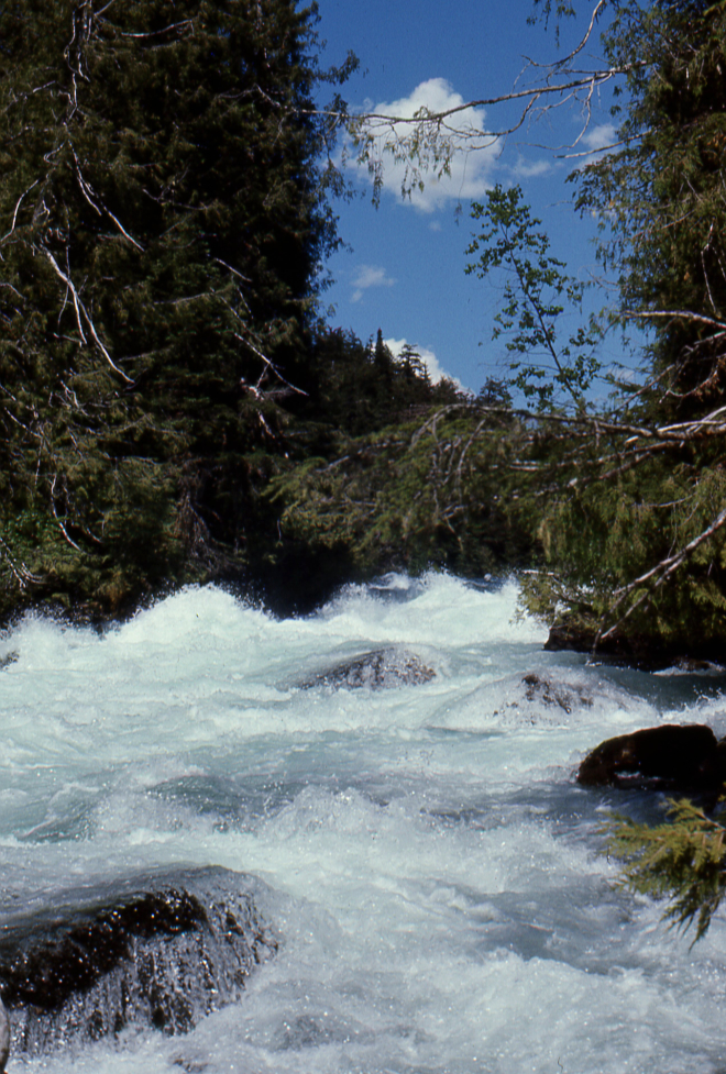
The circuit begins with a lot of portaging. The first photo looks down the cascades on the Isaac River.
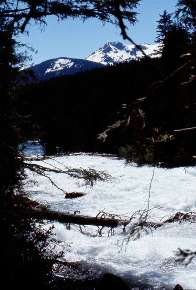
Looking back up the cascades on the Isaac River.
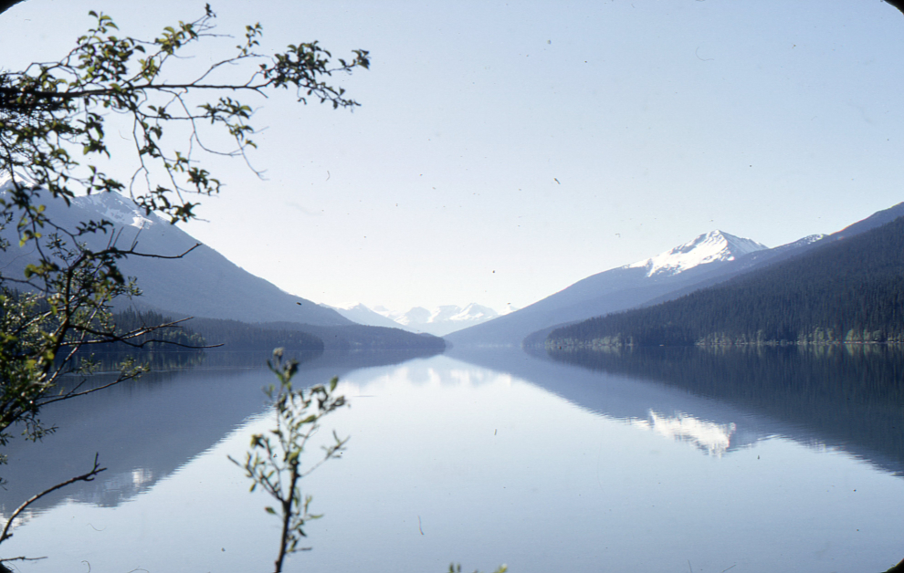
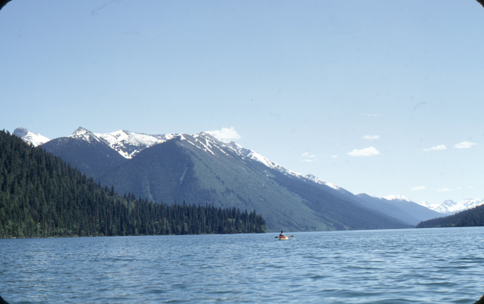
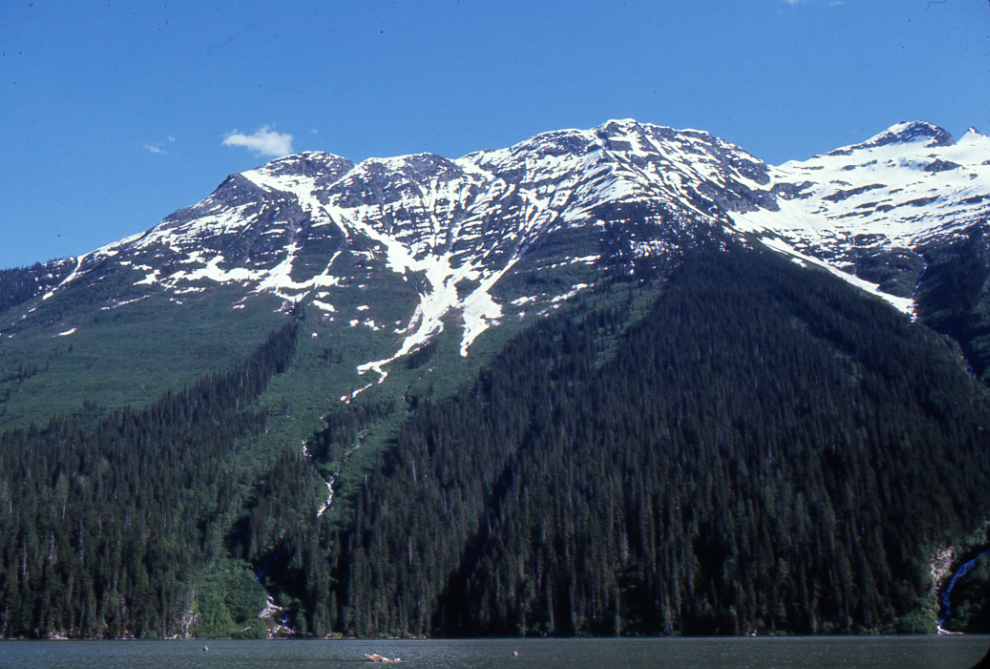
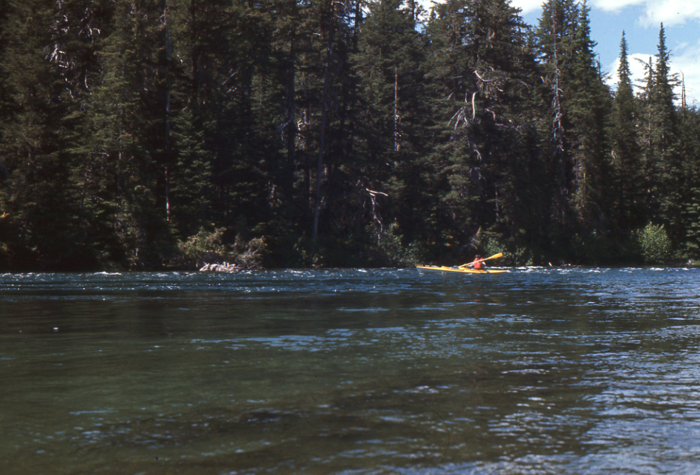
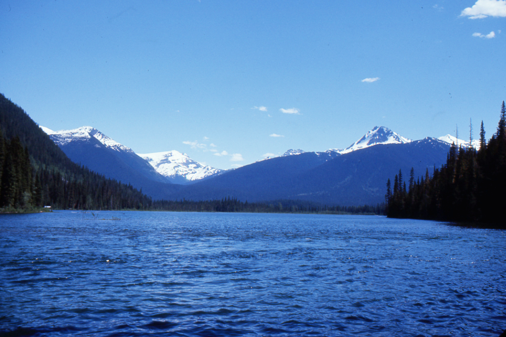
With the weather Randy and I got, the 38 kilometers of paddling on Isaac Lake was certainly the Cariboo country at its finest.
I brought my Pentax 135mm lens, but this seems to be the only photo I shot with it. It’s more wide-angle country, I suppose.
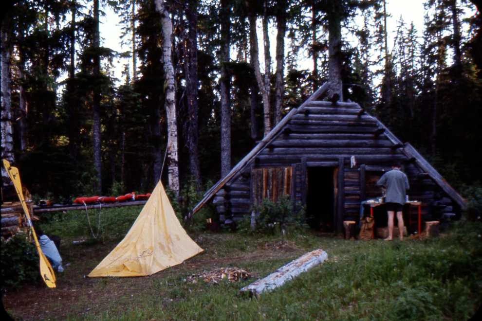
I don’t know where this triangular cabin was – I can’t find it mentioned in any report. That was a very basic tent we used – probably $20 at Woolworth’s.
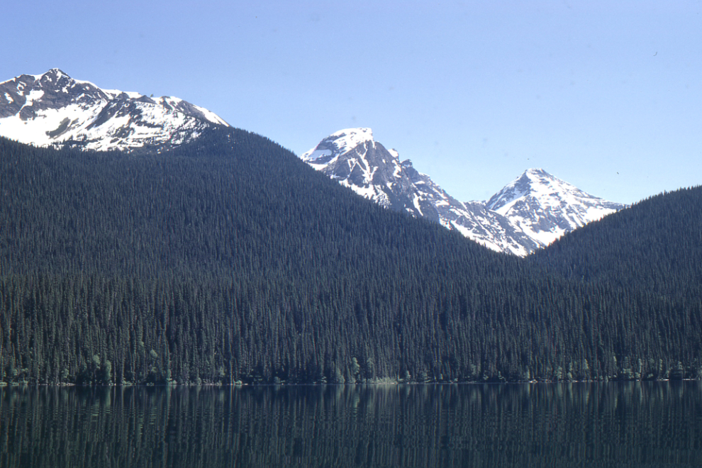
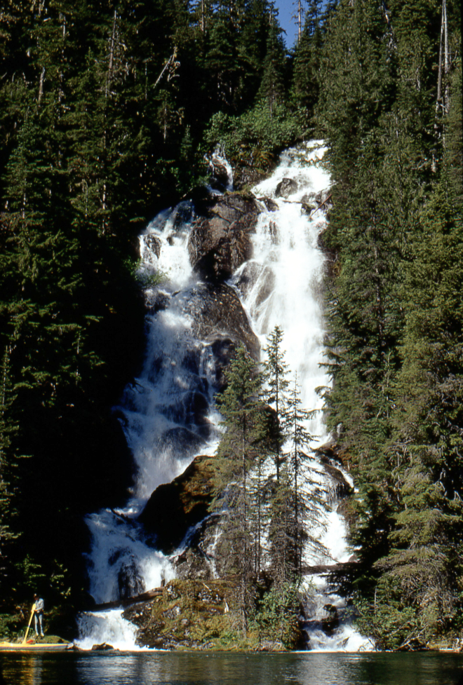
This waterfall was at the south end of Isaac Lake.
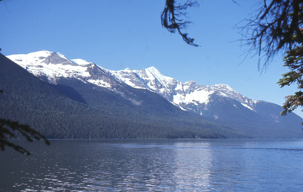
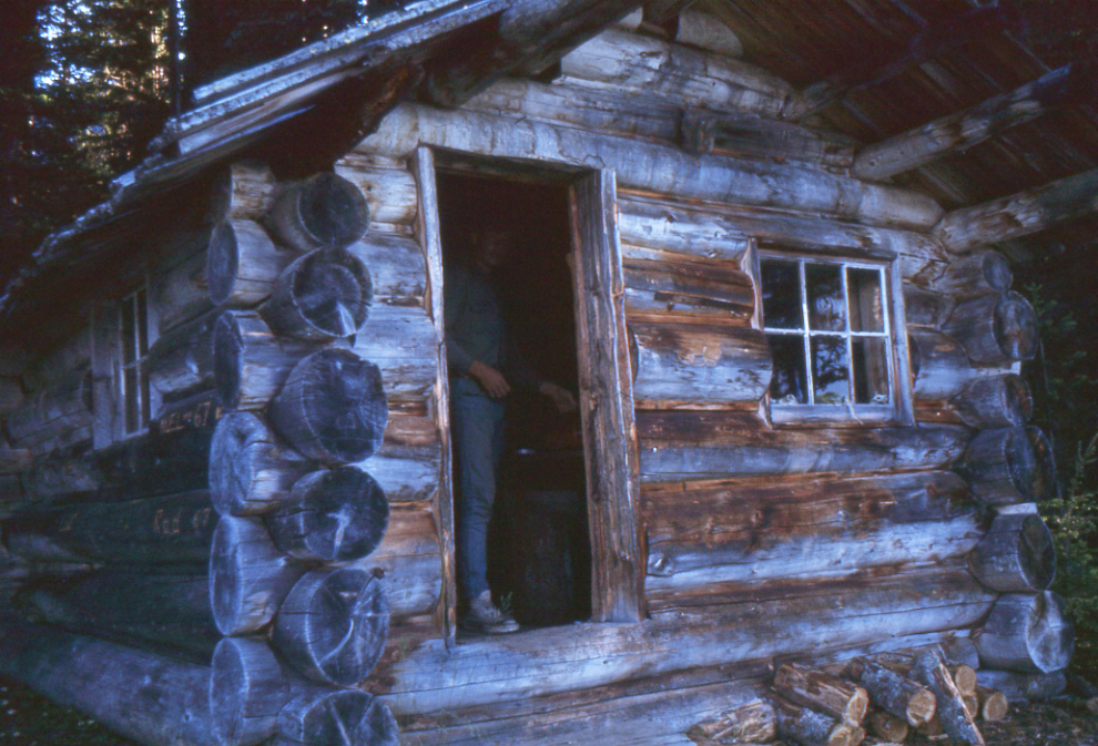
An old trapper’s cabin on the eastern shore of McLeary Lake was an interesting place to stop.
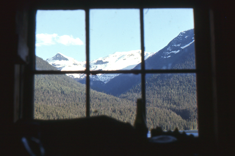
The cabin had a wonderful view from that window.
Randy finally covering some distance quickly, on the Cariboo River 🙂
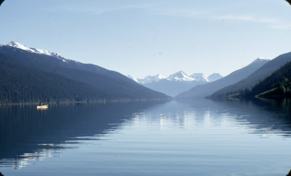
Taking a break along Sandy Lake.
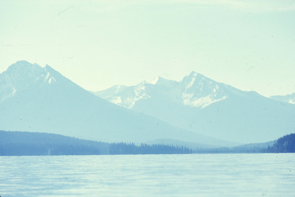
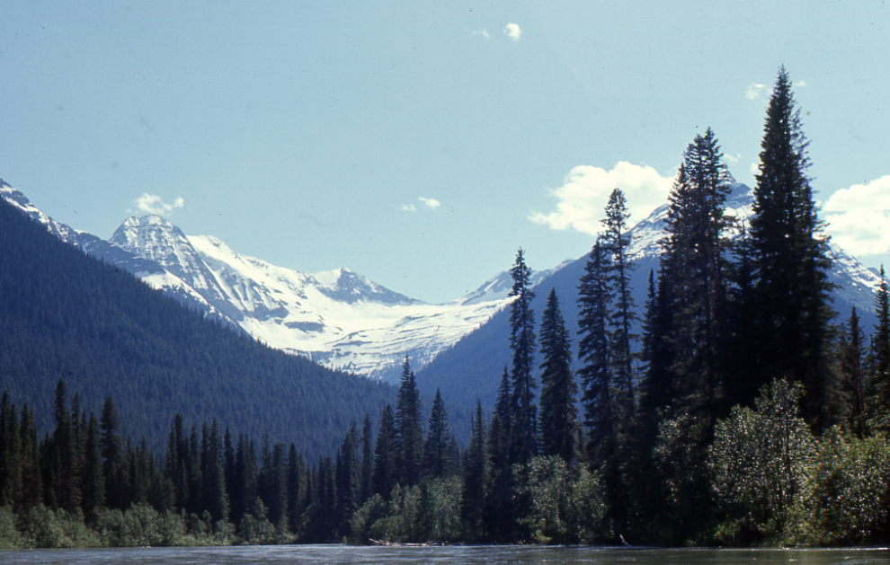
The Cariboo River below Sandy Lake.
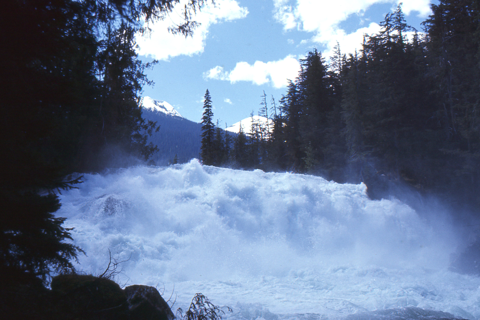
Cariboo Falls, on the Cariboo River just past Unna Lake, is 24 meters (79 feet) high.
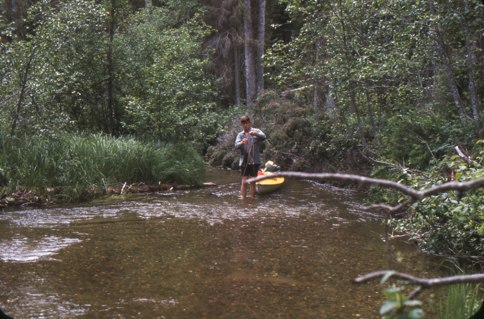
In the next photo Randy is lining up Babcock Creek, which today is a 1.2-km-long portage, probably to avoid disturbing fish, which I think we saw in the creek.
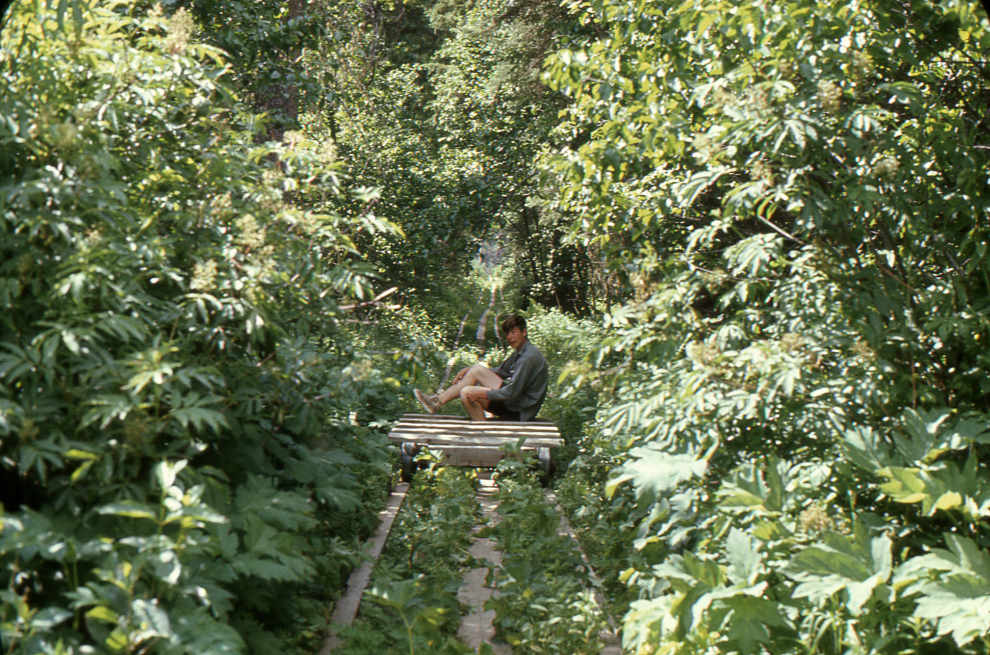
From the mid 1930s to the late 1950s, the Wells Rod and Reel Club did a great deal of work on the west side of the chain, including upgrading rail portages (using squared timber rails and ore carts from the mine in Wells) between Spectacle Lakes and Skoi Lake, and between Skoi Lake and Babcock Lake. The original rail portages had probably been built in the early 1930s by Jim Kew and Sid Susag according to Jeff Dinsdale in “The Bowron…A Short History Presentation“. In 1968 at least one of them (and I think both) were still in place, but they are no longer mentioned, so I assume they were torn out by Parks.
The Bowron River.
I think this final photo was shot on Bowron Lake.
As I post this, I still have many questions, and am not certain I have the order of the photos correct, but I’m hopeful of learning more so I can make edits as appropriate.
Some really nice photos in there…that really must have been a great adventure for two young guys just getting their feet wet. Did you see anyone else on the way? I assume there is an order (direction) of travel given the drainages?
I think we saw a few people – very few, and all at long distances. The drainage dictates a clockwise circuit to do the entire circle as we did.
Wow…. some beautiful scenery.