Maligne Canyon – a Winter visit is the best
This is Part 2 of a post about a day trip to Jasper that turned out exceptionally well. I reached the top of Maligne Canyon at 2:20 pm, but I’d been here before probably 30 years ago and figured that an hour would be lots of time to see what I wanted. Was I ever in for a surprise!
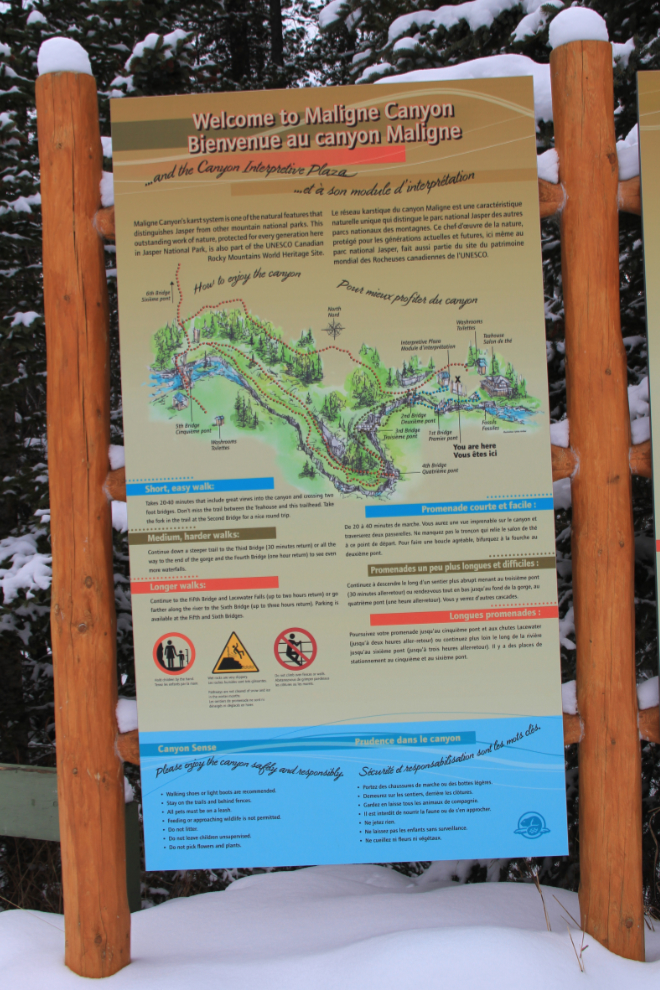
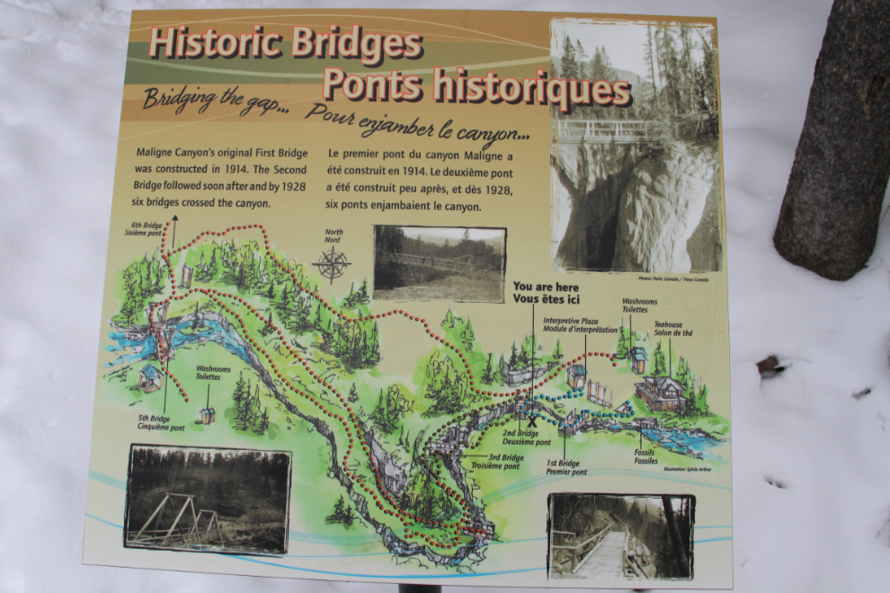
Parks Canada has developed a series of self-guided interpretative trails along the canyon’s rim, with signs describing the geology and other aspects of the natural history. There are 4 bridges across the gorge proper, each with its own special view. A short hiking trail loops around the upper reaches of the canyon (20-40 minutes), while a longer trail follows the entire gorge (30 minutes to an hour return), and another exits at a fifth and sixth bridge below the gorge (2-3 hours return).
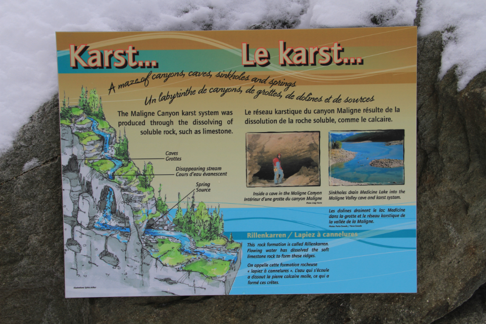
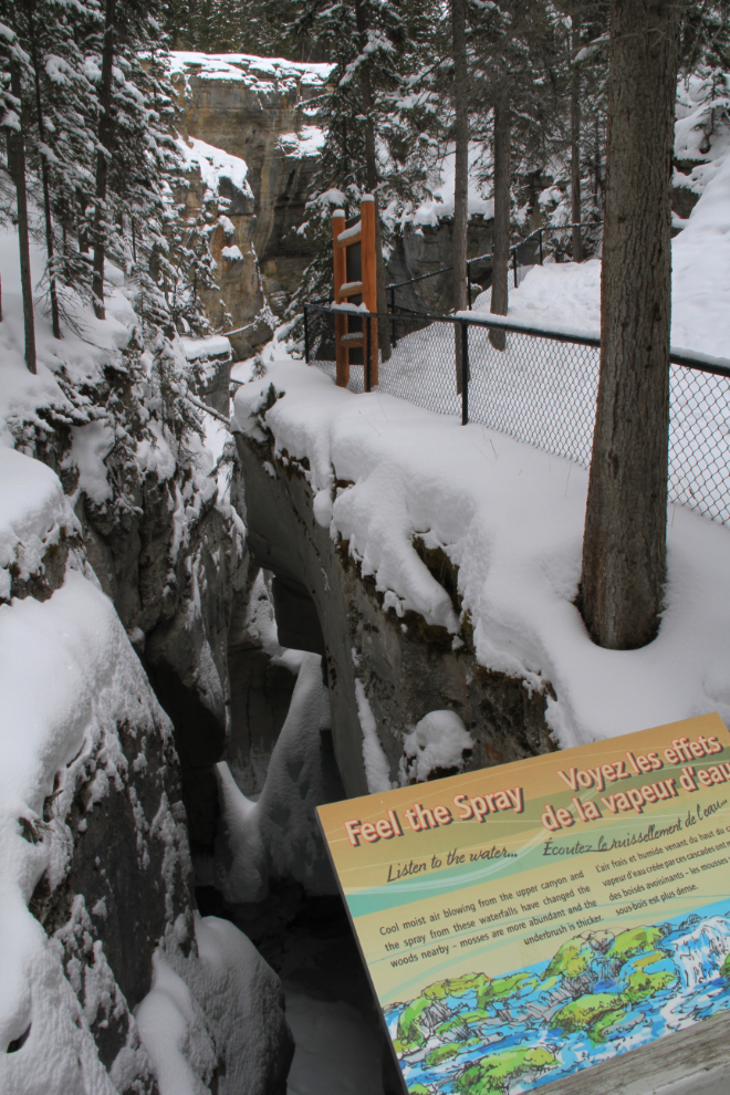
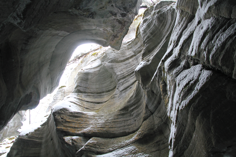
Maligne Canyon (pronounced “mah-leen”) is a karst formation in the Palliser Formation, a layer of limestone deposited in a shallow tropical sea by lime-secreting plankton about 365 million years ago. This is thought to be one of the largest karst formations in the world, though little of it has been explored. Some geologists speculate that parts of the canyon were originally deep caves (as seen on this sign) that have since been uncovered by glacial scraping and water erosion.
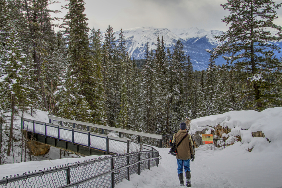
The views as you approach the second bridge (I skipped the first one) give little hint about the presence of the gorge.
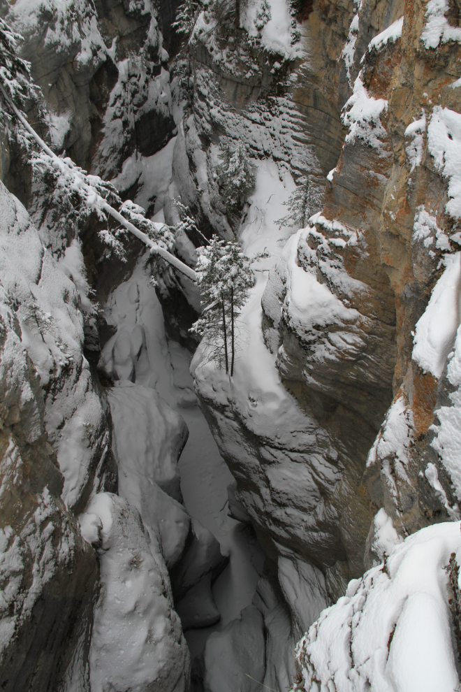
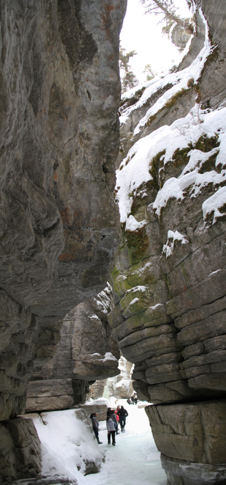
The first view of Maligne Canyon, from the second bridge.
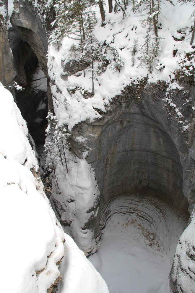
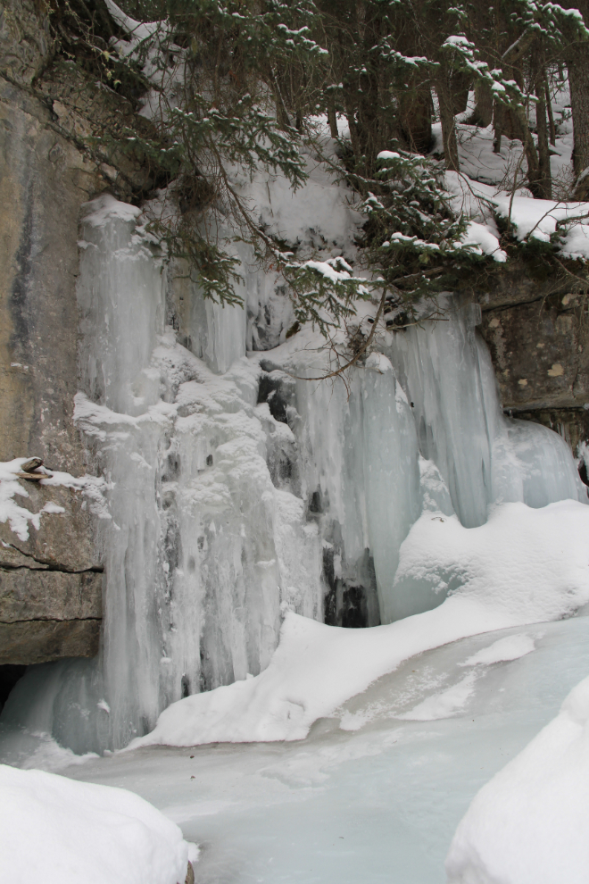
Another look at it. The canyon is only 2 metres (6.6 feet) across at some points, and attains a depth of more than 50 metres (164 feet).
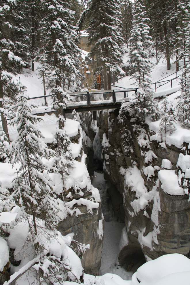
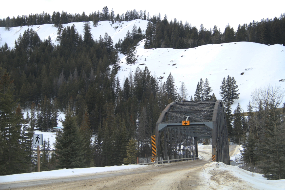
Maligne Canyon’s original First Bridge was constructed in 1914. The Second Bridge followed soon after and by 1928 six bridges crossed the canyon.
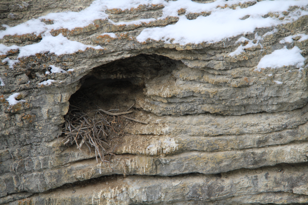
Although there are very few birds in the winter, the black swift (Cypseloides niger) can sometimes be seen flying here at dawn and dusk, and birders from all over the world come to Maligne Canyon to add them to their life lists. Although they have a huge range, from the Canadian Rockies to Costa Rica and Brazil, within this range they’re found in rather isolated pockets, sometimes separated from each other by hundreds of miles except during the breeding season and migration. In Canada they’re only found here and at Johnston Canyon.
At various places the canyon opens up…
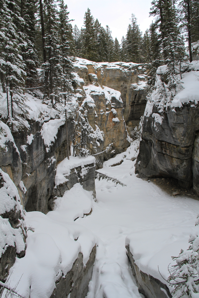
…and then closes almost shut again. At peak water levels the creek far below is a torrent, and the mist from the many waterfalls carries right up to the trail in several places.
This is Third Bridge. I met a couple of ice climbers here, heading back to their car.
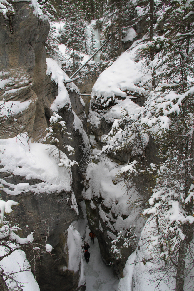
Look down, look waaay down, and you’ll see some people walking along the frozen creek. I hadn’t expected that, and immediately knew that this would be a much longer visit than I’d planned on. I should have had lunch at the Fairmont!
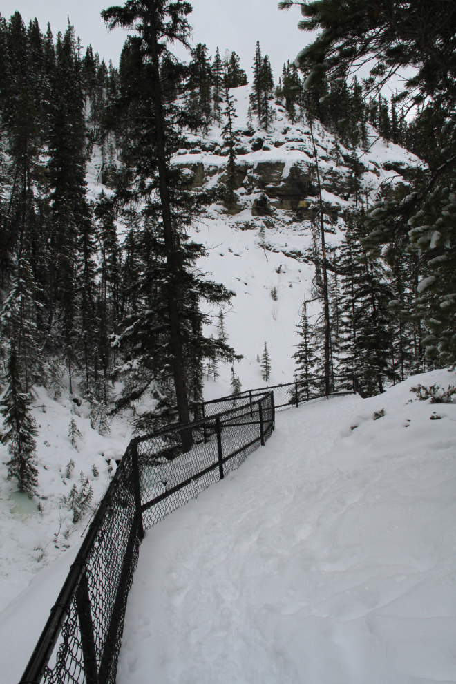
The entire trail along the top of the canyon is fenced, in many places with wire as well as the bars.
This was a commercial tour group, one of 4 I saw during my time there.
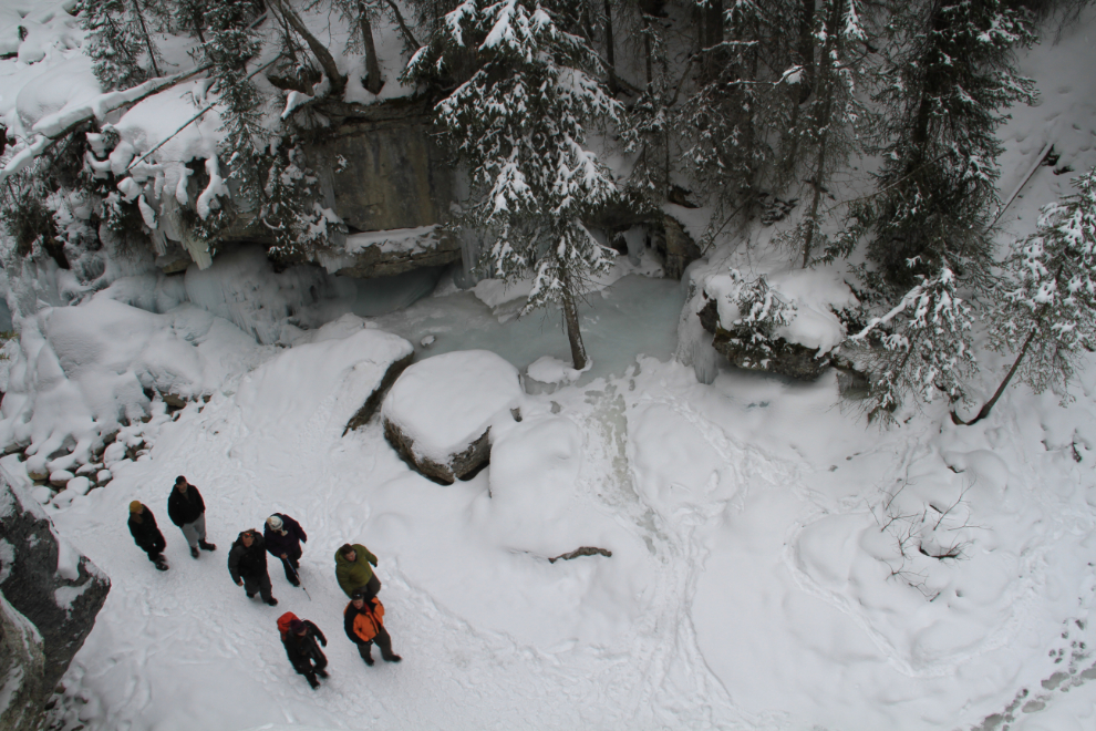
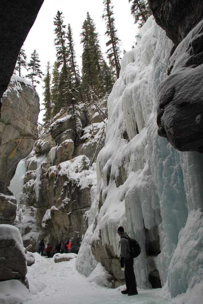
As I watched these hikers negotiate the frozen rapids, I realized that my snow boots weren’t the best gear, but I’d give it a try, as it seemed a safe bet that many of them didn’t have ice cleats either.
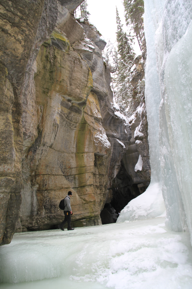
This was the lowest part of the canyon I saw, below the Fourth Bridge. The trail on the frozen creek got very faint below this point, so I assume that open water or other hazards block hikers.
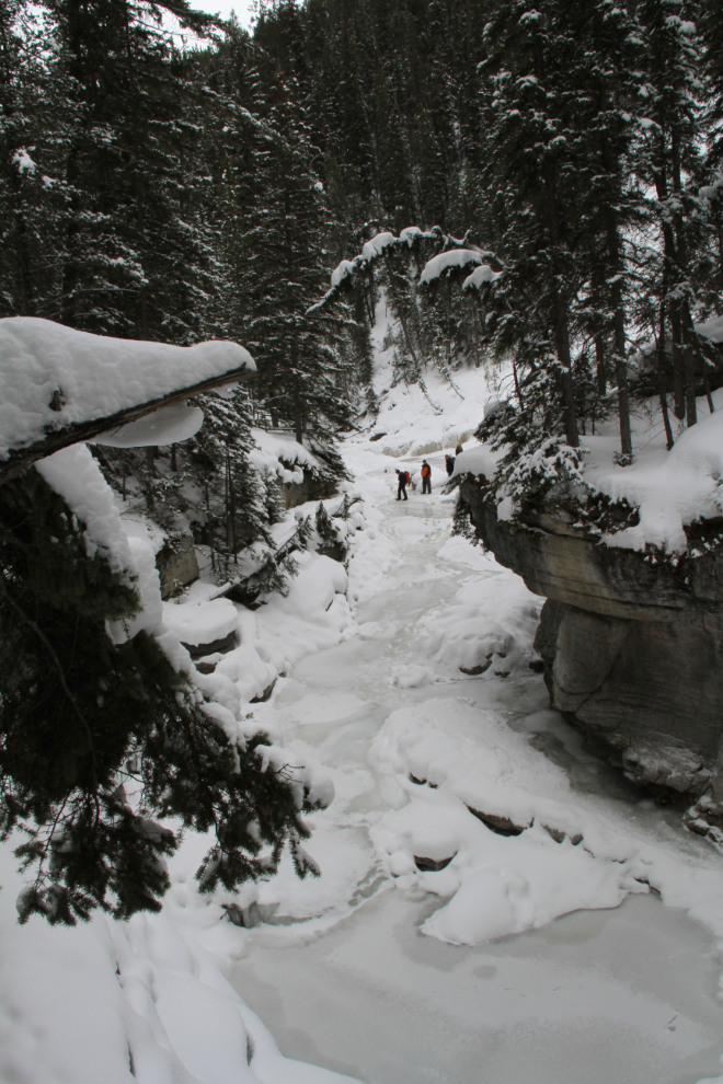
At the point seen above, I climbed through the fence and started hiking up the creek behind a tour group of about 8 people from all over the world, and a couple of young locals.
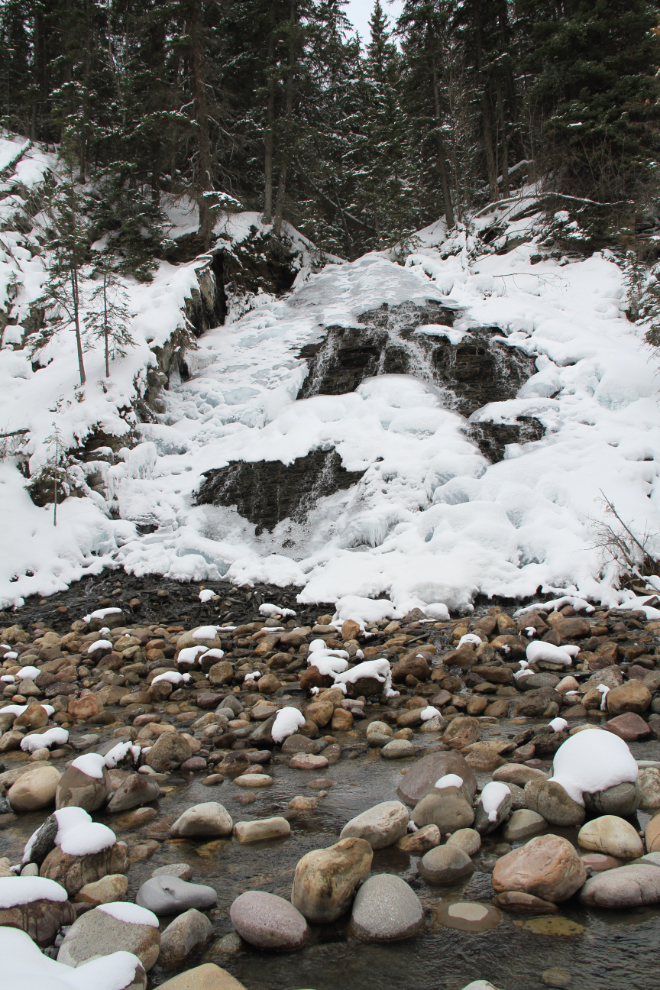
For a photographer, the hiking is slow. And thank heaven I don’t have to pay for film anymore – this would have been an expensive hike! The icefalls are of all sizes, this one being about 10 feet high.
Fourth Bridge can be seen at the top.
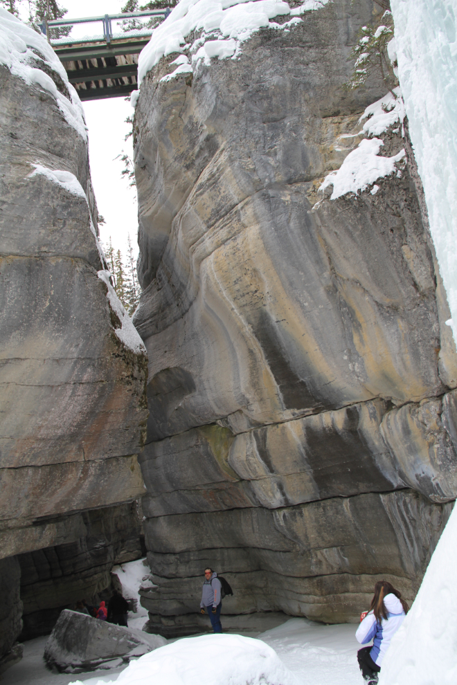
This is a panorama created by stitching 2 vertical photos that were shot with an 18mm wide-angle lens.
By stitching 3 photos I was able to get the bridge in as well but the hikers had moved on.
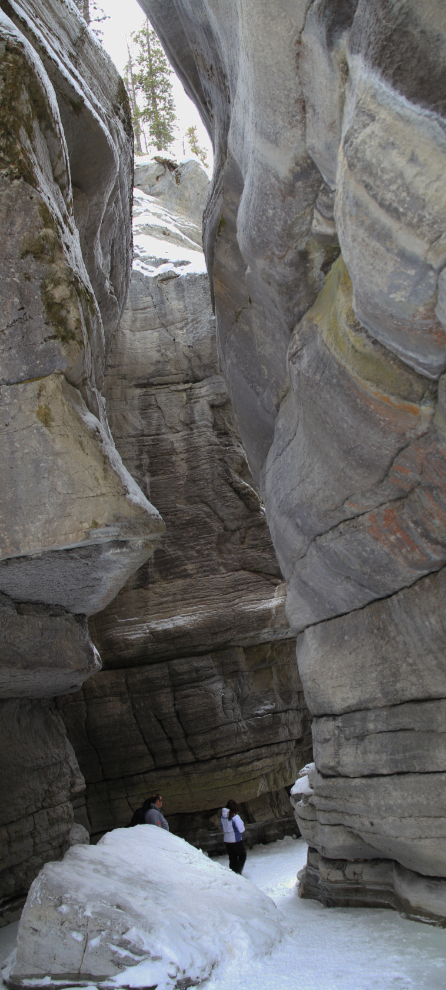
Another 2-image panorama.
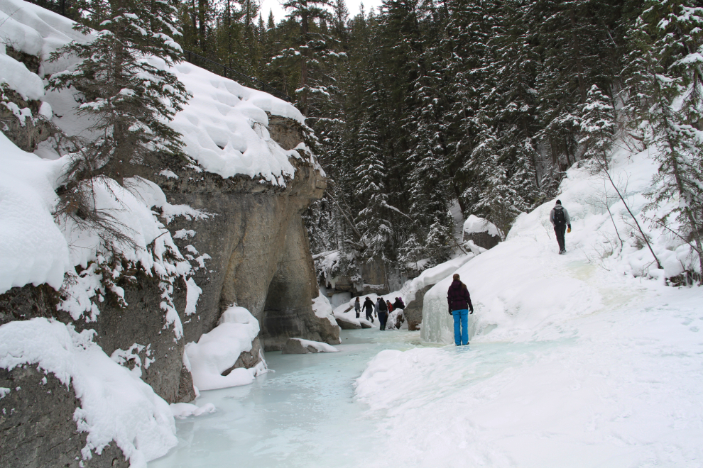
The variety of views is simply stunning.
That ledge was a bit tricky to manoeuvre up, but I was doing fine with my snow boots.
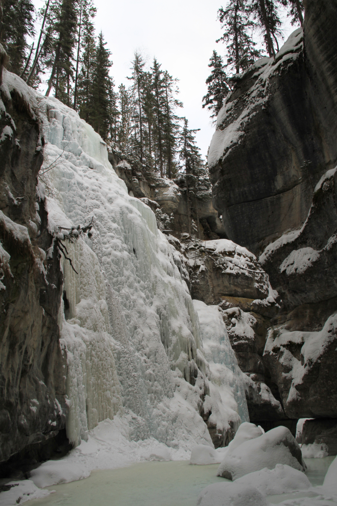
This was the highest of the icefalls, perhaps 80 feet high.
This 3-minute video may help give you the proper perspective.
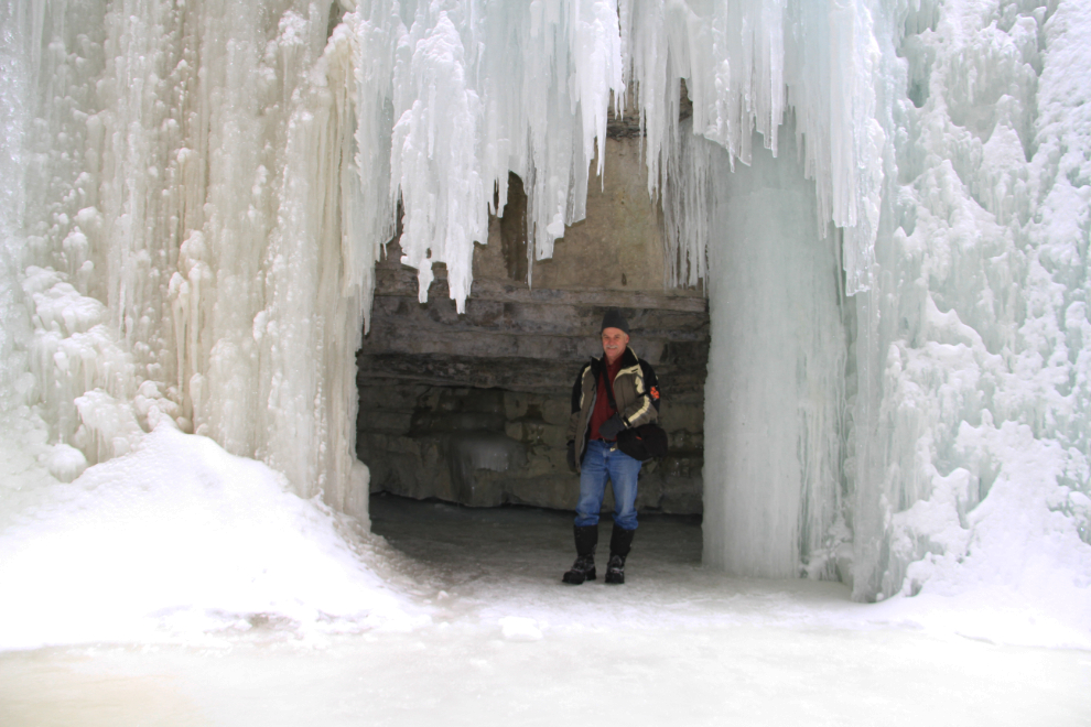
Shooting through a frame of ice from inside a large cave.
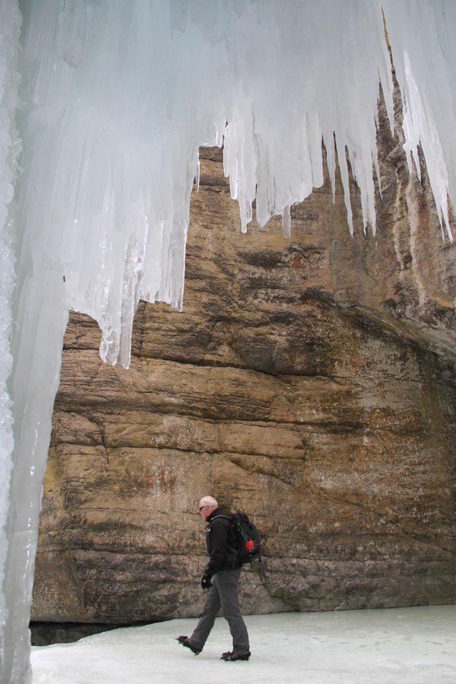
Me inside that cave.
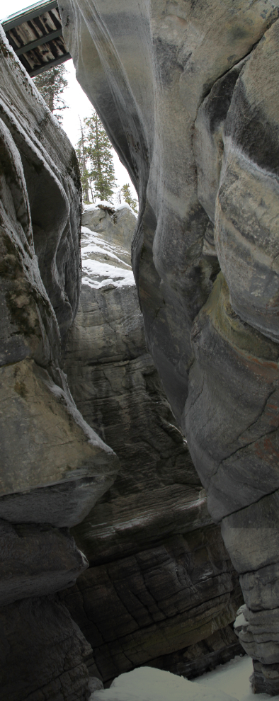
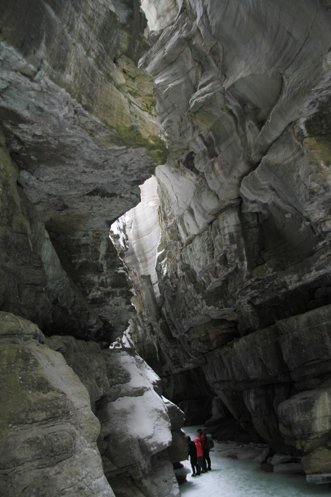
Nearing the end of the walkable part of the canyon, with the walls close to the canyon’s maximum height of 50 metres (164 feet), and the top nearly closed. Bloody awesome! 🙂
Much of the lower 1/3 of this photo is a reflection in open water that blocked further hiking. Now, of course, I want to know how much further you could go with the right gear. I expect that a helmet as well as high waterproof footwear would be needed, as the walls get very tight.
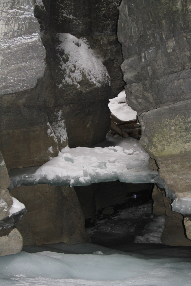
The view straight up from that spot.
The hike back to the car was fairly quick, and by 4:20 I was about to cross over the Athabaska River and turn onto Highway 16 for the short drive into Jasper for what would now be dinner.
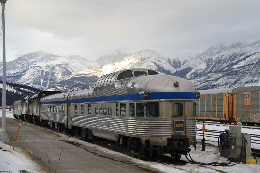
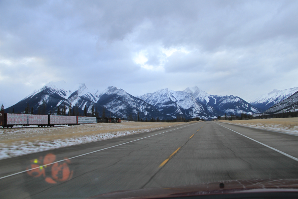
After parking, I got distracted by a particularly fine train, what is now the VIA Rail “Canadian”. I rode this train all the way from Vancouver to Montreal on a student exchange back in 1968.
I picked the De’d Dog pub for dinner for no really good reason, and wasn’t disappointed. I had a Big Game burger, whose patty is 6 ounces of venison, bison and elk. With a Rogue Dead Guy ale, it was just what the doctor ordered. Although it tasted great, it wasn’t very photogenic 🙂
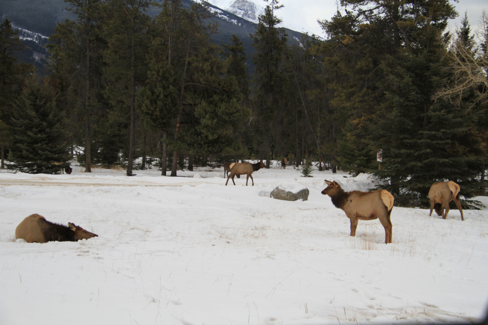
Back on the road for the return to Hinton at 5:30, there was a herd of elk on Highway 16 right at the Jasper turnoff.
Heading north by the Jasper airport, with Spot hard at work letting Cathy know where I am, at the lower left. Jasper is an important rail centre, as the extremely long trains used on the Prairies, like the one on the left, are broken up into much smaller consists (the term for complete locomotive and railcar combinations) for the mountain climbs.
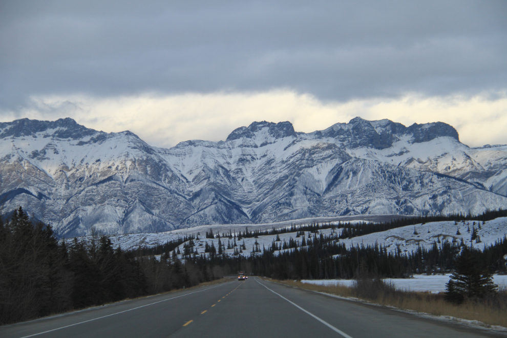
Back at Talbot Lake.
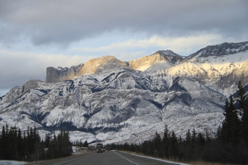
One final shot, with the highest cliffs being the south face of Roche Miette.
I’m posting this at 7:00 pm on Saturday, March 8th – I have 2 more full days in Hinton before heading home, but no plans so far.