Hiking the White Pass – wilderness, solitude and then trains!
I was in a bad way yesterday, desperate to just get away. I packed the minimal gear I needed to go hiking in some form and hopped on the bike, headed for Skagway, but was unsure what it was exactly that I needed.
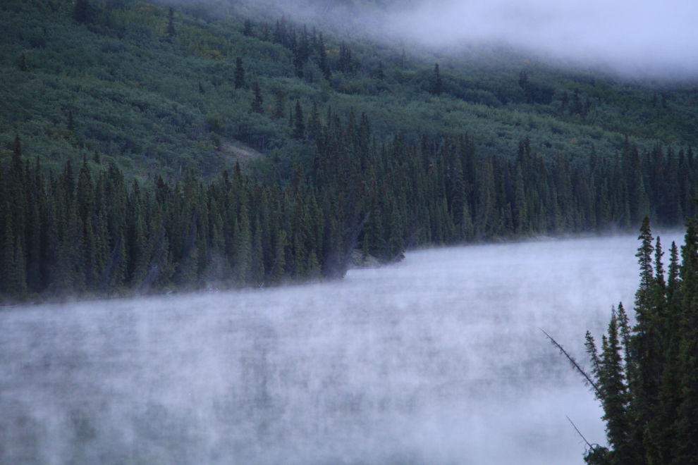
It was cold when I left home just before 9:00am – minus 3°C (27°F). Even more than usual, dressing in layers was the key to being comfortable all day, going from -3 with four layers to +20 with no layers less than four hours later. The fog on Spirit Lake got me to do a U-turn to capture a few shots.
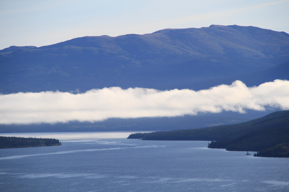
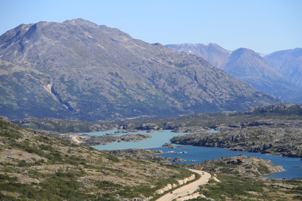
It had warmed up a bit by the time I teached Tagish Lake and the Bove Island viewpoint.
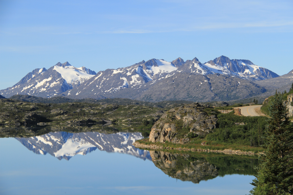
My mind was a million miles away as I rode, and another U-turn was needed to get this shot down at Ptarmigan Point.
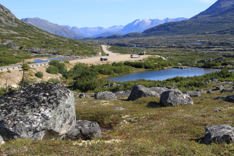
As I neared the White Pass, I started scouting and imagining routes that would get me into the high country by myself. I had to go right to Skagway to get fuel, as with no gas in Carcross anymore I can’t do a round trip to the White Pass and back. I thought briefly about hiking the Upper Dewey Lake trail, but there were far too many people around so I fueled and immediately headed north again.
The route that kept coming back to me over and over again was from the highway summit to the railway summit. I was guaranteed solitude for at least a couple of hours, and trains are always a bonus. I parked the bike on the shoulder of the highway a few hundred feet from the main viewpoint, got changed and did a short walk to see how it felt.
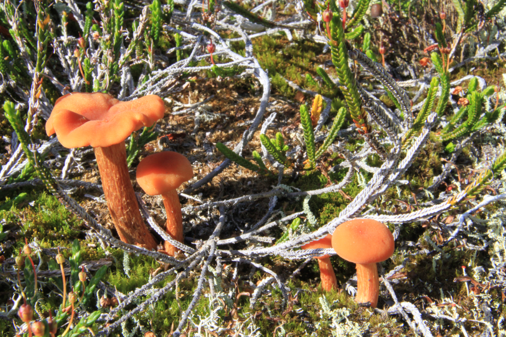
There were lots of mushrooms sprouting, and I spent a while shooting them as well as other subjects. I’d just bought a new prime lens a couple of days ago (a Canon EF-S 18-200mm 1:3.5-5.6 IS), and wanted to test it at a wide range of settings – this was the perfect location to do that.
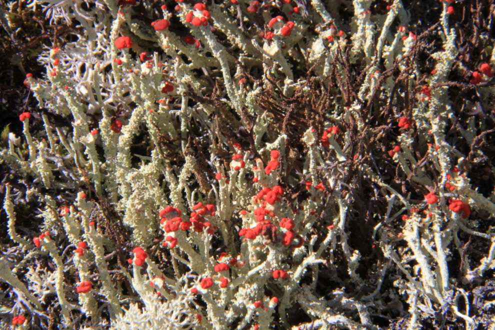
This tiny lichen is called a British soldier (Cladonia cristatella). The red head that gives it its name is less than 1/8 inch across.
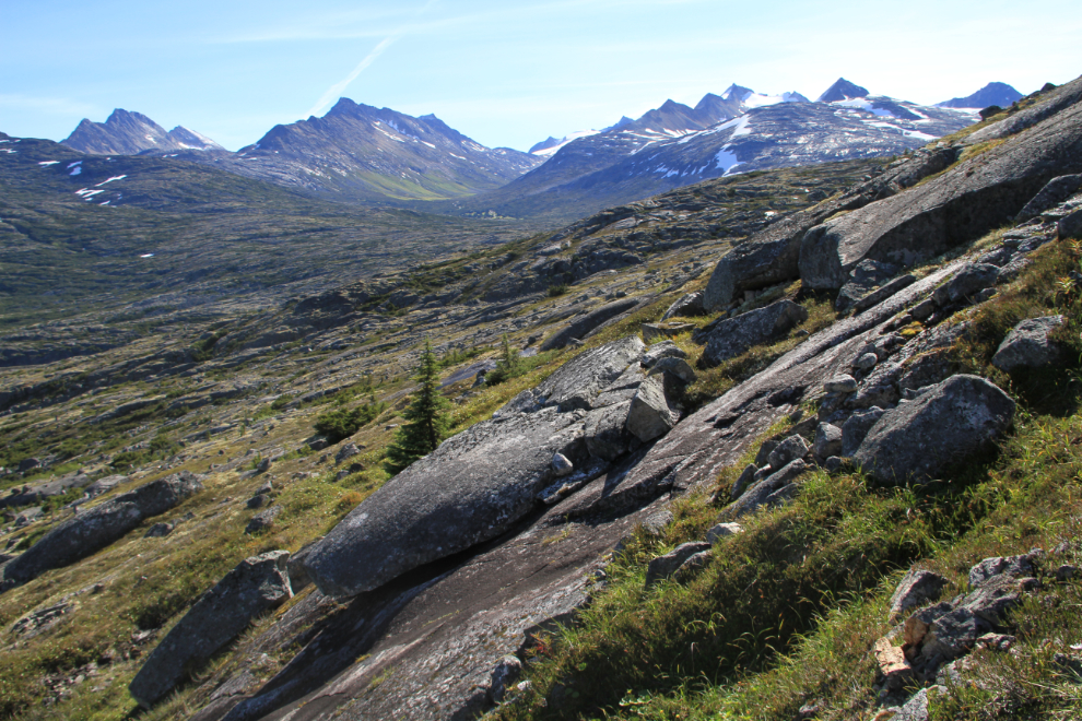
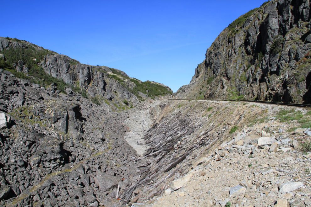
Feeling good that this was the hike I needed to clear my head, I climbed high above the highway. As well as getting this telephoto view of Summit Lake, I got above the junipers that can be all but impenetrable in some places, and the canyons are smaller and easier to cross at higher altitudes.
There’s nothing difficult about the route generally, but there are some tricky sections including very slippery slanted granite slabs.
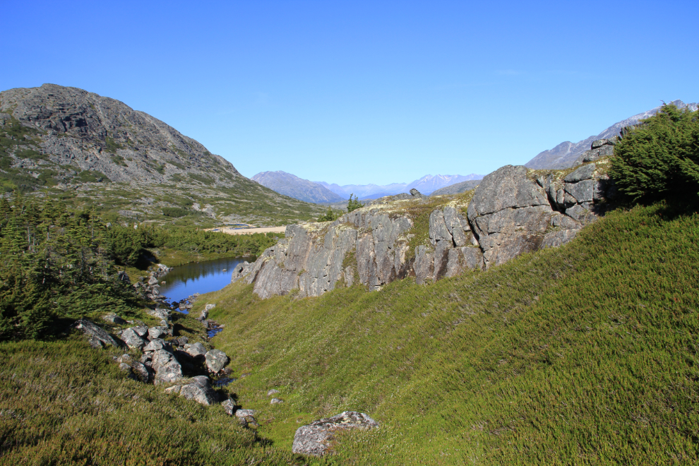
A couple of the canyons took some thought to navigate through. Two of them had tiny creeks that offered icy, pure drinking water.
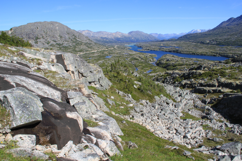
Many sections of the route offer superb walking on a thick cushion of lichen, with no sign that any other person had ever been here before.
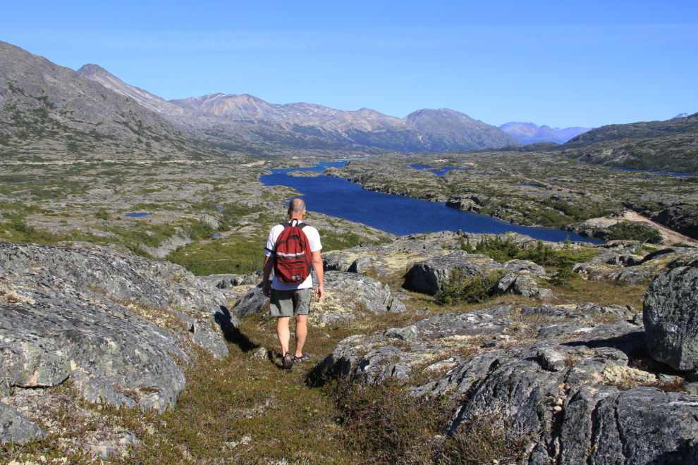
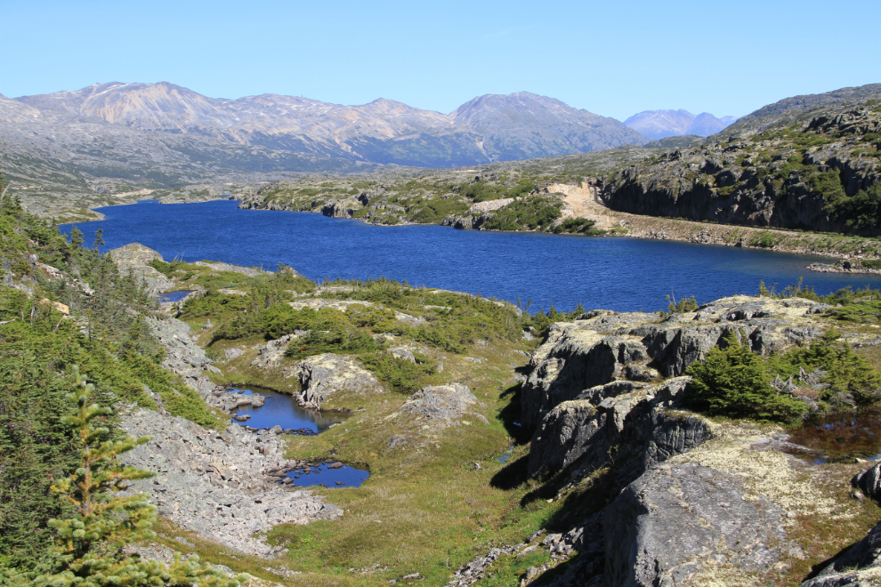
Dropping down to the head of Summit Lake, it occurred to me that I hadn’t seen a single train yet. That might mean a big problem on the White Pass & Yukon Route line somewhere – a rockslide?
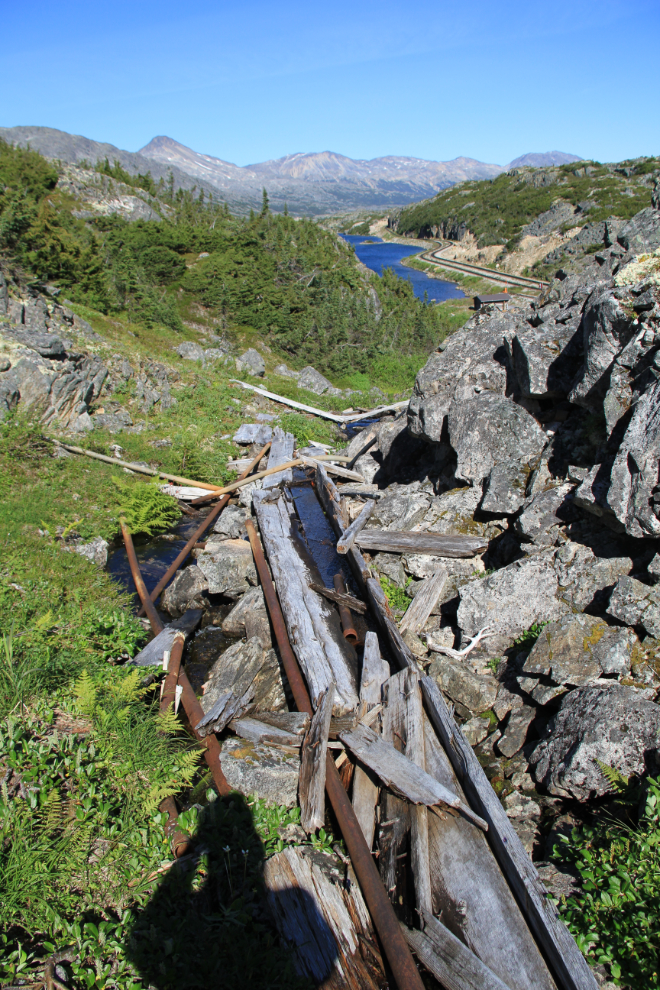
The Summit has very little man-made other than rails now, but historically this was a significant site. Among the features from those days is this old wooden dam far above the tracks.
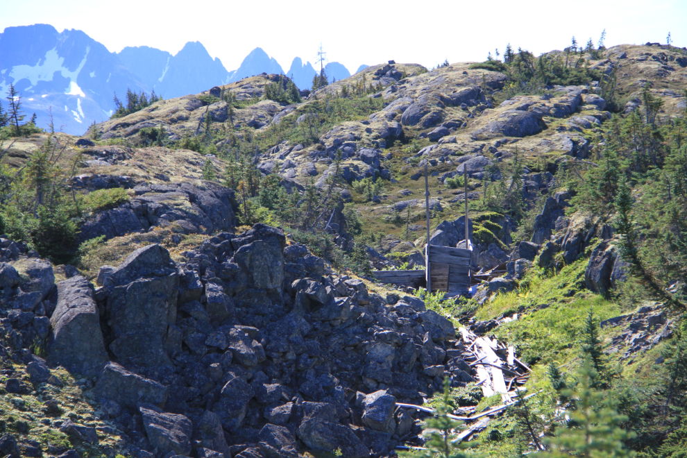
This flume brought water down from the substantial lake created by the dam.
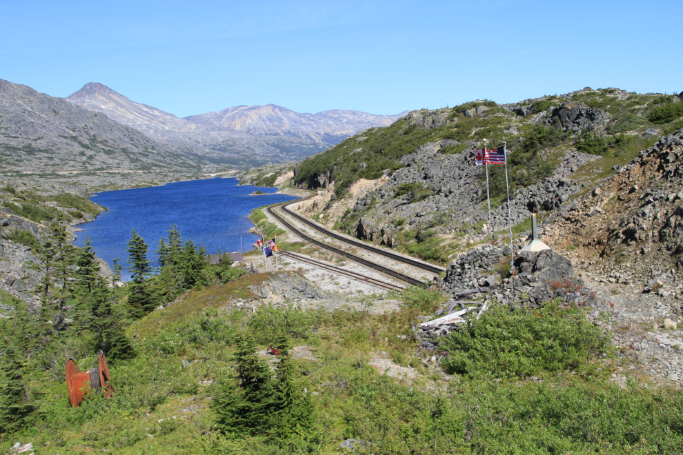
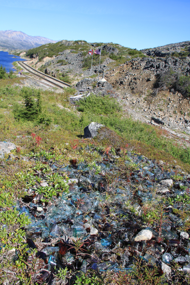
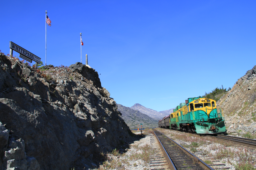
The border monument looks much better from this angle than from the tracks 40 feet or so below. Alaska is to the right, British Columbia to the left.
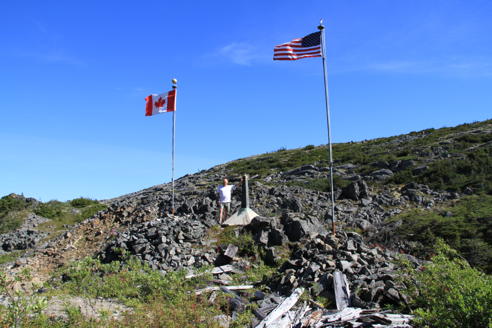
The border monument from a higher angle.
There is a lot of broken antique glass of all colours on the hill above the border monument.
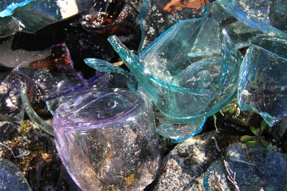
This is the largest of the glass dumps.
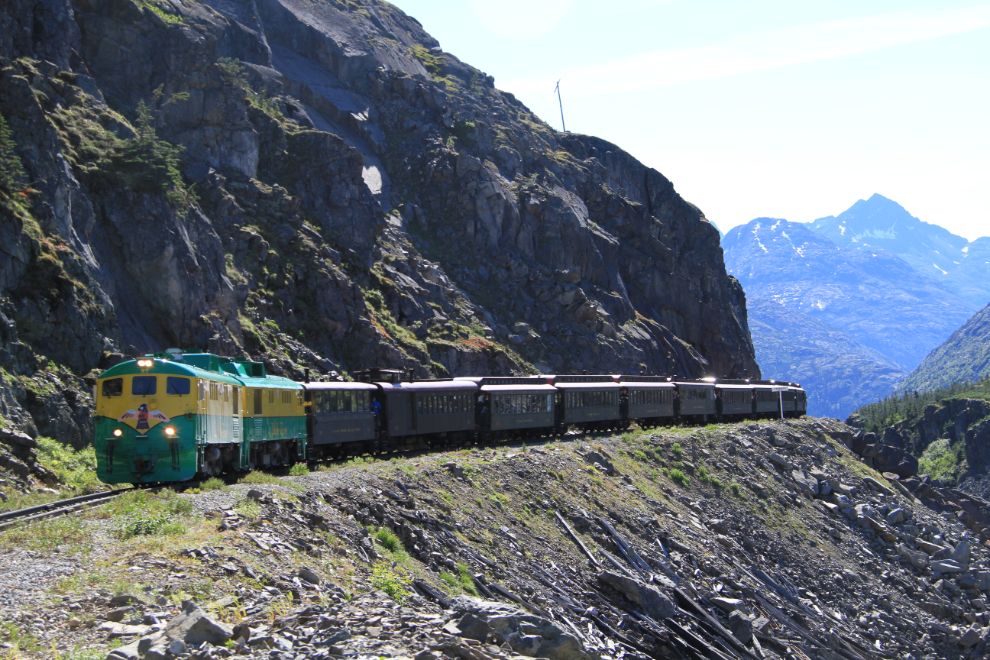
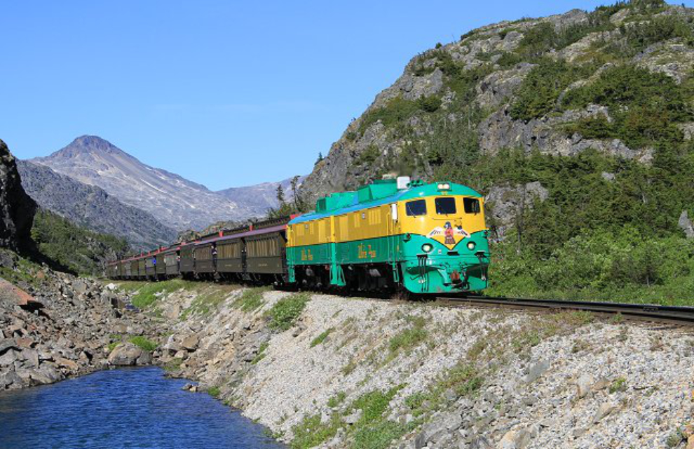
I decided to continue hiking down the tracks, probably to the cantilever bridge. Finally, at 2:48pm, I met a train! I always enjoy the reaction of many of the train passengers at seeing a lightly-dressed hiker (t-shirt, shorts and sport sandals) out in the middle of nowhere. I heard my name from one of the speakers as it passed – either the guide or the engineer on this train recognized me. 🙂
This is American Shed, once the site of a very large snowshed. With the railway only running in the summer now, the snowsheds were all demolished many years ago. This view is back towards the summit.
Six minutes later, another train. And they kept coming – three, four, five, six long trains a few minutes apart. The blockage was cleared and the railway was trying to catch up, I assume.
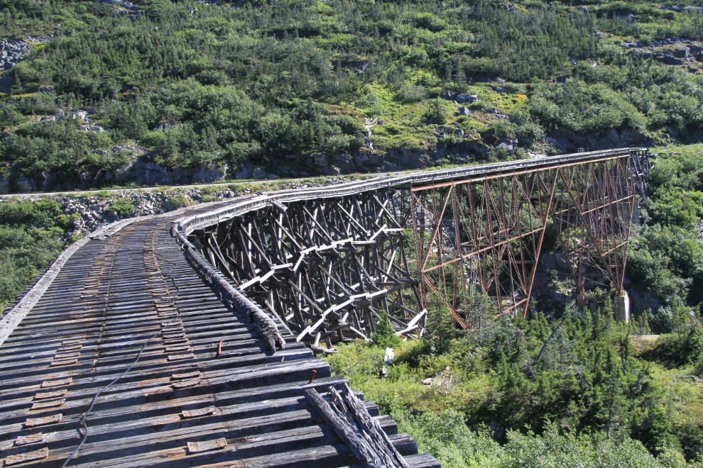
The cantilever bridge, built over the winter of 1900-1901, was the highest bridge of its type in the world at the time. The West Fork of the Skagway River is 215 feet below the bridge deck. I needed both time and inspiration to properly photograph the bridge, and I had neither, so came back disappointed at what I’d gotten.
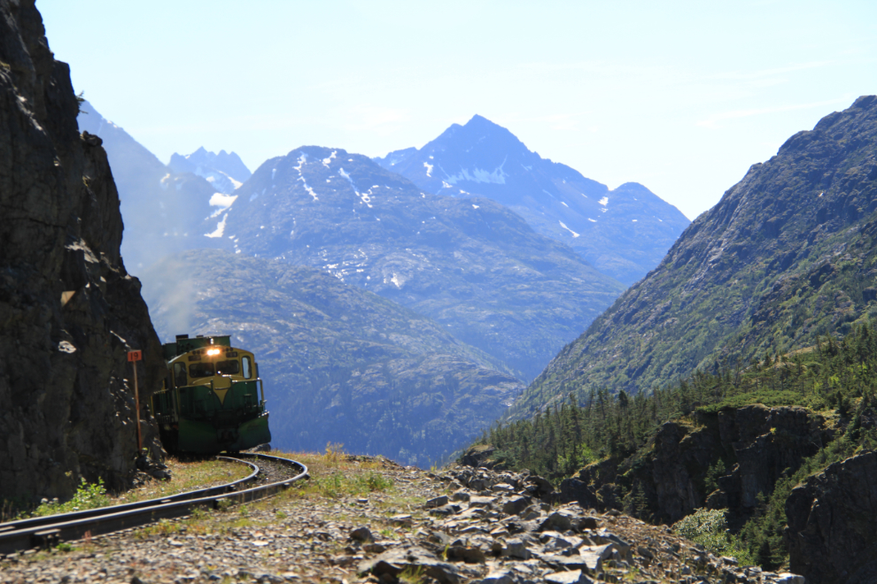
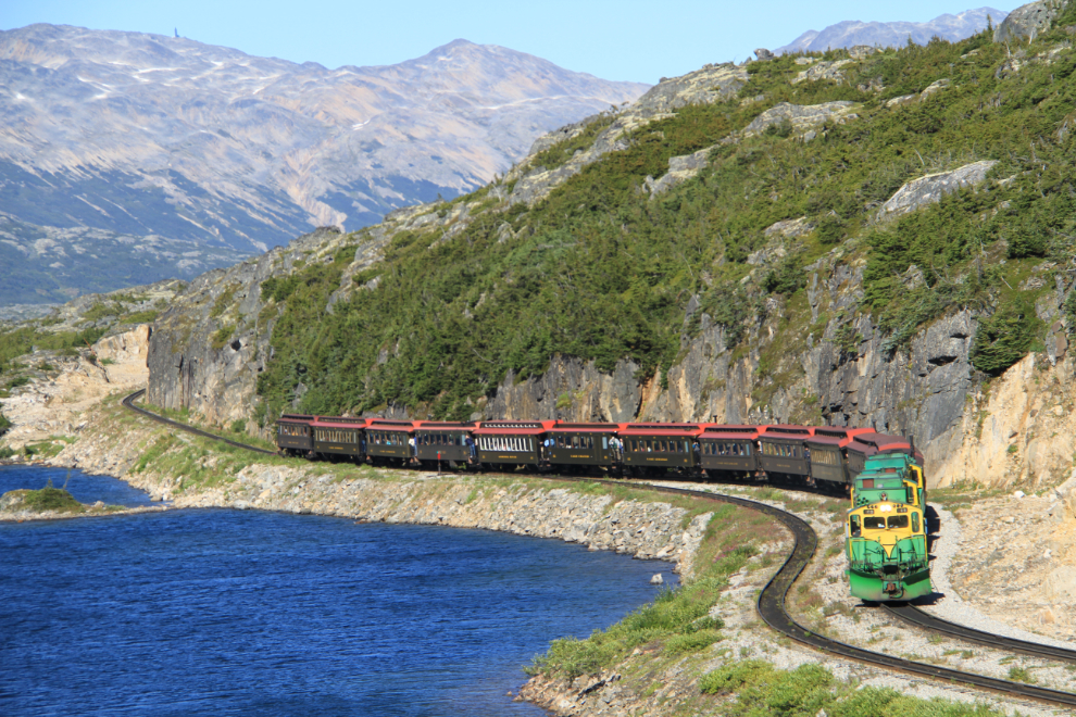
Nearing the summit just after 3:00pm, with perfect light for shooting the trains going downhill to Skagway.
Back at the summit at 3:50.
As I climbed back up the slopes to return to the highway, I watched 3 more trains winding around Summit Lake.
I took a very different route on the return, but I was getting tired after almost 5 hours of virtually non-stop walking so didn’t take very many photos. Not intentionally, I also didn’t climb as high up the slope, and got into some nasty thickets of juniper.
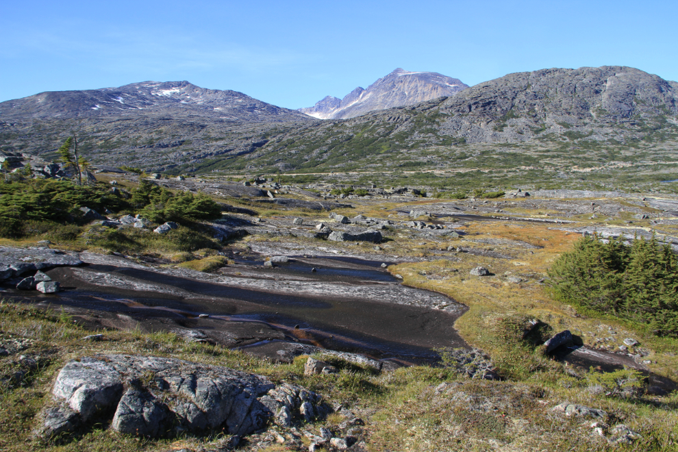
There are many ponds of all sizes. While the water in any is probably okay to drink, I stuck with the little creeks that I knew were only a few hundred yards from their snowfield sources.

One of the last canyons to cross at 4:55, just before reaching the highway. By about 5:20 I had changed back into my riding gear and was headed home.
I actually surprised myself, being able to hike that far and hard after being sick for almost a week. It did have the desired effect – the motorcycle, wilderness, exercise and trains are each good for my head, and in combination they work magic.