Hiking to the crash site of RAF “Dakota 576” near Port Hardy, BC
We had planned to take a ferry to Alert Bay, but fog changed our plans. The site of a 1944 plane crash, of a DC-3 known as “Dakota 576”, became our morning destination.
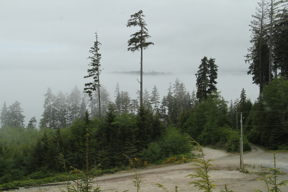
When we woke up on Day 26, May 21st, dense fog enveloped our camp site at the Cedar Park Resort, high above Broughton Strait south of Port McNeill. By 10:25 when I shot the new photo, it had dissipated a lot, but we had given up on Alert Bay and made a new plan to go for a hike.
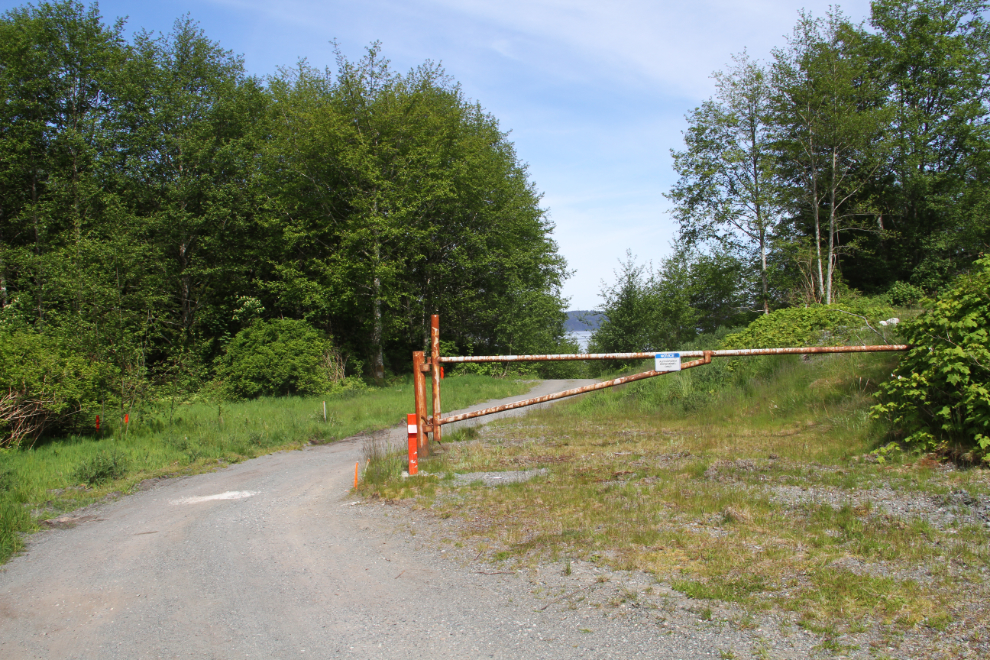
Bobbie came to get me just after 11:00 – this was going to be a fairly difficult hike and Cathy was taking a pass. Our first stop was an old ore shipping site near the campground. The next photo shows site security, Port McNeill style – the sign on the locked gate says “Notice. Authorized Personnel Only.” 🙂
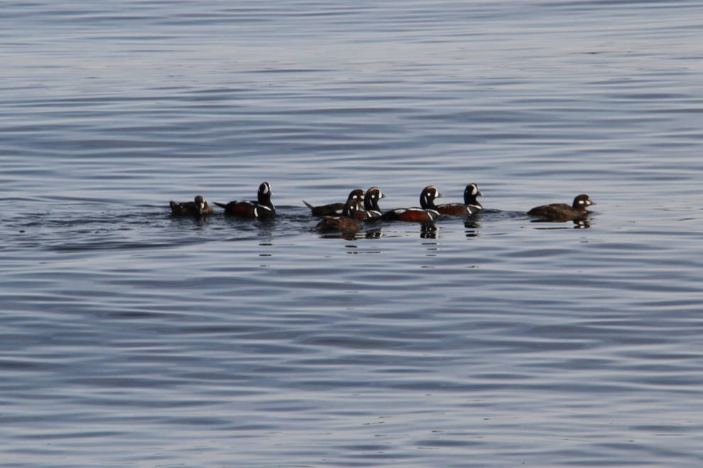
As I’d been told, the site had been totally cleaned up – no buildings, no dock, not even any pilings remained. I don’t have my bird identification book handy, so these birds swimming past the site are temporarily what Cathy and I term “DLBs” – Duck-Like Birds 🙂
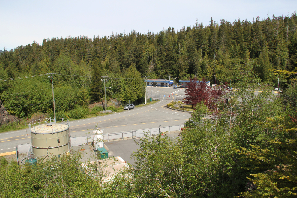
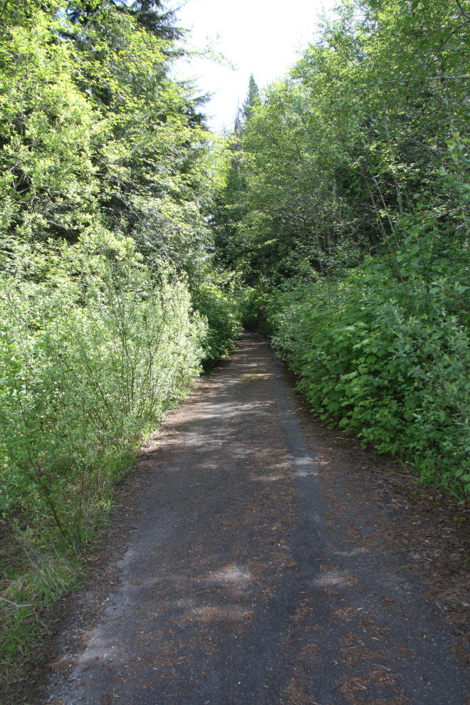
Just before noon, we started up the old road that leads to the trail to the wreck site. The next photo is the Port Hardy ferry terminal from that road.
The road is paved for a few hundred meters. The photo doesn’t show how steep it is. It leads to an abandoned sawmill site that has been cleaned up, but at the top of the hill, we kept going straight instead of following the road to the right.
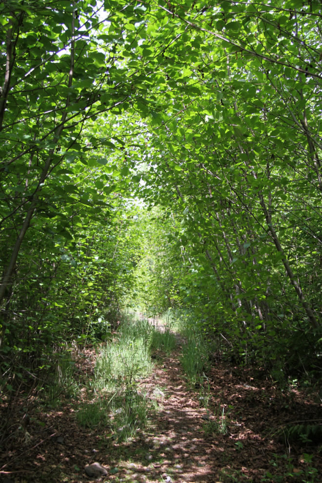
The trail goes into a clear-cut logged area, and goes through new growth along the south lip of a small but steep valley.
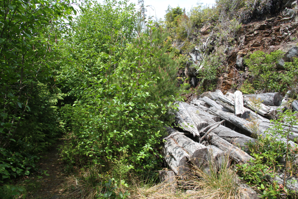
At the head of the small valley, the trail crosses to the north side of the valley and heads back towards Port Hardy. The trail can just barely be seen to the left in the next photo. There’s a lot of logging waste along this part of the trail, some of it trees of a fairly substantial size.
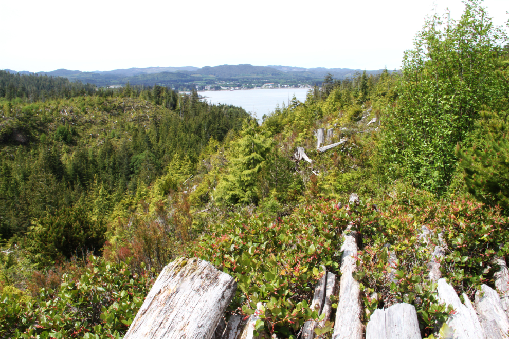
There are good views of Port Hardy for a few minutes. At this point we’d been hiking for 20 minutes.
About 25 minutes from the car, the trail enters old-growth forest and the trail gets rougher and wetter.
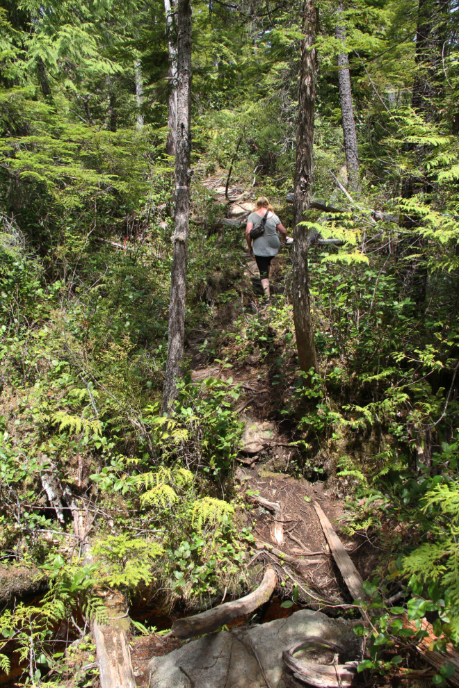
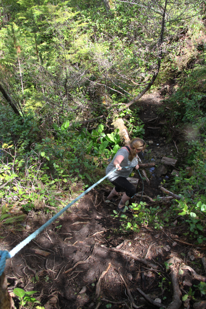
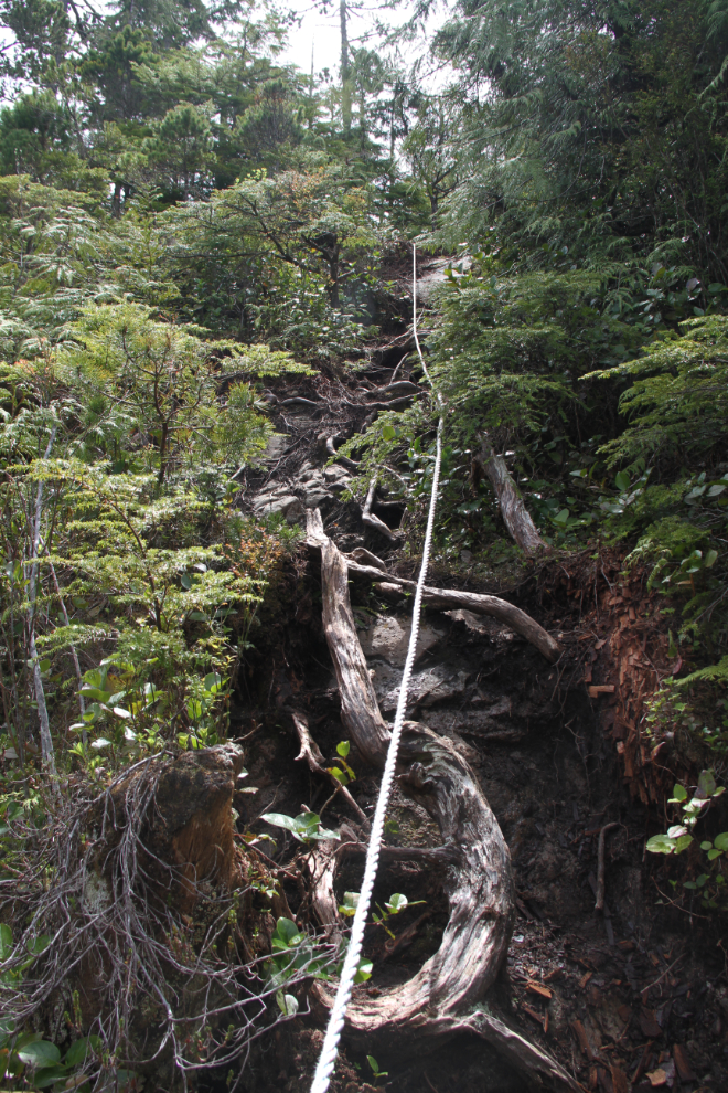
About 35 minutes in, a lengthy rope assist has been installed to help hikers get down a steep rock slope.
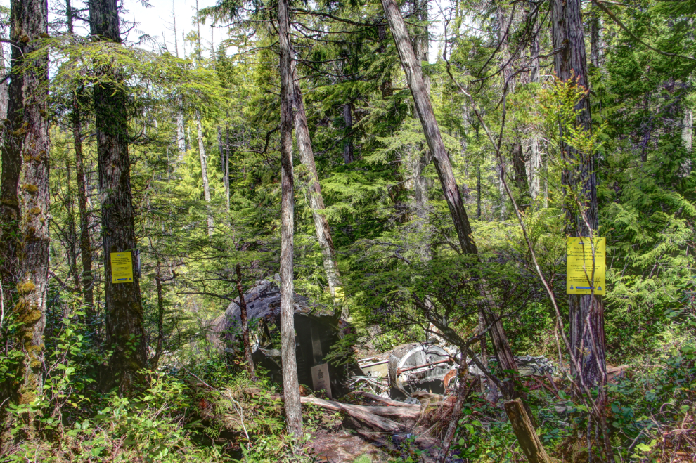
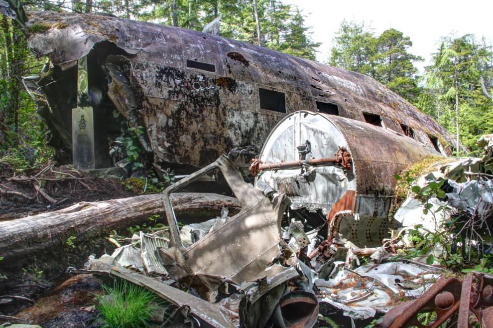
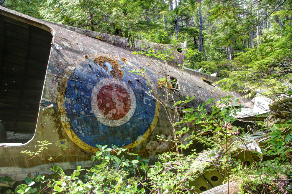
Bobbie had told me that the first sight of the wreck was quite shocking because of its size, and 45 minutes from the car, I discovered that to be true. The yellow signs say: “This is a protected Provincial Heritage Site. Please respect those who perished here. It is illegal to damage, desecrate or alter the site, or remove any object or material. An offender is liable is liable to a fine of up to $50,000 or imprisonment up to two years, or both. For a corporation the fine is up to $1,000,000.”
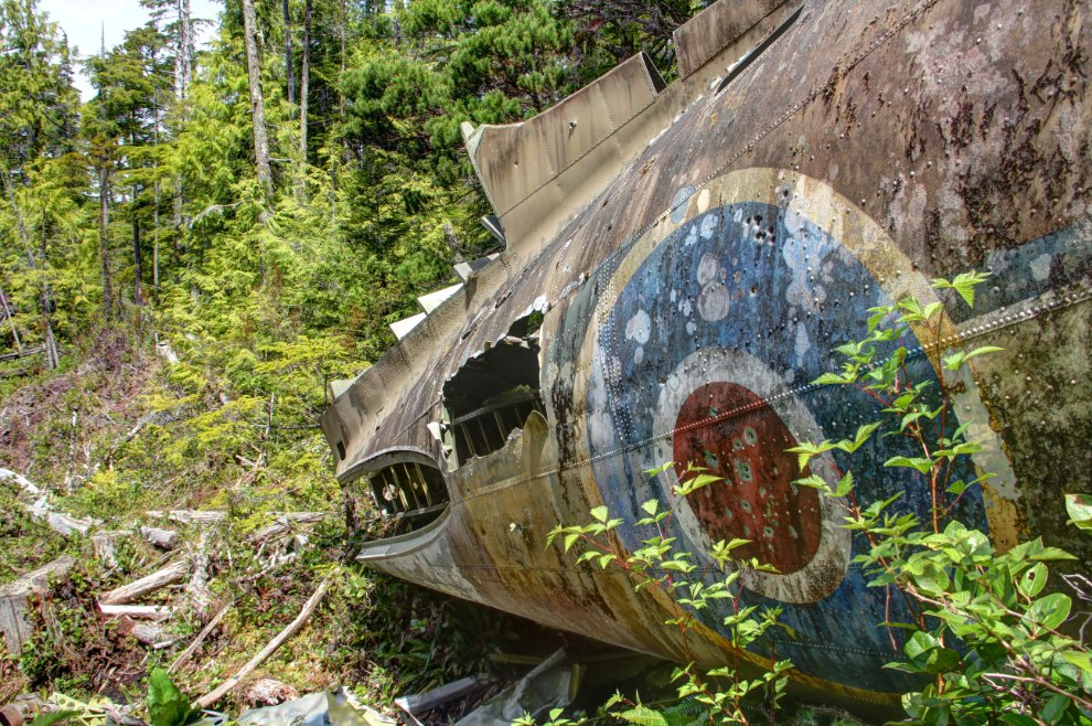
This stainless steel memorial on a concrete base is at the forward end of the fuselage (the cockpit is gone, I expect removed during the salvage). With a Royal Canadian Air Force crest at the top, it reads: “Dakota 576. Crashed 19th April, 1944.
P.O. J.M. Talbot, Pilot – KIFA
P.O. T.S. Wordlow, Pilot – KIFA
Sgt. T.R. Moss, W.A.G. – Survived
While on a navigation exercise from R.A.F. 32 O.T.U. Pat Bay, B.C., the aircraft overshot Port Hardy airport and ran out of fuel.
Reqiescat en Pace Fratres
101 R.C.A.F. (North Island) Squadron, August 2001″
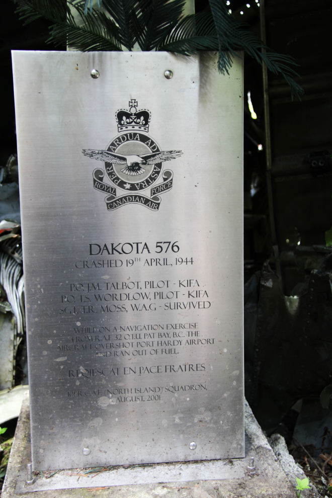
The term “R.A.F. 32 O.T.U. Pat Bay” refers to the Royal Air Force No 32 Operational Training Unit which was based at the Patricia Bay Air Station, now Victoria International Airport (YYJ). “P.O.” is Pilot Officer, and “W.A.G.” is Wireless Air Gunner – a W.A.G. was responsible for both radio operations and the gun turret on a bomber.
More of the story of the crash is told at the Web site of the group that erected the memorial, the 101 (North Island) Squadron. Part of 888 (Komox) Wing of the Royal Canadian Air Force Association, “it serves to commemorate the achievements of the men and women of Canada’s Air Force, to advocate for a proficient and well-equipped Air Force, and to support the Air Cadets.”
This is a powerful site, perhaps even more so for a pilot. This is what can happen when things go wrong.
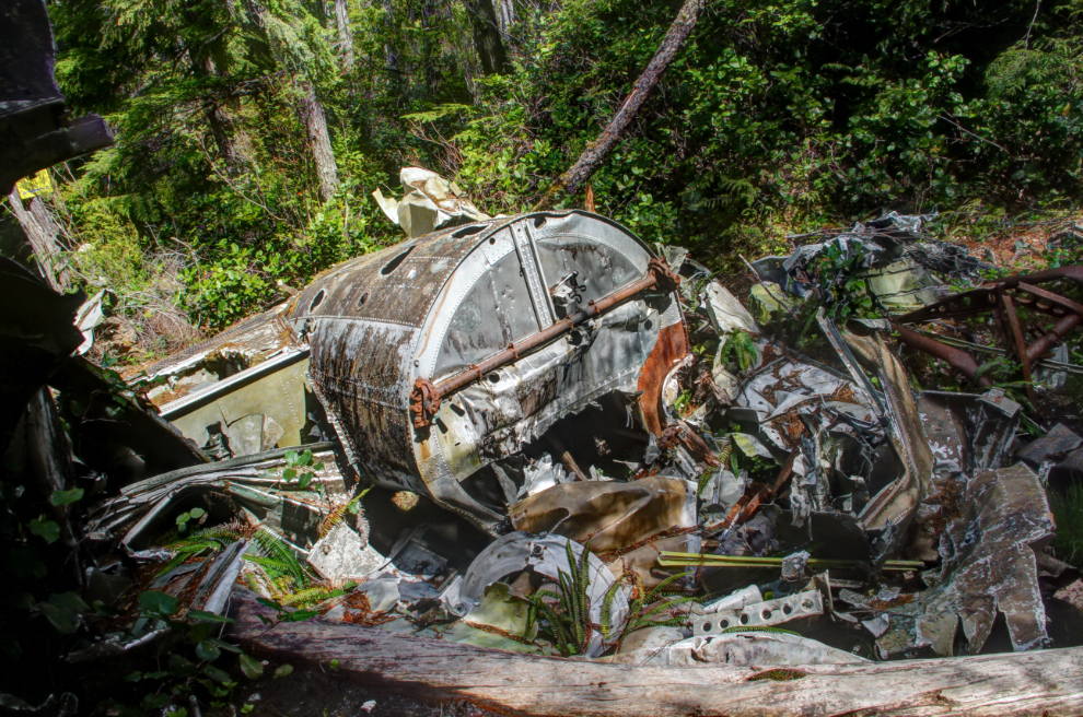
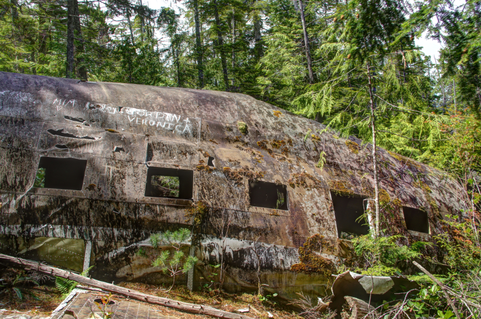
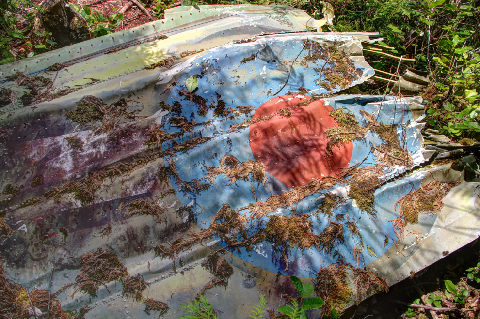
I was surprised at the excellent condition of the wreckage, given the climate here.
I would love to hit that couple with a $50,000 fine. Morons 🙁
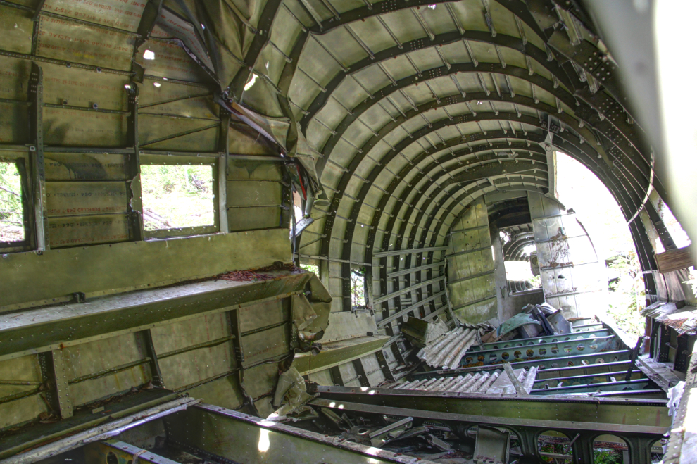
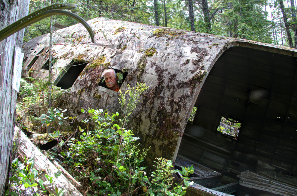
Inside the fuselage.
One of the things that struck me soon after arriving at the wreck is the piloting skill that would be required to get the aircraft down in these conditions and have a survivor. Although 101 Squadron says that “the nose of the aircraft hit a large bolder”, I saw no evidence of such a boulder.
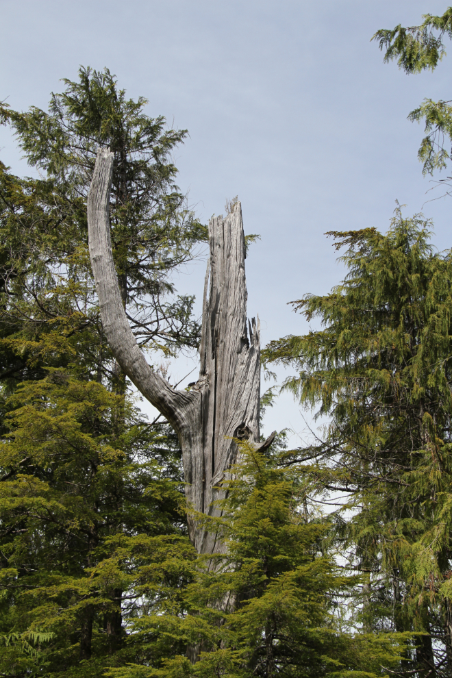
One of the images that I found the most powerful at the site were the trees that were snapped off by the aircraft. These are large trees, up to about 3 feet in diameter.
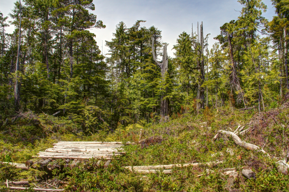
The log pad was used to land a helicopter several times for the dedication of the memorial on September 25th, 2002. I expect that a similar mat was used during the 1944 salvage work.
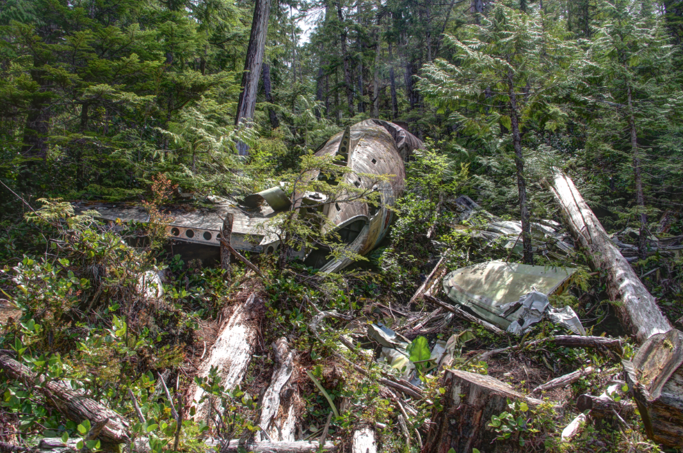
The wreckage seen from the helicopter landing pad.
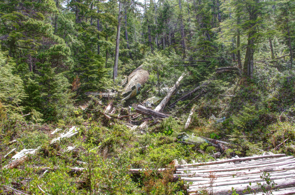
A closer look at most of the wreckage.
The port wing.
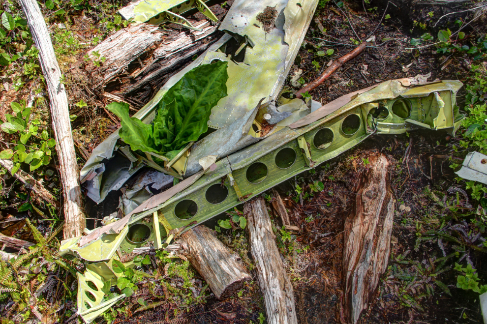
I took many photos of aircraft details. The force that it would take to fold up some of the components is hard to imagine. There’s been surprising little work done by Mother Nature to reclaim the site, though.
A last look inside the aircraft. We only spent half an hour at the site before starting back.
This rope in particular sure makes getting back to the car easier.
Two hours after leaving the car, we were back. My niece and are I are very much alike in many ways, including our love of exploring. “Where to next, Unk?” 🙂