Hiking the Summit Peak Trail in Stone Mountain Provincial Park
So many mountains, so little time! For 25 years I’d been driving the Alaska Highway, past the spectacular limestone peaks around Summit Lake, always wishing I could see the view from the top of one.
I finally got that opportunity see the view from the top of one during the first week of July, and can now share one of the finest day-hikes I’ve ever done.
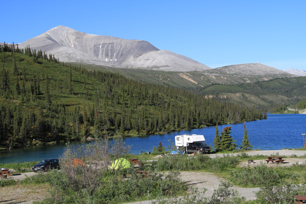
The 28-site campground at Summit Lake offers the only vehicle-accessible campground in 25,691-hectare Stone Mountain Provincial Park, and is also one of the most scenic campgrounds on the entire Alaska Highway. It is located at Km 597.6 of the Alaska Highway (Historic Mile 392), about 140 km (87 mi.) west of Fort Nelson, at an elevation of 1,295 meters (4,249 feet). I’ve spent a few single nights there over the years, but it’s on my short list of destinations to spend several days at. It has basic facilities (water taps, picnic tables, fire rings and outhouses), with a $16 per night fee during the open season, May 1 – September 6. There is also a boat launch, but it’s very rough.
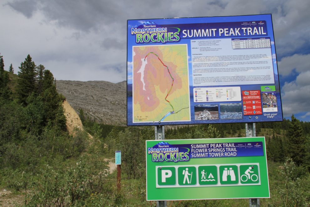
The Summit Peak Trail shows up only sparsely online – BC Parks has this basic description: “a 5 km round-trip hike leads through lodgepole pine forest to a spectacular view of the alpine area. Recommended only for fit individuals.” There is also some confusion about mountain names – there is no “Summit Peak” officially, and the peak at the end of the Summit Peak Trail on the trailhead sign is officially Mount St. Paul. So, I’ve taken the map from the trailhead sign seen in the photo below…
… and created one that illustrates my take on the various terminology used. This map shows the peak most commonly referred to as Summit Peak, which is also often termed “St. Paul E2”, meaning that it is 2 km east of Mount St. Paul.
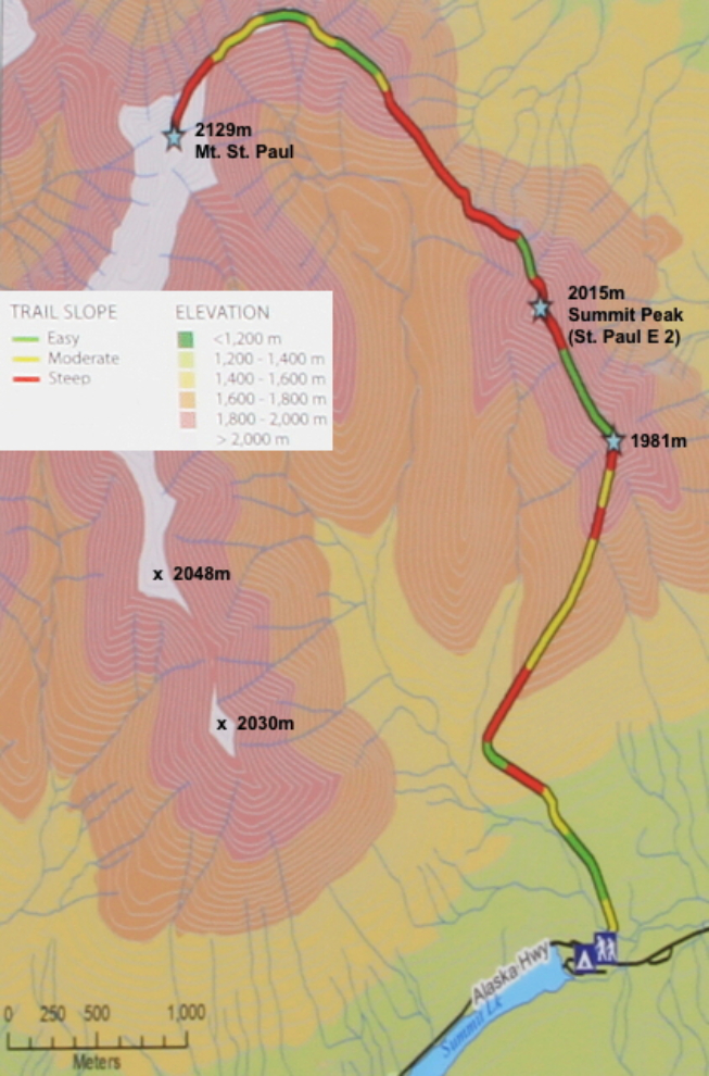
The trailhead sign notes that the trail is “moderately difficult”, 6.7 km long to the “upper viewpoint” (Summit Peak on my map), and you should allow 3½ hours for the hike up and 1½ hours to come down. I found those figures to be accurate.
Weather can change dramatically and quickly in the northern Rockies, and changes should always be prepared and watched for. Hikers comfortable with no visible trail or markers will enjoy this hike the most – those unnerved by such conditions may find some extra challenges.
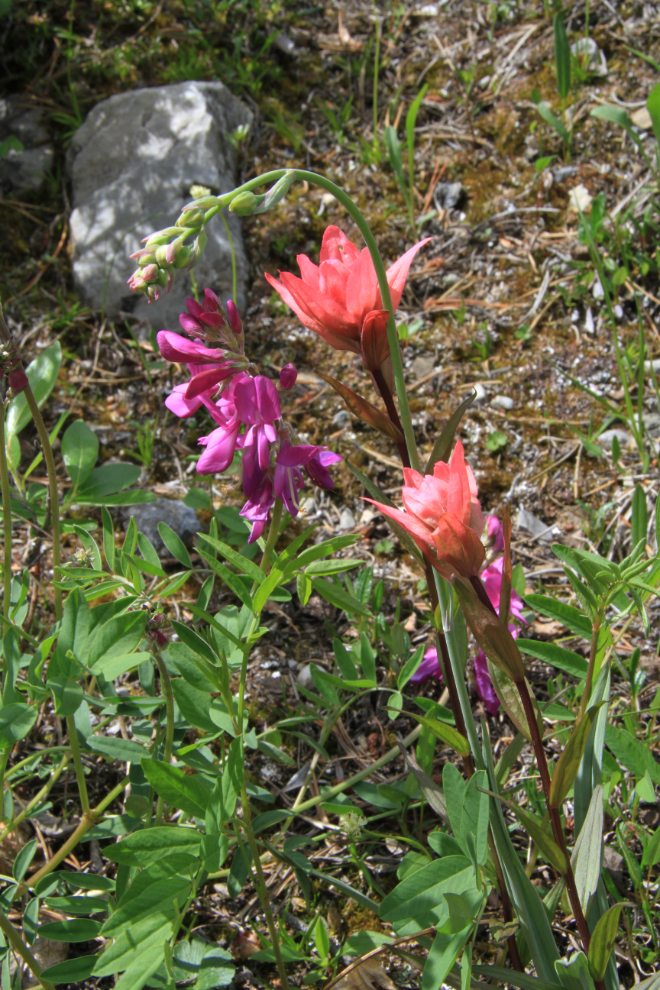
I started up the trail a few minutes after 8:00 am, with not a cloud in the sky, though it was a bit chilly at about 13°C (55°F). The first few minutes of the trail were lined with a profusion of wildflowers, including the Mountain Indian Paintbrush (Castilleja parviflora) on the right in the next photo.
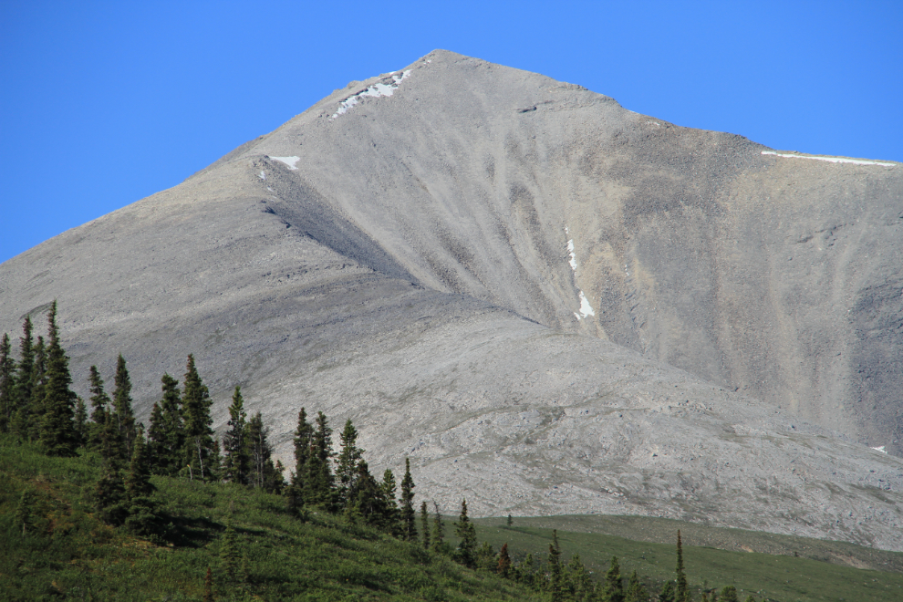
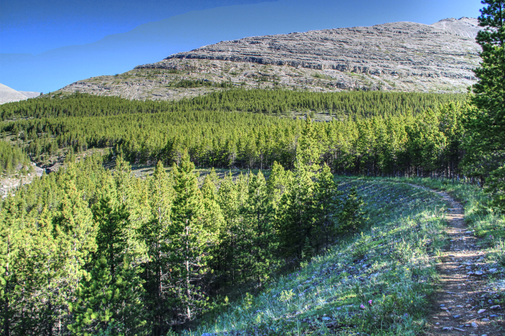
The trail very soon crosses the unnamed creek that flows from the east side of Mount St. Paul, and a short but steep climb takes you to the top of what would have been a glacial outflow channel thousands of years ago. Straight ahead is the ridge that ends 3 km north with the summit of Mount St. Paul.
It warmed up quickly, both because of the weather and the climb. With no vehicles at the trailhead, I felt confident that I had the mountain to myself, so put my clothes in my pack, to hike in comfort. I put clothes on briefly many times to take photos suitable for the blog and possible articles.
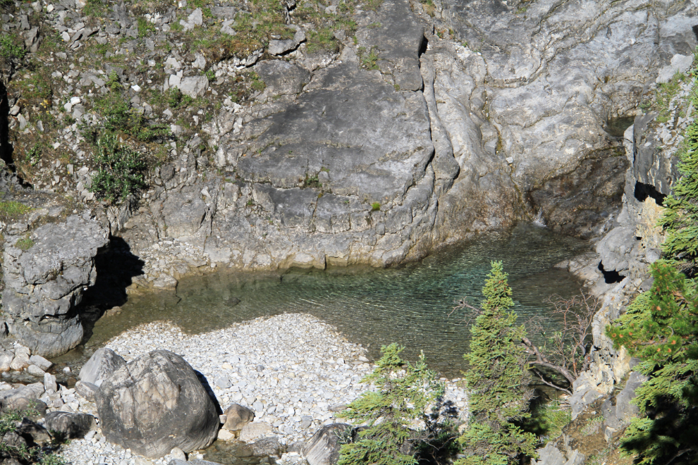
There are some enticing views of crystal-clear pools below. While I wasn’t about to climb down to them at this point, I’d try to get to them on the way down.
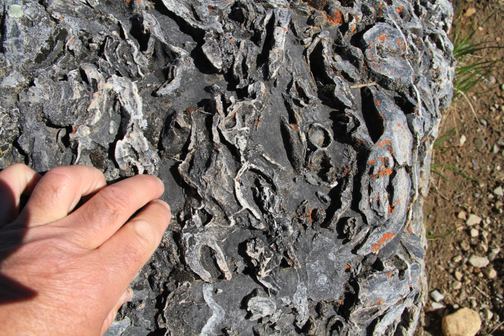
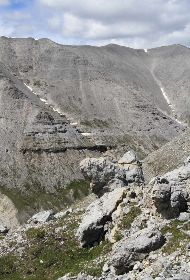
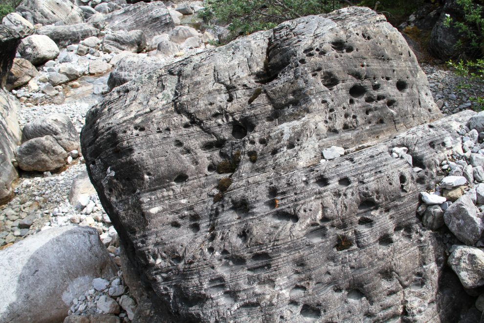
This is fascinating country geologically. BC Parks notes that these peaks are “composed of layered sedimentary rock, mostly seabed dolomite, laid down in Devonian times and raised along with the rest of the area approximately 80-90 million years ago.” Although I didn’t see anything that I was certain was a fossil, in formations like this, some certainly may have been.
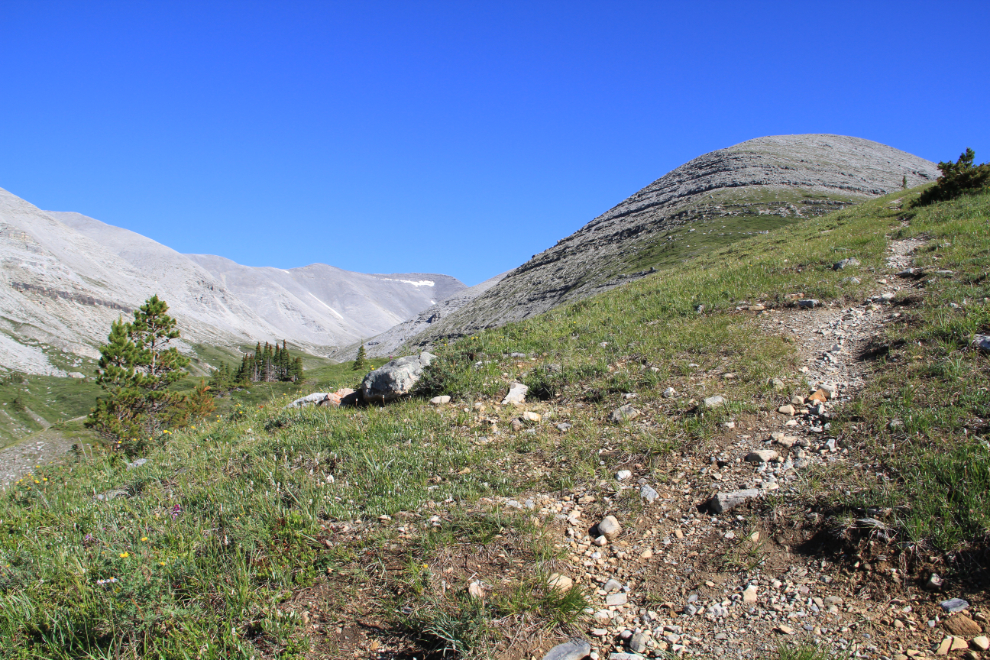
Half an hour after starting, I had reached treeline at approximately 1,450 meters elevation (4,750 feet), and the grade of the trail steepened (the second red section on the trail map).
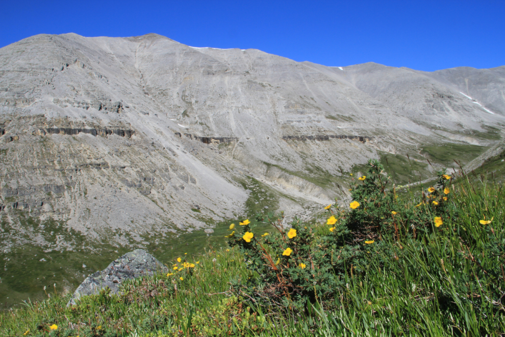
Above treeline, the amount of soil lessened considerably, but some small pockets held wonderful floral displays, including Moss campion, Alpine anemone and these Cinquefoil.
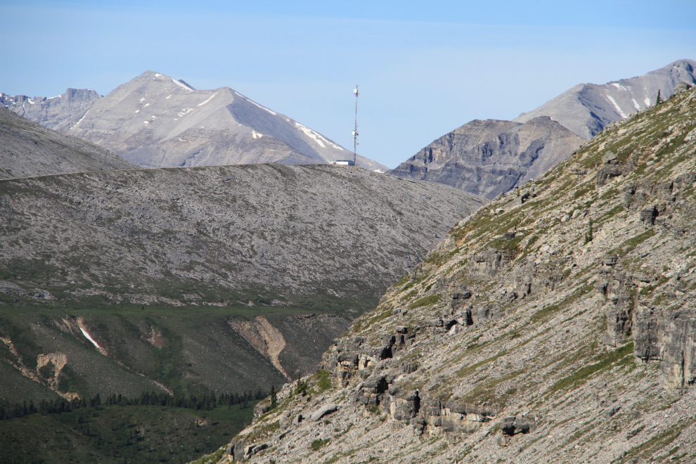
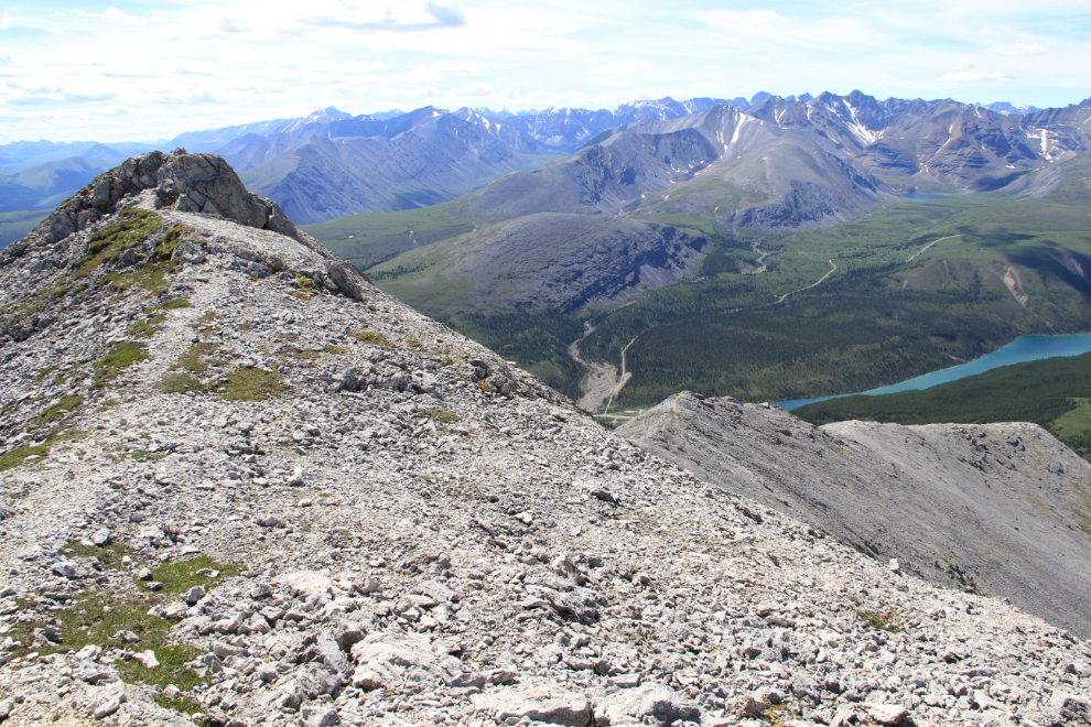
As you climb, the views get increasingly better – to the point that progress can be slow, especially if you have a camera with you. The next photo is looking across the valley to Flower Springs Lake, which you can get close to via the road in the foreground, a 4-wheel-drive road that goes to a microwave tower.
Here’s that tower.
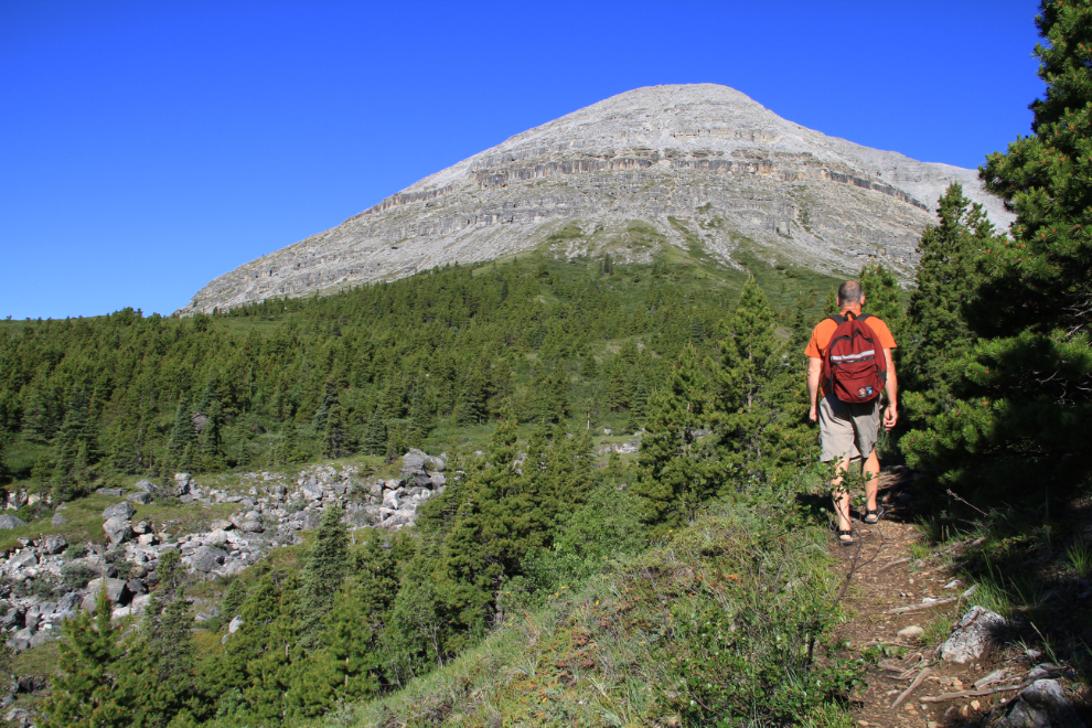
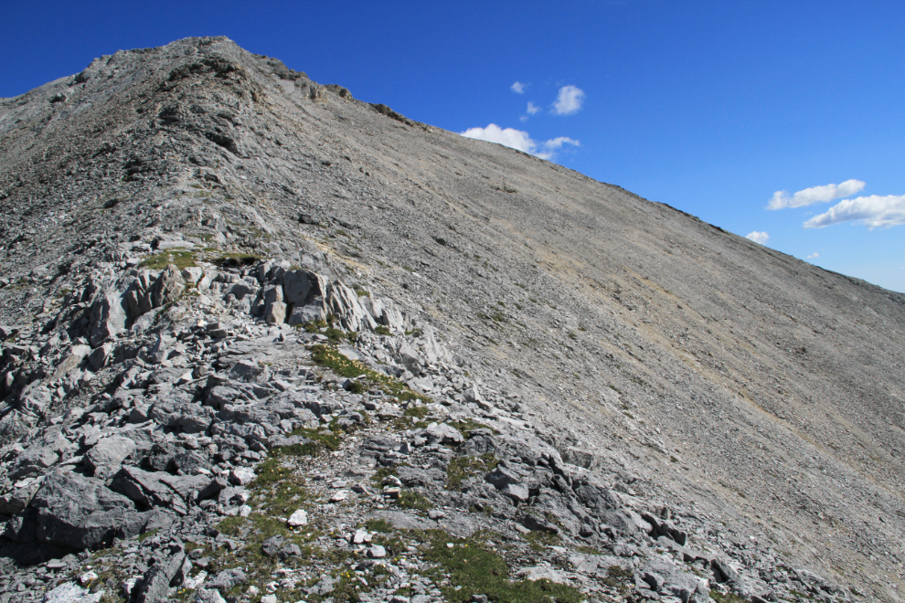
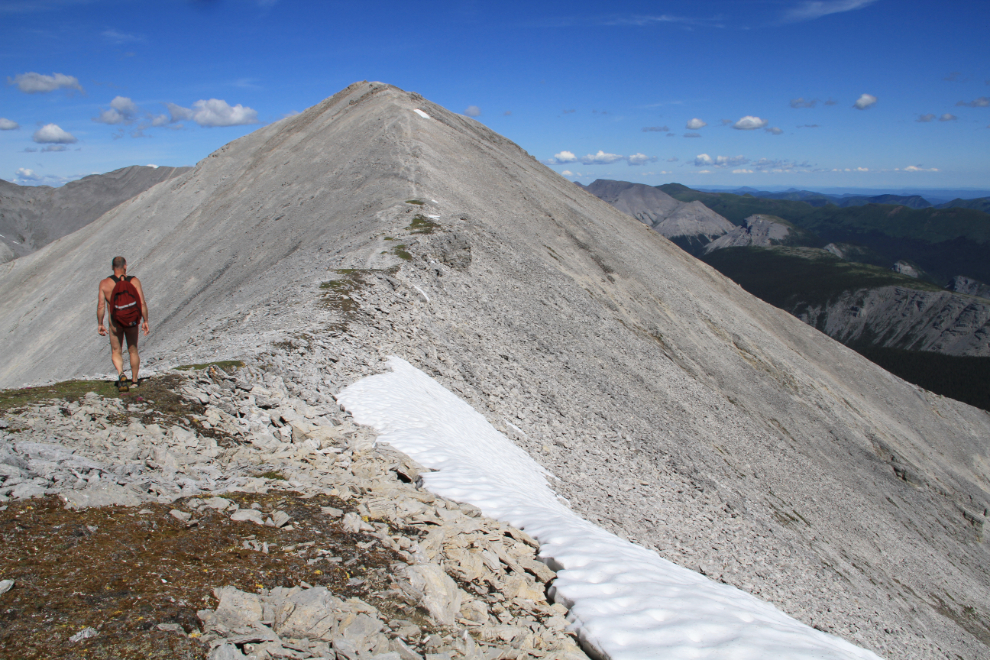
Nearing the top of the ridge, the trail disappears several times, but any route chosen through the rocks will get you back onto the obvious trail at the top.
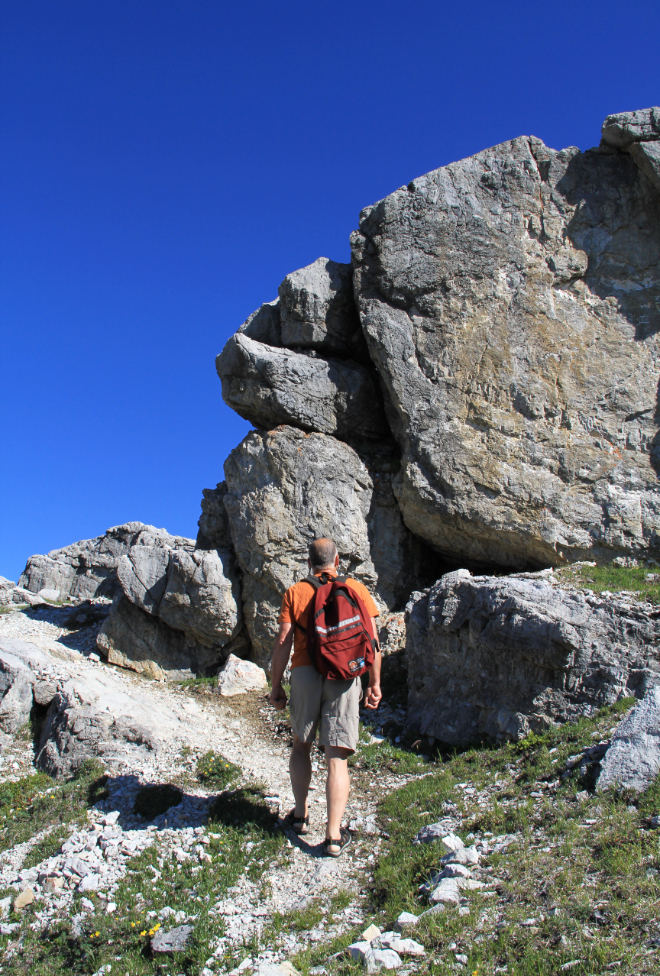
Along this section, I learned that my assumption that I had the mountain to myself was incorrect. I met a solo hiker. There he is, after we passed 🙂
The next day, at Liard Hot Springs, I met that hiker again, with his wife. They were Australian, probably in their late 40s, and were staying at the Summit Lake Campground while I was there. He asked if I was the naked guy he had met on Summit Peak the previous day. When I said that I was, we got into a fairly lengthy conversation about nude hiking. He had told his wife about meeting me, and they were quite intrigued with the idea. By the time we parted ways, they thought they would give it a try 🙂
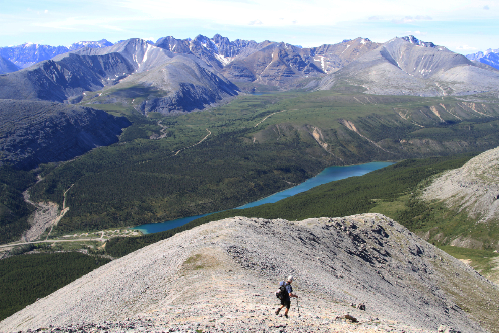
I reached the location noted on the trail sign as the first viewpoint (at 1,981 meters) at 10:20, and almost turned back here, thinking that the views couldn’t get any better than this. The ridge walk ahead towards the summit, however, looked wonderful, so after a short contemplation, I continued on.
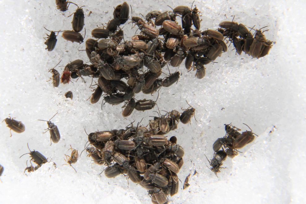
The long dipping ridge had a fair accumulation of soil in many spots, as well as some large patches of snow which were fun for a barefoot walk. The soil allowed for many flowers to grow, making the ridge walk even nicer than I’d thought it would be. The ridge and the summit also, though, had millions of these bugs, which I’ve been unable to identify. They’re perhaps 5 cm (3/16th inch) long, and while large numbers flew onto me, they didn’t bite. The unlucky ones who somehow got themselves on the snow patches, like the ones below, died. One of the things that made this encounter so surprising was that other than butterflies, there were very few other insects anywhere along the trail. Of particular note was the virtual absence of mosquitos.
The final steep slope up to the summit.
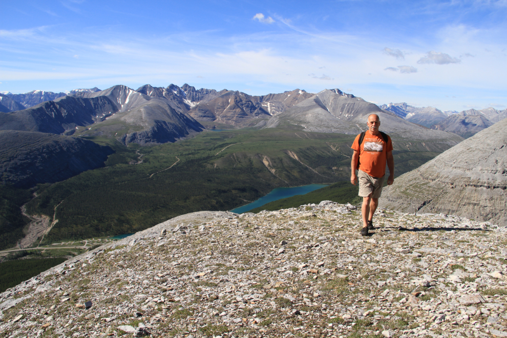
The ridge was even better than I had expected. Wow!
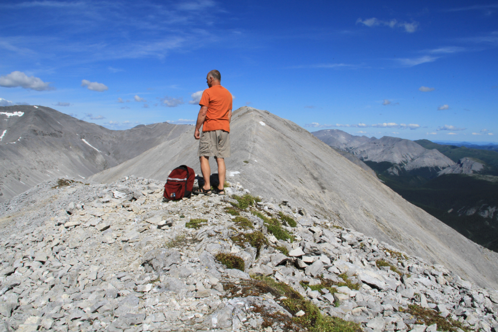
OMG that felt good!
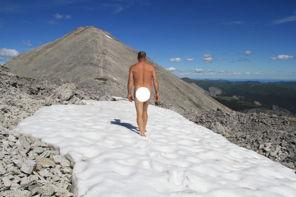
Continuing on. I now wanted this mind-boggling trail to never end…
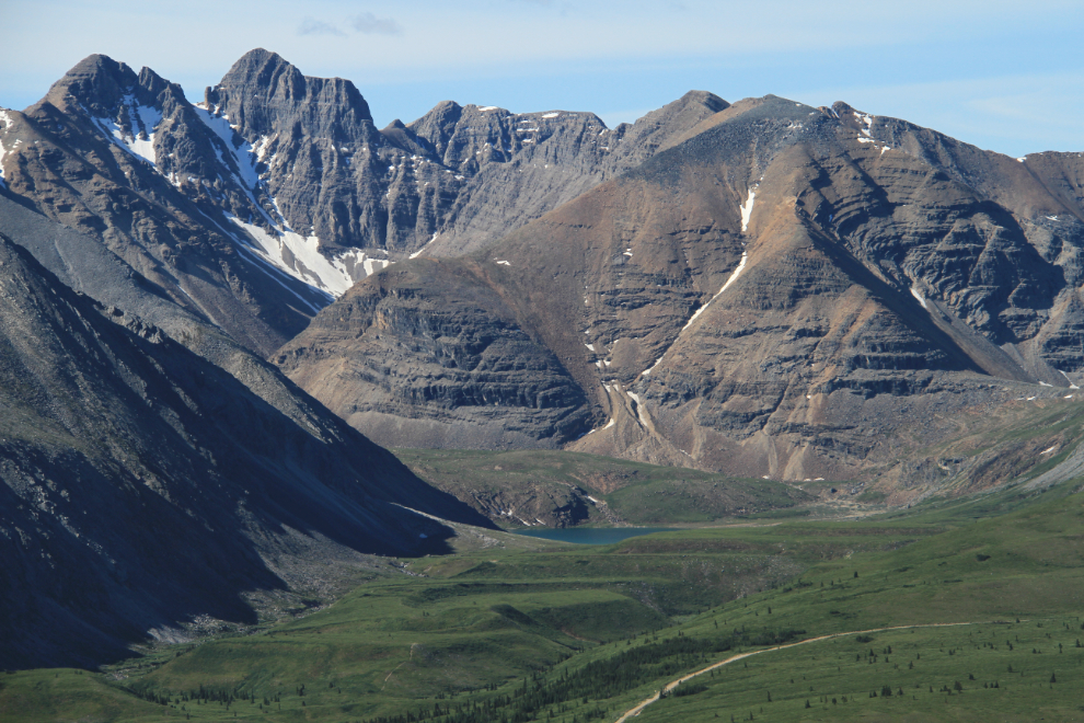
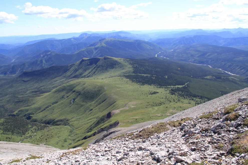
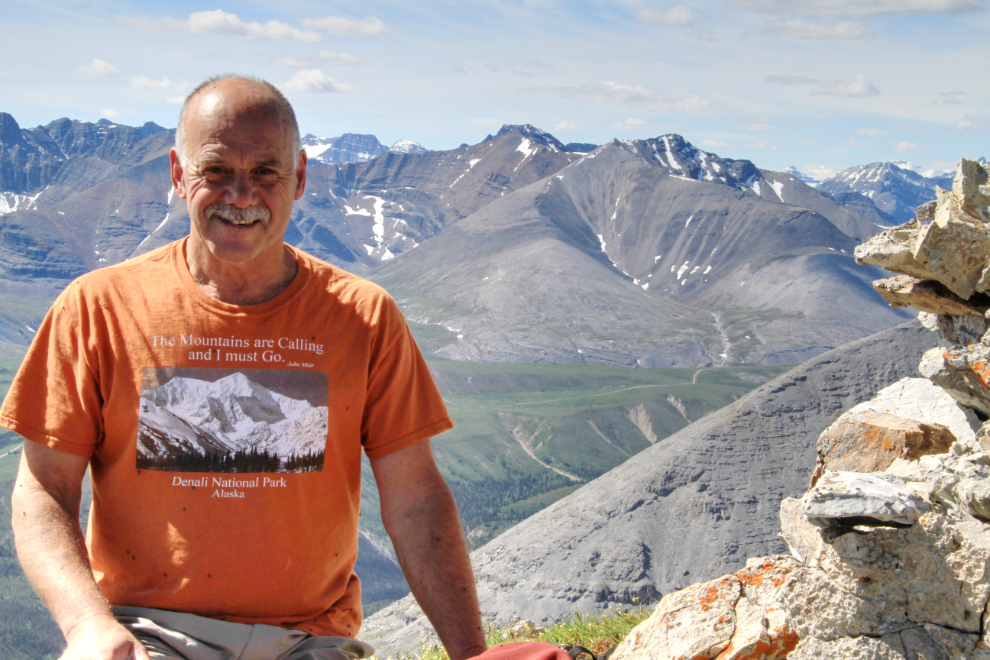
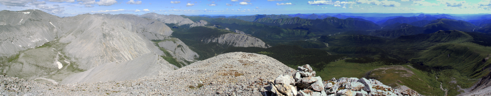
The cairn at the top of Summit Peak, looking across Summit Lake and Flower Springs Lake into a sea of other peaks in the 2,000-meter range. This truly is the Northern Rockies at their finest.
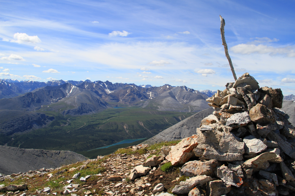
Click here to open a large version of the panoramic photo below in a new window. It shows about 180 degrees of the view to the north from the summit. Mount St. Paul, 2,129 meters high, is to the left, the broad and roadless Dunedin River Valley in the center, and the Alaska Highway is visible to the far right.
The hike back down from the summit was quick…
I wasn’t ready for the experience to end yet, though, so at treeline, I left the trail and dropped down to the creek. The snow melt was almost finished so there was little water flowing, but the pools I had seen on the hike up were even more lovely up close. On the far side of the creek is a little-used trail – from descriptions I’ve found online, that could be another route to the summit of Mount St. Paul.
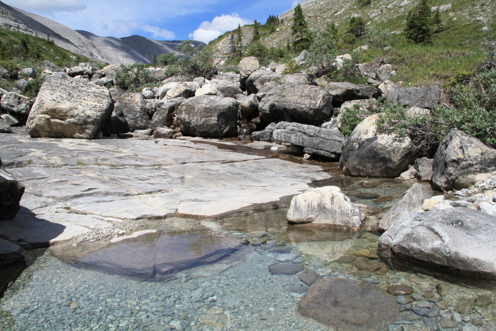
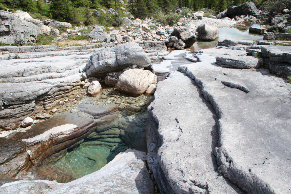
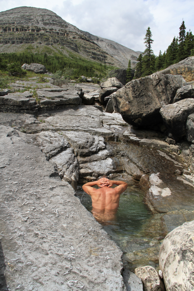
The creek was great fun to walk down, with all manner of glacier-and-water-polished slopes and boulders to walk across, over and around. There were a few really nice pools, and when I found this deep one pool I couldn’t resist the opportunity to cool down and clean off before getting back to the motorhome and continuing the drive.
As I mentioned earlier, the geology here is fascinating, from the big picture to the small details, including some not-small boulders along the creek.
I took 190 photos during the 5½ hours I spent on the trail. Not only was the Summit Peak Trail one of the finest day-hikes I’ve ever done, it has convinced me that the Summit Lake campground needs to be my base for several days, for more hiking, to drive the 4-wheel-drive road to the microwave tower, and just to sit still and soak up the majesty of the Northern Rockies.