Hiking Boulder Canyon at Muncho Lake, BC
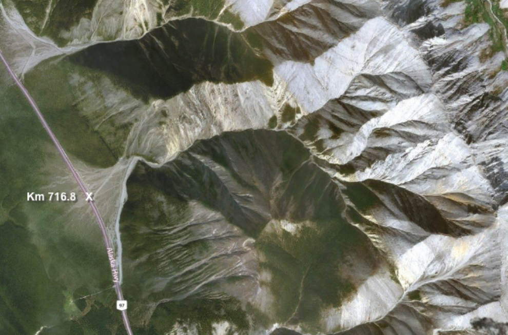
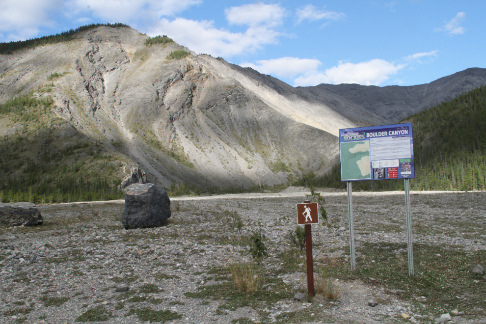
This is Part 2 of my Muncho Lake canyon hikes series of three posts. In the late afternoon of Friday, August 25th, I hiked one of the 2 canyons that are signed as hiking routes – Boulder Canyon, at Km 716.8, where I parked the motorhome. The information panel at the trailhead gives it a difficulty rating of “Moderately easy”, which I consider absurd except at the very lowest section. I turned back when the route got too extreme. It was just good luck (or perhaps listening to that “little voice”) that I hadn’t taken the dogs despite that rating, or I wouldn’t have gone very far at all. The panel says that the route is 4.6 km return, which should take 3 hours – I went much further in much less time.
Here’s the complete trail description from the Tourism Northern Rockies guide:
The trail starts heading east up the alluvial fan on a road leading to an old quarry. In about 10 minutes you will cross over a berm created to contain the water coming out of the mountains, and take your first turn a tight valley. Follow the creek bed for several turns until you reach a small (4 ft) waterfall or rock wall (depending whether there is still water flowing in the creek). Here you will have to decide if you can climb over the rock (good foot and handholds) or backtrack a short ways and wander up the right side and walk along the top to get over.
Carrying on, you’ll shortly enter a very steep walled section of the creek bed. It’ll lead you to a dead end with sheer, rock walls over 25 ft high. Backing out of this canyon, you’re able to scramble up the right side again and pass over this section. A distinguishable trail is visible in the ground at this point and continues on for a short while before dropping back down into the creek bed.
It’s possible to continue on past this point all the way until the creek bed splits in two or beyond. Be aware, that small waterfalls or rock walls are prominent along the way and you’ll have to climb up or scramble around them to continue.
Special Notes: This trail is best done in the fall when the water levels are low or there is no water running in the valley at all. Don’t be fooled by the fact that there is no water down at the highway level; there could still be water further up the creek bed disappearing into the ground before reaching the highway. Also be careful when clambering up side slopes in this valley. Much of the rock is loose and is easily dislodged. Proceed up side hills one at a time.
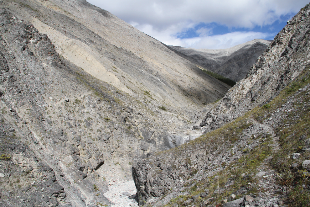
The start of the “trail”, at the south end of the huge pullout where I’d parked the motorhome.
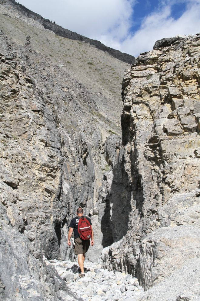
Fifteen minutes along, I entered the start of the canyon proper.
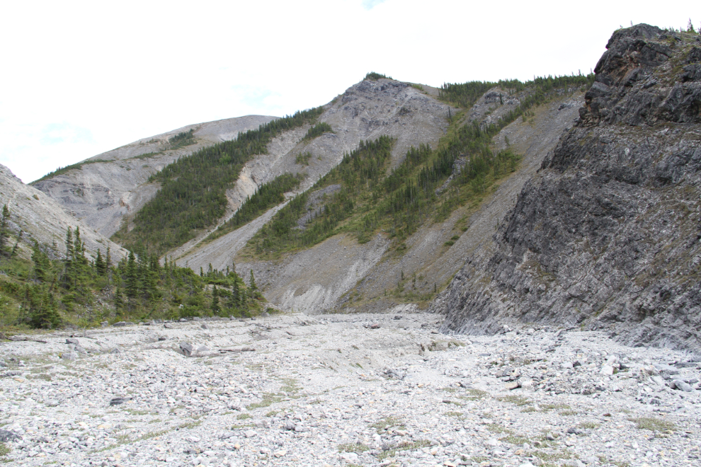
It got much rougher quickly past that point. I met another couple of hikers at this point who told me that you need to be part mountain goat to do this hike.
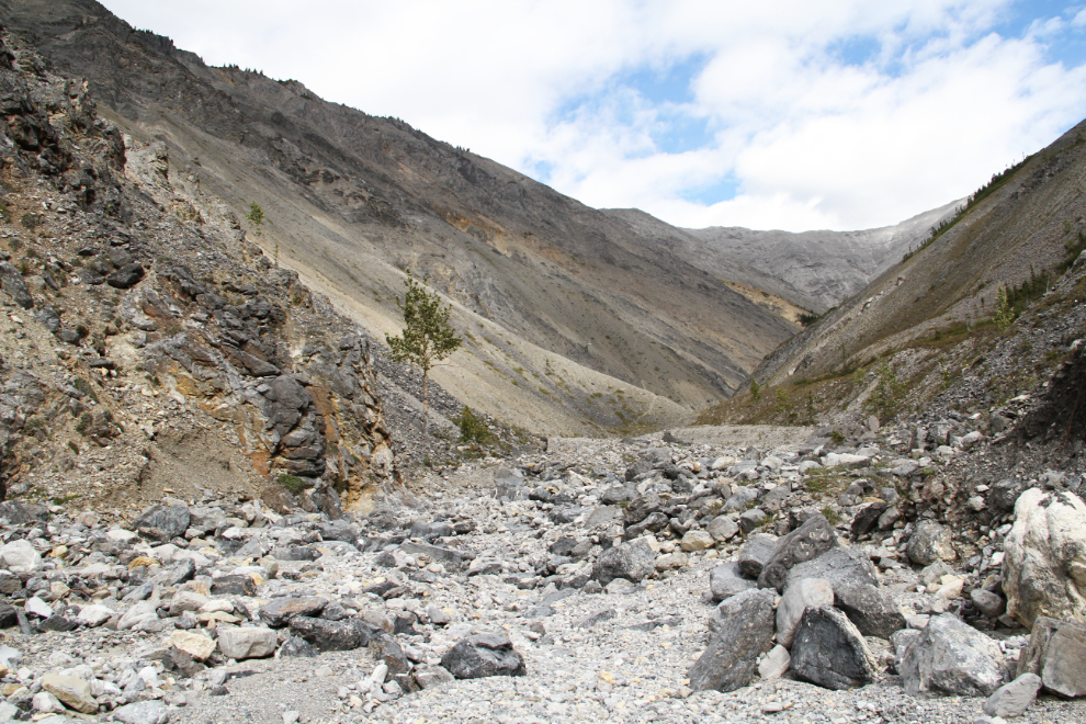
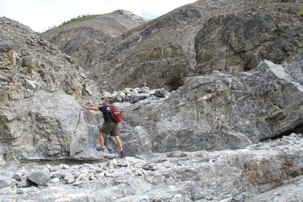
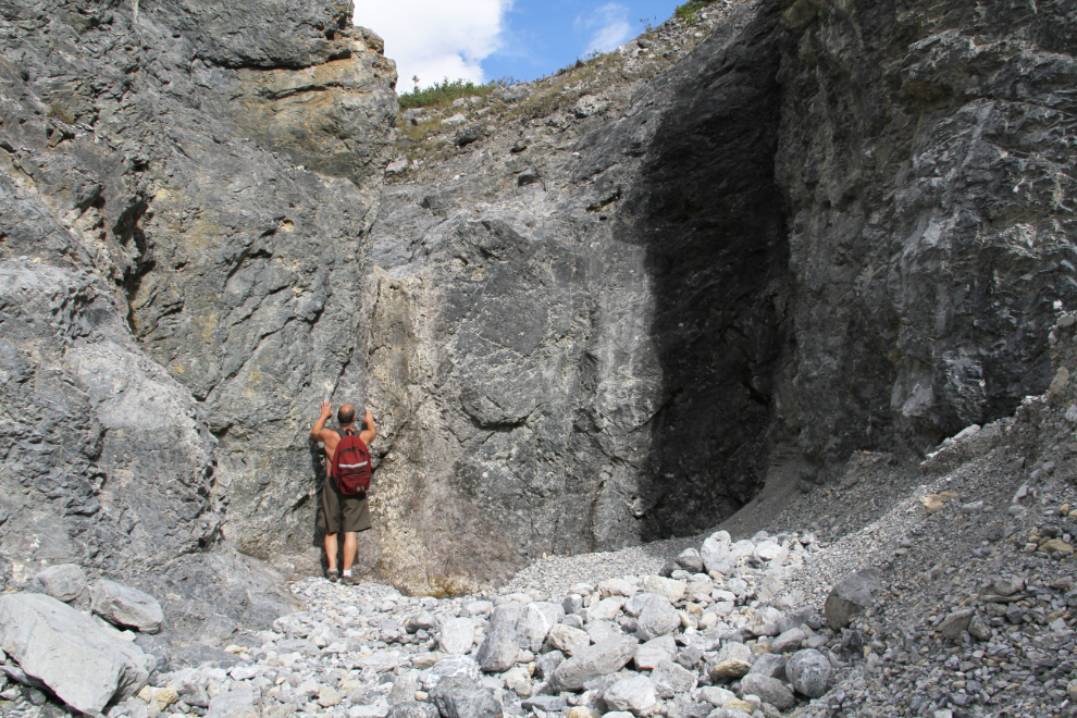
Half an hour from the start, the rock wall described as being 4 feet high (I’m quite a bit taller than 4 feet 🙂 ).
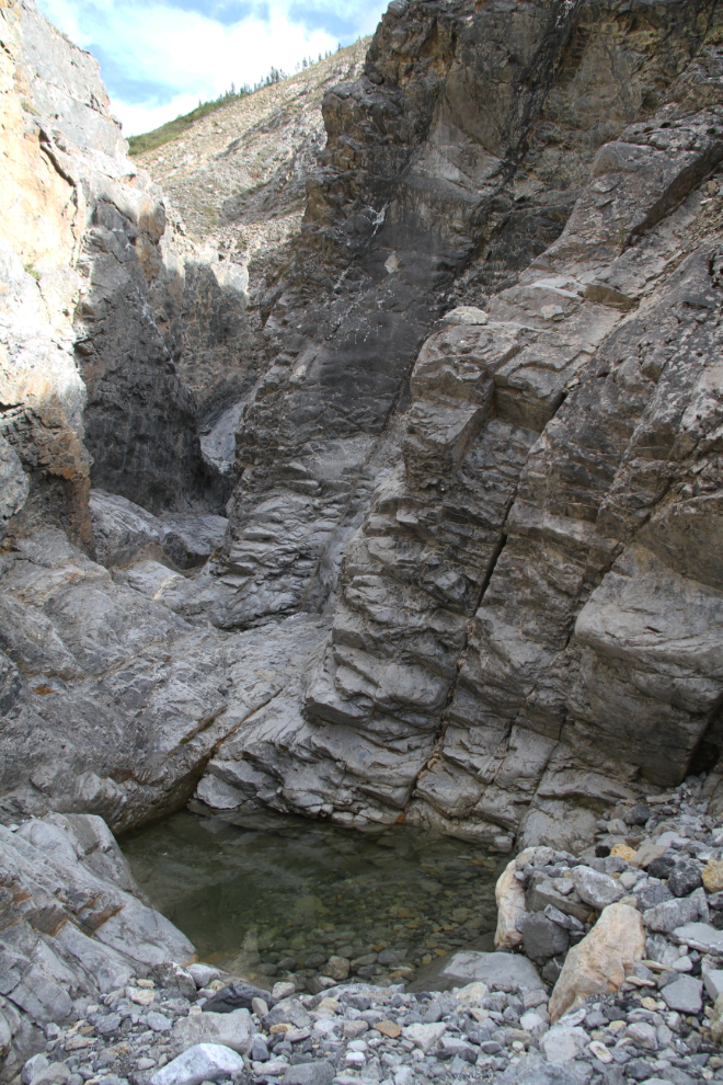
After another 5 minutes, this very impressive slot canyon is reached. It isn’t walkable even with no water running, so I backtracked down the canyon to climb around it.
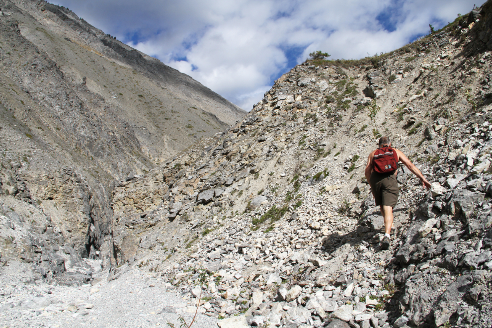
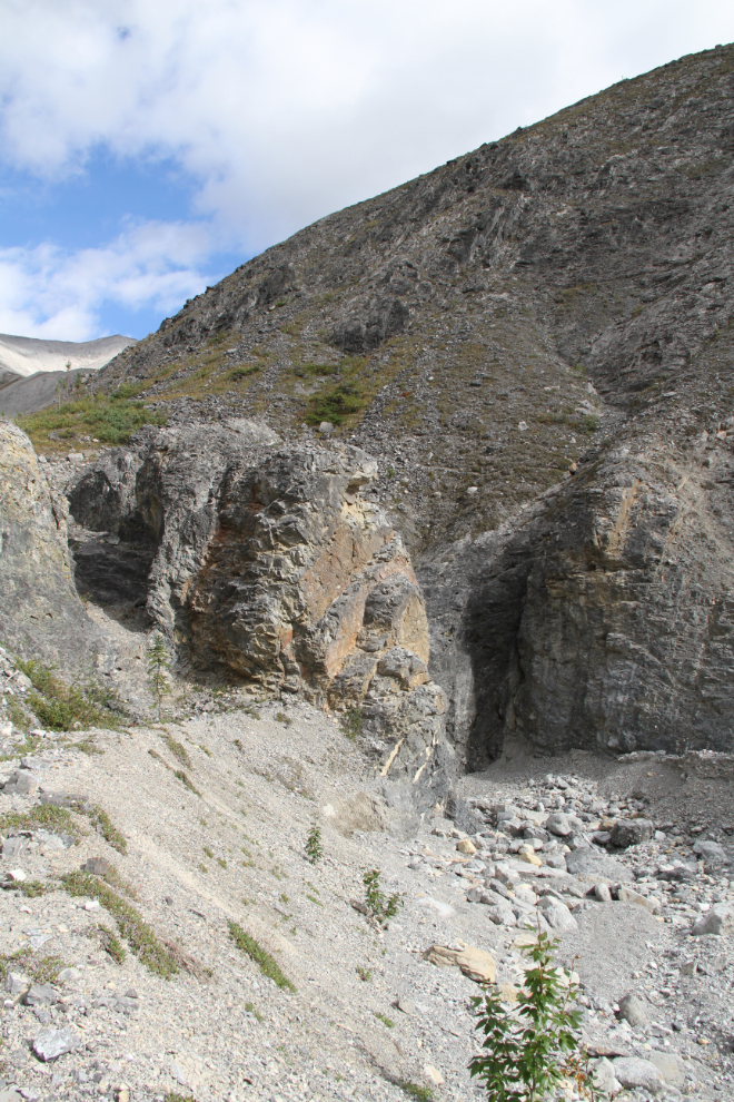
On the way out, I found that there’s a fairly good route up the slope further down the canyon, but I hadn’t seen it, so used this steep and loose route up to a sheep trail that goes around the slot canyon.
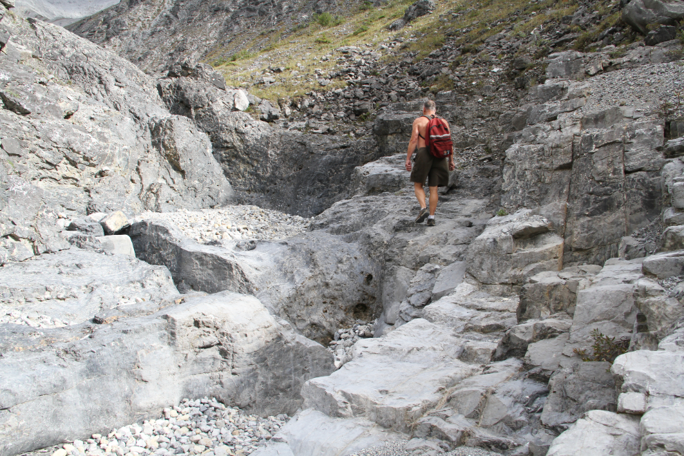
Dropping back down to the canyon floor, some wonderful sections of rock are encountered, all fairly easy to navigate. I really need to get back to see these when the creek is flowing. I think that this is about where the trail description panel assumes that hikers will turn back.
Running into another slot canyon, I was back on a high sheep trail at 55 minutes from the parking lot.
Back on the canyon floor, this impassable wall was soon reached, but a route around it looked fairly easy.
Looking down from the route around the impassable wall. It wasn’t as easy as I’d expected – it was both steep and loose.
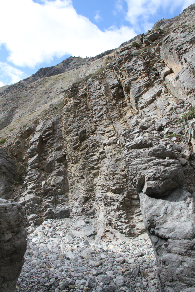
Forced back down to the canyon floor by cliffs, I soon reached another section that could be considered impassable or just extremely difficult.
With the next photo showing the view up from that difficult/impassable spot, this is where I quit, an hour and 15 minutes from the parking lot. Going beyond here is not for solo hikers.
The next post will be Part 3, with the canyon hikes at Km 714.9, Km 708.3, and Km 699.4…