Flying home: Amsterdam-Reykjavik-Vancouver-Whitehorse
This is 30th and final blog post from our 38-day tour of northern Europe (in the Post Archives, the tour posts start on June 24th, 2025). This post is for people who are passionate about travel, for people who are fascinated by airports, and in particular for window-seat junkies like me – if I don’t get a window seat, I’m simply not flying. This folder after editing has 304 photos, of which I would really like to show you about 250. But I’m not going to – I managed to get it down to 73 🙂
These 73 images were shot with one of 3 cameras – 33 were shot with the Canon EOS 7D Mark II, 32 were shot with the Canon Powershot SX40 and 8 were shot with the phone. The images from the big Canon scale to 990×660 pixels on the blog, the little one and phone to 990×743. I often crop the 743-pixel ones down to 660, but on the aerial images in this post, I haven’t because the full frame is of interest.
Okay, let’s get home!
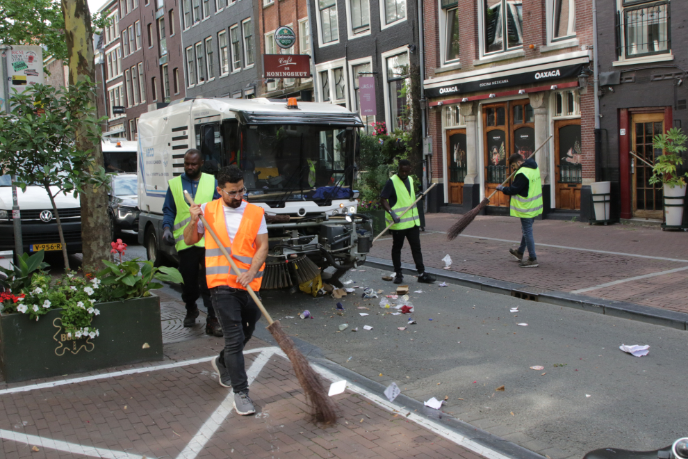
Things began with a bit of a clunk just before 10:00 on Monday, July 28th, when our tour-shuttle driver got trapped behind this street-cleaning team for a long time – there was simply no way around it, no way to get to a different street by the time he realized the problem. He and Cathy were texting, so no big deal to us – we knew he was coming right behind those flashing lights I’d been watching for blocks.
It’s a half-hour drive to AMS – Amsterdam Airport Schiphol – and we arrived at 10:30.
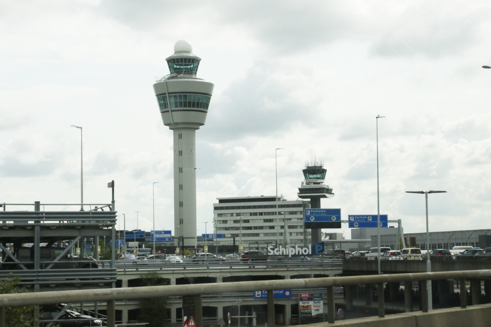
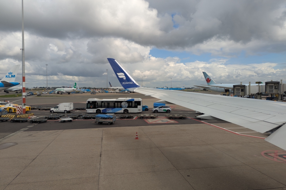
We’ve only flown out of AMS once before, after our Rhine River cruise in 2012. The size of the place is hard to wrap my head around – it covers almost 28 square kilometers, and serves over 70 million passengers each year.
For airplane geeks, though, this place is gold. Airplanes on two levels. I don’t even know how that happens – I’m pretty sure I’ve never gone up or down a ramp while in a plane.
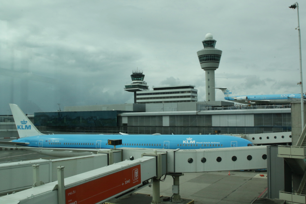
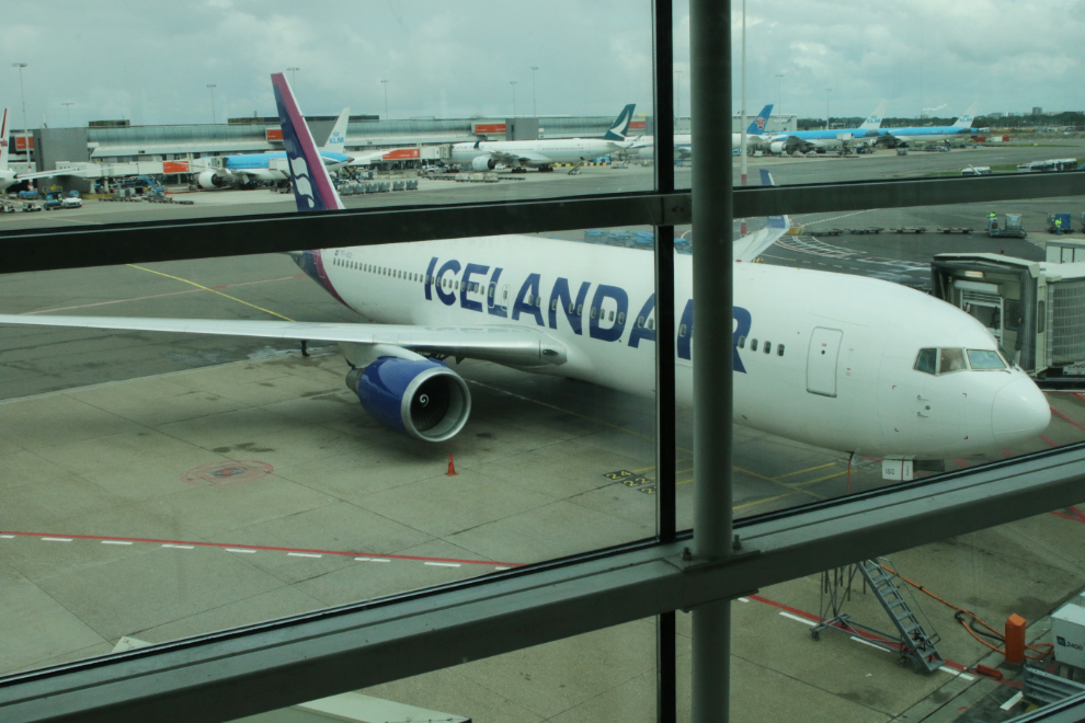
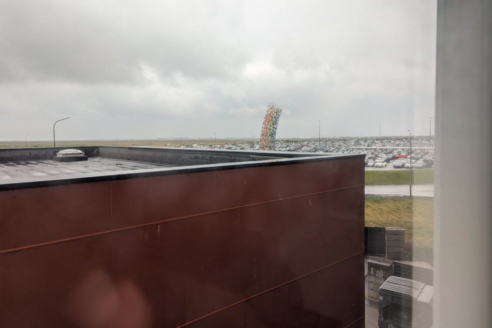
It was nice to see a bit of home sitting there 🙂
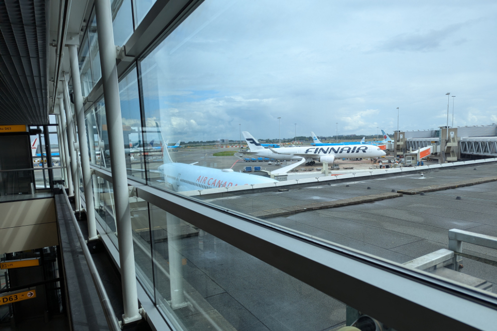
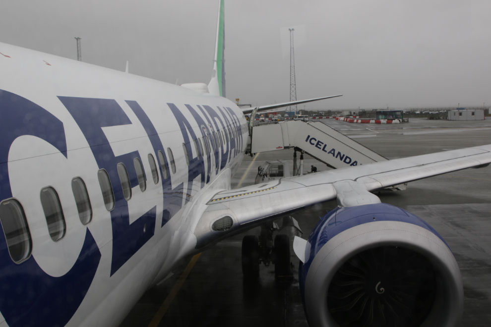
With all that was going on, it was almost a miracle that I saw our plane land and taxi in. TF-ISO is a Boeing 767-319(ER) operated by Icelandair (who were great to fly with 37 days before this).
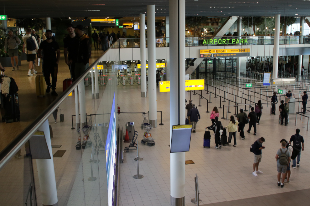
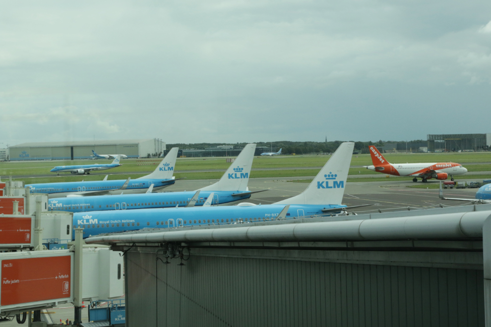
This is a busy place!
We got checked in and through security fairly quickly. We had arrived way early to ensure no problems, so we had a lot of time to kill. In 2012 it seemed like we walked kilometers from security to our gate, but this time it was a reasonable walk 🙂
Our departure was delayed a bit, but no big deal.
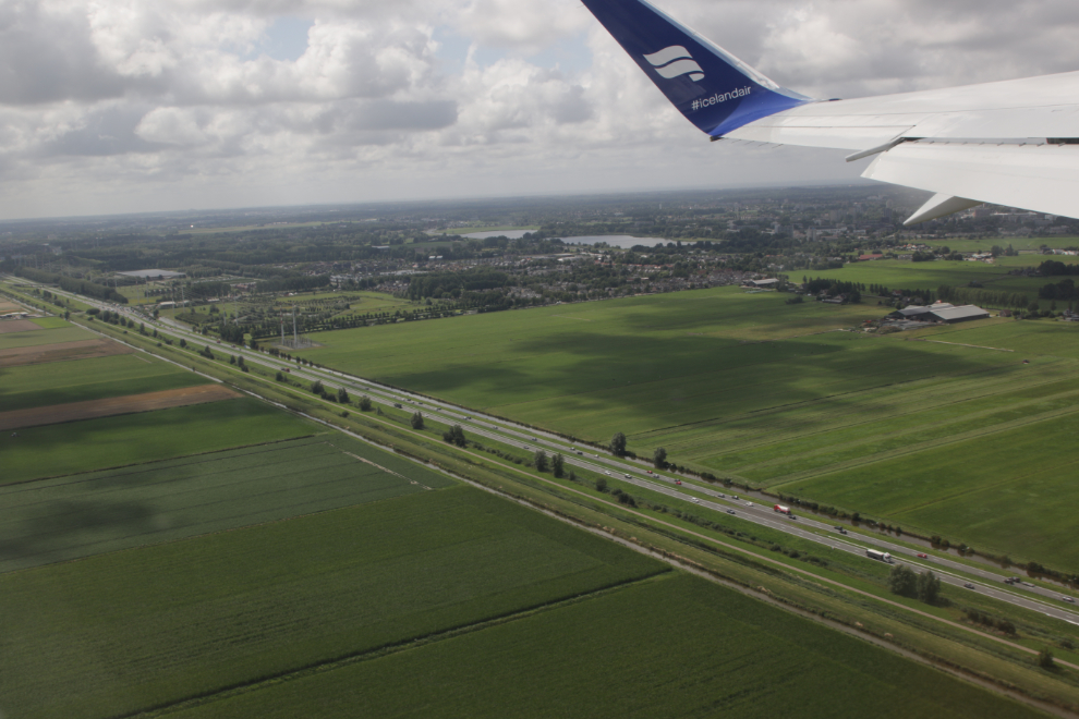
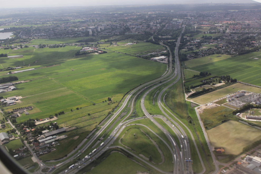
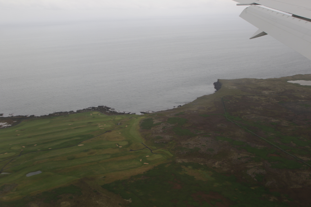
Taxiing at AMS is quite an experience – as was the case last time, I started thinking we were taxiing to a new runway in Belgium 🙂 You taxi over a couple of freeways…
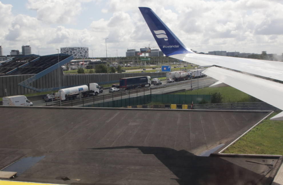
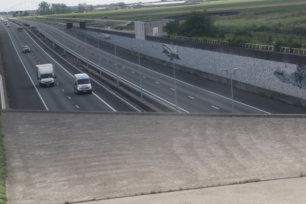
…a canal and some smaller roads, past large farms…
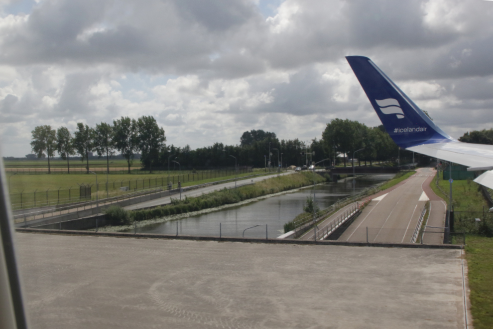
…until finally reaching the assigned runway. But, at 2:46, we were climbing out, headed for the Arctic again.
Only from the air can you really see how complex “the big picture” is.
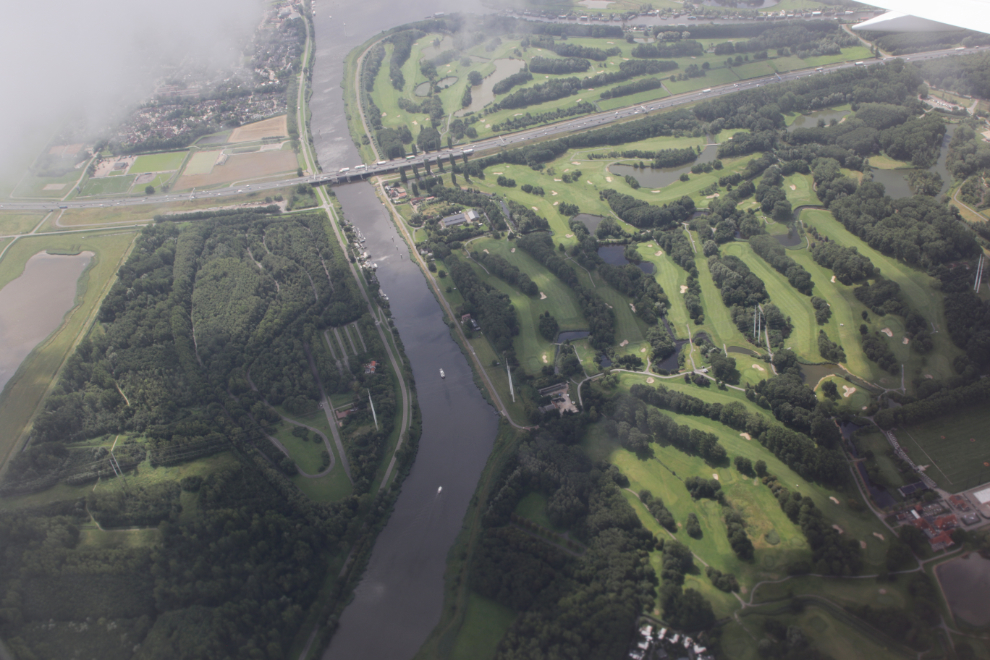
That’s quite a golf course. Or is it two – a 9-hole and an 18-hole?
We soon climbed into the clouds, and the ground stayed invisible for the whole flight.
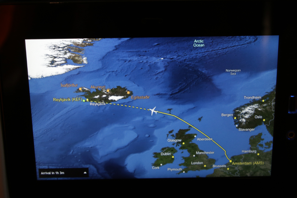
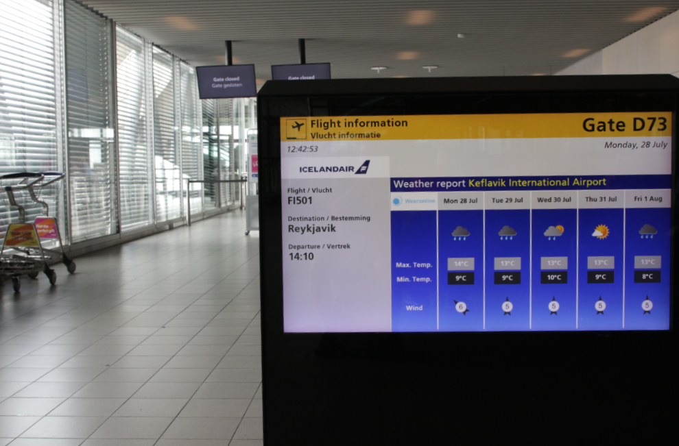
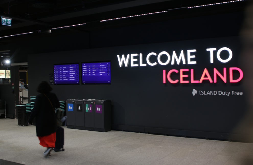
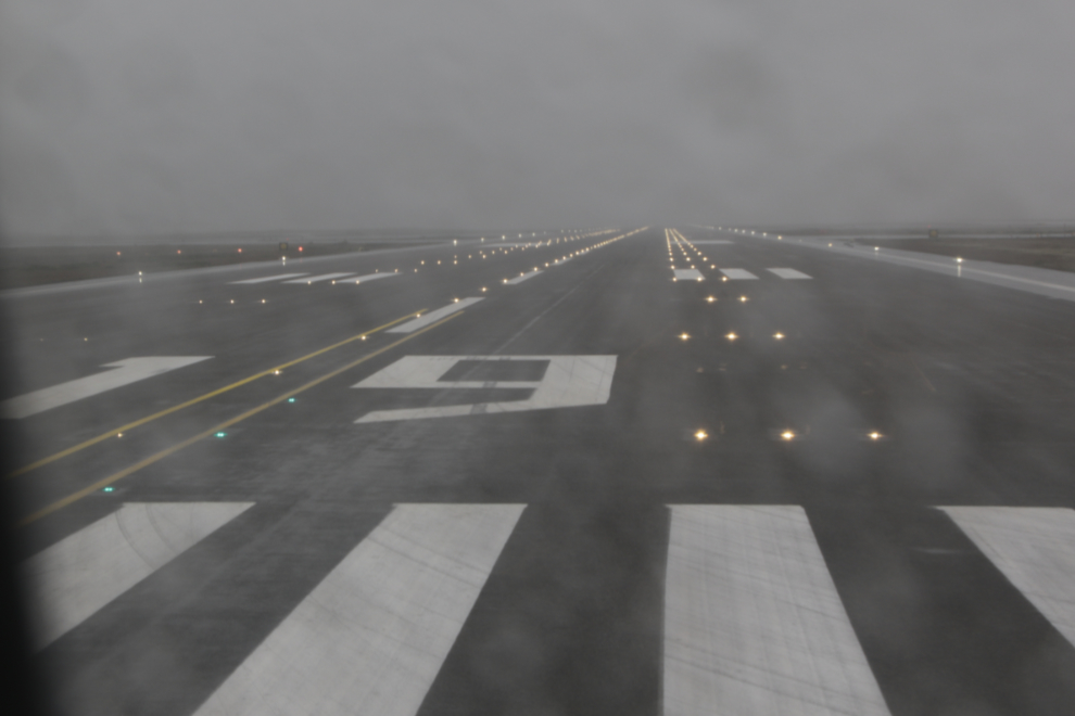
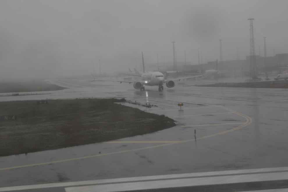
A few minutes less than 3 hours later, we were descending into rainy, dreary Reykjavík–Keflavík Airport (KEF). We had crossed two time zones, so it was 3:41 pm local when I shot the descent photo.
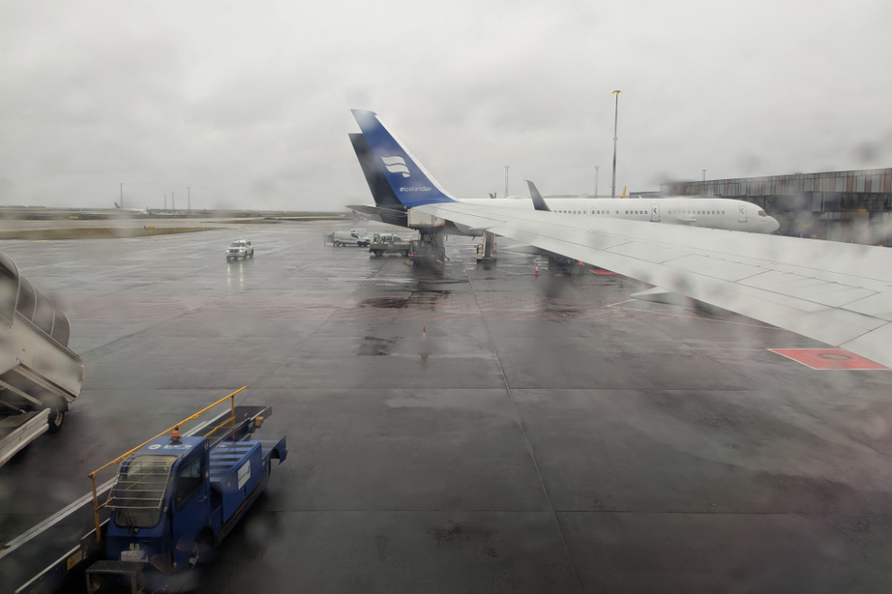
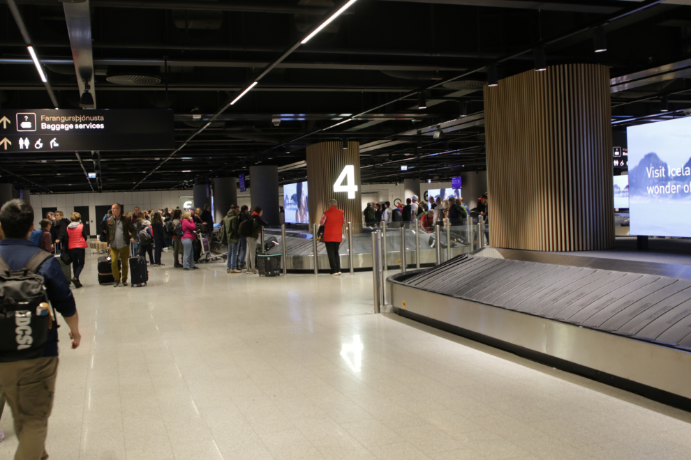
When we arrived a month before I had commented that “the terminal is quite small.” It felt more like we were in a converted warehouse during our Customs clearance and shuttle back out to the plane. This was a very different experience – KEK is large, modern, and quite efficient.
Doing the full departure from the airport was a pain, but much less so than continuing on to Vancouver or Whitehorse.
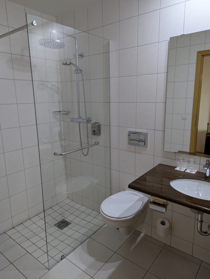
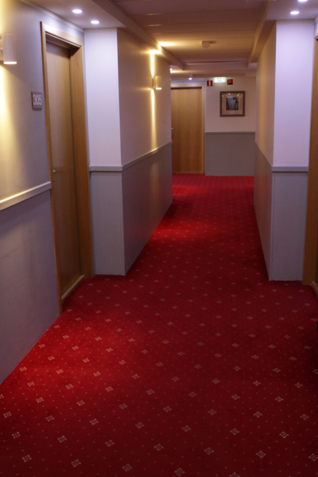
Cathy had booked us into the Aurora Hotel, which the hotel website says “is located just 100 meters” from the airport. That is a complete lie. My impression from Google Maps was correct – it’s at least 6 times that far from door to door. The room was basic but clean and nice.
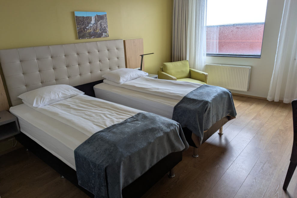
Getting a view is usually important to us – it apparently wasn’t this time 🙁 (Room 305)
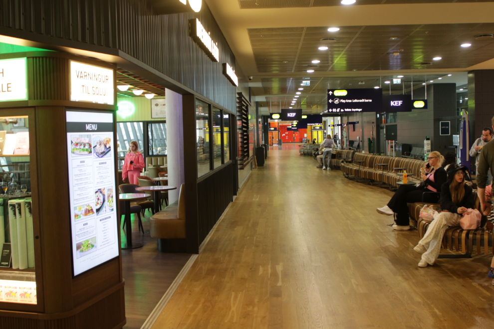
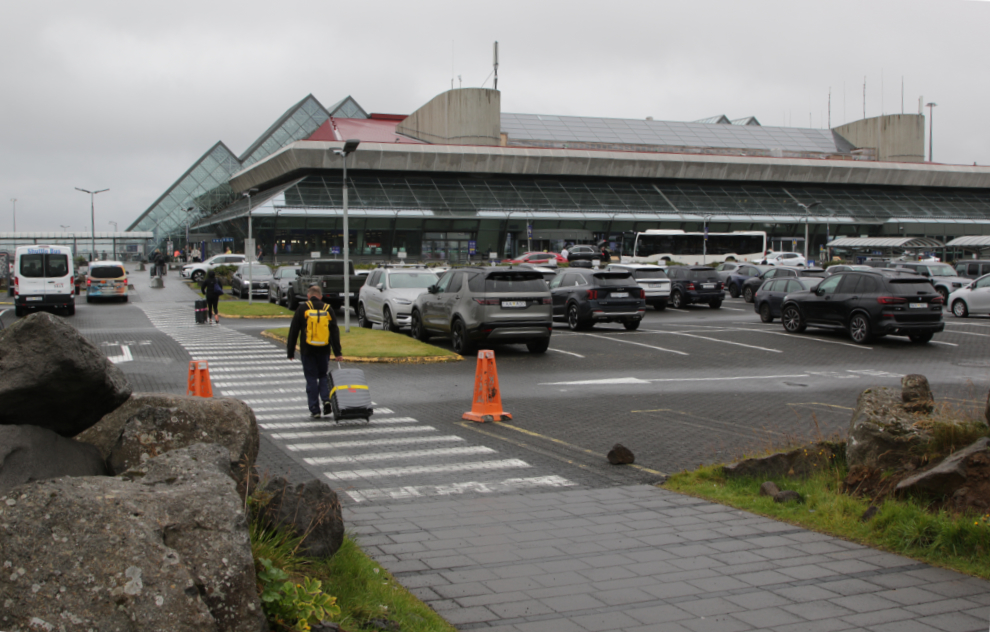
The next morning – Tuesday, July 29th – we got a fairly early start to arrive the requested 3 hours early for a 10:15 flight.
The walk back to the airport terminal was in a light rain.
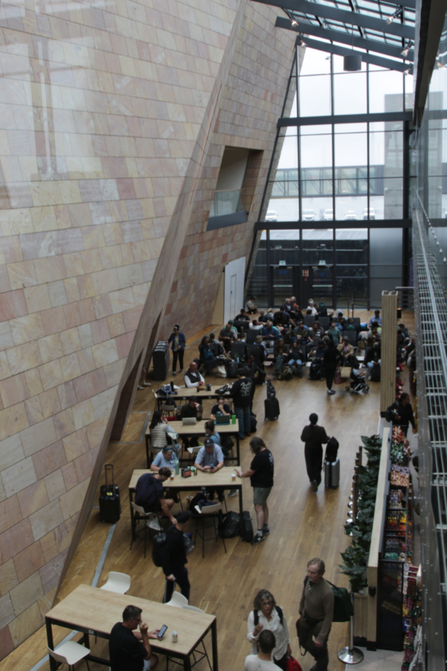
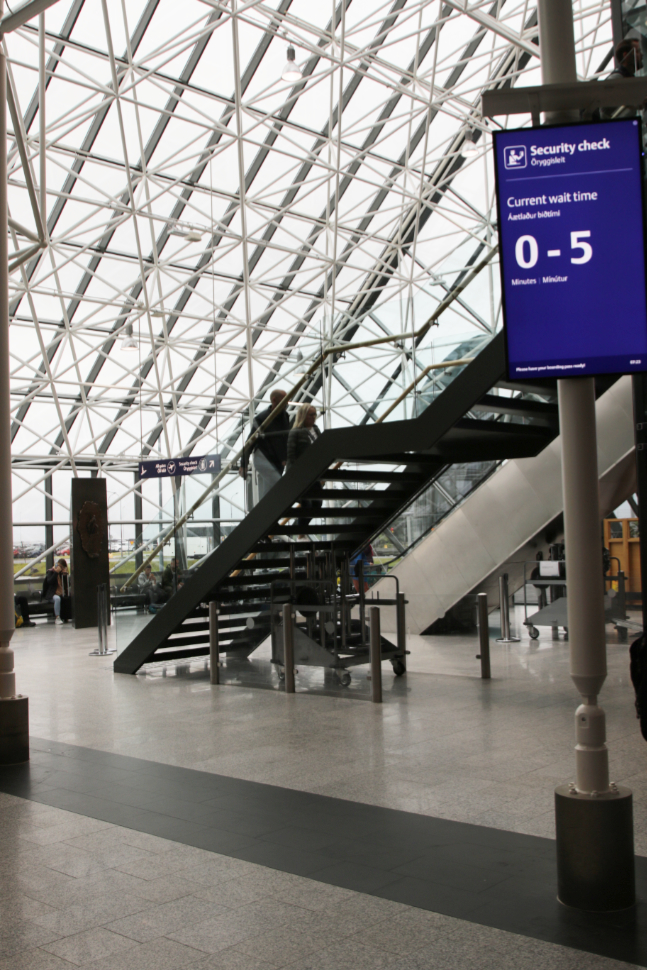
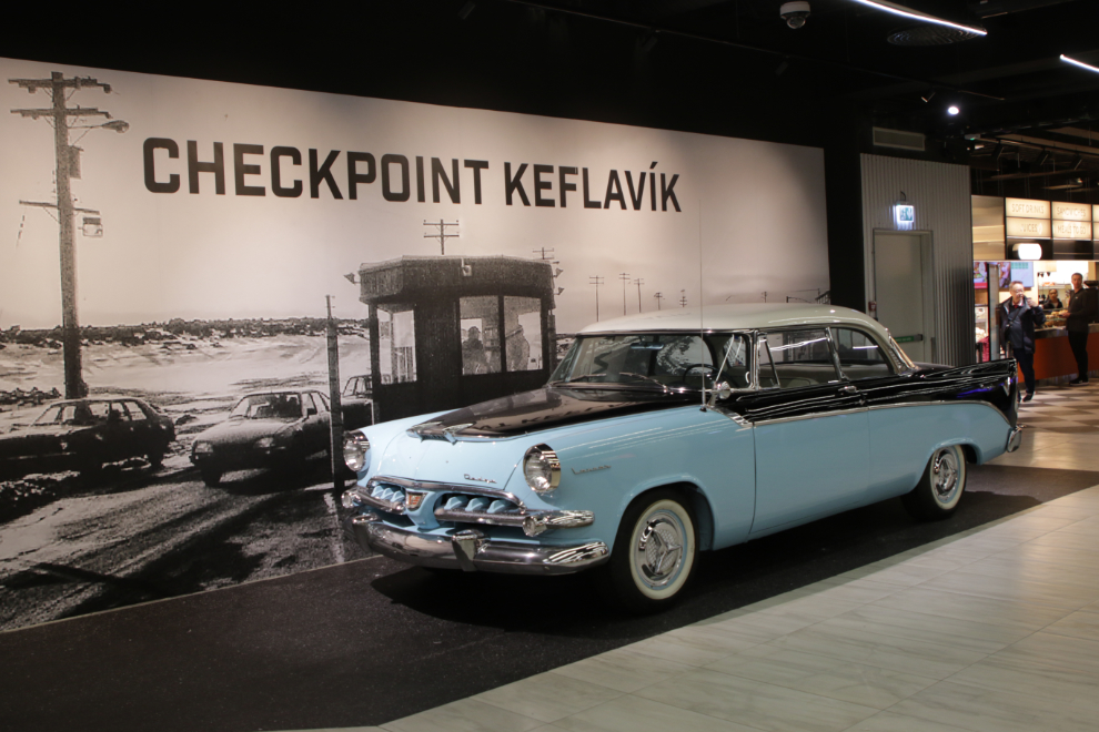
At first look I thought this was very cool, but from the top of the escalator I found it disorienting to the point that I had to hold onto a railing.
I loved the nicely restored 1956 Dodge Royal Lancer in this display 🙂
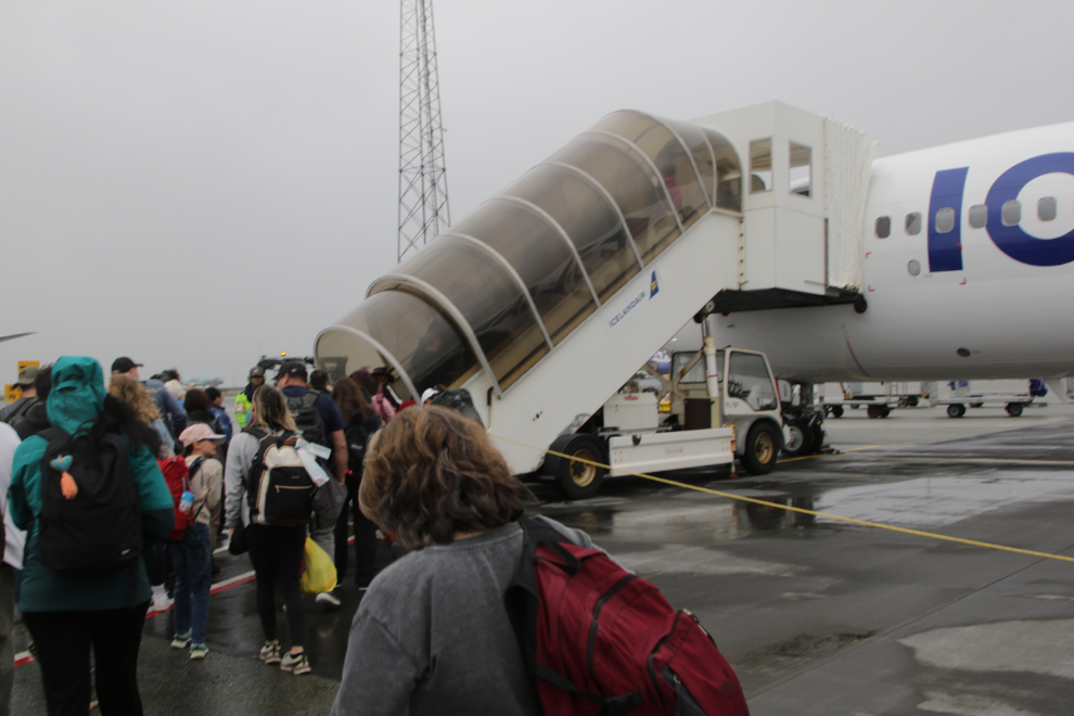
We took a bus out to the plane, as we had for the KEF-CDG flight a month before.
There would be no views of Iceland this morning, but I had my fingers crossed for Greenland and the eastern Canadian Arctic.
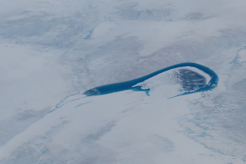
I got blessed, and the weather cleared as we neared the western side of the Greenland ice cap. The aerial images that follow were selected from 172 that I shot between Greenland and Whitehorse, almost all with the little Powershot. This was dramatically the best weather I have ever had for an over-the-Arctic flight. In every case, it shows places that I really wanted to see on the ground 🙂 Many of them have had very minor editing to improve visibility – commonly 3% darkening and a 15% contrast increase.
A bit less than 2 hours from Iceland, the skies suddenly cleared. I shot the first photo, of one of the many supraglacial lakes on the ice cap, right at noon Iceland time (I’ll keep using that time as a base). At this point I had been seeing the ice cap for a while, but there was nothing worth photographing.
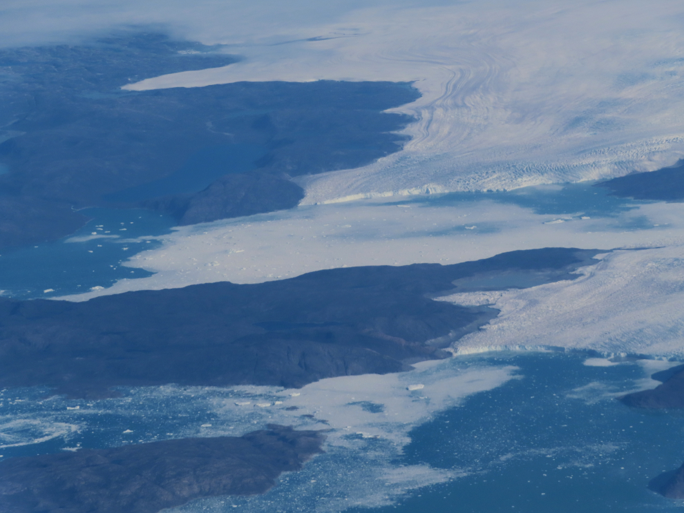
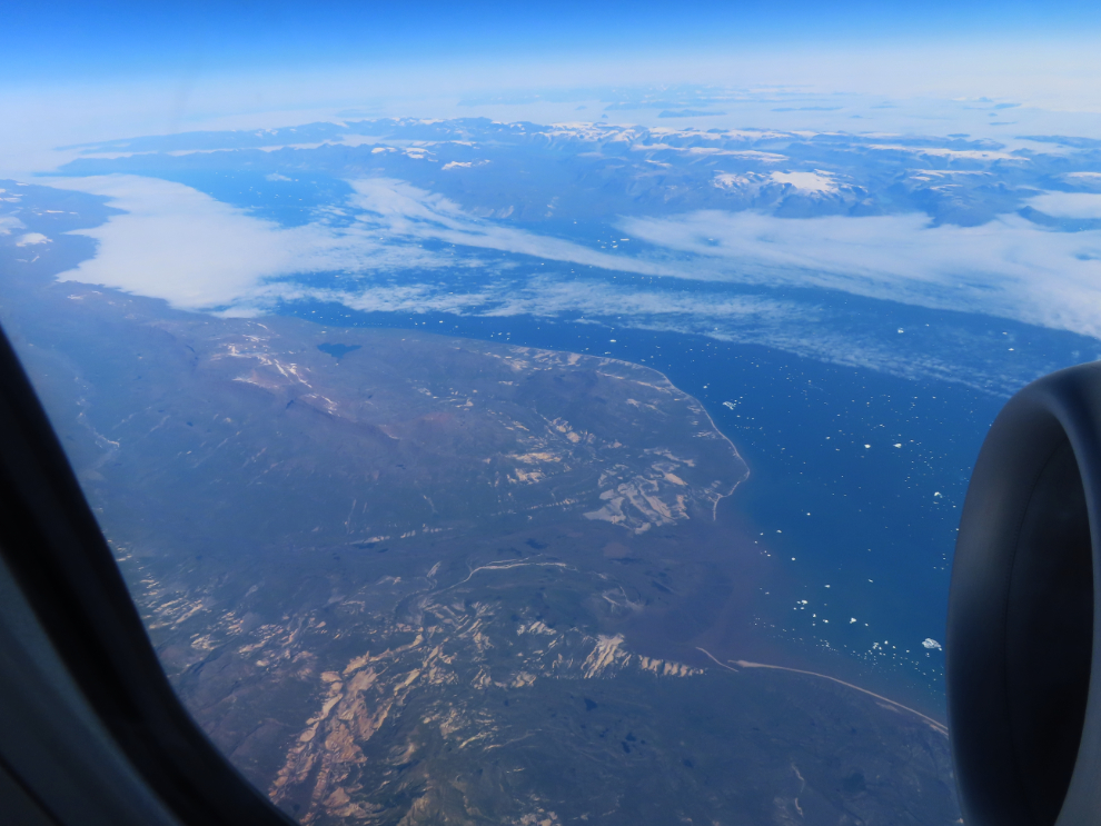
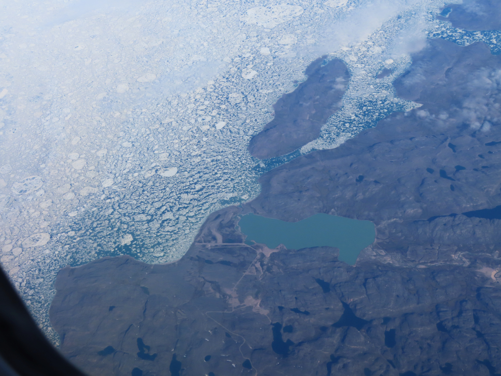
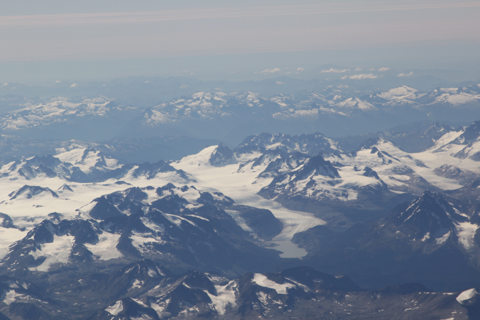
Just 3 minutes later, we were over the western edge of the ice cap, north of Ilulissat, about to head across Disko Island. This is the scene I had most wanted to see 🙂
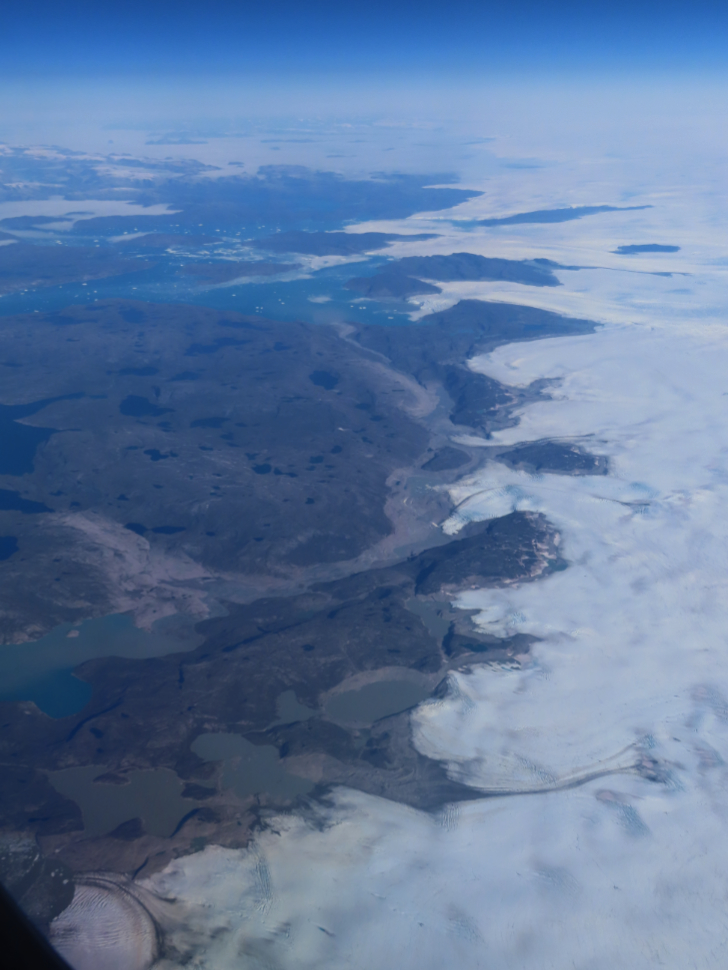
The next 4 photos were shot between 12:19 and 12:21.
It’s hard to guess how high that ice sheet face is, but it’s hundreds of feet.
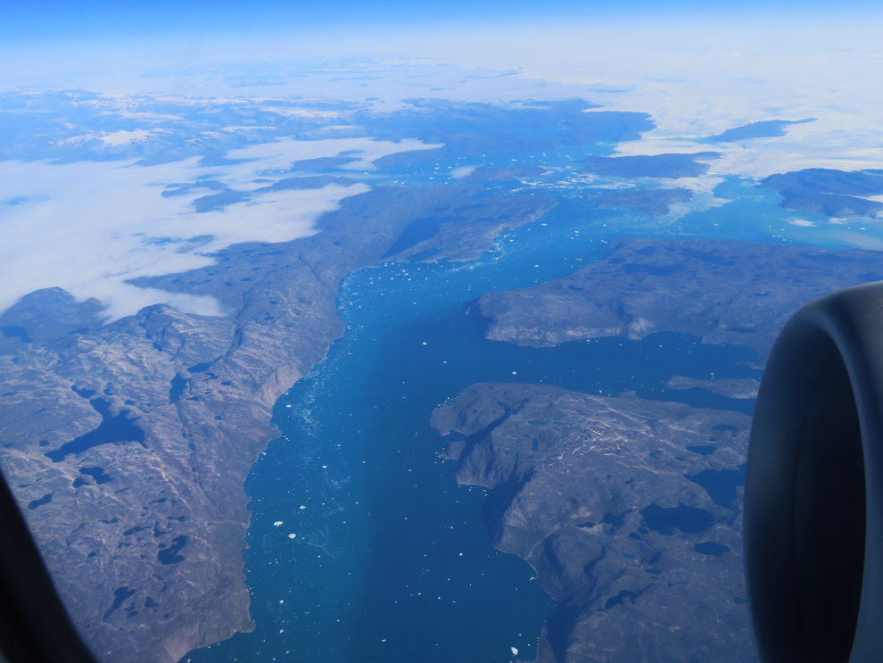
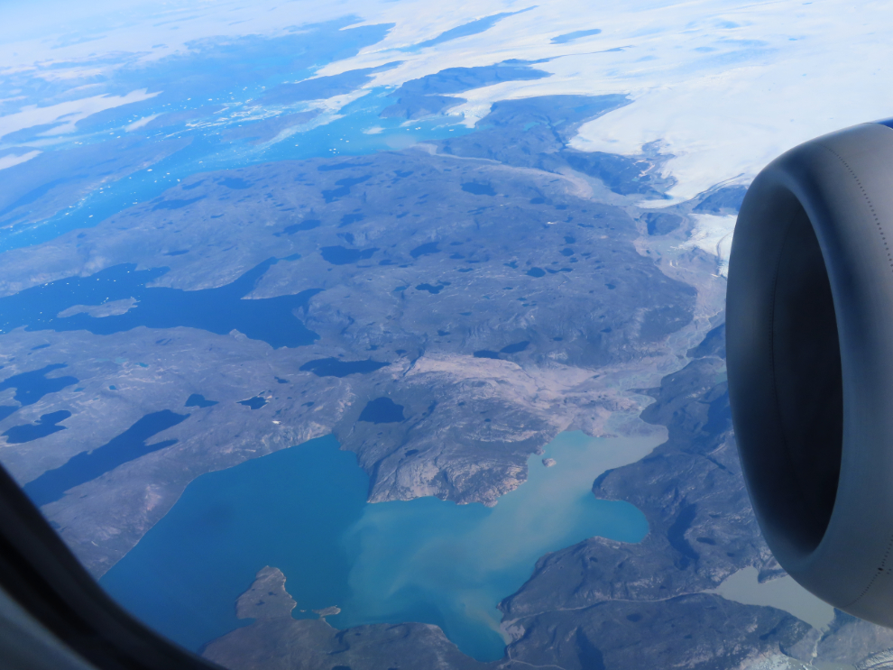
I occasionally took photos of our location map (and the flight stats screen) to help with identifying places. That’s Disko Island we were approaching.
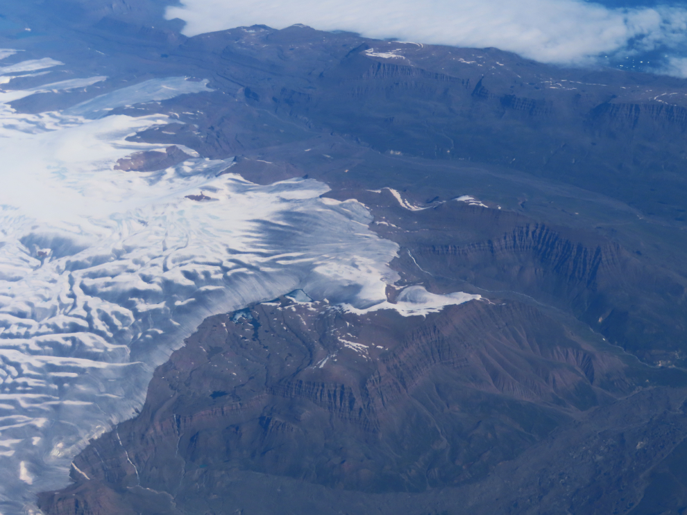
The next 4 photos, which I think show Disko Island, were shot between 12:24 and 12:31.
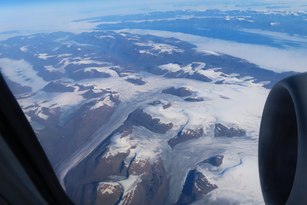
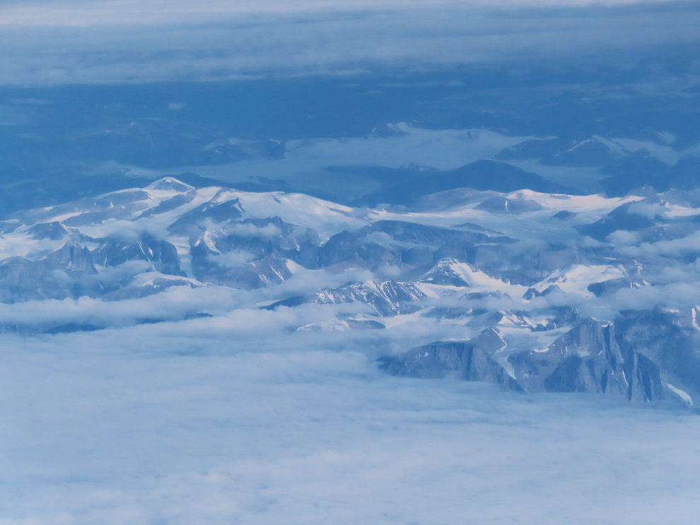
Davis Strait, which separates Greenland and Canada, was clouded over, but to the north I could see some impressive peaks. This photo was shot with about 250mm of zoom, at 1:15 pm.
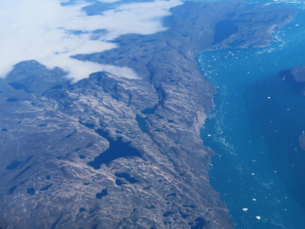
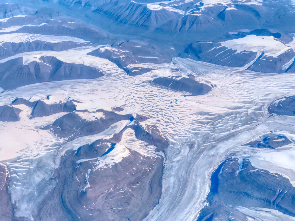
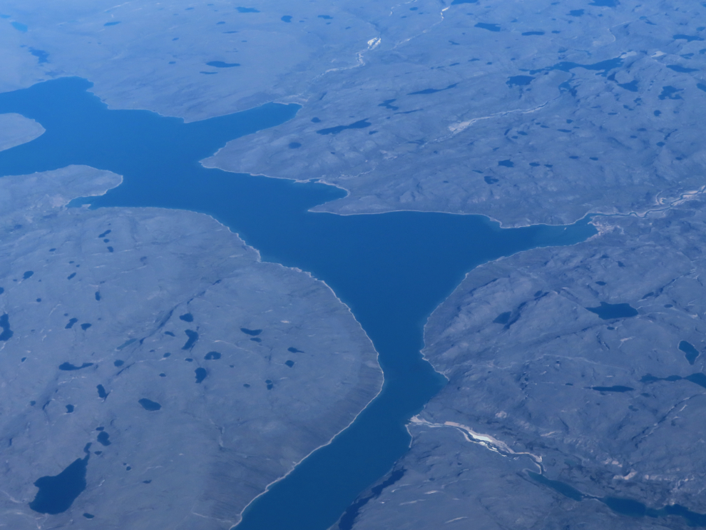
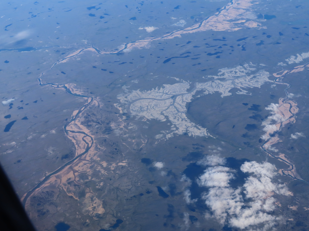
1:31 pm – the clouds had now cleared and we were over western Baffin Island. While I can find this large lake on maps, none of them name it.
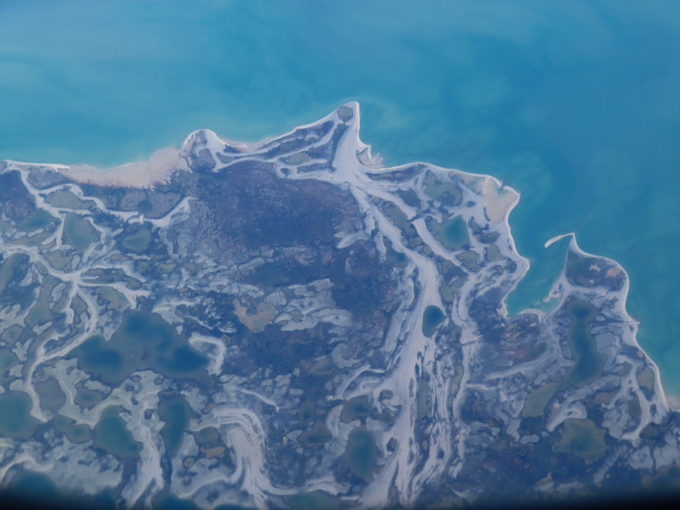
Bray Island, Nunavut, at 1:34. I think of images like this as rather like reading a book written in calligraphy, in Latin – I only understand a little bit of what I’m reading, but it’s beautiful in any case.
I tried to photograph places that would be easier to identify, but no luck yet with this one from 1:47.
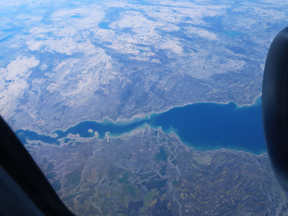
There even an airport near the centre of this one shot at 2:00.
By 2:12 we were nearing country with few readily identifiable features, northwest of Baker Lake.
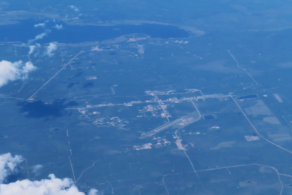
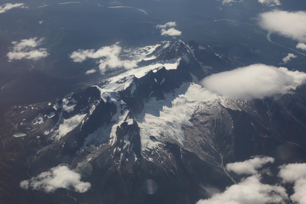
I only shot 16 photos during the next 2 hours, partly due to light wildfire haze, and the next one I’ll show you was shot at 4:15, of a small community in northern Alberta, I think.
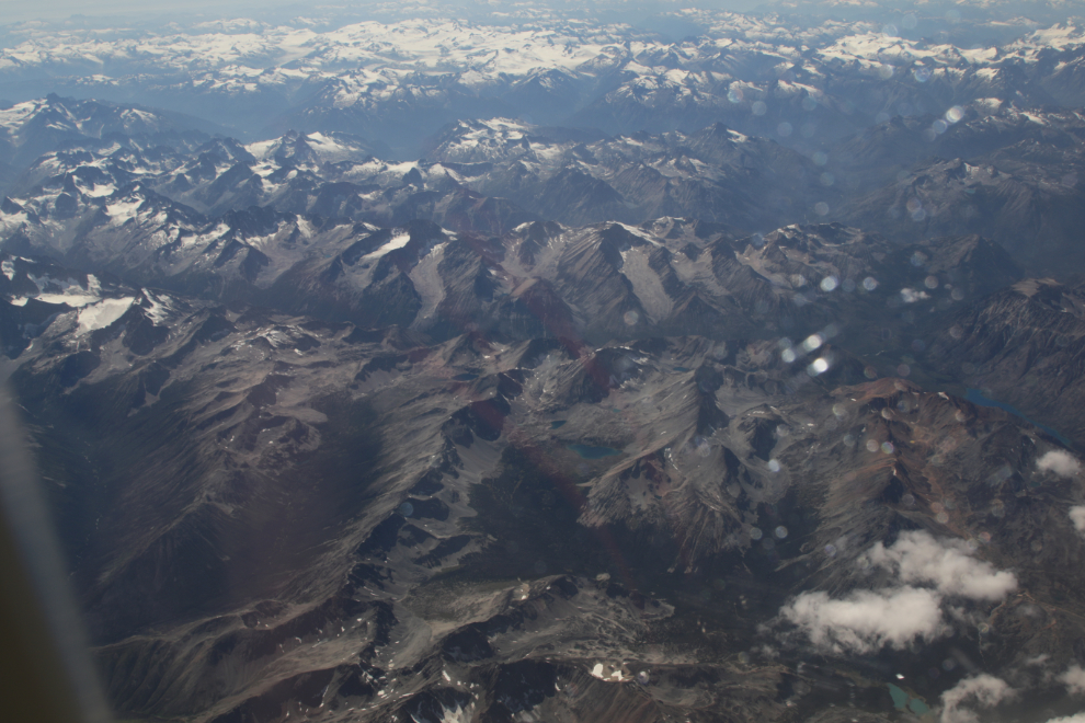
At 4:45 we had reached the Northern Rockies.
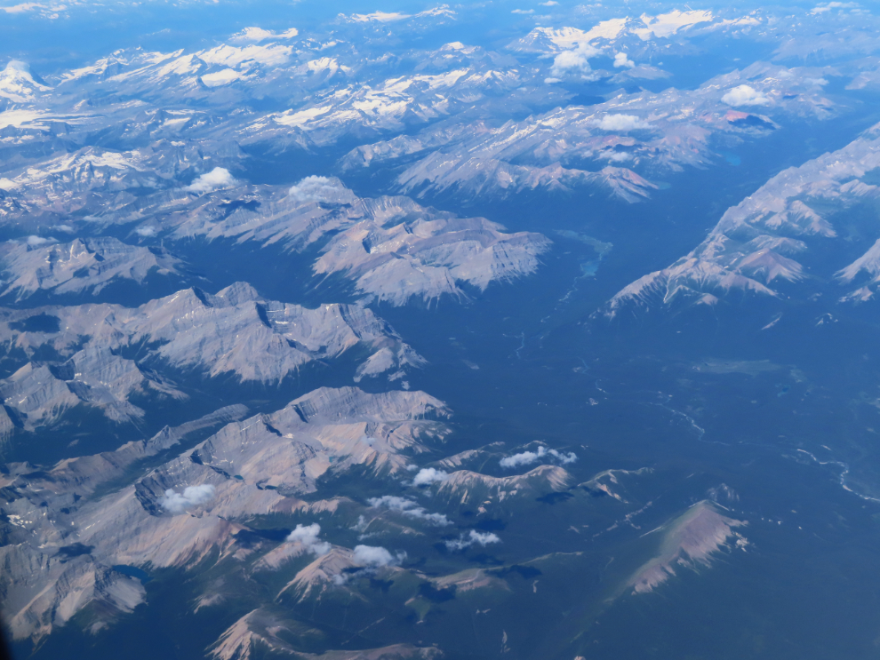
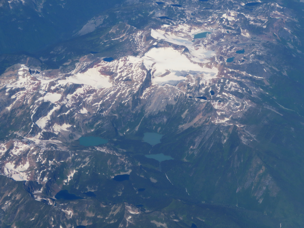
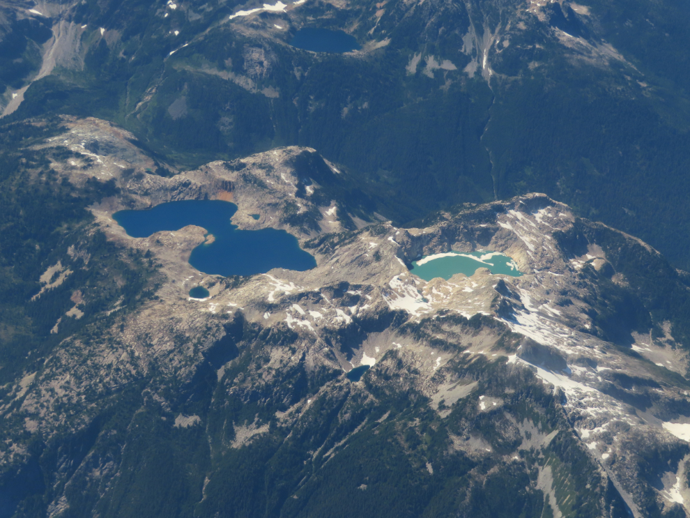
This incredible area of high alpine lakes was shot 10 minutes later. I used to shoot places like this with the idea of finding a way to hike in to them.
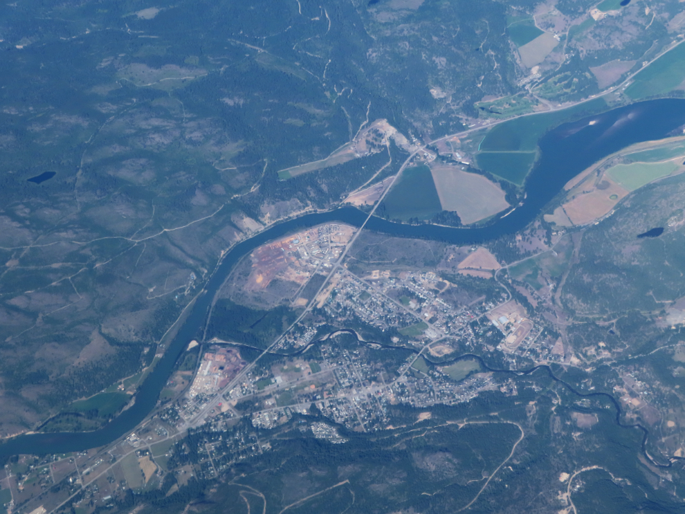
The community of Barriere, BC, on the North Thompson River, at 5:04.
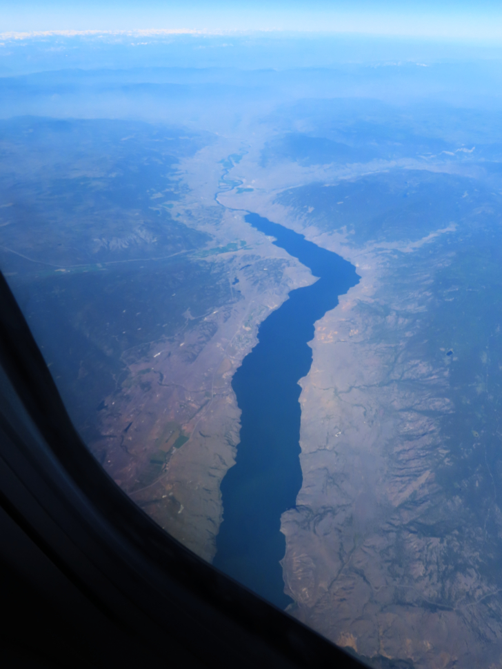
Looking west down Kamloops Lake 4 minutes later. We would have been pretty much over the city of Kamloops.
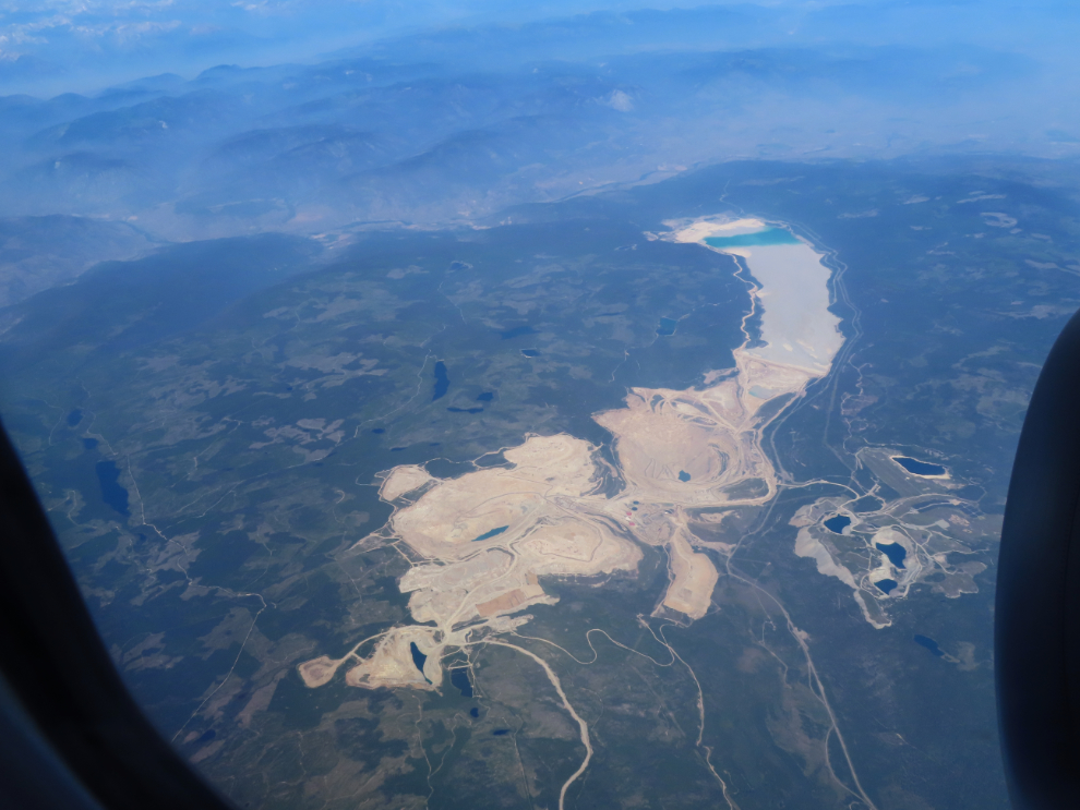
The Highland Valley Copper Mine, the largest open-pit copper mine in Canada. That tailings pond is almost 10 kilometres long.
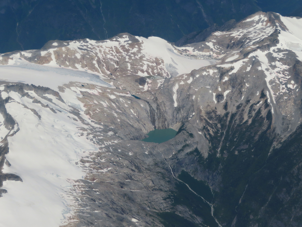
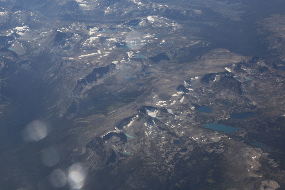
In my really hardcore hiking days in southern BC, I sought out lakes like this, and got into a few. These places are powerful, magical places to me. We flew over this one at 5:20 (still using Iceland time).
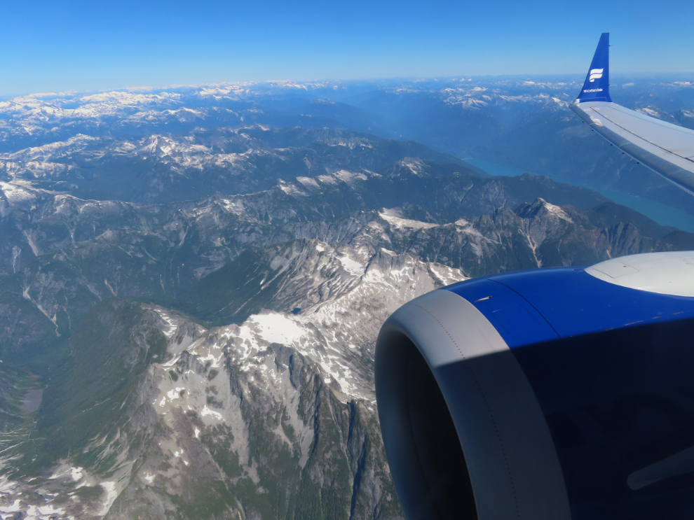
These are the mountains I used to live in for a couple of decades on my time off work – 5:22.
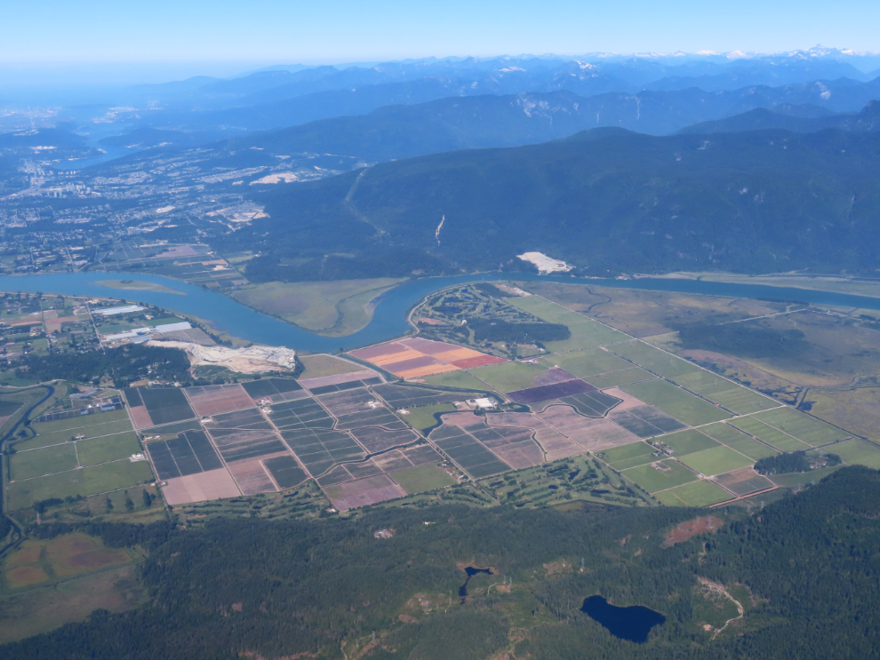
At 5:28 we reached civilization again – this is the Pitt River entering the Fraser Valley, about 35 km by air from the Vancouver airport.
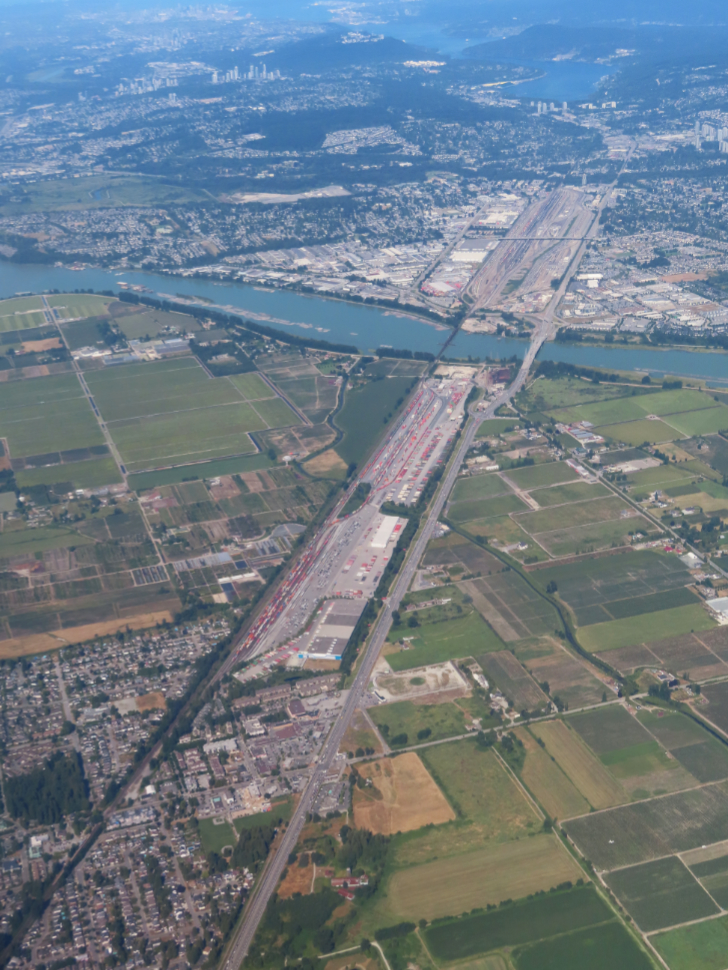
The huge rail yard and Intermodal Facility at Pitt Meadows, and the PortCoquitlam railyard beyond.
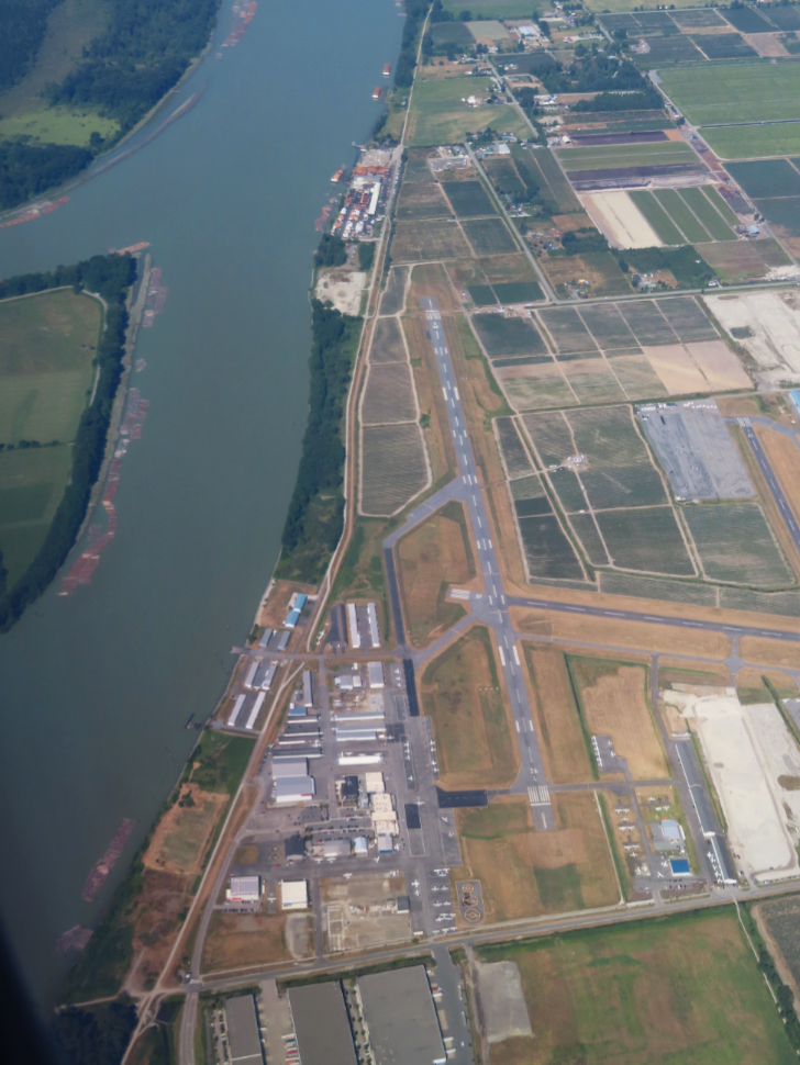
Pitt Meadows Airport, where I put in my first 60 hours or so of flying in 1967-68, mostly flying Fleet Canucks with the Aero Club of BC.
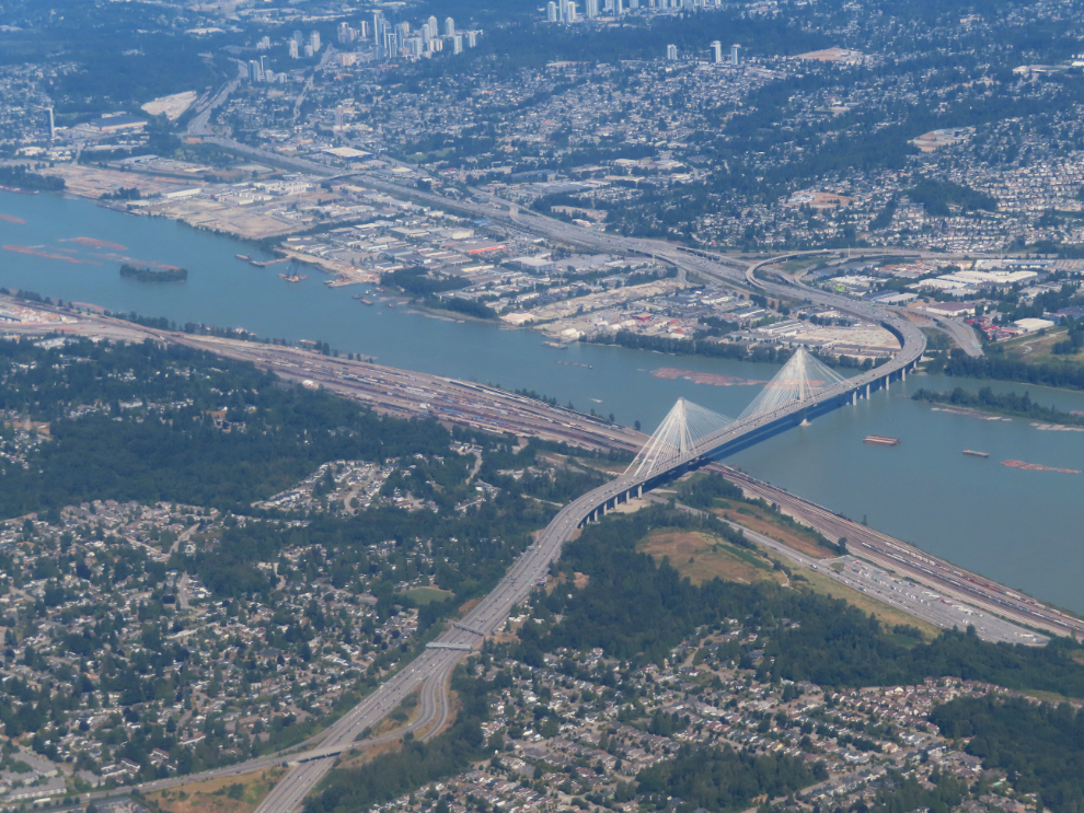
The Port Mann Bridge, 2,093 meters long and carrying 10 lanes of traffic, opened in 2012.
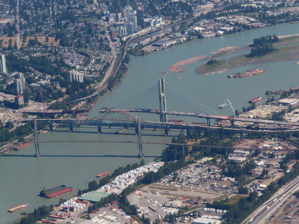
The Fraser River at New Westminster, with construction of a new bridge to replace the Patullo Bridge coming along nicely. Three minutes later, we touched down at Vancouver International Airport (YVR).
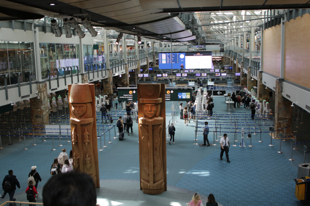
Switching from Icelandair to Air North, and International to Domestic terminals, meant that we had to pick up our luggage, leave and start the process all over. But we had lots of time (about 3 hours), so no sweat.
With fresh comparisons in my mind now, YVR is a great airport in every way 🙂
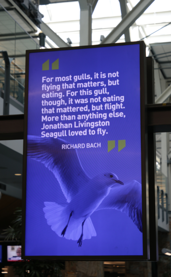
At the luggage carousel there were large screens with rolling ads. But not just ads. Every few ads, a great quote about flying was shown. Brilliant – I’m sure many people like me will watch the ads just to see the quotes 🙂
We were able to check in and drop our luggage at Air North, then went upstairs and settled ourselves in the observation lounge for a while to enjoy the sunshine and the airplanes.
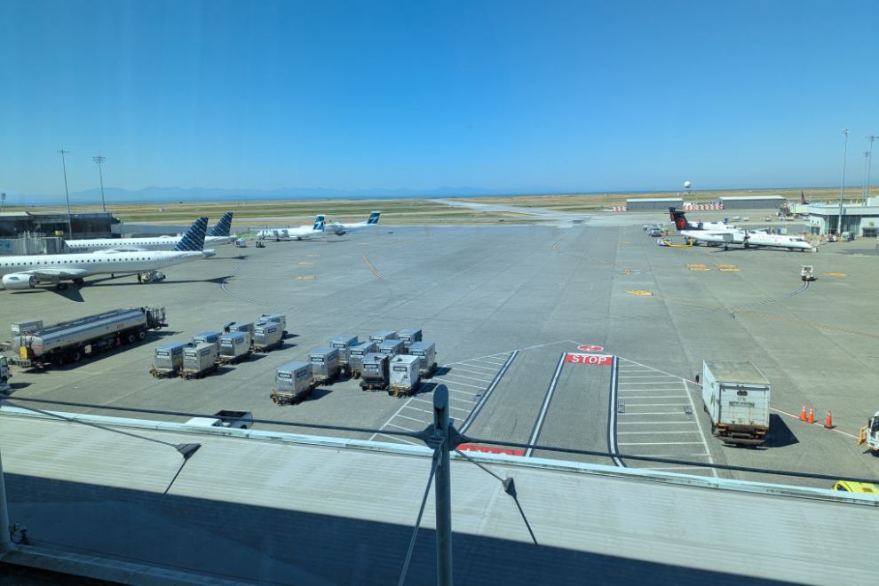
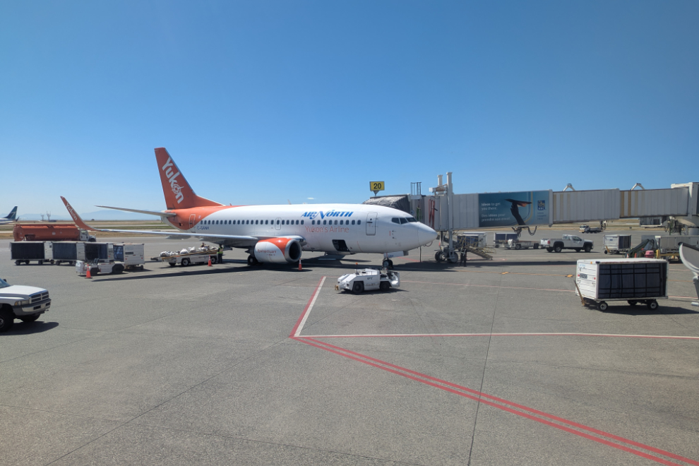
We eventually went back downstairs, went through security, and settled into new chairs at our gate. There were two Air North 737s there – I don’t see that very often.
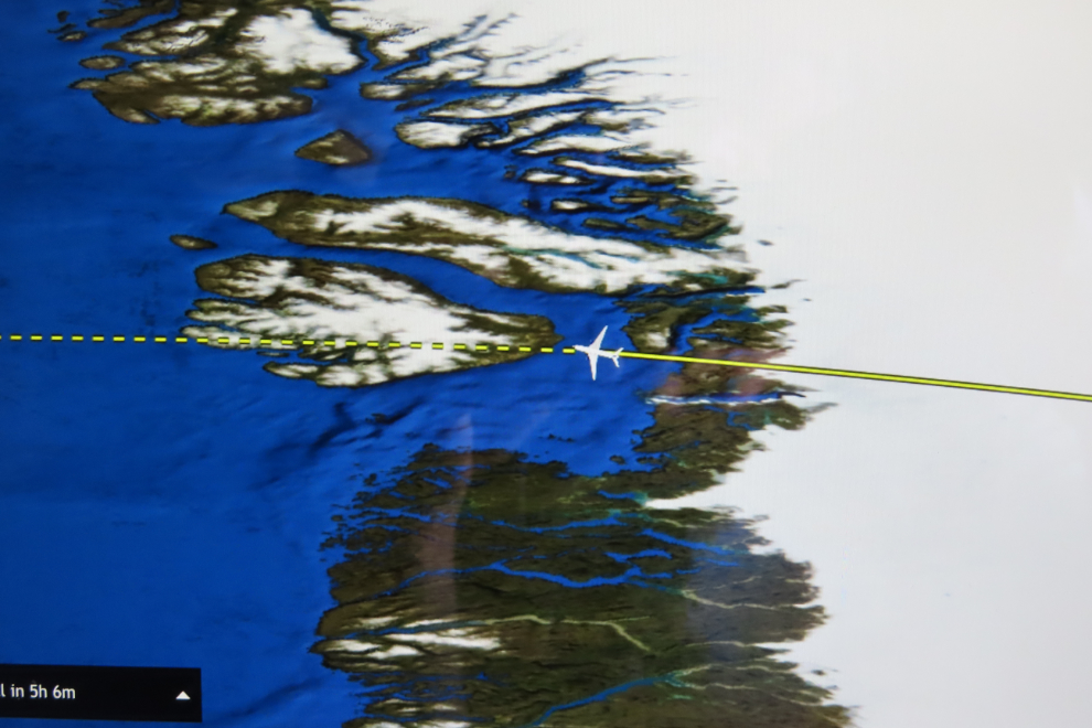
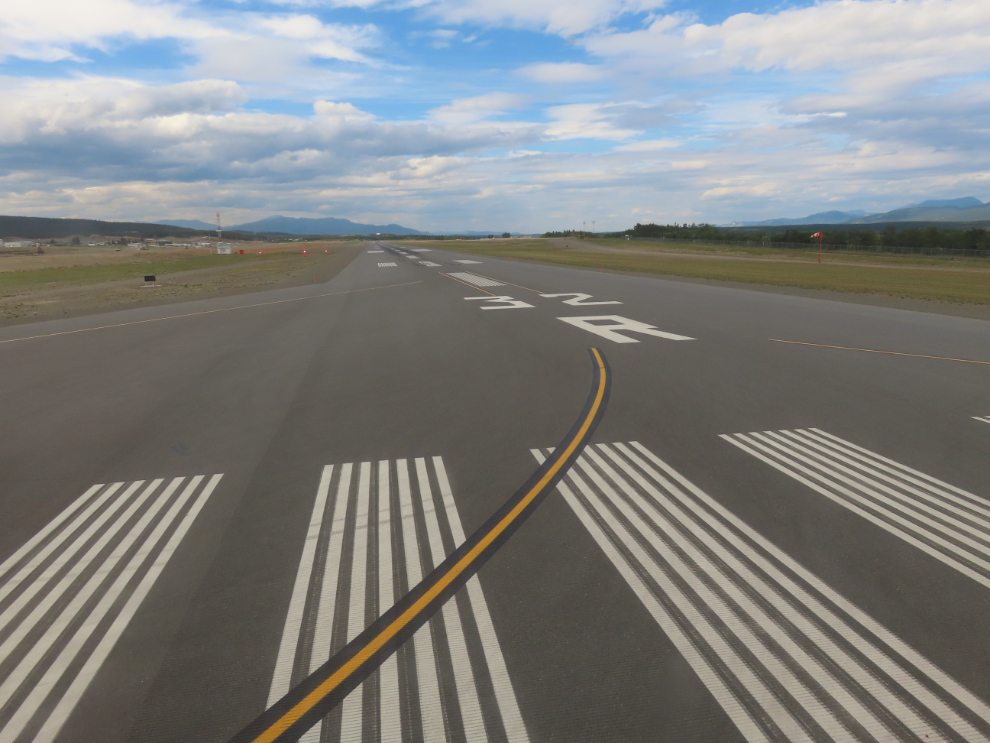
Some views of the flight north to Whitehorse, which I’ve recorded in detail a few times. This time our flight path was 30-40 miles east of the usual one.
And this photo marks The End of a truly incredible Adventure. Our house-sitter, pet-sitter, and dear friend MJ picked us up, fed us when we got home, and I was soon in bed asleep 🙂
Murray,
Firstly, what an amazing adventure! Secondly, I’m so pleased to hear of the progress you have made with your health situation, how far you have come, the work you’ve put into getting yourself to this point where you could even entertain a trip of this magnitude! Thirdly, despite a few days of brain overload, you have managed to capture and document this amazing once in a lifetime trip with Cathy. Well done !!! I wish you continued good heath and enjoying the wonders of this beautiful world we live in. Thank you for taking me along, vicariously with you. 🙂
Thanks very much Bill. It certainly was an amazing Adventure, and I’m really pleased that you came along. I fairly regularly, on particularly challenging days, have to go back into my journal to remind me of how dar I have come since my injury 6 years ago.