Back to the White Pass for a few days
With my health improving, I’ve worked my way slowly up to a normal outing with the motorhome, and the White Pass, 90 minutes south, has been my location each time. First a single day with the car 3 weeks ago, then 2 days with the motorhome, and I’ve just returned from a wonderful 4-day trip with it. The trip was so varied that I’ve had to break it into 2 blog posts to accommodate a selection of the 381 photos remaining in the folder after editing.
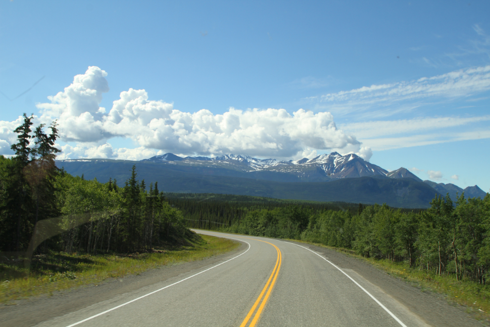
The first photo was shot on Tuesday, June 30, at 10:45, as we were driving down the South Klondike Highway. At this point I didn’t know how long we’d be gone – a few days was all I had in mind. The length would depend partly on the weather – the forecast was quite erratic.
At 11:35 we reached the Highways and Customs camp at Fraser, BC. Some construction, likely new services to the Customs post, necessitated a little detour through the Highways yard.
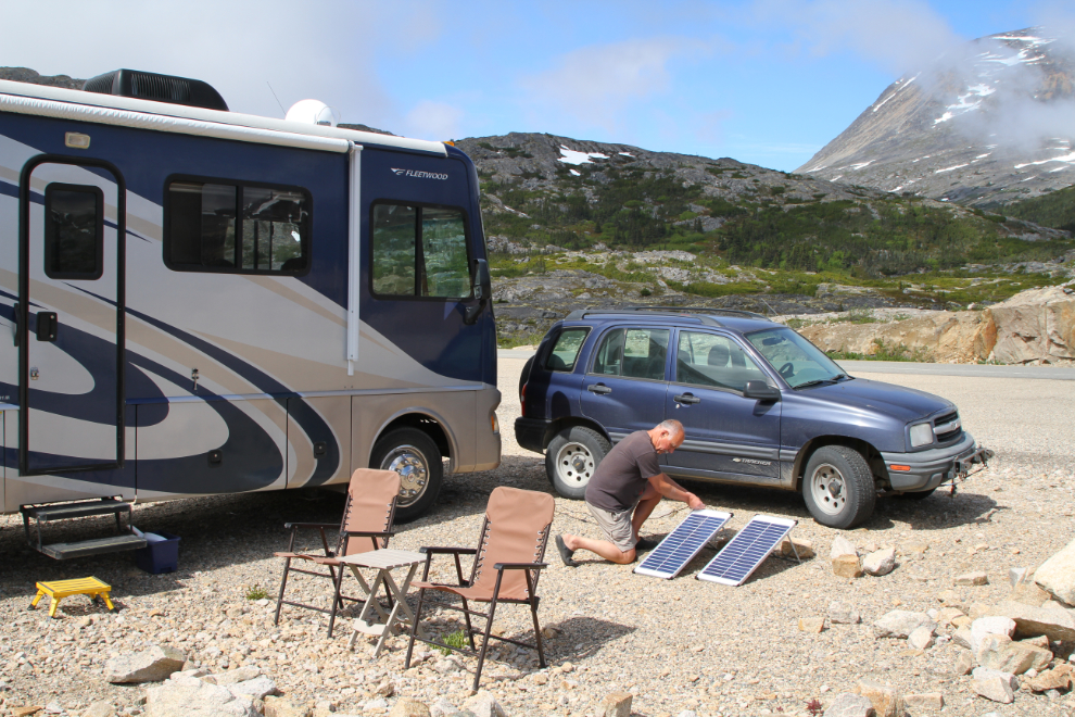
The spot I chose the last time down, on the north side of Summit Creek, worked out well, but this time I parked the rig 90 degrees to the highway instead of parallel to it, so it would serve as a wind break. By 10 minutes after noon I was almost finished setting up camp, with the solar panels set up to keep the batteries charged.
We went for a short nap, but by 1:30 were out for a short walk. It was extremely windy.
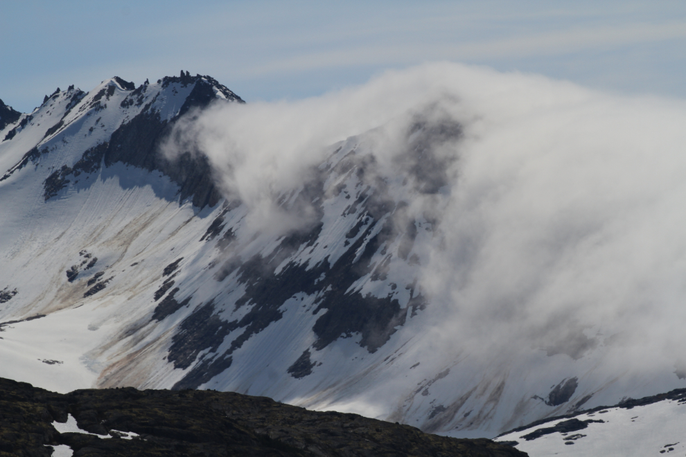
Clouds were trying to sneak in from the coast, but a fairly strong high pressure area was keeping them at bay.
My wind meter was showing sustained winds of about 25 mph at 7 pm, but in the next photo I had caught a gust of 52 mph, and a minute later, there was one that hit 68 mph!

Wednesday, July 1, Canada Day, dawned with some blue sky but clouds both to the south and north, and the wind was still screaming. By 09:00, a nasty-looking storm with heavy rain was moving in from the Yukon.

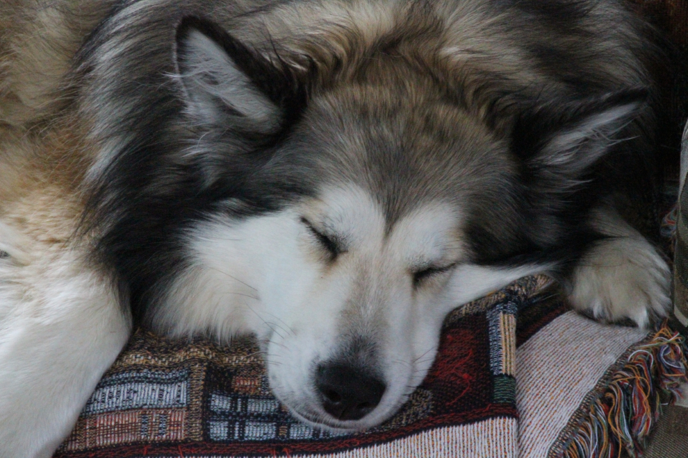
Bella doesn’t mind storm days! 🙂
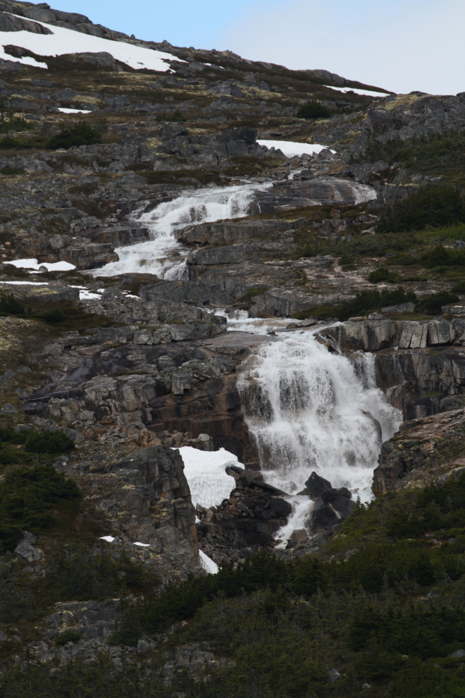
The storm moved through fairly quickly, and about 11:30, we went for a short drive to the south. The waterfalls along the International Falls trail were roaring – this series was shot from the highway with a 400mm lens.
In a normal year this pullout at the “Welcome to Alaska” sign would be jammed with cars and buses.

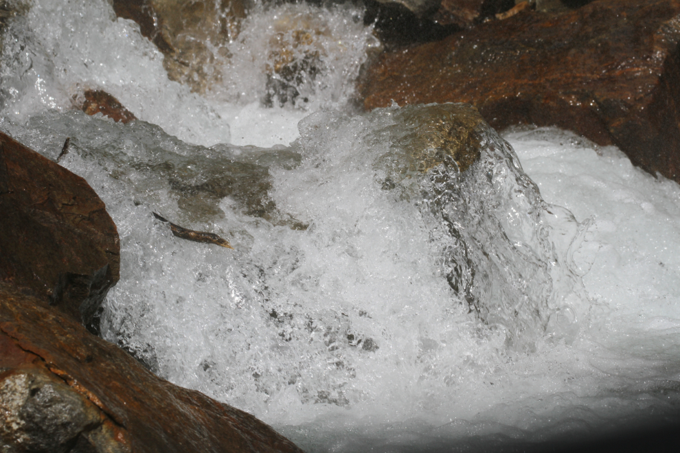
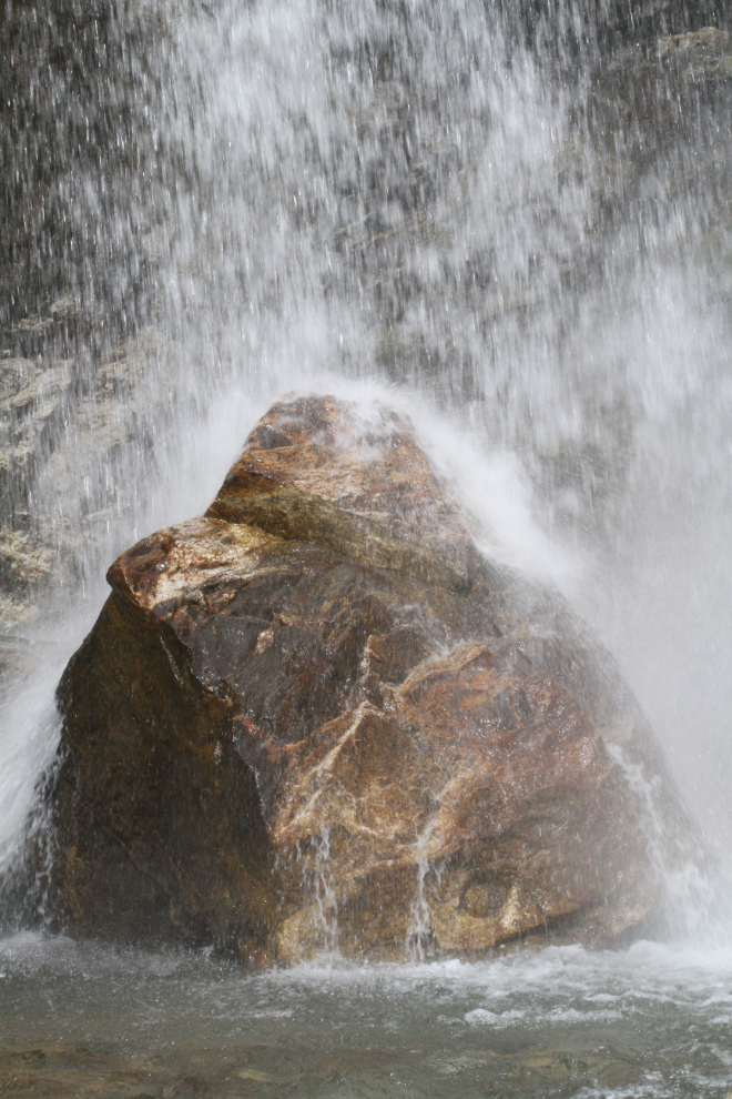
I drove down to the largest waterfall along the highway, at Mile 10. It’s often called Bridal Veil Falls, but Bridal Veil is actually much larger, out of sight below the highway – the railway offers a great view of it. Sometimes it’s the details of the cascading water rather than the big picture that I enjoy.
The wind is normally from the south in the White Pass during the summer, but for much of this day it was from the north so my camp setup to shield us from the wind didn’t work as well as I’d planned, and we spent much of the afternoon inside the rig looking out.
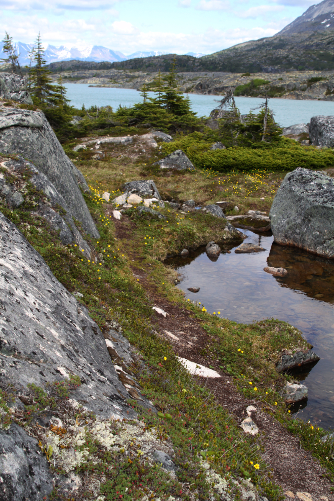
Just before 5 pm, I decided to make another try for the beach, which all the fur-kids love. The trail down to it is lovely, now lined with flowers in a few places.
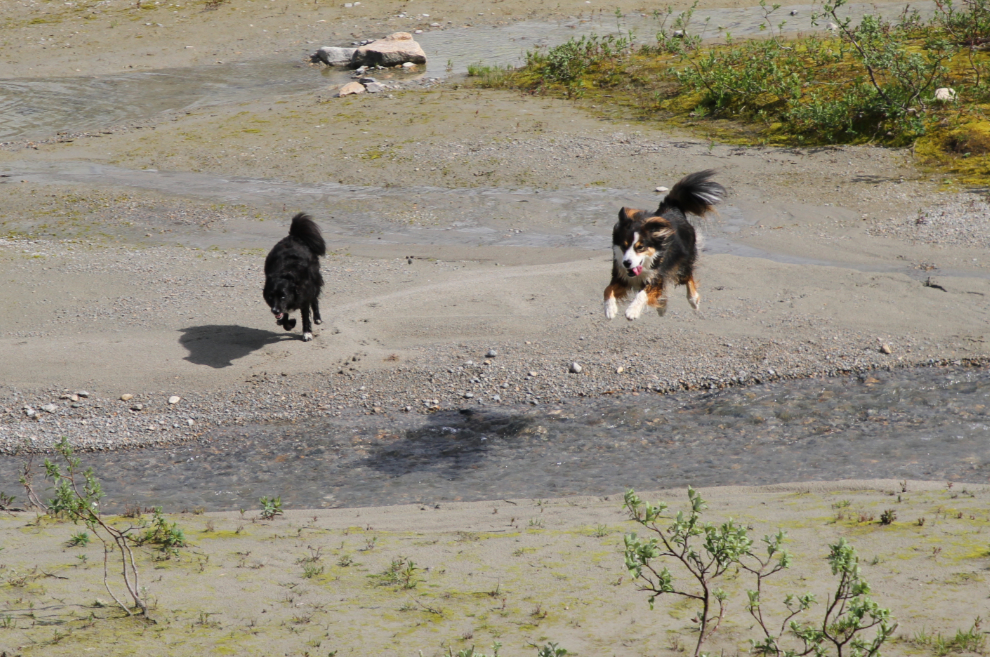
The kids all went nuts on the beach! When Granite, jumps, he doesn’t mess around – he can get some serious elevation in his flights 🙂
A flock of Canada geese was cruising around near the beach, and when they came fairly close to us, Bella decided she could get to them, and Tucker and Granite decided that was a good idea. The geese were clearly teasing the dogs, and I was a bit nervous that it would convince Bella to go out further than her ability to get back. I’d be very unhappy about having to swim out in that icy water to rescue her!
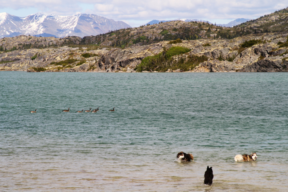
Bella didn’t get her goose, but sure had fun trying 🙂
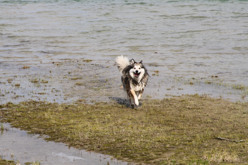
They played and they played and they played!
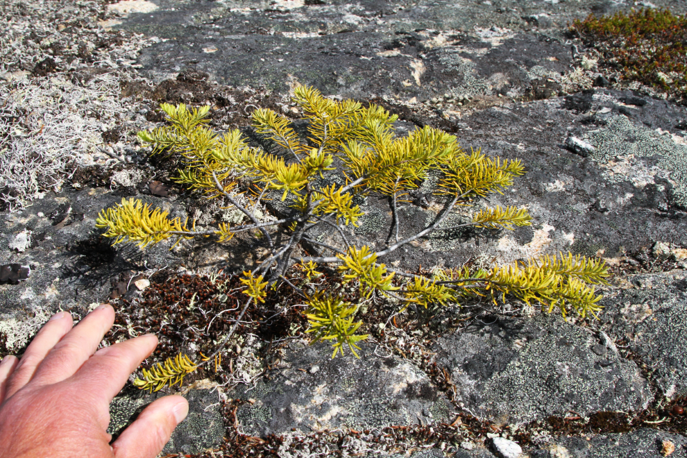
I could only deal with the wind for about half an hour, and we headed back to the RV for dinner. On the walk back, I spotted a particularly beautiful little bonsai. Mother Nature’s unique creations up here never cease to amaze me.
At 7:30 that evening, we took a short walk on the opposite side of the very quiet highway – during the entire day there had been perhaps 15 semis and half a dozen cars. The next photo looks back at our camp during that walk. In a normal year, this is a very popular spot for tourists to stop and take pictures, so we camp half a k further south – this spot is much nicer.

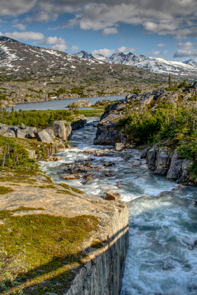
Looking down Summit Creek from the highway bridge. I processed this image as an HDR to bring out the details in the shadows.
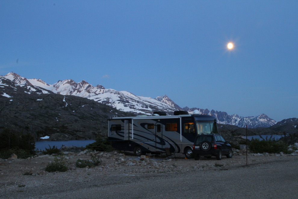
We went to bed fairly early, but something woke me up just after 11 pm, and it was so beautiful I went for a walk with my camera equipment and no dogs. This was the view to the north from right in front of the motorhome, at 11:20.

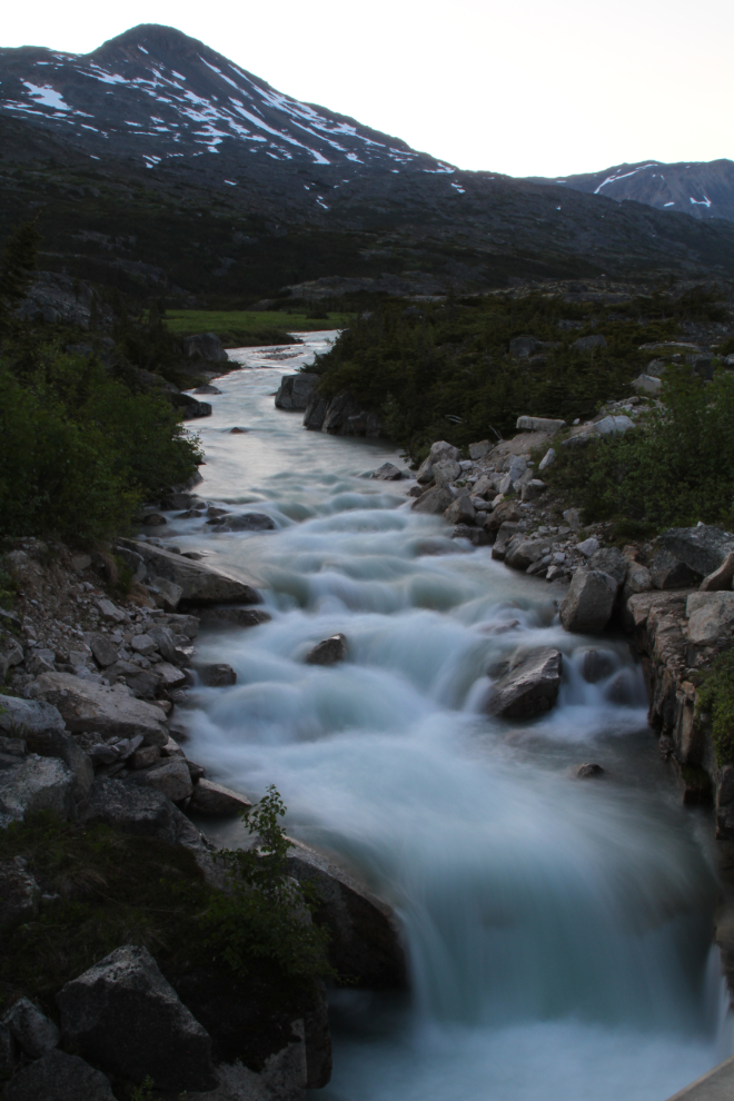
At 11:40 pm, I shot the view down Summit Creek again. This, however, is a 25-second exposure due to a neutral density filter (ND8) used, with ISO 100 and f20.

This image of Taiya Peak and Summit Creek from the opposite side of the highway bridge was shot 10 minutes before midnight. This is a 20-second exposure, also with ISO 100 and f20.
I tried many locations and camera settings to get a shot of me walking down the highway at midnight. By the time I got this one, it was 13 minutes after midnight. While I could do anything I want with the lighting, this light level is what it actually looked like.

Midnight:23 – every time I look at this photo, I want to pack up and go back down there. It is so powerful, yet so serene.
Going back to bed at “zero dark 30”, I spotted this scene through the RV window, and grabbed this shot. It’s grainy because it was shot at ISO 6400 and 1/2 second, because I didn’t feel like setting all my gear up to do it properly. Good night. 🙂
The story continues tomorrow…