Fall colors on the Haines Highway
Doing a Fall Colours tour is a must for me, and yesterday I headed out to what is normally a particularly good area, the Haines Highway. With sunshine and temps nearing 20°C (68°F), my motorcycle was the vehicle of choice.
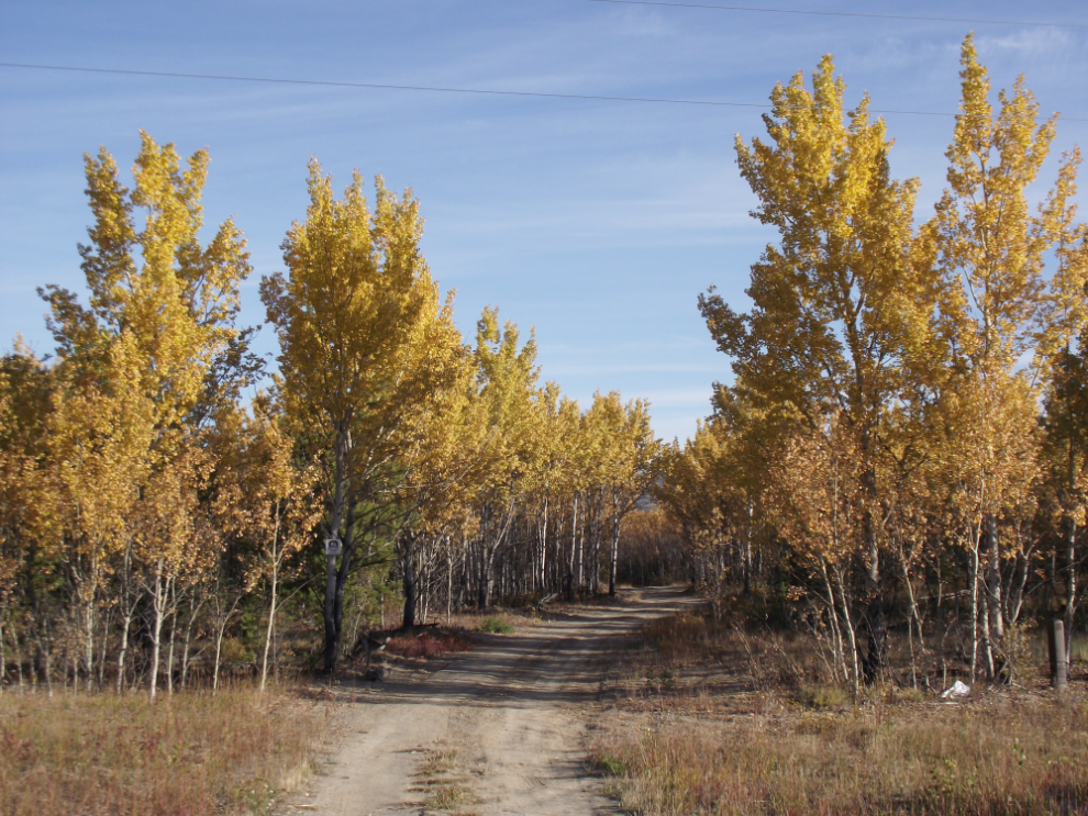
This side road at Km 1470 (50 km west of Whitehorse) was my first photo stop.
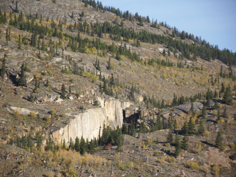
For over 20 years this geologic anomaly has intrigued me. Some day I must make the cross-country hike (a couple of miles one way?) to see it up close. It’s north of the highway at Km 1477. [Edit, 2022: this has become a popular hiking location, now called Spirit Canyon]
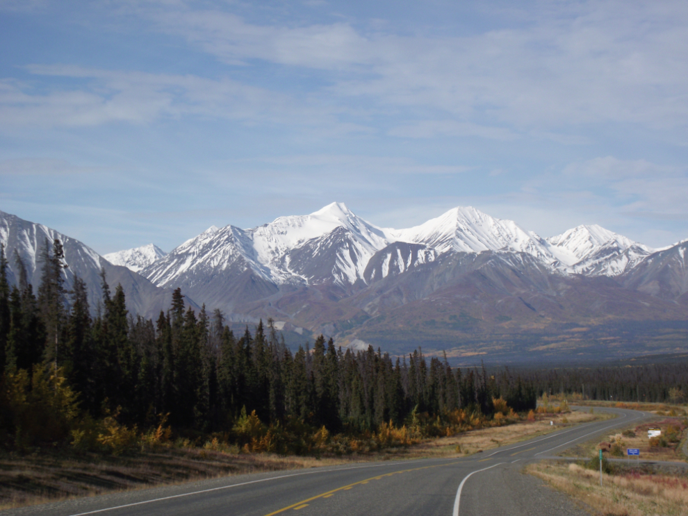
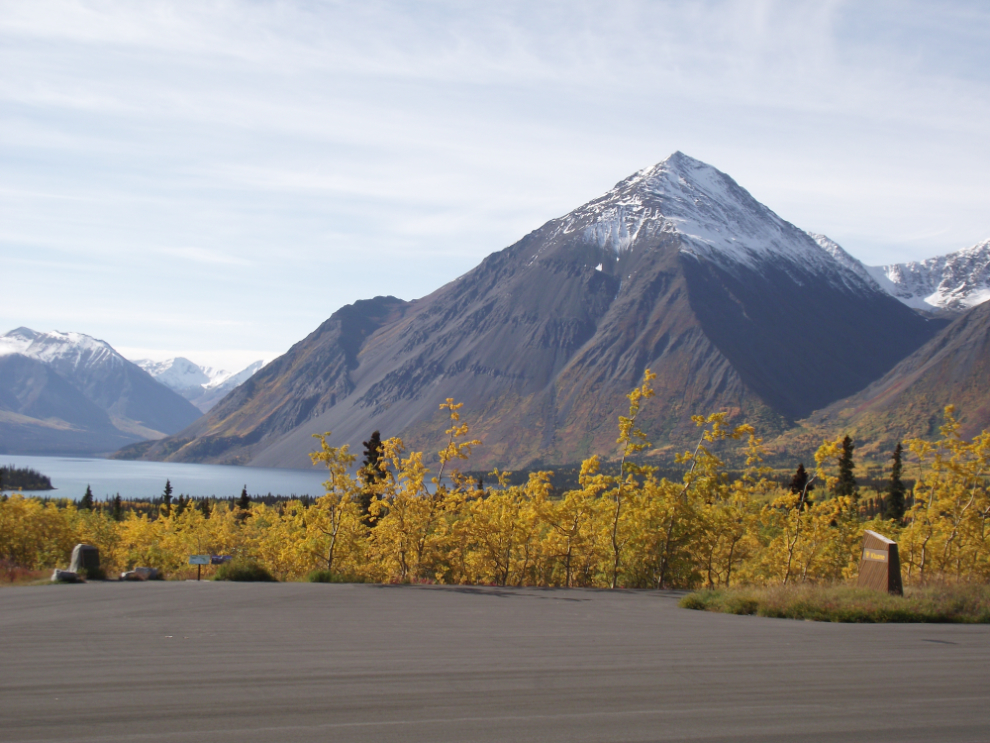
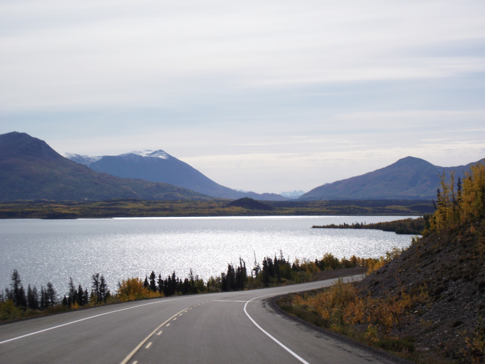
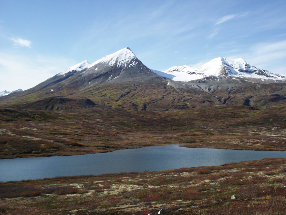
The Kluane Range from Pine Lake, Km 1572.
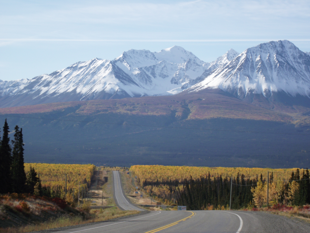
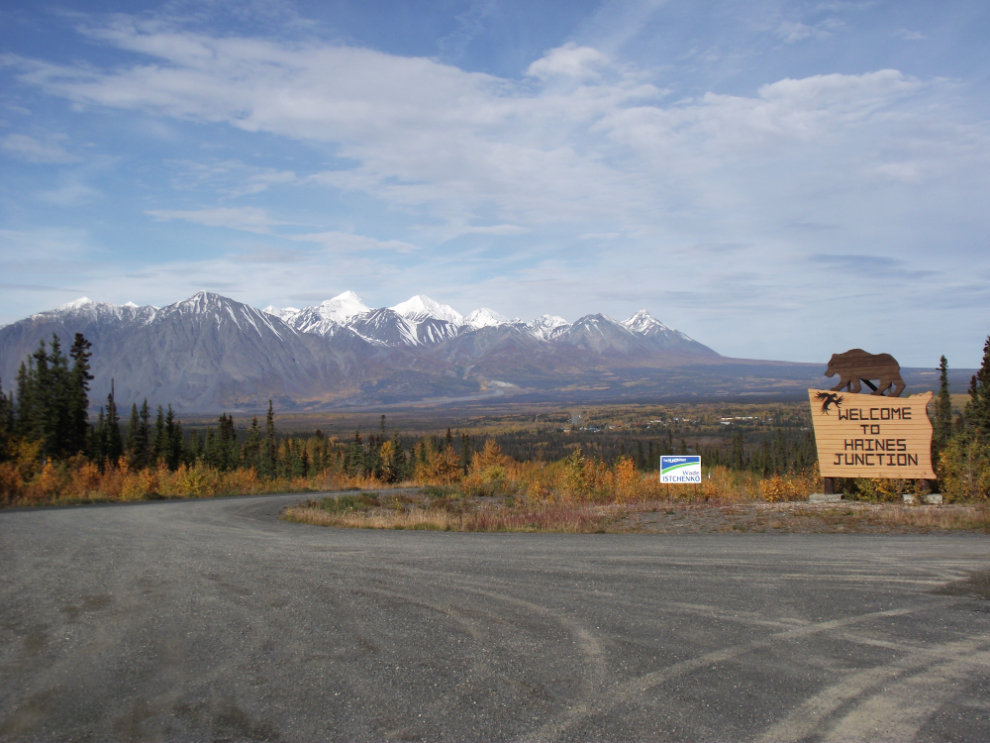
The dramatic approach to Haines Junction always stops me (at least mentally when I’m unable to stop physically).
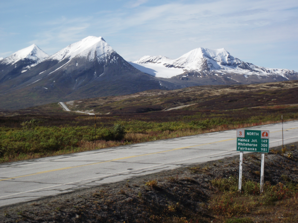
Looking back at Haines Junction from the Haines Highway. This is just south of a sign that says there’s no fuel for 203 km – which is at the 33 Mile Roadhouse 33 miles north of Haines.
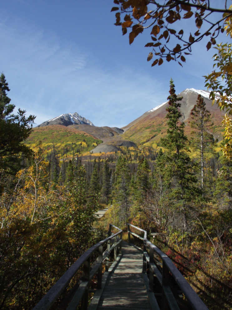
The start of the Auriol Trail, a 15 km (9 mile) loop that takes 4-6 hours. In this area, as soon as you step off the highway you’re in Kluane National Park. The trailhead is at Km 239. See “Hiking along the Haines Highway” for information about all the trails.
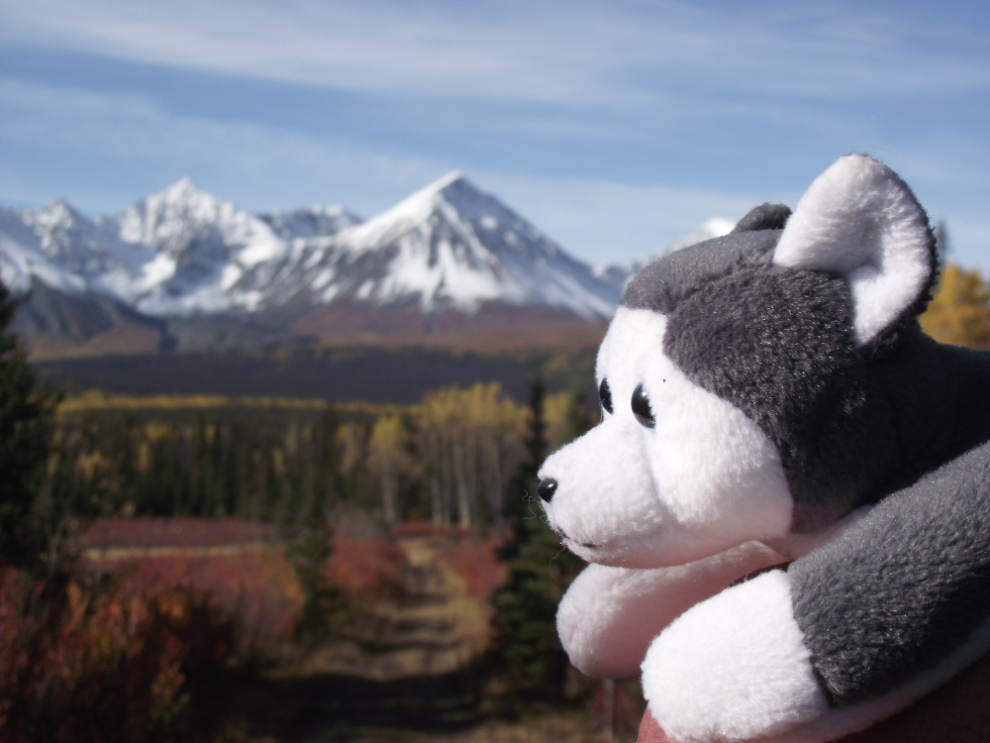
Nanook visits Kluane National Park! 🙂
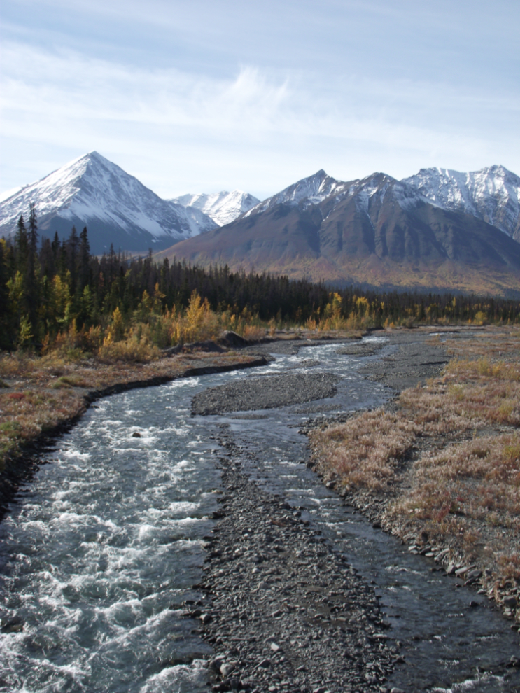
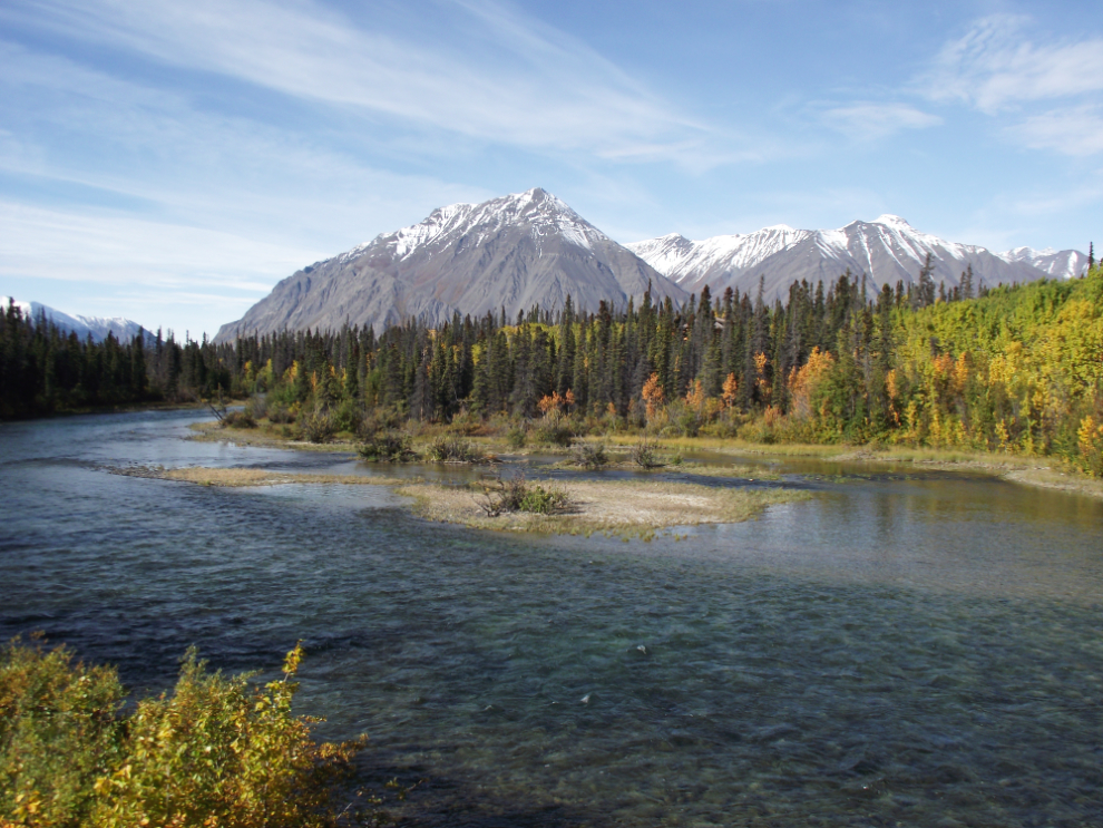
Quill Creek at Km 233.
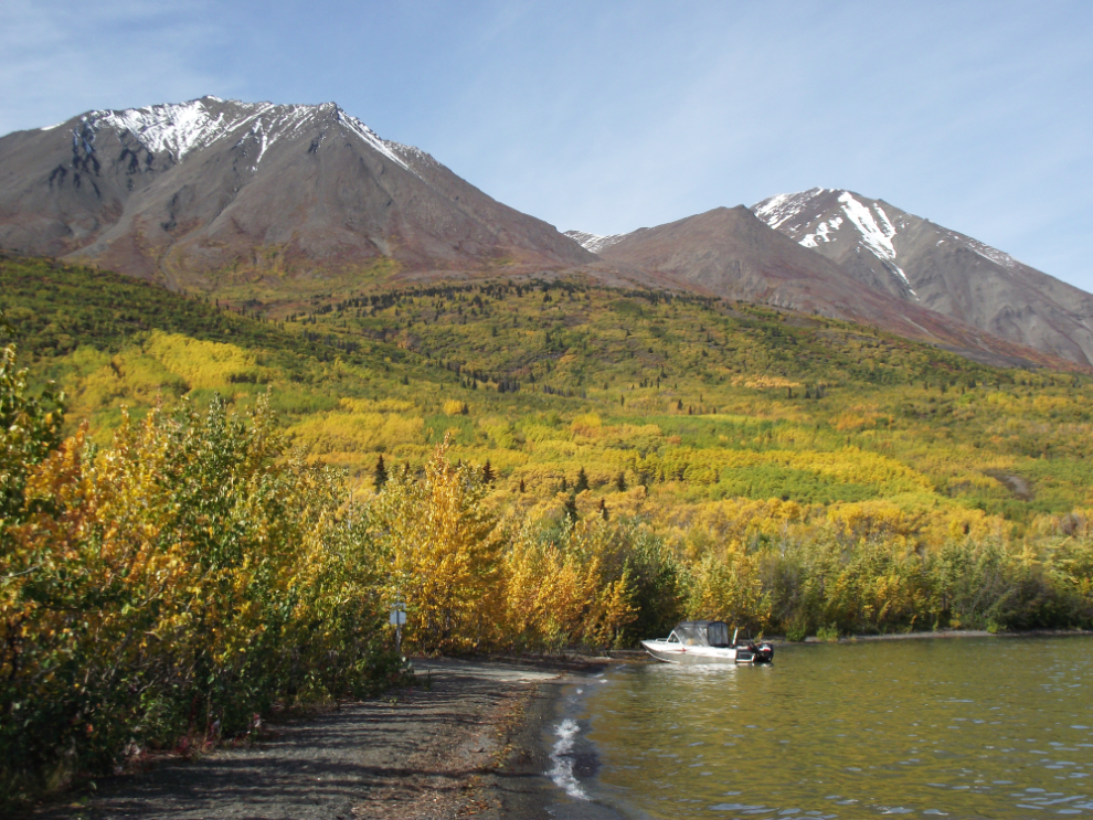
The view over Kathleen Lake from Km 226.
The Kathleen River from the highway bridge at Km 221, just above the Kathleen Lake Campground, which is the only road-accessible campground in Kluane Park.
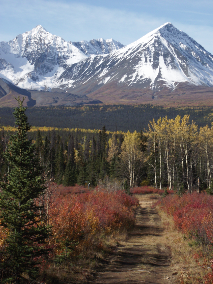
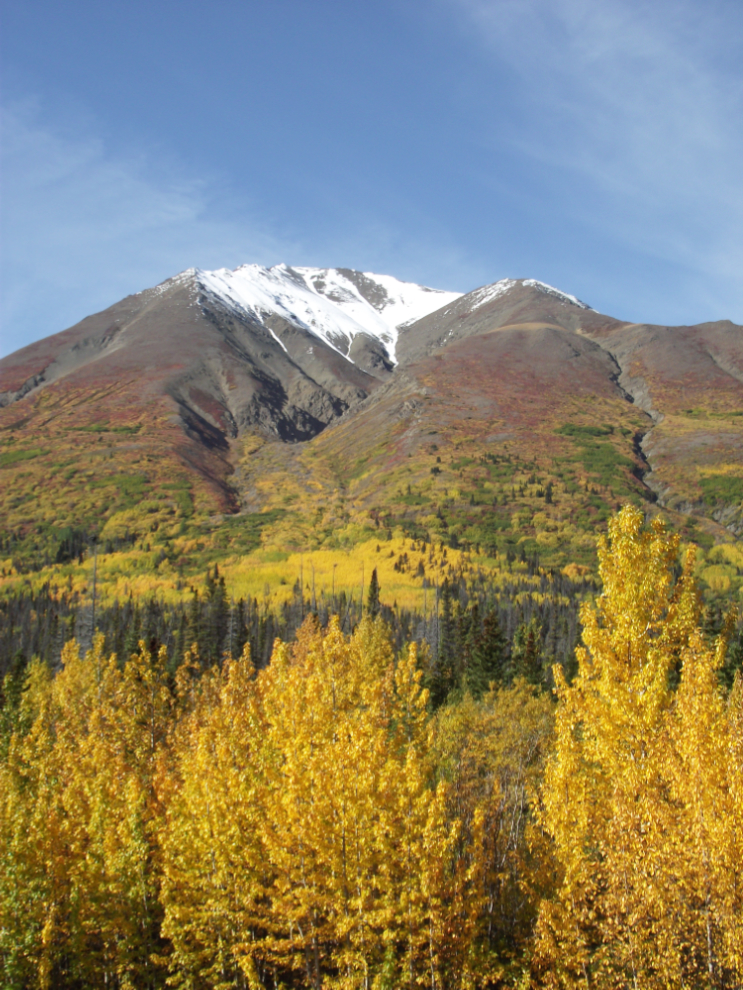
Fall colours at about Km 204.
The start of the Rock Glacier Trail, a short and fairly easy trail that takes you up onto the rock glacier and provides great views of Dezadeash Lake. The trailhead is at Km 202.
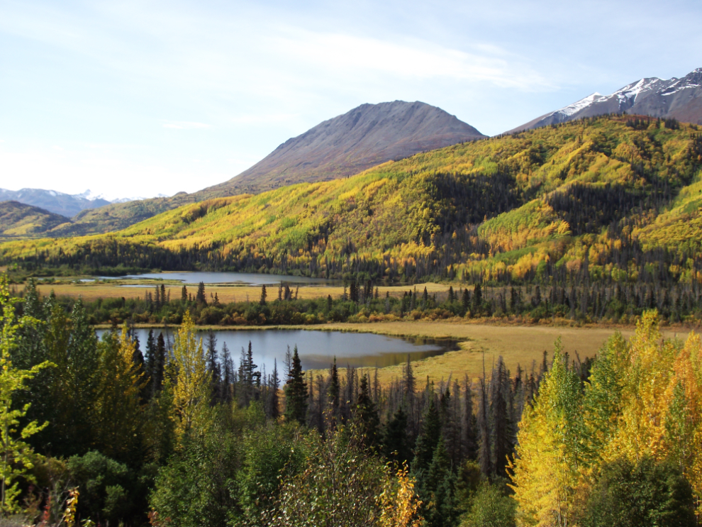
This view of Dezadeash Lake at about Km 197 is beautiful whatever the weather.
Dezadeash Lake Campground has 20 sites, a boat launch and excellent picnic facilities.
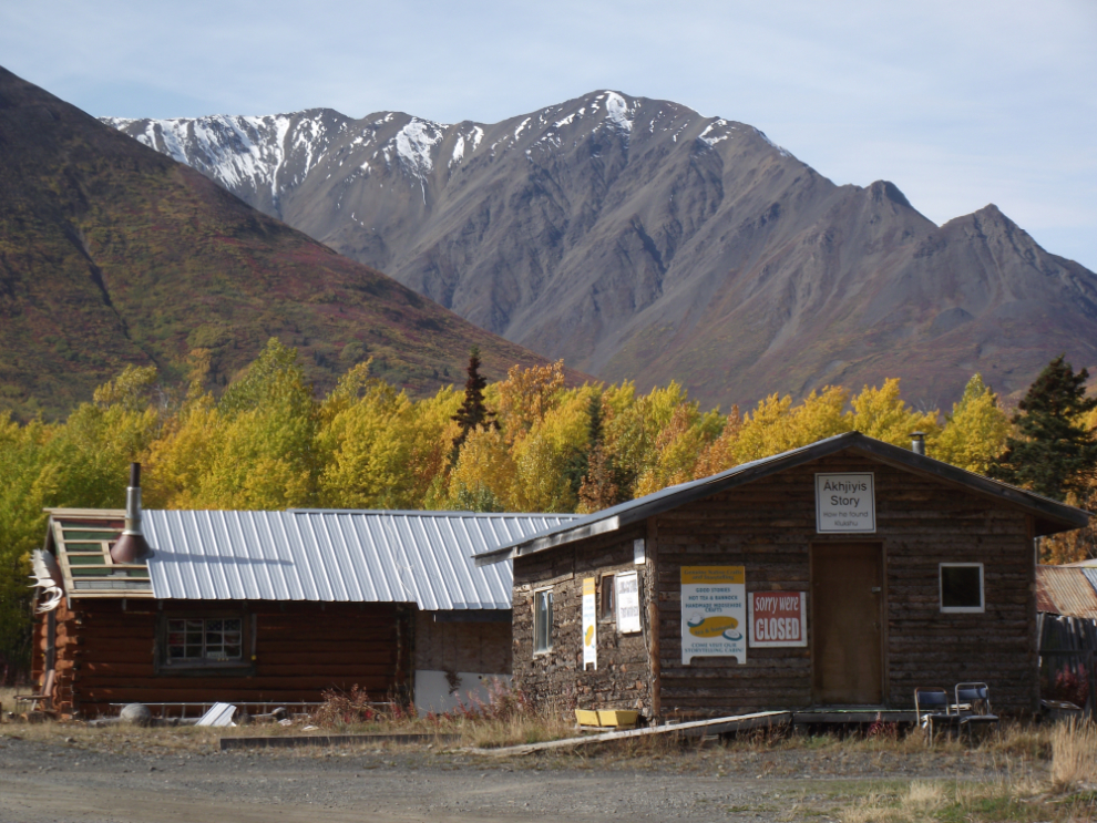
A kilometer off the highway at Km 183 is Klukshu Indian Village, a historic fishing camp. It was very quiet – only a handful of the many cabins were occupied and none of the tourist operations were open (not surprising that the tourist operations were closed, since traffic on the highway was extremely light).
The Klukshu River.
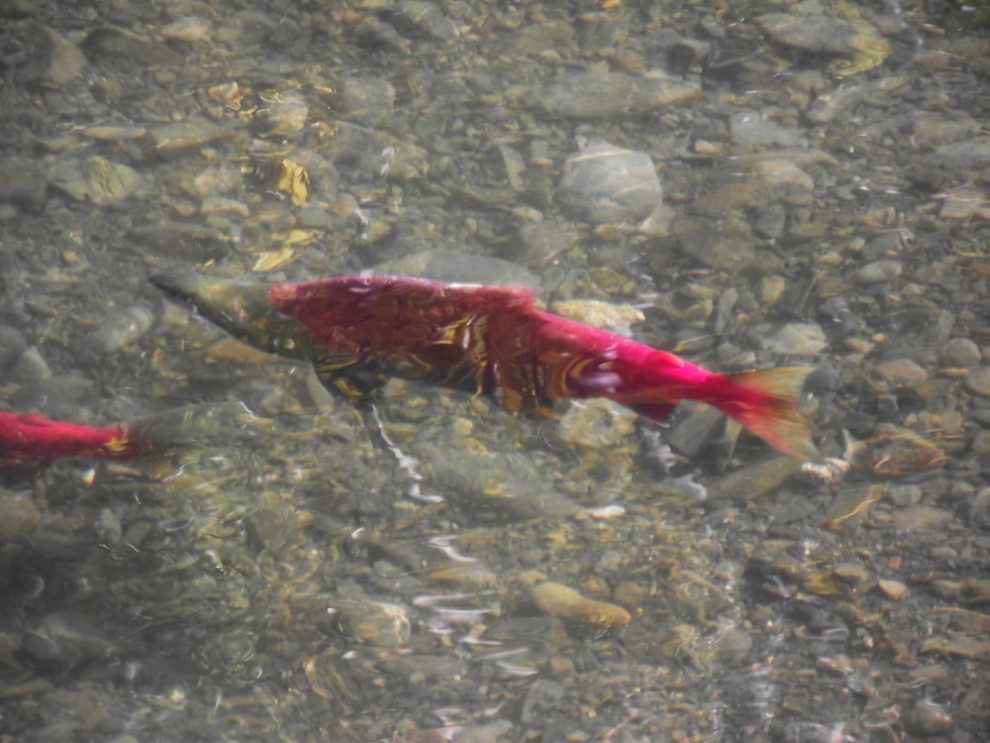
Spawning salmon in the Klukshu River.
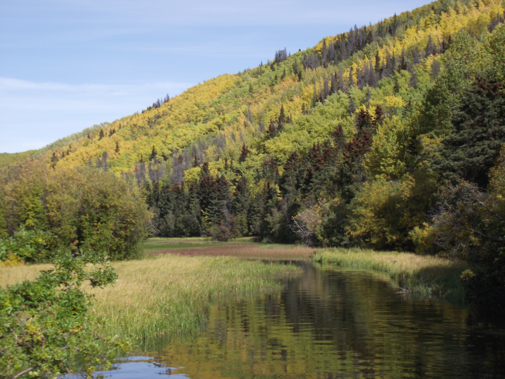
The Klukshu wetlands are great for birdwatching.
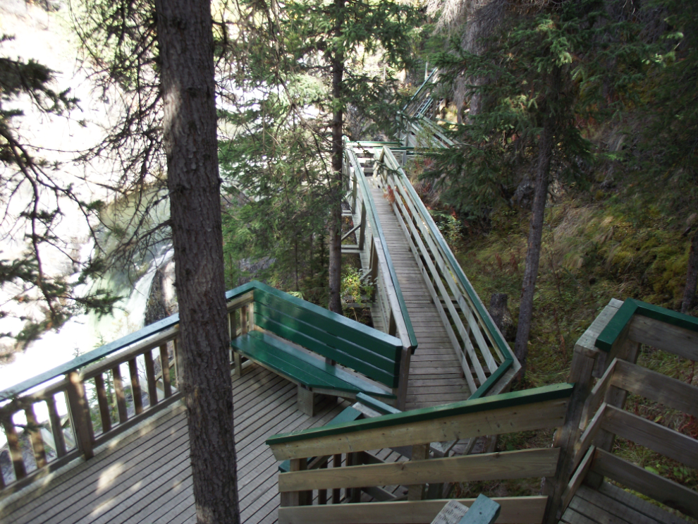
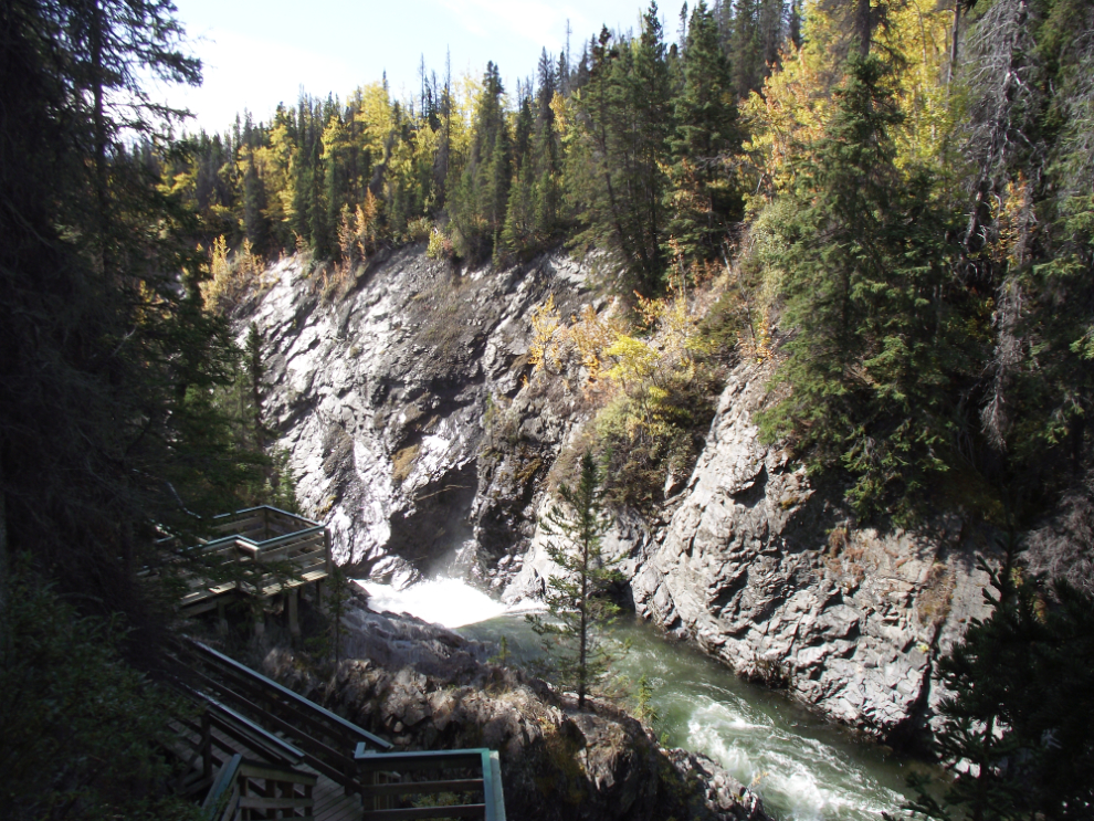
A kilometer off the highway at Km 159 is Million Dollar Falls campground, with an extensive stairways system to view the falls, and lots of chain-link fencing along all the trails since the last time I was here 🙁
Million Dollar Falls, on the Takhanne River.
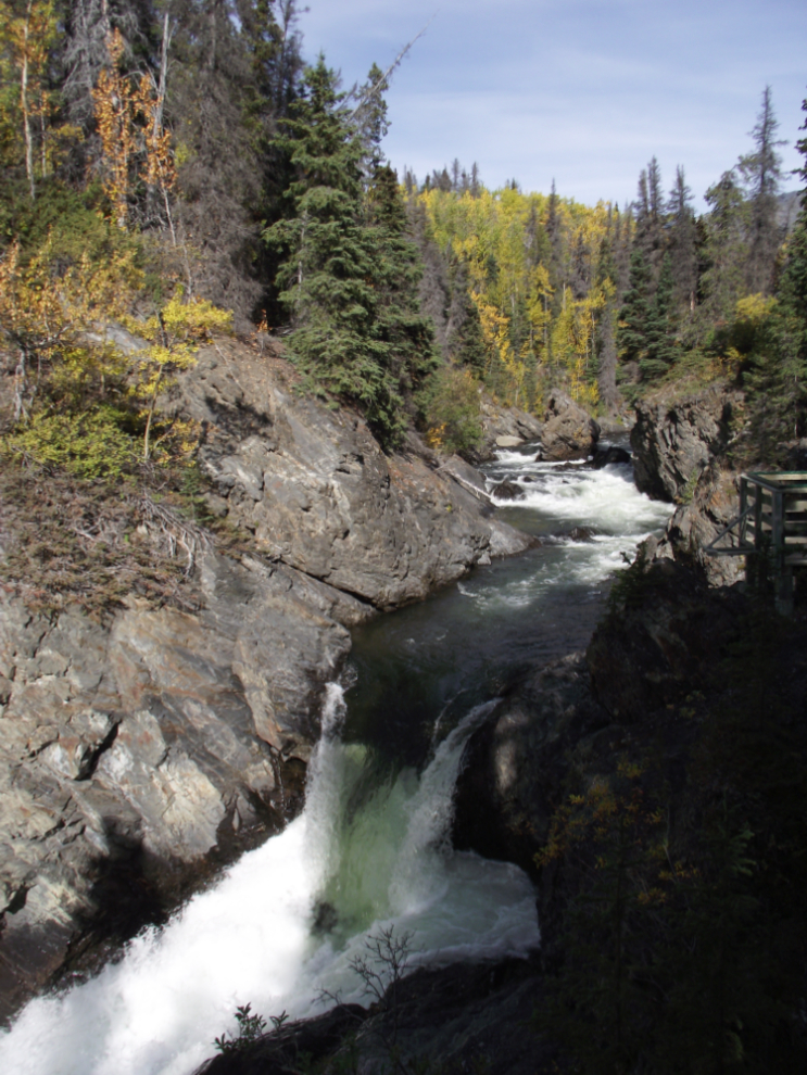
There are tantalizing glimpses of the falls below the featured one. Some day I’m going to explore the other side of the river, which I think offers better views of the canyon and the entire series of falls, though it’s tough to access.
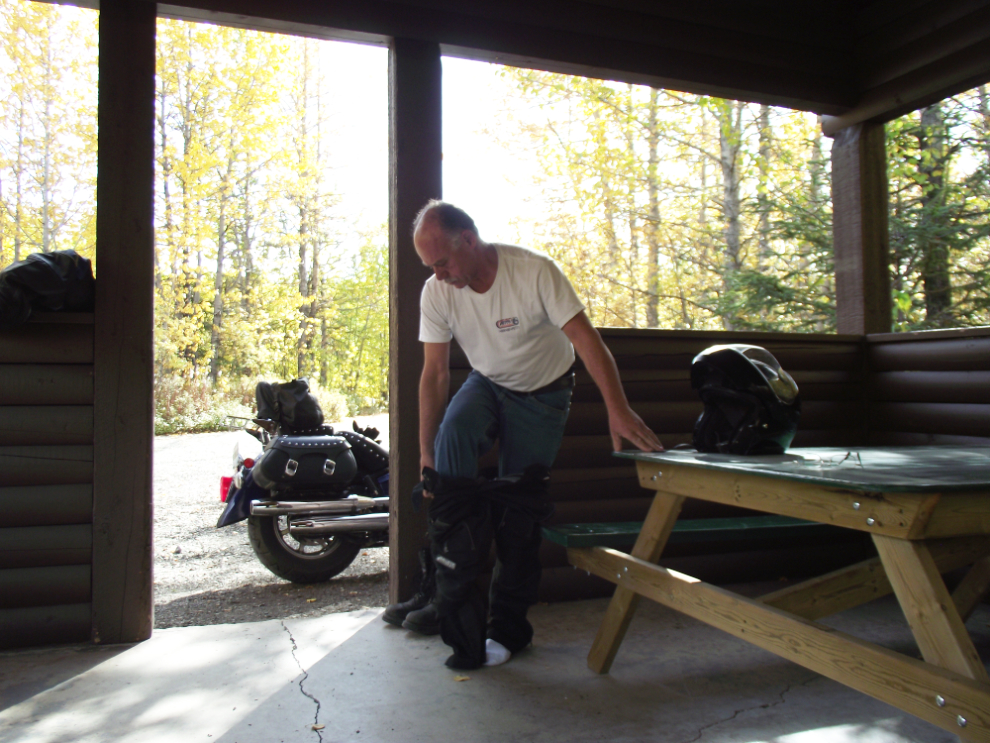
By now (2:30 pm) it was getting too warm for the way I was dressed, so before leaving Million Dollar Falls I got rid of the fleece base layer and the cotton layer above that (it was -4°C or 25°F when I left home at 08:30, hence the layers).
As with the South Klondike Highway, the Haines Highway goes through British Columbia for a few miles. This is the introduction to the high country for southbound travellers, the magnificent valley of the Tatshenshini River.
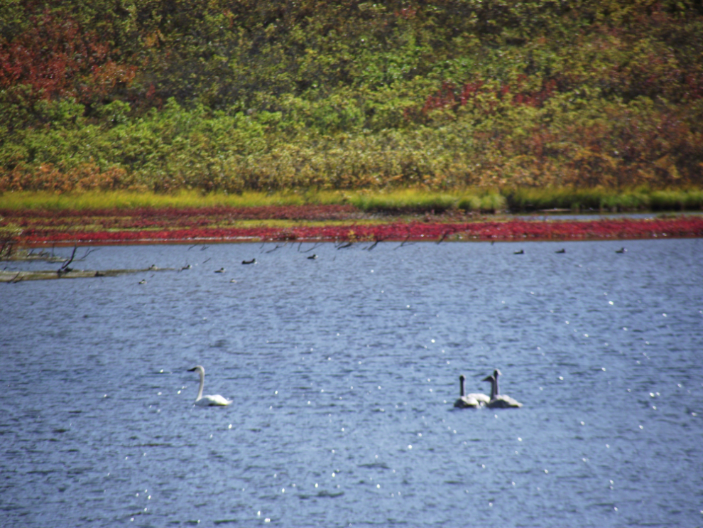
Trumpeter and Tundra swans are now on their migrations south – we saw a huge flock, perhaps 100 birds, south of Whitehorse last week.
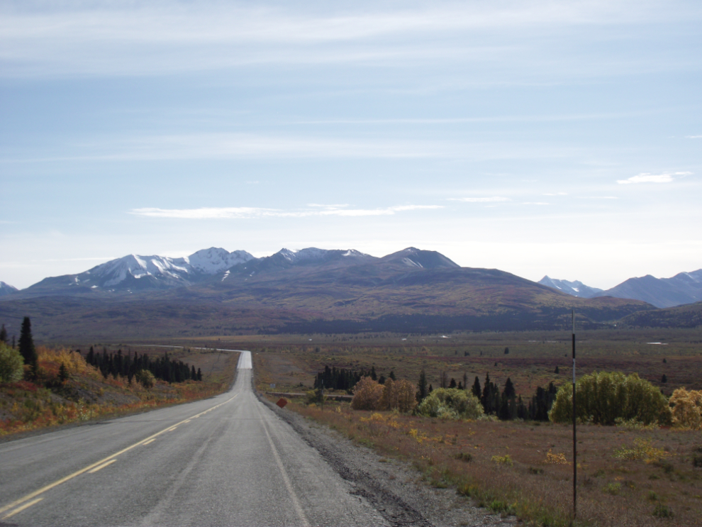
The Haines Summit, 1,070 meters (3,510 feet) high. This is at Km 103.
Looking north to the summit from about Km 100.
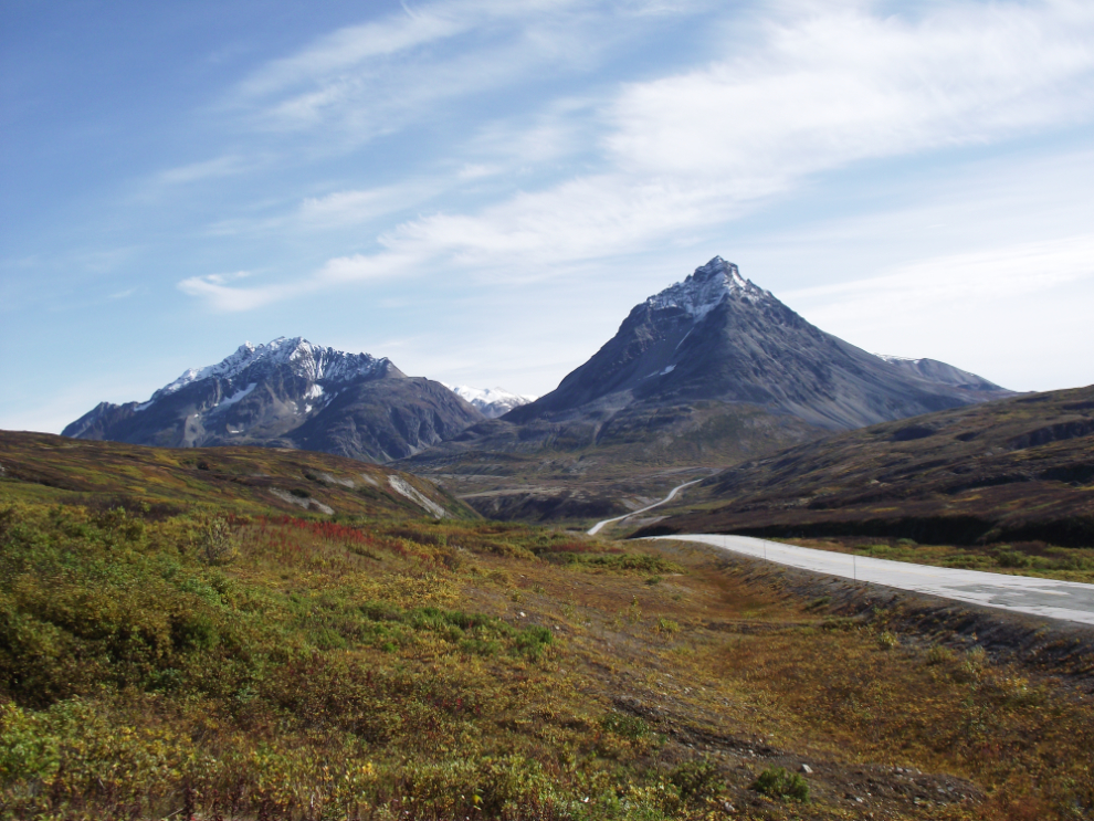
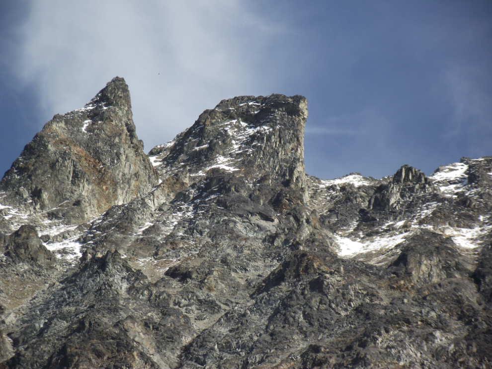
Looking south to the dramatic peak known as The Three Guardsmen from about Km 100.
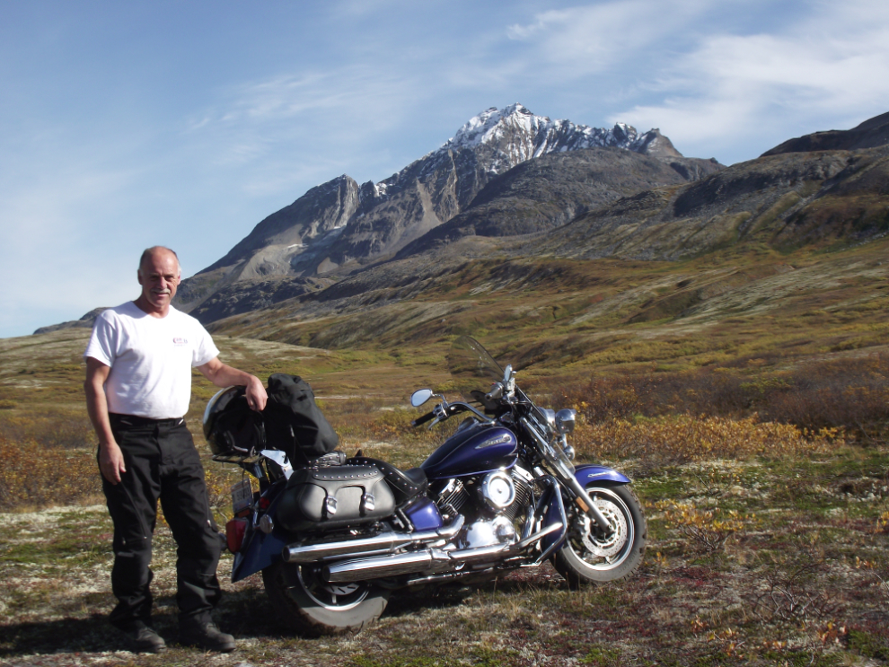
A side road at about Km 93 got me to this spot below The Three Guardsmen (though that’s not the mountain in this photo).
This is The Three Guardsmen again. The white stuff on the far side of the pond is Arctic cotton grass.
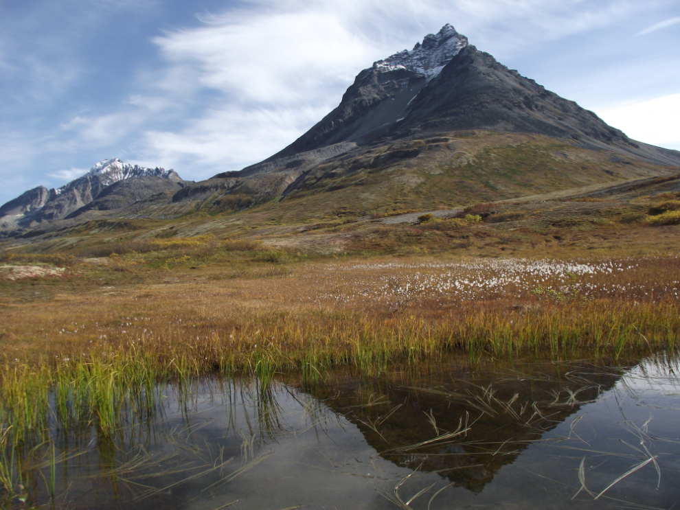
The peak of The Three Guardsmen.
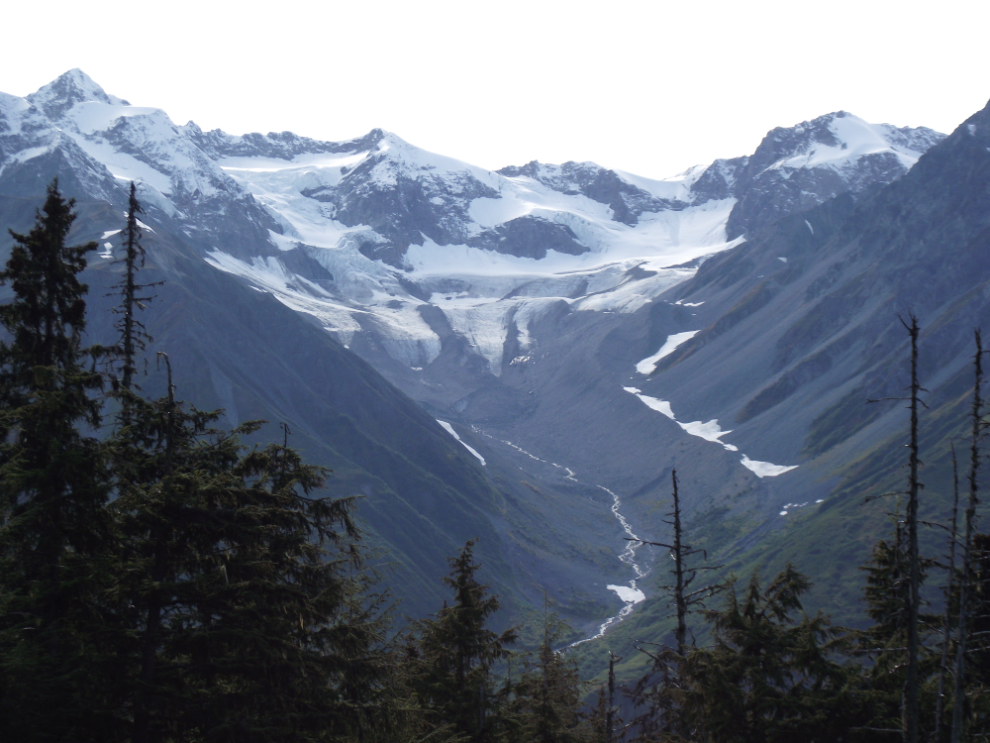
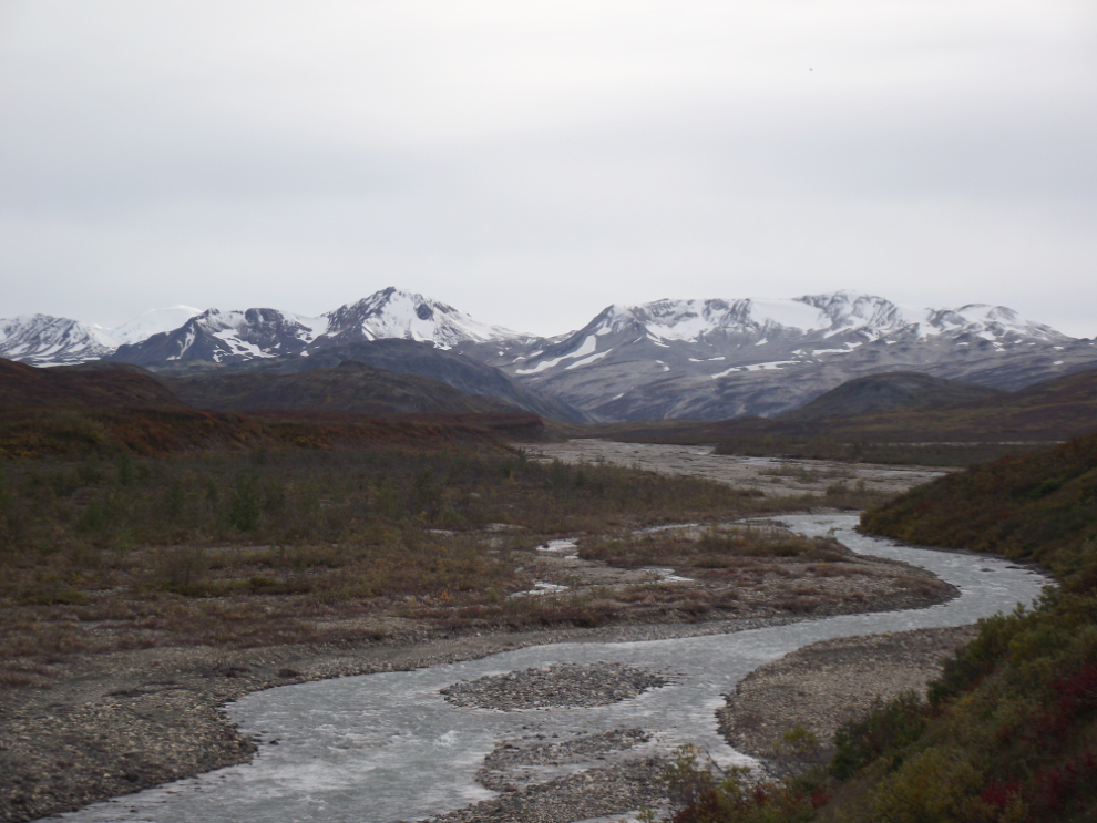
The drop down from Three Guardsmen Pass takes you past mountains with many glaciers – this is one of if not the most glacier-rich drive in North America.
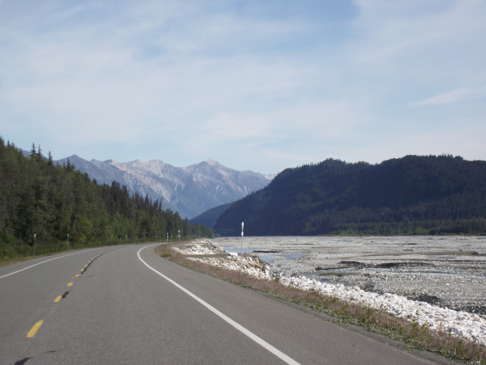
The Klehini River, a braided river, is the main stream that takes the meltwater from the glaciers to the Chilkat River and then the sea.
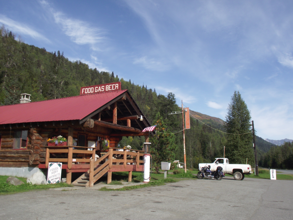
For the past couple of hours I’d been tossing around thoughts of how long I wanted this day to be – or if I wanted to overnight in Haines. I really wanted to see The Three Guardsmen, which put me far past the point where I could get back to Haines Junction with the fuel I had, and the next shortest option for gas and dinner (it was now after 4:30) was the 33 Mile Roadhouse, 33 miles north of Haines. Their excellent “33 Mile” burger is only $8.95.
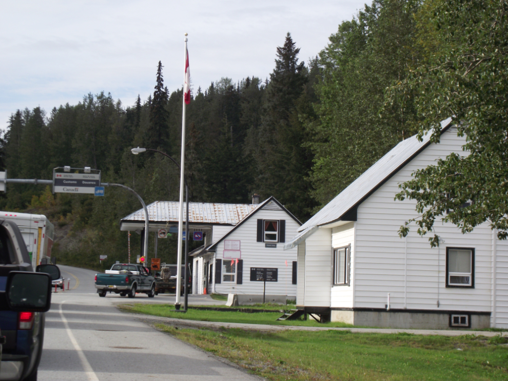
While I was stopped taking photos along the Klehini, a caravan of 6 pickups and U-Hauls full of people moving to Alaska went by me. That made the border stop at Pleasant Camp very slow – almost half an hour. No, the photos weren’t good enough to justify that! 🙂
Nadahini Creek, looking back at the peaks surrounding the Haines Summit.
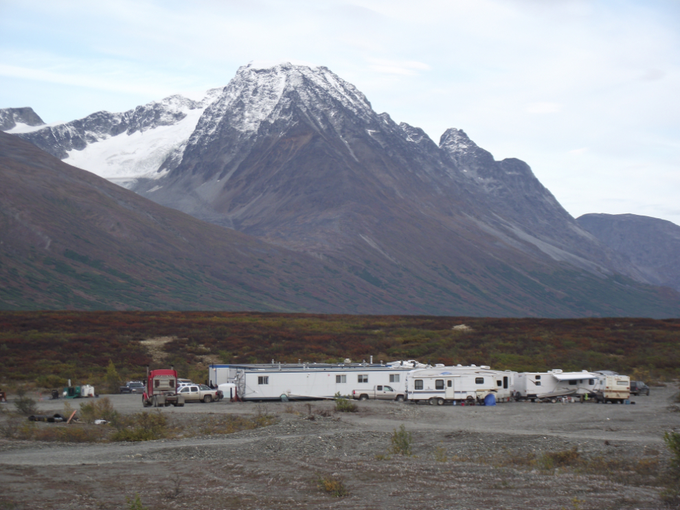
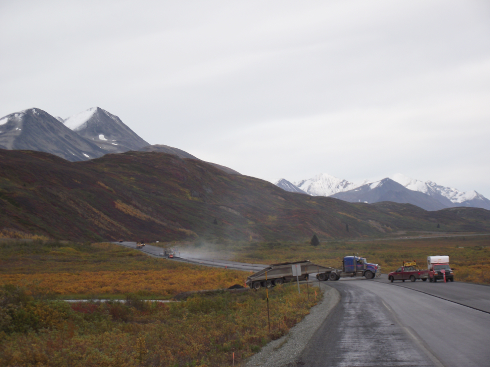
There are crews just finishing off 2 long stretches of new pavement (which is like riding on silk!). This is the asphalt plant at about Km 124.
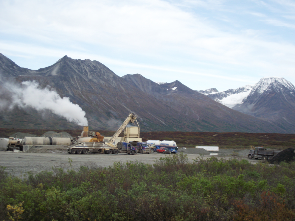
The camp the paving crews live in is a few hundred yards further north.
The final piece of paving beside Twin Lakes, Km 131.
What a superb Fall Colours tour that was! I put on just over 800 km (500 miles) and came back with 144 photos and a much improved attitude 🙂