Exploring the Twin Falls Recreation Site, Smithers
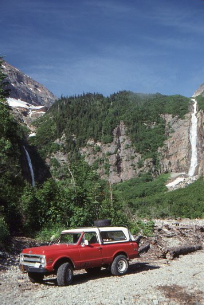
There are some special places in BC that tease me. Places that I see just enough of to want to see much more, but the timing is never right to see it all. In 1985, some Smithers locals took me for a brief look at Twin Falls, long before it was an official Recreation Site. The spectacular view stuck in my mind, but although I’ve been back several times, I’ve still only managed to see the lower, easy-to-access part.
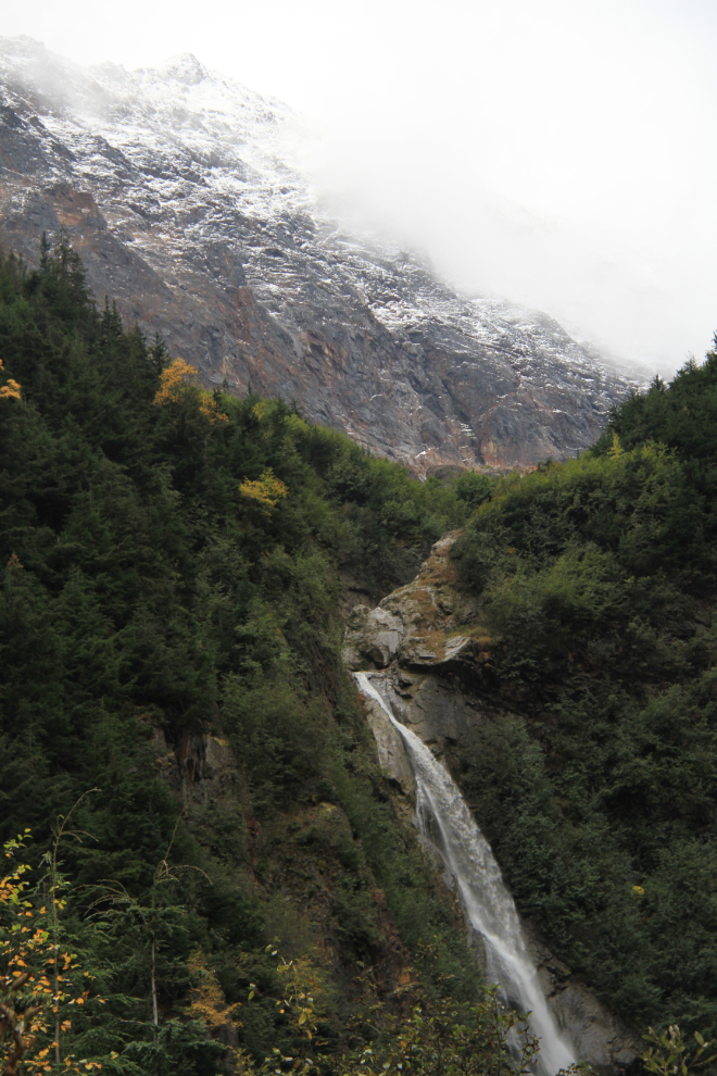
In June of 1991 when the first photo was shot, the best view of the falls was from an abandoned logging truck loading area, and there were no obvious trails to go further. The waterfalls flow from the Lake Kathlyn Glacier, one of several glaciers on Hudson Bay Mountain.
Today, Twin Falls Recreation Site is a popular place to go for short walks, and 2 camp sites are available for those who want to spend more time. In late summer 2014, the parking area and campsites were improved, and new concrete accessible outhouses were installed. By the coming summer, new picnic tables will also be in place.
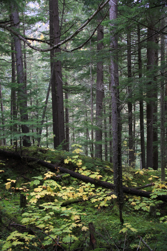
It only takes about 15 minutes to reach Twin Falls Recreation Site from Smithers. Take Lake Kathlyn Road, just north/west of Smithers, to Glacier Gulch Road, and follow it to the end, through the beautiful second-growth forest seen below. The road is an improved logging road, with narrow and steep sections, but is accessible by regular vehicles. For very large RVs, the parking area is tight but manageable with care.
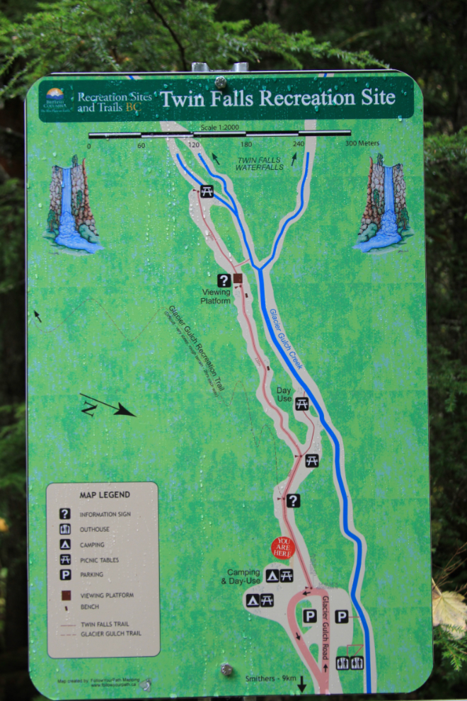
This map shows the recreation site and facilities, with the parking area at the bottom – click here to open a much larger pdf version in a new window.
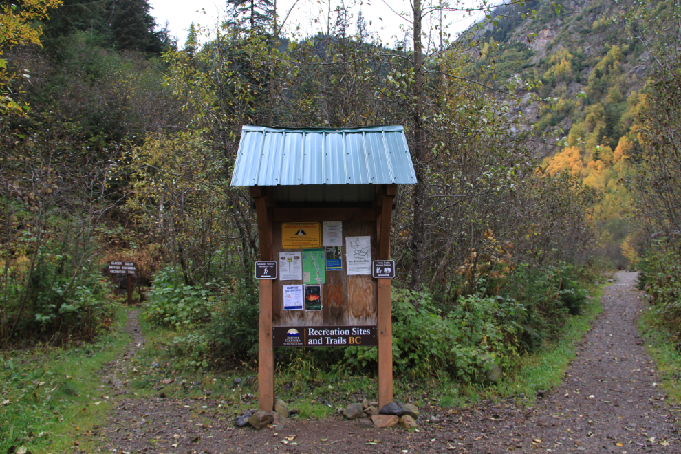
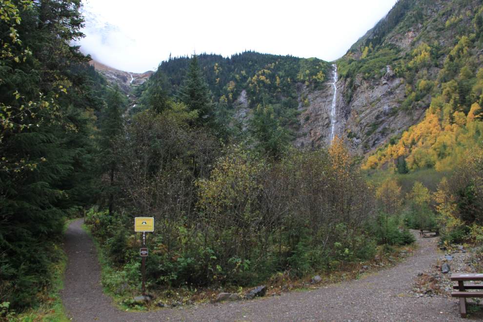
At this information sign, the main trail to the right goes to the day use are and falls viewing platform. The trail to the left is the Glacier Gulch Recreation Trail, a challenging trail that takes 2-3 hours one-way to reach the first of the glaciers high above. When these photos were shot the first week of October, snow had already closed the upper trail to regular hiking.
The power of this little valley thrills me. Hudson Bay Mountain can be seen through the swirling clouds at the upper left of the photo. The day use area with picnic tables beside Glacier Gulch Creek is to the right, the viewing platform is to the left.
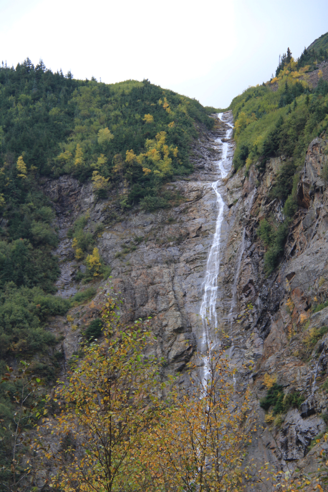
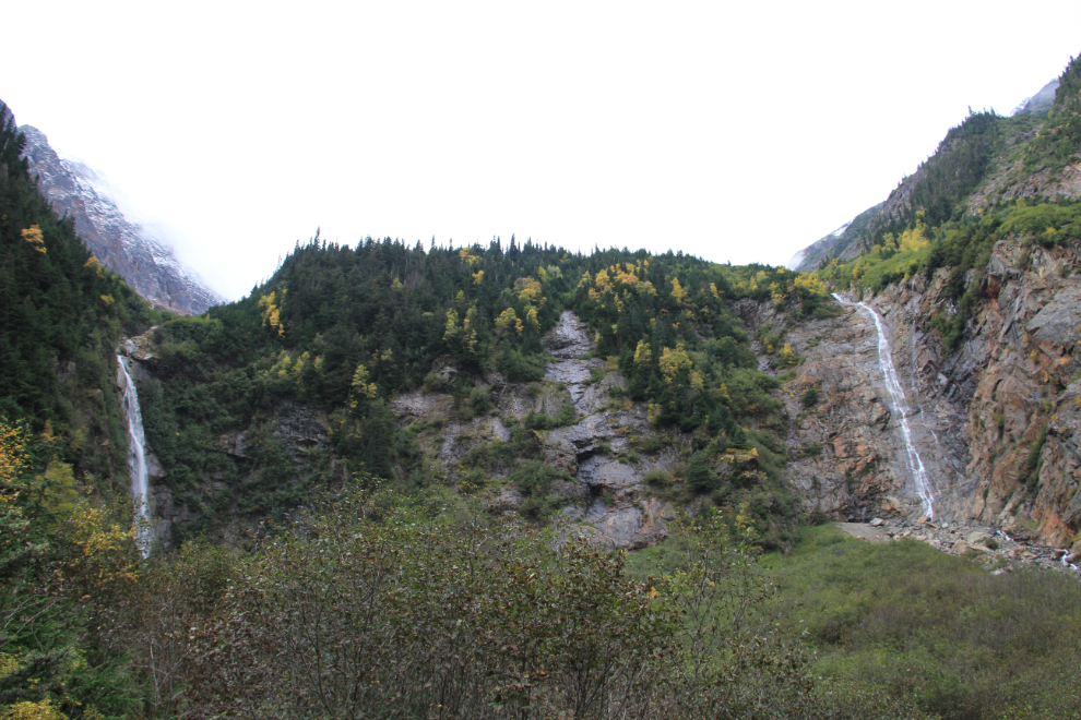
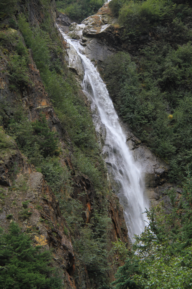
I never get tired of waterfalls – every one is unique, and even these “twins” are very different. The drop is said to be 168 meters (550 feet).
It takes a wide angle lens to get both waterfalls in one photo – the next photo was shot with an 18mm lens.
A telephoto lens is the best way to get a close look at the falls, as there is no trail to their bases – this is the left one.
I’ll be stopping at Twin Falls Recreation Site many more times, no doubt. Some day, I’ll be able to show you photos from the top of the the Glacier Gulch Recreation Trail!