Exploring Bennett and the Chilkoot Trail
For 3 days last week, I immersed myself in 2 things that I haven’t gotten anywhere near enough of in recent years – history and wilderness. This is a very long post – after the final edit, I have 476 photos from this trip. As well as the 69 photos in this post, though, there’s a lot that I’d like to tell you about – about the history and ecology of the area, but also about people.
The prompt for this trip was an offer from historian/author Michael Gates to help him with a little piece of a new project, studying the cattle drives that took meat to the Klondike gold fields during the rush. The White Pass & Yukon Route offers a great deal to people who would like to experience Bennett – they have a Backpacker’s Special that takes you from Carcross to Bennett, where you can camp for as many nights as you want, then return to Carcross after having a great lunch in the Bennett station. The total cost for the trip and meal is only $69.
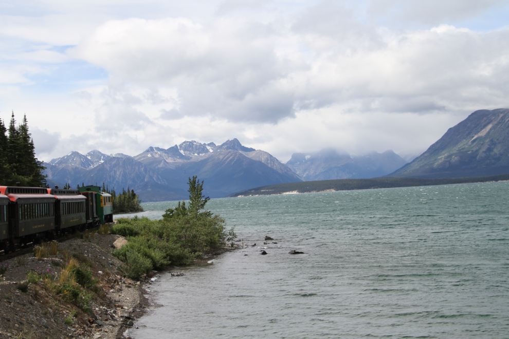
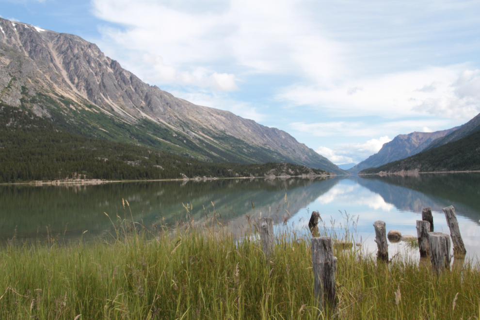
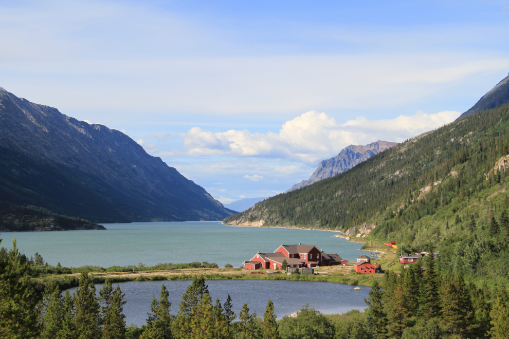
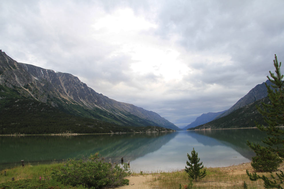
I arrived at Carcross just after noon on Tuesday, totally stressed out by having too much going on. But, it didn’t take long for the beauty of Lake Bennett (and the lack of Internet, cell phone, contractors, etc) to start calming me down. That’s the West Arm of Lake Bennett ahead.
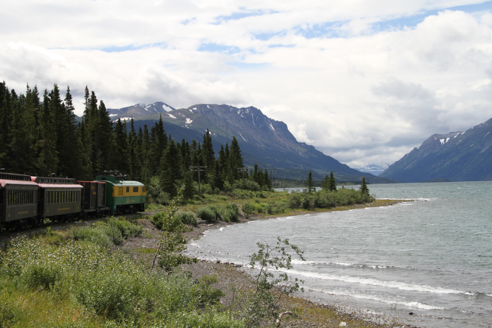
South of the West Arm, with a good long view down the 26-mile-long lake.
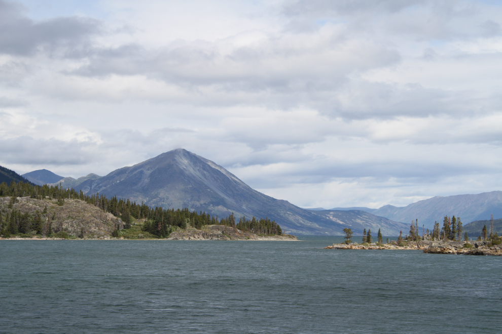
Looking back to the north, with the islands at the BC/Yukon border.
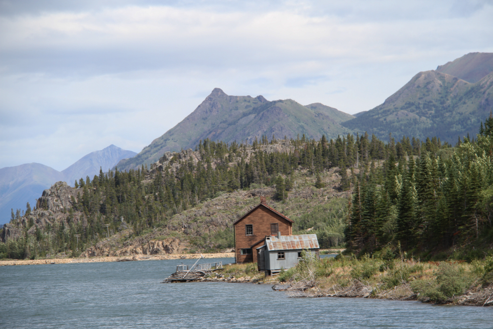
The long-abandoned Pennington section house.
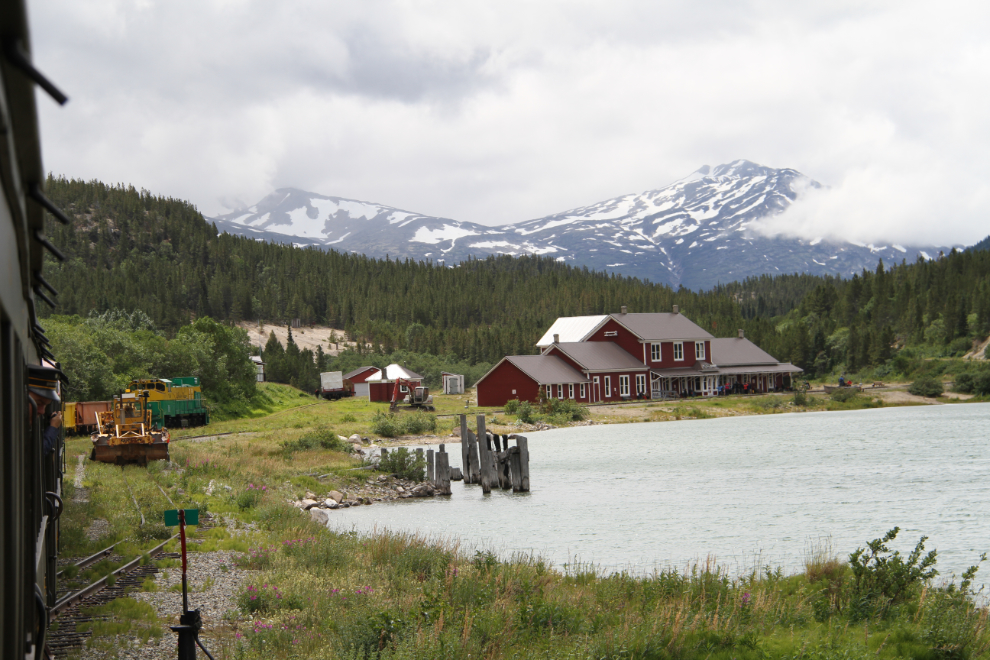
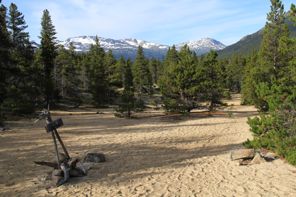
Arriving at Bennett at 1:55 pm.
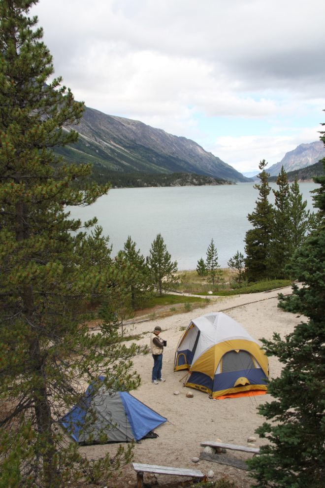
The first order of business was to get our camp set up. Campsites are reserved with Parks Canada – it costs a few cents under $10 per person per night. My teeny blue tent was very quick and simple to set up 🙂
Soon after we were set up, several Parks staff met us, and we headed up the Chilkoot Trail to a cattle slaughter site that had been identified in a 1991 survey. The rangers try hard to keep people on the main trail – here, a ranger is erasing the footprints of someone who had strayed off, so as not to encourage others.
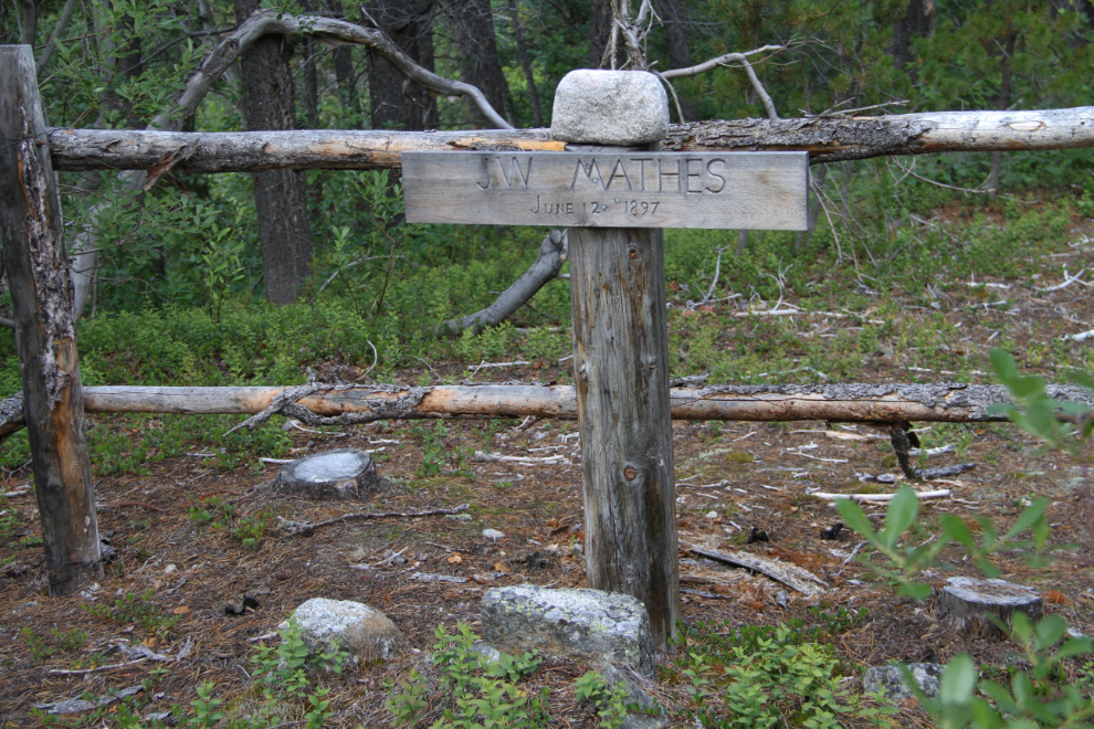
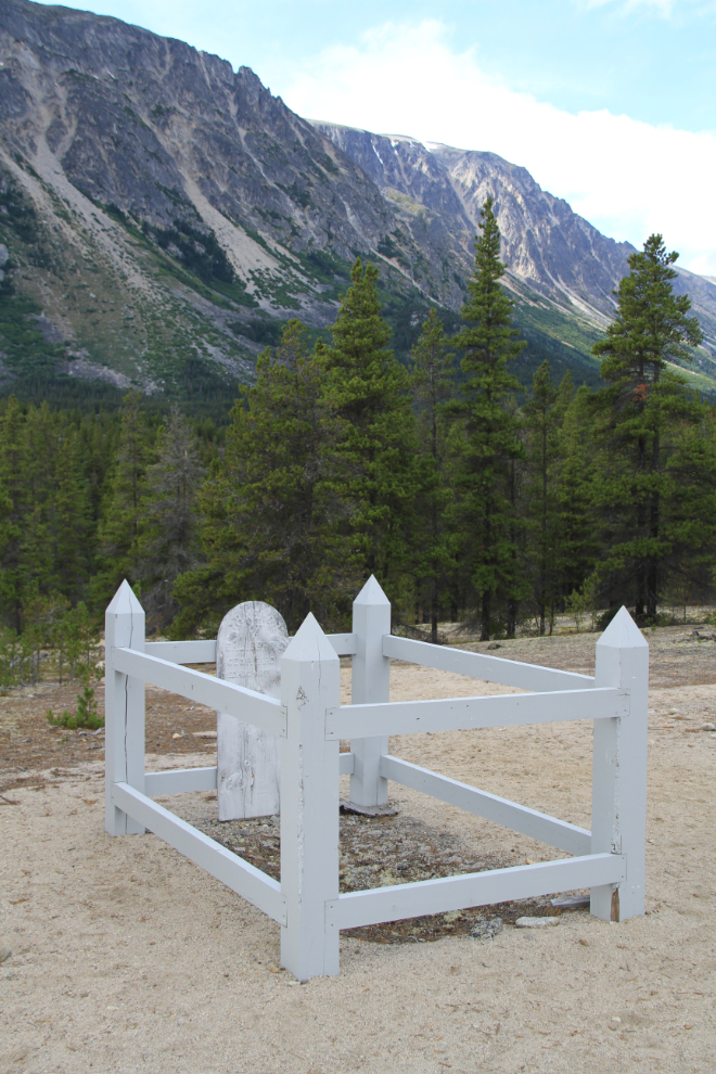
Just to the side of the main trail is the fenced grave of J. W. Mathes, who shot himself on June 12, 1897, after losing not one but two outfits in the rapids on the short river that flows from Lindeman Lake to Lake Bennett.
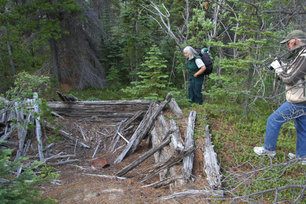
Very few cabins were built during the rush – this one hidden in the forest far off the current trail (which in this area doesn’t follow the historic route very closely) may have served as a post office. Ranger Christine Hedgecock, who probably knows more about the Chilkoot than any other person, was our guide.
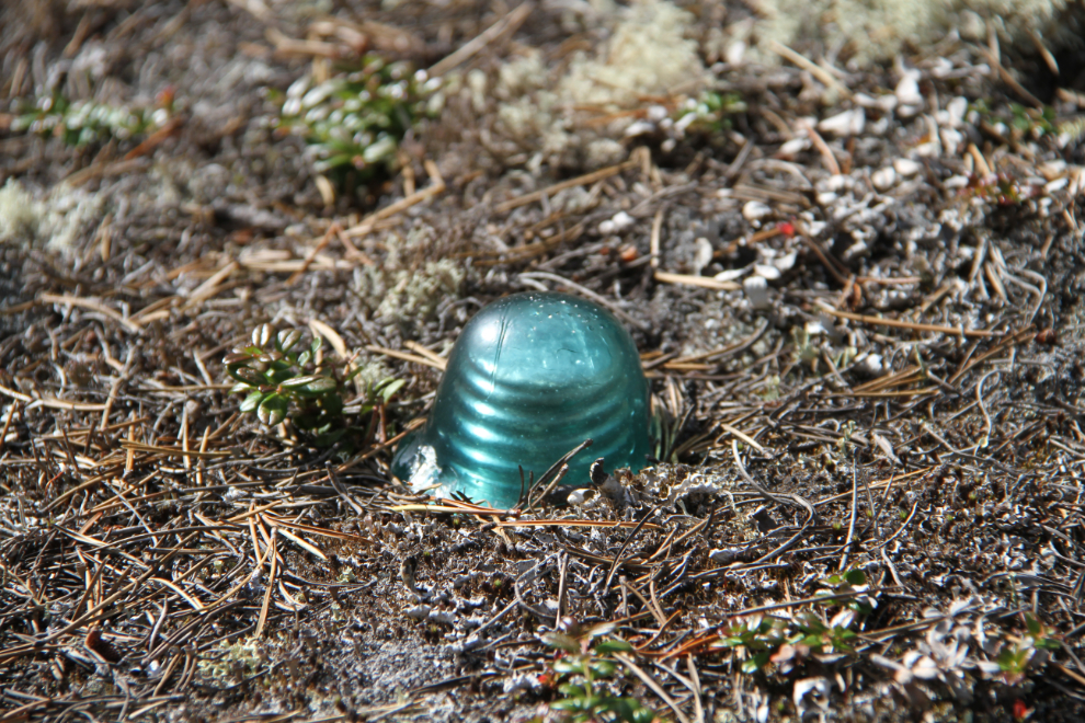
This insulator is a good example of why Parks Canada insists that hikers stay on the trail – countless artifacts like this have disappeared forever over the years. Its much more significant to historians in situ than it ever could be on the bookshelf of someone who once hiked the trail.
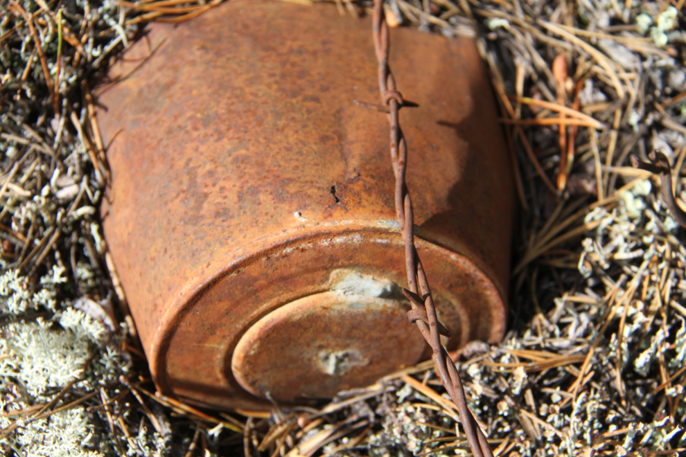
One of the mysteries we were shown is a bunch of barbed wire – although this just shows a single strand with a historic soldered-tin can, there’s a loose bundle of 15-20 strands, about 30 feet long. None of us could figure out why it was left that way in that place.
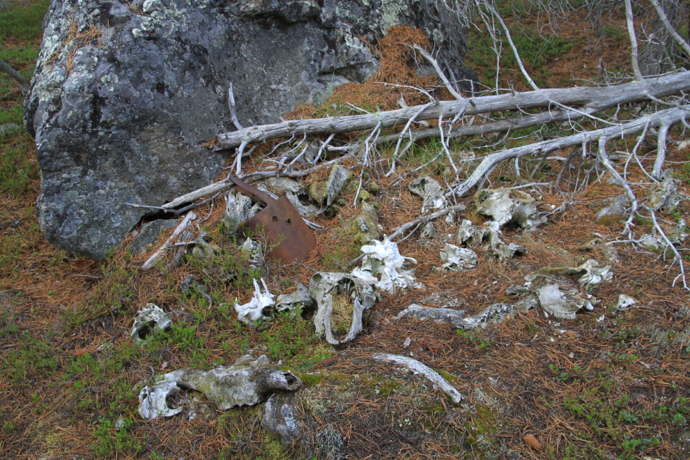
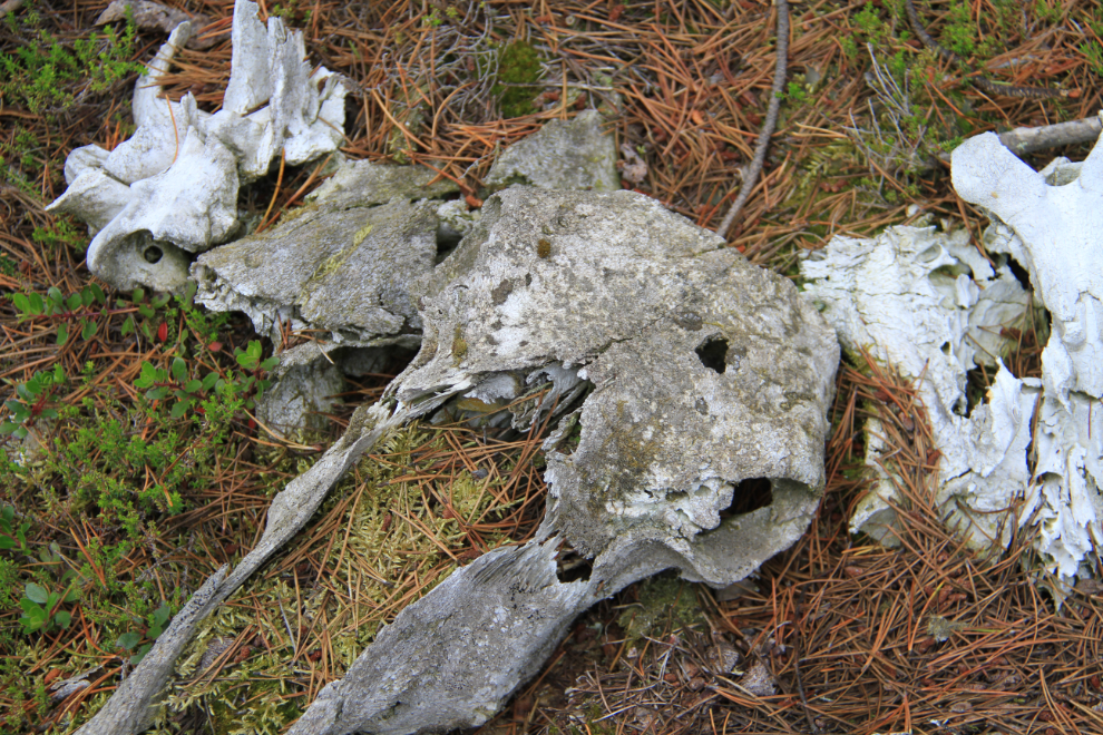
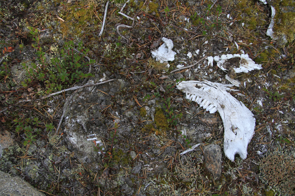
This is the main bone concentration at the cattle slaughter site. We were just there for a quick look so that Michael and I could return the next morning for a detailed examination of the site.
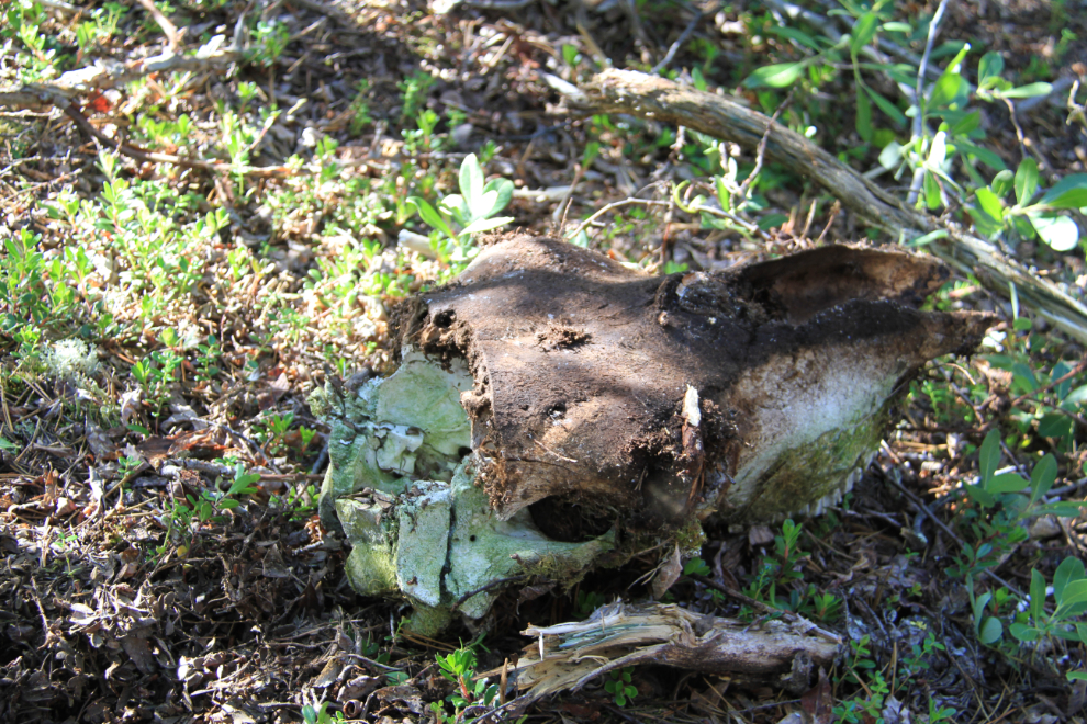
This is the sort of thing that we’d be looking for specifically during the in-depth examination – a skull with a bullet hole in it.
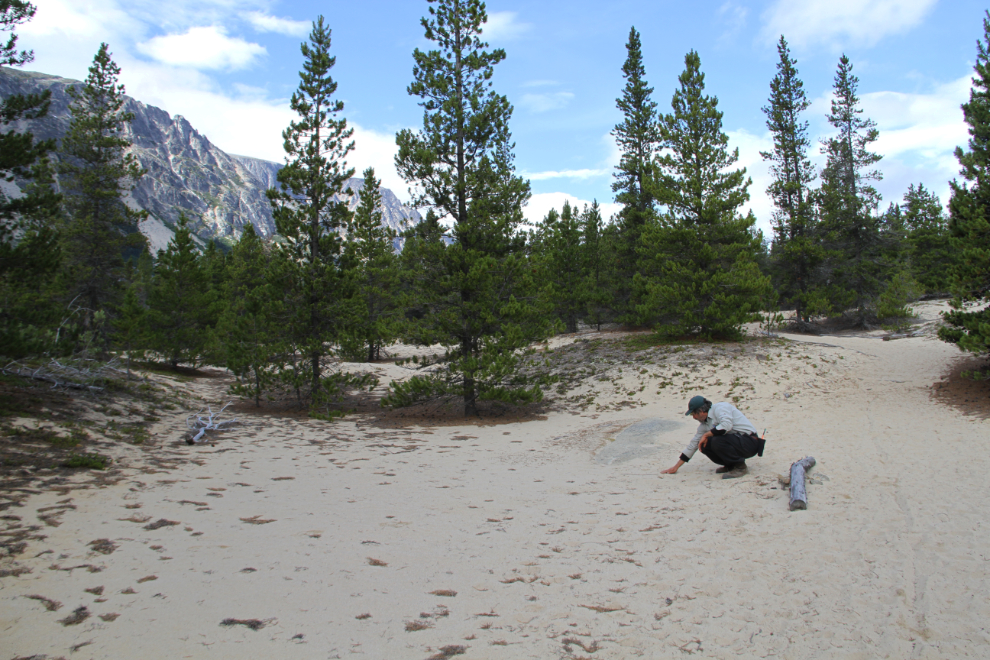
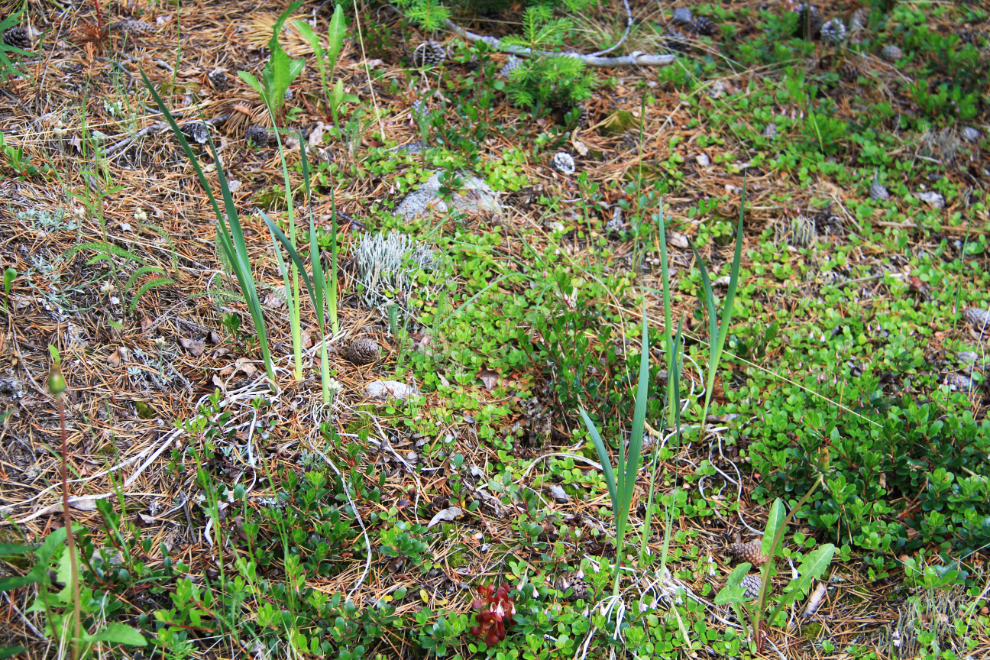
The next mystery was an open area in the forest, perhaps 60 feet square. At the upper end of the clearing are these wild irises, a species which doesn’t grow here naturally. The flowers are abundant at Dyea, however – was hay gathered at Dyea fed to livestock at this location? If, so why haven’t trees grown here in what would be manure-enriched earth?
On our return to Bennett, we made the short detour off the main trail to the small cemetery, where this grave was empty, the body exhumed at some unknown time in the past.
Although this will look like scrap wood to the casual observer, if you look closely you can see a couple of grave-surround corner posts, which were used as models to restore the grave, which is shown in the next photo below.
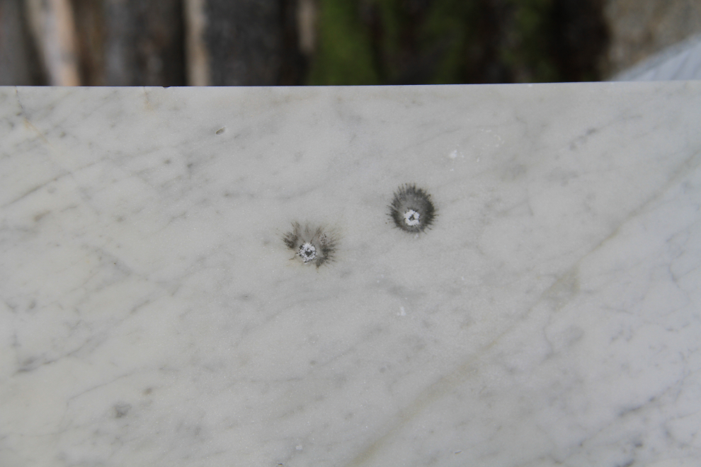
Chips in the memorial to 5 men who were killed during construction of the railway, caused by bullets. I don’t even have words for how this sort of of vandalism/desecration makes me feel – what’s misfiring in the brains of the people who would shoot at grave markers?
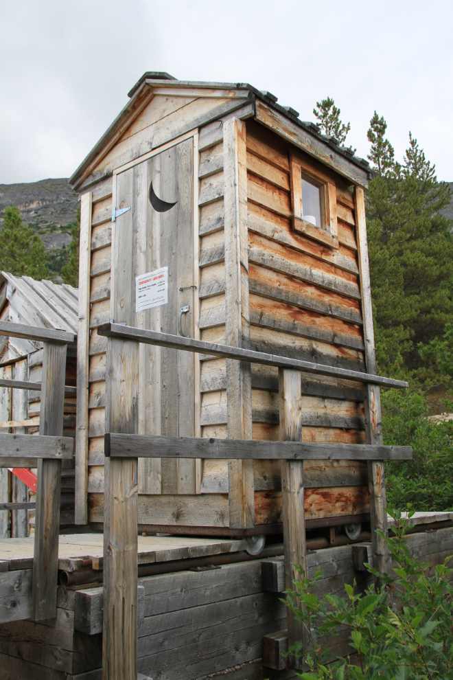
Back at the campground, where the outhouse is high off the ground and mounted on rails. When the barrel under it is full, the house is rolled off it and a helicopter comes, hooks onto the barrel and takes it away for proper disposal of the contents.
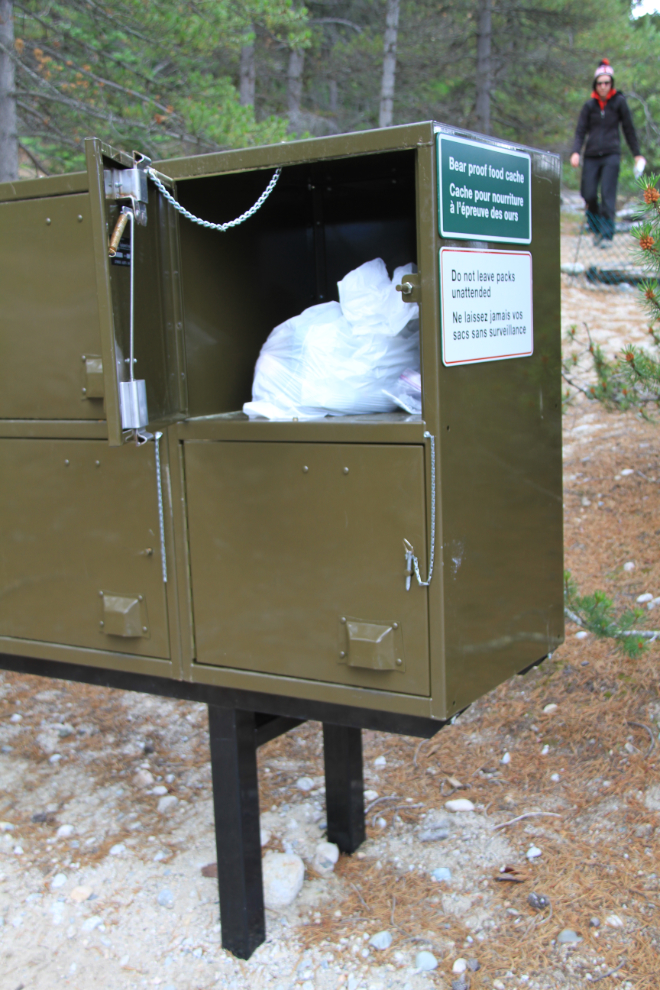
Hikers used to hoist their packs and food up onto poles far above the reach of bears and secure them with ropes, but now bear-proof lockers are more convenient and probably more effective.
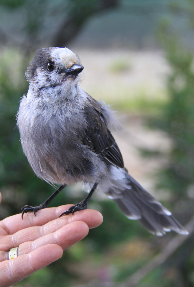
This young gray jay (“whiskeyjack”) on Michael’s hand is wondering where the treats are!
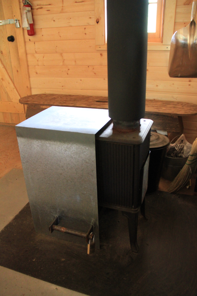
There’s a beautiful new warming hut at the campground.
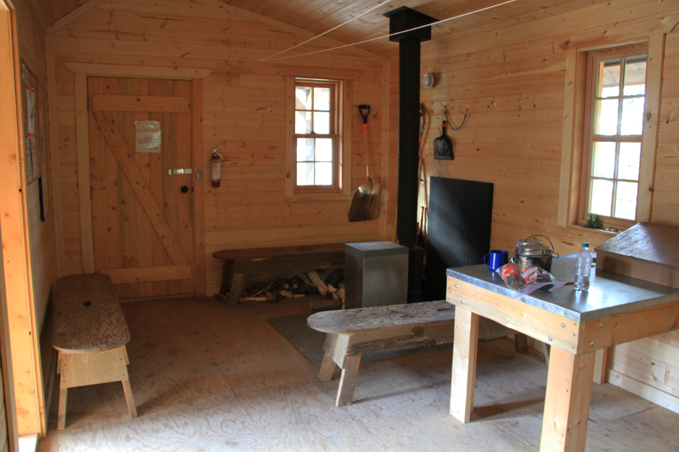
The warming hut has a woodstove, but it was covered and locked, I assume due to the high fire hazard right now.
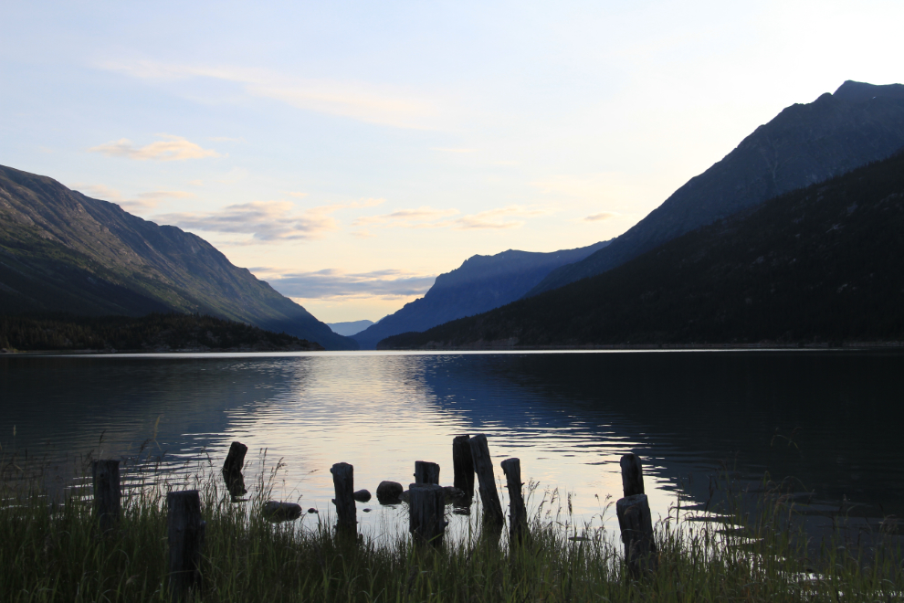
The view to the north down Lake Bennett at 06:15 on Wednesday morning. The temperature was probably about 8°C (46°F), a bit chilly but not bad when you know that the warm sun isn’t far away.
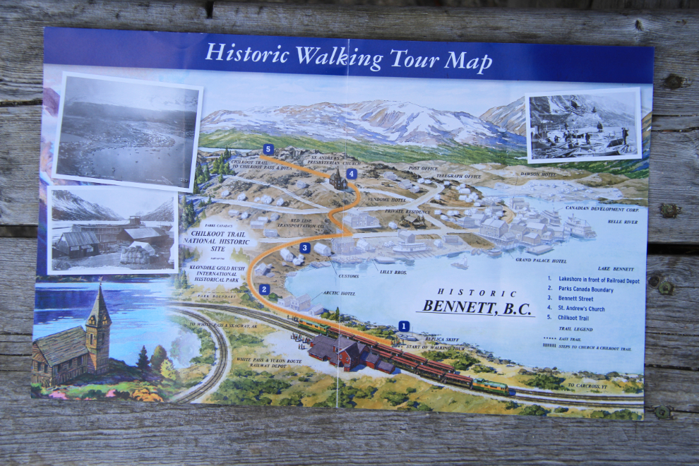
This walking map of the Bennett townsite is handed out on the train – even for people who have been here before, it’s an excellent reminder of what used to be here.
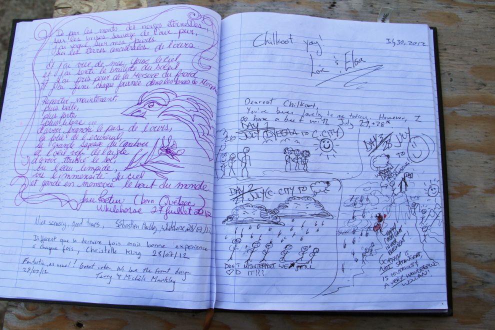
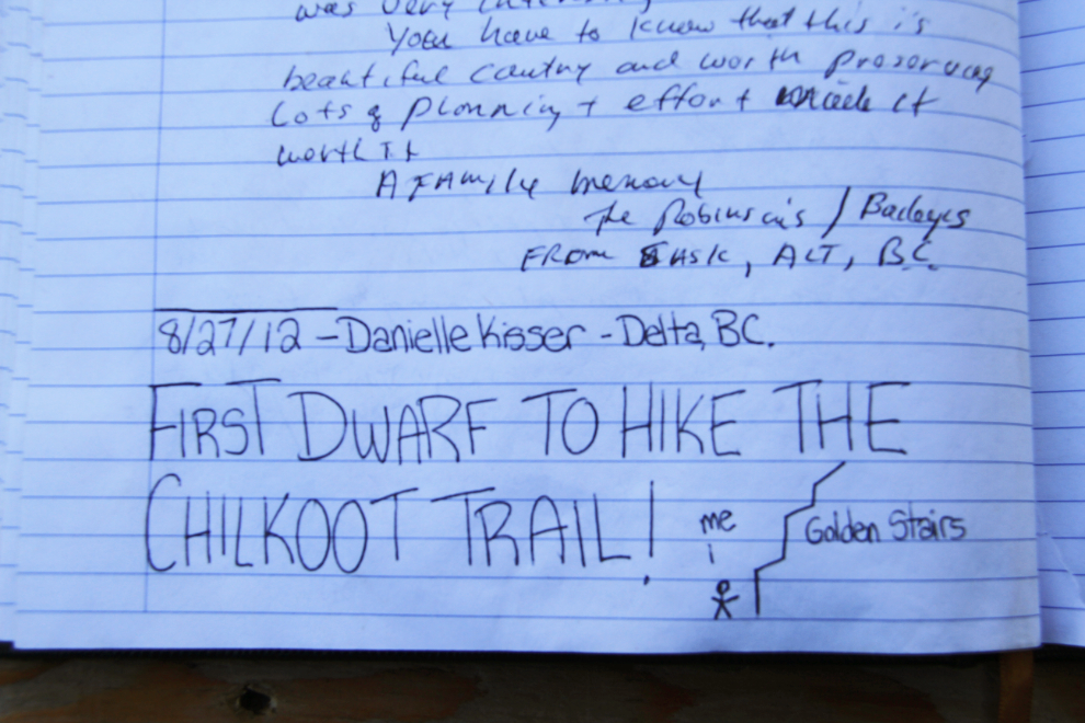
The trail book with hiker’s notes and drawings is fun to go through 🙂
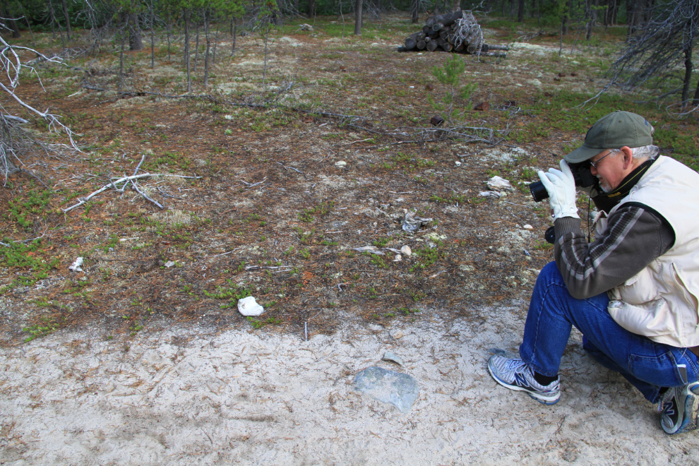
Michael and I were off on our quest fairly early. Michael discovered that much of what he had planned for us (a grid search of a large area) had been done in 1991, so our focus was much tighter. This bone beside the Chilkoot Trail wasn’t significant, but worth recording.
The view south up the Chilkoot Trail. Tough way to start a day! 🙂
Back at the cattle slaughter site, where the primary goal was to ascertain how many animals were killed here. To do that, we recorded skulls and jawbones (noting whether the jawbones were from the left or right side). Our commitment to Parks Canada was to not disturb anything, despite the fact that much material of interest would be buried under leaf matter or moss. While one jawbone is clearly visible in this photo, if you look closely you’ll see another on the left side of the photo.
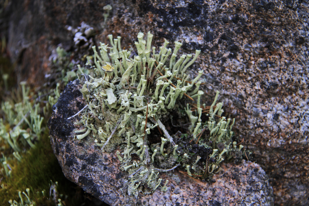
I get distracted easily, and couldn’t resist this tiny fungus.
A beautiful example of what we really hoped to find – a cow skull with a bullet hole.
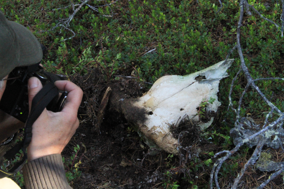
We only found one like this – was the back of the skull cut off to get the brain or just the horns? And when? We’ll almost certainly never know for sure. It didn’t take too long to achieve the goal of the trip – we had found a total of 32 skulls plus a pile of half-buried and very deteriorated ones that we couldn’t dig into for a count. That was a much higher number than I’d expected.
By 10:30 we were back at camp, I had an early lunch and was off on my own exploration while Michael worked on a couple of talks he was scheduled to give.
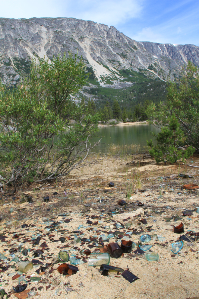
One of the glass middens along the riverfront section of the Bennett townsite. This is generally a sign that a saloon was located here, though I didn’t check to confirm that that was the case for this site.
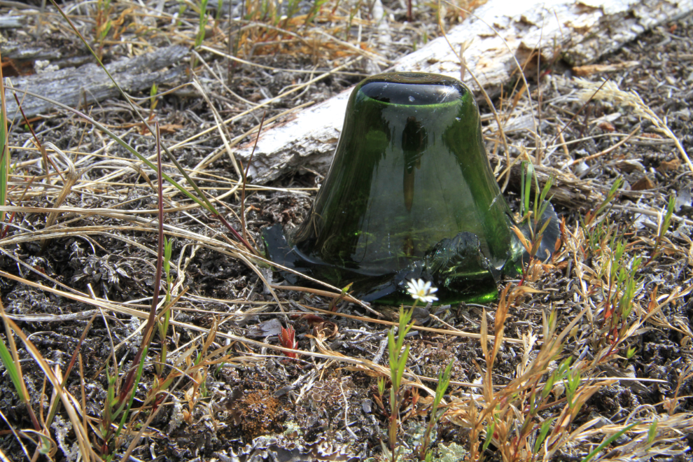
The bottom of a liquor bottle.
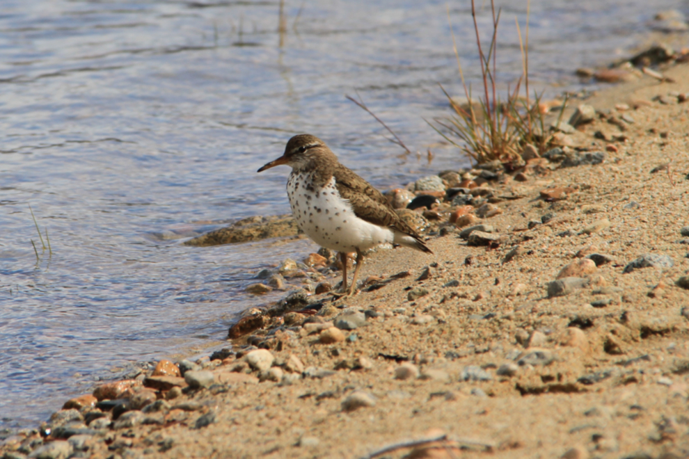
While I was looking for photo ops among the broken glass, this spotted sandpiper (Actitus macularia) came along.
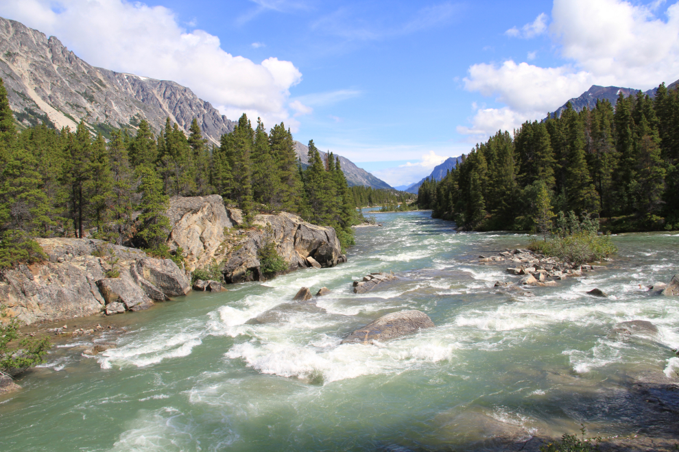
Whenever I look at the rapids on the river, I’m at a loss to understand why anyone would try to run their boat loaded with supplies through here (though many were somehow successful). This spot is a few minutes from the Chilkoot Trail on a well-used trail, below the cemetery.
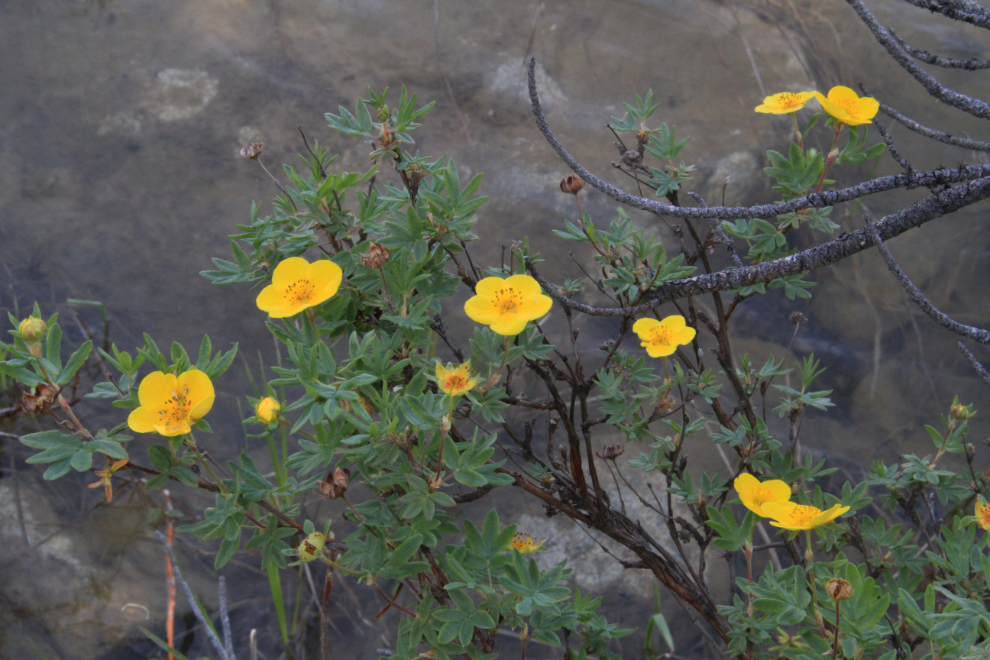
Shrubby cinquefoil (Potentilla fruticosa) along the river at the rapids.
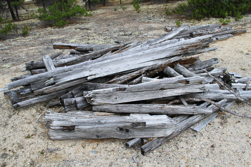
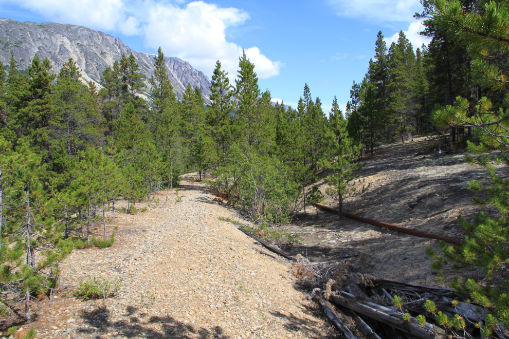
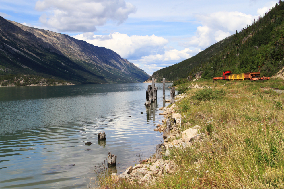
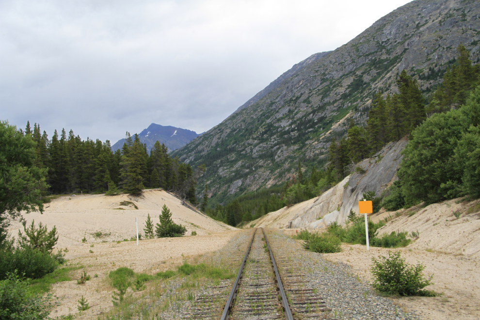
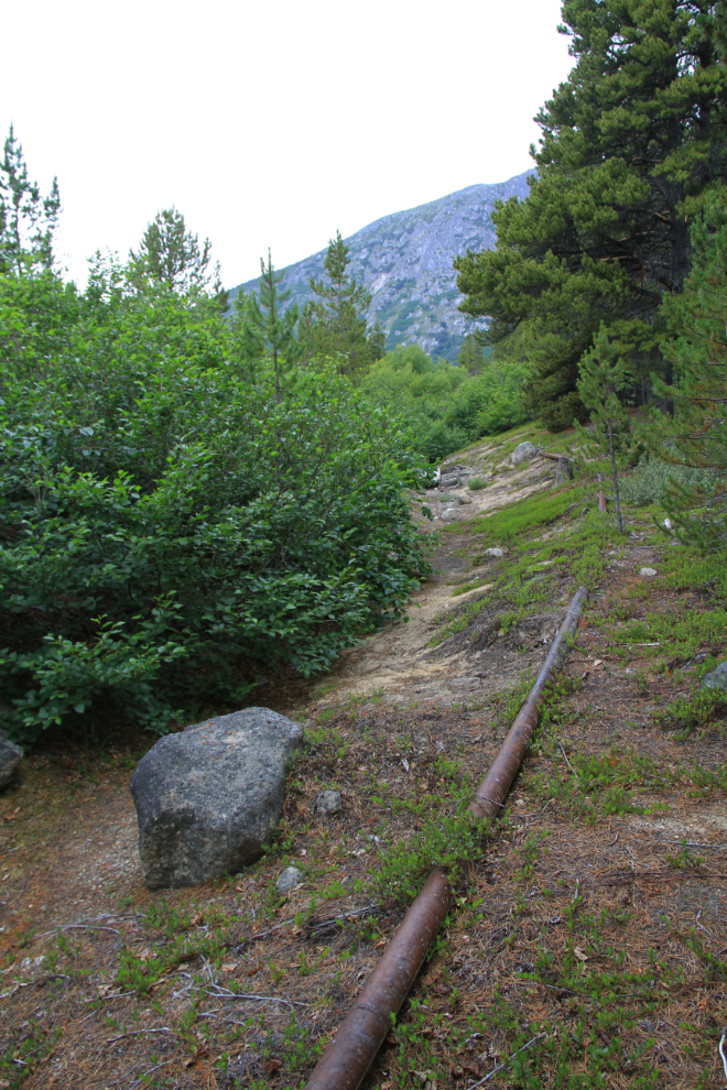
I was surprised to find an abandoned section of railway grade. The gasoline pipeline shows that it was being used in the 1940s.
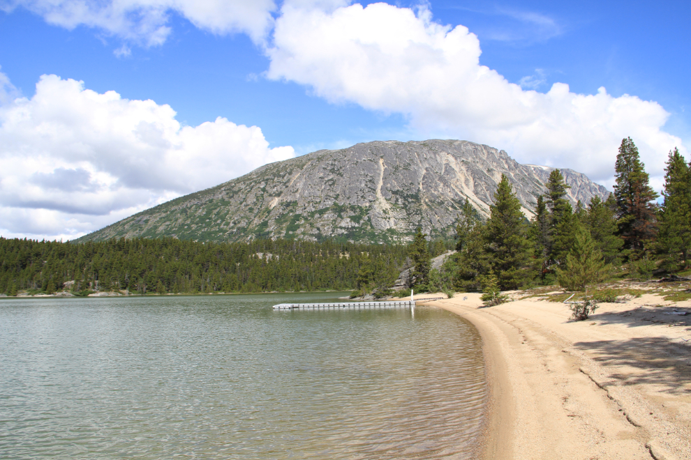
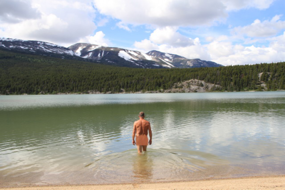
A beautiful beach along Lindeman Lake – the dock is used by Parks Canada staff for the boat they use for shuttles to and from the campground at the south end of the lake. I had gone for a very refreshing dip in the lake when I found a rough beach a half-hour or so before…
…but couldn’t resist another one at this spot 🙂
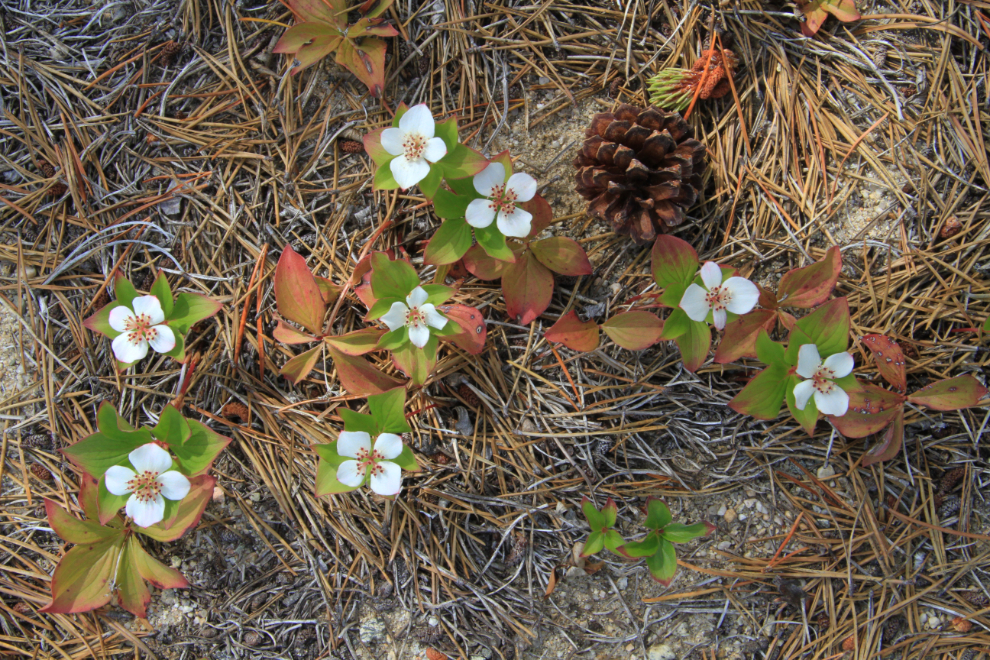
Dwarf dogwood (Cornus canadensis) along the beach. I had photographed this group and then decided that it was missing something, so added the pine cone for another couple of shots.
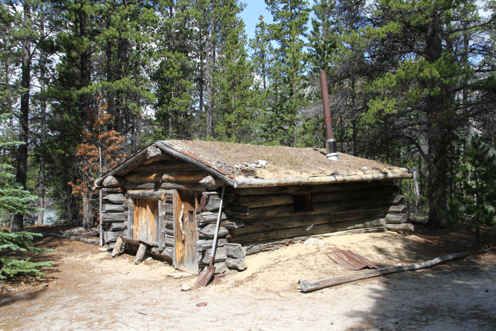
This is a trapper’s cabin – there are still several active trapline licenses along the Chilkoot Trail.
I had no particular goal in mind for my hike, but went almost to Bare Loon Lake before turning around and retracing my steps.
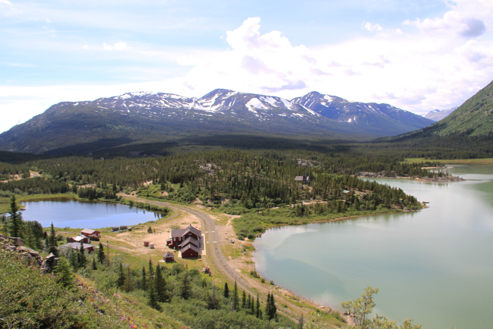
I had decided that I wanted to get some photos from the hill above the railway station at Bennett, so after lunch, Michael and I went over to the historic dock area to start the steep climb. A small section of this dock was rebuilt around the time of the Klondike centennial (1998) for a boat shuttle from Carcross, which ran for a few years. Two wall-tent restaurants also operated at Bennett around that time.
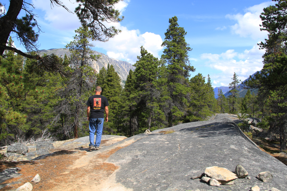
This was as high as I climbed. It was proof that this was the location I was after – this is where many photos were shot from during Bennett’s heyday. To make the effort to go higher, I needed the incentive of perfect light (a totally clear sky at about 11:00 am), and I’ll be back.
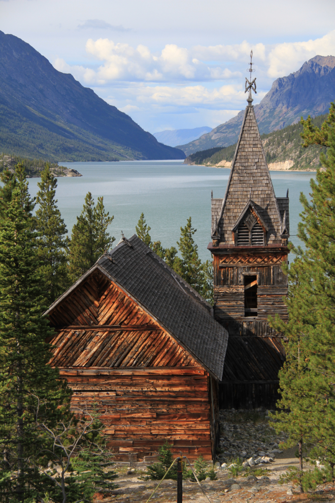
The evening light was perfect for shooting St. Andrews Presbyterian Church – this was shot at 6:20 pm.
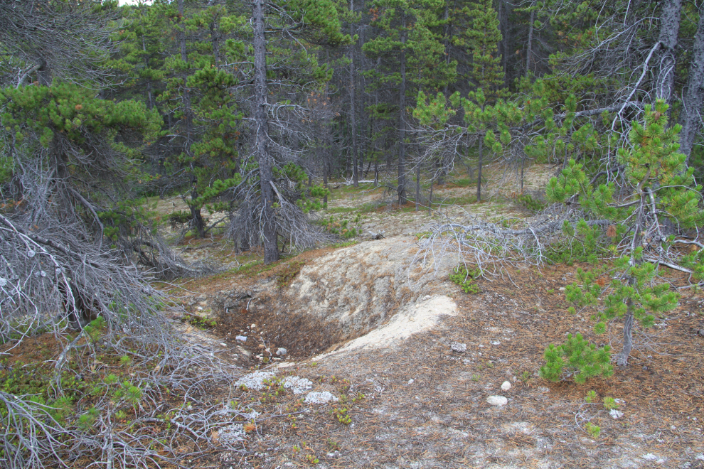
The next area I wanted to see was the loop track south of Bennett – this photo looking north down Lake Bennett was taken from a large gravel pit above that track.
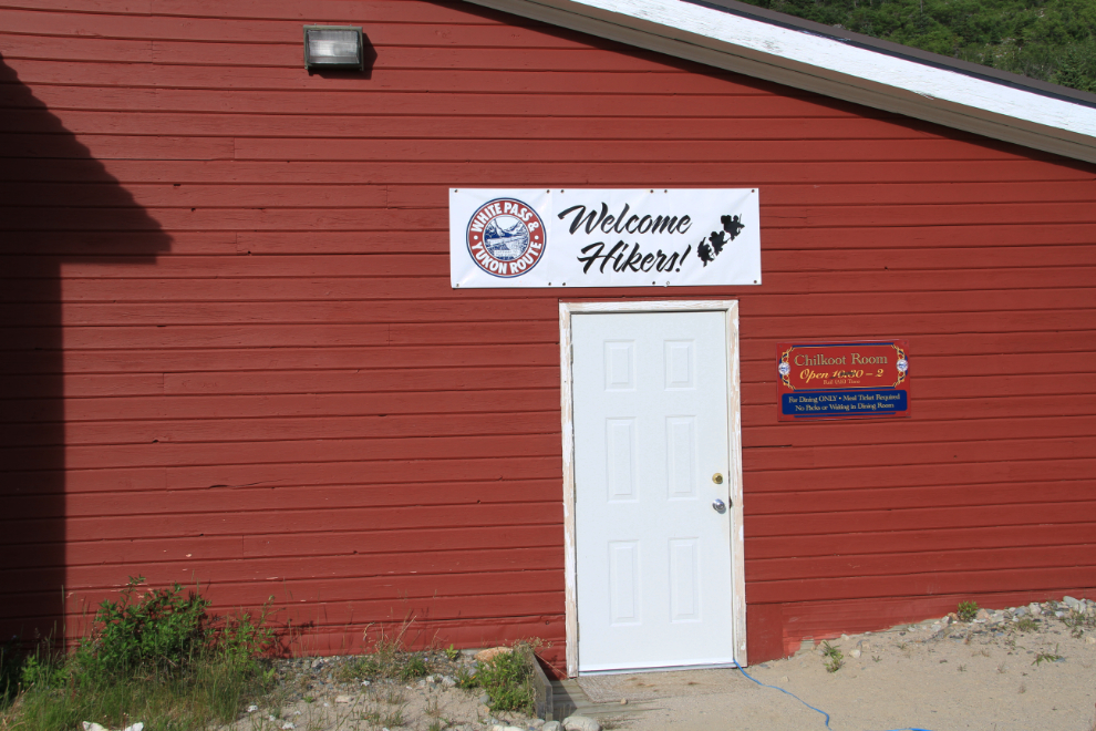
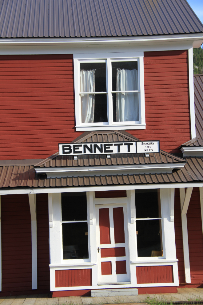
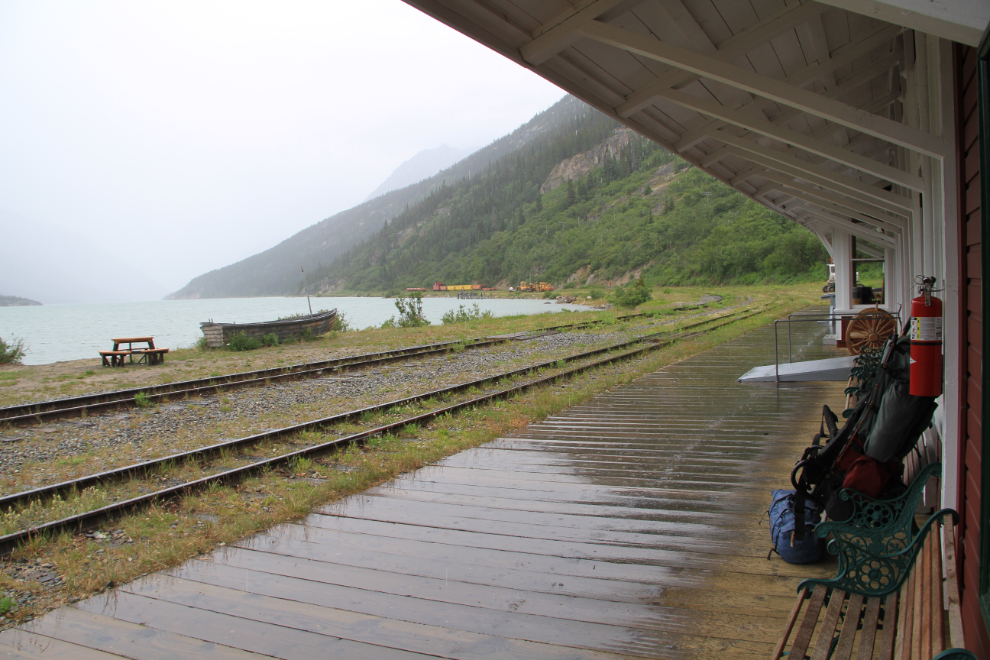
My collection of photos of the railway station was far from complete, so I took many more that evening. There are 3 dining rooms at the front of the station for regular train passengers from the cruise ships, another one at the side for hikers, some of whom are in need of a bath when they get here 🙂
It was great to finally add photos of the station with sun on the front – I’d never been here in the evening before.
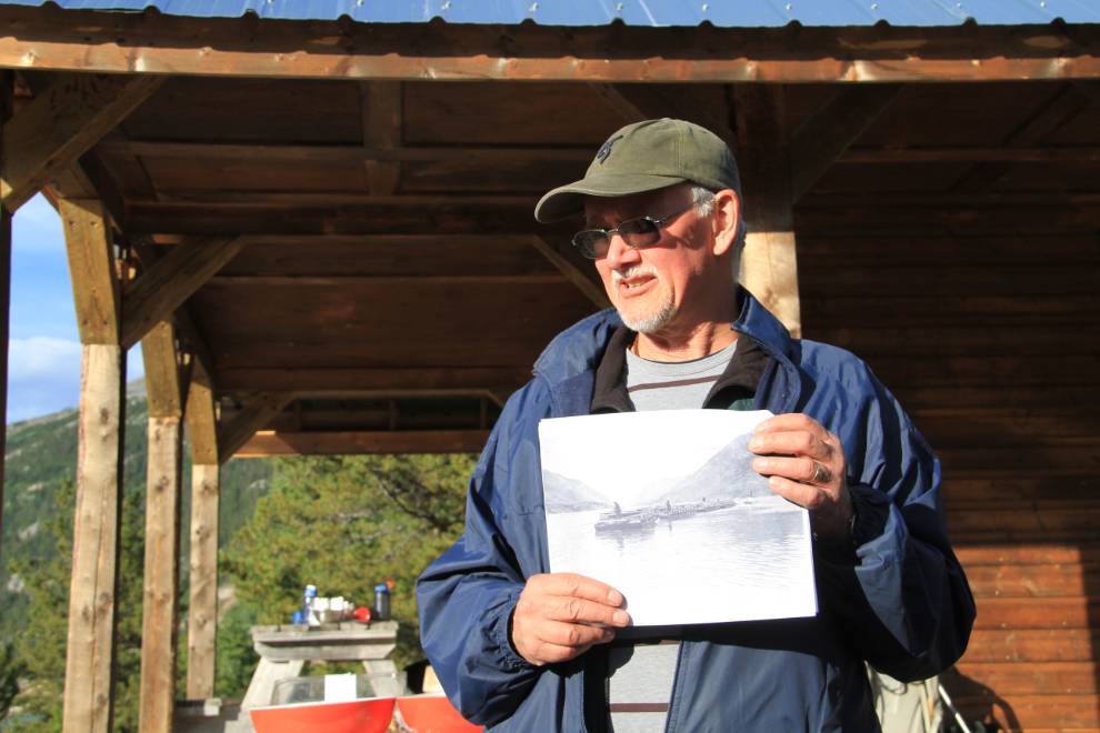
Word had been spread about Michael giving a talk about his cattle-drive project, and attendance was excellent.
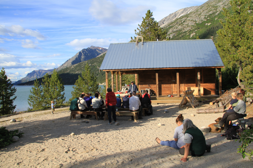
The History Hunter’s passion for history is infectious, and both the talk itself, and people’s reaction to it, was excellent. Several photos of both cattle and sheep drives helped take us back to the Klondike rush – this one shows 3 livestock scows being towed down Lake Bennett.
Morning light over Lake Bennett – this was shot from my tent at 7:18 am on Thursday.
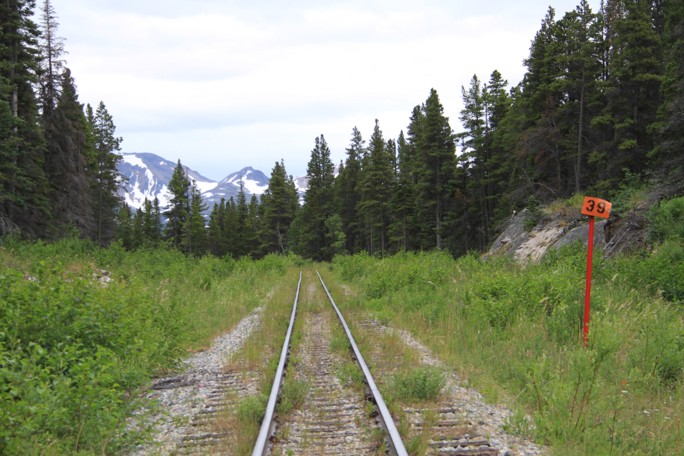
My goal before catching the train back to Carcross was to find where the abandoned section of railway grade I’d found the previous day left the current line. I walked about half a mile past Mile 39, then turned around as I knew I’d missed it.
On a hunch, I followed a faint trail off to the west (left) at this point…
…and found what I was looking for. The railway grade is hidden in the alder to the left.
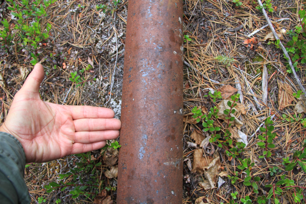
Confirming that the pipeline is indeed 4 inches inside diameter. During World War II, it carried gasoline from Skagway to Whitehorse where it connected to the CANOL system. The pipe was removed from its position along the active rail line perhaps 15 years ago.
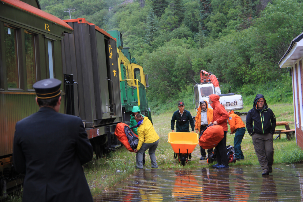
A few drops of rain had started to fall as I got back to Bennett, where I met Michael carrying the first of his gear to the station. The rain increased as I was taking down my tent, and by the time we got to the station with all of our gear, it was pouring. Near-perfect timing!
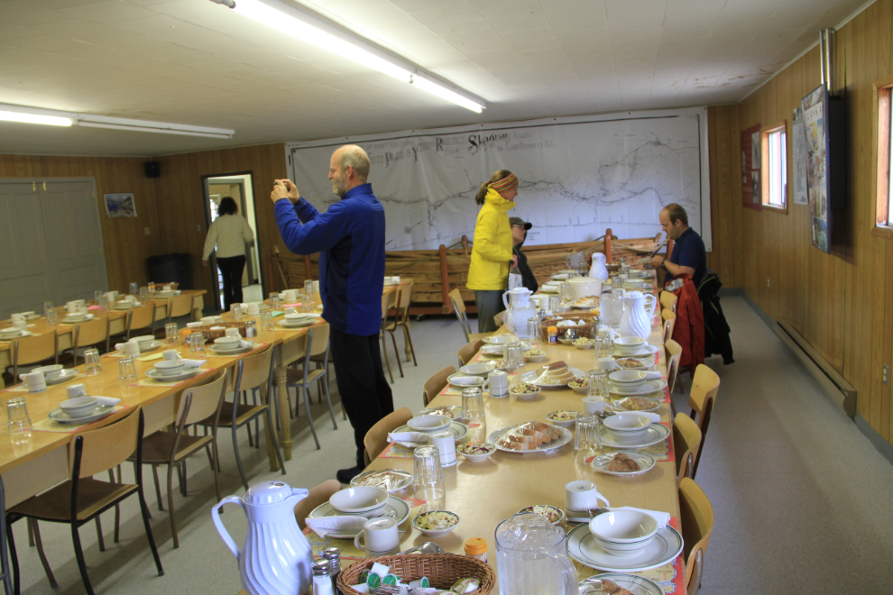
The hikers’ dining room, where the hot lunch of beef stew and apple pie was wonderful (!).
Just after noon, we loaded all of our gear into the freight car on the train that had arrived while we were eating.
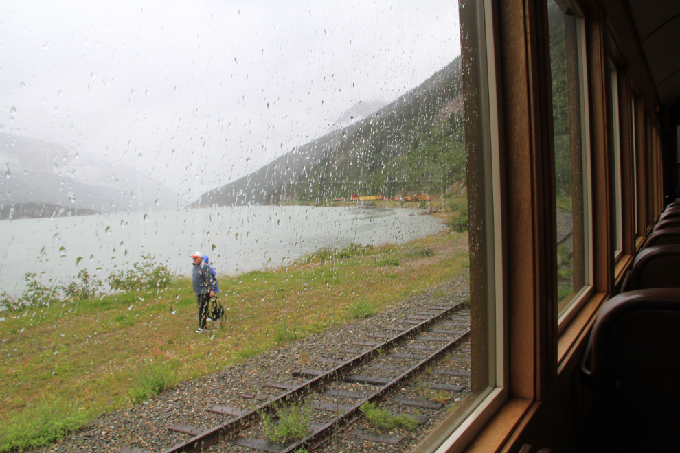
The passenger car was stifling hot when we boarded, but the conductor very soon got the temperature adjusted, and right at 12:30, we headed north. With low cloud and heavy rain, there wasn’t much to see on the way back, but conversation was lively. One of the Parks staff has been studying the 1897 horse-trail route through the White Pass for a few years on his own time, and his stories in particular were fascinating.
I got home about at about 3:00 pm and started catching up on emails, sorting photos, and checking out the ceiling-installation work going on in my basement (it looks great). It had been an exciting 3 days. I love being around people who are passionate about what they do, and the Parks Canada and White Pass staff I met were all in that category. I’ve already arranged to join a similar sort of historic-research outing into the backcountry of the White Pass in August – more about that later 🙂