Exploring around Braeburn, Yukon, by e-bike and 4×4
The weather continues to be wonderful, and though I haven’t been feeling well recently I really needed to get out, so I was determined yesterday to load up the e-bike and go somewhere for a major Adventure, though I had no idea where that might be.
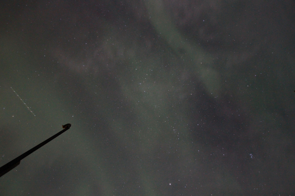
I’m usually up in the middle of the night for a few hours, and yesterday was no exception. When I got up at 01:30, I went out on the back deck, and it looked like there might be a wispy aurora starting. I got my camera together, and the next photo was the first one I shot. We don’t see this type of aurora very often, and while they’re not very impressive and are difficult to photograph because they move so rapidly, they intrigue me. This one was shot at ISO 2500 with a 10-second exposure.
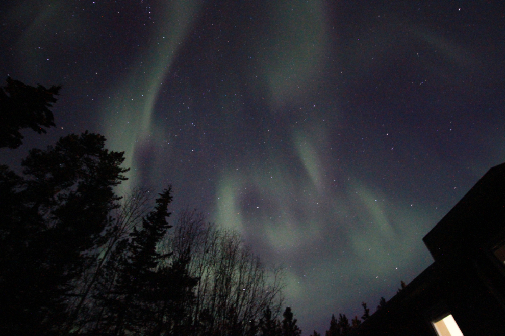
I took a couple more photos just after 03:00, then went back to bed for a couple of hours. Just after 06:00, a post in my Aurora Alert group sent me back outside, and the display was getting quite good. The next photo was in the final series I shot, the best of the night, at 06:35.
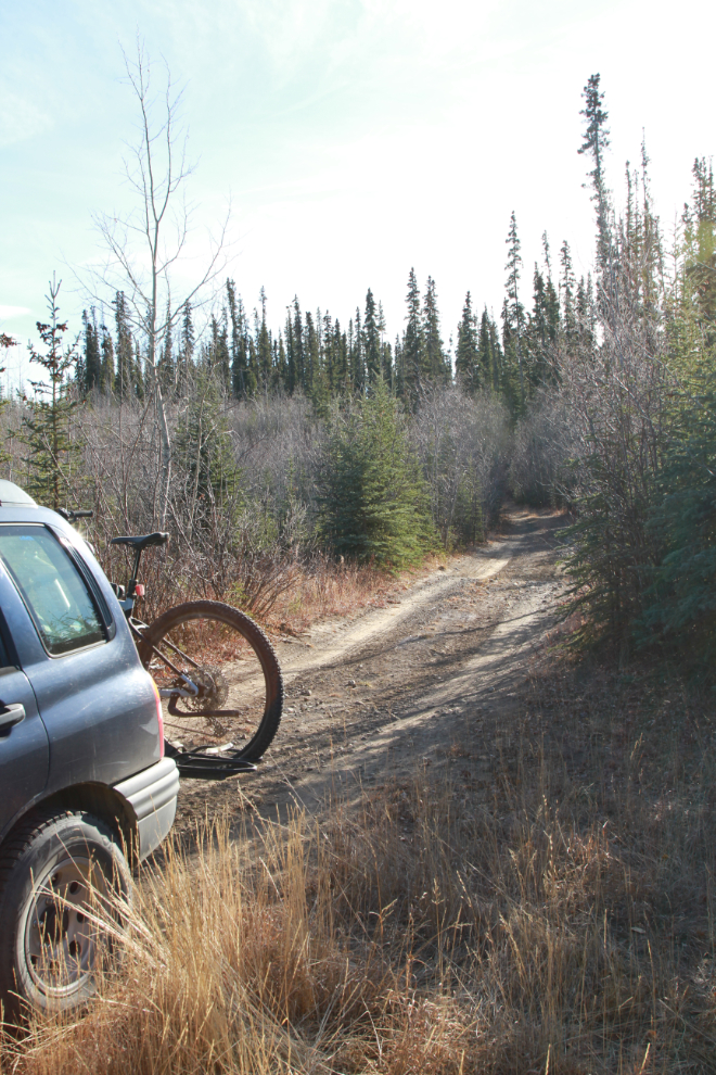
It wasn’t until I was actually loading the bike that I finally came up with a plan – a rather vague one, but a plan. On September 13th I had ridden 30 km of historic Dawson Overland Trail just north of Whitehorse. Where I turned around, there was another 70 km or so of wilderness before the trail came out on the North Klondike Highway at Braeburn Lodge. So, I’d see if I could ride 30 or 40 km south from there.
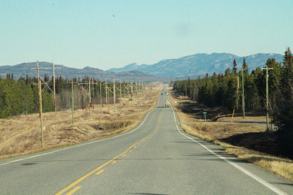
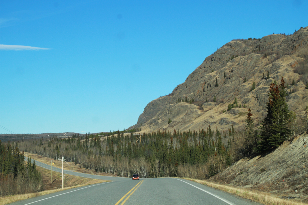
By 12:20, with the temperature at 10°C/50°F, I was well up the North Klondike Highway.
The Kilometer 210 sign can be seen on the right in the next photo. That distance is measured from the ferry terminal in Skagway, Alaska.
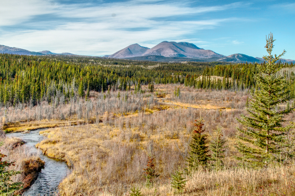
This large volcanic mud flow is one of the more interesting sights along the highway. An outcropping of a similar flow, called Conglomerate Mountain, is a rest area and interpretive sight at Km 298.
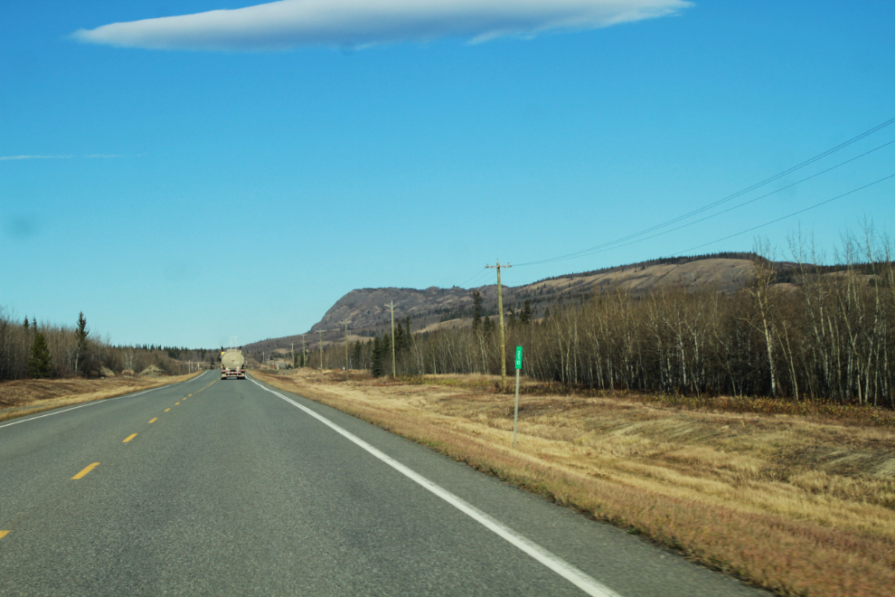
The Fox Creek Bridge, replaced about 3 years ago, is at Km 228.4.
I drove past this scene, then a kilometer or so further north made a U-turn to come back and capture this. That might be Grizzly Mountain, but I’m not certain – I can’t find a map with a name on it.
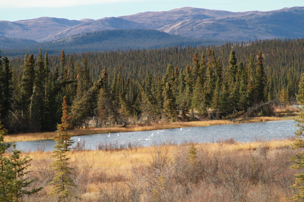
As is often the case this time of year, there were about 20 migrating swans in a small bay at the south end of Fox Lake, right at Km 238 on the highway. I had decided to not bring my heavy telephoto lens on this trip – of course 🙂
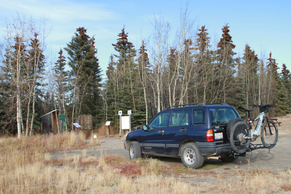
I had forgotten how far Braeburn is, I guess (I’ve only made this drive 2 or 300 times), and didn’t reach the trail until 1:20.
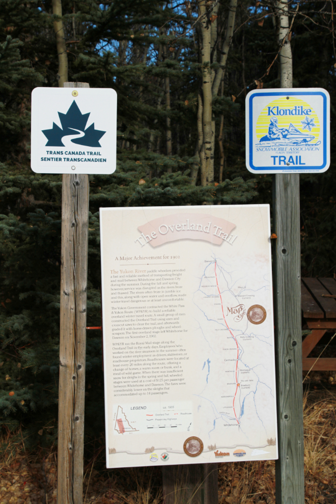
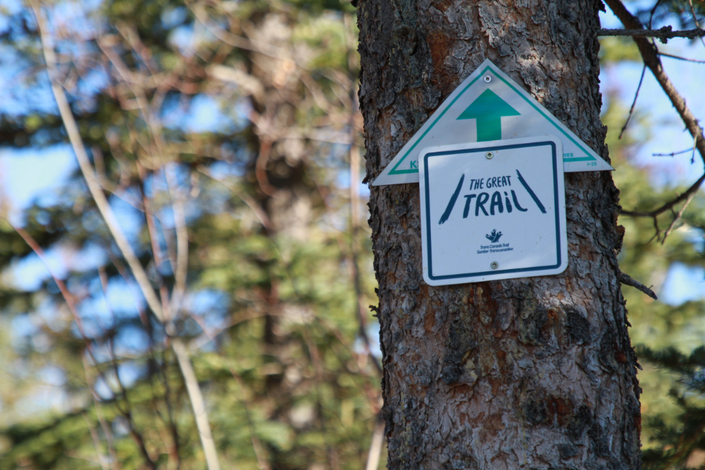
Some information about The Overland Trail. The Klondike Snowmobile Association takes care of much of the Trans Canada Trail within 100 miles or so of Whitehorse. See the KSA website for much more information about that.
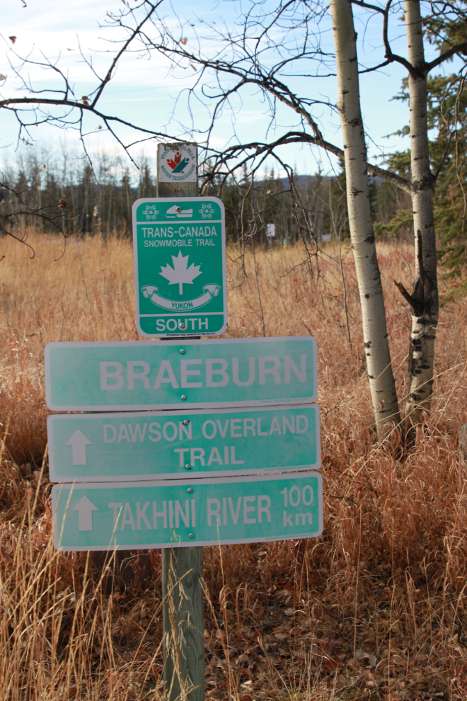
There are the signs I wanted to see – “Dawson Overland Trail” and “Takhini River 100 km.”
The actual trail starts about 100 meters behind the lodge, and that’s where I unloaded the bike.
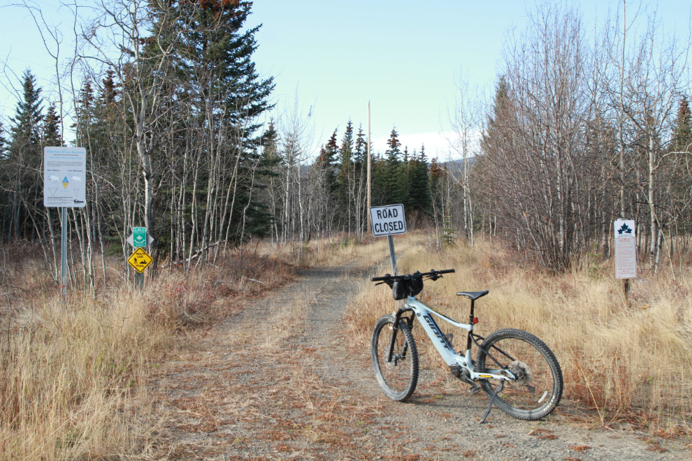
They seem to have blown their entire sign budget on the first couple of hundred meters, because after that you’re on your own. My first guess went into a residential area so I backtracked, and that trail ended here, on the shore of Braeburn Lake. I had ridden 3.3 km at this point.

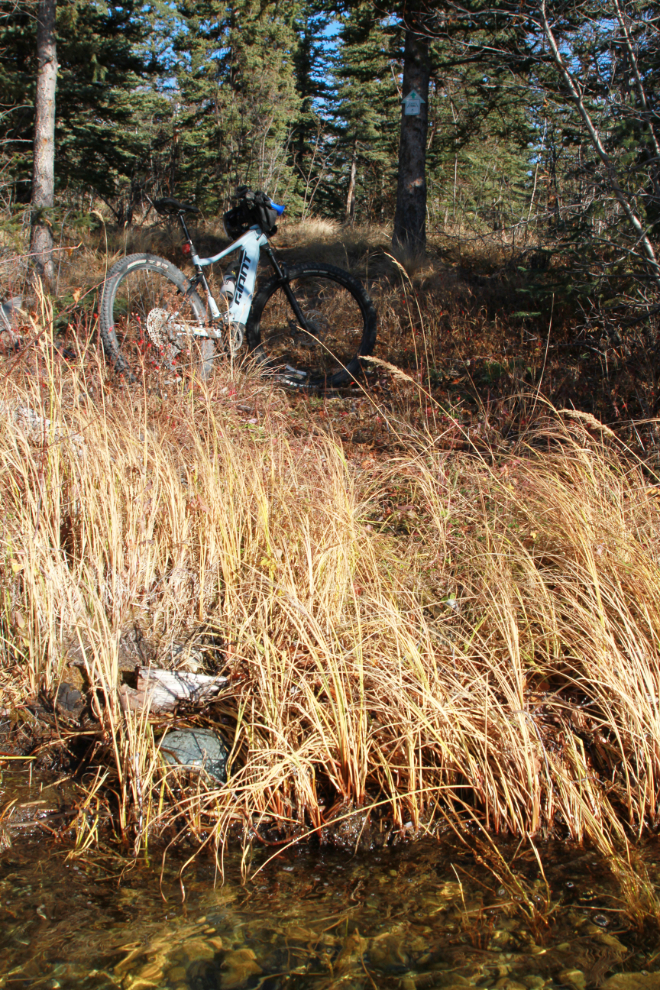
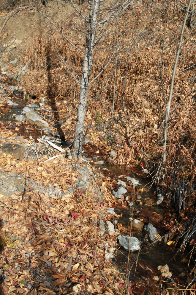
The next trail I took was quite vague, but I saw no other options. At 3.9 km I came to a creek crossing. Luckily I had decided to wear my sport sandals – despite weather that made them a questionable choice – so water crossings weren’t an issue.
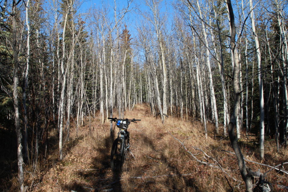
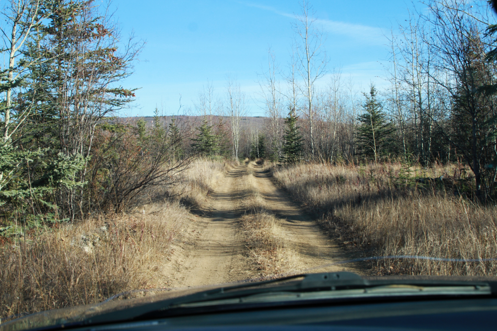
Finally at 2:00, some really nice riding of the sort I had expected 🙂 I still wasn’t certain I was on the Trans Canada Trail, though.
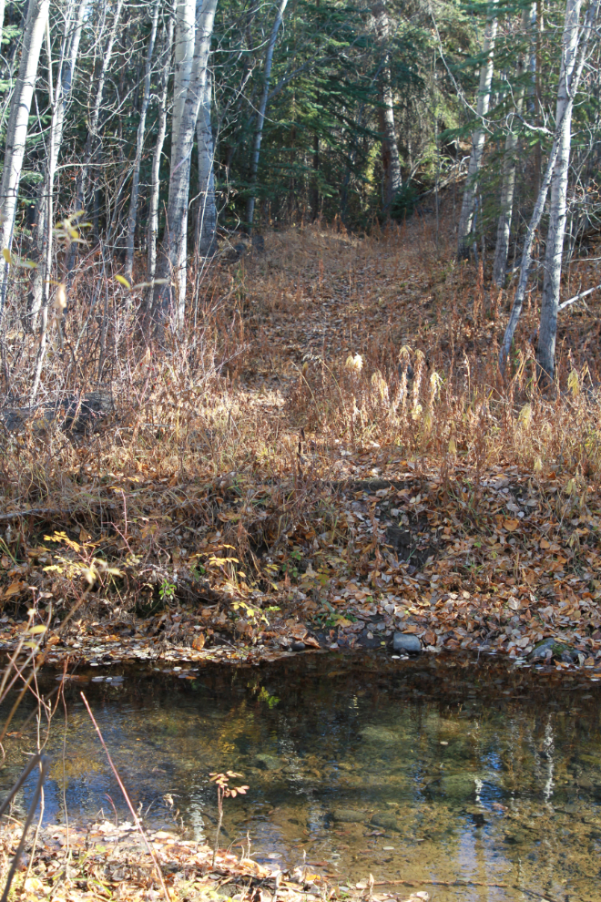
That trail, too, ended at the lakeshore. I searched around for another trail, but found nothing. Finally I went down to the water, and when I looked back, saw this pair of signs on a tree. The trail was winter-use only, and went across the lake ice. * sigh *
This is the view of the trail from out in the lake a few feet.
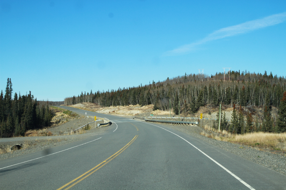
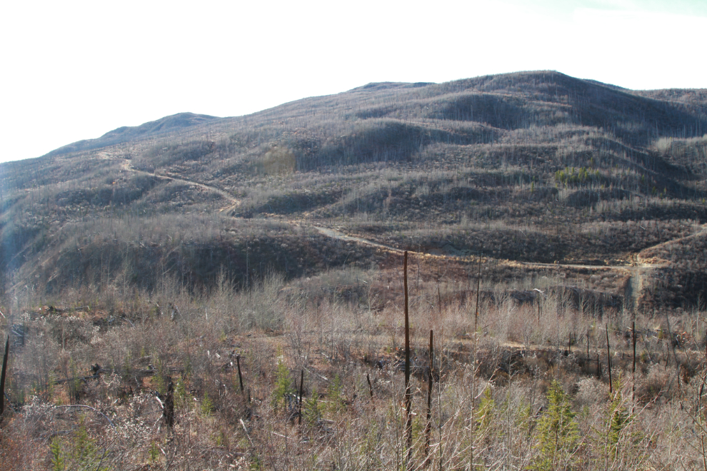
Now at a dead-end with no solution, I rode back to the car, loaded up the bike, and started south. That had been a very long drive for a short ride, so I decided to explore Sawmill Road, a few miles back. It got very interesting, to the point that I started to think I may have found a trail around Braeburn Lake. But after a few miles I gave up, and turned around at the spot seen in the next photo, at 2:50.
The light for photos was better going back to the highway – this is what much of the road looked like.
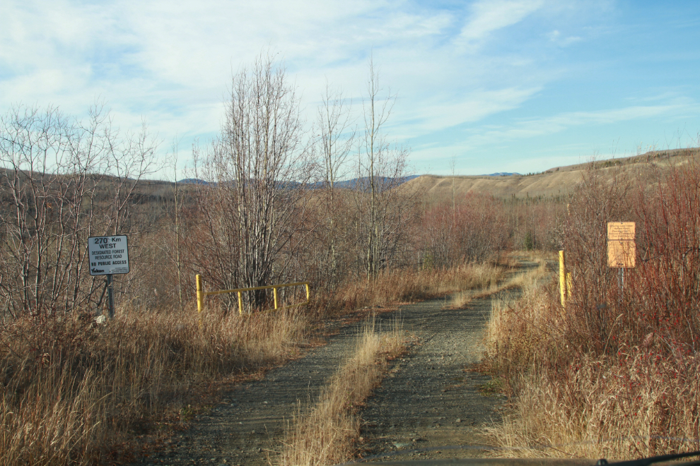
I’d been wondering for years where this road at about Km 269 goes. Although I knew there was a gate across it at the bottom of the valley, I decided to go for a look.
A hundred meters off the highway, these signs clarified it – a restricted forest access road for firewood cutting. Okay, now I know.
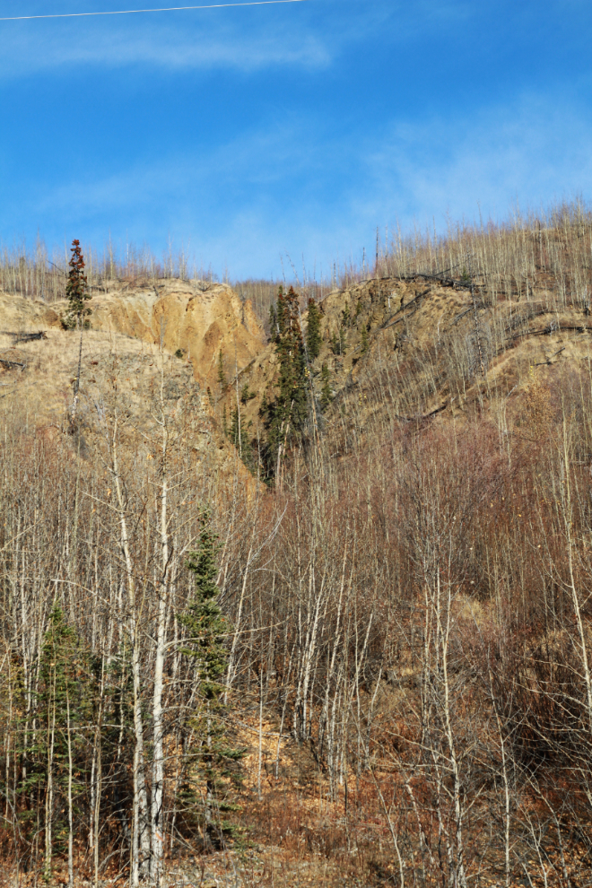
At about Km 265 there’s a dramatic little canyon visible for a couple of seconds off to the side of the highway. I drove by it as always then decided this was a good day to go for a look at it, so made another U-turn.
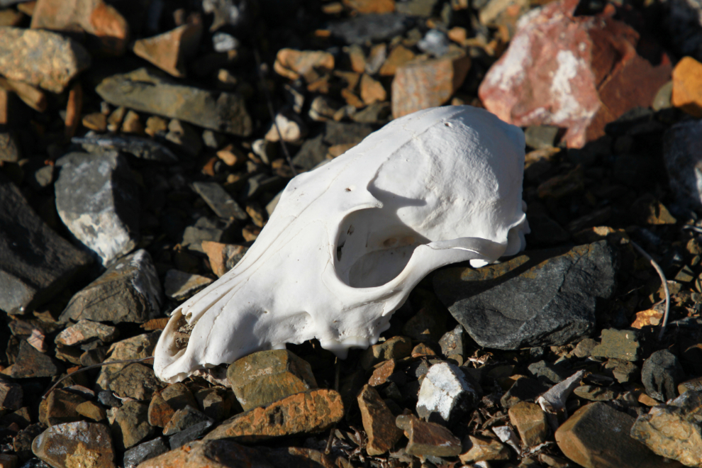
Hey, a fox skull! That was a cool find, and I set it in a place of honour surveying the world.
This little creek apparently created that canyon. It turned out that I was more tired than I was curious, so didn’t go very far. I’ll see it another day. Or not, perhaps… 🙂
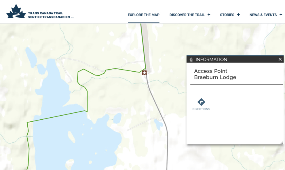
As I started writing this post a few hours ago, I pulled up the Trans Canada Trail website, and it does indeed show the trail crossing Braeburn Lake. DOH!
A friend said last night that they used to access the trail from the north end of the lake, but when I looked at the aerial photos of that area, that access is far too complex for me. So, this part of the Dawson Overland Trail wil remain a mystery to me, as I won’t be making another attempt.
The weather forecast for today calls for a mix of sun and cloud with a high of 16°C/61°F, so I really should get out somewhere again. We’ll see how that idea progresses.
On the map you show, the Old Dawson Trail Access continues down that good residential road that ends at the lakes North outlet stream. Wade that stream (shallow most of the time) and you’ll then be on the ODT. The trail heads around the North end of the lake then swings South. It’s pretty well used as there’s an active homestead over towards the Nordenskiold. Late May can be a good time to bike in there as it dries out pretty quick.
Sometimes the days ‘adventure’ turns out to be missed turns, misread maps, mud holes, flat tires… all part of the process…and makes the good days just seem that much better and rewarding. One step sideways…not a bad thing really.
Amazing Murray! That bike has brought you so much joy!! Thanks for sharing!
Ellen
Thanks, Ellen. Yes, the bikes were a great investment in our quality of life. Cathy doesn’t hers anywhere near as much as I do, but it still gets her out.