Driving from Hudson’s Hope to Clinton and West Kelowna
I got home from Kelowna just after midnight last night (Thursday), but this post will cover the final legs of the drive down, from Hudson’s Hope to Clinton, and Clinton to West Kelowna.
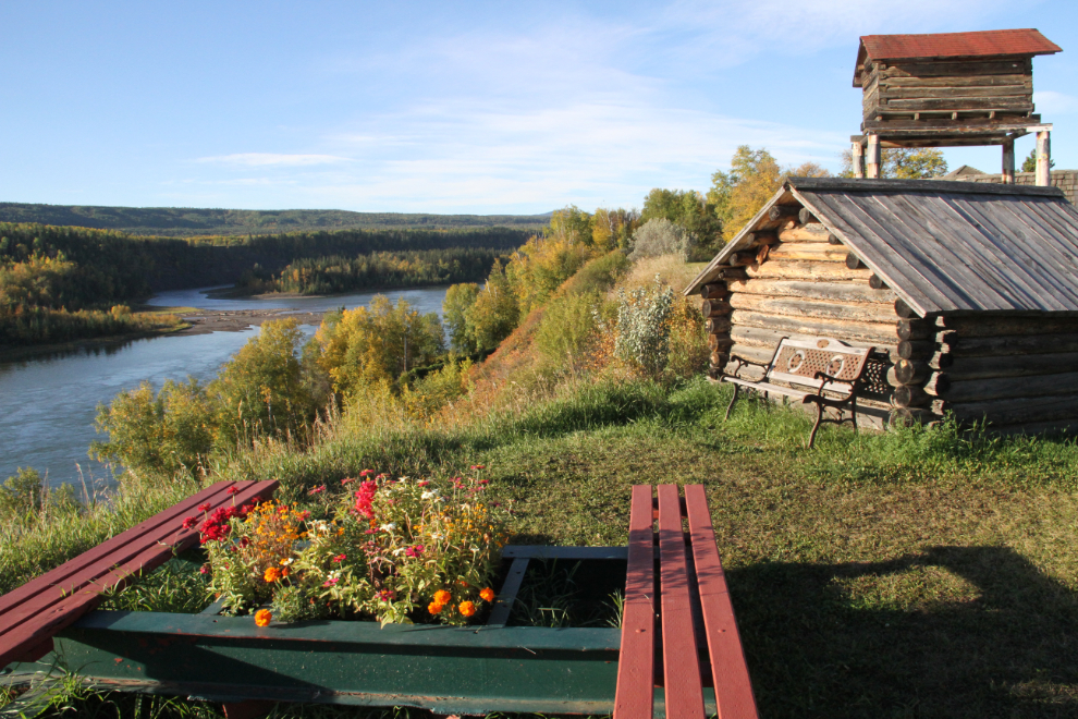
After checking out of the Sportsman’s Inn in Hudson’s Hope at about 07:45 on Tuesday morning, I drove back to the small museum. I knew that it wouldn’t be opened, but I got the views over the Peace River that I wanted. After a huge dinner at the hotel the night before, I hit the road without breakfast.
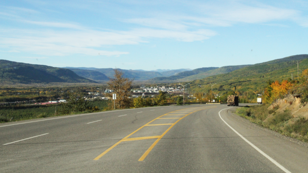
At 09:25, I was at the eastern end of Highway 29, dropping down into Chetwynd.
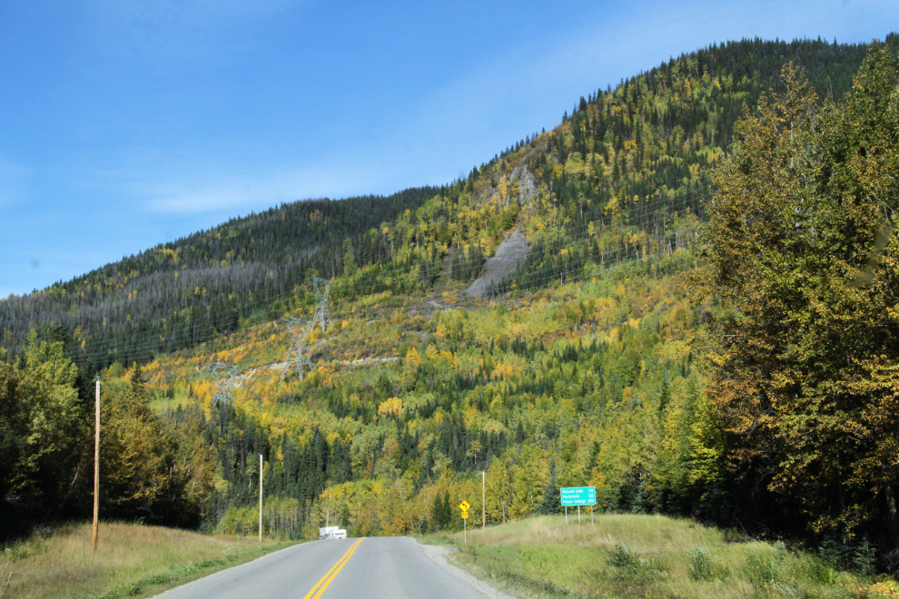
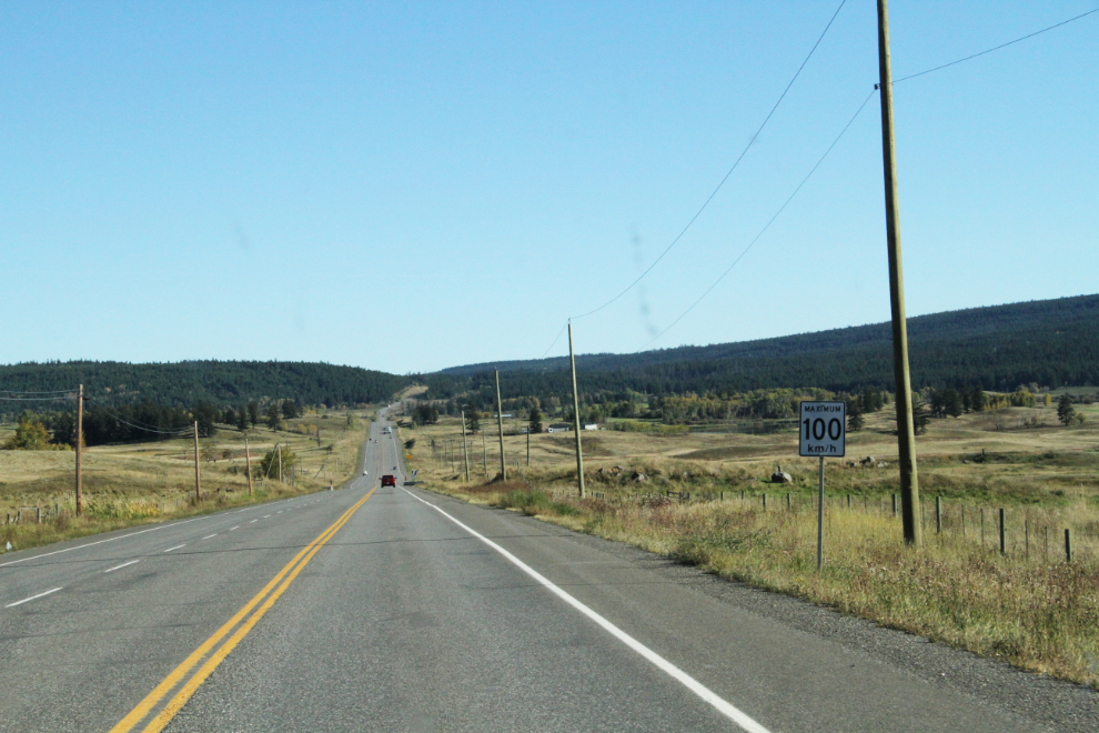
Heading south from Chetwynd on Highway 97, BC’s longest highway, after fueling up at Chetwynd. Highway 97 stretches right from the Yukon to Washington State, under several different names for various sections – this one being the Hart Highway. Much of the hillside is covered with electrical transmission lines from the massive W. A. C. Bennett Dam at Hudson’s Hope.
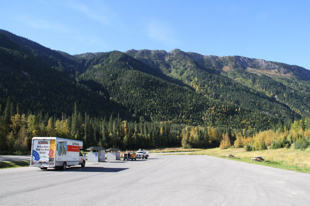
At 10:30, I stopped at the huge Pine Pass rest area for a few minutes. There was extensive damage to the highway in the area from floods this past June, but I couldn’t see where the road had been destroyed. There’s a great deal of work being done on creeks all along the highway from Chetwynd south, though, and there were a few short delays.
Bijoux Falls Provincial Park is a wonderful place for a short walk as long as there are no tour buses there, and I spent a few extra minutes chatting with a woman from Mackenzie who had a friend’s recently-rescued dog out for the day.
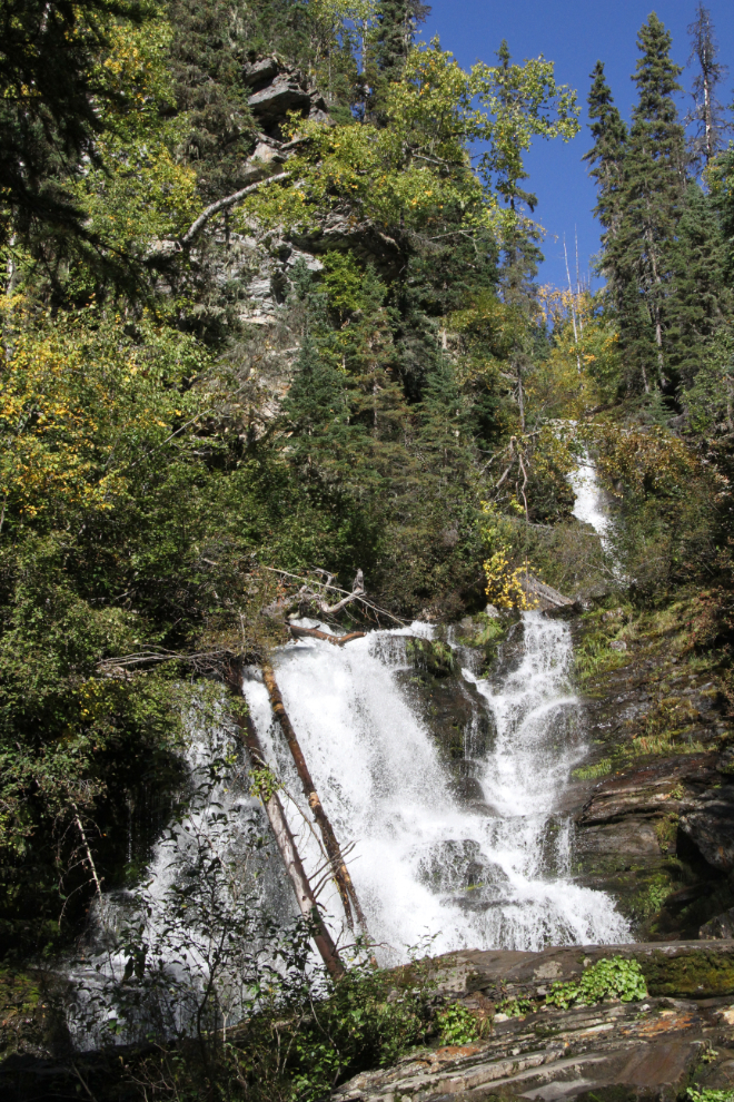
From Bijoux Falls I drove straight through to Clinton, where I planned to spend the night. This photo was shot south of Williams Lake at 4:30.
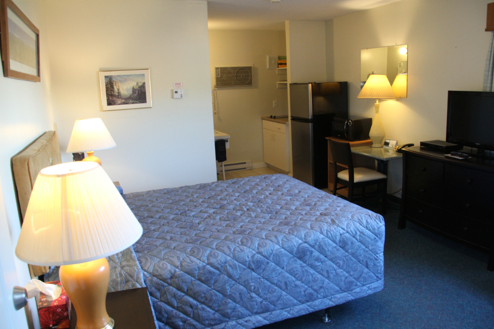
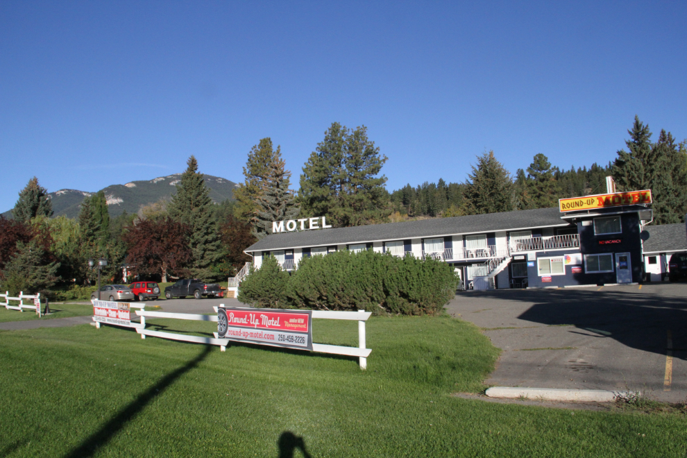
I reached the Round-Up Motel at Clinton at 6:00. I’ve stayed here 3 times in recent years, and it was the reason I chose Clinton to overnight. The motel has a new owner, and I wasn’t surprised to hear that the previous owners have retired in Edmonton. I got the last room available (room #17), a kitchenette which the owner gave me for $80 plus taxes, a bit of a senior’s discount. I was very pleased to see that the new owner is keeping up the previous owners’ high standards.
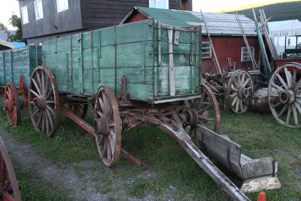
Once I got settled, I did a bit of browsing at the antique store across the highway from the motel. The Clinton Emporium has a large and varied stock, and much of it, right down to toy trucks and other “portables”, is left outside on tables beside the road overnight.
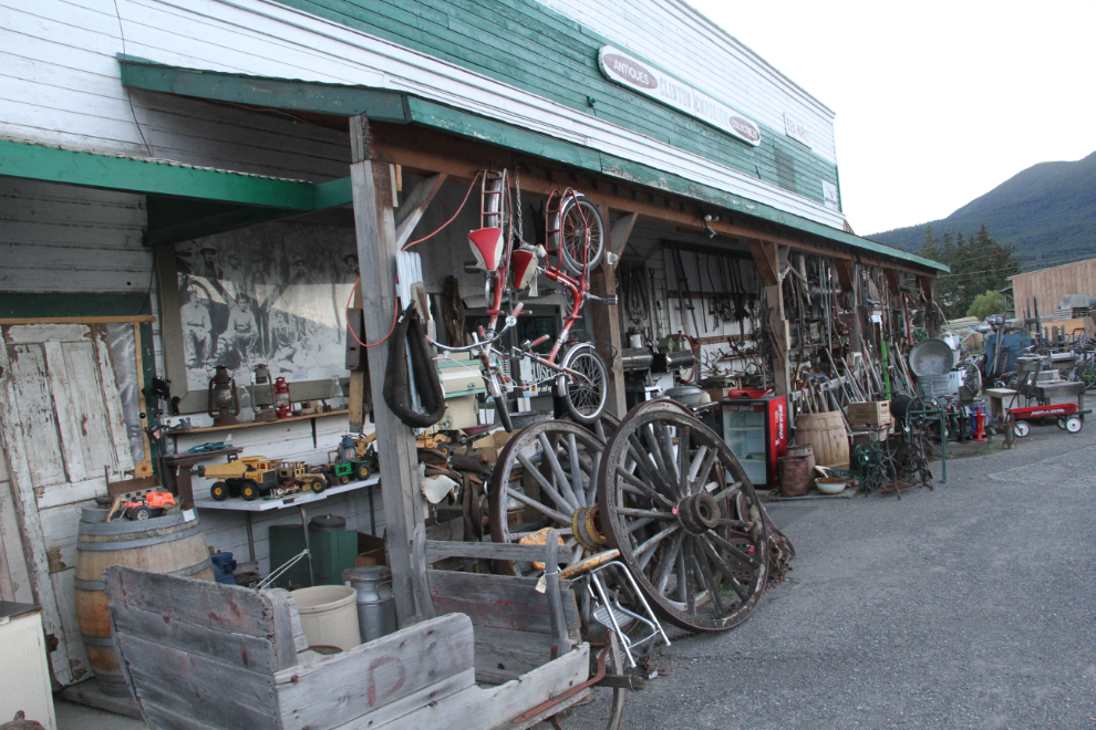
Prices seemed really reasonable, too – this large freight wagon was only $1,795. No, I’m not shopping – there was a time, however, when this freight wagon would have gotten me thinking… 🙂
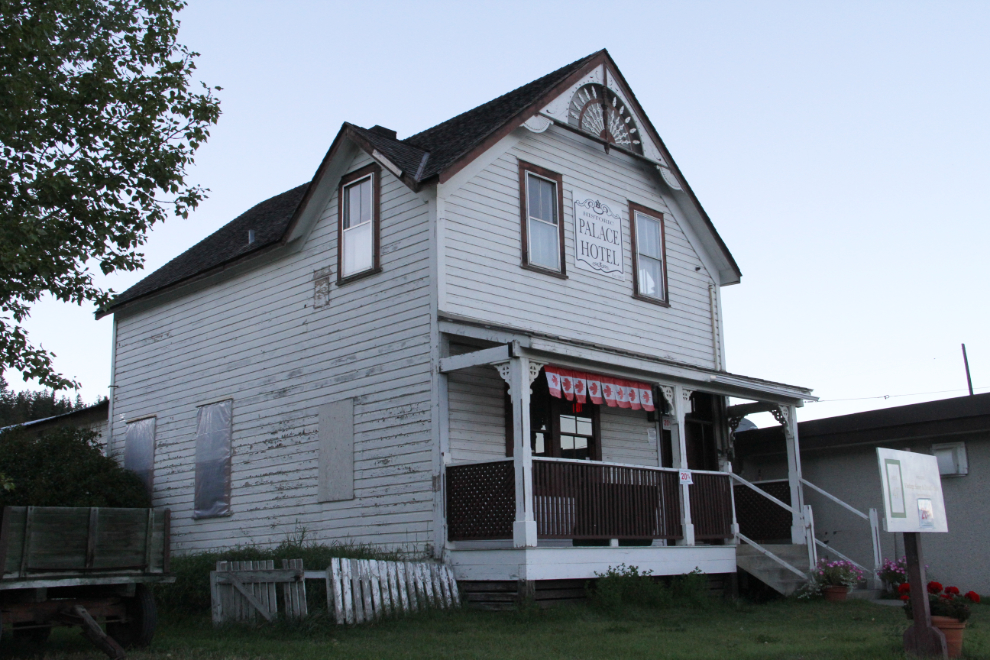
Although fires have taken many of Clinton’s oldest buildings since I started seeing the community almost 60 years ago, but there’s still a lot left. The Palace Hotel was built as a private home in 1862, and became a hotel in the 1880s.
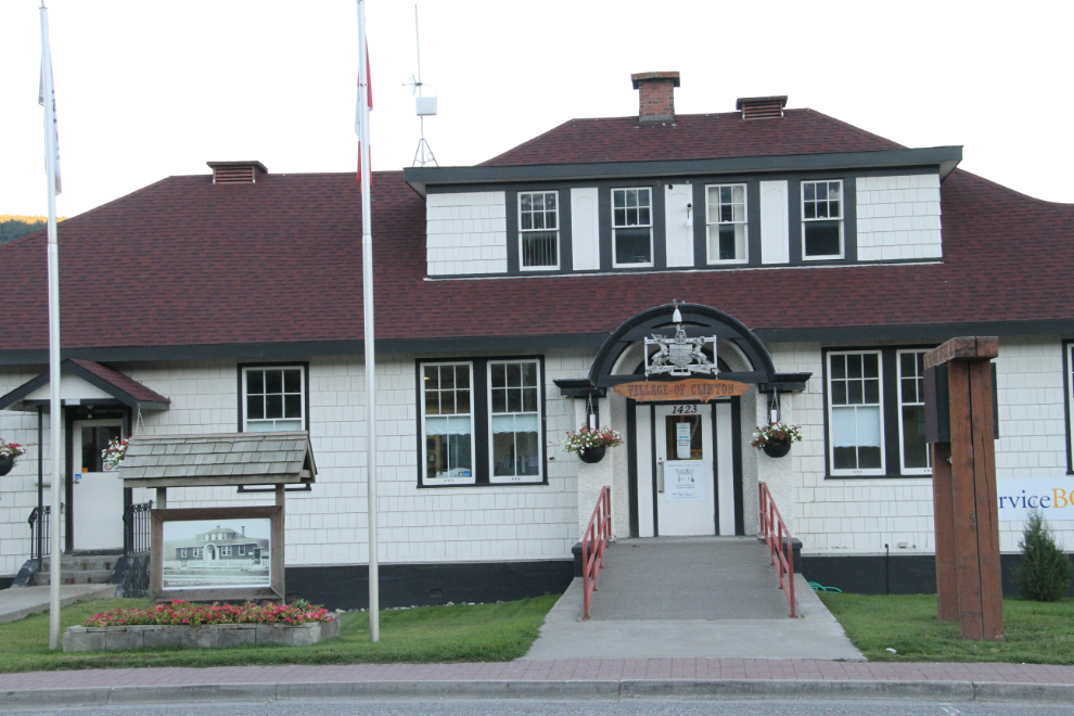
Even the government office building, built in 1927, looks like it would be worth a look inside. It nows houses both the Village of Clinton and Service BC offices.
I had dinner at the pub in the Cariboo Lodge, four blocks or so from the Round-Up. The waiter screwed up my order, but the chicken burger was good, and probably healthier than what I ordered anyway 🙂 After a fairly long day of driving (769 km / 478 mi. in 10 hours), I was in bed early.
This is the Round-Up Motel on Wednesday morning just after 8:00, as I was about ready to hit the road.
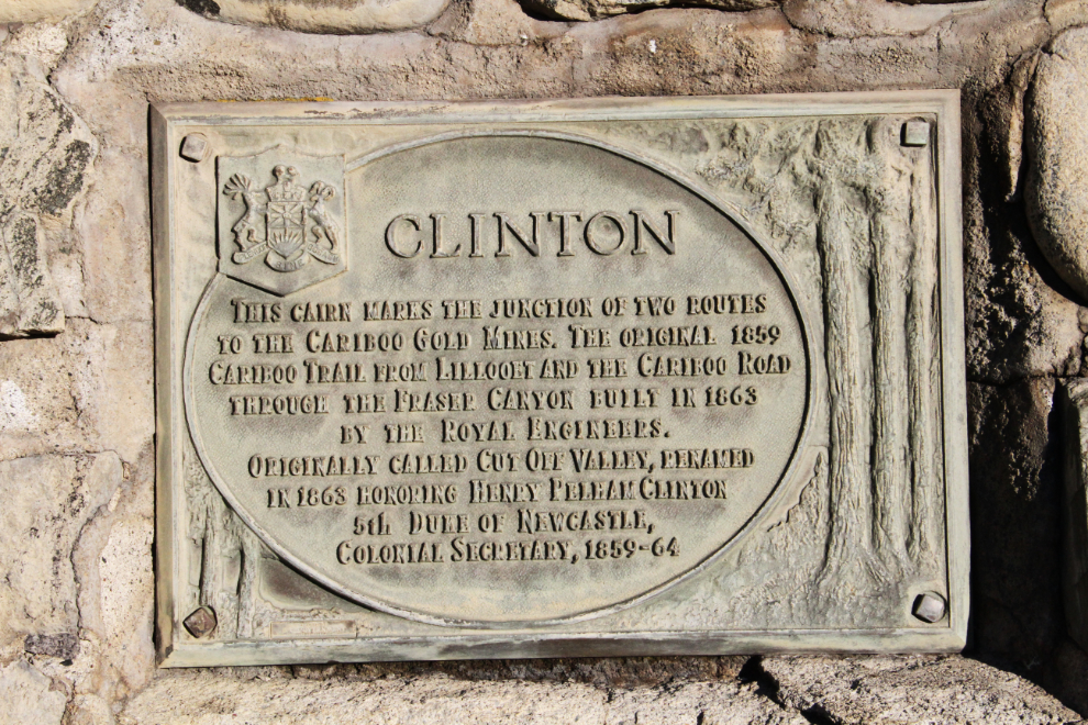
Beside the motel, at the southern edge of Clinton, is this cairn: “Clinton. This cairn marks the junction of two routes to the Cariboo Gold Mines. The original 1859 Cariboo Trail from Lillooet and the Cariboo Road through the Fraser Canyon built in 1863 by the Royal Engineers. Originally called Cut Off Valley, renamed in 1863 honoring Henry Pelham Clinton 5th Duke of Newcastle, Colonial Secretary, 1859-64.” A tiny plaque below the large one says “Derward Smith, Clinton’s Land Inspector 1955 – designed and built this cairn with stones he collected from both routes”.
At 09:00, I turned off Highway 97 onto 97C, which would take me through Ashcroft, Logan Lake, and Merritt. Despite some very steep grades, it’s the shortest route, avoids the awful traffic congestion through Kelowna, and I hadn’t driven it in many years.
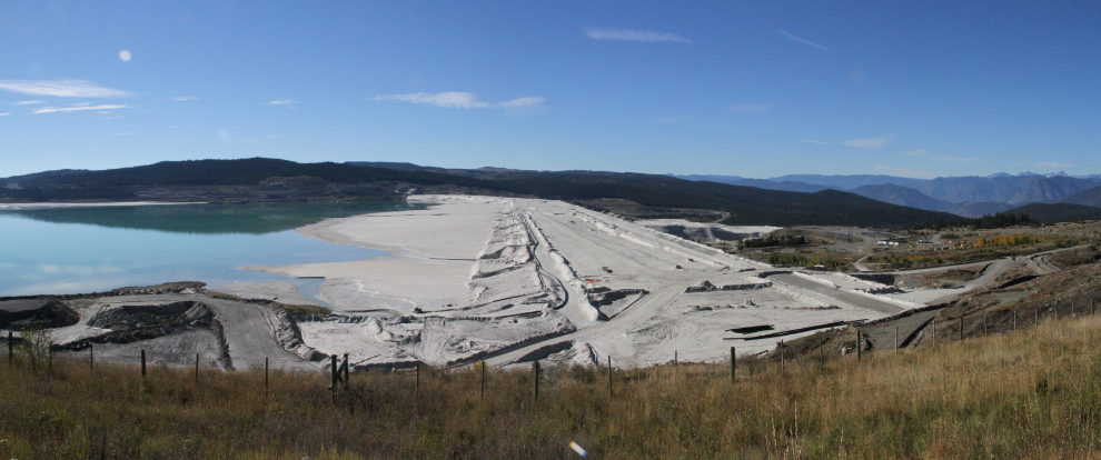
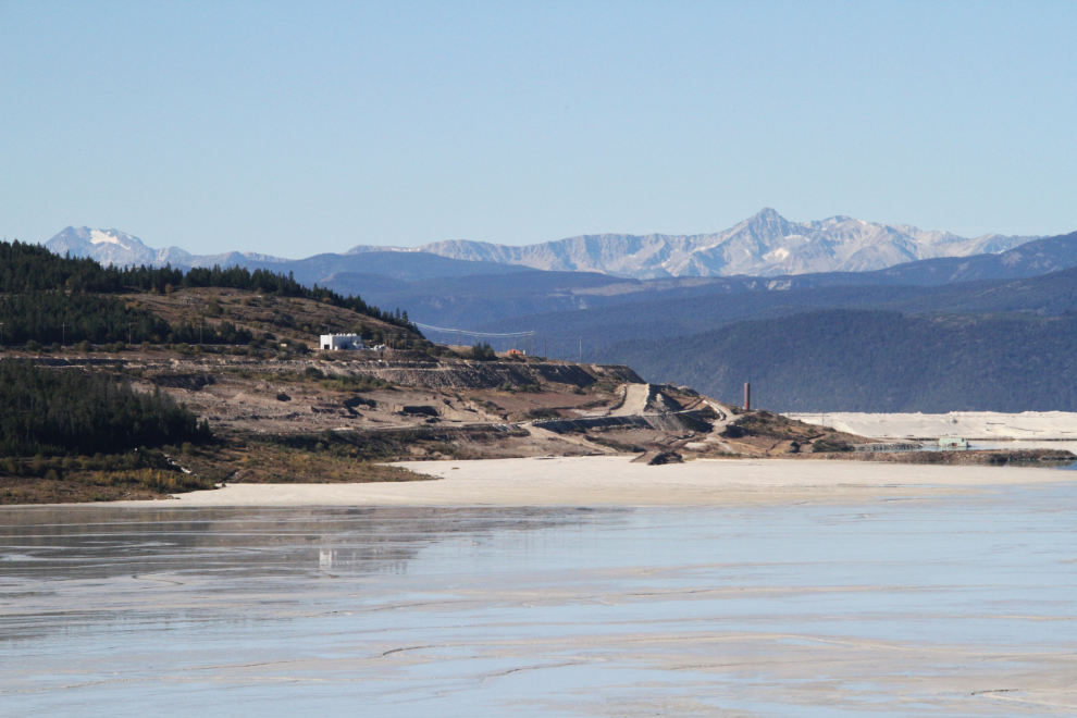
Nearing Logan lake half an hour later, I came to Highland Valley Copper’s mine tailings pond. It’s almost 10 kilometres in length, with a massive earthen dam, seen in this panoramic photo. The Highland Valley Copper mine is the largest open pit copper mine in Canada. It also produces large amounts of molybdenum, and small amounts of gold and silver.
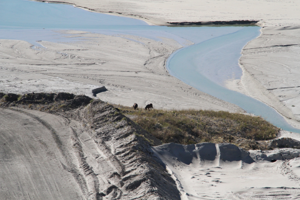
I was very surprised to see a couple of wild horses grazing on a small patch of grass among the vast expanse of tailings.
A closer look at the far end of the earthen dam.
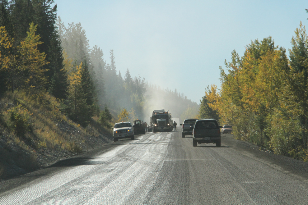
There were short delays at a few spots along the highway west of Logan Lake. This one was for re-paving of a section of the road.
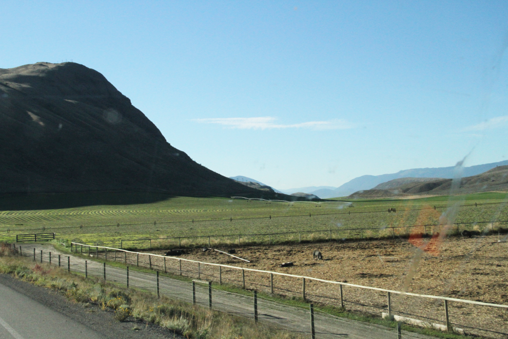
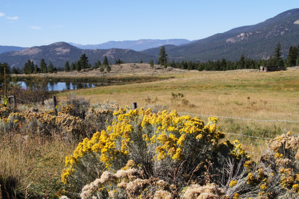
Ranching is still important throughout much of the dry areas of central BC. Although the log building in the distance was abandoned long along, the fence and gate leading to it are fairly new.
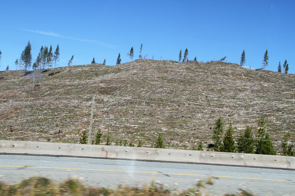
Clear-cut logging along the Okanagan Connector part of Highway 97C, between Merritt and West Kelowna.
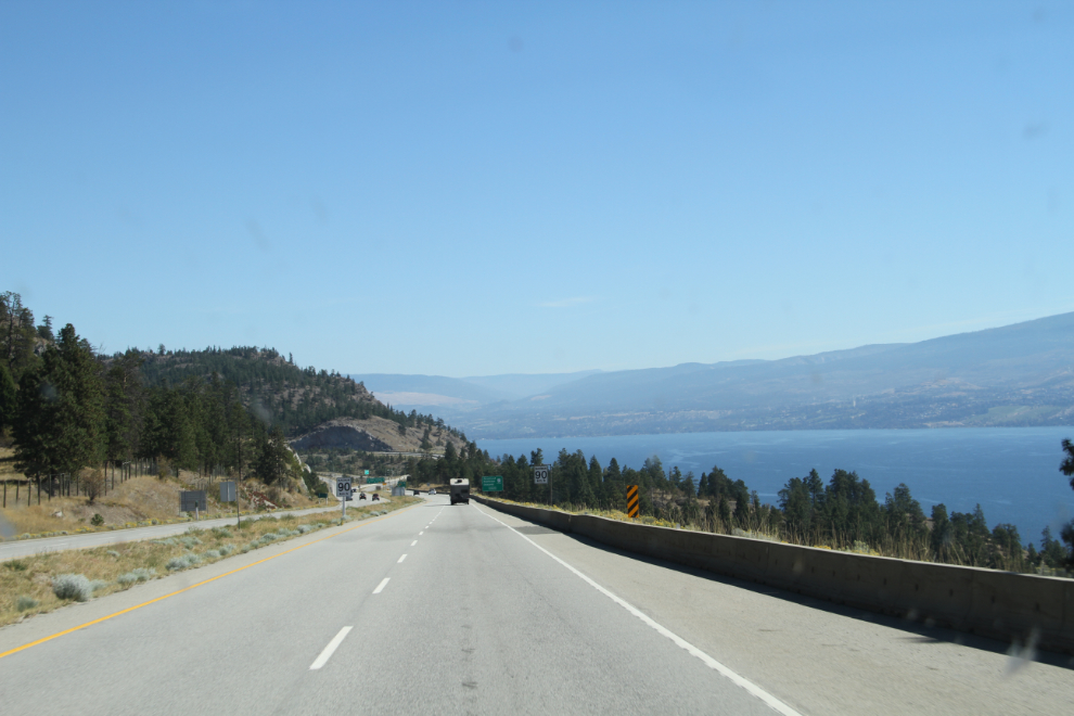
Nearing the eastern end of the the Okanagan Connector at noon, with Okanagan Lake visible.
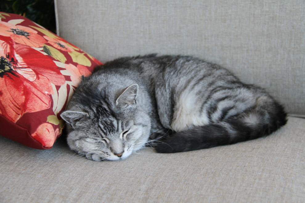
About 3 minutes after I arrived at my friends’ home, a couple of energetic young fellows arrived to unload the truck. All the kitty’s stuff was now in her new home (she flew down from Whitehorse on Air North on Sunday night), and she was settled 🙂
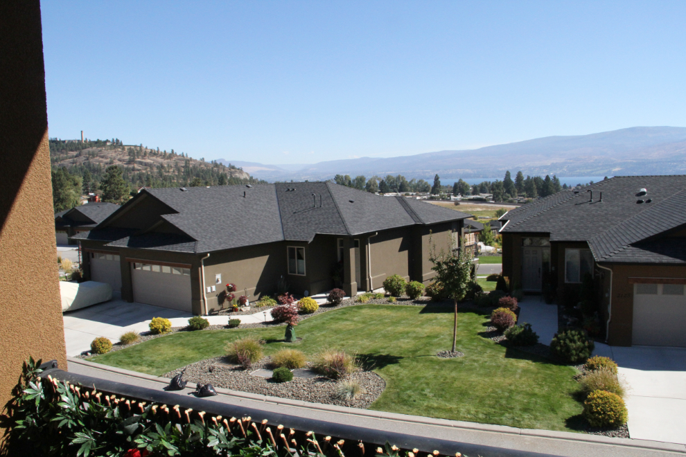
The view from the kitty’s new home. I had a very enjoyable visit, spent some time with my Dad at his new home nearby, and at 7:30 on Thursday, headed for the airport to fly home.
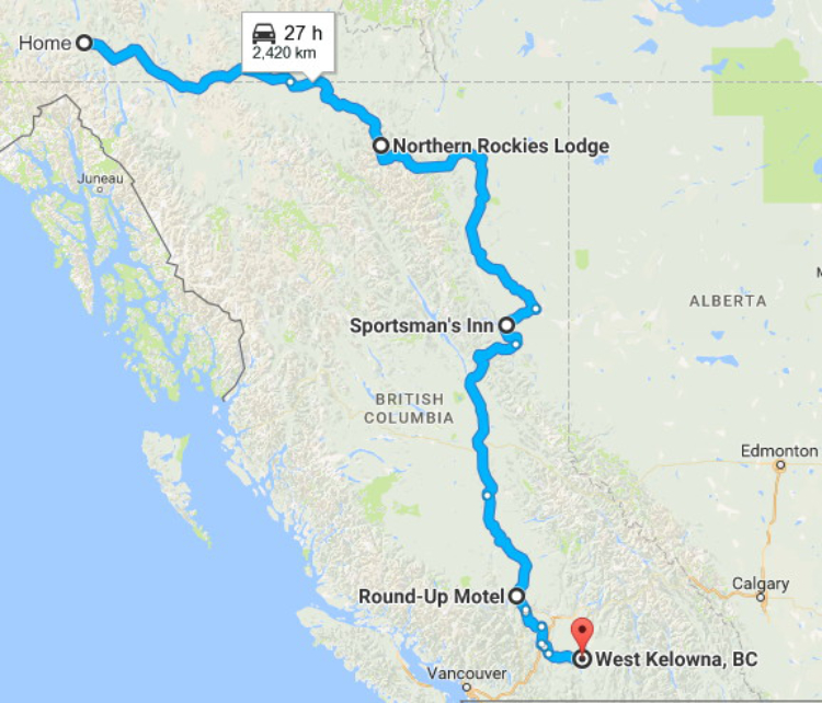
This is a map of the entire 3½-day trip – click here to open an interactive version in a new window.
I was going to leave for a couple of weeks with the motorhome tomorrow (Saturday), but I’ve all of a sudden developed a bad cold, so we’ll see what happens in the morning.