BC RVing: Liard River to Summit Lake
Day 2 of the trip, Thursday, September 10th, was so busy that by the end of it, it took me a while to figure out that it actually had been just one day 🙂
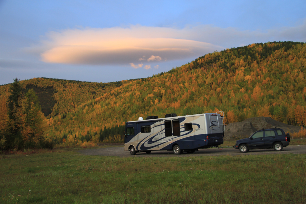
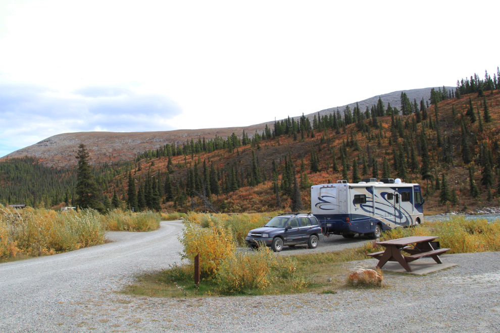
Dawn at our parking spot for the night, a large gravel pullout at Km 749.5, about 15 km (10 miles) south of Liard River Hot Springs. I shot this at 07:47, as we were about to unhook the Tracker and go up the road a bit to take some photos of the thick fog in the Liard River valley far below us.
The sun peeking over the mountains at 08:08.
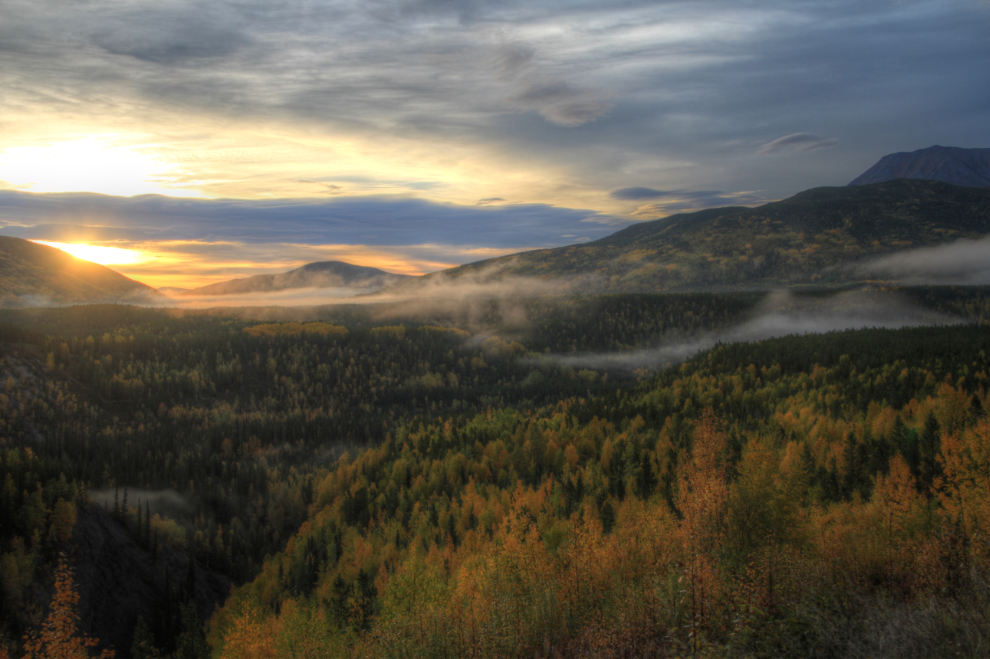
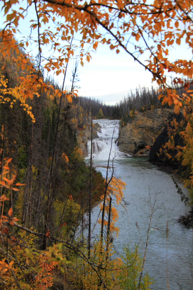
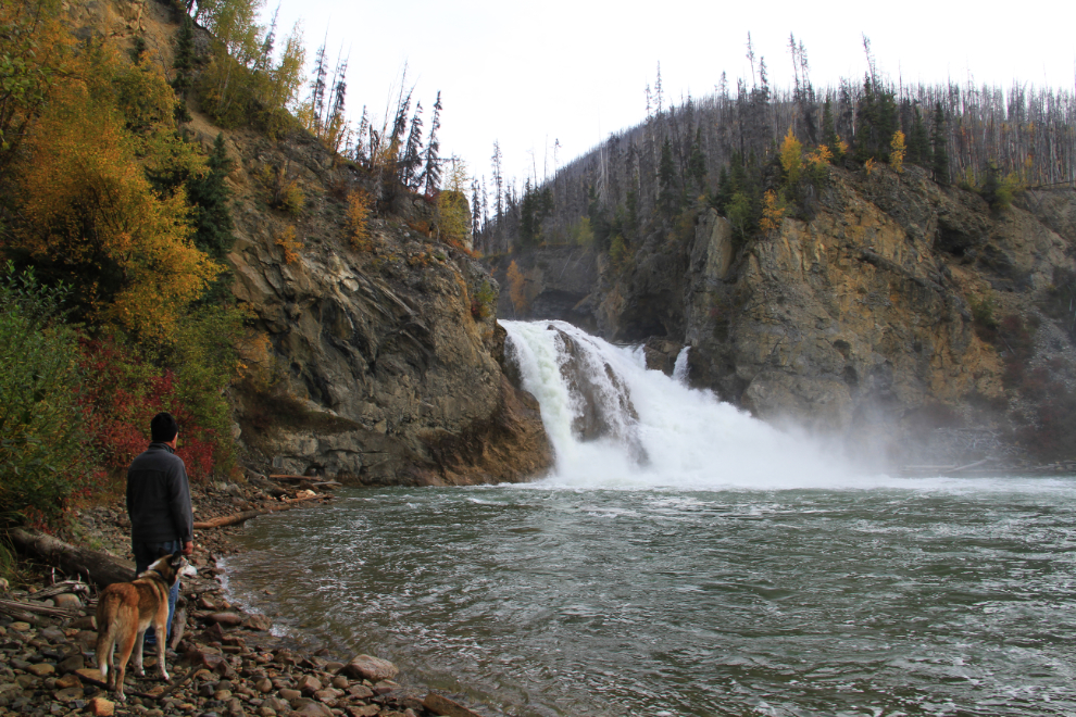
The fog didn’t really offer the photo ops that I’d hoped for, so I continued on to Smith River Falls, mostly for my next post at Destination BC (that blog series is now gone). From Km 792.6 of the highway, a narrow, winding gravel road leads 2.5 km (1.5 mi) to a parking area where a trail leads to the falls. A couple of hundred feet from the parking area, this is the view.
There used to be an impressive series of stairs to get down to the falls, but they were all destroyed in a forest fire in 2009 and haven’t been rebuilt. It doesn’t show in the photo, but the first drop from the parking lot is very steep.
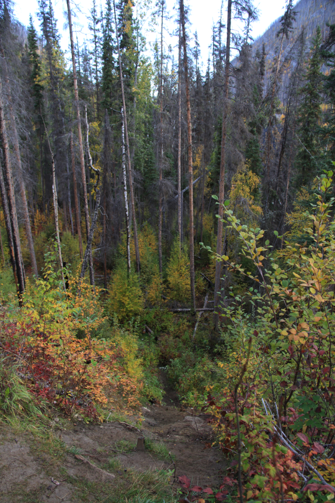
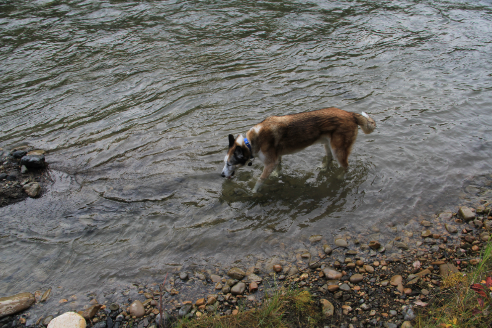
At the bottom of the drop seen above, there are 2 trails to choose from. The one to the right is new since I was last here, so we went that way first. The trail is very rough, but offers a relatively easy route to the river below the falls. The kids never pass up an opportunity to drink cold, natural Northern waters.
The trail continues up the river (either through the brush or along the bank), but at this point, further access is blocked by a cliff – the river is too deep and fast to wade even if I was so inclined on a warm day 🙂
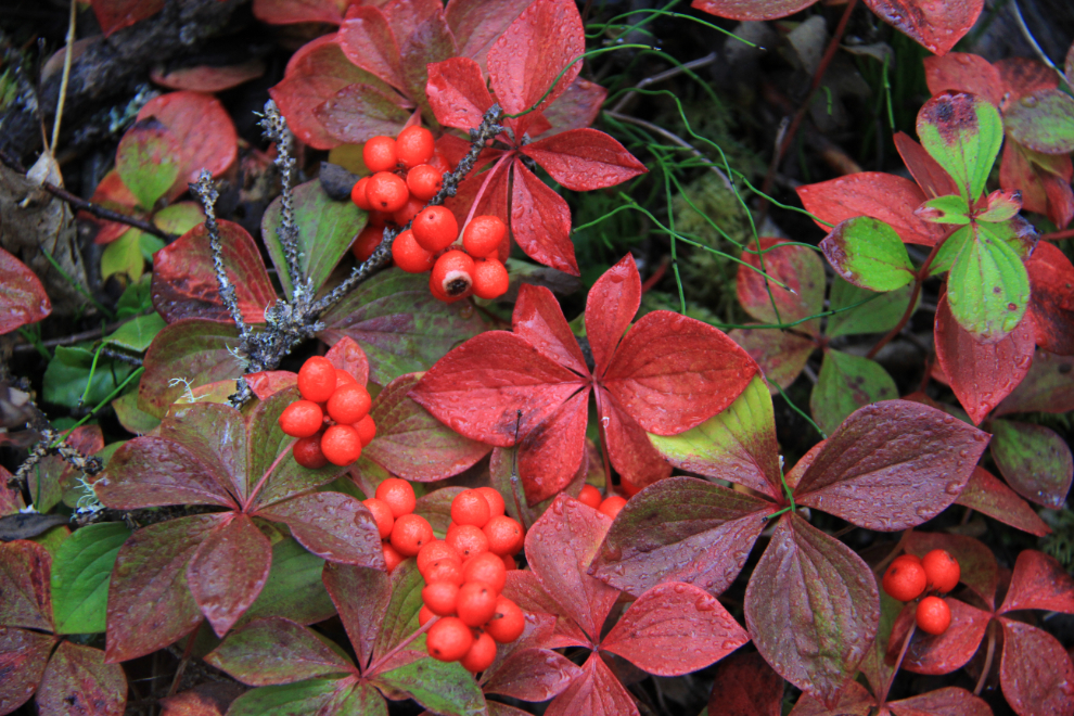
Back up to the other trail, the original trail to the base of the fall. Some of the Fall colours on the forest floor are lovely.
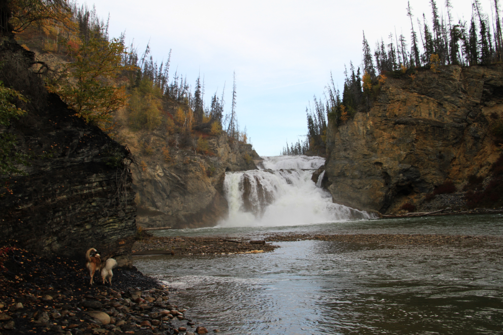
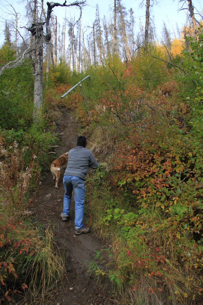
This view is wonderful, and I thought about ending the hike here. I’ve been down to the base of the falls before, both on the stairs and down the slope without stairs. The first drop was steep, this one is even steeper, and somebody has installed 3 ropes to help. Monty was my big concern, but after some thought I decided that if he had trouble, I could get him up.
Superdog and I viewing the reward 🙂
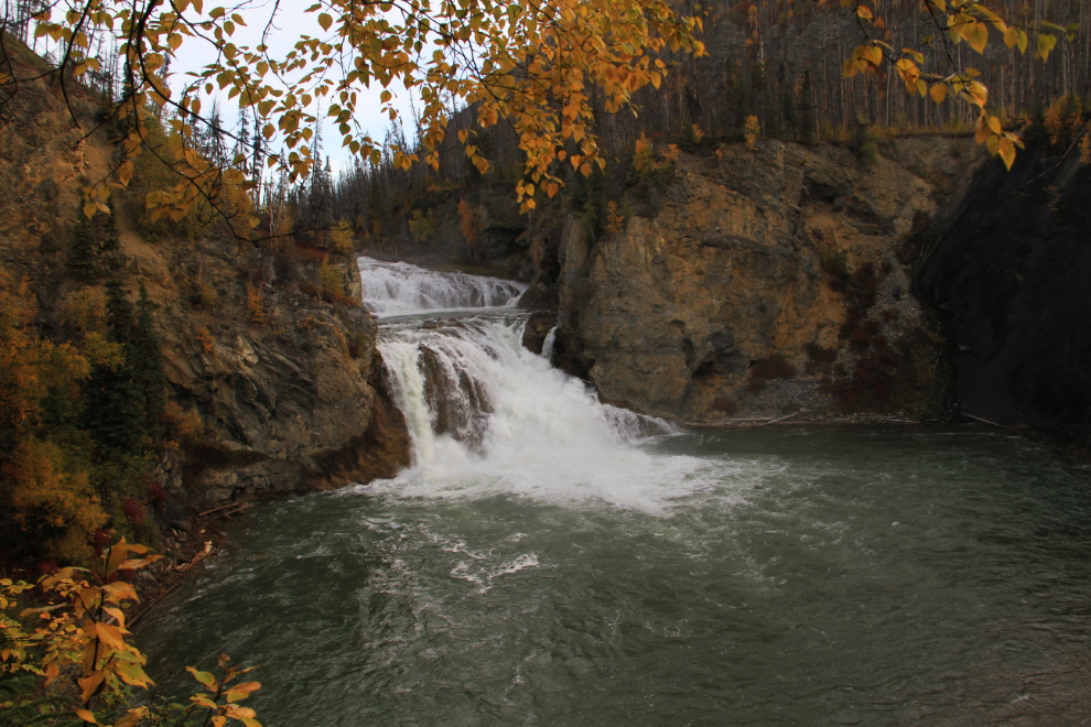
Again, steepness doesn’t show in photos like this, but the ropes come in very handy, and the climb is long as well as steep. I had to give Monty a hand at one point, but he powered up. A handrail from the stairs still stands, but offers no help.
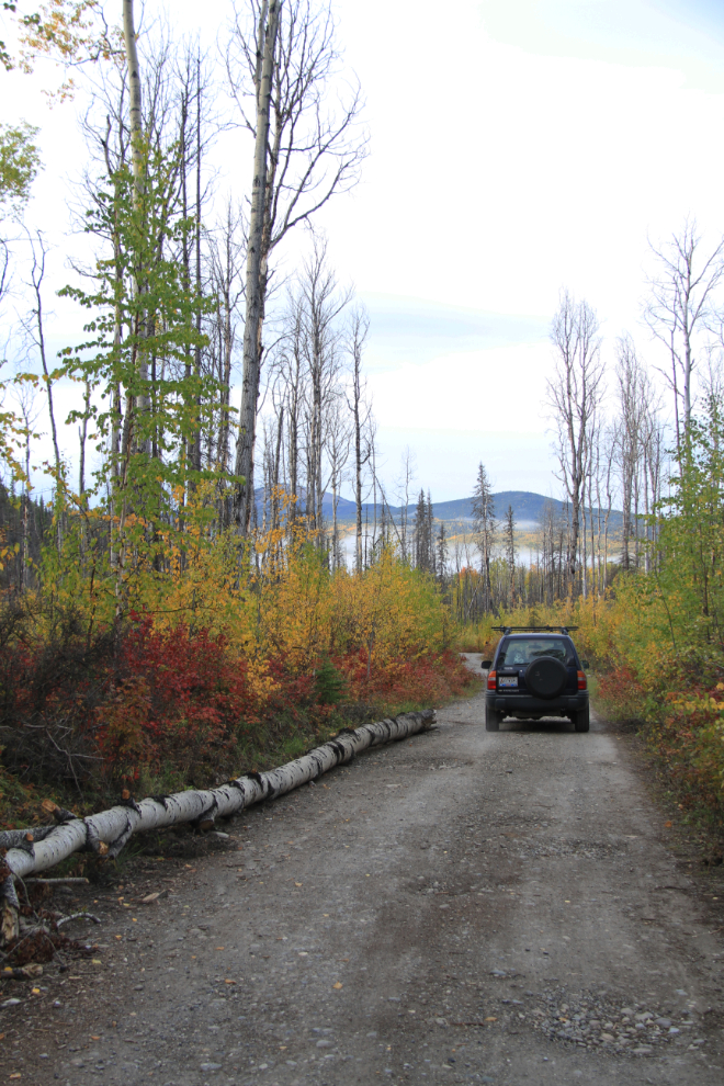
The road out. The Milepost says that the road isn’t recommended for large RVs or trailers or in wet weather. While the parking area would be large enough to turn my rig around in (barely), there’s certainly no room for 2 vehicles to pass except at 3 or 4 small spots along the road. We spent a total of an hour, from the time we left the highway to the time we got back to it.
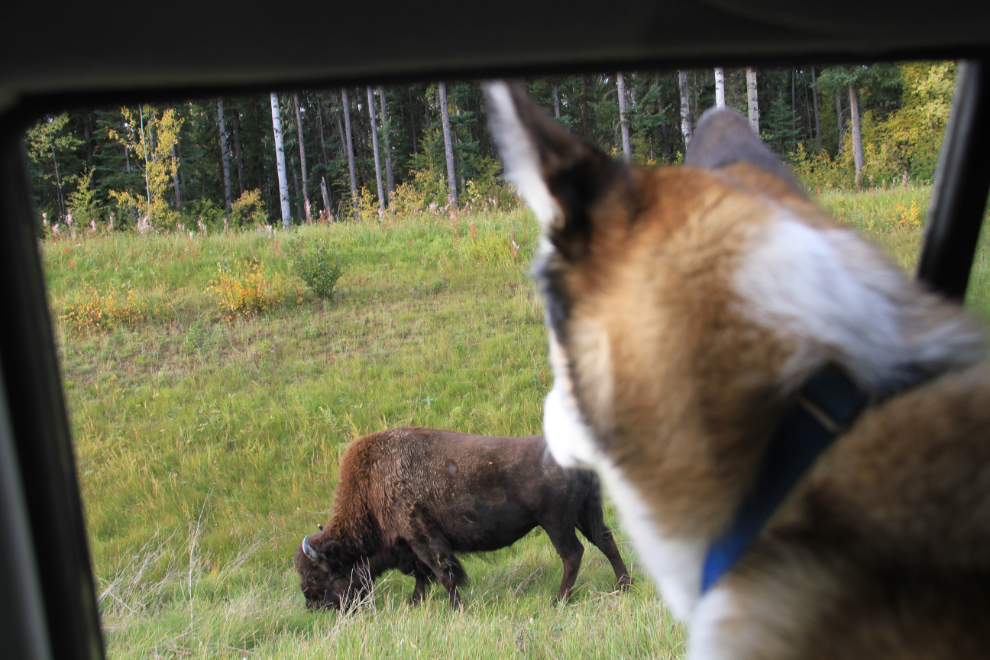
We spent a while with the bison on the way back. Monty was particularly intrigued by them this time, perhaps because he was energized by the morning hike.
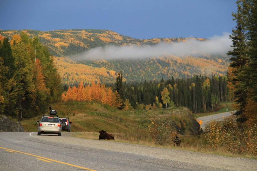
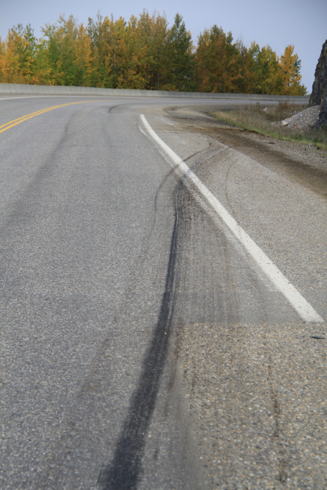
Bison do occasionally get killed by vehicles – virtually all semis that run the Alaska Highway have massive “bison catchers” to protect their front ends. At the end of this fairly recent skid is the remains of a bison, with ravens cleaning up what the Highways people didn’t cart away.
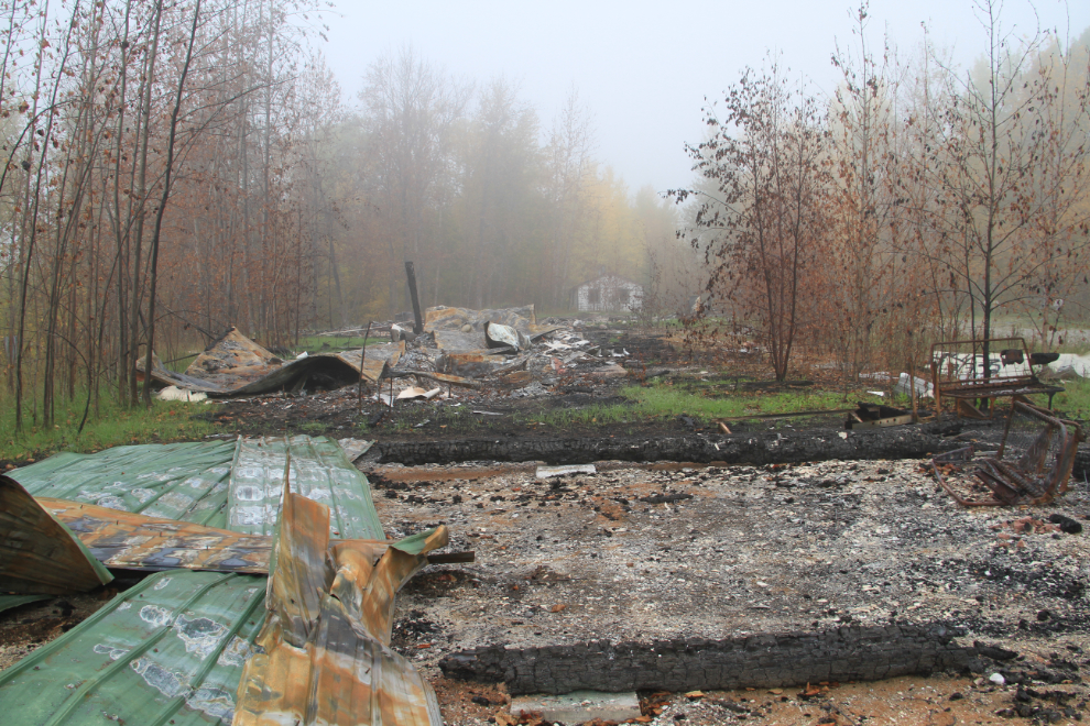
I went in to the old Liard River Lodge property to get some more photos of it, and was very surprised to see its burnt remains. It smelled like the fire had been fairly recently, but when I went back to the hot springs campground office, the woman on duty didn’t know when it was. The lodge closed in the late 1990s. My son and I actually spent a night there when it had already closed – a guy rented us a room anyway. It was in rough shape, to say the least.
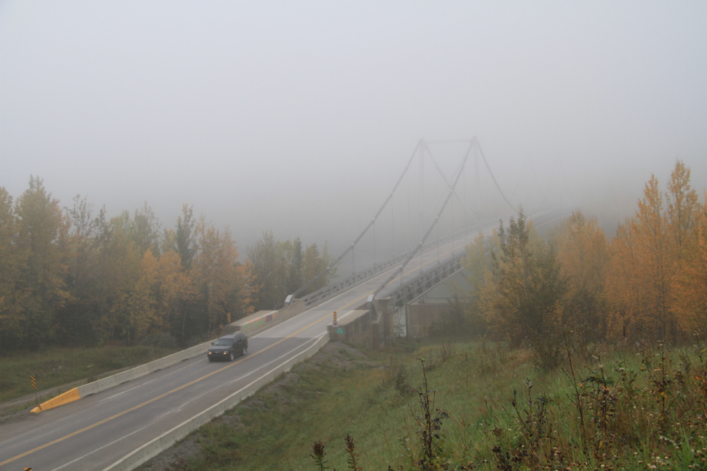
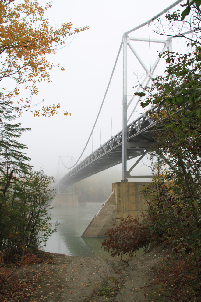
The Liard River Bridge as seen from the lodge property. This 1,143-foot-long suspension bridge was built in 1943, and is the last remaining suspension bridge on the Alaska Highway.
I was starting to feel a bit guilty that I hadn’t even given the kids breakfast before we left – I was only going to be gone a few minutes to get some fog photos! But just one more little side trip, driving down a 4×4 trail to the river under the bridge.
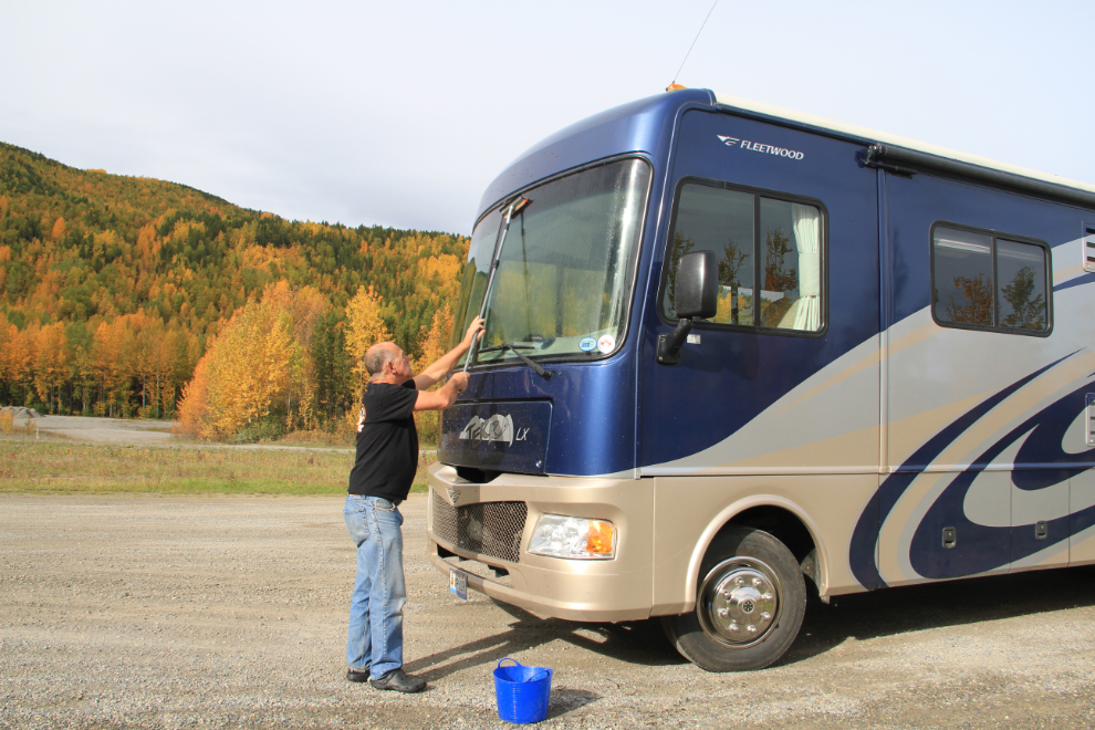
At 11:30, we were finally fed and ready to continue the Adventure. All those years of driving tour bus gave me some really useful experience for our new life 🙂
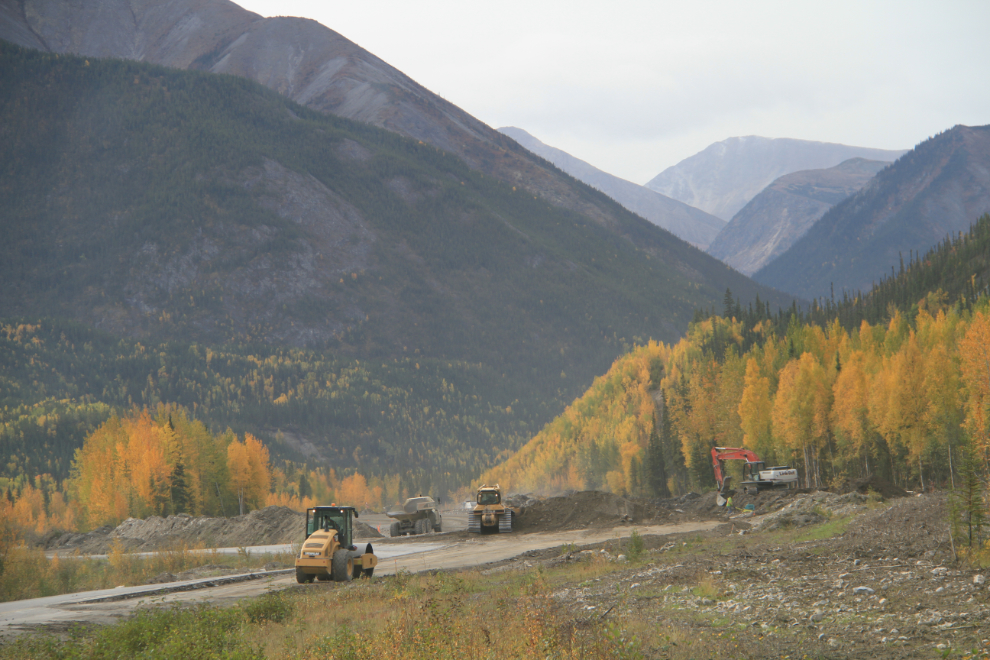
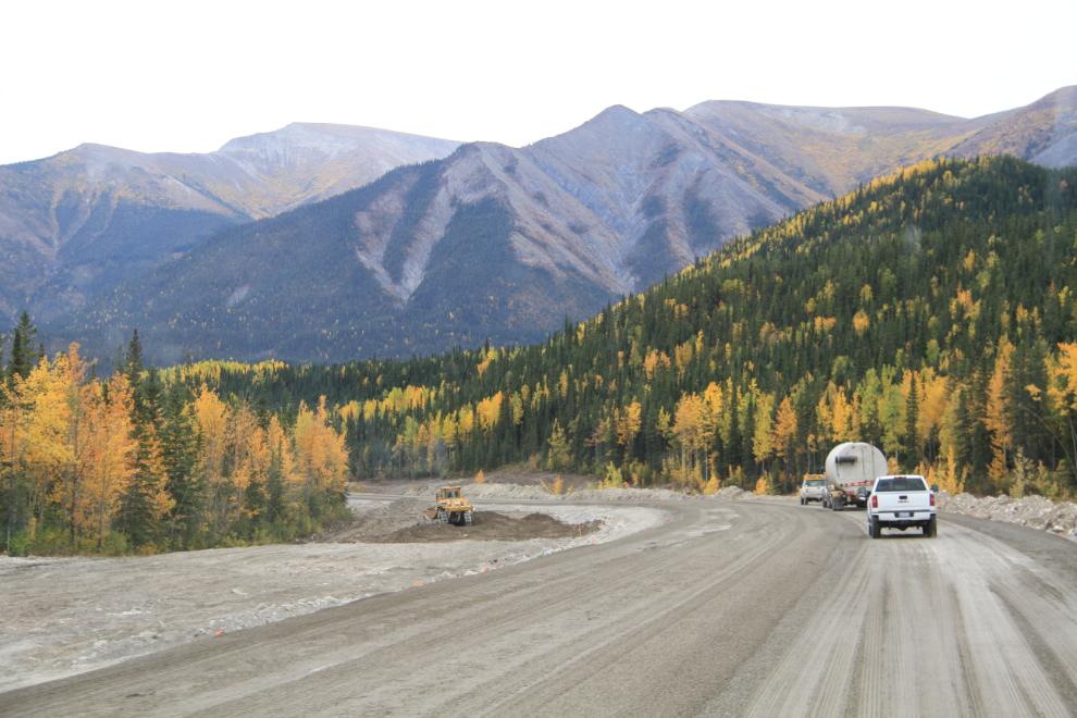
Just 10 minutes down the road, a mountain of gravel that forced a tight corner in the highway is finally being tackled.
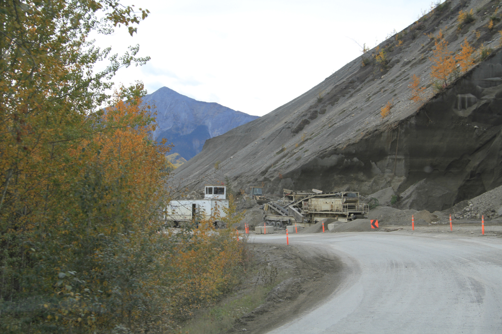
As well as eliminating that bad corner, that gravel is being put to very good use, on several kilometers of new road just beyond.
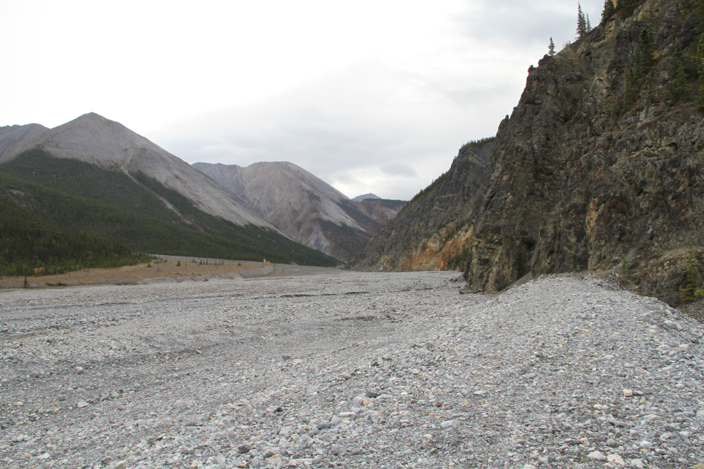
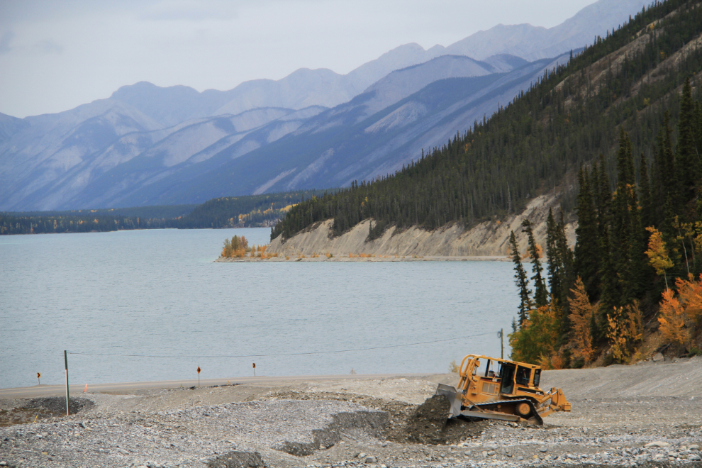
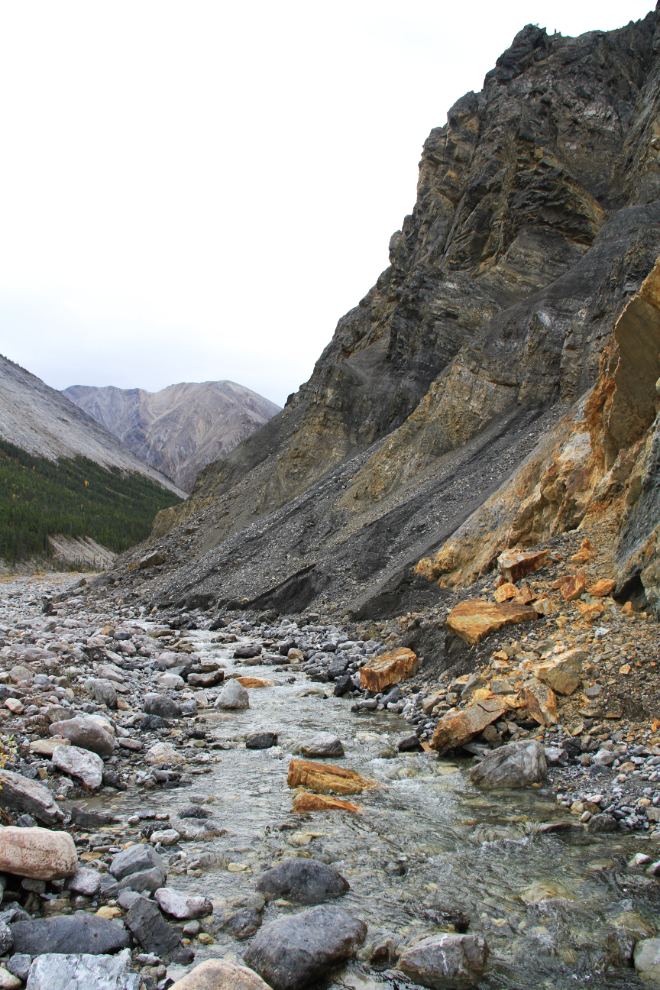
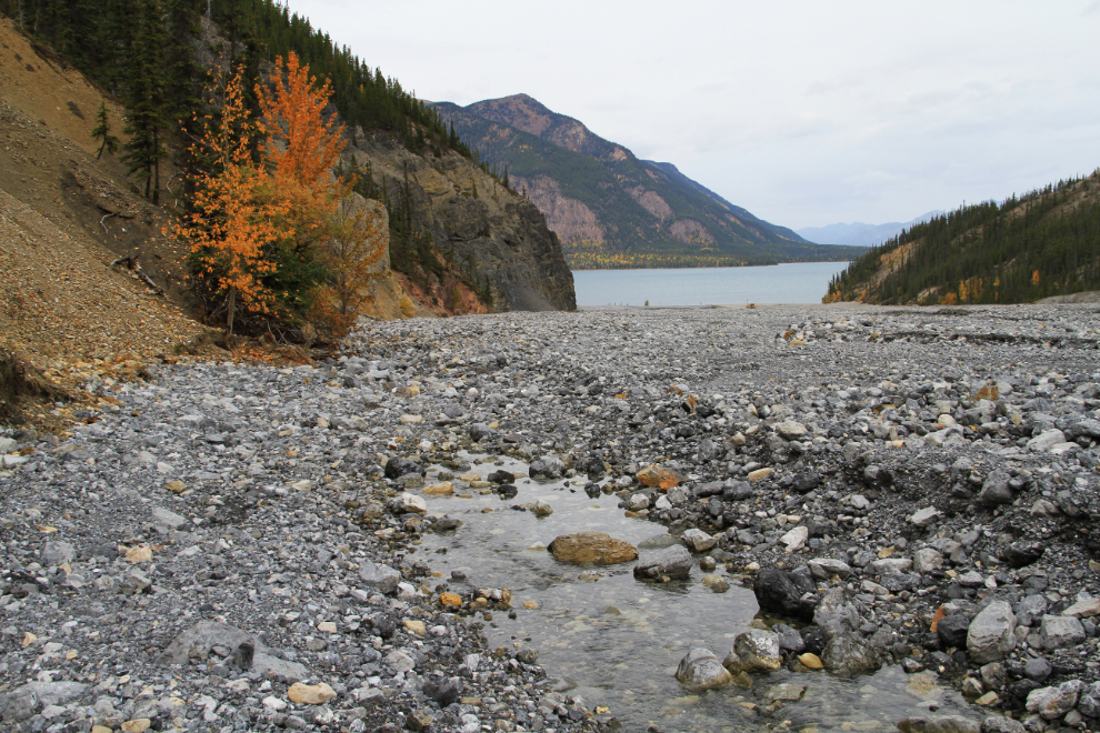
Just before 1:00, it was time to go for a walk at Muncho Lake. I decided to have a look at one of the fascinating valleys that pump trillions of tons of gravel down towards the lake. This particularly large one at Km 704.4 has a large pullout with information panels about Stone sheep. The creeks from all of these valleys have been dyked, though most only flow for a few weeks each year.
A Cat was rebuilding the dyke below us.
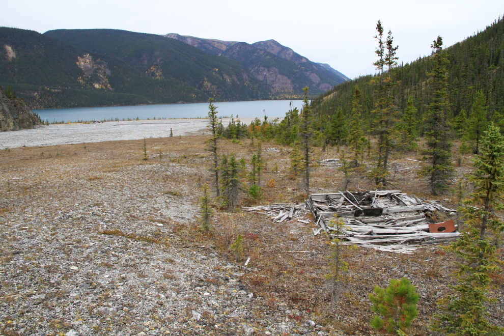
Something about this valley intrigued me, so we crossed to the other side, where I was very surprised to find the remains of several buildings. I initially thought it was a mine, but I found enough to suggest that it was a lumber camp from 1942-43, the original highway construction days.
By 1:15, we found a creek that goes underground long before reaching the lake. The kids, of course, were happy for a drink.
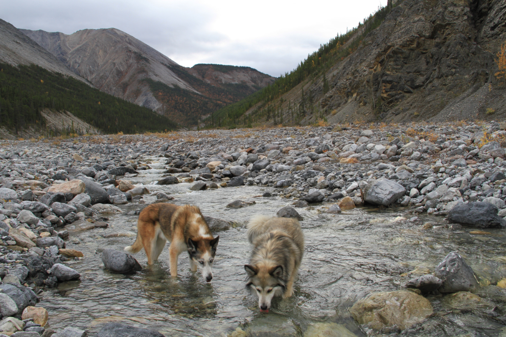
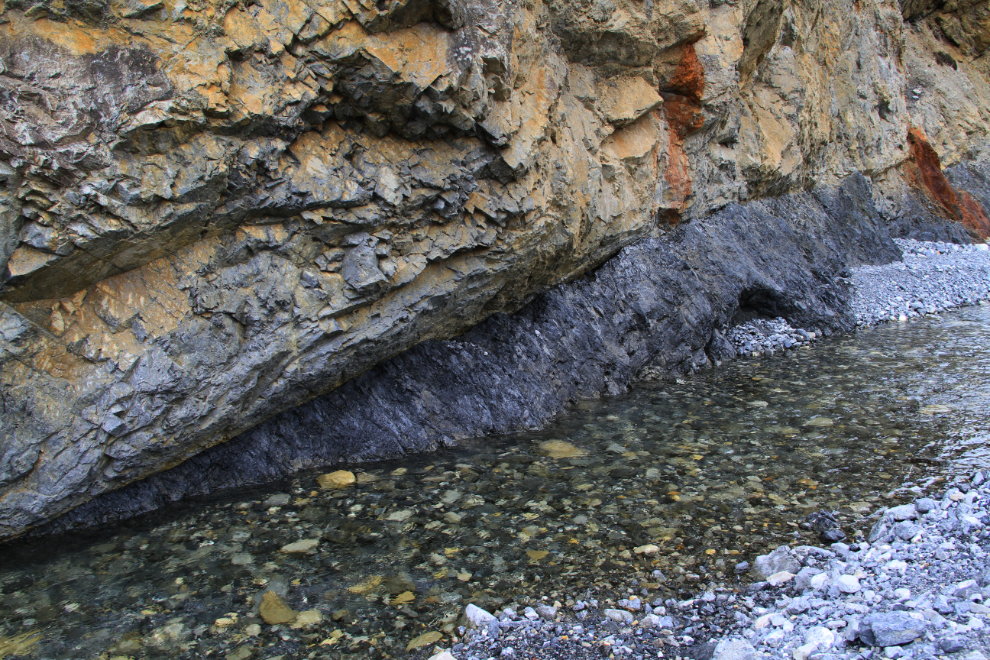
This hike had been a great choice. The valley has plenty of variety, some interesting history, and some awesome cliffs!
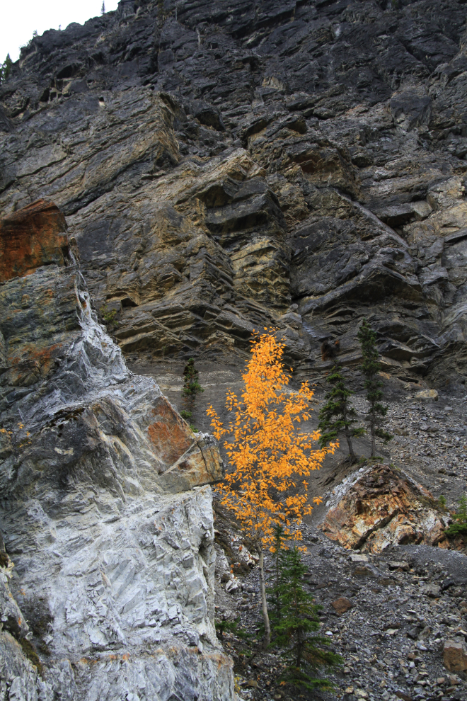
There’s even a coal seam!
This is where the stream goes underground, never to be seen again.
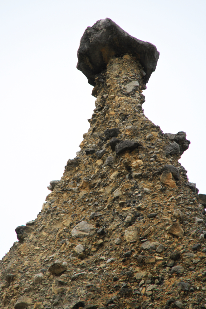
There are several very impressive hoodoos – a.k.a. erosion pillars, fairy chimneys, etc). This one is about 30 meters high (100 feet).
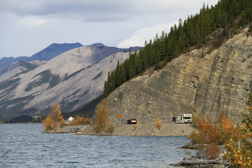
Just before 2:00, we were back on the road. The original highway was built above these cliffs along Muncho Lake, and is a very good hiking trail now (fairly recently signed as the Old Alaska Highway Trail).
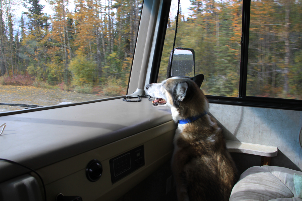
My co-pilot. He spends a lot of time cuddled up beside me, and no amount of encouragement will get him to lay down.
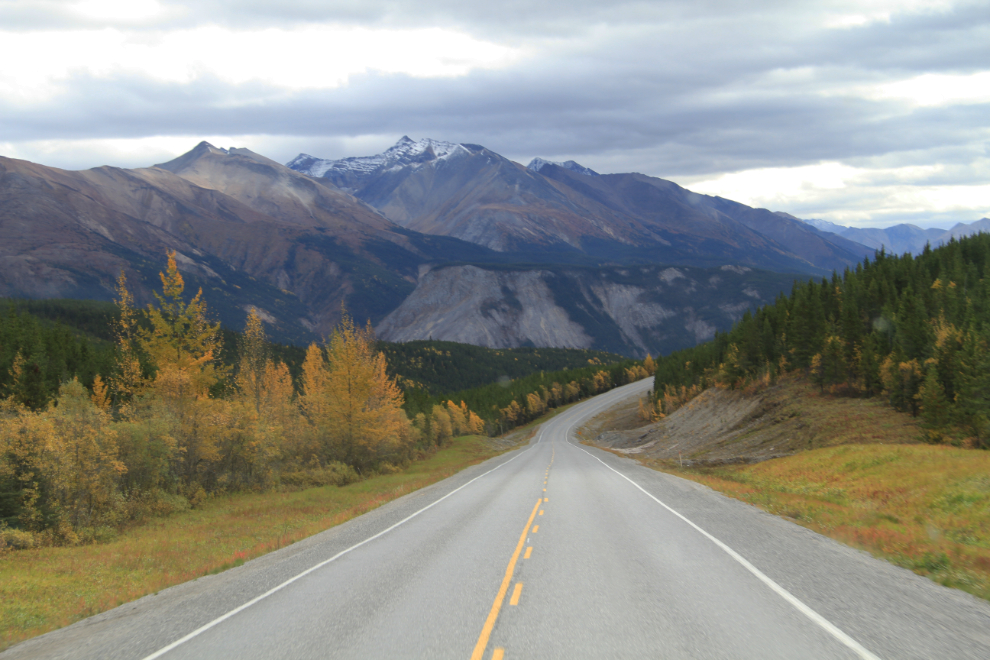
Peterson Hill at about Km 685 offers some wonderful views for southbound traffic.
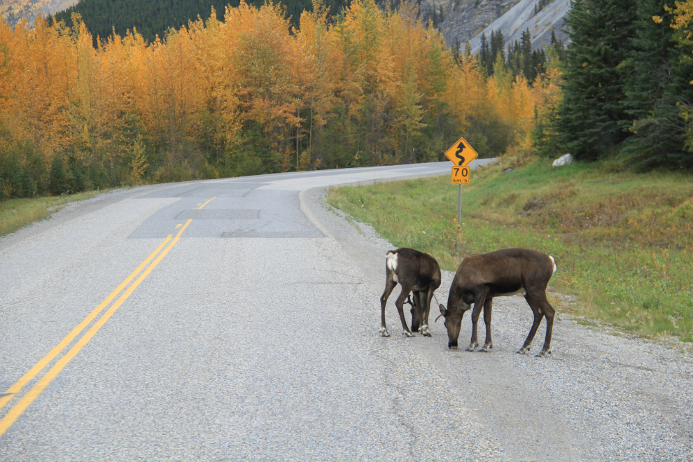
The first caribou of the trip – I had expected to see more this time of year. These two were not at all interested in getting off the road as I inched towards them
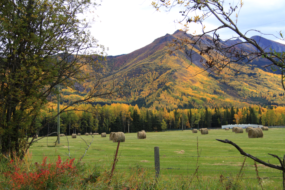
I always enjoy seeing the very few farms along this part of the highway. This one at the Racing River has recently opened a horse-friendly B&B.
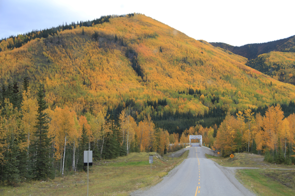
The mountain behind the Racing River Bridge was particularly nicely lit up with Fall colours.
We reached Summit Lake just after 3:30 and decided to call it quits for the day. I love this area, and nothing in Fort Nelson gave me any cause to continue. For $18, I got site #11 in the BC Parks campground, right on the lake. There may be pull-though sites elsewhere in the 28-site campground, but since I was unhooking to go exporing anyway, it didn’t matter.
There were a few places to check out including a couple of short hikes…