Another Vancouver-to-Whitehorse road trip: Day 1 of 4
I returned home at midnight Monday from a 4-day drive up from Vancouver, with a U-Haul belonging to a friend who has moved to Whitehorse (I drove her car up in 2 days last October). To make things easy at home for Cathy, I arranged to do this trip over the Easter 4-day weekend, flying down on Air North’s Friday morning flight.
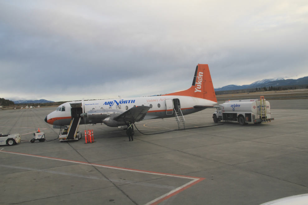
While everyone else was getting settled on the plane, I watched one of Air North’s Hawker Siddeley HS748s being readied for a flight. A friend and his wife recently moved to Old Crow, and a funny story he wrote about the flight up in this plane was published in What’s Up Yukon (unfortunately the article is no longer online).
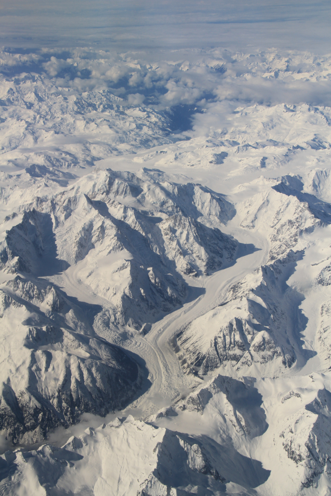
It was cloudy for much of the flight, but the skies were clear for one of the most spectacular parts of the route, in the Tweedsmuir Park region of west-central British Columbia. Below are two of the most beautiful of the many glaciers there.
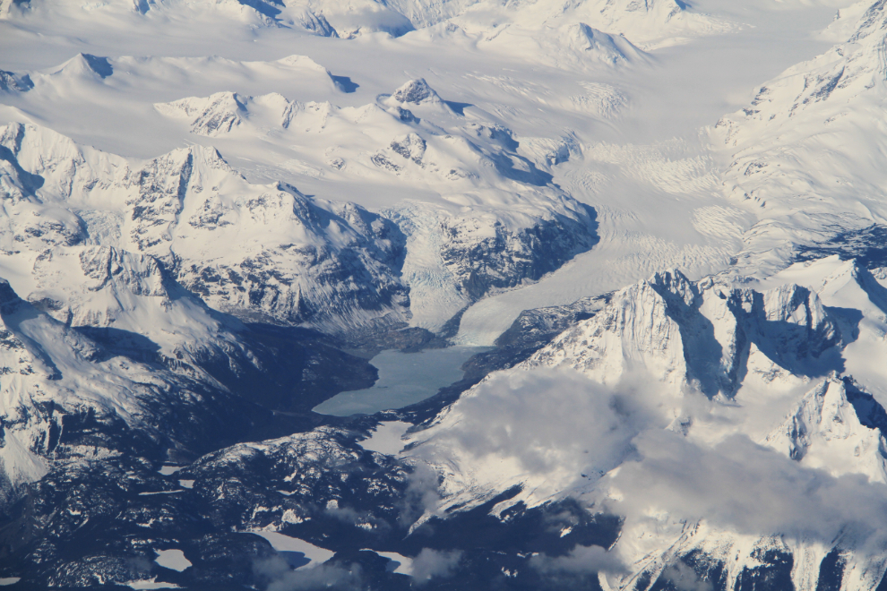
I believe that the next photo shows the Scimitar Glacier in the centre, with the small Chaos Glacier feeding into it from the left, and Mt. Hickson the dominant peak between them.
Just after 10:00, we passed by the Vancouver International Airport, and made a turn over New Westminster and Surrey to approach the runway.
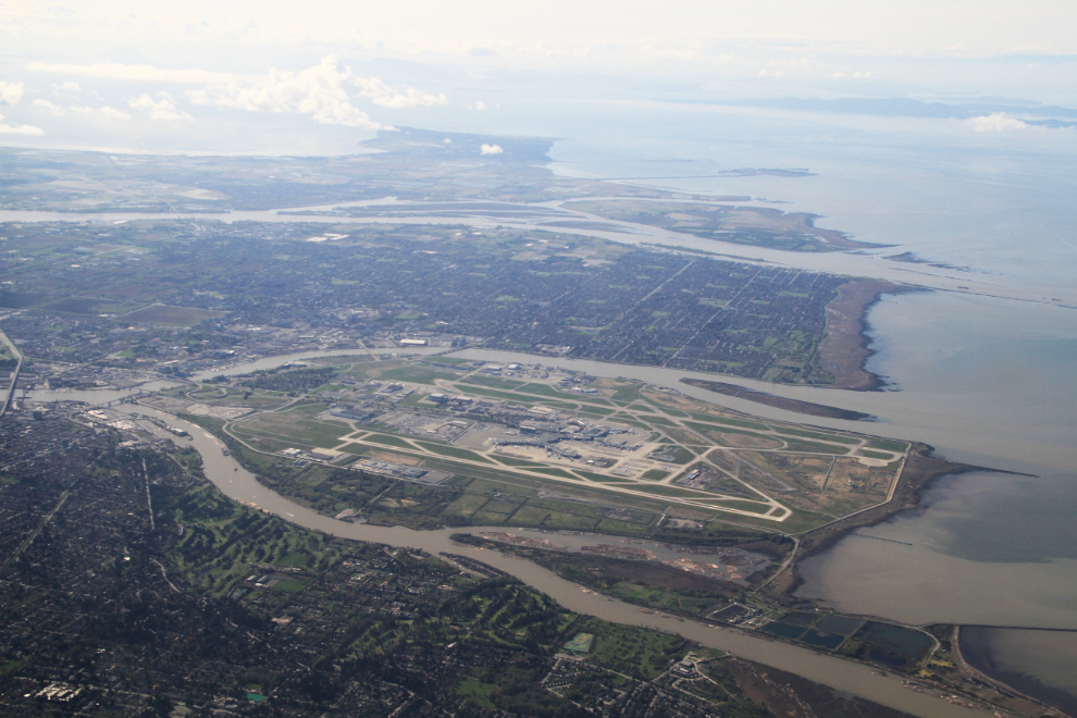
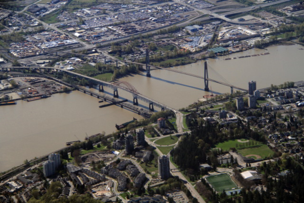
Three bridges cross the Fraser River between New Westminster and Surrey – the railway on the left, the Pattullo Bridge (built in 1936–37 and named for the premier at that time), and the SkyBridge, which carries the rapid-transit-system Skytrains.
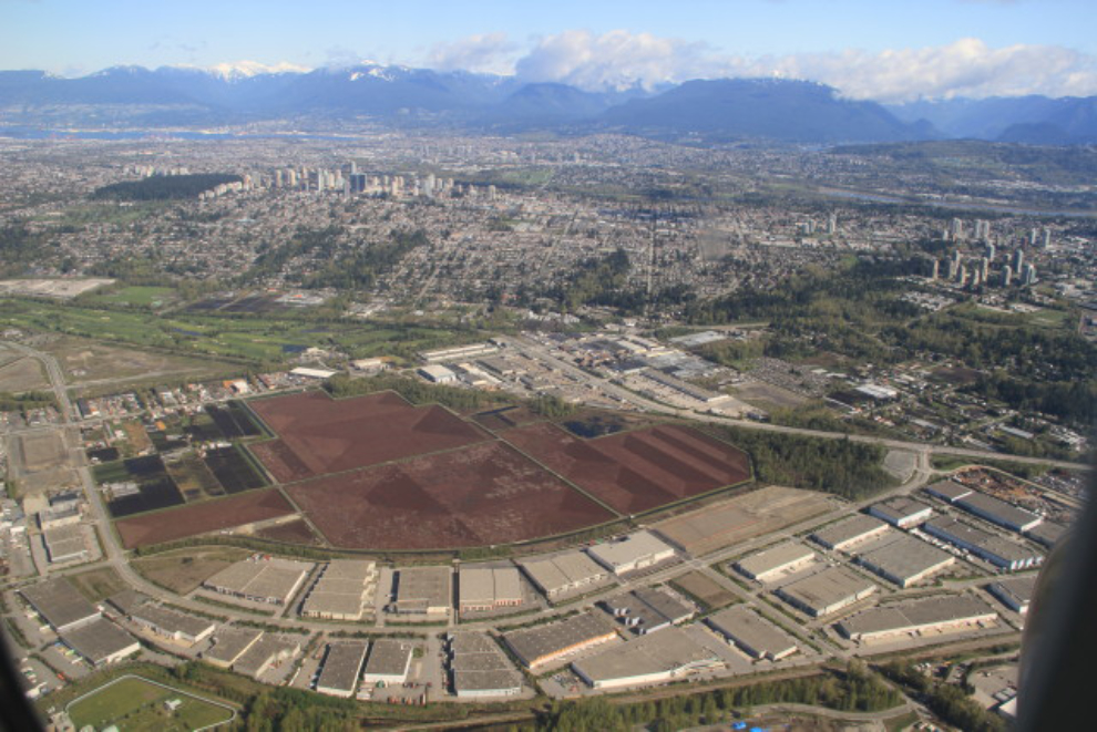
Evolving Vancouver, with light industrial areas squeezing farms ever smaller (those are probably cranberry fields). The green space at the upper left is Central Park in Burnaby. Downtown Vancouver is out of the frame at the upper left.
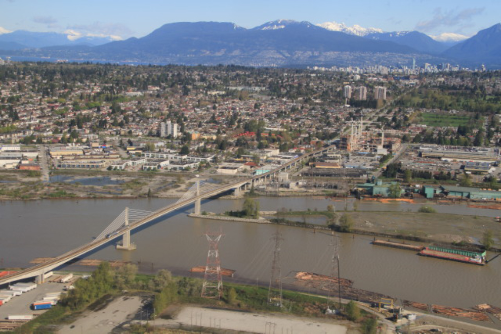
This is another Fraser River bridge, carrying the Canada Line extension of the Skytrain into Richmond and to the Vancouver airport.
Laurie met me at the airport, and we drove out to Delta to get the U-Haul truck. Shortly after 11:00, my gear was loaded and electronics (Spot and GPS) all fired up and I was ready to hit the road. The plan was to overnight at 100 Mile House, 440 kilometers (273 miles) north.
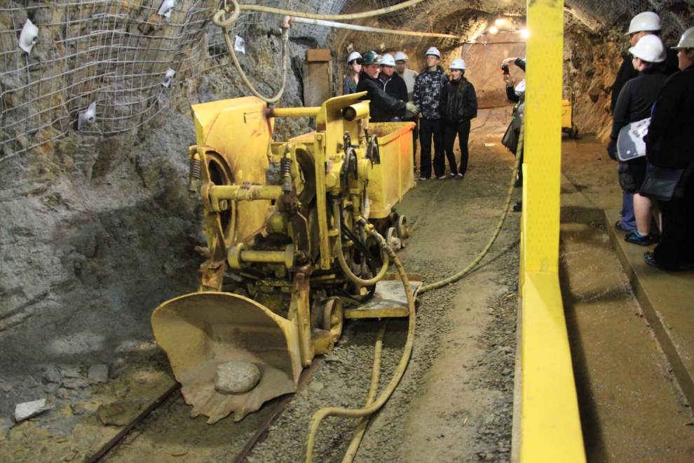
I had arranged for my niece, Sari, and myself to tour the Britannia Mine Museum for an article on my ExploreBC site – it is now posted as “Going deep at the Britannia Mine Museum“. I’m very fussy about the quality of mine tours I go on, and Britannia Mine Museum and our guide, Michael, did an exceptional job that I’m looking forward to telling you about.
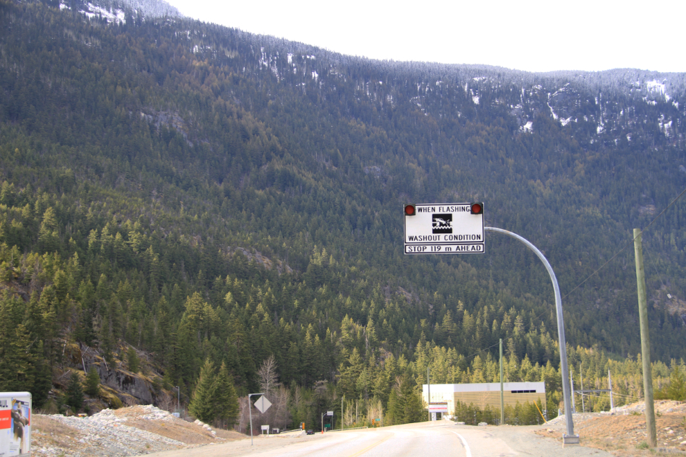
I didn’t get away from Britannia until almost 4:00 pm, and after a fast-food lunch in Squamish, was anxious to hit the road. This sign over Rutherford Creek, though, was odd enough to get me to do a U-turn and come back for some photos. In October 2003, the bridge was washed away following torrential rains, and 5 people were killed – you can read more about it on the Pique News Magazine site.
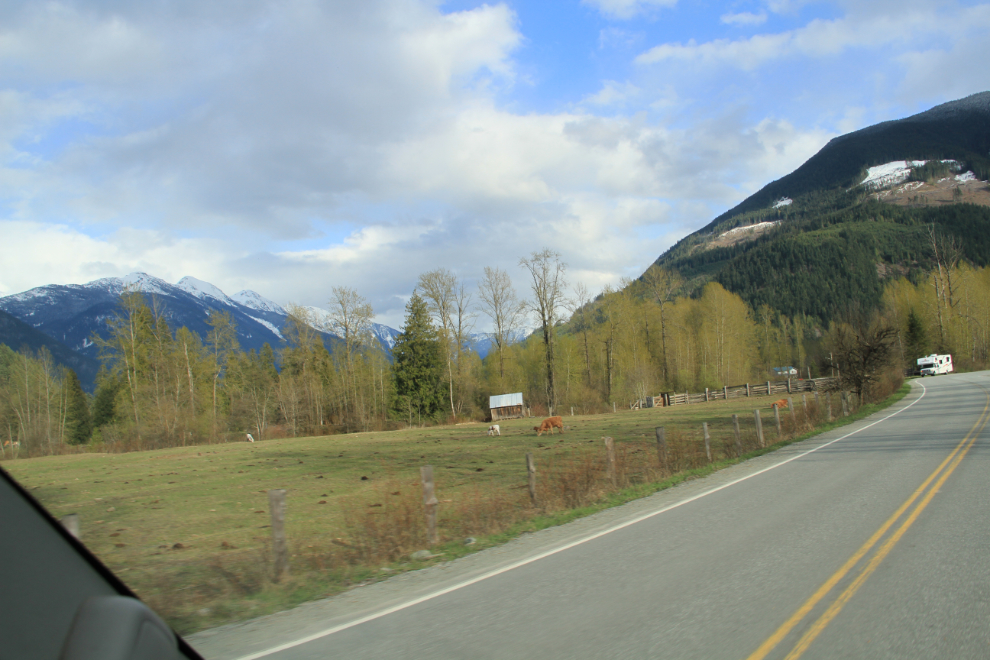
At 6:00 pm, when normal people are thinking about shutting down for the day, I was in the small farming area north of Pemberton, about to head up into the wilderness of the Duffey Lake Road (still Highway 99 officially).
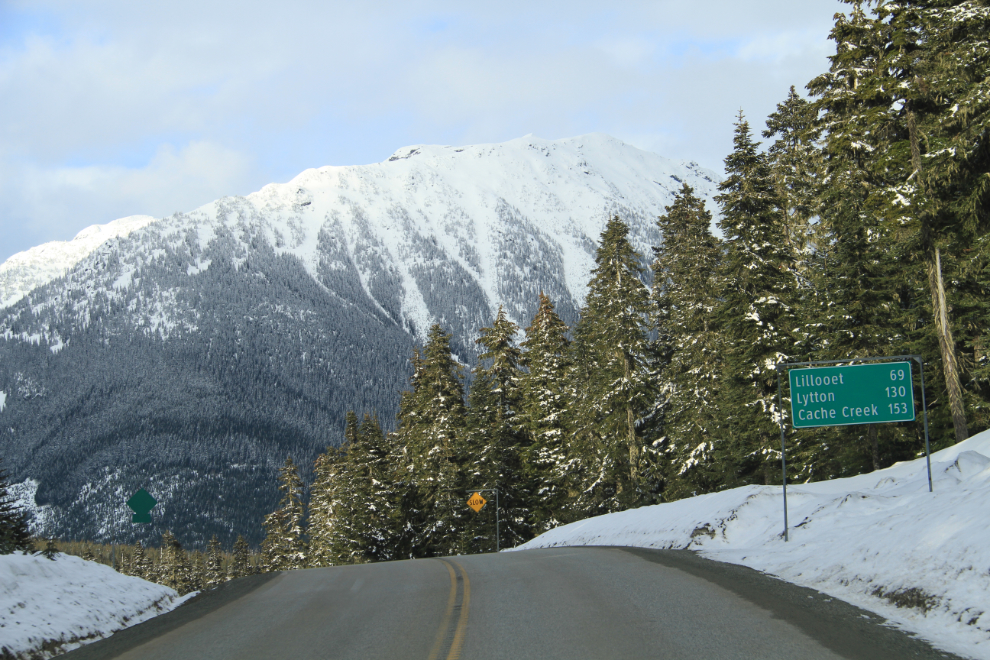
The highway climbs steeply out of the Lilloet River valley into the Cayoosh Range of the Coastal Mountains, and gets to an elevation where snow was possible (1,275 meters, or 4,183 feet). Although a couple of inches had fallen very recently (the day before?), the road was clear.
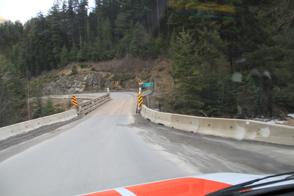
There are several one-lane bridges along the Duffey Lake Road.
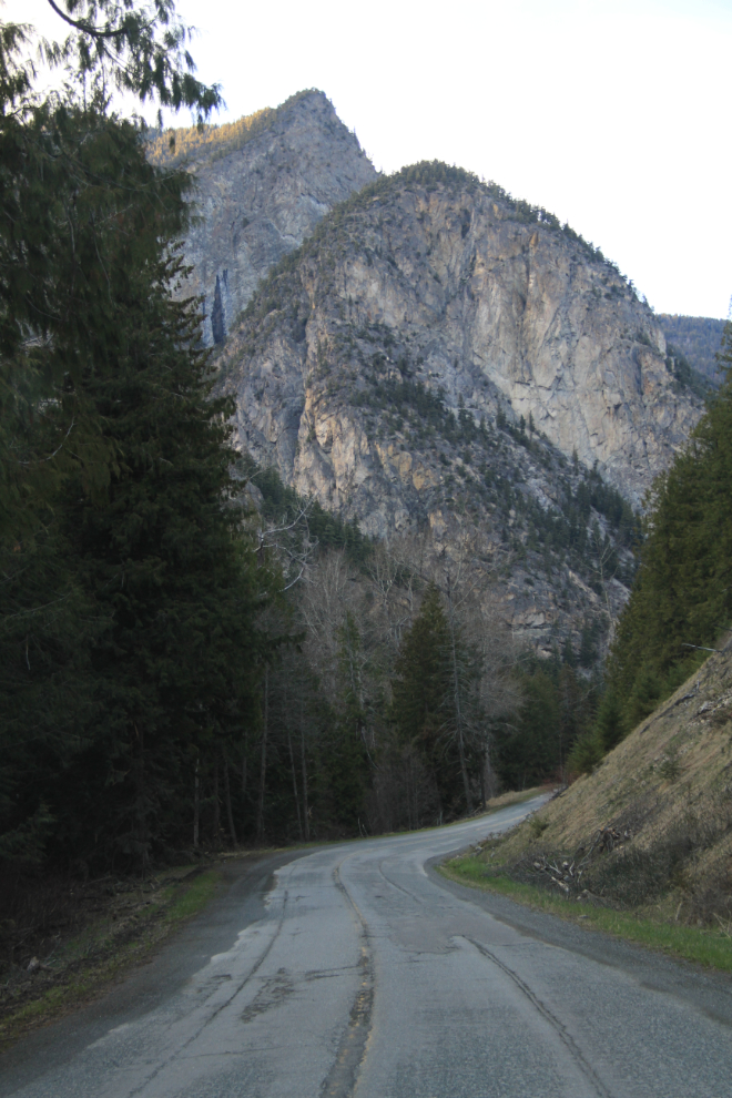
Although the mileage from Vancouver to the Interior of the province is less by using this route instead of the Fraser Canyon, this is not a road to make time on 🙂 The transition from the wet coastal climate to the dry Interior is quite rapid – this photo was shot at 7:00 pm.
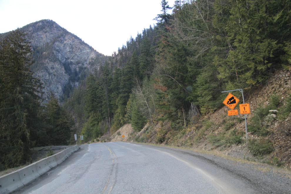
There are several 13% grades in both directions. The U-Haul has some sort of power management system that I soon came to hate, as it would drop gears automatically at times and to gears that I didn’t want – downhills would often drop it 2 gears and then it would refuse to gear back up for far too long.
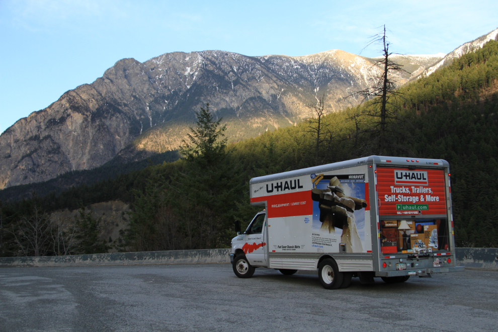
Time for a stretch and a shot of the truck. Other than the power management issue, it’s a very nice rig, though quite basic of course.
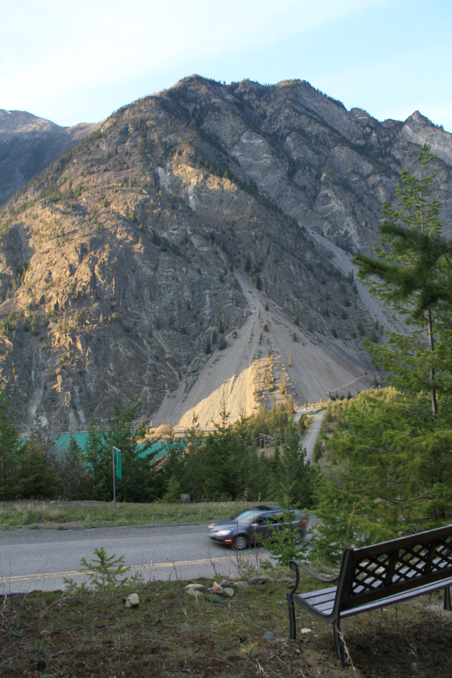
While looking for a spot to get a picture of Seton Lake and the highway far below, I came across a very nice bench out in the middle of nowhere.
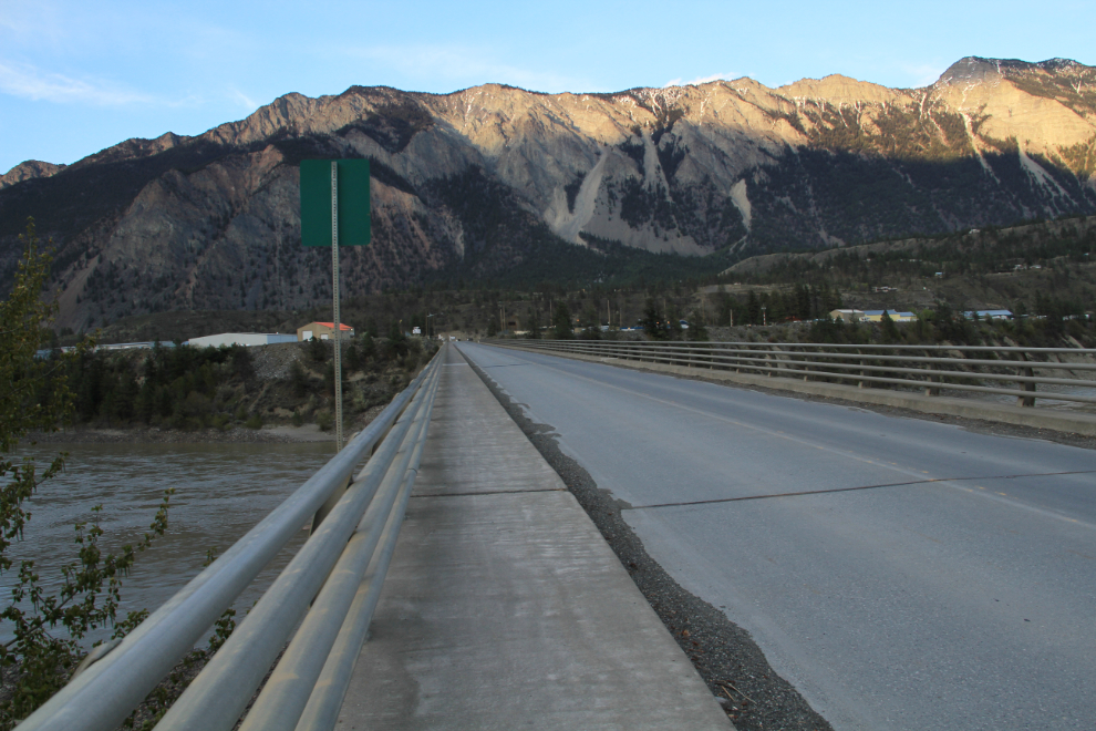
The Bridge of the 23 Camels takes the highway across the Fraser River at Lillooet. It was named to commemorate BC’s first – and last – experiment with using camels for transport. In 1862, 23 of the animals were imported to carry freight from Lilloet to the Cariboo goldfields. The experiment failed largely because horses and mules were scared by the camels, and the camels were eventually let loose to fend for themselves.
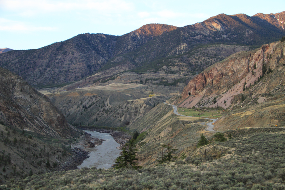
This view up the Fraser River just north of Lillooet is one of my favourite highway views in the entire province.
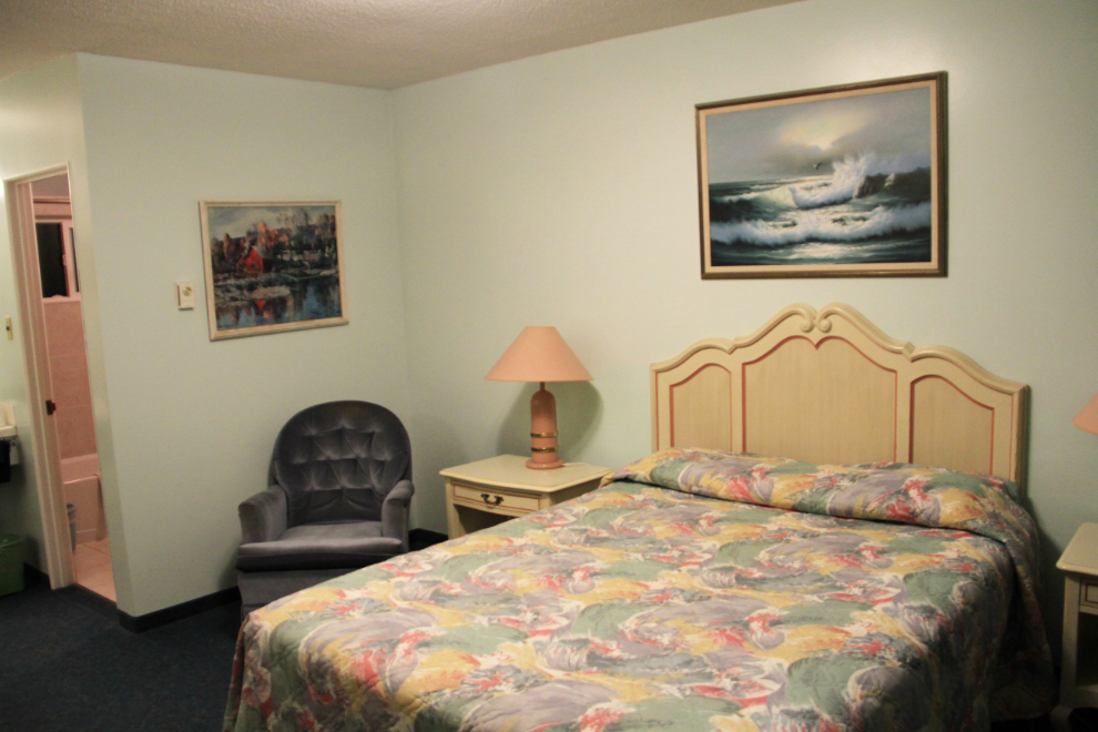
It was almost 9:00 pm when I reached Clinton, and although I initially decided to continue on, I turned around a couple of miles past the town, and checked into the Round-Up Motel. For $69, it offers excellent value, and I slept like a log 🙂