A winter walk on the Millennium Trail in Whitehorse
This post was written this morning for my page at The Outbound Collective, but I decided to post it here instead. The writing is a bit different than my normal because it’s written for people who know nothing about the Yukon – the articles are meant as a “first look” at new places.
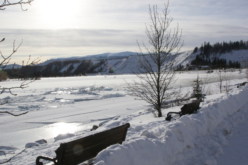
As February progresses, the light starts to noticeably change from the cold and colourless sun of mid-winter to the warmth and colour of spring. Much of the Millennium Trail is open to the sky so offers a wonderful opportunity to get out and enjoy that light.
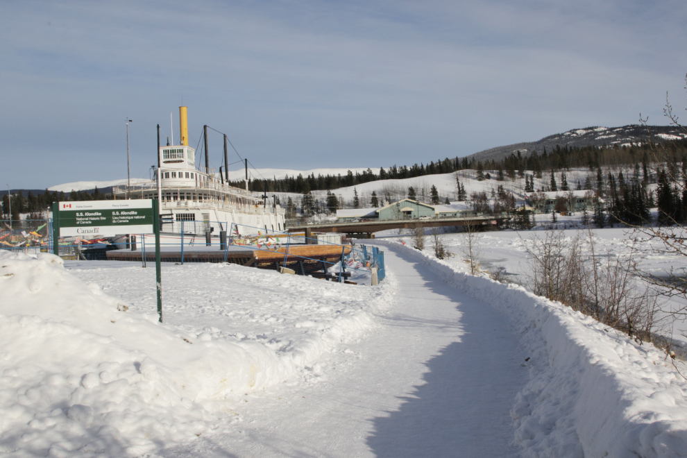
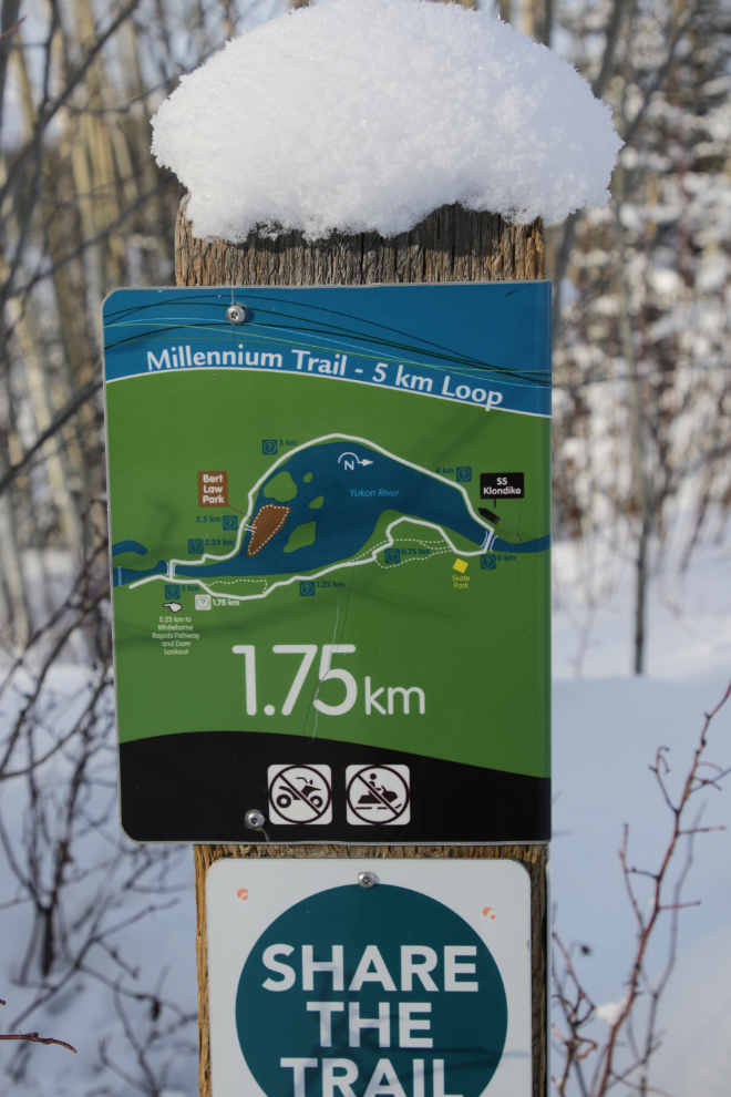
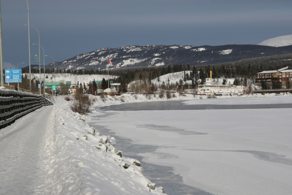
The trail runs along the Yukon River, and two bridges allow a loop of 5 km / 2.8 miles. It is paved, and well maintained year-round. There are four main access routes to it – I find that the large parking lot at the SS Klondike National Historic Site works best for me, for a variety of reasons.
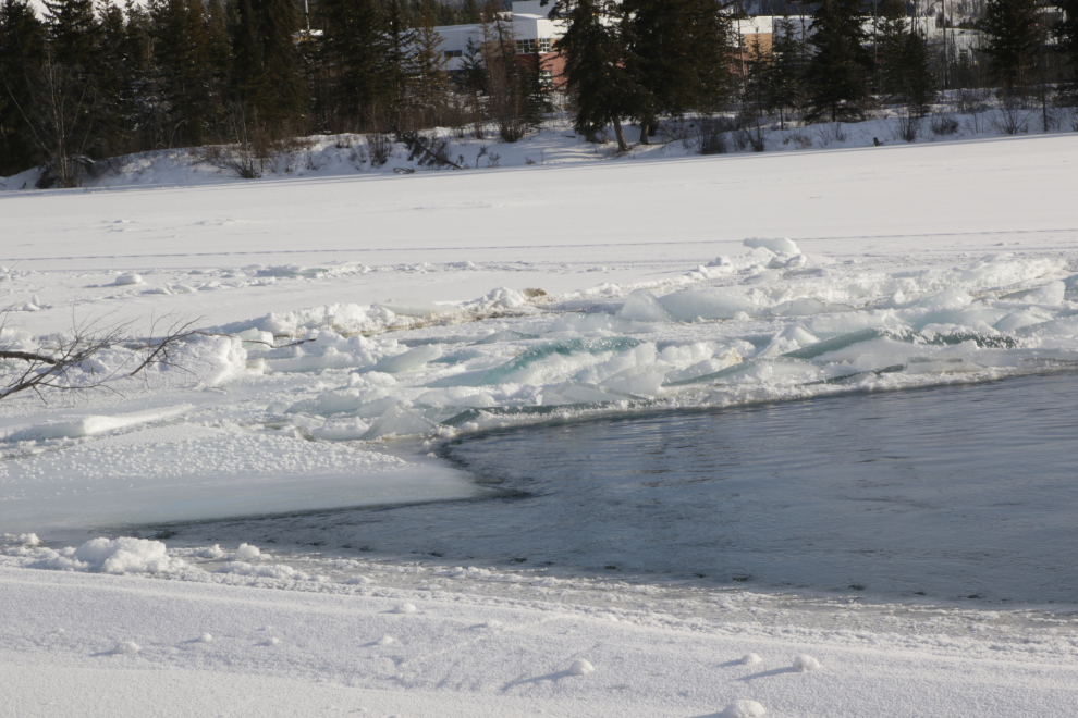
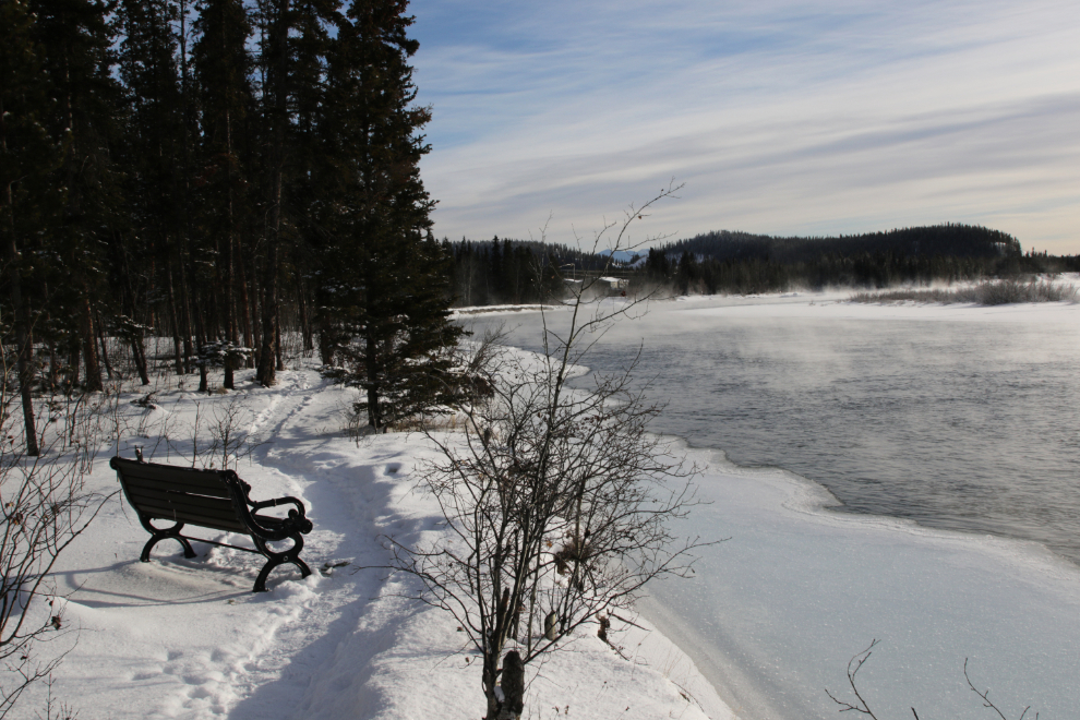
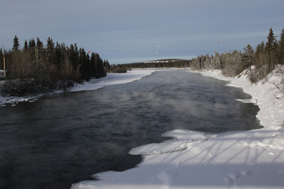
The temperature was -18C°/0°F yesterday, with a light north wind, so choosing appropriate clothing was important. Despite that temperature (and it hit -30°C/-22°F a few days ago), the river wasn’t completely frozen. The open water provides extra points of interest along the trail – pans of ice floating by and sometimes being forced up onto the shoreline ice, and a fog or “smoke” that is caused when cold air moves over the warmer water.
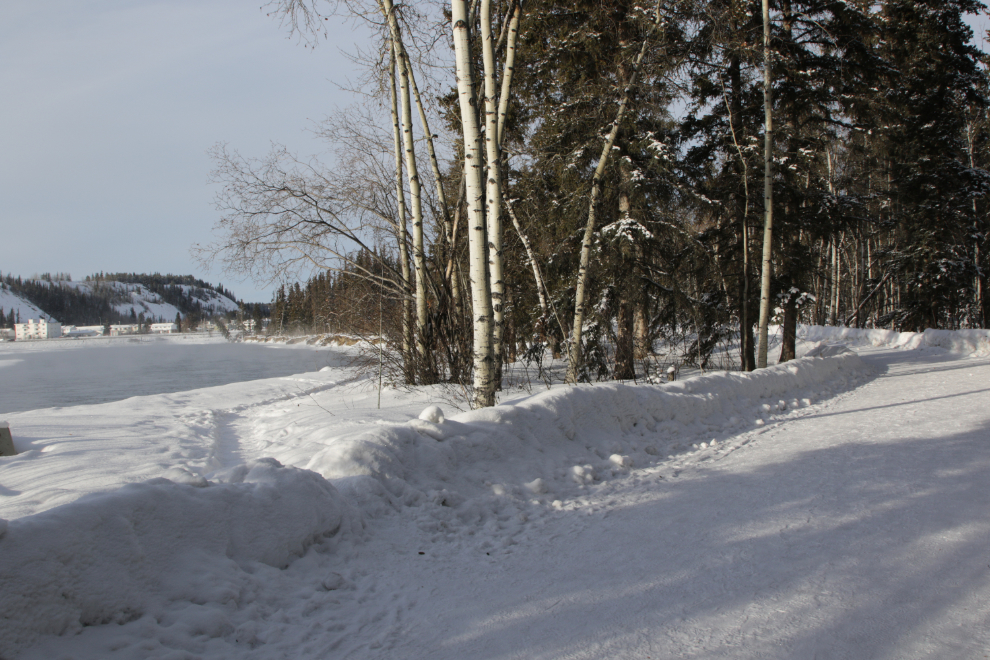
Once you walk across the Robert Campbell bridge that carries traffic to and from the Riverdale residential area, the trail enters the boreal forest. For a few hundred meters/yards, a casual trail runs right along the river bank – it is not official and is not maintained, but on sunny days is a lovely option.
In the next photo you can see both the paved trail and the unofficial one leading off it.
The trail has many interpretive signs, as well as these small markers that allow you to easily check your progress.
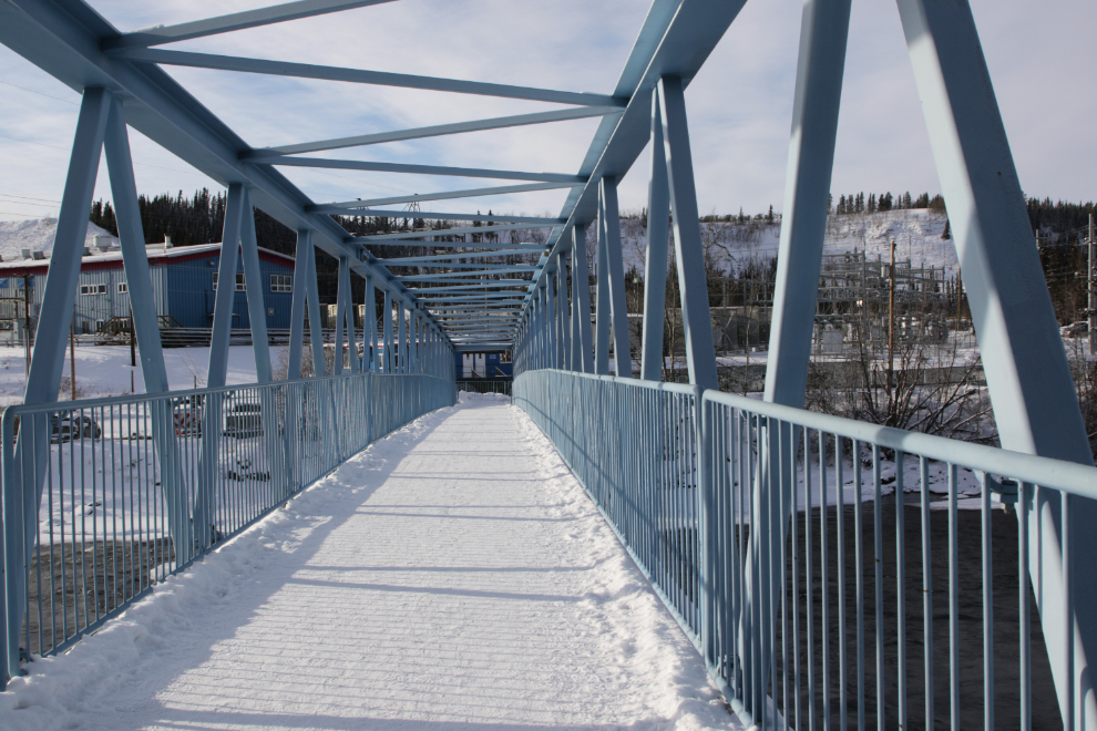
About 30 minutes of walking gets you to the other bridge across the Yukon River. The Rotary Centennial Bridge is only for foot and bicycle traffic.
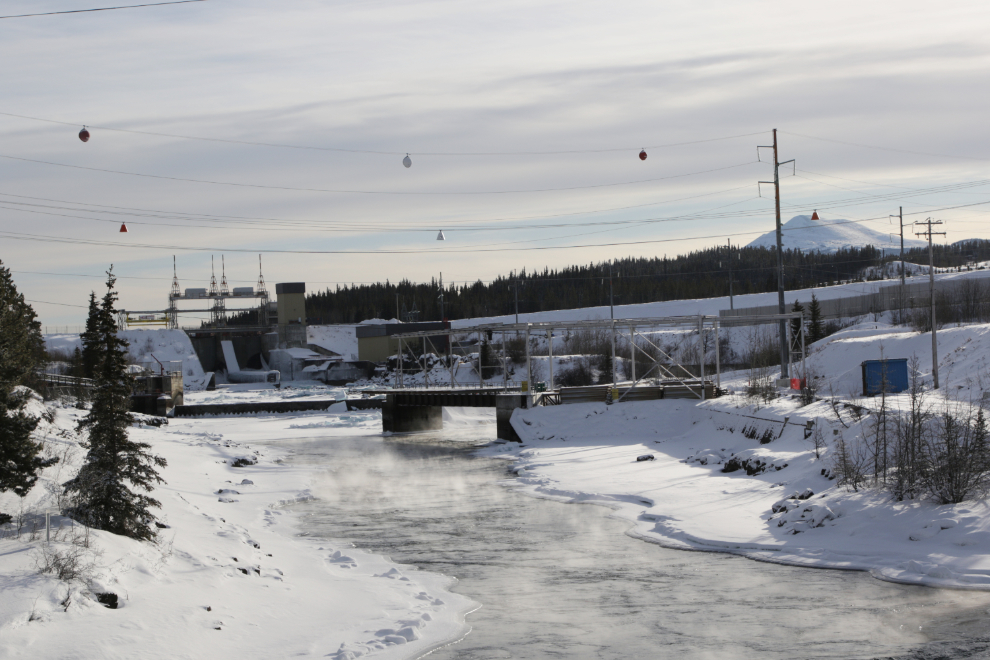
From the bridge, the power generation plant and offices of Yukon Energy are ahead. The view down the river towards town is very peaceful.
The view up the river is very different. What you see of the river itself is the remnants of the Whitehorse Rapids that, with Miles Canyon above them, caused great danger to the people floating down the river towards the legendary riches of the Klondike gold fields in the late 1890s. In the distance are the facilities of the Whitehorse power dam which was built in 1958, eliminating the rapids. The mountain to the right is called Golden Horn.
After a few minutes walking through the forest behind Robert Service Campground, you reach Robert Service Way, the southern access to downtown Whitehorse from the Alaska Highway. It would be quite noisy if not for the fact that the Millennium Trail was built about 6 meters / 20 feet below the road so most of the noise goes over your head. The Whitehorse airport is at the top of the escarpment seen to the left in the next photo.

The final photo shows you the main reason I like to start this walk at the SS Klondike – I find this to be a wonderful view to finish with.
Although the Millennium Trail is one of the two most popular walking trails in Whitehorse, in the hour I spent on it yesterday, I saw a total of four people walking, and one riding a fat bike. And the light was glorious! 🙂