A spectacular early-morning drive to the White Pass
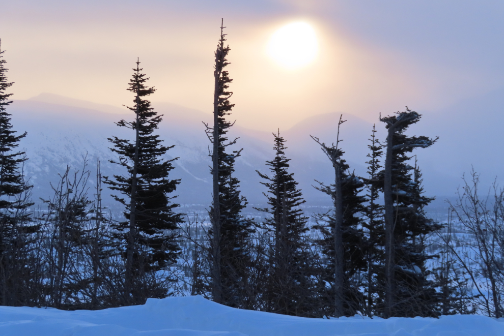
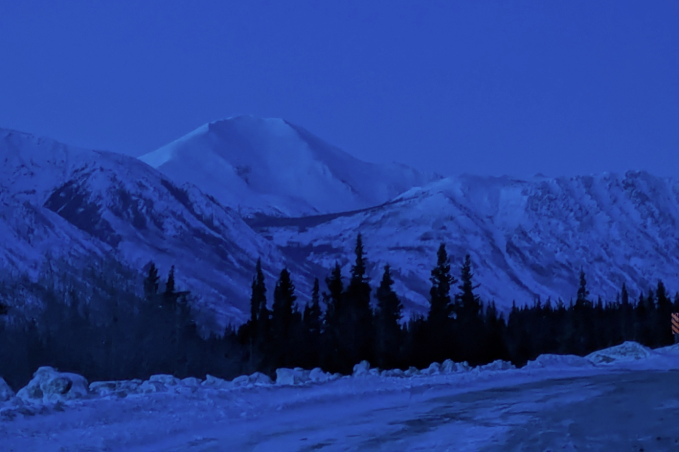
As our very hard winter continues, my need for a proper day in the mountains is getting stronger. Ten days ago I headed south on a day that had potential, but the weather went sour in a major way just south of Log Cabin. This was the final photo I shot, at the pullout where I turned around. I didn’t shoot enough photos during the short day to even bother posting about.
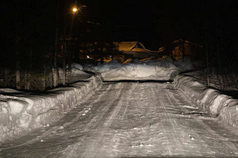
Yesterday (March 28th), the day was pretty much guaranteed to give me sunshine all the way to the White Pass and possibly back home. It was still much colder than I would like, but the night before, I packed Cathy’s Jeep with all the gear I might, with extra survival gear including a sleeping bag in case of problems. Being at the Bove Island viewpoint at dawn was wonderful on my last drive, so I planned for that again. At 05:40, with the temperature at -28°C/-18°F, I pulled out of the driveway. Sunrise would be at 07:27.
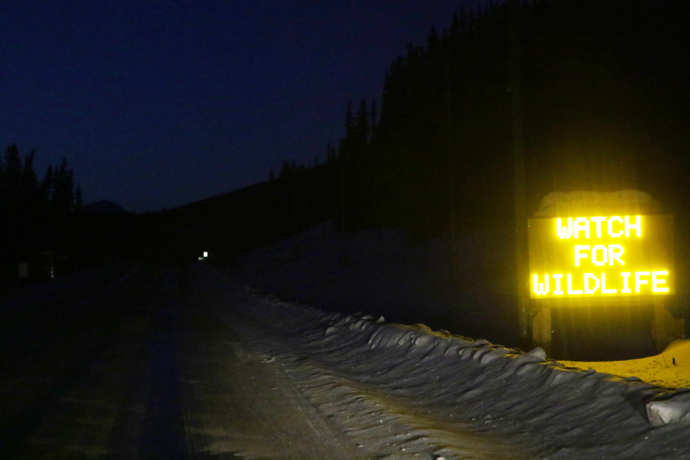
With the chance of caribou on the highway being fairly high, I kept my speed down. As is often the case, the temperature bottomed out at Robinson, at -31°C/-24°F. This “WATCH FOR WILDLIFE” sign just south of Carcross reinforced the need to be vigilant on the road.
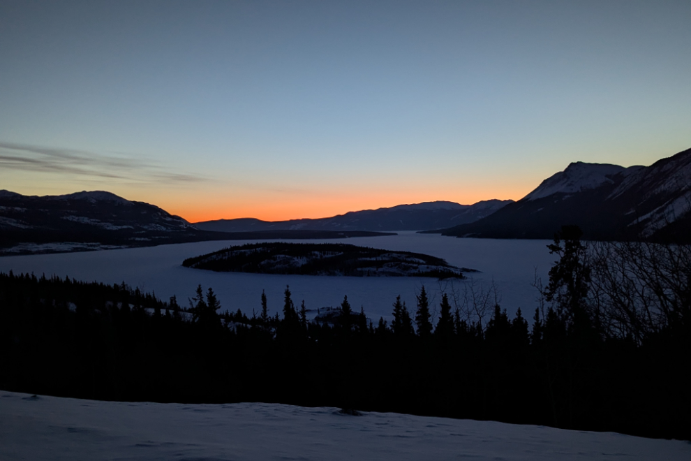
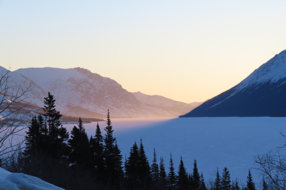
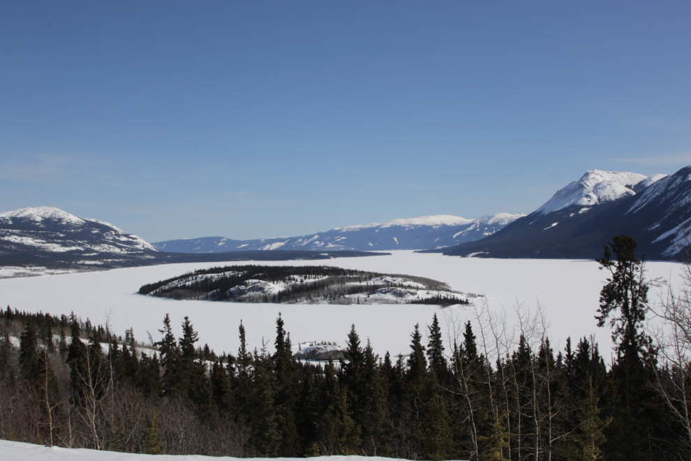
I reached Bove Island at 06:40, far earlier than I needed to be to get the light I wanted, but this is a nice spot to start the day – it has good energy. This is the furthest south that cell service reaches, and I shot the next two photos with my photo to post on Facebook. It was -19°C/-2°F here, with no wind. The reports had been a light south breeze at Whitehorse but a 10-20 mph north wind at Skagway (with a forecast high of 33F at Skagway).
Looking south, the dim light on the peaks was beautiful, and I should have also shot the scene with my real camera as I usually do, as it was a bit beyond the capabilities of the phone.
I stayed at the viewpoint for quite a while, and probably had a nap while I waited for the right light before continuing on. One minute after official sunrise, I was 6 km south, passing the ghost town of Conrad. To the left is one of the towers for an aerial tramway that climbed to one of the silver mines in 1906.
A minute later, the sky was starting to get a bit of a blush to it – beginning the short period of the day when photography would be the best.
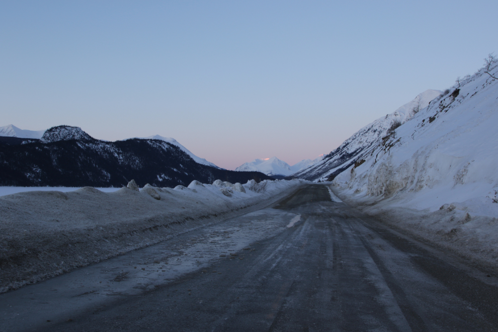
Looking across the delta of Pooley Creek, at Km 85.2.
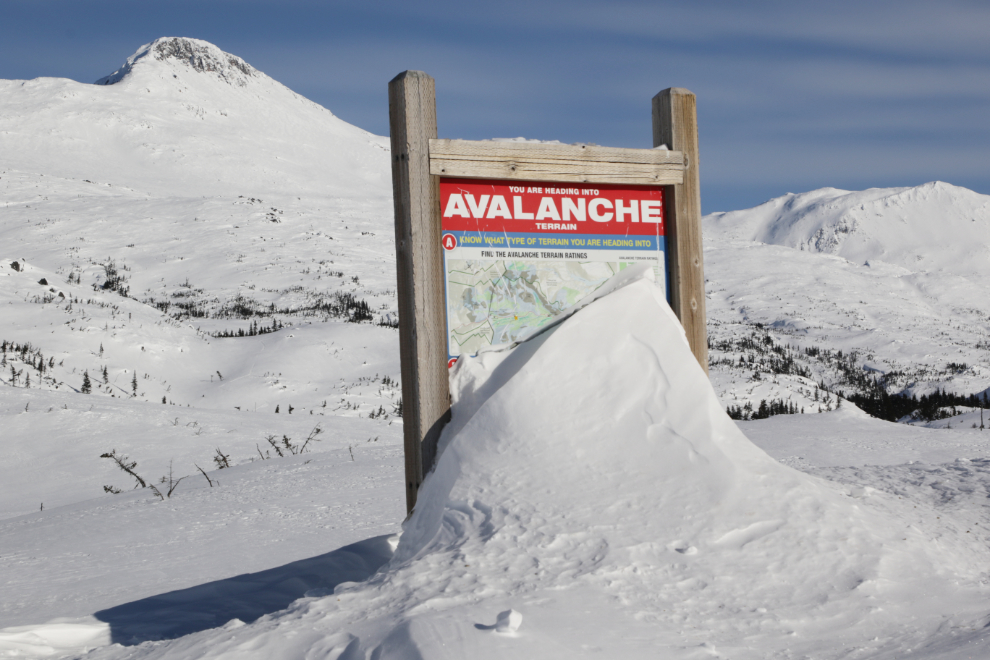
There have been a lot of avalanches this year, some in places I don’t think I’ve ever seen one before. Just after passing a very fresh one at Km 84, I came to a pool of meltwater, which was a surprise – I didn’t think it had been getting that warm during the day. The temperature hadn’t yet budged from -19C. At 07:38, the sun was just hitting the highest peaks ahead.
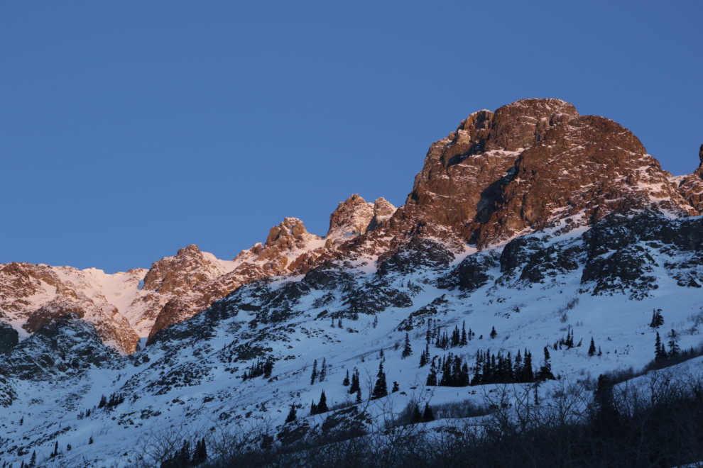
The first light of the day hits Dail Peak.
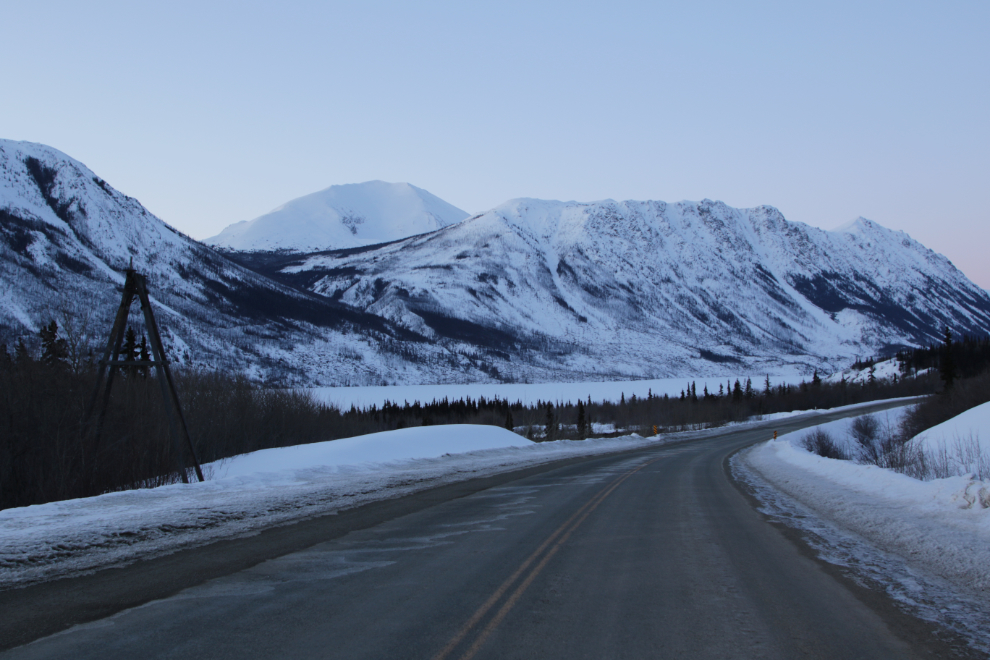
Dropping down to Tutshi Lake usually results in warming a few degrees, but today the temperature dropped to 23C.
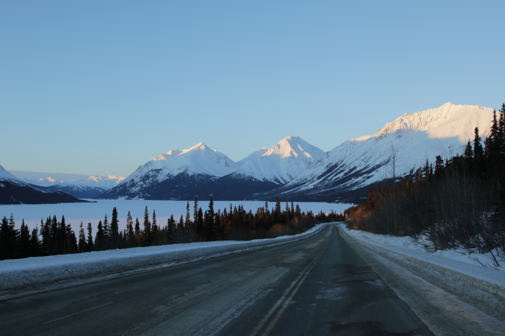
To capture the perfect light to the left in the photo above, I switched to the little Canon with about 170mm of zoom. I posted this on Facebook with the comment “The first rays of sun hit Tutshi Lake yesterday morning (15 minutes after official sunrise). I’m deeply grateful that I can experience such scenes.”
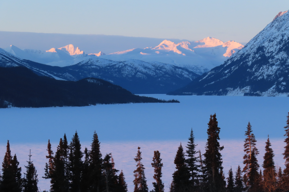
I drove another kilometer or so to get a clear view back down the lake for the next scene.
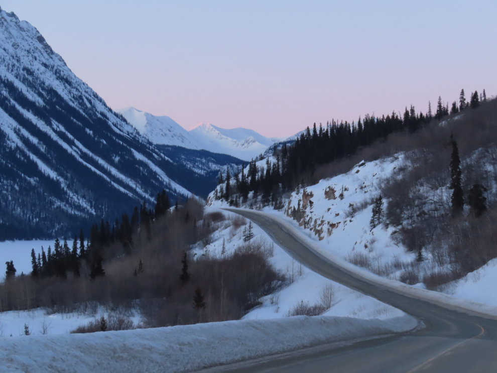
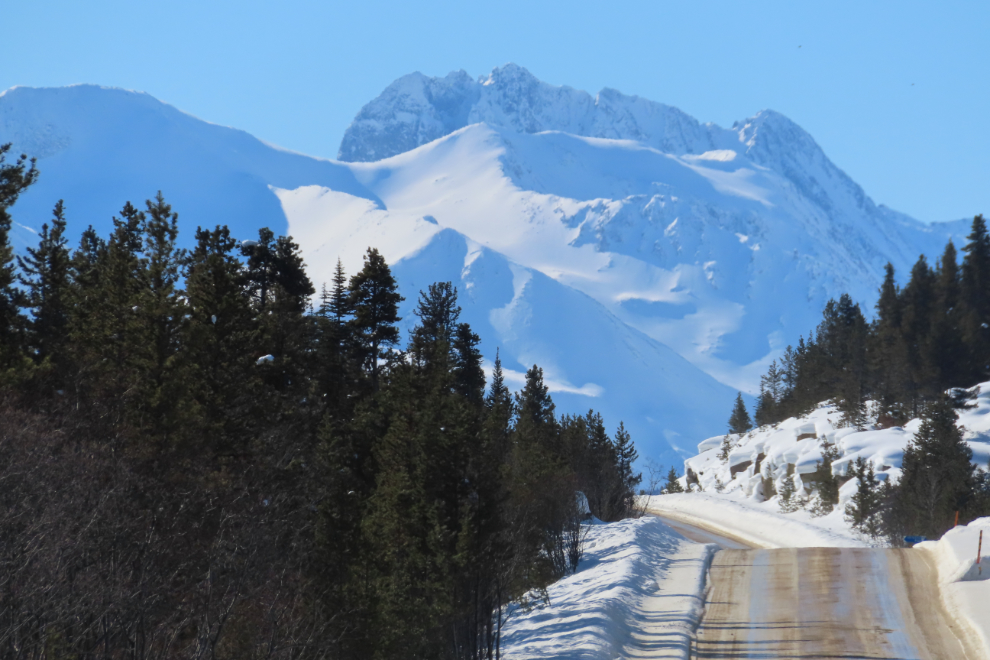
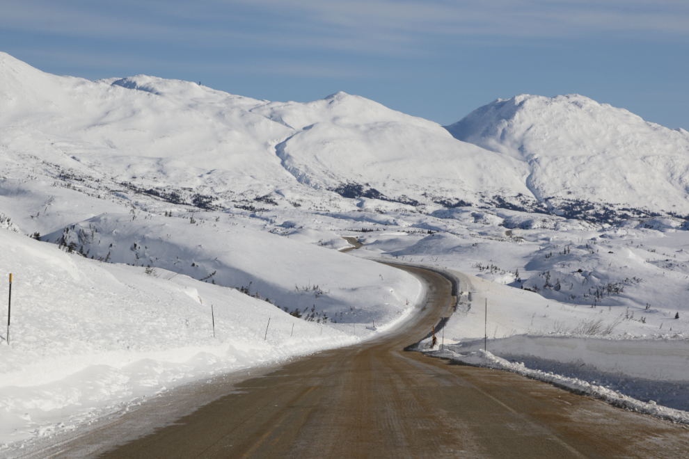
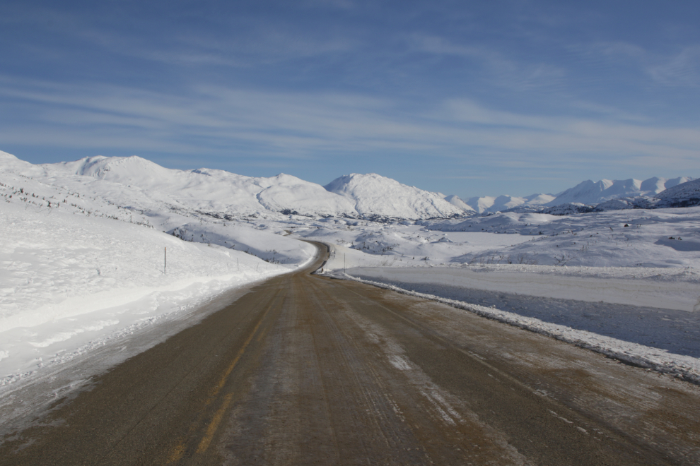
The first good view of the peaks of the White Pass, from about Km 149, just north of the Yukon Suspension Bridge.
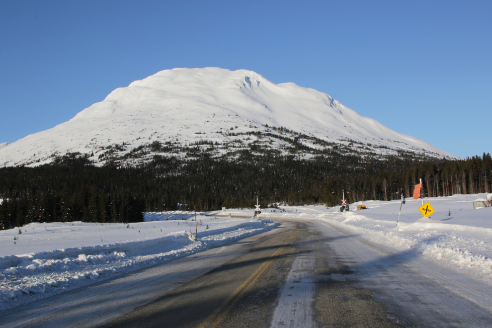
Approaching the railway crossing at Log Cabin (Km 43.9), with Mount Halcyon ahead. Most mountains in the Yukon and northern BC don’t have names, and those that do have official names often have other names that are commonly used. Mount Halcyon is a.k.a. Log Cabin Mountain or Shallow Peak (because Log Cabin and Shallow Lake are both at its base).
In the next few weeks, trains will once again be seen rounding Ptarmigan Point, still buried deeply in snow now. It was now 08:37, and normal people in Whitehorse would just be starting their days 🙂
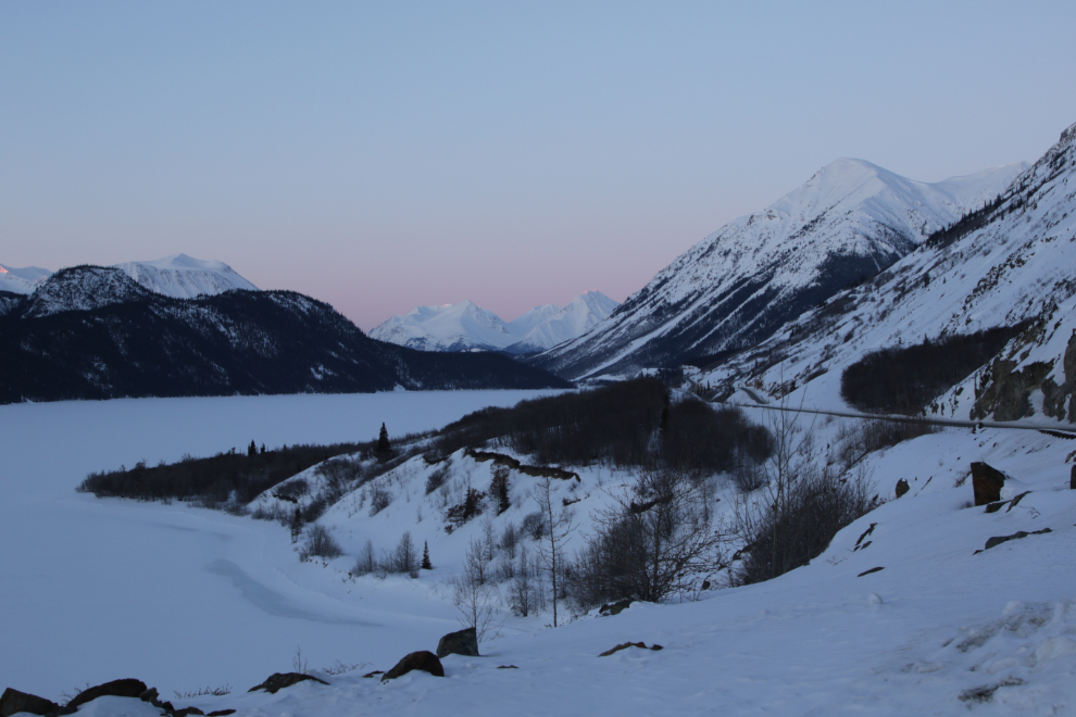
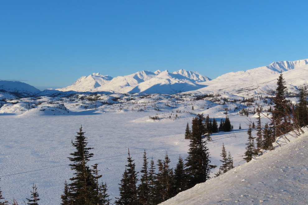
The view across Bernard Lake to the peaks surrounding the White Pass summit.
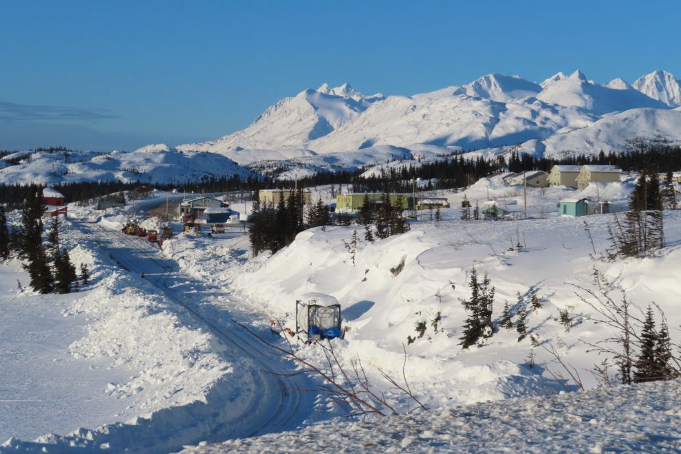
Fraser was a very busy place, with White Pass railway crews clearing snow. This is where trains and busses meet for the various excursions.
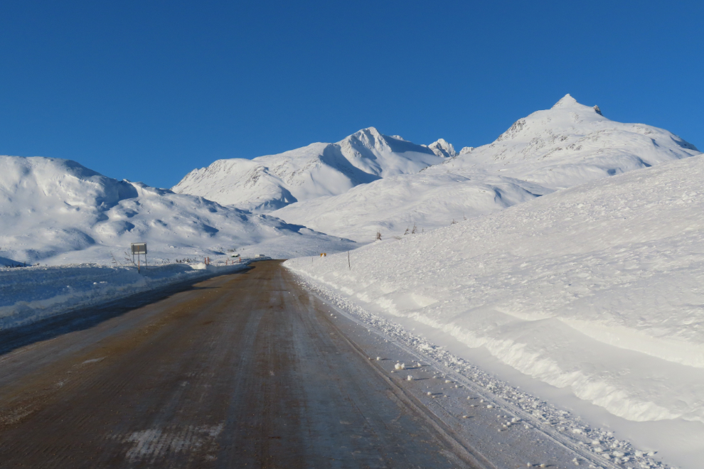
The final climb to the White Pass summit, with “Outhouse Hill” (Km 25.1) ahead on the left.
Looking a bit to the east, to the pass that the railway goes through, and beyond. What a place – there really are no words to properly describe it, and even photos probably don’t do it justice. You have to experience this place, preferably alone or with your special person, in silence.
Outhouse Hill at 10:00 – when I came back 15 minutes later, several vehicles were in various stages of unloading snowmobiles and/or setting up their camps.
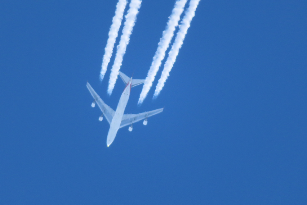
The air is incredibly clear in the White Pass! This photo looking almost straight up isn’t cropped – that’s maximum zoom on the little SX740. Not bad for about 6 miles away. The plane is a Boeing 747 freighter going from Asia to the eastern States.
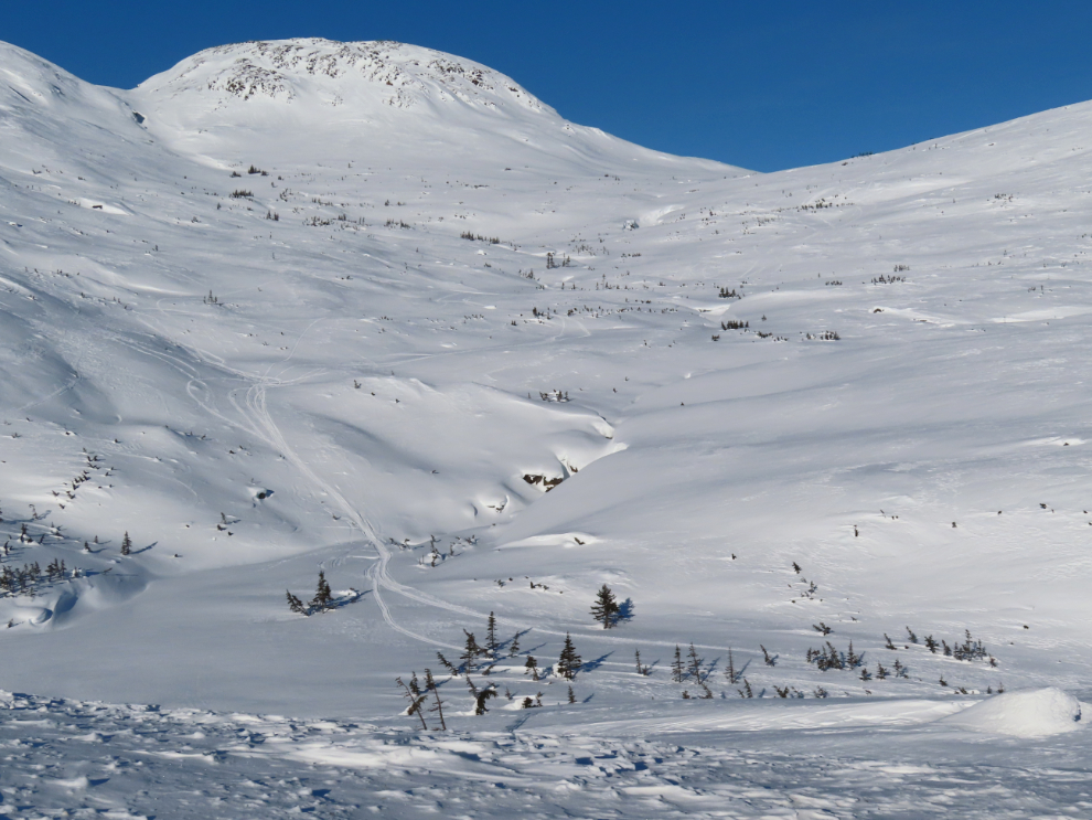
Deeply buried down there is a creek with a lengthy series of waterfalls and cascades, with what is commonly called the International Falls Trail on the right of it. Questions about the trail have already started on the hiking group I belong to, and this was a useful summary of conditions to post on that page.
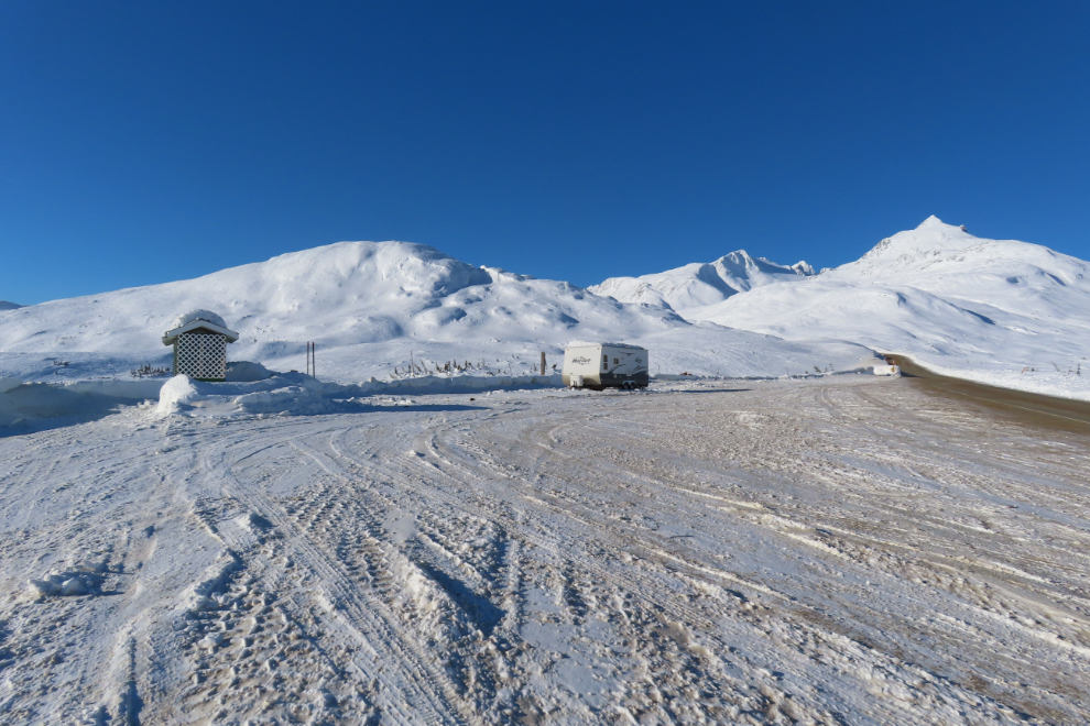
Km 24.1 is the end of the road for me – that’s the Canada-USA border ahead. The temperature was still -19C and there was a fairly strong north wind – definitely not the conditions I was hoping for when I packed my snowshoes.
Looking north from about Km 27, at 64mm and 24mm – in the broad view, Summit Lake can be seen to the right.
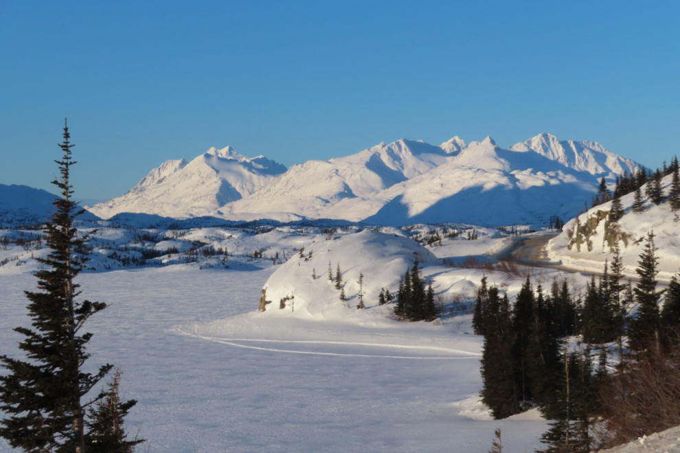
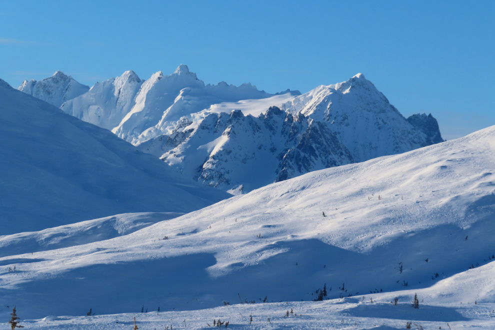
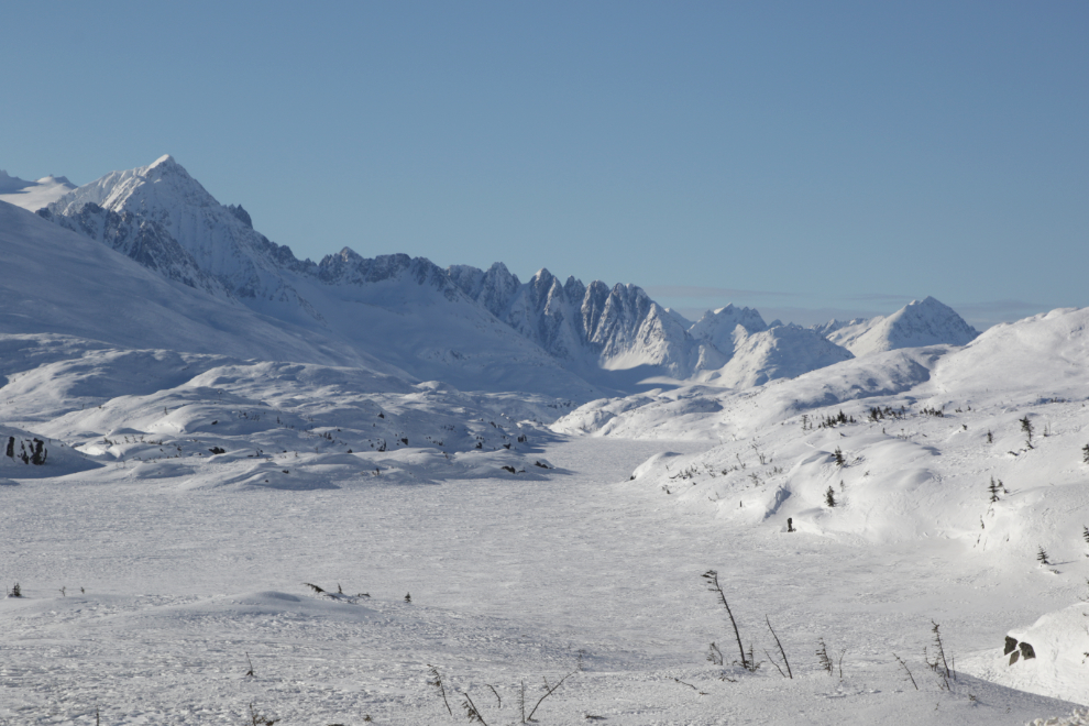
Looking back to the south, up Summit Lake to the Sawtooth Range.
North wind!!
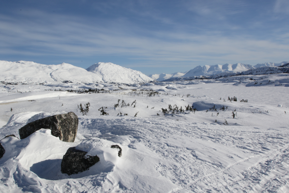
At Summit Creek I went for a walk, just using snowmobile trails rather than put snowshoes on. The wind was much lighter than it had been at the summit.
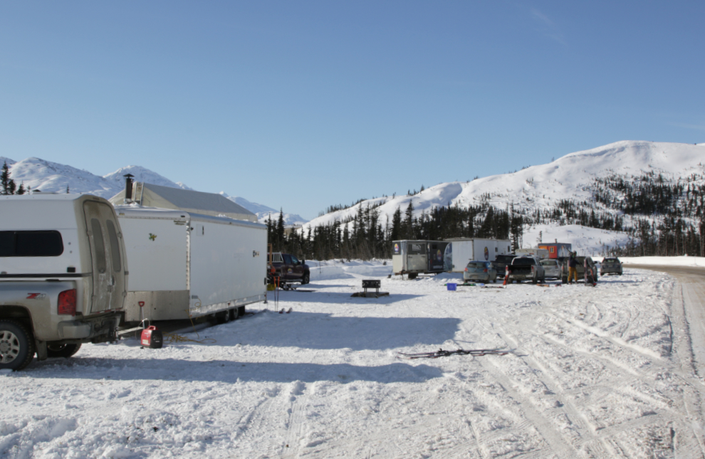
I thought about hiking up to Bryant Lake, but the trailhead was now a very busy place. This is the base of operations for Yukon Heliskiing, but there were lots of other activities happening as well, and several people were heading up towards the lake on skis so I gave up that idea.
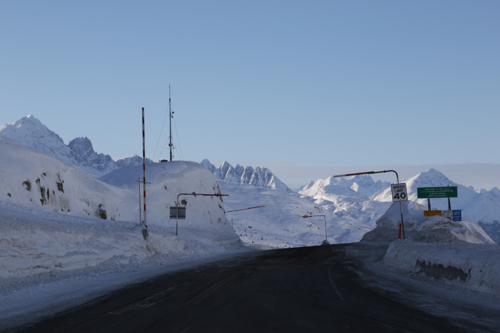
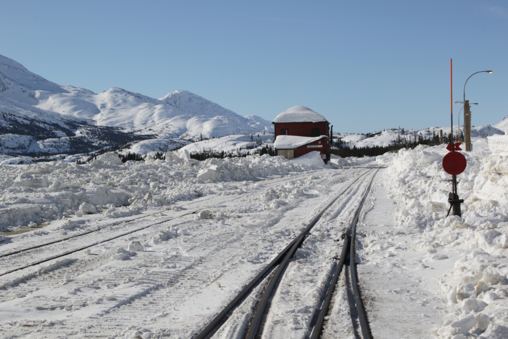
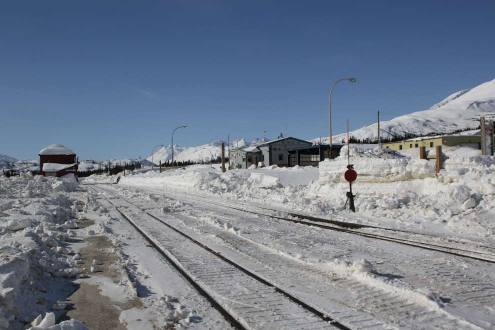
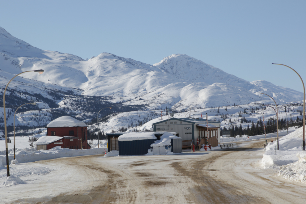
Checking in at Canada Customs was simple and friendly as usual, then I stopped and took a a few photos of the railway’s snow-clearing operations.
Looking back at the Customs post. Although the actual border is at the summit, 12 km further south, the Customs and Highways stations are at Fraser where the weather is much less severe. Although you don’t leave Canada going to the summit, you still need a passport to get processed the same way you do if you go to Skagway.
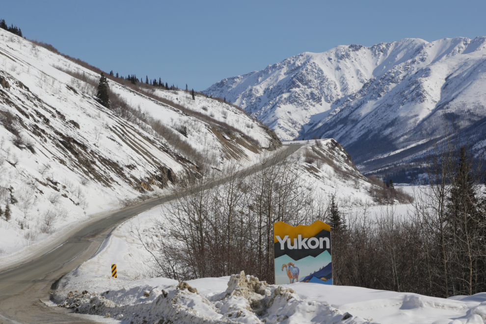
The BC-Yukon border, with the new “[Welcome to the] Yukon” sign 🙂
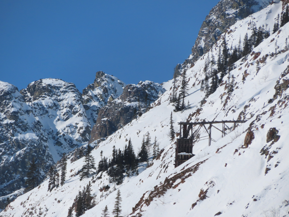
Look up, look waaaay up! to the historic Venus silver mine.
Back at the Bove Island viewpoint.
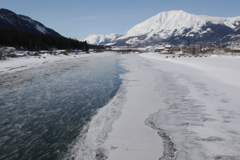
Driving across the bridge at Carcross, I decided I hadn’t shot the “classic” Carcross view in a long time, so parked and walked back across the bridge. This scene at the boat launch stopped me for a minute.
This was the photo I wanted.
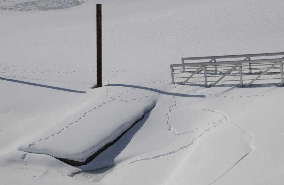
I detoured into Carcross and shot a few deep-snow photos, then was on my way home. It had been a good day, and I think that pre-dawn start may become my regular routine on those drives – that light is very special.
I really enjoyed the images here. Thank you for taking the time to share your journeys
Thanks for joining me – I’m really glad you enjoyed the virtual drive 🙂