A look at Conrad townsite, today and in the past
On Wednesday (May 1st), I decided on the spur of the moment to do my almost-annual because-I-still-can hike up to the upper adit of the historic Venus silver mine. That’s not the way the day played out, though – here’s the first of two posts about what I did do (both are Venus mine related).
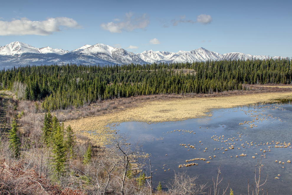
Although it started off well below freezing again, it was a spectacular day, with a forecast high of 13°C/55°F. My first photo stop was at Rat Lake. I’ve seen moose in the willows there recently, but there were none this morning.
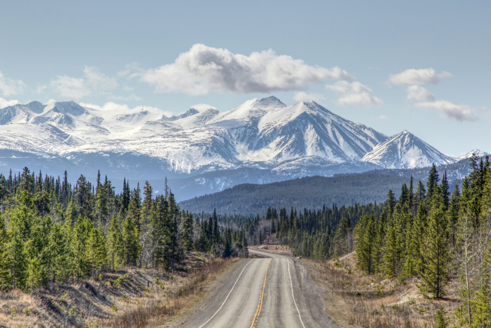
Montana Mountain from one of my regular photo stops.
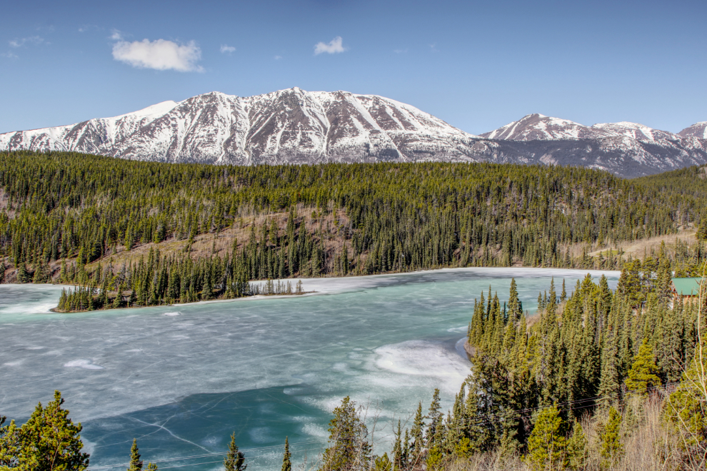
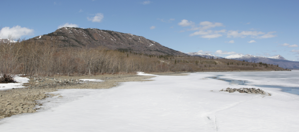
The ice on Emerald Lake looks like it will break open any day now. All it will take is a windy day.
I popped in to Carcross for a quick look. It’s still very quiet. There was a time when those two buildings, Matthew Watson’s Store and the Caribou Hotel, were the big draws in Carcross, and when I lived there, my Siberian husky I spent a lot of time sitting on a bench in front of the store chatting to people, usually folks up on cruise ships.

The light and background were finally good for a photo of the old truck beside the Caribou

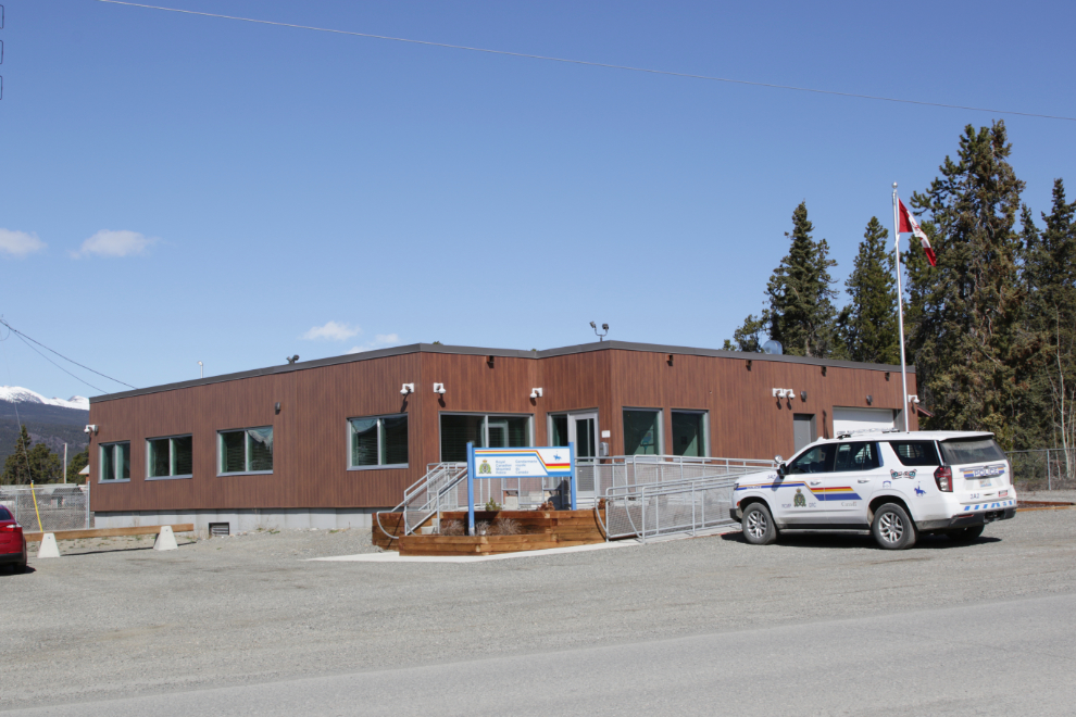
The new RCMP detachment building is a nice improvement.
Although I had a plan when I left the house, this was apparently going to be a let’s-see-what-happens day 🙂 – the next stop was the Conrad Campground. This is the group camping area.

The playground is new since I was last here – it looks like a lot of fun.
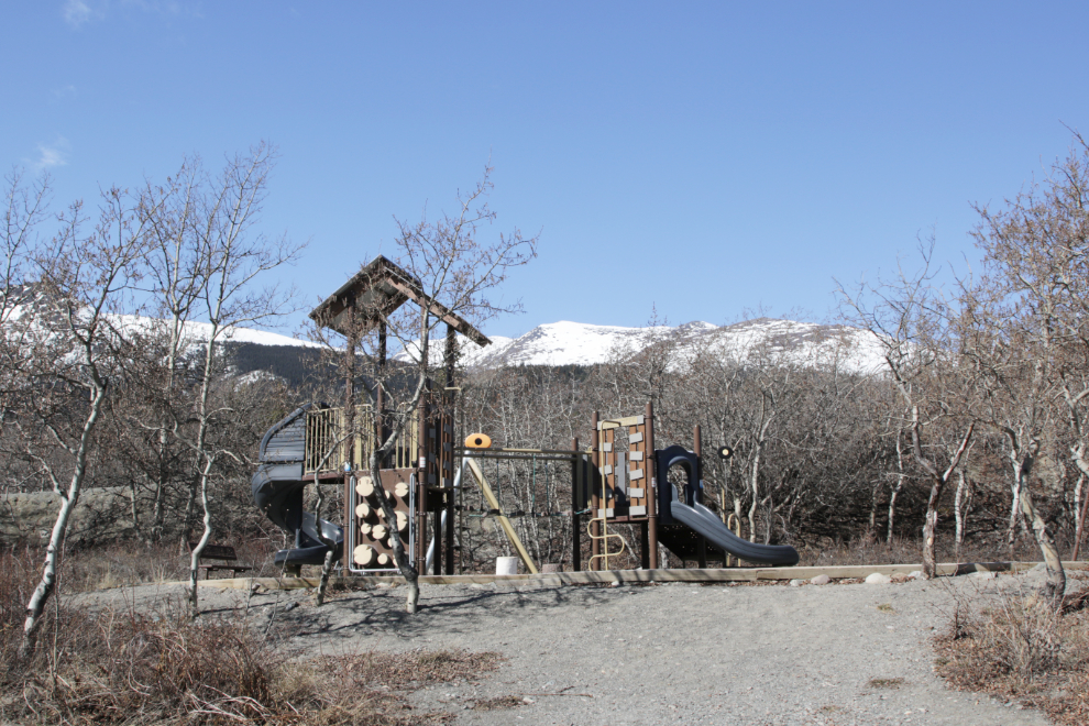
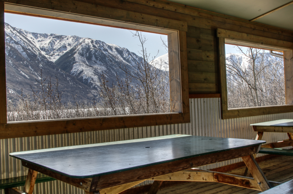
Spotting scopes are set up outside the picnic shelter – that’s the view across Windy Arm.

The view from inside the shelter.
I hadn’t really planned to walk down into the historic Conrad townsite, but then I saw a construction fence and had to check it out.

There are only two buildings remaining at Conrad, so I knew what the construction fence was around.

This cabin was quite solid, and it’s great to see it being rebuilt – it’s going to be the historic site’s interpretive centre.
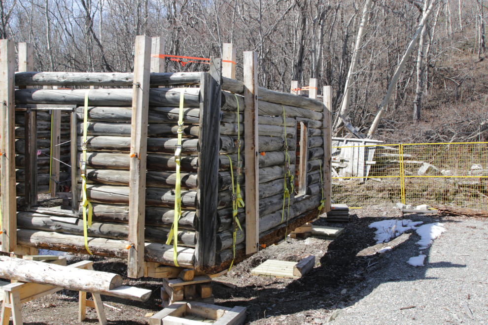
The sign explains that the cabin was built “using round, peeled logs with Yukon Corners (logs butted at corners and nailed to vertical 2×6 at 90-degree angles).”
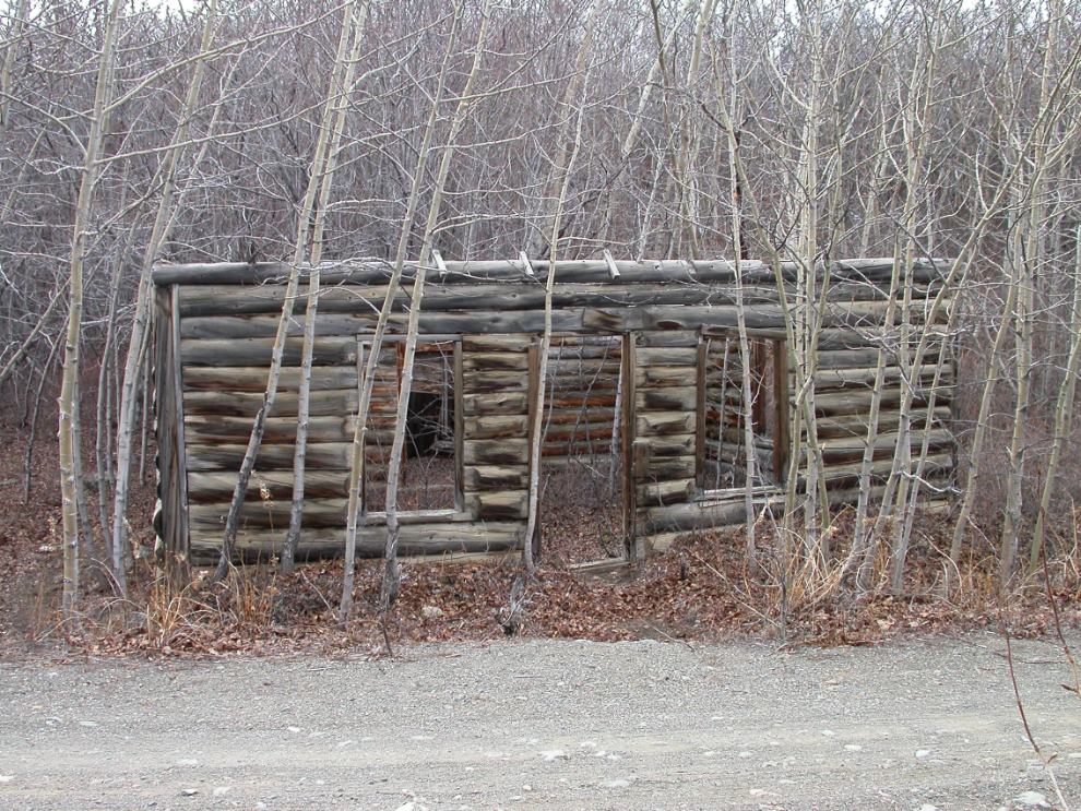
Here’s what the cabin looked like in May 2012.
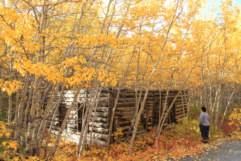
Cathy in front of the cabin on September 22, 2012.
Two more views, from August 2007.
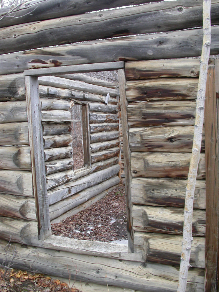
An addition to the rear of the cabin, seen in September 2012.
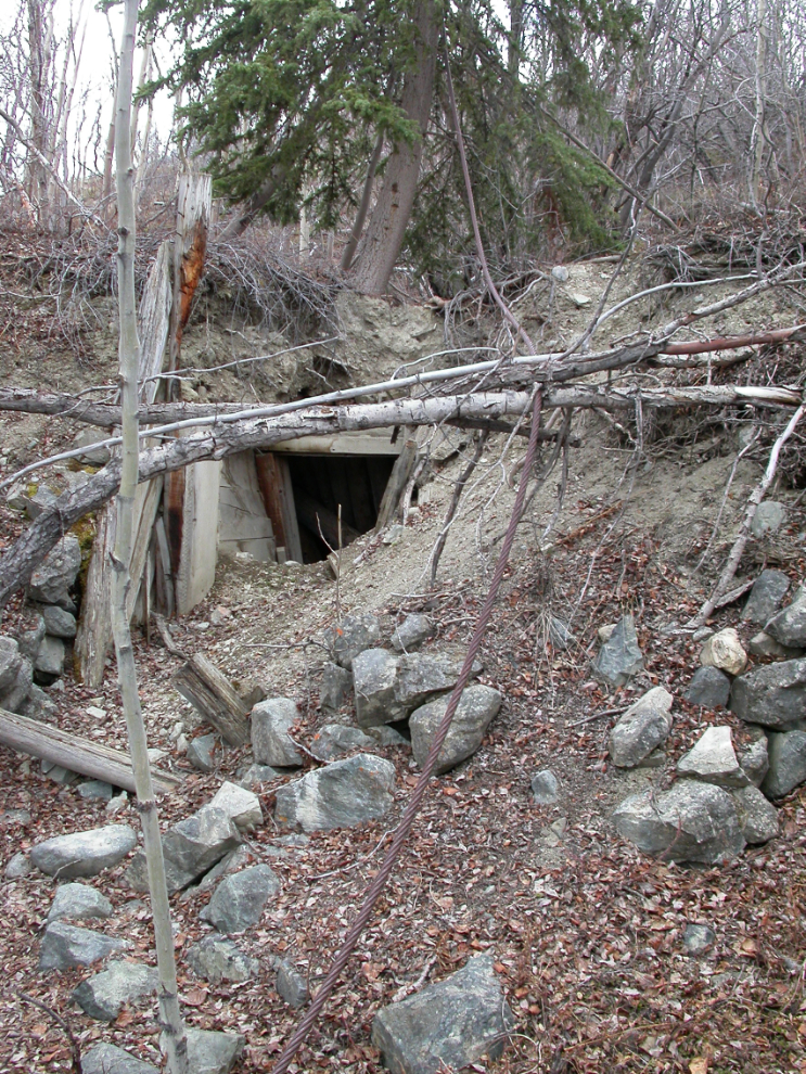
To the left of the cabin is a large root cellar. Now fenced off with chicken wire, it’s seen here in August 2007. The addition to the rear of the cabin, and the adjacent root cellar, have led me to believe that the cabin was the cookhouse for the Conrad mines, though the cabin’s fairly small size has me uncertain about it.
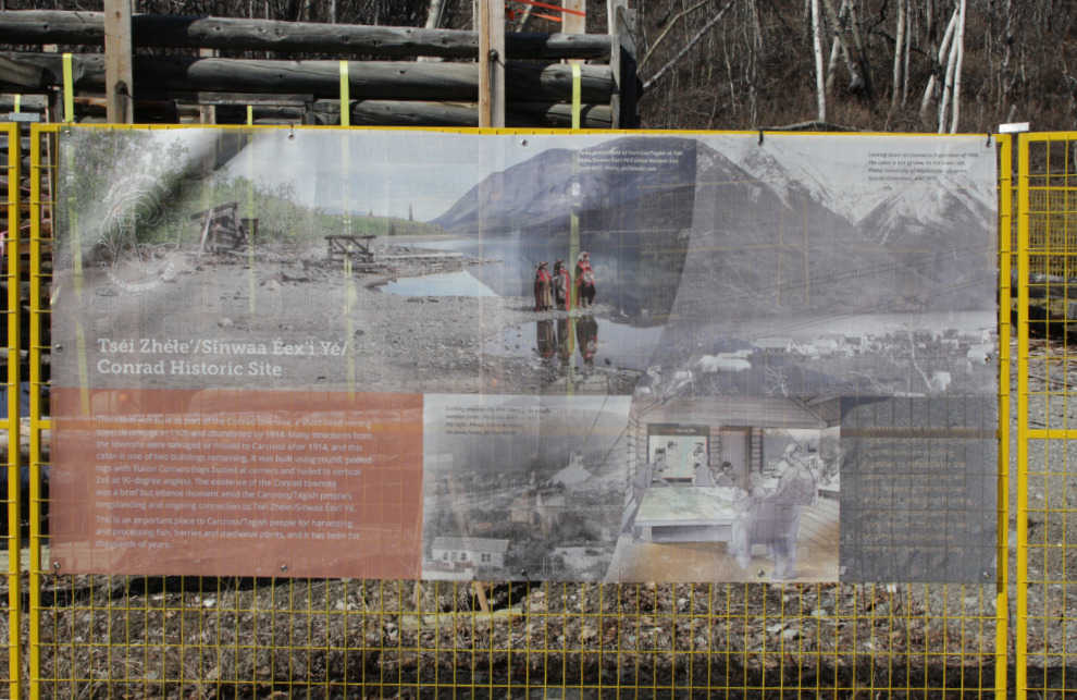
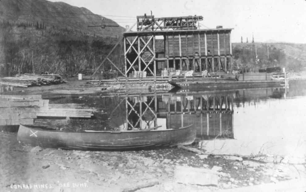
Just past the cabin is a small bay that was the centre of the action for servicing the Conrad mines. This long-gone interpretive sign, photographed on May 11, 1994, reads “In the early 1900s this was the site of Conrad, a supply centre and shipping point. The town was named after Colonel John Howard Conrad, a promoter of silver mining in the area. Discoveries of mineral wealth had created a great deal of interest in the region, and several mines began operations. They were linked to Conrad by an aerial tramway 5500 metres long that carried ore and supplies. The mineral deposits were not as valuable as originally supposed, however, and despite Col. Conrad’s energetic financing efforts, the mines and town were abandoned in 1912.”

This is the view of that bay today. The main structure was the terminus of the aerial tramway to the Mountain Hero mine.

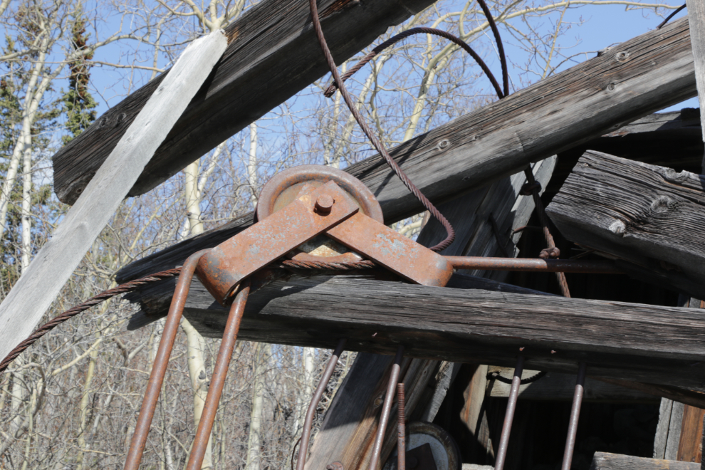
A closer look at the tramway terminus.
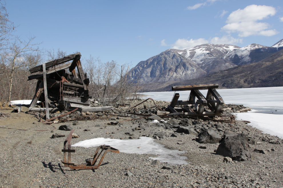
Most of the good pieces were carted away long ago, but there are still some interesting details.
This was the company dock.
This is what the bay looked like in 1906, the height of the boom. The sternwheeler Gleaner was a regular visitor, hauling people and supplies in, and people and ore out, often pushing a barge.
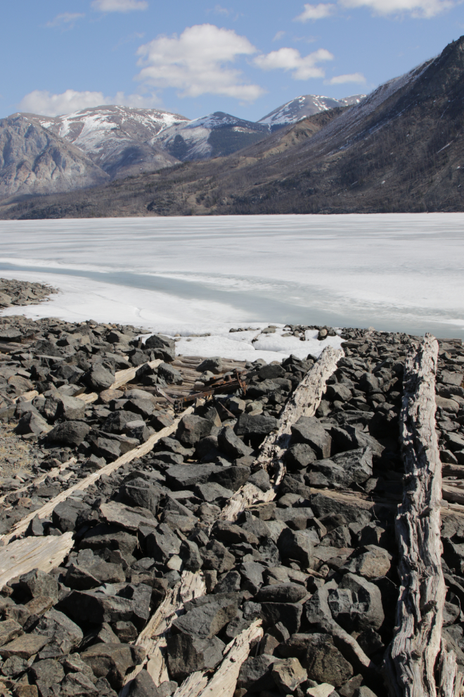
Next, I walked over to what had been downtown Conrad. In this panorama, the pile of rocks to the right was the town dock.
The dock as seen from the beach.

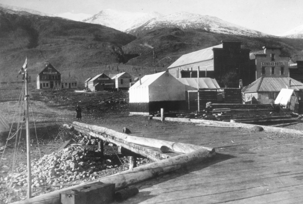
The next photo shows Conrad from the end of the dock. It was shot just after the boom died, probably 1907 or 1908.
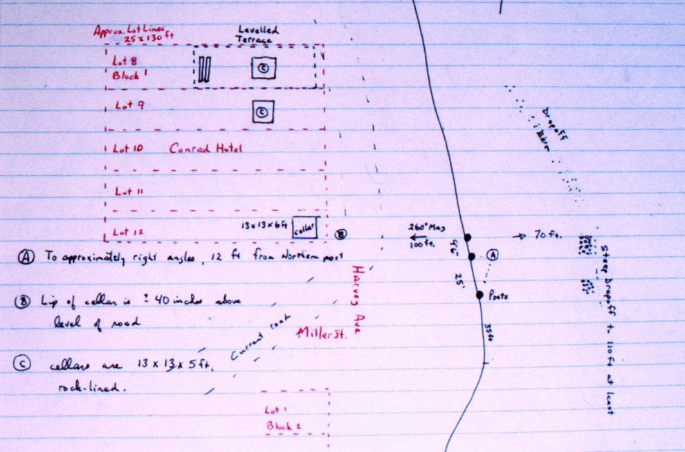
This drawing goes back to about 1995 after I had found and verified the dock by using scuba gear, and then started detailing the town plan using that as a base.
In August 2007 the lower part of the Conrad townsite was flooded – that pile of rocks was covered by 10-12 feet of water.

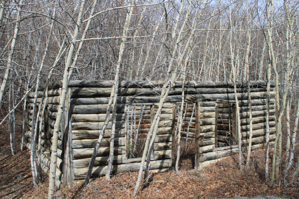
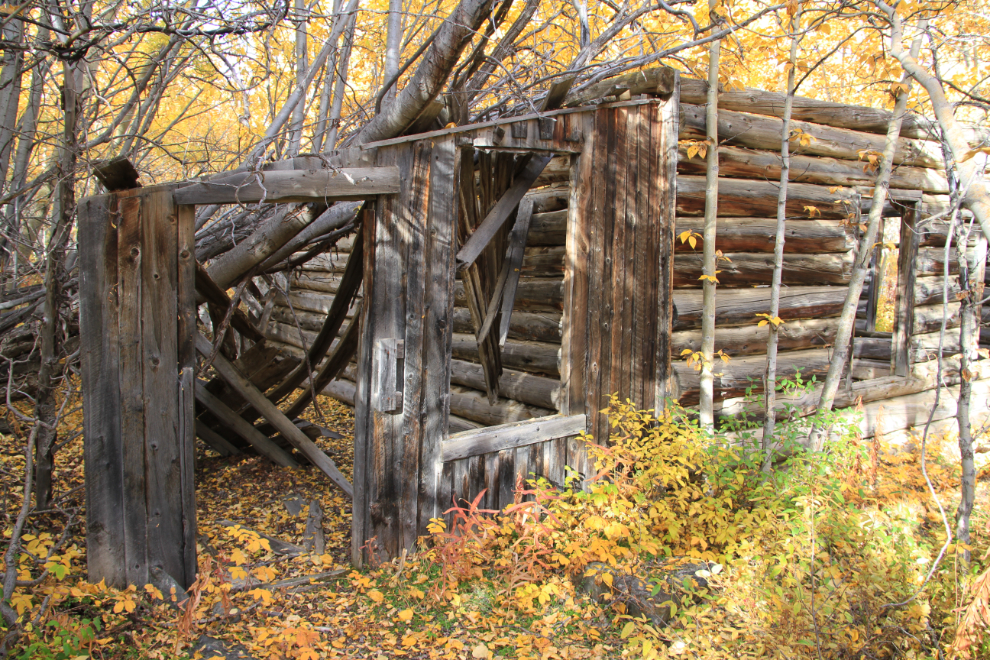
The next two photos show the other building remaining at Conrad (most were moved away to Carcross or further points). Because of its size I’ve always thought this must have been a store but was never able to prove that. The building has been stabilized but I doubt that a restoration will be done.


A final photo from Conrad, of the first buds of Spring on a poplar tree.

I should probably explain that the reason for my strong interest in Conrad is that it, and the mines in the area, were the subject of my first book, “Fractured Veins & Broken Dreams: Montana Mountain and the Windy Arm Stampede,” long out of print.
Next, off to the Venus mine. Maybe 🙂
I was fortunate enough as a child and young adult to be able to spend many weekends in the CA gold rush towns; my dad had a huge interest and I wish now I had been older to enjoy his enthusiasm, knowlege and all the cool out of the way places we tramped in to. A good, day, thanks for sharing.., great images too.
My Dad had a passion for placer gold mining, and the 1958 centennial of the Cariboo Gold Rush in BC spurred an interest that lasted as long as he did. He and I spent a lot of time panning for gold in remote places over about 20 years, and my first book, on the silver mines at Carcross, was dedicated to him.
So interesting. I’ve always loved looking at old places and daydreaming what it was like back then. We’ll go to an old building and I will tell my wife that I wish the building could talk because I’ll bet it could tell some good stories. Old places take me back to when I think things were a lot simpler and more peaceful.
Yes, Neal, I certainly understands that “if these walls could talk” feeling. Simpler and more peaceful times perhaps, but also a whole lot more difficult – I wouldn’t go back in time except for a brief visit.