Flood watch: a high-water tour of the Southern Lakes
Yesterday I took a drive around the Tagish-Carcross loop to have a look at the rapidly rising waters in what we call the Southern Lakes – the headwaters of the Yukon River. A perfect storm has set the stage for the worst flooding ever seen in the region. As of May 1st the snowpack was reported to be 215% of normal. A very late Spring kept the snow much later than normal, and now daily high temperatures from 23-30°C (73-86°F) are melting it rapidly.
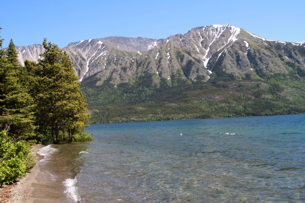
To back up a few days, Cathy and I took Bella and Tucker down the South Klondike Highway as far as our usual “play beach” at Tutshi Lake, but there was no beach left.
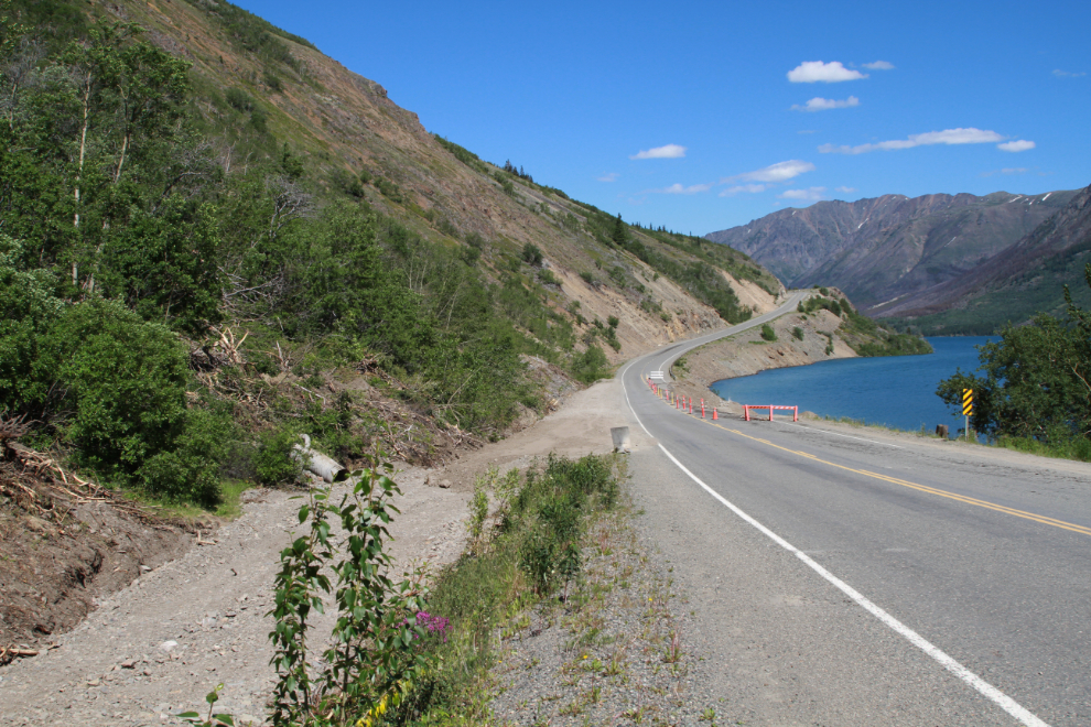
On the way north, I stopped to get a few photos of the progress being made on a large washout of the highway right at the BC-Yukon border. The culverts that usually allow Dail Creek to pass under the road got plugged by debris a couple of weeks back, and the water flowed down the side of the road, then across it and washed out one complete lane for 50 meters or so. There are two lengthy one-lane stretches now, but there is so little traffic that no lights or flag people are there – it’s up to drivers to work it out.
On June 29th, Tucker and I went for a walk at the Lewes River Control Structure (a.k.a. the Lewes River dam) and as well as the very high water, I was surprised to find that the boat lock had been taken apart.
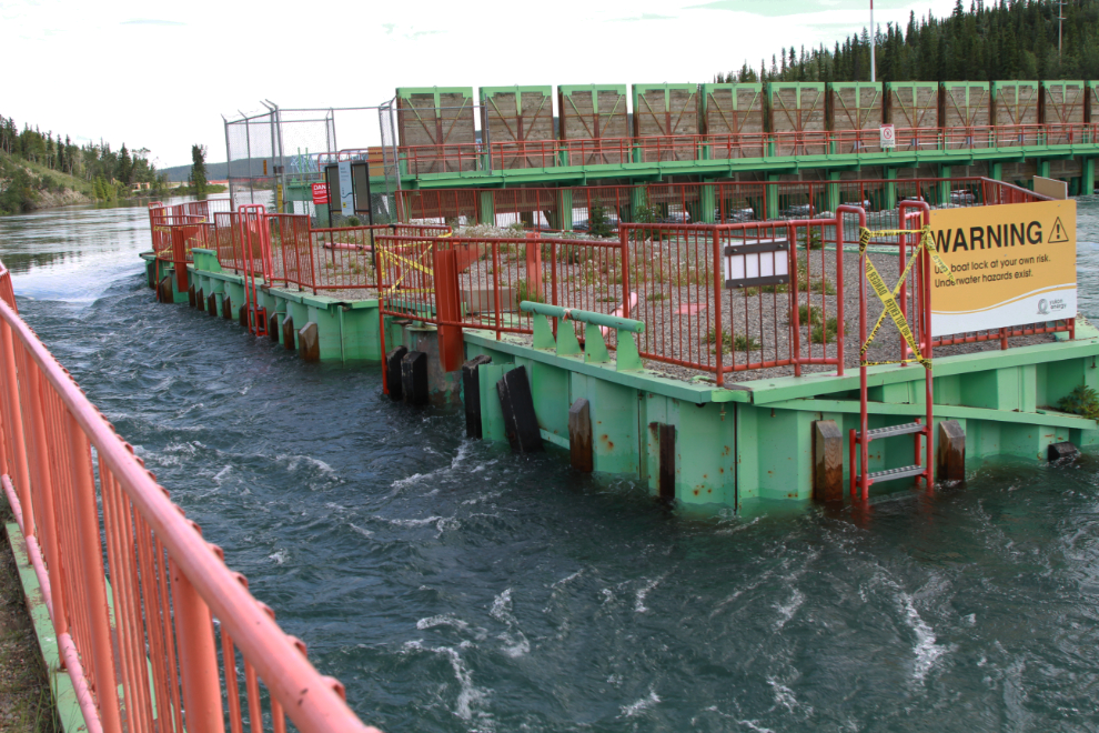
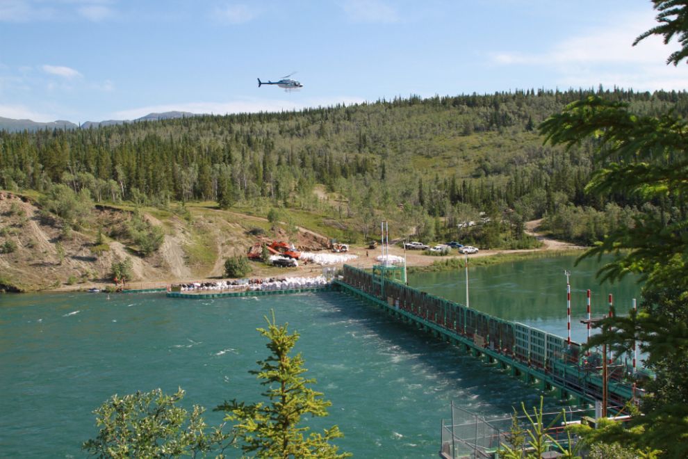
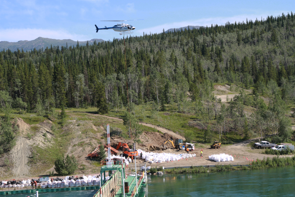
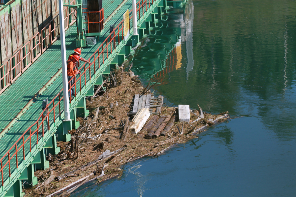
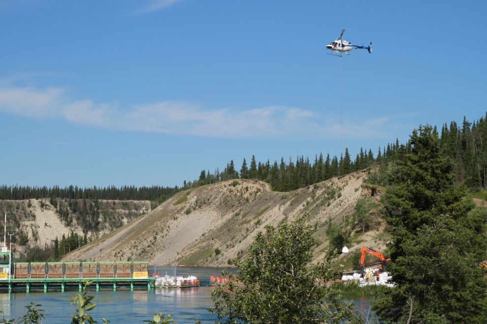
On to yesterday’s tour. Yukon Energy said yesterday afternoon, “Like many residents in the Southern Lakes, we’re preparing for high water levels in the area. Our team is installing sandbags around the Lewes River Control Structure to minimize the chances of erosion. We’ve also closed the access road to the boat lock due to unsafe conditions.” There were a lot of people working when I got there, even a helicopter moving the sandbags.
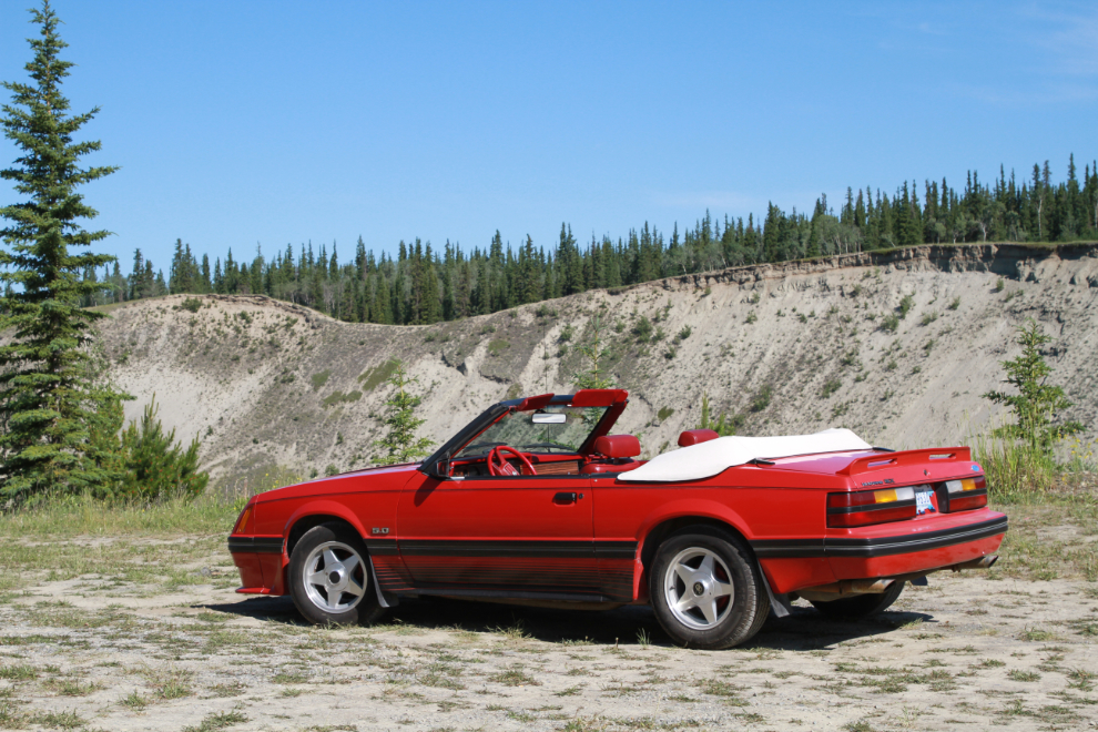
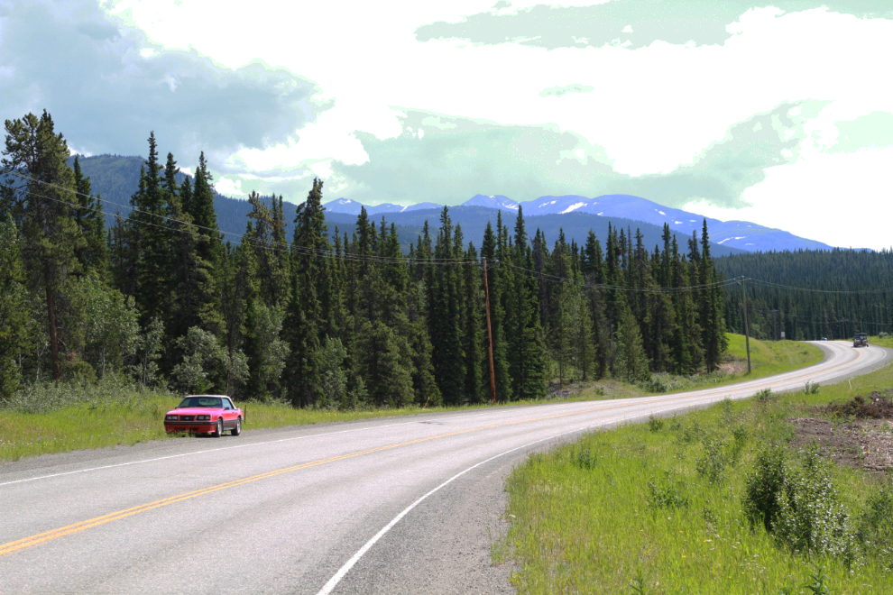
I took the Mustang for this tour, planning to put her back in storage last night, as her owner may not be able to get to Whitehorse this year. I got her all cleaned up and running great for him, but the stars are not aligning. 🙁
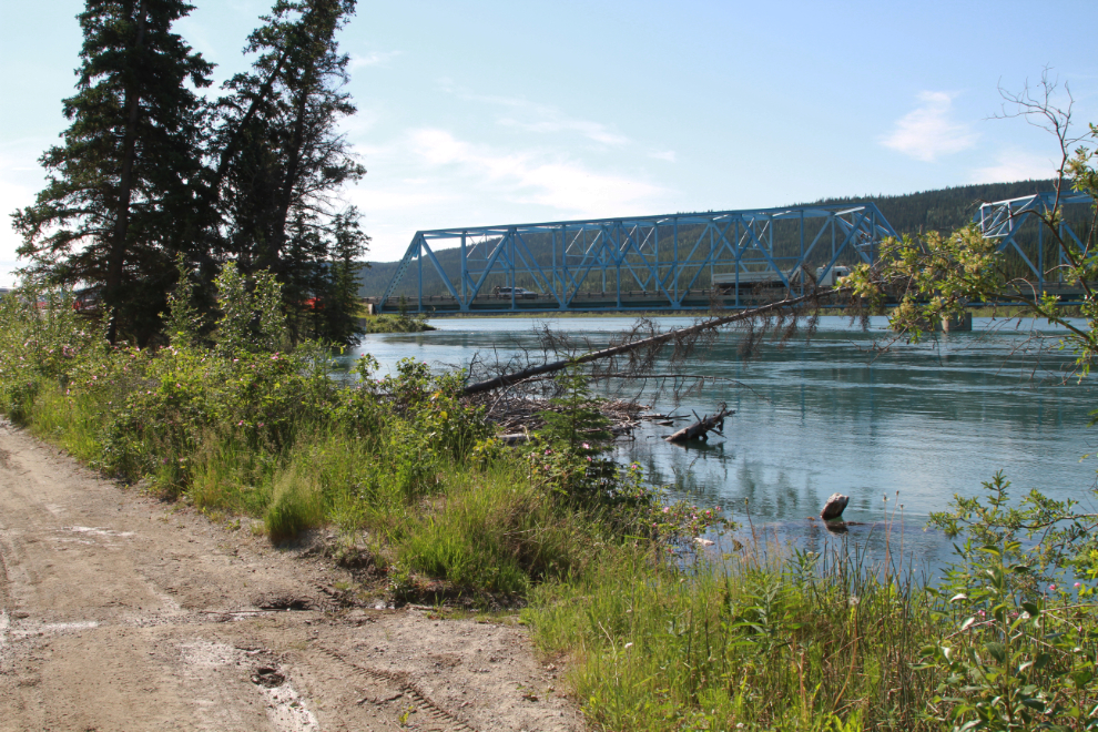
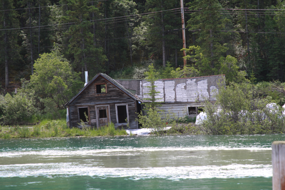
Debris is compounding the high water issues. The large stuff there used to be somebody’s dock – many upstream along Marsh Lake are under water or have been washed away.
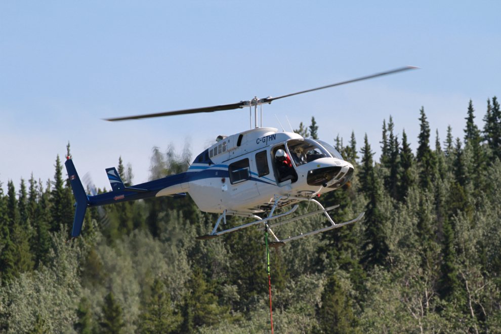
A closer look at Discovery Helicopters’ 2000 Bell 206L-4 LongRanger IV, C-GTHN.
I drove around to the Yukon River Rest Area for a different vantage point. I don’t know what’s going on at the “blue bridge” that carries the Alaska Highway across the river there.
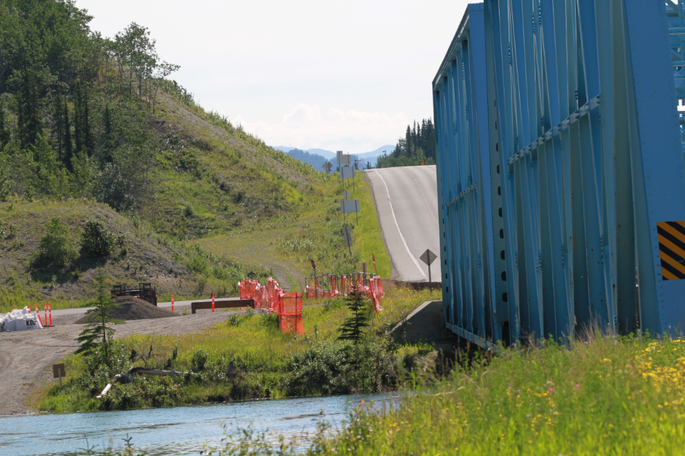
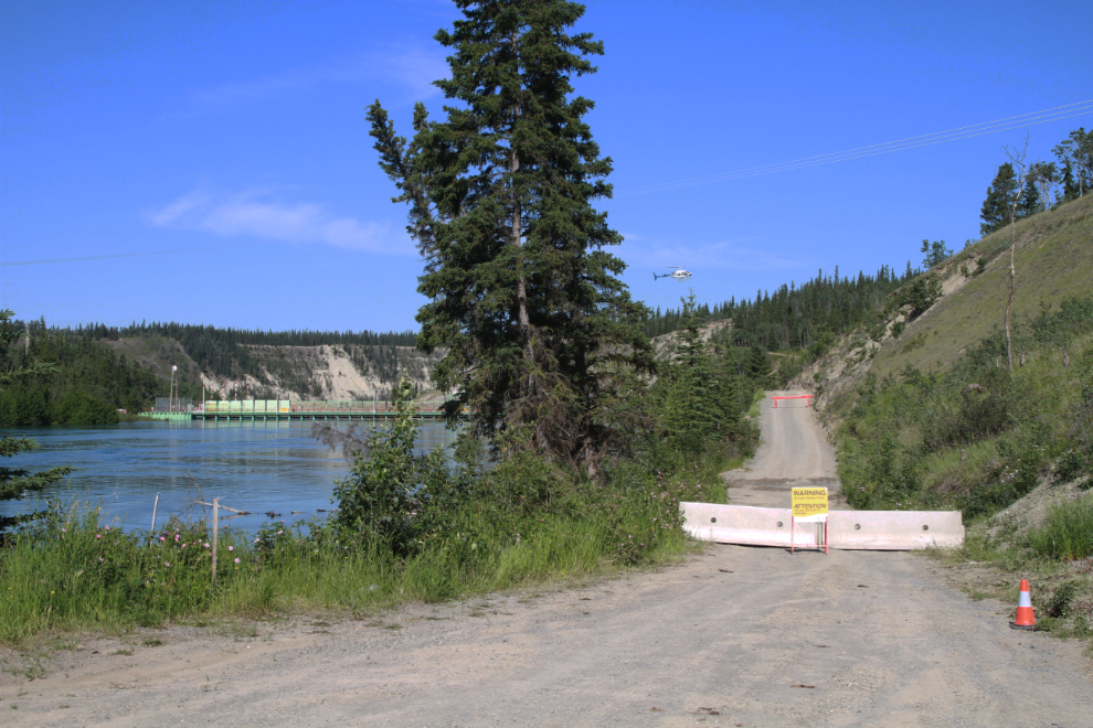
The road to the dam has been blocked off since I was there a few days ago, and walking up it a bit, I could see why – the high water is causing the slope below it to fail.
This view looking straight down the boat lock gives a better perspective on the work being done.
The water has even damaged a beaver lodge beside the road.
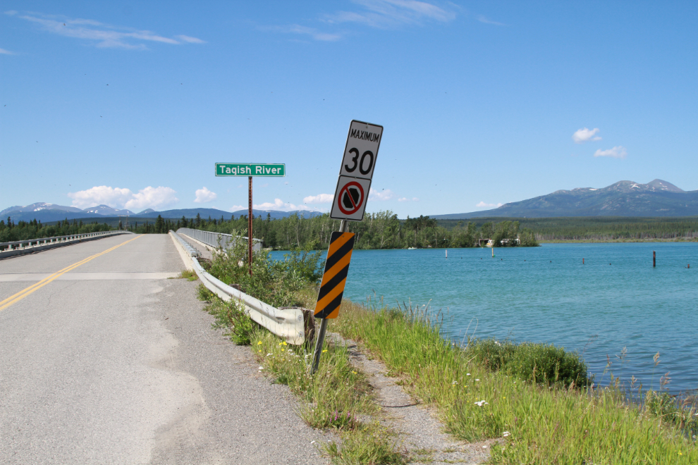
I stopped along Marsh Lake but didn’t see anything photo-worthy. My next stop was at the Tagish Bridge.
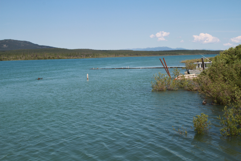
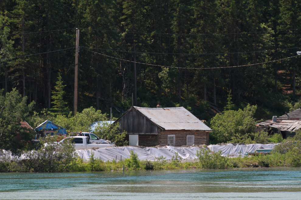
Looking to the right from that spot, you’d never know there used to be a fairly busy marina there.
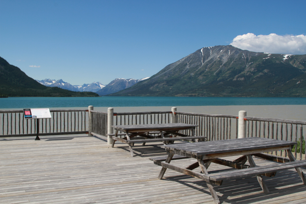
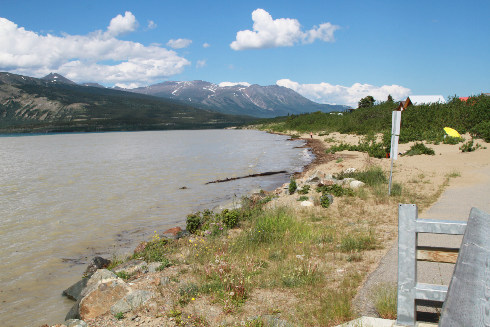
Carcross was my next stop, starting at the viewing deck overlooking Lake Bennett.
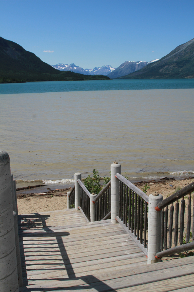
These stairs from the viewing deck usually lead to a huge beach.
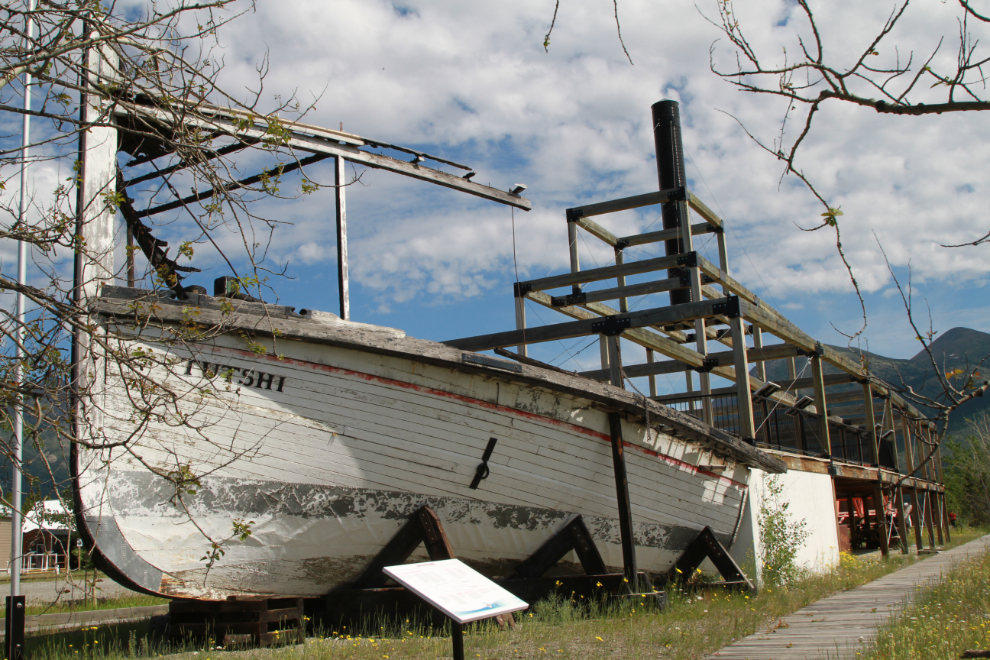
The deck on the Tutshi sternwheeler memorial offers a decent view.
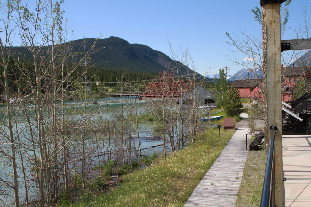
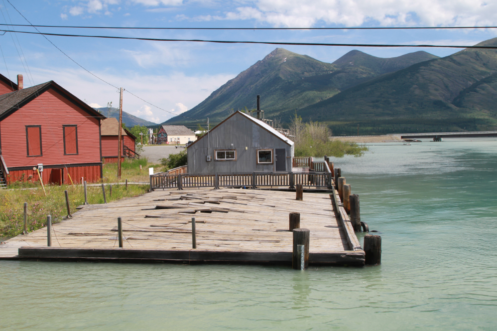
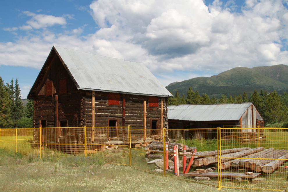
The BYN (British Yukon Navigation) warehouse and dock was the next stop. The dock deteriorates more and more each year…
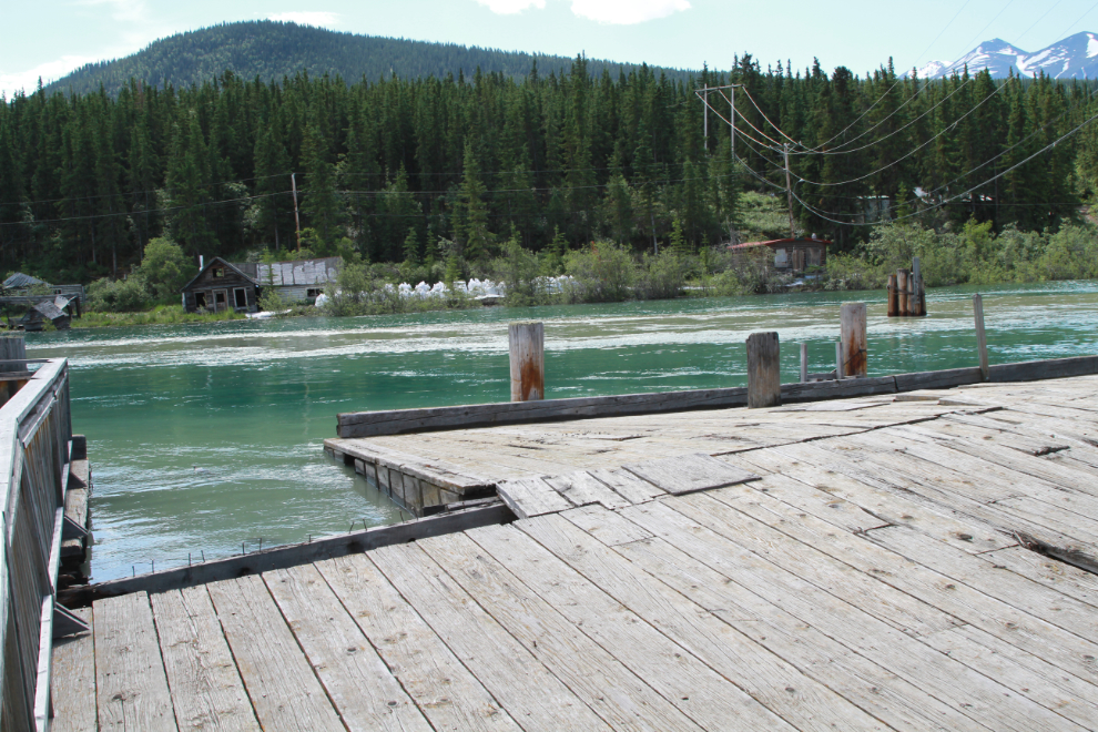
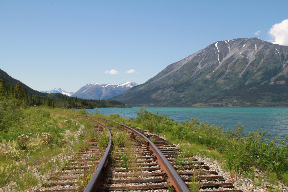
When you’re used to the water being many feet below the dock and railway bridge, a scene like this is pretty shocking.
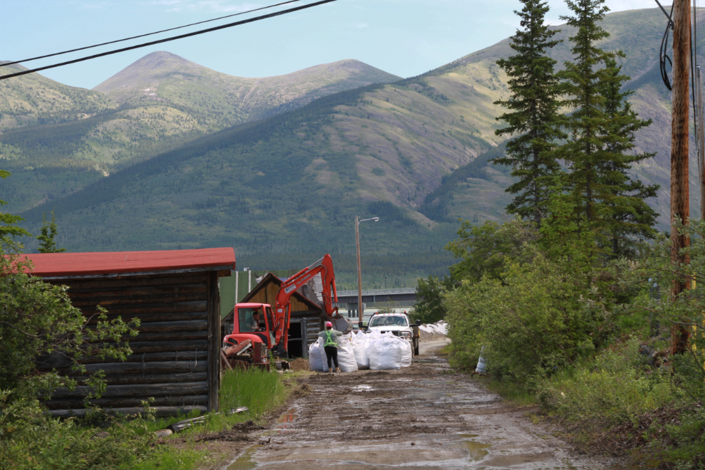
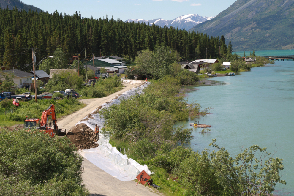
Several of the oldest buildings in Carcross are threatened by the high water. The dyke being built will help this one, but a couple further downstream are outside the dyke.
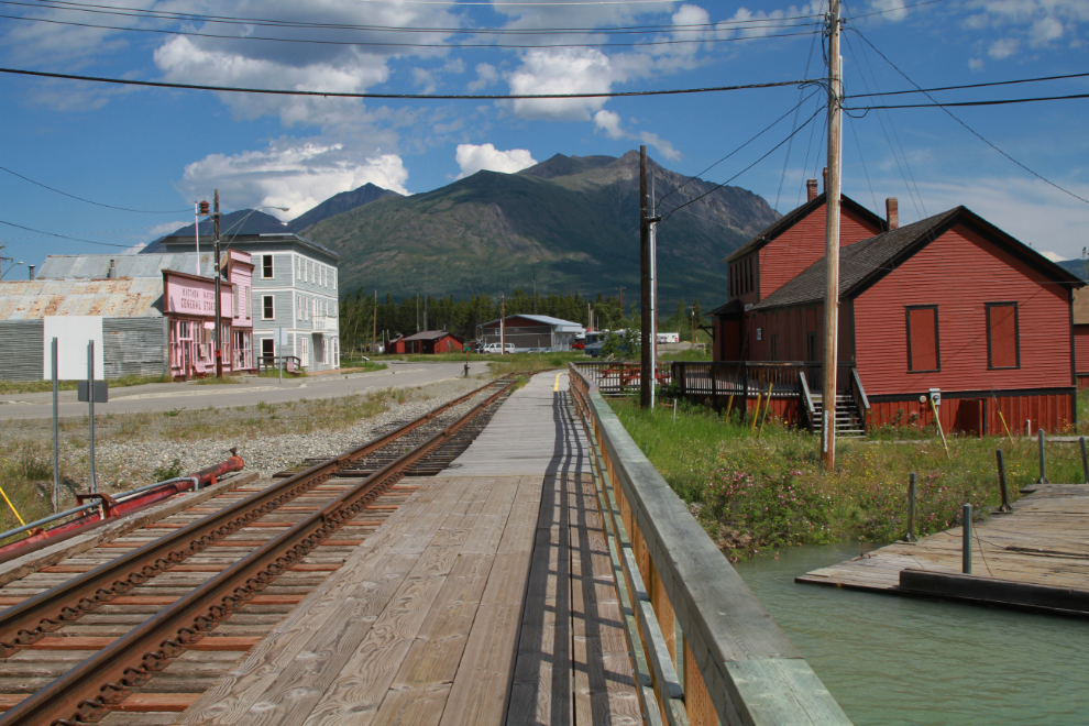
The railway bridge offered a better look at the dock and warehouse. As I was writing this, Yukon Protective Services posted on Facebook: “Wind and boat wakes are causing wave action that is increasing waterfront risk in the Southern Lakes. If you’re out on the lakes this weekend, please avoid causing wakes near shore while flood mitigation work is ongoing.”
Carcross is normally a very busy place in the summer. COVID-19 continues to decimate our tourist industry, though, as we have by far our worst outbreak of the pandemic going on right now. While many places have been through their third of fourth waves, this is really our first wave. The Yukon’s total case count since March 22, 2020, has been 388, but 303 of those cases have occurred in the past month (since June 1, 2021).
Another look at what remains of the Lake Bennett beach as I started walking across the footbridge.
It’s “only” been two years, but Mother Nature is working hard to reclaim the WP&YR railway line. A few hundred feet further south, there are trees a foot and higher growing between the rails.
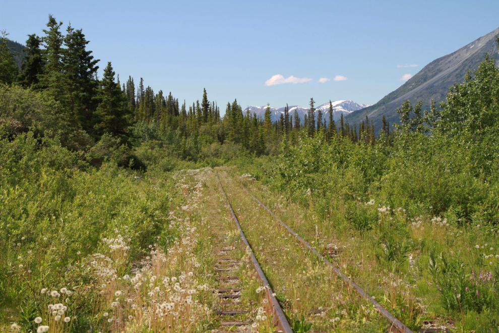
This was as far south as I walked along the tracks.
Another view of the dyke-building at the old cabin see above.
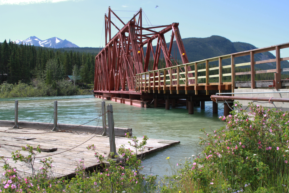
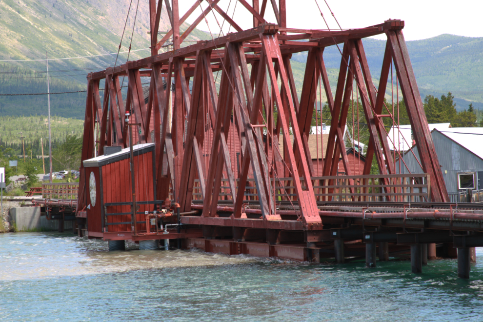
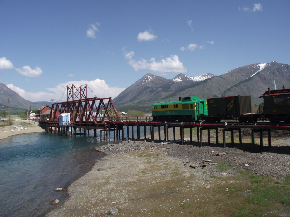
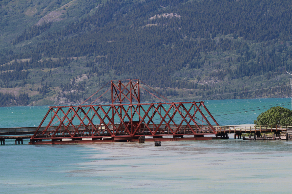
A closer look at the upstream side of the railway bridge.
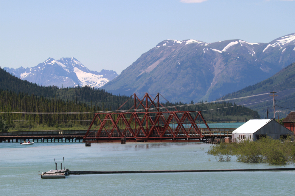
This is what the railway bridge looks like in late May in a normal year (this was shot a few years ago).
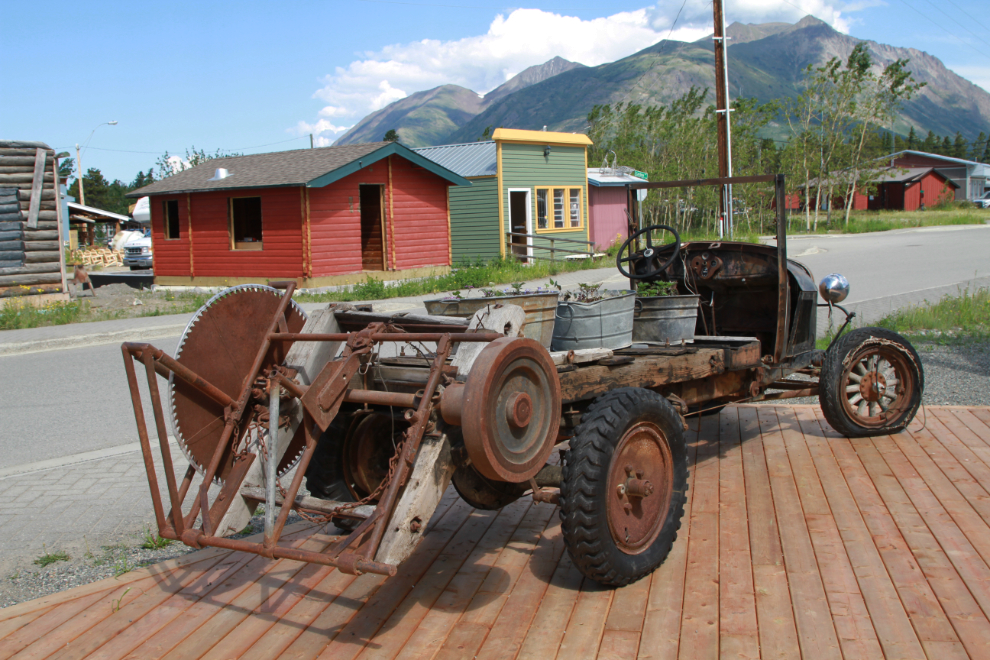
This truck-and-saw seen behind the Caribou Hotel as I walked back to the car is quite a rig.
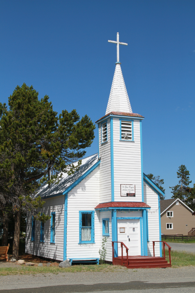
St. John the Baptist Catholic church, built in 1905, was brought from Conrad City to this site in the early 1940s.
My final stop in Carcross was the highway bridge, where I took quite a few photos. It offers a good look at the dyke construction.
Another view of the railway bridge.
And a final look up the Nares River, originally Naataase Héen.
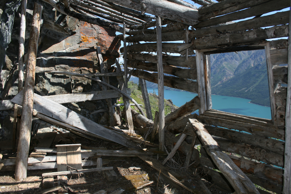
I had actually planned to continue south to hike up to the cabin seen in the next photo, but ran out of time. I’ve been there a few times since reaching it for the first time in 2009 – see that hike at “A higher exploration of the historic Venus silver mine.”
The car started overheating so I pulled into the Robinson Roadhouse rest area and let it cool down for a while. When I popped the hood before leaving, I could smell antifreeze but couldn’t see a problem. Stabilization work at the roadhouse seems to be continuing, though nobody was working during this visit.
Well poop – the car overheated again, and when I popped the hood I could see that the upper radiator hose had split. I thought about calling Cathy, or a friend, or a neighbour, for a ride, but decided to suck it up and walk the 6½ kilometers home. If not for the covid outbreak, hitch-hiking would be easy there. I would still get picked up, I’m sure, but I’m just not comfortable getting in a stranger’s vehicle right now.
I went back down in my own car, with duct tape and a big jug of water, and got the Mustang home. Then when Cathy got home, we got the Caddie.
Many of you will be used to seeing floods that last a few hours, or at most a few days. This sort of high water, though, can go on for weeks. Anyone living along the waters of the Southern Lakes, as well as a few locations downriver, are in for the long haul, and we can all only hope for the best.
Next time you have a problem with a car overheating like that (with GLOVES on) loosen the rad cap after it has cooled down, fill up with water and drive home with cap loose , keep eye on temp gage, you may have to repeat this process.
Great post Murray! Thank you for sharing! Certainly highlights well the dire situation ahead with the floods.
Thanks, Stéphanie – my fingers are sure crossed that things slow down.
Murray, you could have called me… I’m usually available…
Thanks, Gerry – I just hate taking people away from their busy lives.