A 14-hour day of photography between Whitehorse and Skagway
Yesterday was a marathon day of photography. I left the house at 3:30am to shoot the Northern Lights, and didn’t get home until 5:30pm. The result was over 300 photos of a wide variety of subjects from the area bordered by Mary Lake, Jake’s Corner and Skagway. Here’s a little sampling from the day…
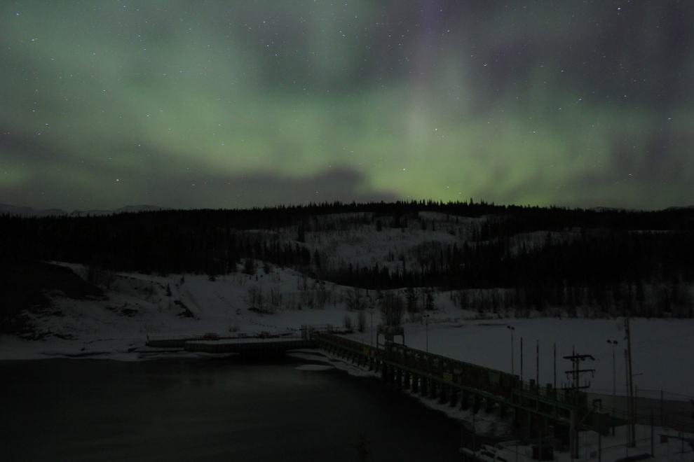
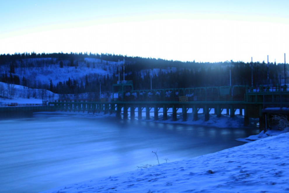
The Yukon River Bridge is my favourite starting point for shooting the aurora. This is the Lewes Dam at 04:27 am. The temperature was -12°C (+10°F) when I left home, -14 (+7F) at the dam.
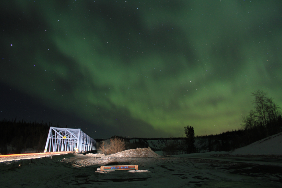
A car goes across the bridge at 04:37.
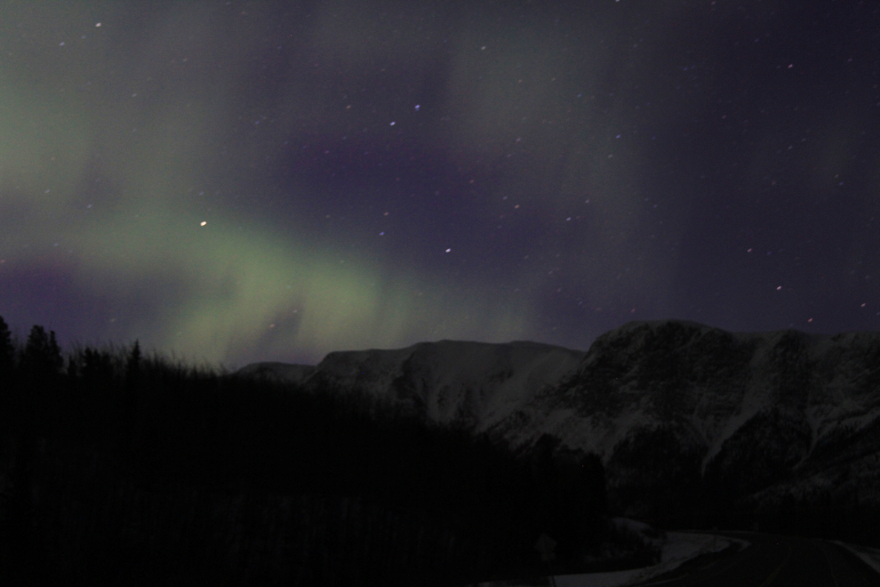
I went out to Jake’s Corner (Historic Milepost 866 on the Alaska Highway) again, still with a specific shot in mind. The required situation didn’t appear for the shot I’m after, and the dawn light was starting to wash out the auroral light when this was shot at 05:29 (sunrise was at 07:39).
I stopped at the dam again on the way home – a 4-second exposure turned the turbulent water below the dam to silk. This was shot at 06:24 am. I’d already decided that with a good weather forecast, I was just going to make a short stop at home to get changed and then head south, probably to Skagway unless the forecast snow flurries there made the road too bad.
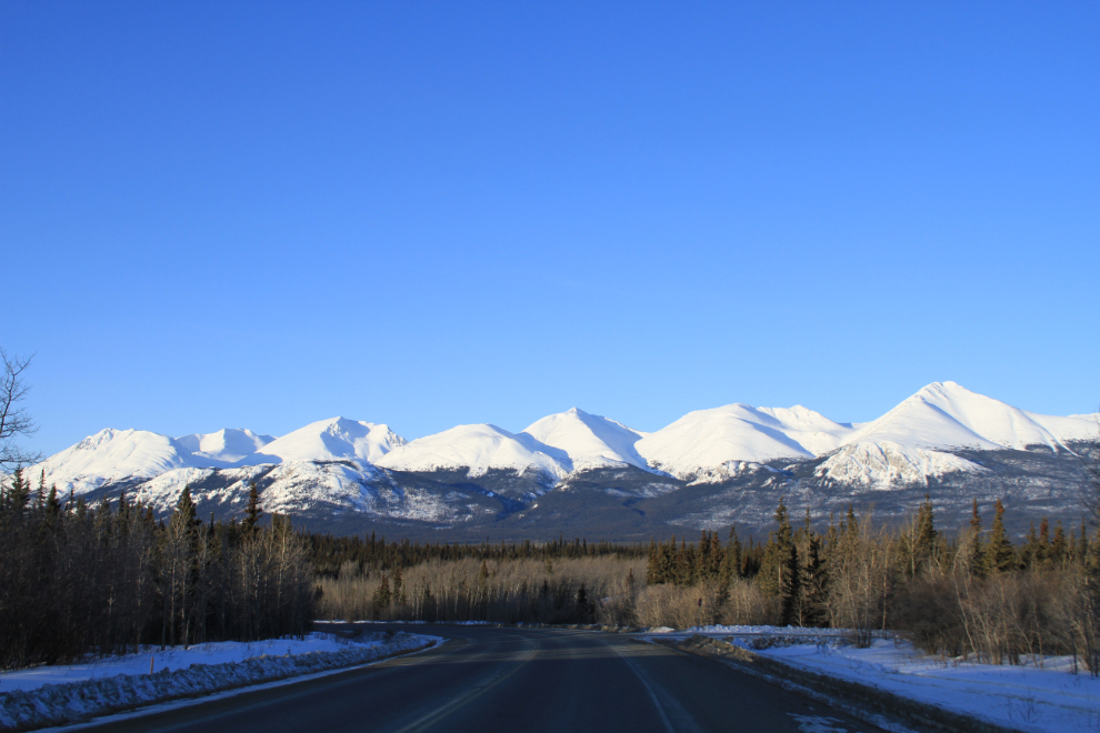
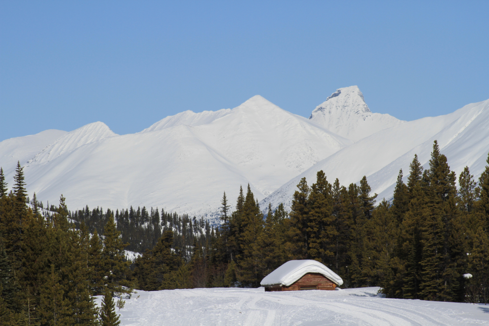
I love this view of Gray Ridge at the Lewes Lake Road.
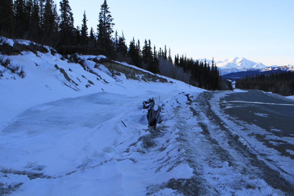
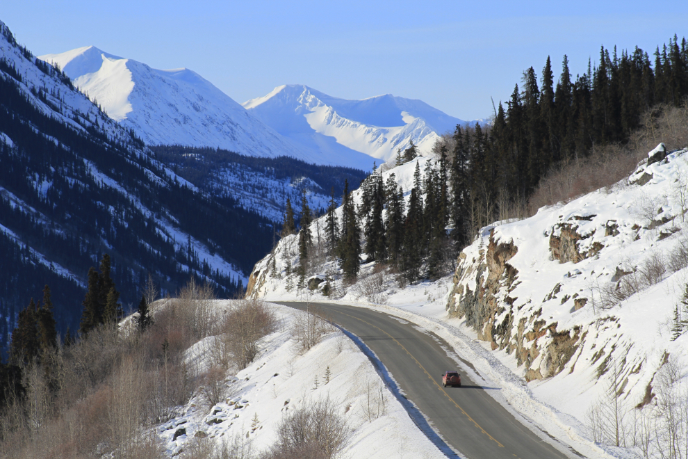
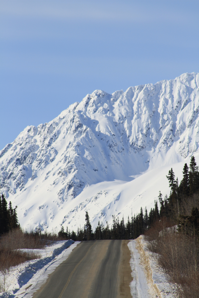
Here’s a section of the South Klondike Highway that’s been a constant headache for engineers in recent years. Water started seeping from the hillside year-round, collapsing the bank in the summer and sending mud across the highway. In the winter it’s much worse, as the water freezes, forming a concrete-hard glacier of ice that creeps across the road. It takes a great deal of work with heavy equipment to keep the ice at bay. Various types of dams have been tried but the ice just goes around and/or over them.
By the time I reached Carcross at 09:05 the temperature was sitting at -18°C (0°F). There was a lot of fog, meaning a lot of open water. The fog is called Arctic steam fog, which forms when cold air moves over warmer water (“warmer” being a relative term!) and picks up moisture until its humidity reaches 100%, when the fog forms. When this happens over the ocean (we see it in Skagway every now and then), it’s called sea smoke.
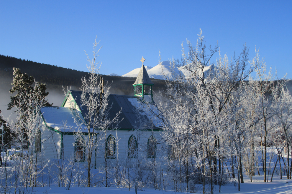
The fog produces beautiful hoar frost on everything, particularly noticeable on trees. This is the historic Anglican church.
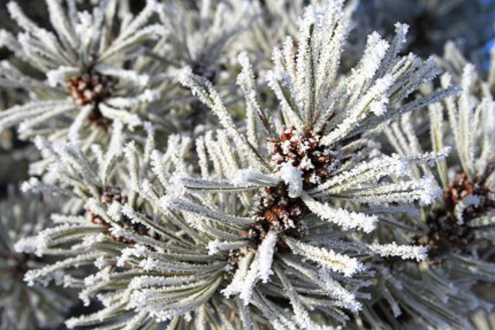
Hoar frost on a lodgepole pine tree.
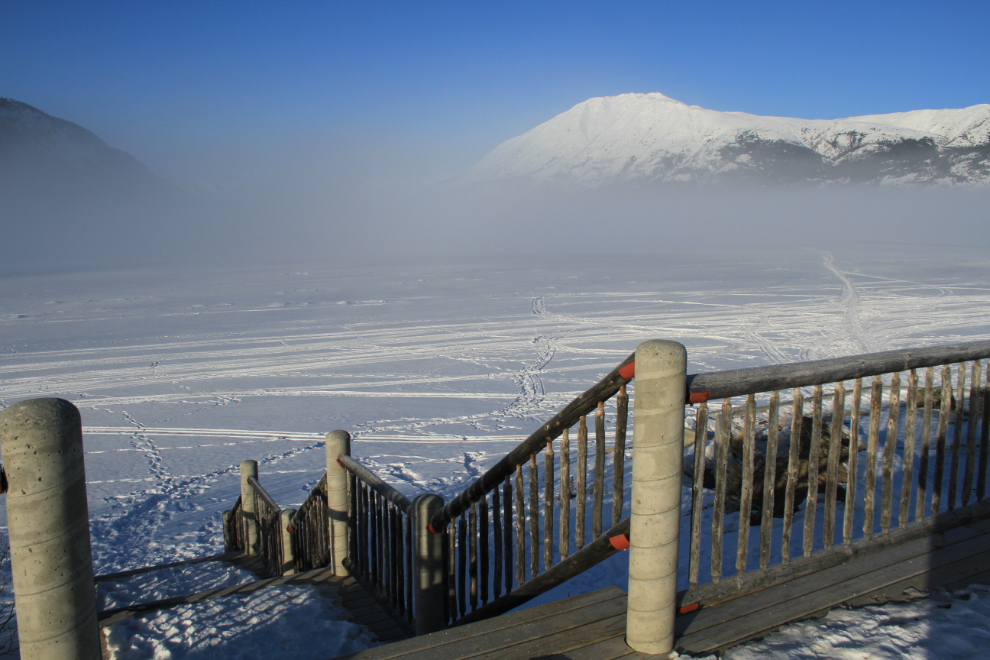
Lake Bennett was pretty well socked in. It’s unusual to have that much open water up the lake this early – that bodes well for an early breakup.
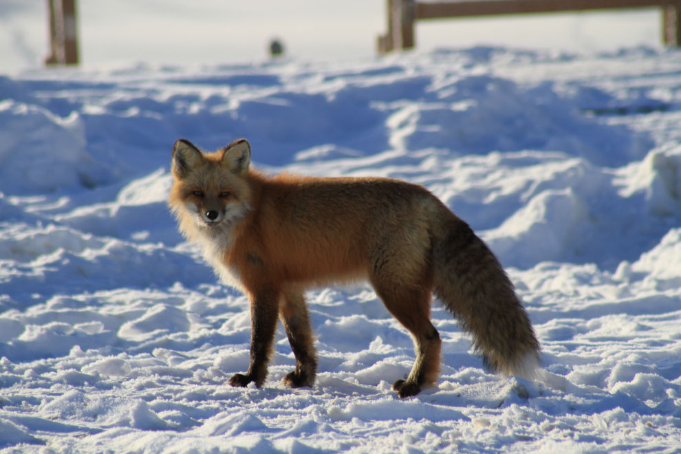
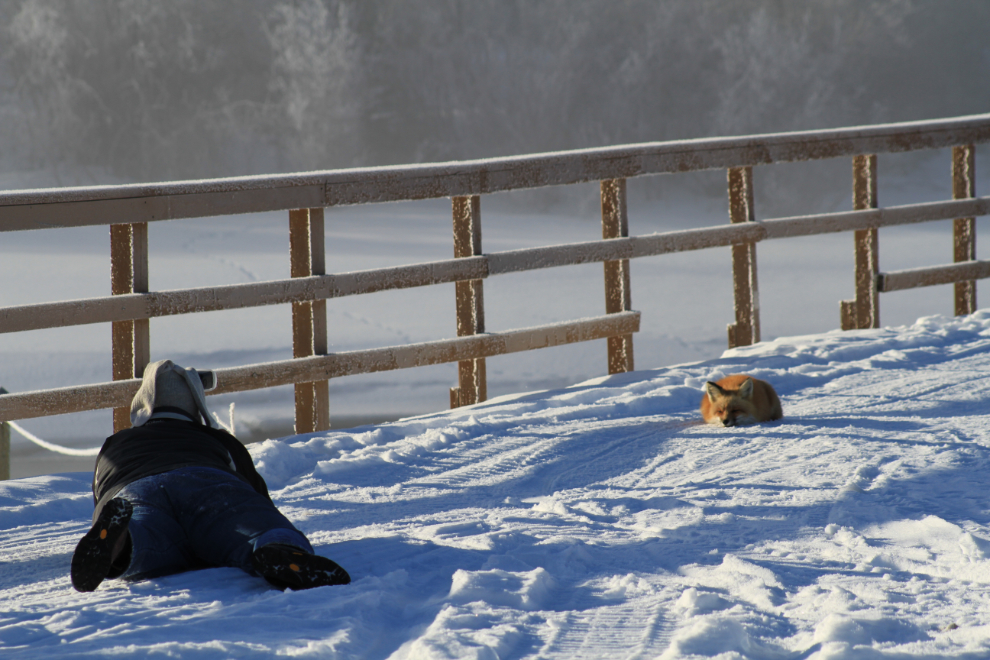
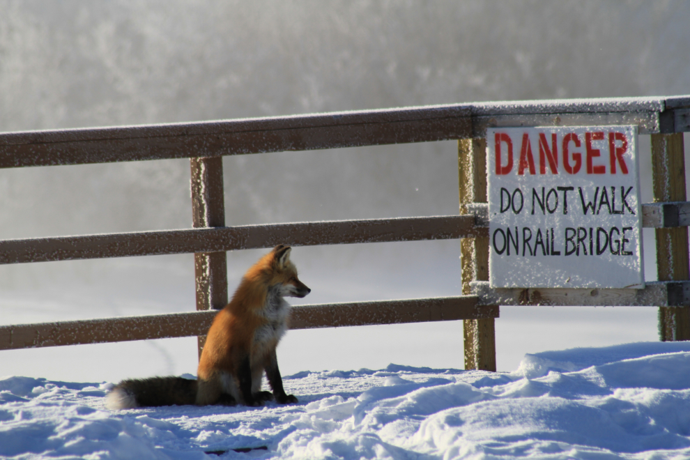
As I continued my loop around Carcross looking for subjects, I saw one of my neighbours taking pictures of a red fox (Vulpes vulpes). I stopped way back, blocking the road because to continue would have scared the fox away. After a few minutes I moved ahead and joined in on the fun.
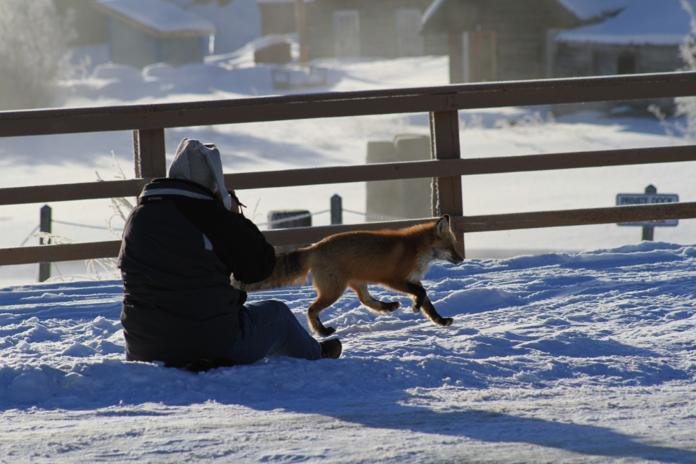
This beautiful young fox is a real character, and seemed to enjoy Heather’s company as much as she was enjoying his/hers.
I took a lot of photos of these two. You can see some of Heather’s work on her HPJ Photography page at Facebook.
“Hmmm – I hear that the mousing is better on the other side of the river, but…” 🙂
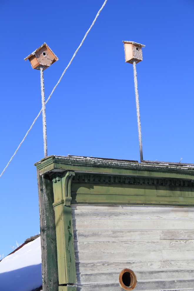
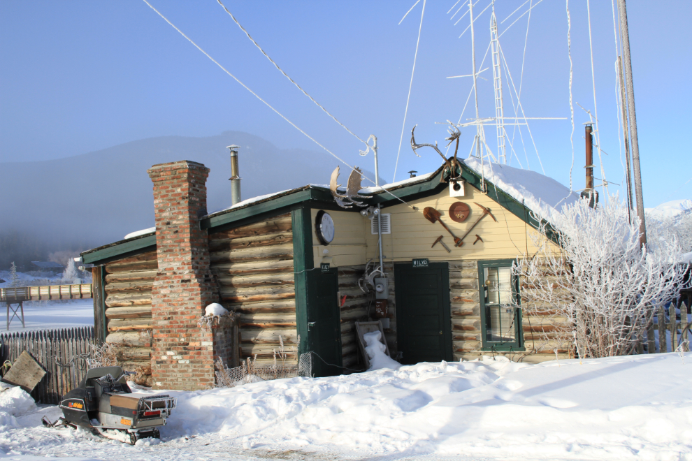
Some additions to one of Carcross’ more interesting heritage buildings wait for their summer “renters”.
The old Bobby Watson cabin is well loved.
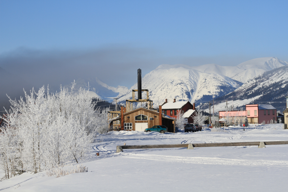
Looking back at downtown Carcross as I left at 09:54.
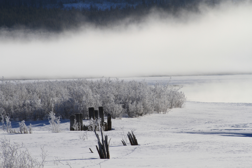
The pilings are the remains of a wingdam that was built a century ago to keep the flow of the Nares River scouring the channel out for steamboat navigation. The dam used to separate the river from Grayling Bay. On the other side of the river, the sternwheeler Gleaner was scuttled to act as a wingdam.
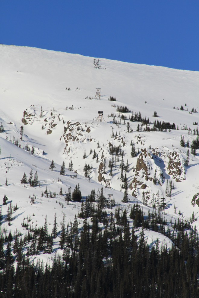
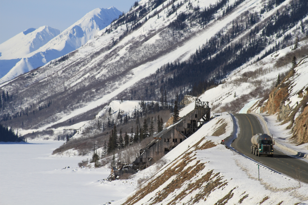
The 107-year-old aerial tramway to the Mountain Hero silver mine can be seen running up the centre of this photo. Some day I’ll get my book about these mines back into print. Yup, some day…
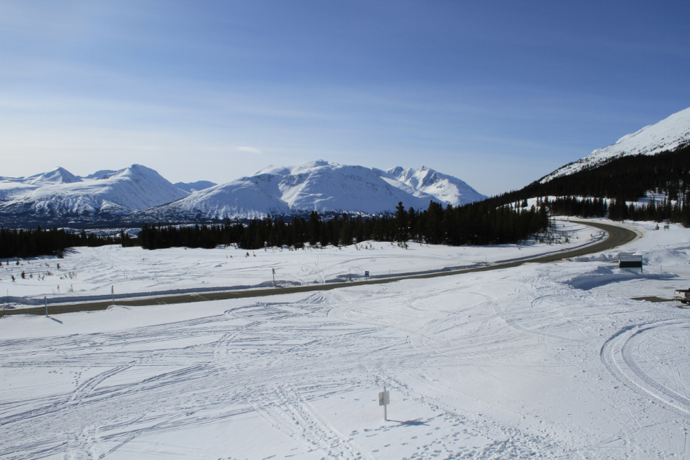
I had expected to see some cloud by the time I reached Km 86, but it was gorgeous and had warmed to to -8°C (+18Deg;F).
I wonder how many more years the Venus mill will be standing. We’ve lost 2 of its auxiliary buildings in recent years – the mine manager’s house collapsed and the warehouse floated away during exceptionally high water.
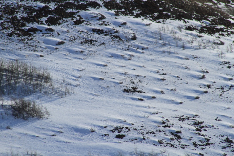
Wind erosion on the far side of Windy Arm. For a sense of scale, those are 30-foot-high poplar trees to the left.
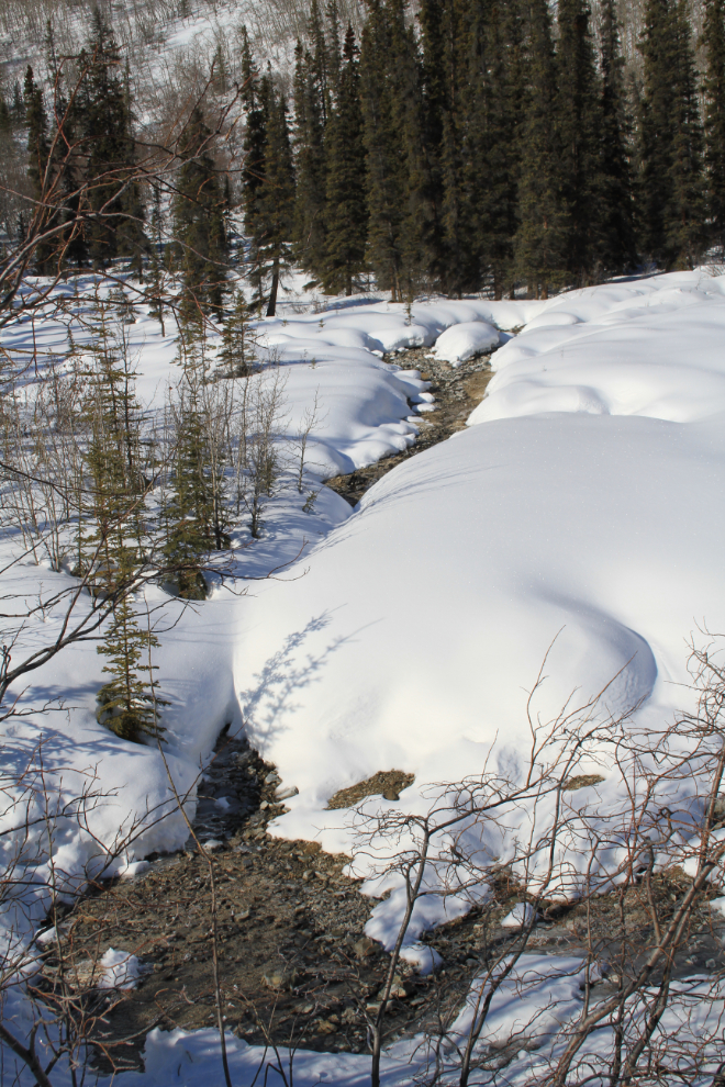
At Km 68 there’s a mineral spring on the slope high above the highway. Its small flow keeps a creek open all winter except during periods of extreme cold.
Climbing up to the summit of the ridge between Windy Arm and Tutshi Lake.
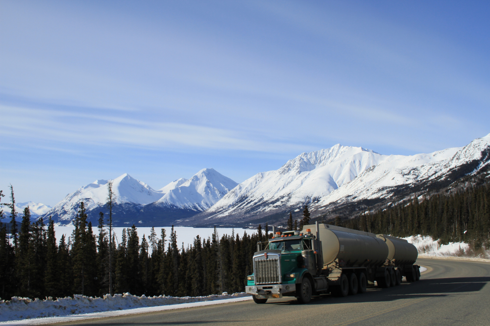
There were 3 fuel trucks running – I saw all three heading north as I was southbound, and heading back to Skagway as I was going home. Most fuel comes to the Yukon via barges to Skagway, from where it’s trucked.
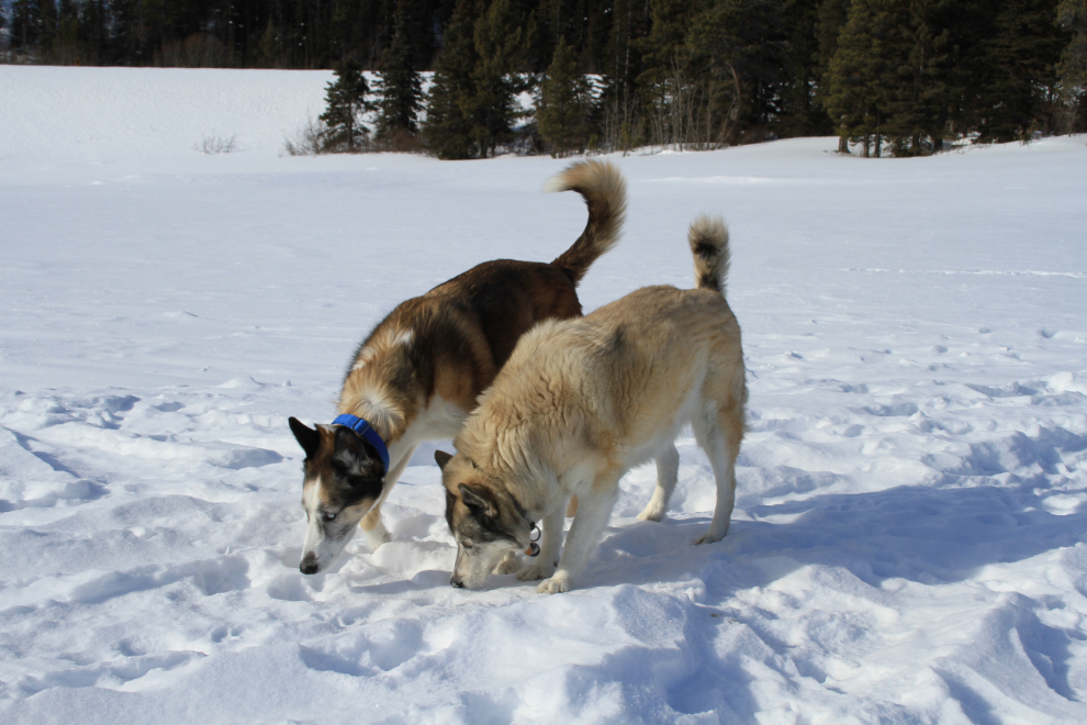
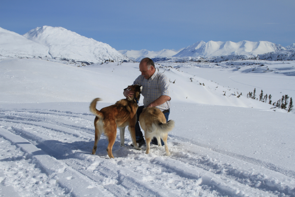
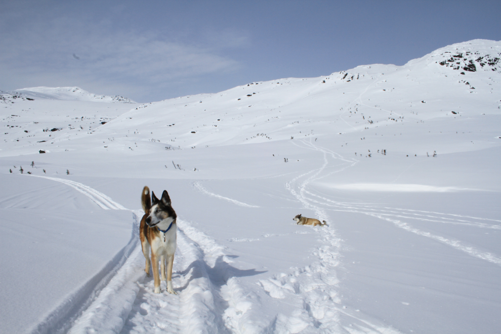
At our usual Tutshi Lake stop, teamwork by Monty and Kayla seemed to be the key to getting the best sniffs!
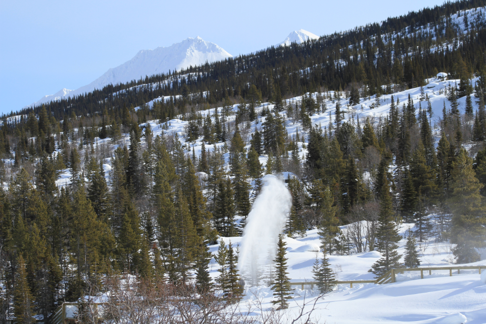
At the Yukon Suspension Bridge, a crew was hard at work getting ready for summer. This fellow was using a snowblower to clear the walkways and viewing deck on the far side of the Tutshi River.
Looking down the White Pass & Yukon Route tracks (well hidden by the white stuff 🙂 ) at Log Cabin. This was shot at 11:43.
A broad (18mm) view of the Log Cabin area from the top of the ballast gravel pile. The WP&YR line cuts diagonally across the photo at right angles to the highway.
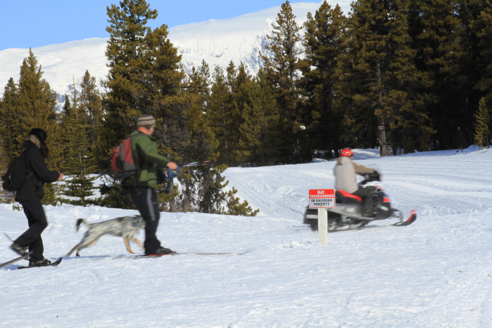
Enjoying the superb conditions on snowshoes, cross-country skis and by snowmobile.
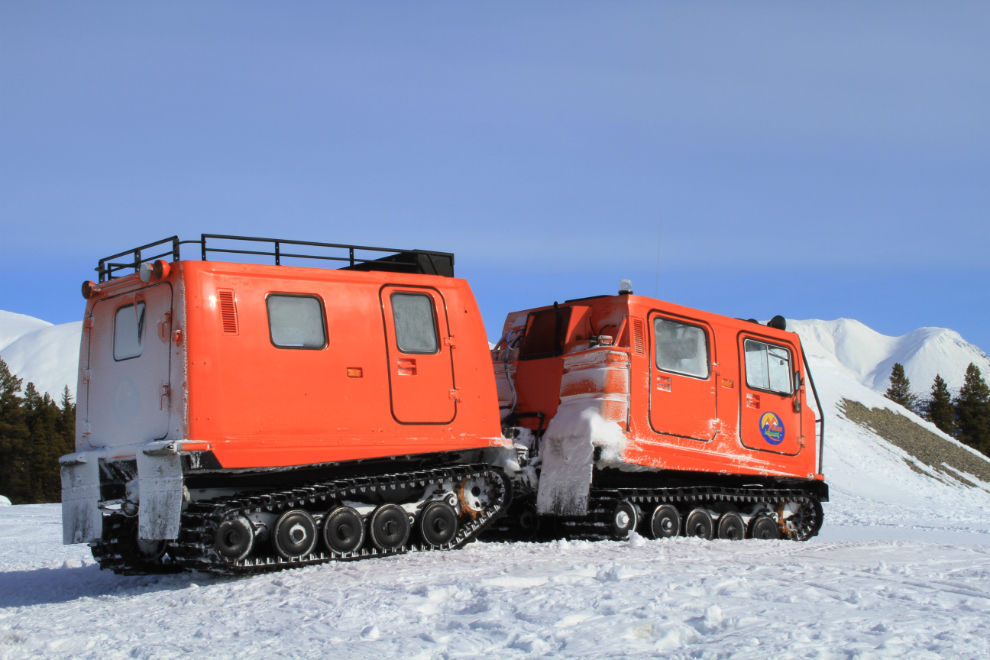
Timing is everything. Just as I was about to leave Log Cabin, this snow-cat arrived from down Lake Bennett way. Always curious about such things, I chatted with the operator, Randy Baxter, for a few miinutes and he told me about the new company, Yukon Heliskiing, which is doing exploratory work and hopes to be offering tours next winter. This is a new incarnation of Klondike Heliskiing, which used to opereate at Atlin.
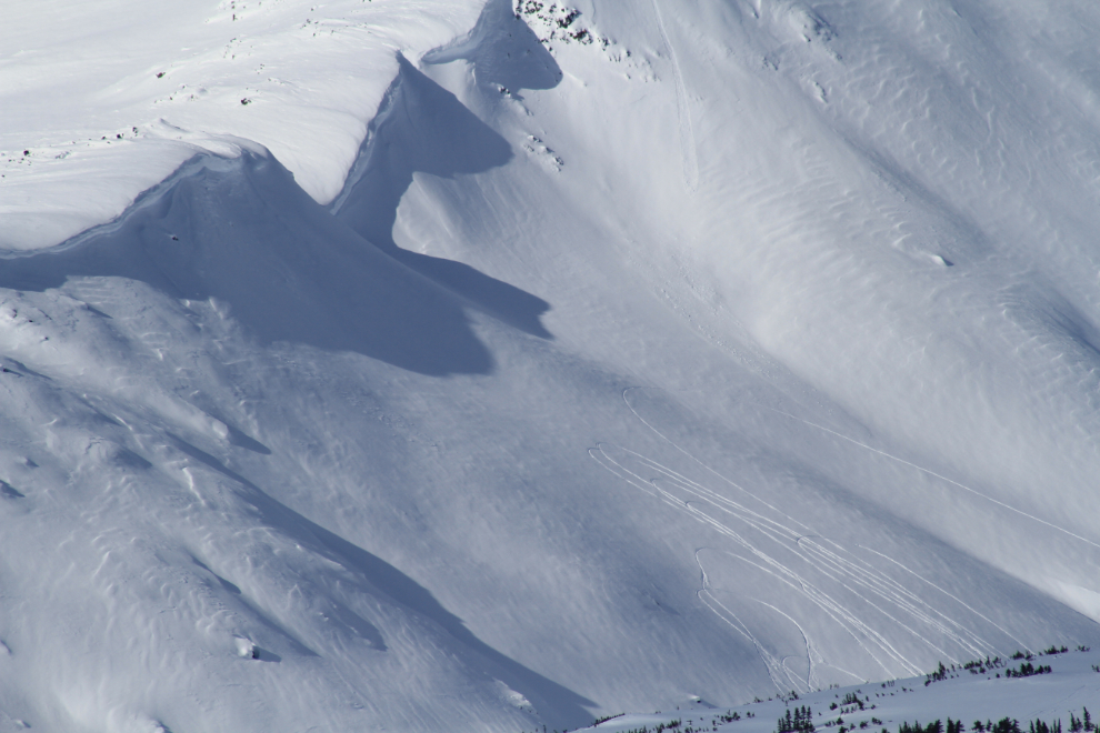
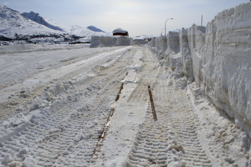
Some snowmobilers don’t seem to have the brains they were born with. The cornices that the tracks are climbing towards at Fraser are huge!!
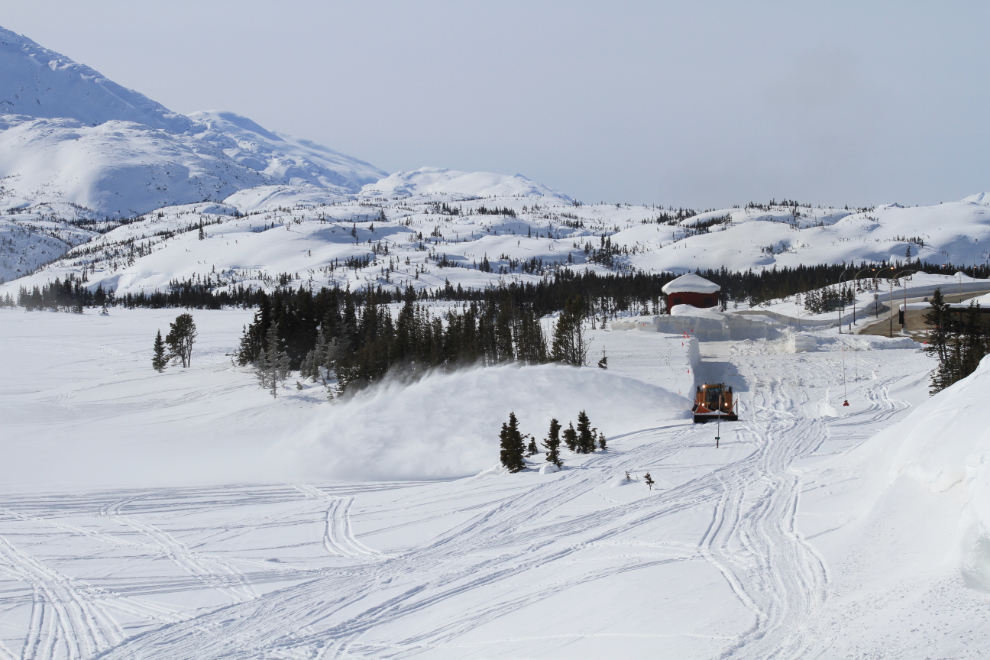
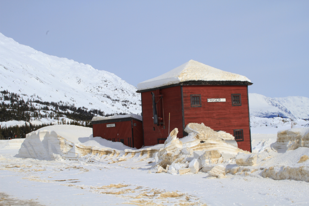
At Fraser, a large rotary plow was clearing the railway tracks and bus parking lot of about a dozen feet of snow. This is where people switch from train to bus or vice-versa for the various combination tours offered.
It really felt like a lounger and a cold beer (or 2!) would make the afternoon perfect!
Nanook has been housebound for a very long time, and a road trip was long overdue 🙂
I almost went without the dogs, but as I was heading out the door, Monty put on his “saddest dog in the world” face, and I gave in. I’m really glad that I took them – they do add a lot to the trip on a day like that.
My stop in Skagway was very short – the day had rather gotten away on me. Heading home, I stopped at Fraser at 3:00 to see how the snow clearing was progressing.
I haven’t heard about the railway running the antique rotary plow and steam trains this year. Perhaps every 3 or 4 years is enough to keep interest up without wrecking the equipment.
I made a short stop at the cabin in Carcross to pick up my roof rake (and for the possibility that there may be some swans on the lake), and was home just after 5:30, some 14 hours after this Spring mania began!