Driving from Calgary to Whitehorse with the new Jeep
The drive home with the new Jeep was much quicker than I prefer, but it’s always enjoyable.
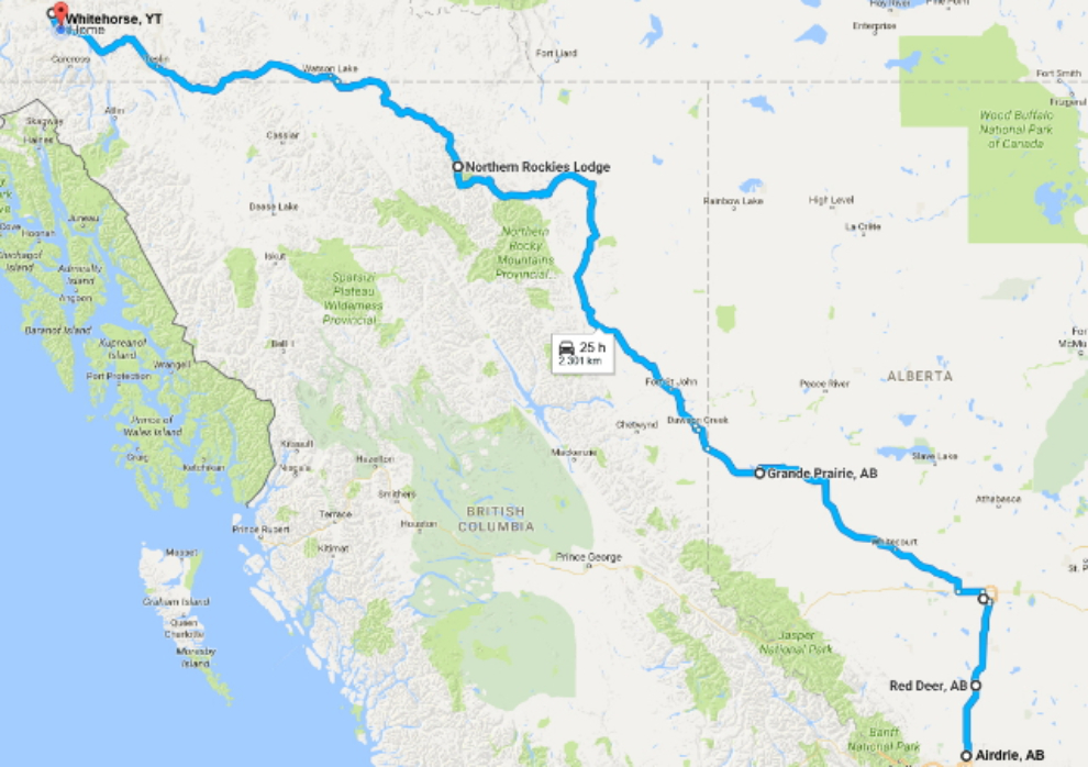
The total distance from my daughter’s home in Airdrie to mine in Whitehorse was 3,101 km (1,927 mi). Click here to open an interactive version of the map in a new window.
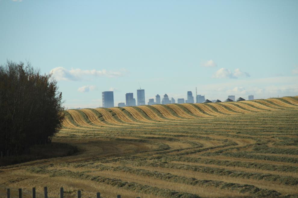
The day-and-a-half with my daughter and her family was wonderful, even with the “wet blanket” of not feeling well. Andrea always seems to be driving somewhere, so there’s always something new to see. This view of the Calgary skyline is just south of Airdrie. With more time and energy, I’d love to spend a day out shooting fields and tractors.
One of our stops was at Rona. I’d seen a Facebook post by a Whitehorse woman desperately looking for some special wood stain that she’d run out of and now couldn’t find. It was in stock at the Airdrie Rona, so I offered to pick it up for her.
This trip turned out to be useful to a friend looking to move back to Whitehorse, too. Teresa was in Red Deer, and I was happy to be able to offer her a ride.
I also got a request to transport a puppy from Fort St. John to Whitehorse, but it turned out to be a very big puppy, and there just wasn’t enough room left in the Jeep when I left Red Deer. The woman really didn’t seem to understand how involved transporting a puppy thousands of kilometers is, so that request may have died anyway.
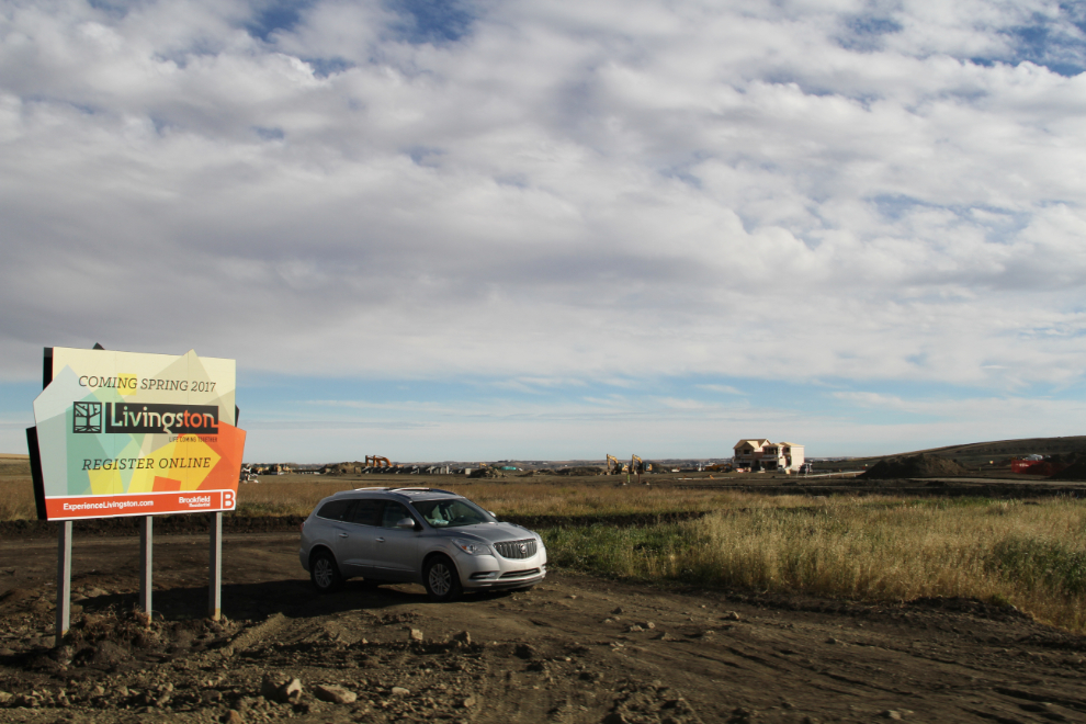
Year after year after year, the number of homes and related services being built around Calgary is shocking. Where do all these people come from? Most of the housing developments are huge – virtually new towns – like this one, Livingston.
Sometimes, a handful of acres are developed in the middle of a farm. That usually results in huge homes, especially when the location is on a hill with a view of the Rockies, as this one is.
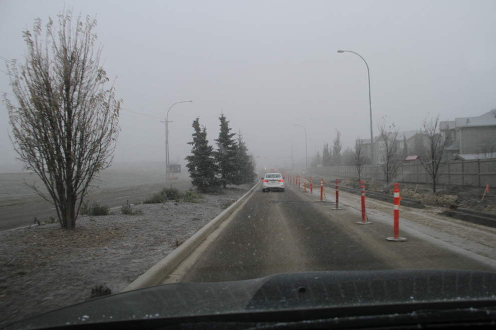
When I left Airdrie at 09:00 on Monday, the weather forecast sucked, calling for fog with occasional light snow or freezing rain.
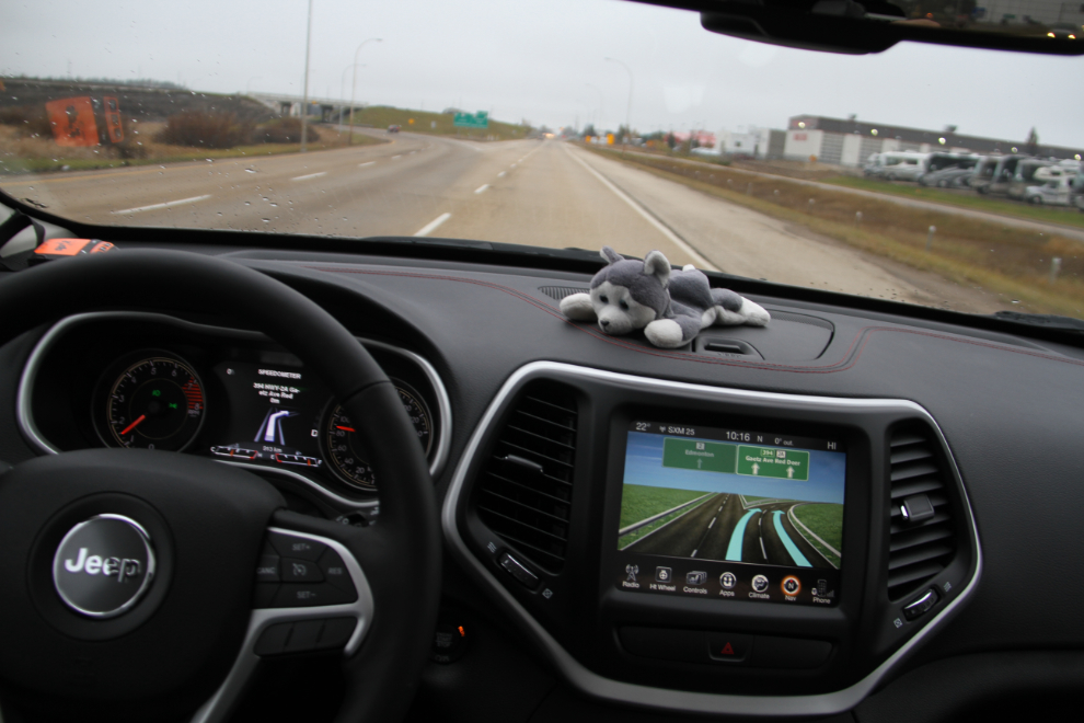
Coming into Red Deer at 10:15. I love the navigation system. When you have a turn coming up, a screen showing the turn approach opens right in front of you, where the speedometer normally lives.
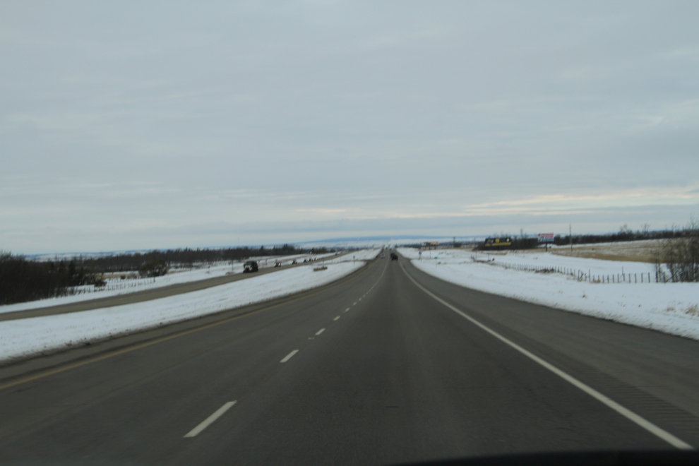
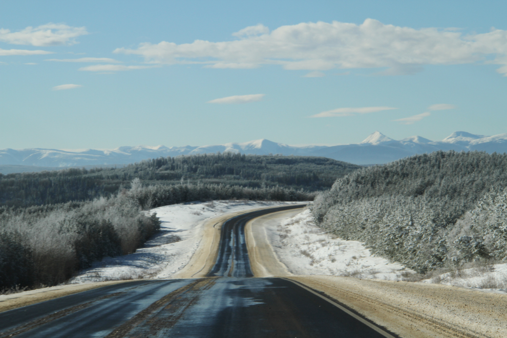
Monday was a flat day, in terms of both landscape and weather. This was the approach to Grande Prairie on Highway 43 just after 5:00 pm. I hadn’t really paid much attention to the approach, and got totally confused trying to find the strip of motels I wanted. DOH! 🙂
Once I found the right area, I quickly chose the Stanford Hotel for the overnight – a good-looking property with restaurant and lounge. The room was good value at $110.88 including taxes, but the restaurant was a huge disappointment to both Teresa and I. The manager didn’t charge me for the rubber-chicken pasta dish that I ate part of. I called a nephew who lives in Grande Prairie, and he met us at the lounge for a while. It was the perfect place to meet, so the Stanford got 2 out of 3.
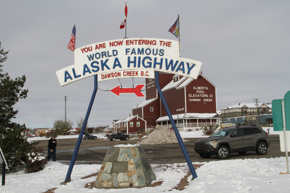
Tuesday started off flat as well, but the weather had started to clear by the time we stopped at Dawson Creek just before noon. I stopped in at Tourism to see my long-time friend Joyce for a few minutes, then got one of the shots I try to take with every vehicle I bring north, at Mile 0.
Up around Km 180 at 2:20 pm. There was enough gravel n the road that I cringed every time a semi approached, and whenever possible I moved to the right as far as possible. I really wanted Cathy to see her new car without a cracked windshield at least once. There were lots of small rock hits, but as the miles passed, my luck held.
We gained an hour as we continued northwest. West of Fort Nelson, I made a short photo-stop at about Km 550, where the Alaska Highway drops down from Steamboat Mountain to the Tetsa River.
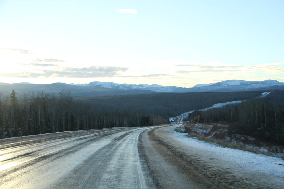
Summit Lake, at 5:43 pm. The temperature had been fairly consistent all day again, up and down between -2°C and +2°C (28-36F), even after the sun disappeared behind the mountains.
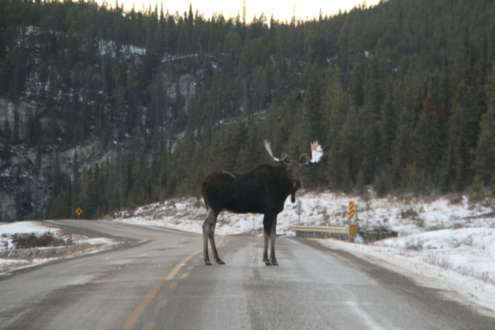
Just past Summit Lake, with the drop into “The Gorge” just ahead, we met this young bull moose and his girlfriend. He didn’t stand his ground for long 🙂
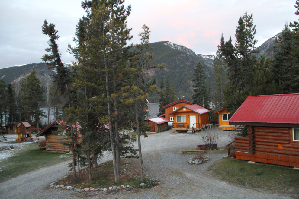
I had made reservations at the Northern Rockies Lodge at Muncho Lake, but by the time we reached Toad River Lodge I needed some dinner (and eating there is much cheaper than at Muncho).
The dinner stop turned out to be not a very good idea. Cathy and I had seen some comments that the headlights are poor on the Jeep Cherokee, and my summary now is that they’re totally inadequate for Northern driving. There’s a good beam of light down the centreline, but no “ditch light”, which is mandatory here for seeing animals. The short drive from Toad to Muncho was much longer than normal, because I couldn’t safely go much faster than 70 kmh (43 mph). We saw elk twice, but the odds of seeing a lot of wildlife along that stretch is very high.
The rooms at the Northern Rockies Lodge are a bit spendy ($190.97), but the rooms – and the entire lodge – are very nice. We had the breakfast buffet at the lodge Wednesday morning ($18.50 each plus tax and tip), I took this photo from our room at 08:10, and we were soon on our way again.
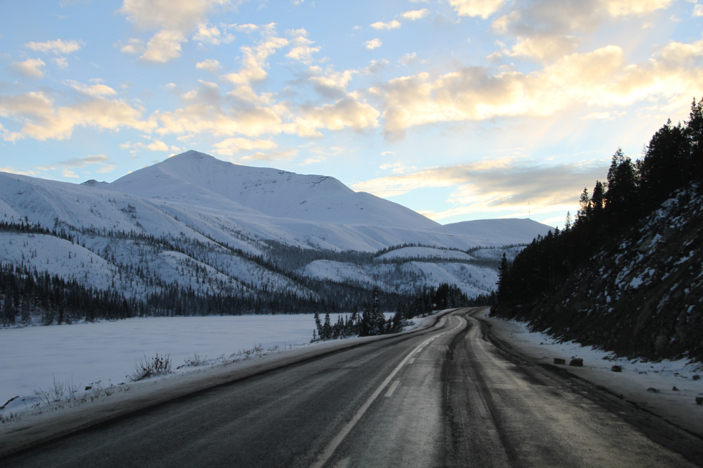
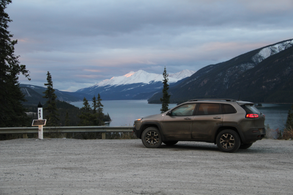
The main Muncho Lake viewpoint, at Historic Milepost 463 of the Alaska Highway (now Km 710.1).
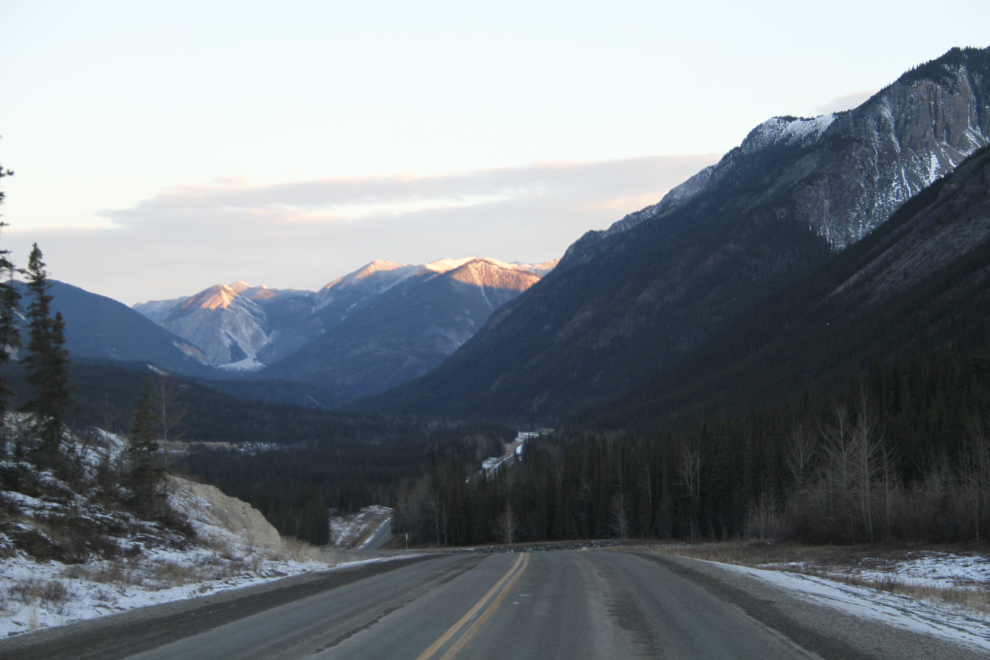
I heard Teresa’s camera clicking a lot, but I only stopped for a few photos – this one at 08:36.
I drove by these sheep – mostly hidden by the concrete – without even noticing them, but did a U-turn and came back.
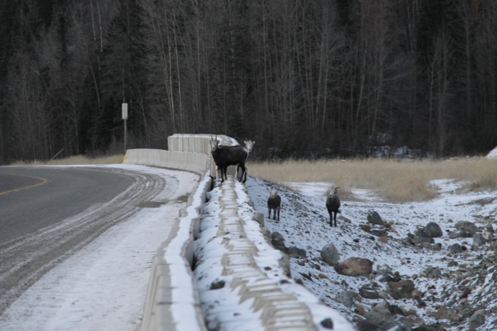
There was very little traffic, and after a momentary jaunt onto the highway, the sheep all stayed behind the concrete barrier.
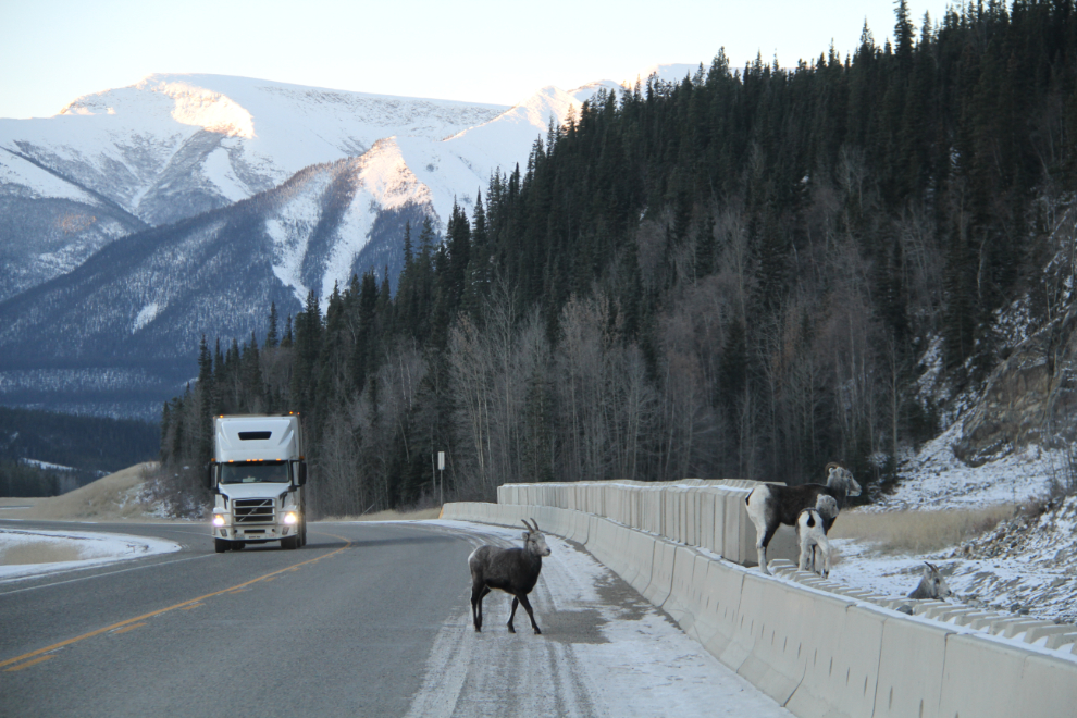
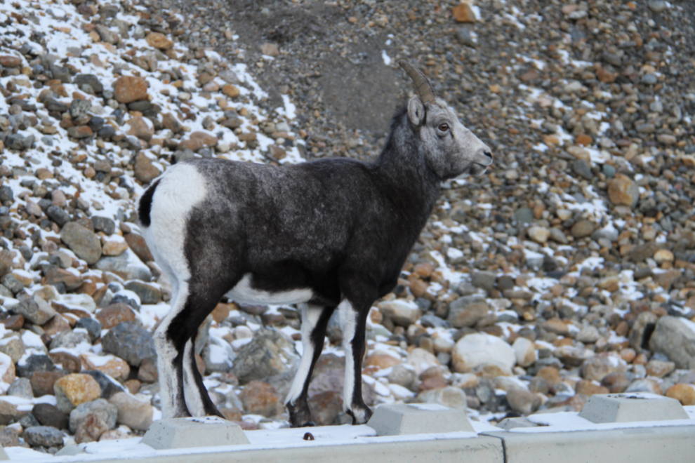
These are Stone sheep (or Stone’s sheep), Ovis dalli stonei. I figured that the lamb probably didn’t want a snuggle, but I sure would have been up for it 🙂
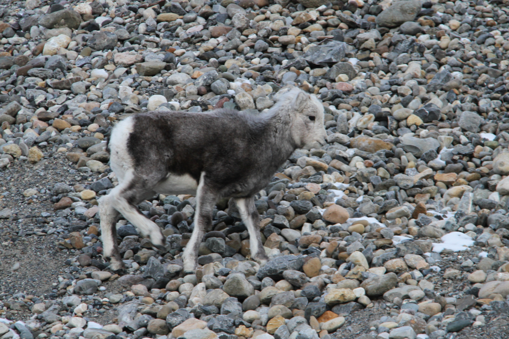
One final portait after spending 9 minutes with the sheep, and it was time to get moving.
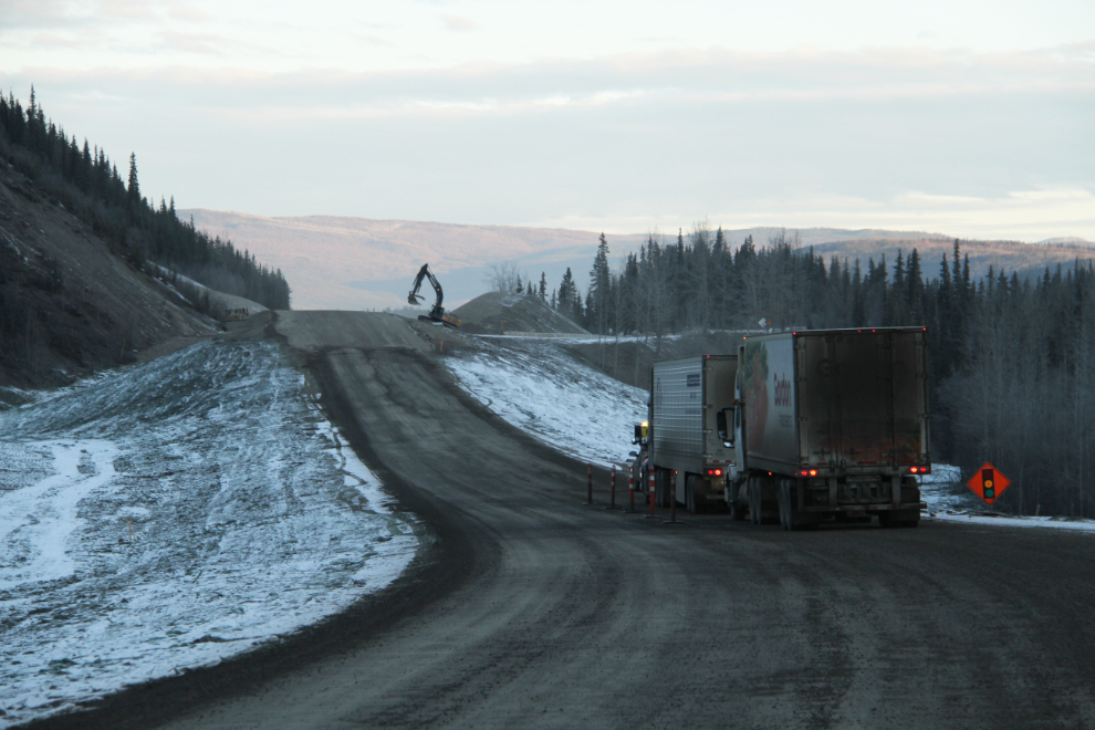
A couple of minutes later, we got stopped for a few minutes to wait for a pilot car. Several kilometers of formerly very narrow and winding road in this area is now history. The job of completely tearing up the old road and seeding it is almost finished.
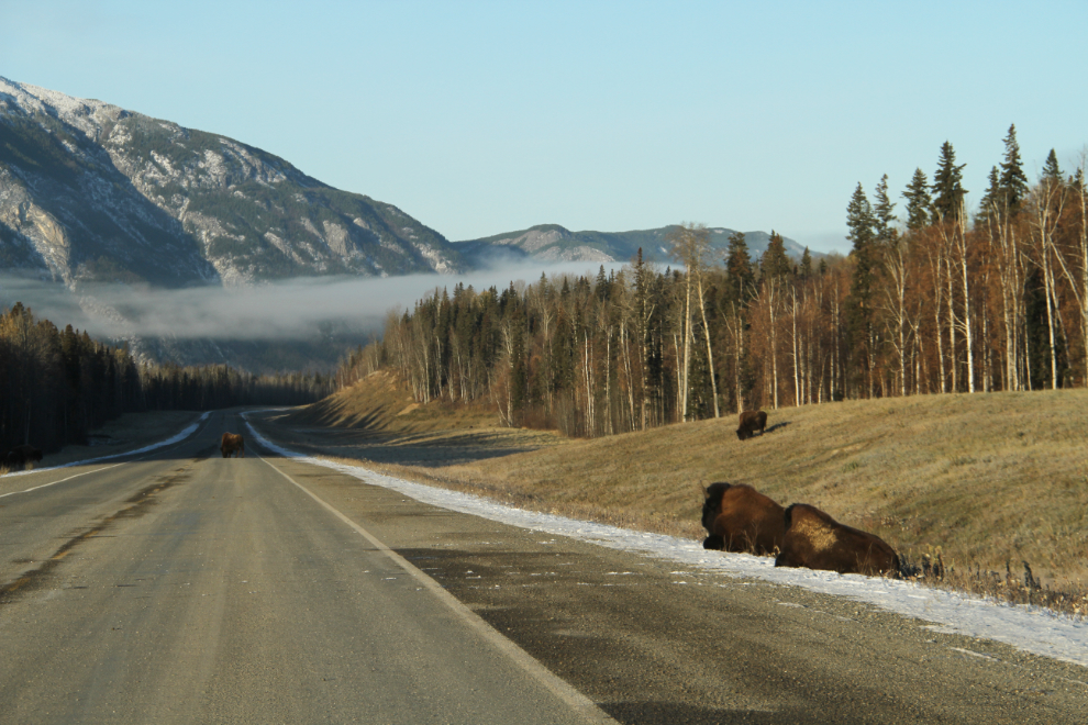
I stop at Liard Hot Springs less and less often as the years go on. A hot soak might have helped the cold that seemed to be getting worse, but we passed on by anyway – it would be just as likely to make me too tired to reach Whitehorse that night. Just past the hot springs, these bison stopped us a for a couple of minutes. The ones in the middle of the road weren’t moving, so I drove slowly around them.
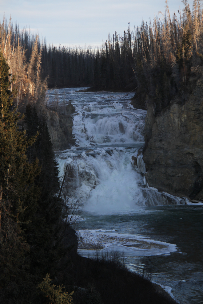
Teresa had never seen Smith River Falls, so I made that detour to show her. The road was the roughest I’ve seen it, but it was still worthwhile. And hey, that’s what Jeeps are for! 🙂
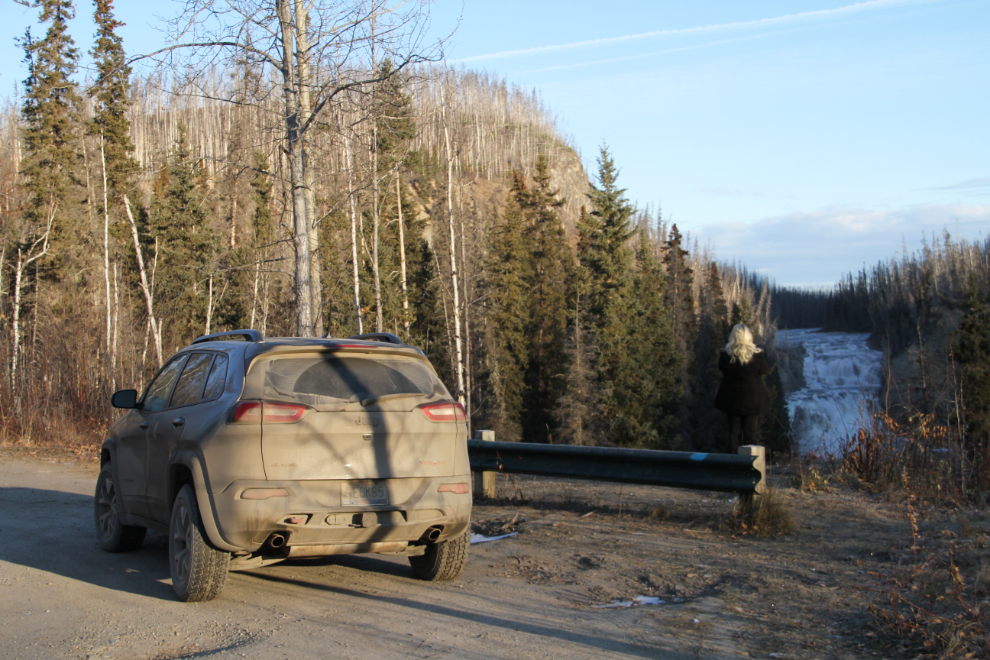
The hike to the base of the falls is pretty tough since a forest fire burned the network of stairs, but when the weather cooperates, it’s a great hike. I wouldn’t do it on a frosty morning – the very steep slopes would be a challenge!
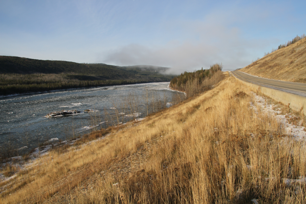
The Liard River at 10:15.
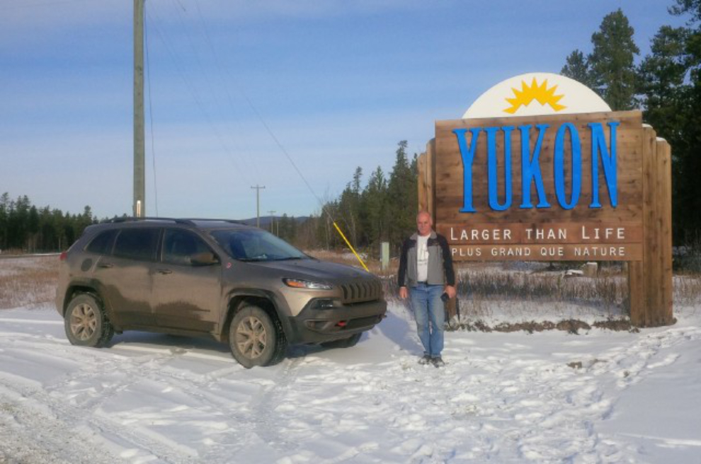
The other photo that I pretty much always shoot with the vehicles I bring north – the “Welcome to the Yukon” sign just south of Watson Lake. Teresa took this photo at 11:30.
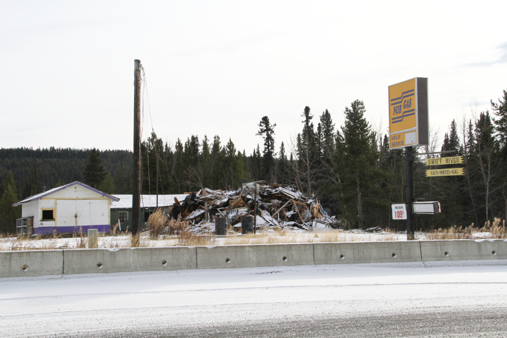
Swift River Lodge is now gone, one of the many sad stories about Alaska Highway lodges. It was closed in several stages after being unable to comply with new Yukon government regulations. (See this article in the Yukon News)
We reached Whitehorse just after 4:30. I dropped Teresa off in Porter Creek, spent a while at the car wash, and was home at 5:20, anxious for Cathy to get home to see her new ride 🙂 Her Tracker looks pretty old sitting beside it!
When I turned the Jeep off in my driveway, it had a total of 3,112 km on the odometer (1,934 mi). The computer says that from the time I picked it up at the dealer’s, it had gotten fuel mileage of 10.0 liters per 100 kilometers, or 23.5 miles per gallon. That’s a bit lower than I’d expected, but not bad given the mountains and snow/slush/gravel encountered. That was an excellent break-in run, and I’m very pleased with the Jeep except for the headlights as I mentioned. But it’s extremely comfortable despite the hard ride that’s to be expected with a vehicle built to be a good off-road machine, and the various components of the operating systems are all easy to use. During the trip, I ran into everything from freezing rain, fresh snow, deep slush, and rough ice, to rain and even some warm, dry roads. Even in the worst conditions, traction was excellent thanks to the combination of drivetrain and the Firestone Destination A/T tires. Only once, when I hit a stretch of ice (rough, frozen slush) north of Jasper, did I have actually select the drive option “Snow” – at all other times, “Automatic” did the job.
Cathy has only taken it to work once so far, and she loves it – both the look and the drive. So the summary is that 2016 Jeep Cherokee Trailhawk was the right choice for us.