Escape Route: the Mt. Thurston Forest Road, Chilliwack (1989)
This post is from my Wayback Machine. I wrote this article and drew the map for the Four Wheel Drive Association of BC, and it was published in the Spring 1990 edition of their newsletter. I have added photos to it for this blog post – the originals are Kodachrome slides. The Mt. Thurston Forest Road is in the Chilliwack River Valley, where I spent a great deal of time in the late 1980s in particular – there are 1,458 photos in my Chilliwack file.
Photo captions are in italics to keep them apart from the article text, none of which has been altered.
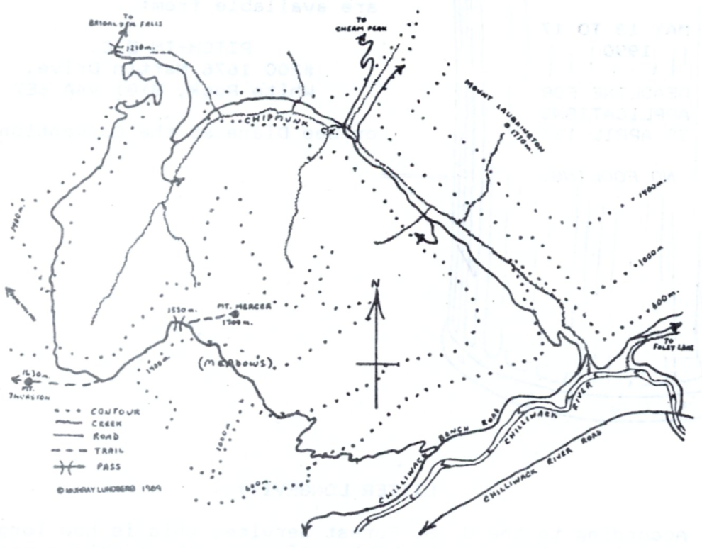
The Chilliwack River Valley is one of the most popular recreation destinations in southern B.C. for everything from fishing to four-wheeling. The campsites that can be reached by car are busy on weekends, and packed on holidays, but it’s still easy to get away from the crowds. The Mt. Thurston Forest Road is the start of a four-wheel circuit that has escaped most people’s notice. For those of you in the Lower Mainland, whether you’re looking for a one-day drive, or a multi-day camping, hiking, and goofing-off trip, this road offers lots of scenery and solitude close to home. Depending on the kind of winter we have, it should be accessible until almost Christmas, but then heavy snows and slides will keep it closed until mid-May. Through the winter, though, it provides superb ski-trekking.
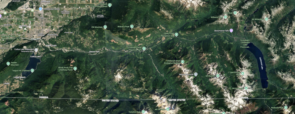
The satellite view below shows the entire Chilliwack River Valley – click here to open an interactive map in a new window.
To reach it, drive up the Chilliwack River Road for 26.7 km past the bridge at Vedder Crossing, to the 3rd bridge, where you turn left onto the Foley Creek Forest Road. A 2 km drive up this road brings you to Foley Creek. Cross the bridge and turn left. A small Forestry sign 6.6 km past this point marks the Chilliwack – Mt. Thurston Forest Road. If you have posi and serious rubber you can probably make it around without locking in, but this is a good place to turn the knobs and slap the stick just for insurance.
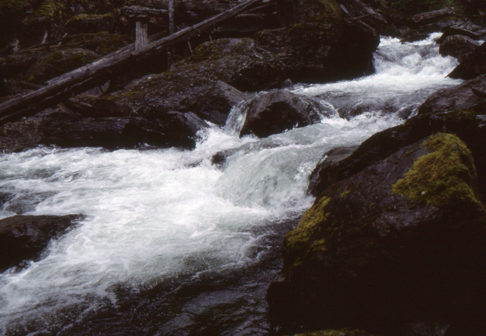
The next photo shows Foley Creek.
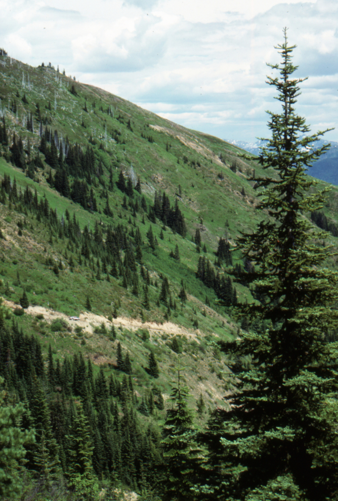
The road climbs through a pleasant forest, becoming increasingly steep as it goes. The Forestry people had the road bulldozed in June this year, so it’s in good shape, but before that, rough stretches at 3.1 and 4.8 km turned back all trucks except those with mucho clearance. If you have an altimeter, you’ll see some impressive numbers before the first view at 5.9 km. Yes, that’s Mt. Baker. At 6.1 km is a small creek that takes out a good chunk of road every spring, and also allows a great view of Mt. Tomyhoi, with its distinctive saddle glacier.
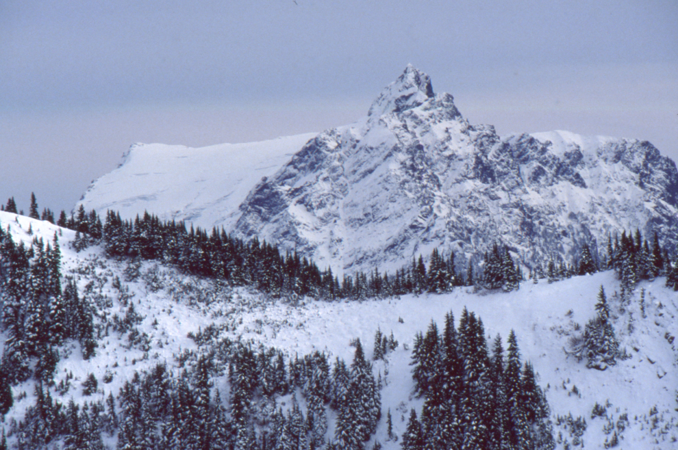
The next photo shows Mt. Tomyhoi.
Looking back down the Mt. Thurston Forest Road.
The next photo shows a steep part of the climb up Mt. Mercer, with my 1970 Blazer.
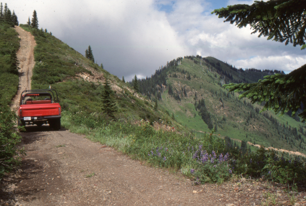
At 6.7 km the road starts traversing the open slopes of Mt. Mercer, which lets you see all the jagged peaks to the south. If you come up in late July or early August, these meadows also have the most impressive flower show in the area. Once you reach the top of the ridge at 7.7 km, a 20-minute walk on a good trail brings you to the summit of Mt. Mercer, with its 360° panorama of peaks. Just the thing to get those kinks out. There is a small bowl on the north side of the summit that was only snow-free for less than one month this year — that gives an idea of just how high you are.
The next photo shows the Cheam Range from Mt. Mercer.
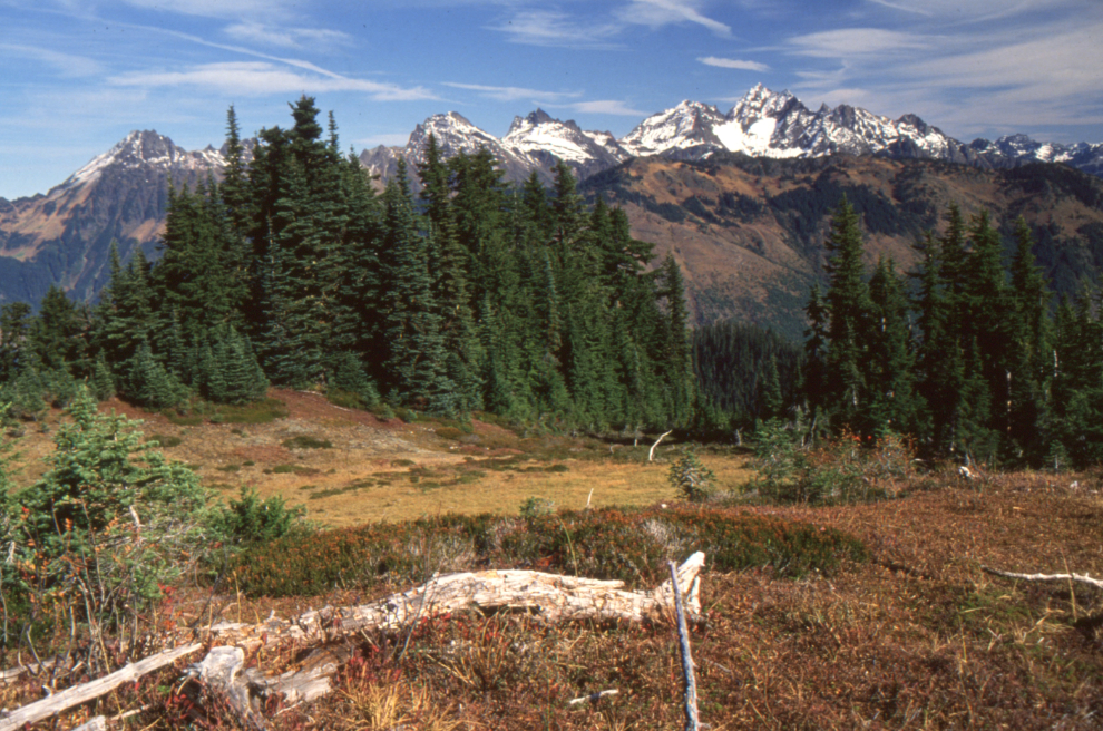
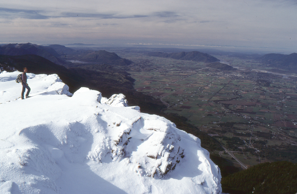
The road now wanders up and down along the open ridge for 2.4 km, past several often-used campsites, then drops down into an old-growth forest that must be an incredible age. This is the best example of medium-altitude old-growth forest that I’ve found by road. Stop and have a good look – they’re disappearing fast, and it takes a thousand years to replace. The road meanders through these wonderful woods at about 1400 m. for 5.2 km, then at 15.3 km, starts its descent off the ridge into the Chipmunk Valley. At 18.0 km you reach the Chipmunk road: take a left for 4 km to get the best views of the Fraser Valley you’ll ever see (unless you climb Cheam Peak). This is accessible by car, and is a very popular camping spot. You may notice the absence of garbage at all of the campsites you have seen so far – it isn’t that people are getting neater; there is a small group of locals who monitor and clean up this whole ridge.
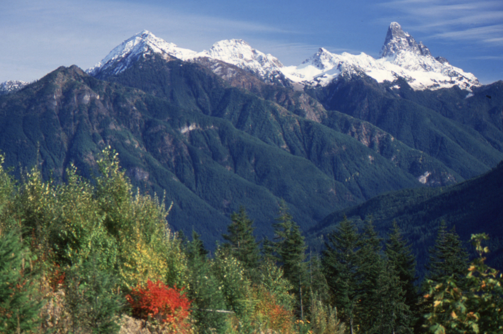
The next photo shows Mt. Cheam and the Lady Peaks from the Chipmunk Valley.
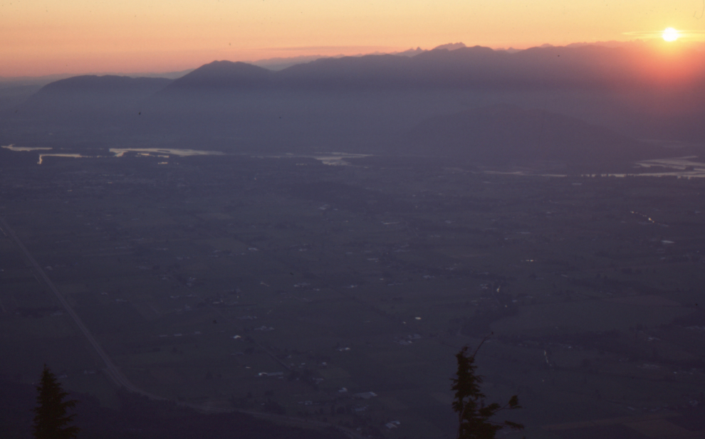
A spectacular sunset view over the Fraser Valley from the Chipmunk road.
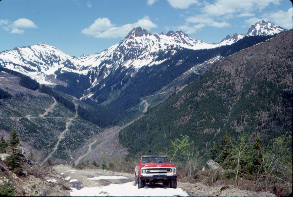
If you want to call it a day, the road from the viewpoint goes steeply down the slope to come out at Bridal Veil Falls. It’s an impressive shortcut, but regularly blocked by slides at any time of year (I don’t know why they keep opening it). Turning back into the Chipmunk valley, you are in an area that has been extensively logged over the past 30 years. The recovery isn’t very impressive, but its coming. At 21.1 km, a road to the right goes to the most recently logged side valley.
If you have some time (and energy), the road to the left at 24.7 km goes to the Cheam Peak Trail, which is the best, and the easiest high-altitude hike in the Lower Mainland. It’s a 4 hour return trip on an excellent trail, and the view from the 2112 m. summit is awesome! You can pick up trail map at the Tourist Infocentre in Chilliwack. Note: this is a new trail which isn’t in any of the guidebooks.
The view from near the summit of Mt. Cheam. This became the photo for the Chilliwack Progress newspaper’s 1990 calendar.
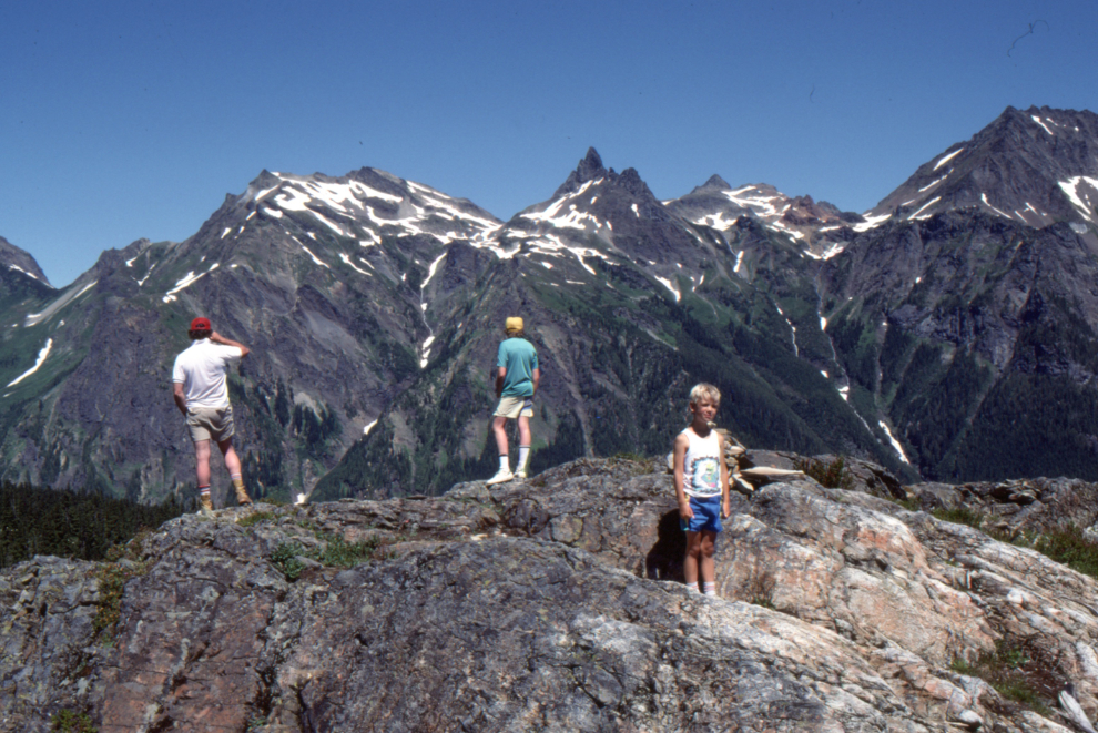
At 25.2 km you come to a bridge over Chipmunk Creek right where Spoon Creek feeds into it. Just past this is a road to the left which goes to another good hike, up Mt. Laughington, a beautiful ridge walk. Plan on 1-5 hours on that ridge, depending on whether you just go up for a quick look, or do the whole ridge. You may find the sight of the peaks to the north so impressive that it’s tough to come down in a hurry.
My son and a couple of friends on a ridge just east of Mt. Laughington.
Back on the road, at 27.0 km, a major road to the right goes up into an old logging area, and provides some decent exploring. Heading steadily downhill, you may notice the fairly new growth on the opposite side of the valley. This is due to an extensive reforestation project following a major fire in 1958. It must have been quite a mess. At 31.2 km, you are back at the Chilliwack Bench Road, and have another choice – go back the way you came (to the left) or try the scenic route, along the Bench Road, and through Ryder Lake, a miniature Switzerland nestled in the mountains northeast of Chilliwack. Whatever your choice. I hope that this trip will provide you with lots of pleasant experiences, and memories.
Slesse Peak from the Chilliwack Bench Road (that’s what the slide caption says, but that view seems too high).
Happy Wandering! Murray Lundberg, Chilliwack
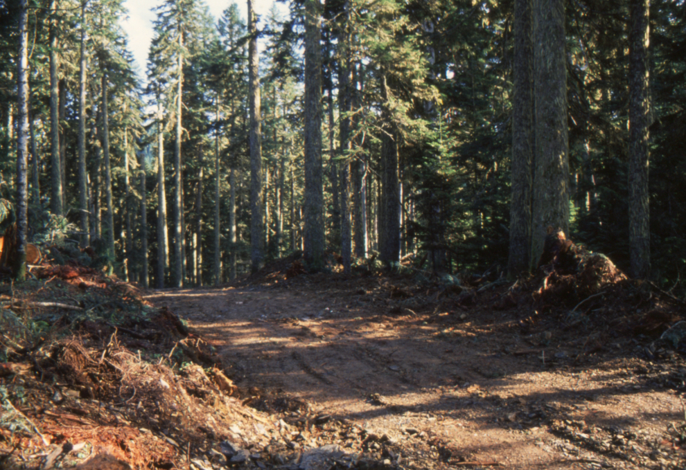
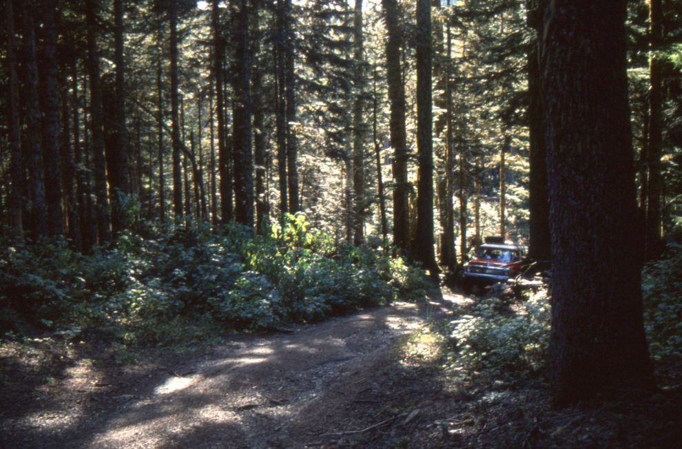
Late Addition: I have just come back from the Mt. Thurston Road (Oct. 19), and a new logging road has just been punched in from the Chipmunk valley to the heart of that beautiful old-growth forest on the ridge! Miles of beauty, thousands of years of struggle, strapped onto the back of a Kenworth. I’m not anti-logging, but SHIT!!!…..
The next two photos show that new logging road, and the old-growth forest past where it ends.
That’s my look back at a place I loved deeply. It may well be a very different world now, but perhaps this will prompt someone to do some exploring to see what it does look like now. Now, as I said 36 years ago, “Happy Wandering!” 🙂