Tour from Reykjavik, Iceland: the South Coast
This is blog post #24 from our tour of northern Europe. On Sunday, July 20th, we spent over 11 hours on a bus touring the top sites of the South Coast, including two waterfalls (Seljalandsfoss and Skógafoss), a black sand beach (Reynisfjara), a puffin-viewing spot with basalt arches (Dyrhólaey), the Sólheimajökull Glacier, and the village Vik. It was a very long day, but an amazing tour.
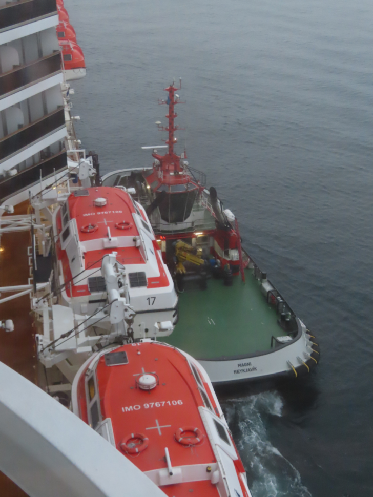
At 05:50, from my usual work station on Deck 9 of the cruise ship Nieuw Statendam, I got the first hint that we were near Reykjavik when the tug Magni appeared out of the fog and pulled alongside. It took me a minute to realize that it wasn’t “tugging,” it was dropping a pilot.
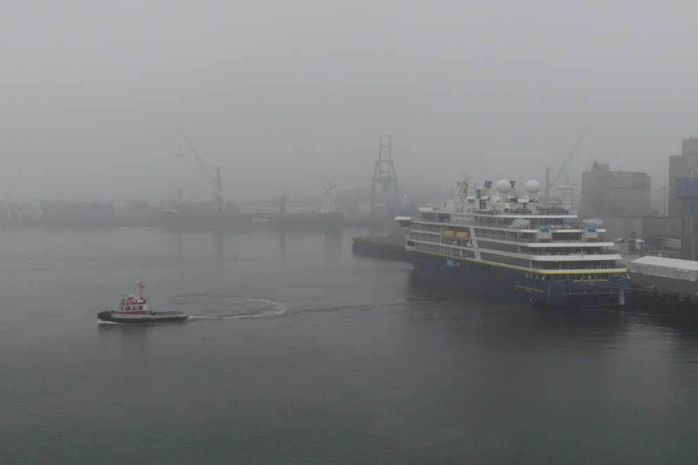
Just before 06:30 we got close enough to the dock that I could see the National Geographic Resolution ahead of us.
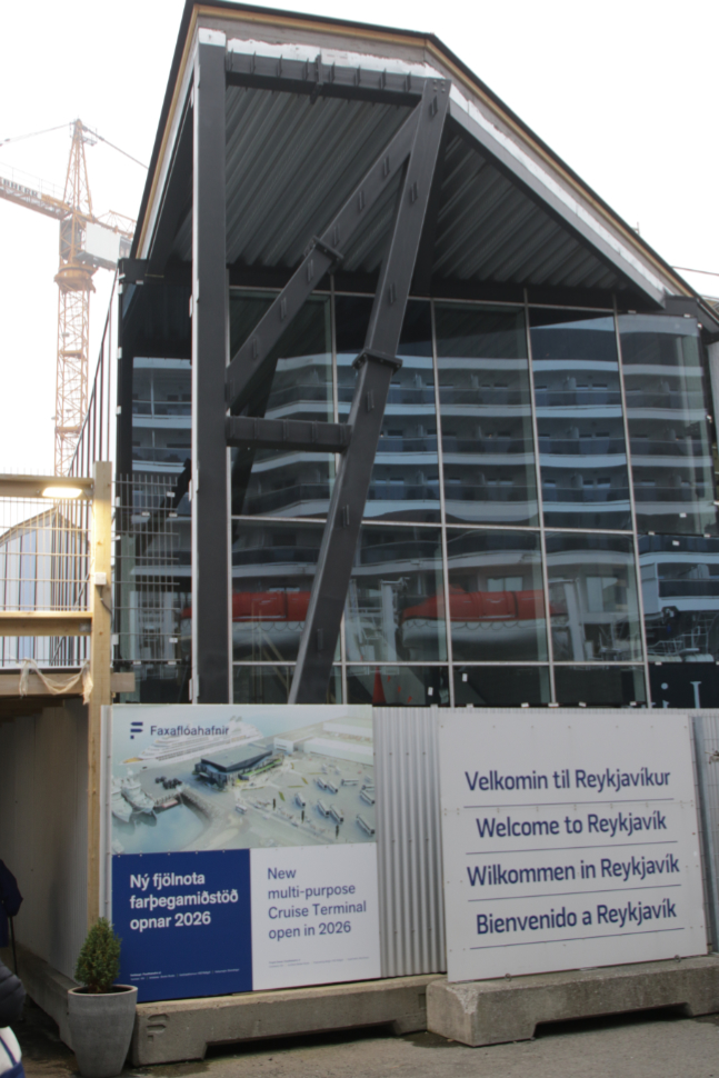
The tour was organized by a fellow passenger, and I guess the response was a bit overwhelming, because it took quite a while to get of people 3 busloads organized. At 08:05, though, we were on shore. Facilities are very basic at Reykjavik, but a beautiful new cruise ship centre will be completed for the 2026 season.
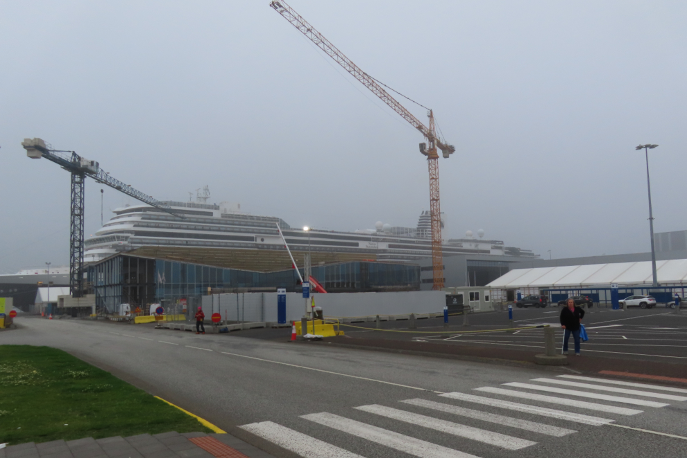
Looking back at the construction and our ship, from the bus parking area.
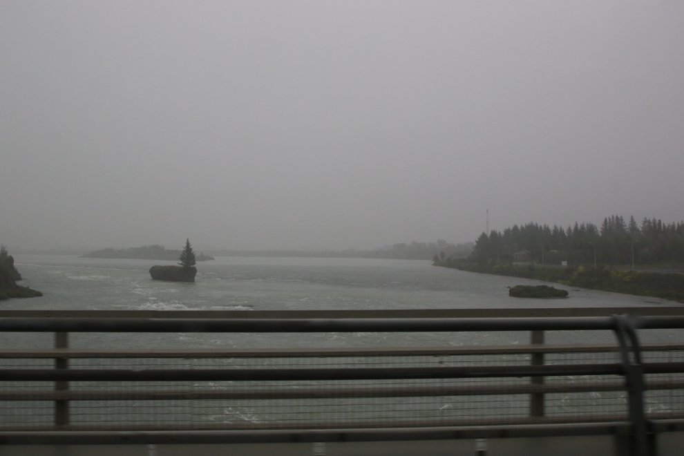
There wasn’t much to be seen for the first hour or so, but I did catch a shot of the river Ölfusá, Iceland’s largest river by volume and an important salmon habitat.
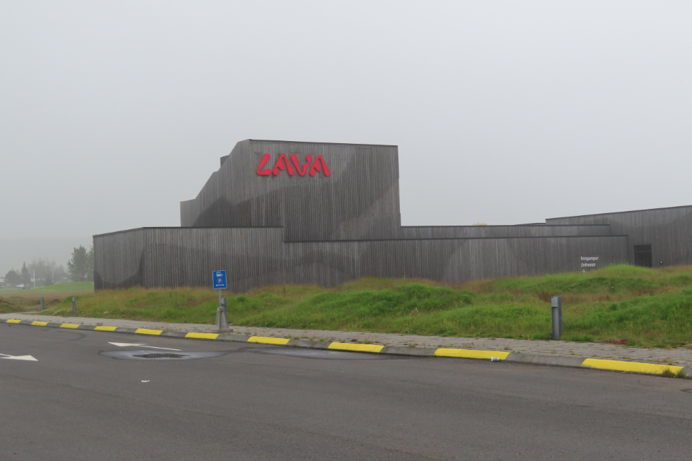
Just before 10:00, we made a rest stop at the Lava Centre at Hvolsvöllur.
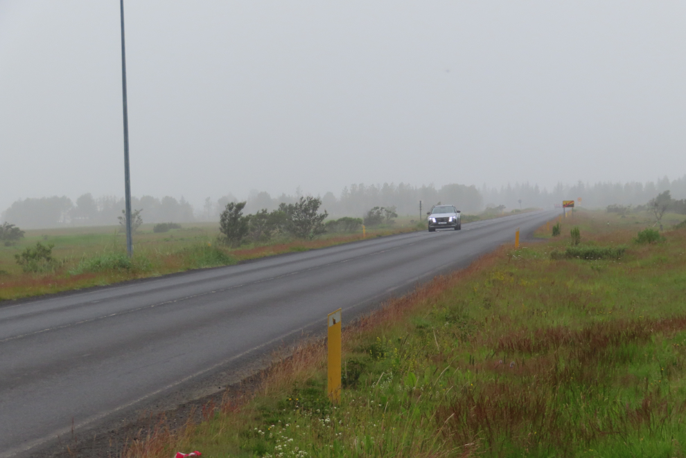
While everyone else went in, I walked back to Route 1 to get a photo of the road we’d been on.
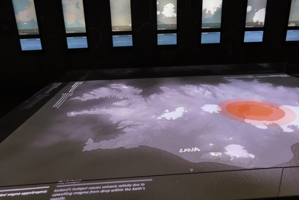
The Lava Centre has some excellent displays and presentations, and it would be easy to spend a lot of time there, but we didn’t.
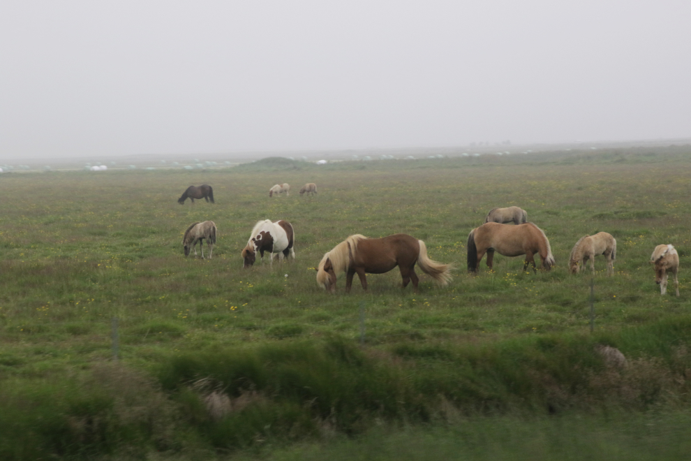
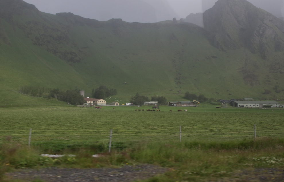
Back on the road, we went by a very large Icelandic horse breeding farm – that would be an interesting tour.
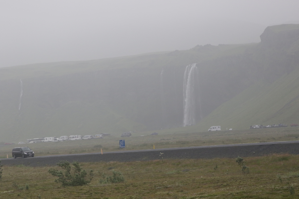
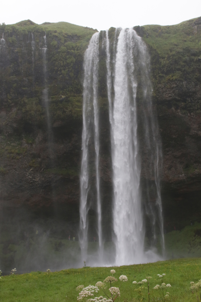
This was our first view of Seljalandsfoss.
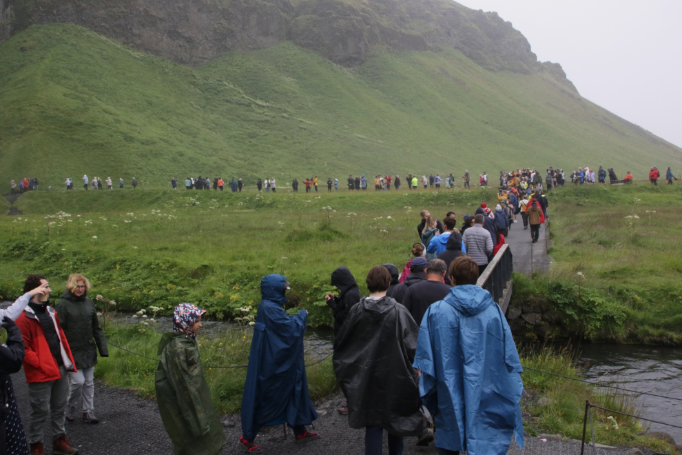
Walking to the falls. Seeing the photos now, I’m quite surprised by how many people there were – I had gotten pretty good at focussing on the goal and ignoring the people. The waterfall is 60 meters/ 200 feet high.
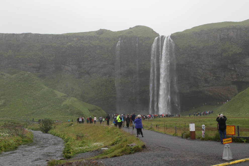
You can walk behind the waterfall, but the lineup to do that was much too long.
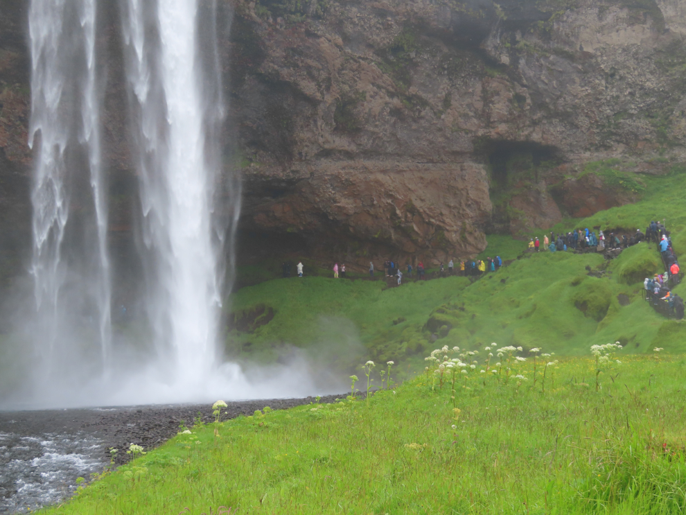
It was possible to get photos that also ignore the crowd 🙂
Our driver (Trond) had chosen to come to Seljalandsfoss first because it gets really busy later in the day! 🙂
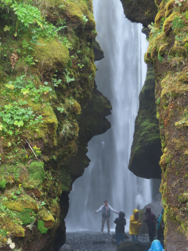
Most people don’t continue on to the waterfall Gljufrabui (luckily), but it is very cool! That’s a real shower in that rock cathedral, and I didn’t go in.
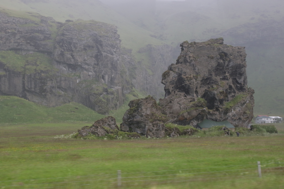
There is a lot to see along Route 1. The big challenge is that, like our experience with a campervan in New Zealand, the roads have no shoulders or pullouts for photo stops.
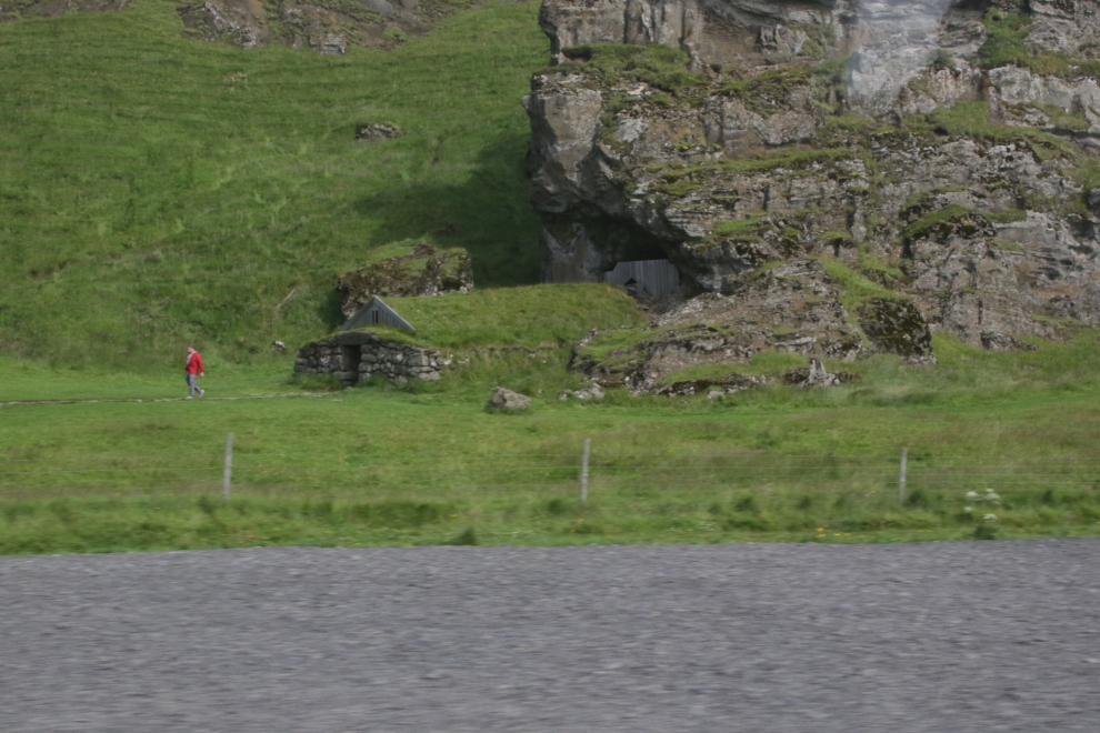
There is a home built into the base of that rock.
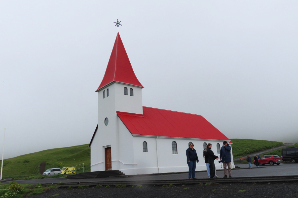
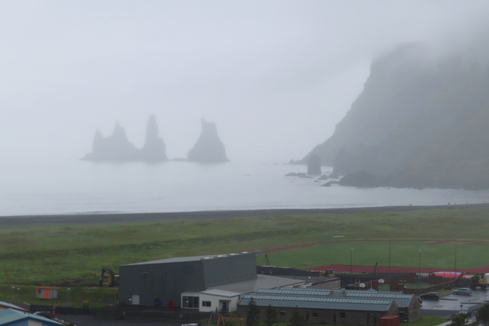
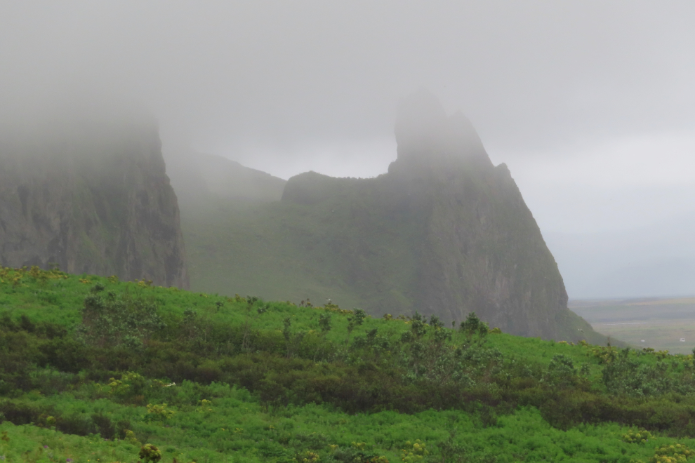
Just before noon, we arrived at Vík í Mýrdal (always just called Vik), the southernmost village in Iceland. While this would be our lunch stop, the beauty of its location makes it worth visiting at any time of day.
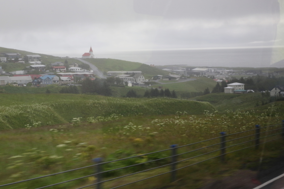
We started at Reyniskirkja, the community’s church that dates to 1929 (and offers great views).
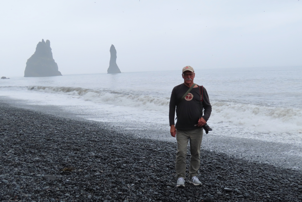
The dramatic views to the southwest, and east. After lunch we would see those rocks to the southwest (Reynisdrangar) from the beach past them.
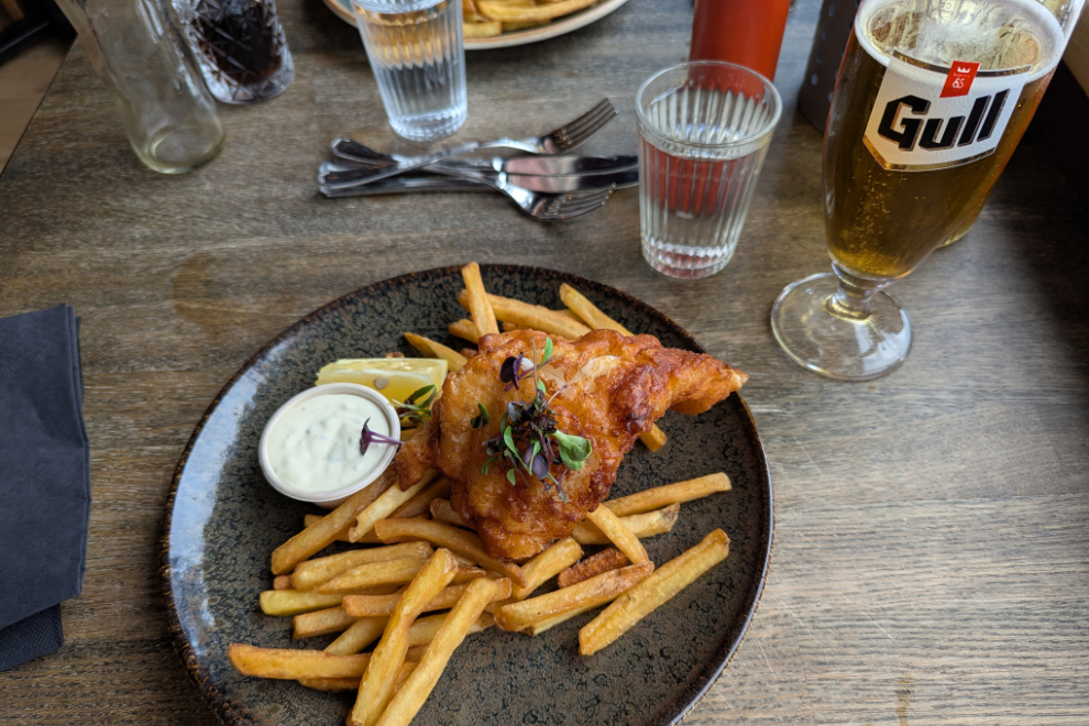
When we went into town for the lunch, our driver, Trond, made 3 suggestions for lunch (which was on our own), but on the way to one, I saw the sign for the Strondin Pub, which sounded like exactly what I was looking for, despite not being on Trond’s list.
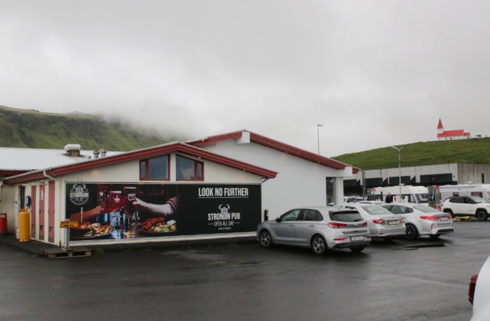
Only one table was in use when we arrived, but it soon got quite busy. It was a nice space, though perhaps not as “Icelandic” as I’d hoped.
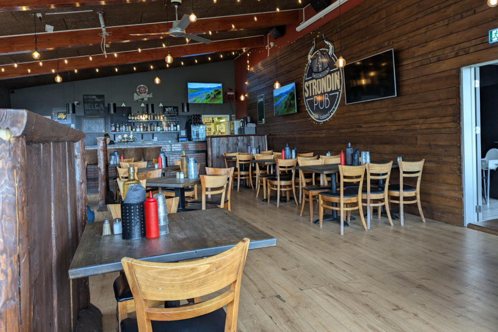
Planning a visit to Iceland requires potential visitors to acknowledge that everything will be expensive, and when you arrive, don’t pay attention to the prices. My fish and chips (cod) was very good (well the chips were very good, the cod was superb!). Cathy had a double-patty burger, and with one beer each, the bill with a tip added (not normal policy in Iceland but of course appreciated) was $115.67 Canadian.
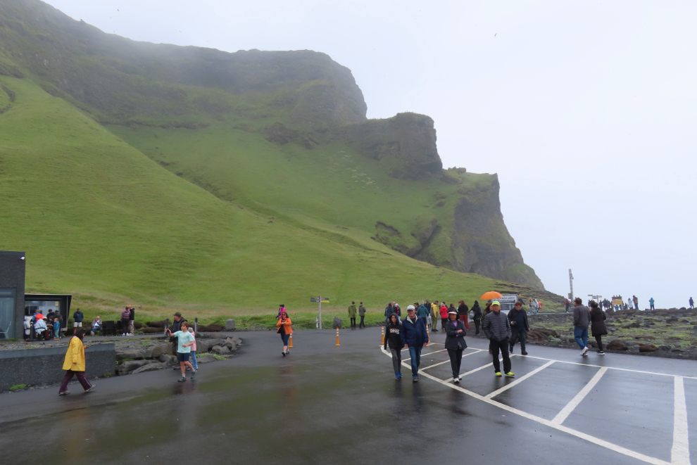
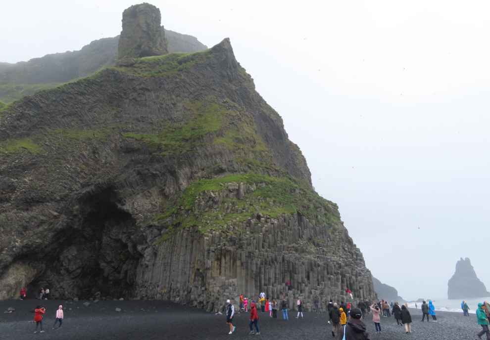
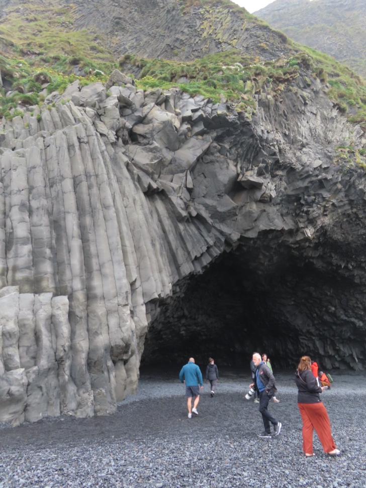
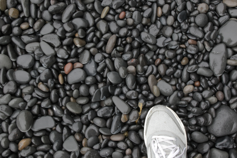
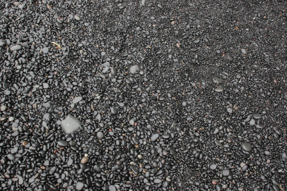
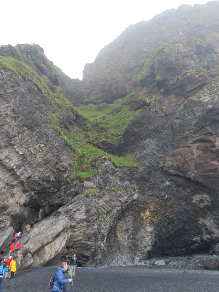
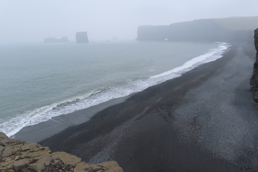
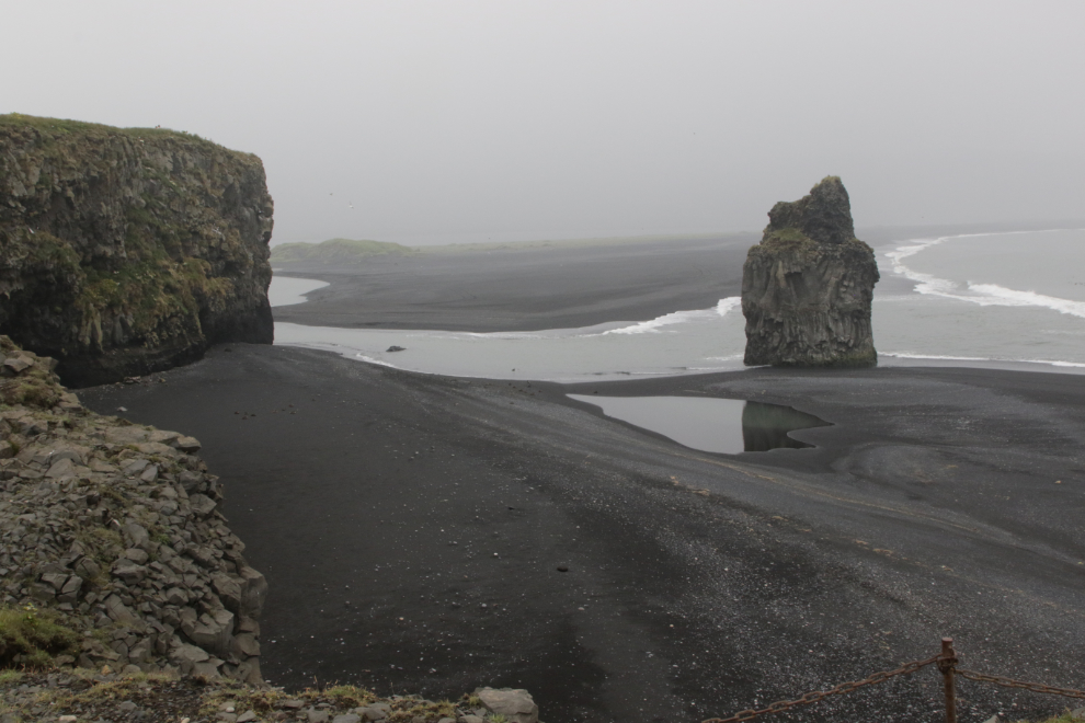
After lunch we made the short drive to Reynisfjara, often termed a black sand beach but most of it is rocks and pebbles, well polished by the surf. It should be at least as famous for its basalt columns and caves. There were, of course, a lot of people there.
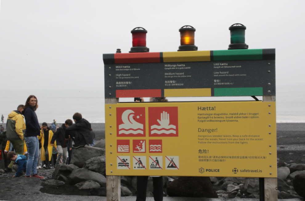
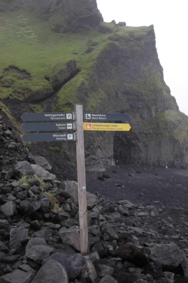
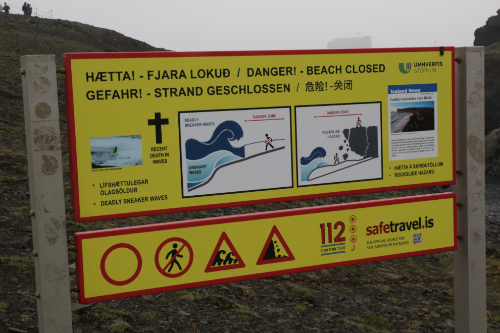
August 5 edit (the 2 photos below and this paragraph were added): On August 2nd, less than 2 weeks after we were there, a 9-year-old girl from Germany was swept into the sea and drowned here – her father and sister were also caught by the waves, but they managed to get back to shore. She is the sixth tourist to die here since 2007 (4 by drowning, 2 by falling on the rocks). Our driver warned us several times about the dangerous surf and rogue waves that Reynisfjara is well known for. When we arrived, an orange light was flashing, and the sign below says “Do not go into the yellow zone.” The directional arrows shown in the second photo below show that the entire area of basalt columns and caves is in the yellow zone (and again warns about “dangerous sneaker waves”), but that’s obviously what people come here to see. There are some incredible videos on Youtube showing people getting hit and even washed considerable distances by huge waves. We were never in danger, but had to jump from a couple of waves that reached much further than we expected. We were there at low tide so there was a lot more room to manoeuvre – high tides reach the base of the basalt columns so it’s easy to get trapped.
Hálsanefshellir Cave.
Here’s what the rocks and pebbles look like. It’s quite unstable to walk on.
The sound of the surf and the black rocks being polished was wonderful, so I shot a minute of video to share that with you.
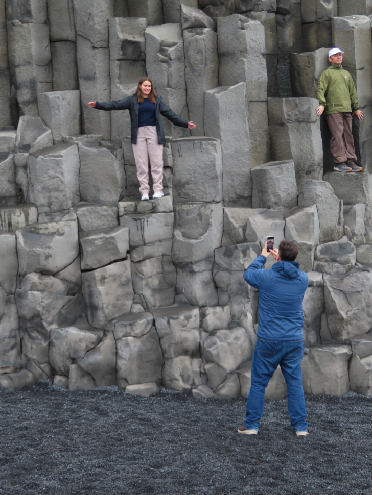
The basalt columns were a very popular place to photograph the adventurous and nimble 🙂
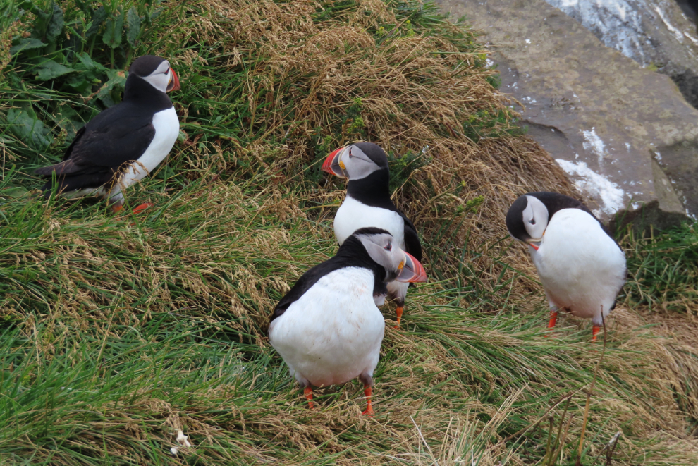
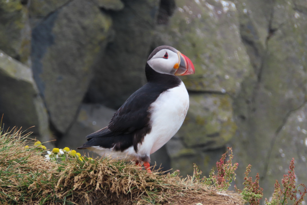
There are lots of puffins, but you don’t get close. It took about 700mm of the little Powershot’s reach to get this shot.
No I didn’t go for a dip!

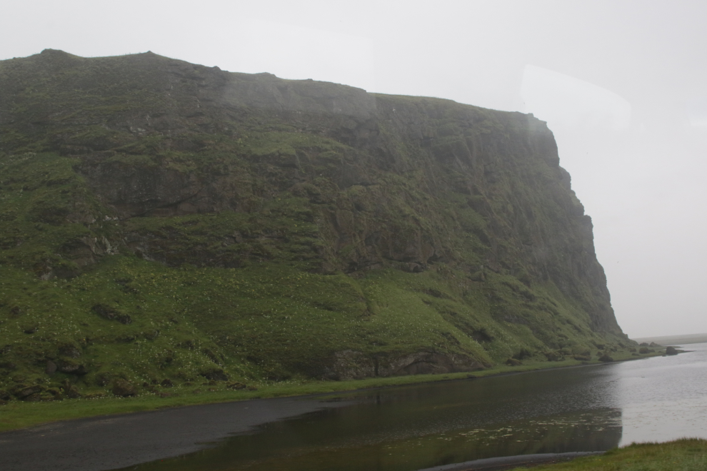
This is a wild piece of coastline!
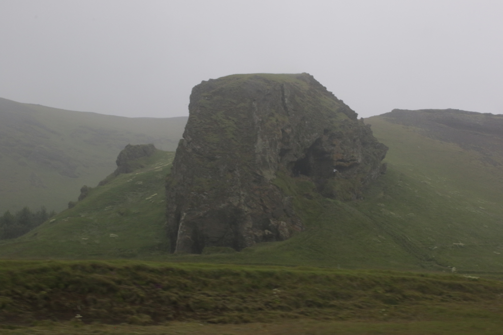
Back on the road, wishing that Cathy had a car or maybe a campervan and a week to explore this incredible area. There were people climbing up to a cave in that volcanic formation we passed.
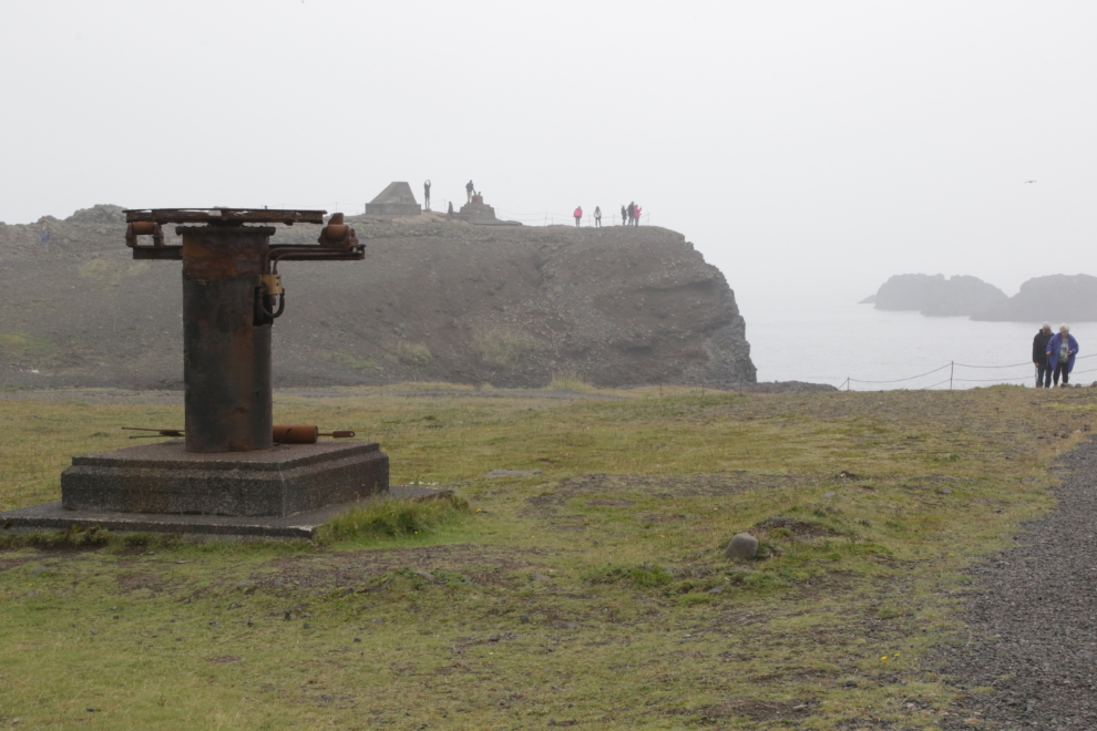
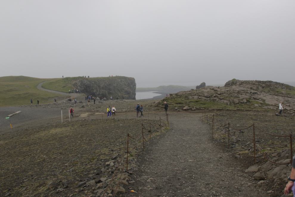
Our next stop, Dyrhólaey, was very close. Trond had been an excellent guide, but he sure dropped the ball here. I don’t think any of us knew why we were here or where to go to see… something.
This equipment may have been for helping to rescue shipwreck survivors.
All access to to the beaches seems to be closed, and signs note that rogue waves and rockfalls injure and even kill people down there.
The beach looks amazing, and in the distance some arches could be seen.
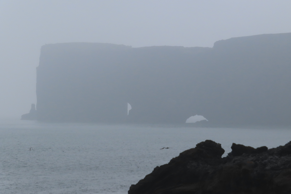
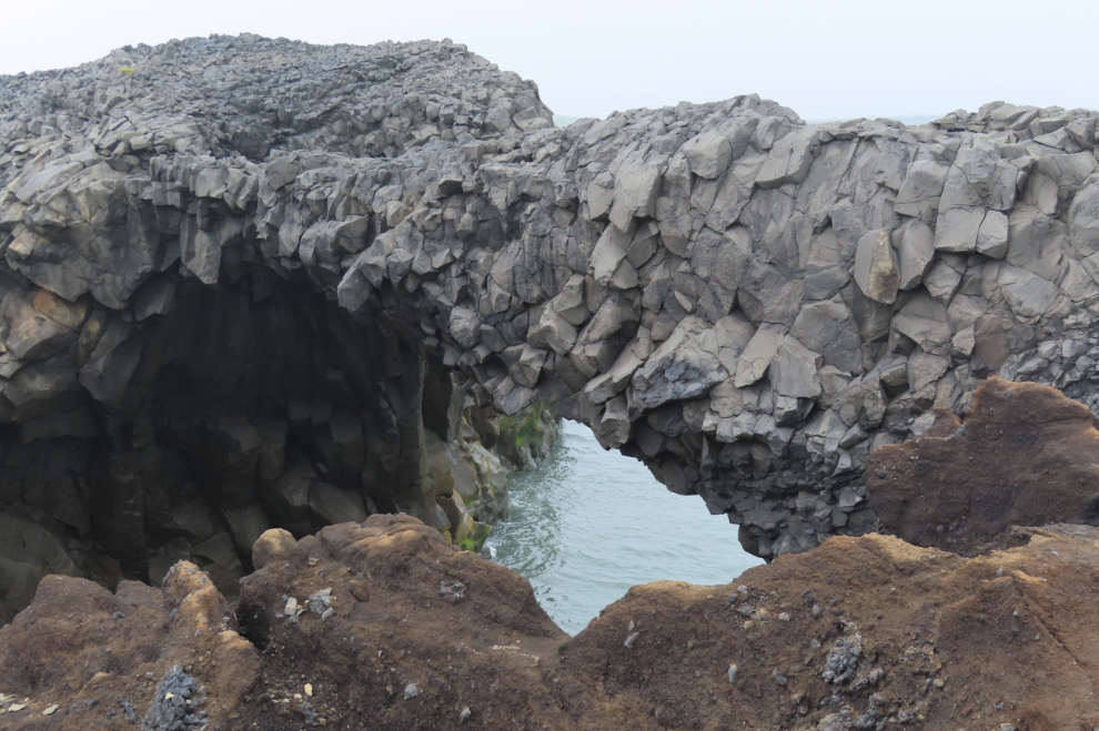
I found a trail that led to this basalt arch.
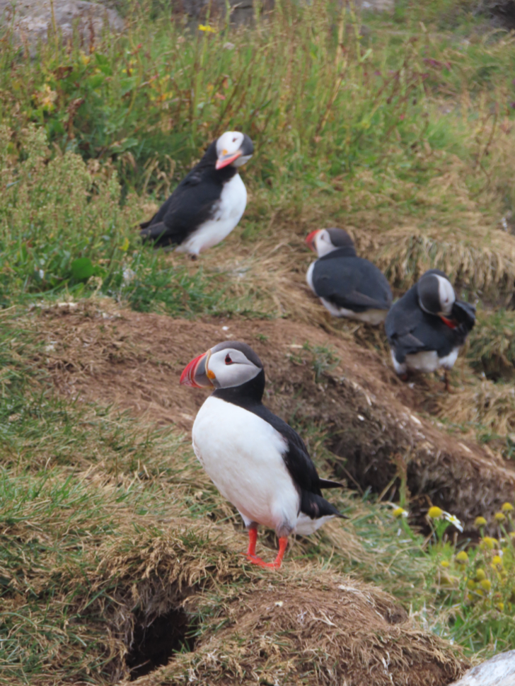
I was walking back towards the bus when I saw a small group of people by the edge of the cliff. “Cliff” could mean “puffins” so I went for a look.
That walk led to this great view…
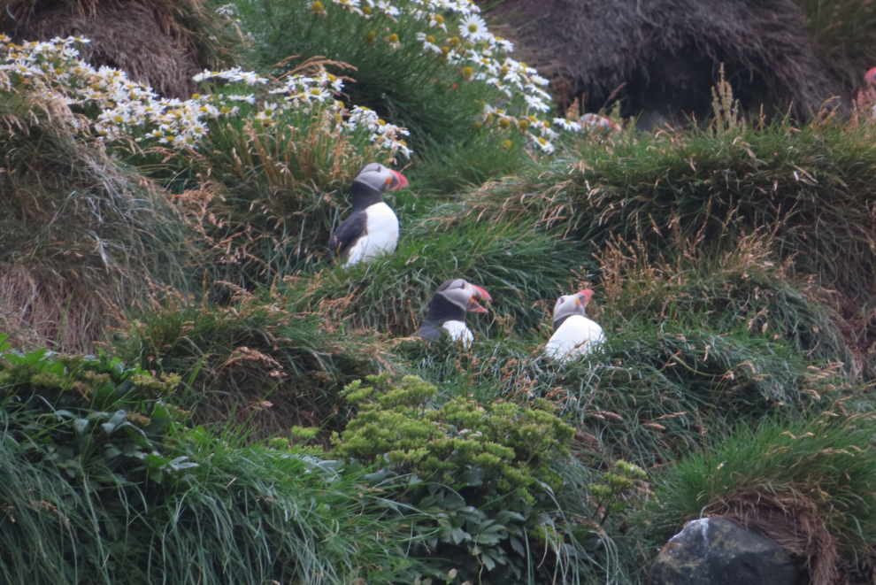
…but it also led to the best puffin viewing of our entire trip. They were just a few feet away, and completely unconcerned by our presence. And if that wasn’t great enough, there were only about 10 people there!
Back on the road, but this drive, too, was quite short…
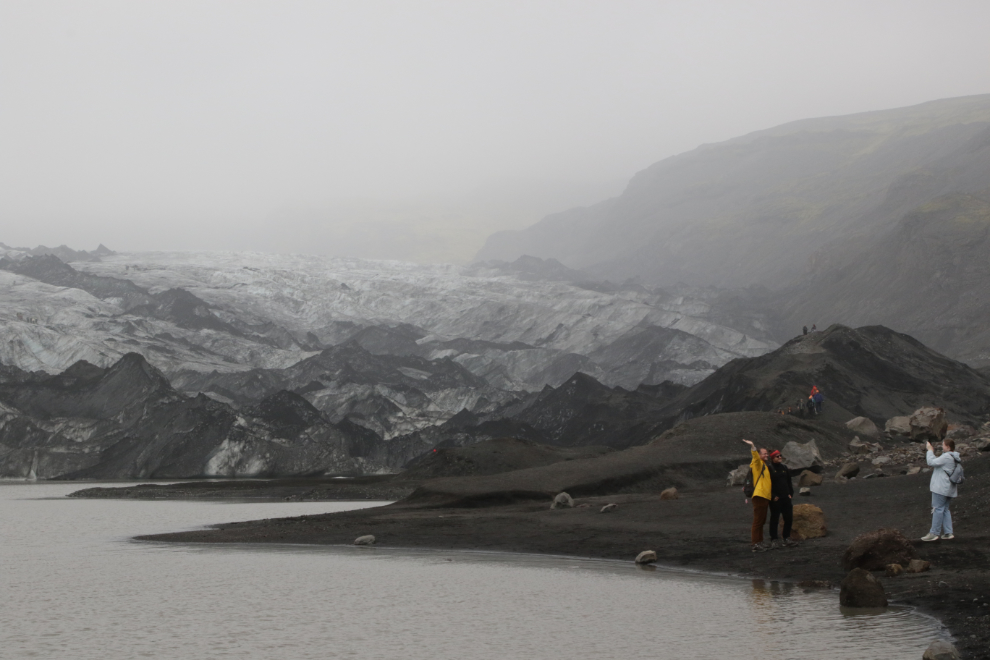
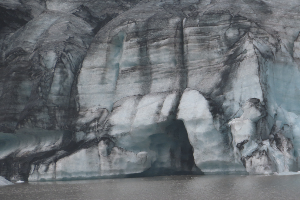
…and we were soon at the glacier Solheimajokull, which is a tongue of the Myrdalsjokull icecap. Cathy walked with me to the first viewpoint, then I continued on.
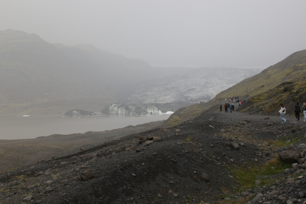
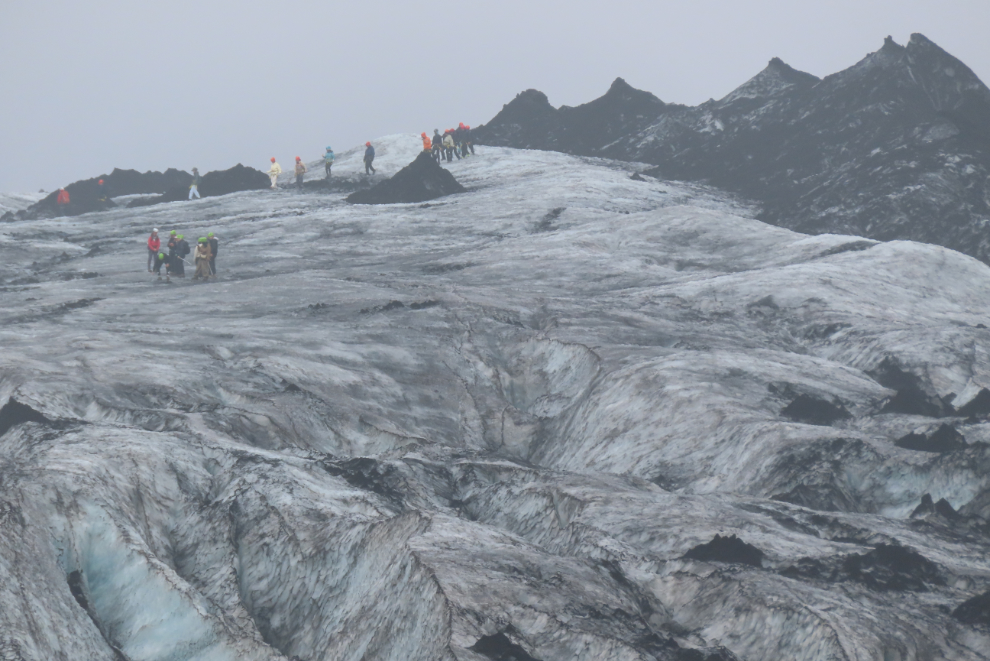
Any glacier is interesting, but Solheimajokull doesn’t rate very high compared to others I’ve visited. Donning gear and climbing on it is big business, but I spent about 1/3 of my life walking on snow and ice so I don’t need to pay to do it 🙂
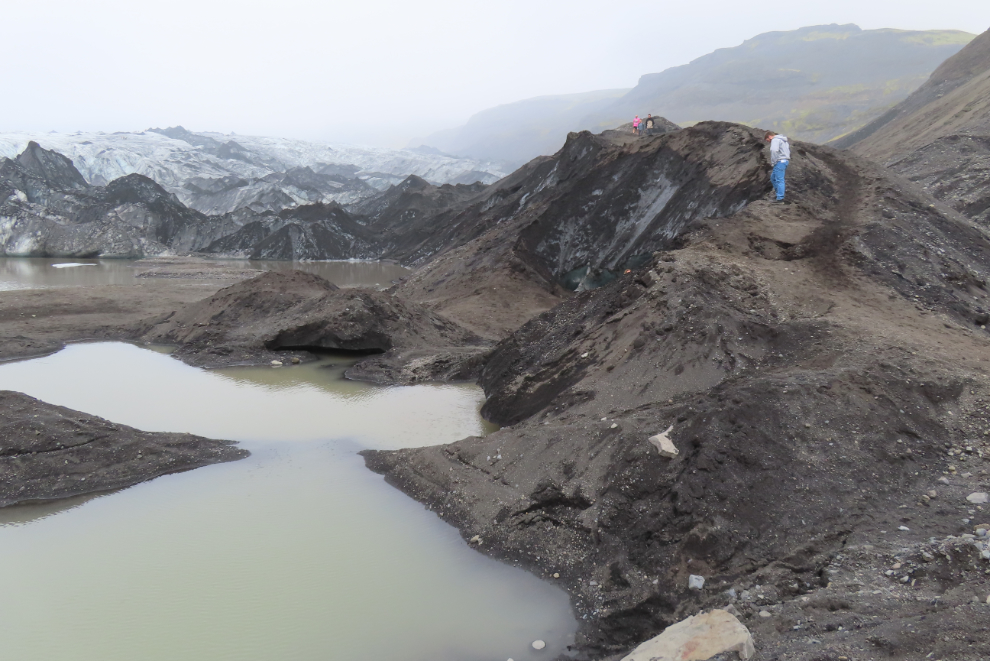
You can walk over and touch the ice, but I didn’t see anyone else from our bus up this far.
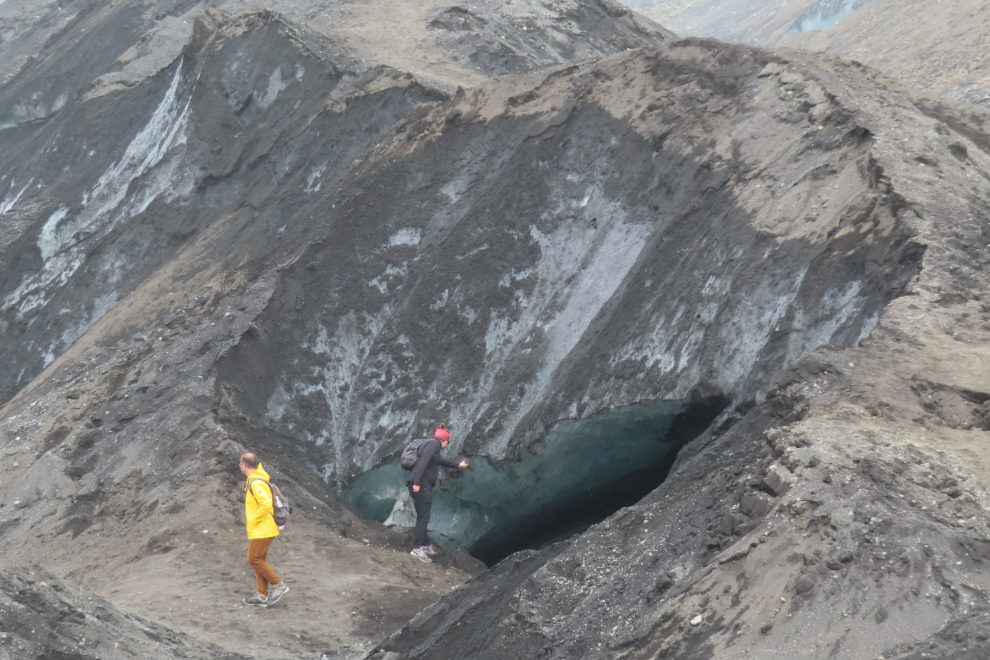
The cave in the face (a former river channel through the glacier) would be interesting if you had a kayak. As was often the case, I was the last one back at the the bus, right at the specified time limit 🙂
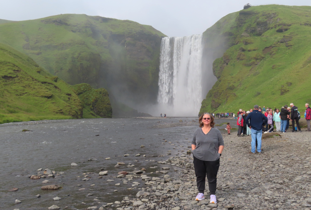
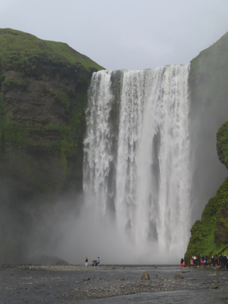
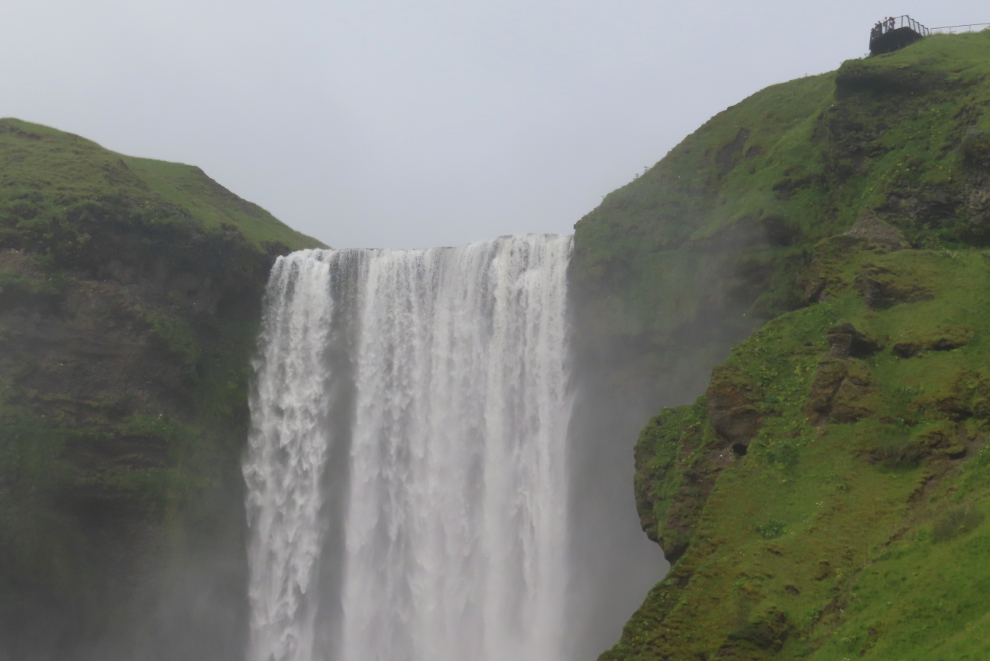
At 4:30 we arrived at our final stop – we had now been on the bus for 8½ hours. The final stop was Skógafoss, widely considered to be Iceland’s most beautiful waterfall. It’s 15 meters wide with a drop of 62 meters.
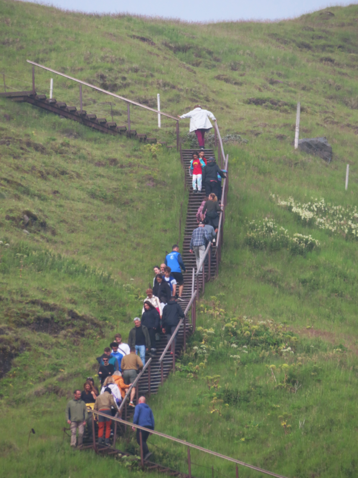
I enjoy seeing waterfalls from the top, too, but there was no way I was joining that parade.
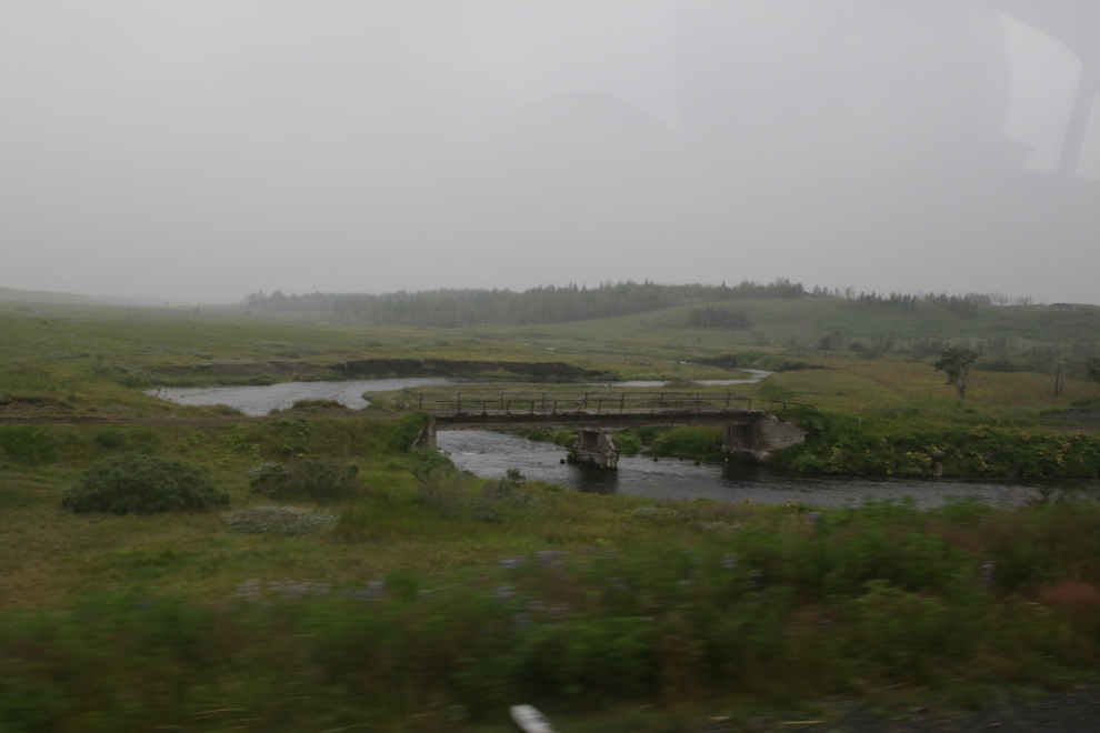
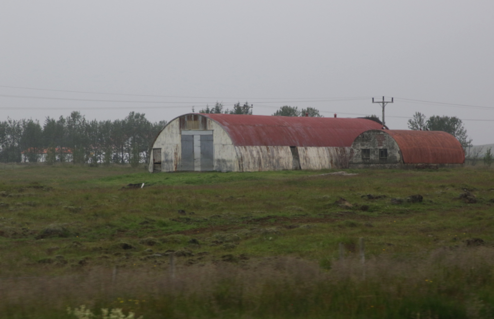
We left Skógafoss at 5:00, and it was a long drive back to our floating home. I took a few photos of places I want to see when we have a month to explore Iceland. Old concrete bridges on the old road…
…a photogenic pair of Quonset huts…
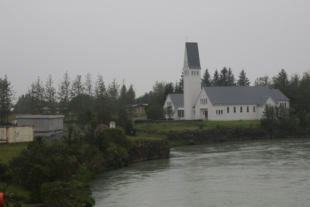
…a lovely riverside church, and a few other things.
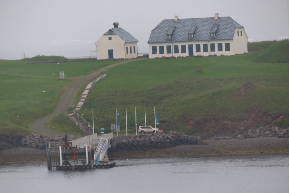
We got back to the dock at 7:30 – that was 11½ hours of exploring. This place was visible across the harbour from our cabin – next time, I’ll find out what it is.
Today’s tour is generally considered to be the second best in Iceland – tomorrow we would take the best one, and it would be shorter 🙂