Hiking the entire Carmanah Valley to the sea in 1990
Last September I posted an article about “Paddling BC’s Bowron Lakes circuit in 1968,” a trip that I have many photos of but no memory of. That was an enjoyable way to recreate a significant adventure and it brought back some tiny fragments of memories of the trip. This post is another like that.
In March 1990, the old-growth forests in the Carmanah Valley on the southwest coast of Vancouver Island were under heavy threat of being logged, and I determined to hike the valley to record it and possibly help in the fight. As well as an SLR camera of some sort, I carried my large and heavy Pentax 6×7, shooting Kodachrome film with both. I shot 138 slides with the SLR, 6 with the 6×7. I was joined by Lorne, whose last name and where I knew him from has been lost, though he was probably a member of the Chilliwack Outdoors Club as I was.
The Carmanah Valley is now, as had been hoped in 1990 would happen, protected as Carmanah Walbran Provincial Park, covering approximately 16,365 hectares. Carmanah is a native term meaning “as far up as a canoe can go,” and John Thomas Walbran was a colonial explorer and ship’s captain. The park was created as Carmanah Pacific Park on July 24, 1990, by The Carmanah Pacific Park Act, and the name was changed to Carmanah Walbran on March 25, 1995.
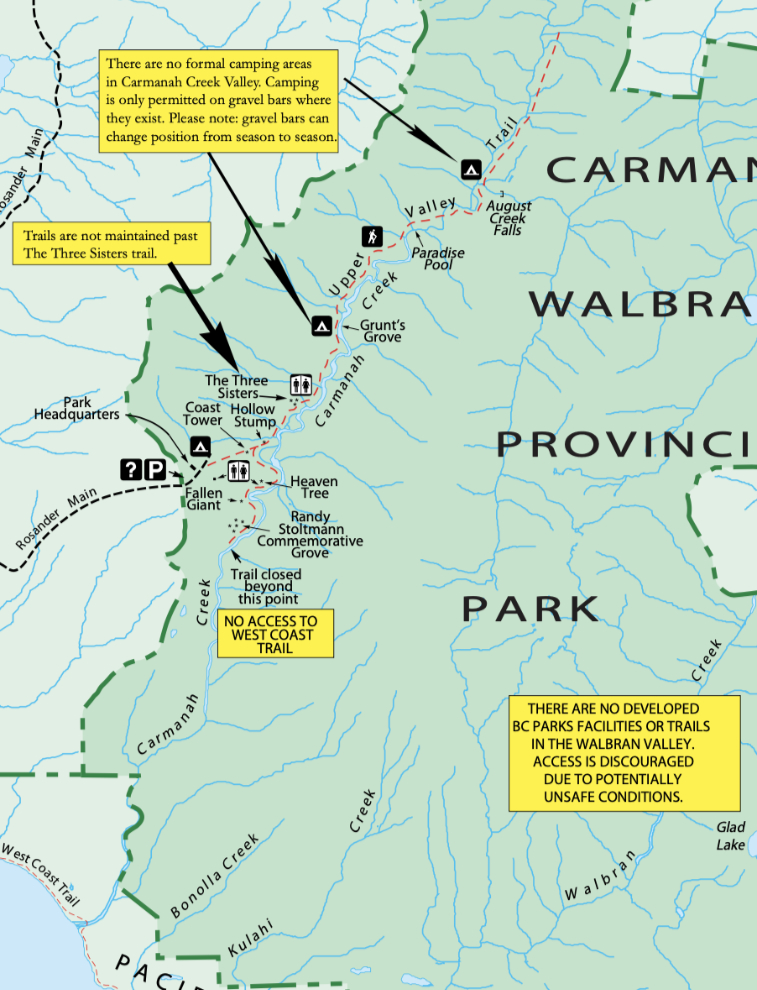
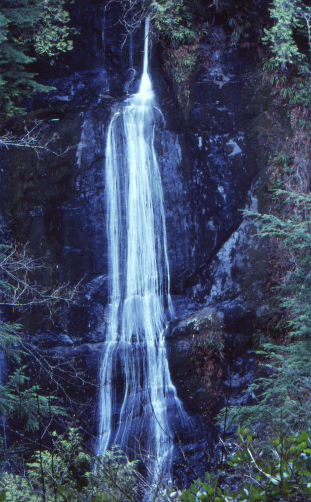
Access to the park is very different now than it was in 1990, and most of the valley we hiked is now closed, so these photos are even more significant than I had expected. I wrote fairly detailed descriptions on each slide, but even some significant locations such as Silver Strand Falls are now unknown (I’ve only found the falls mentioned on one website from 2015, with no information about it). Perhaps I have some detailed information still in the 17 file boxes of material still waiting to be scanned. If so, I’ll update this post when I find it.
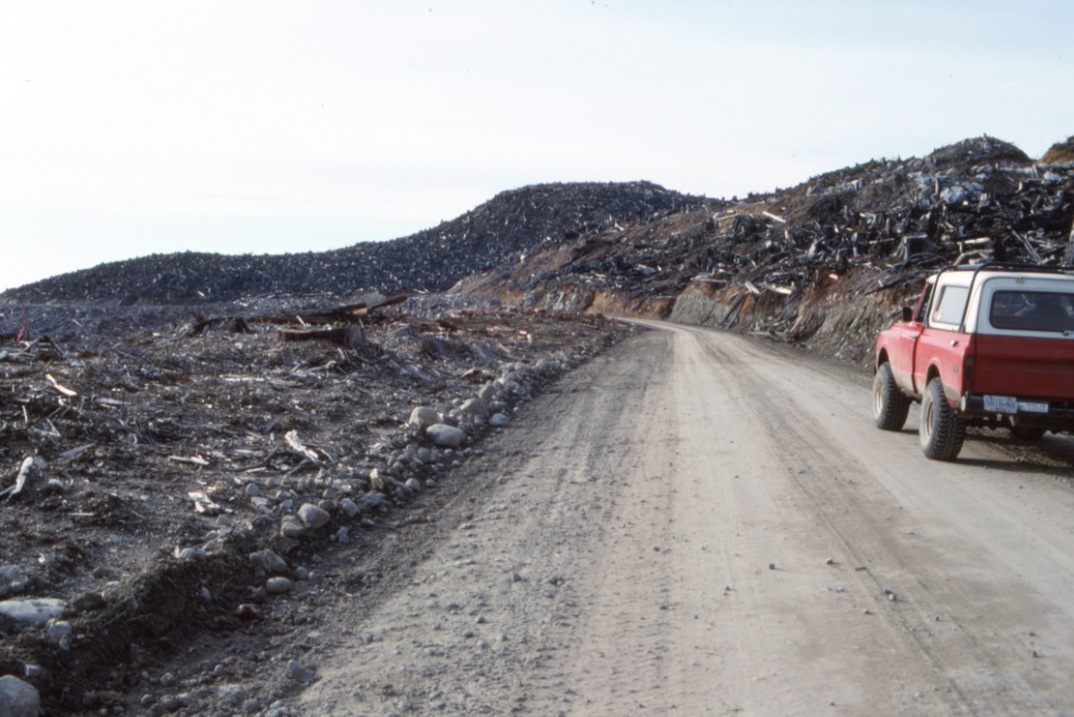
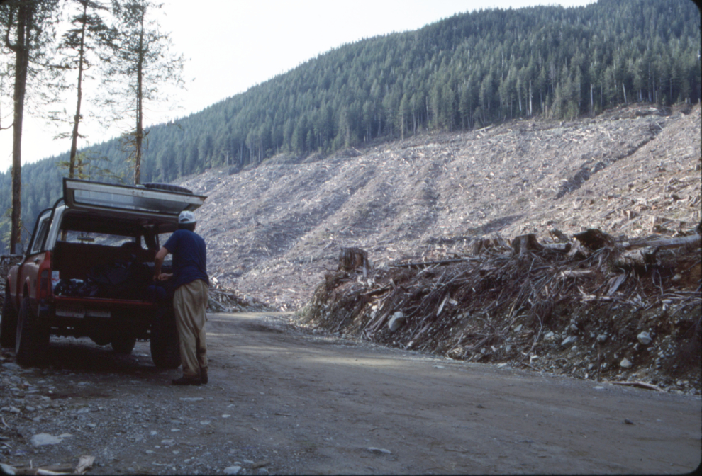
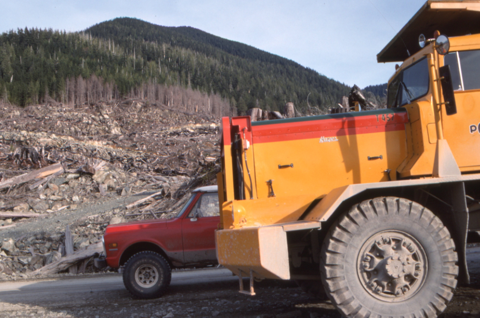
The drive from Port Alberni on March 25, 1990, involved many miles of private logging roads, through both recent and still-being-logged areas.
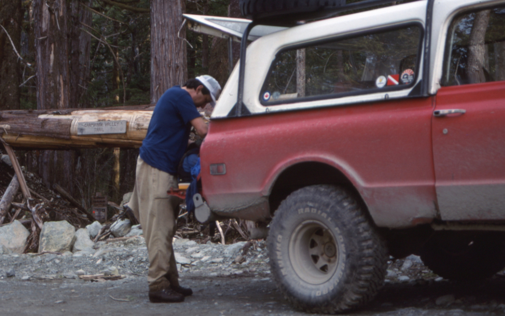
At the trailhead, probably mid-afternoon. The carved sign says “Carmanah Valley Trail.”
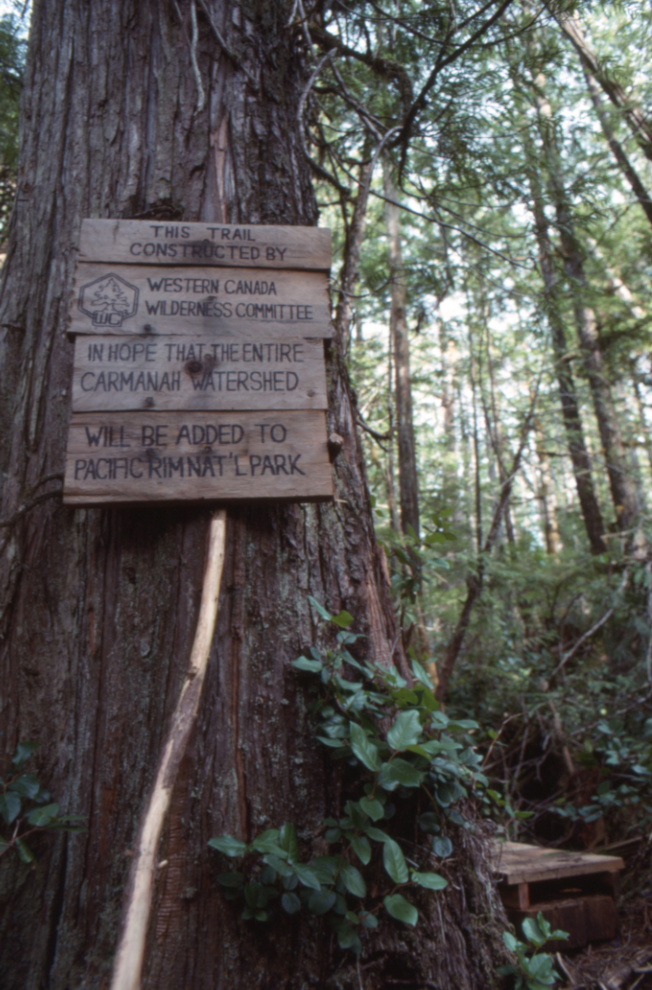
“This trail constructed by Western Canada Wilderness Committee (WCWC) in the hope that the entire Carmanah watershed will be added to Pacific Rim Nat’ Park.” The trail was built in 1988-1989 despite attempts by forest company MacMillan Bloedel to stop it.
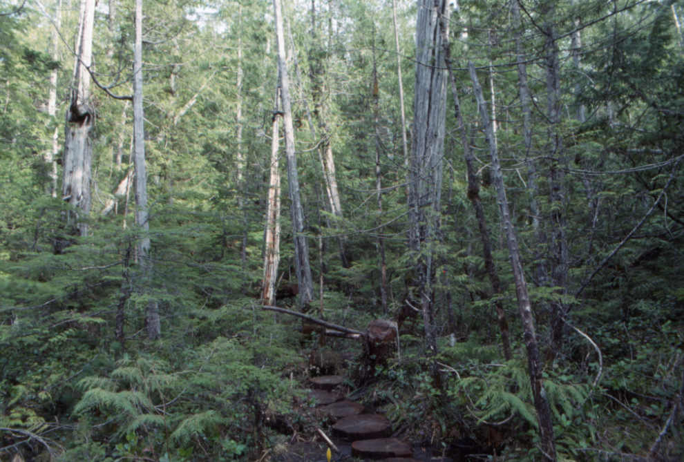
Cuts from logs about 18 inches in diameter were laid to cross a swamp near the trailhead.
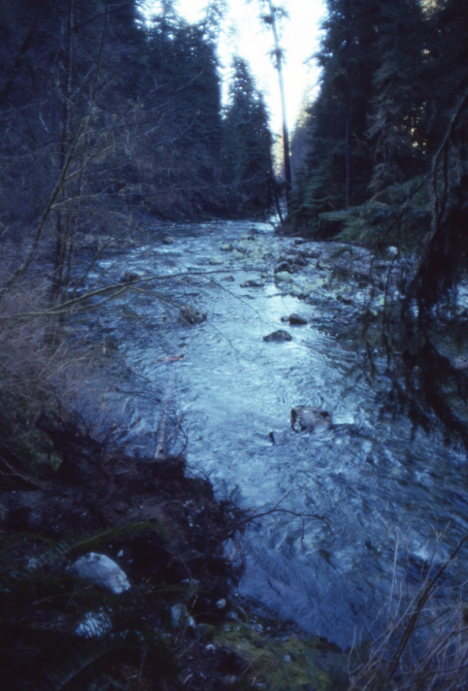
I don’t think we went very far before hacking out a spot to set up our tents. My note on the slide says it was “west of pool.” While it could have been Paradise Pool, I think it was much further up the valley.
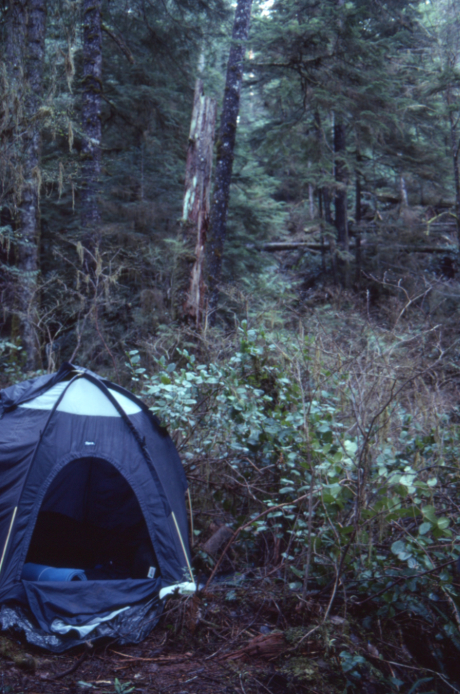
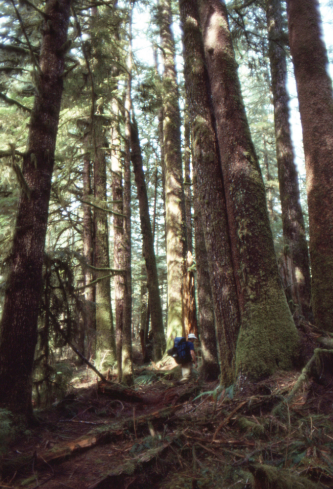
It was very dark in the forest – this slide notes that it was shot with a 2-second exposure at f5.6, with a 24mm lens.
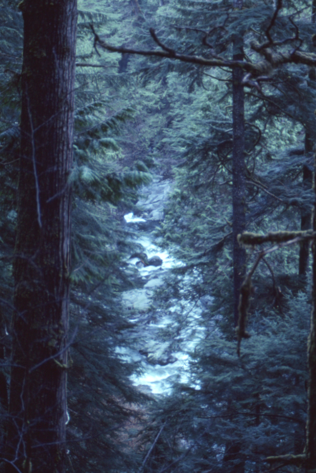
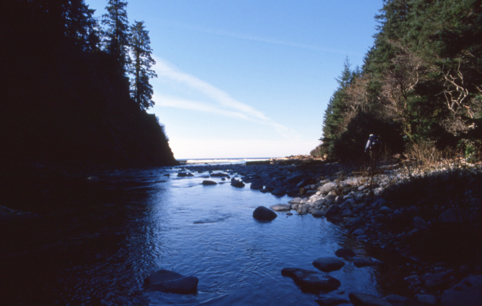
Carmanah Creek “west of pool.”
When we started out the next morning, the sea was our goal. It was tough hiking – only a few hikers had yet used the rudimentary trail. It went under massive fallen trees, across creeks…
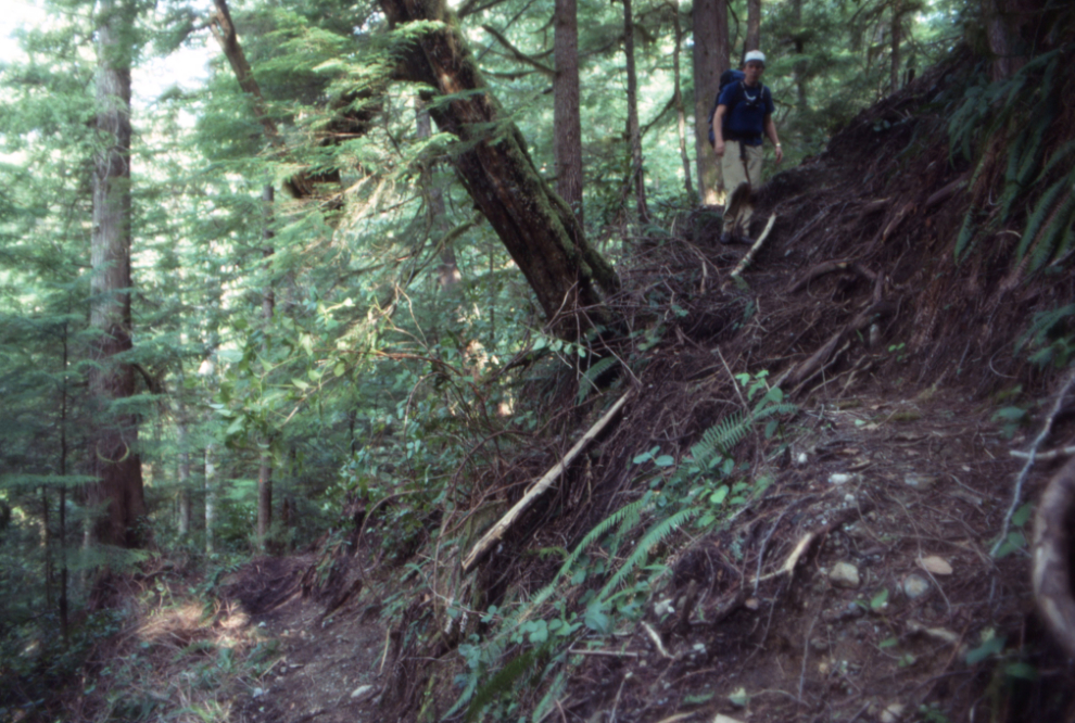
Sometimes after struggling to gain altitude, the trail would take us steeply down again.
The trail is now closed about 4 km from the sea, and signs apparently warn hikers that they can be charged for travelling further. Only about one-third of the route we hiked is now accessible – this map shows what can now be seen 🙁
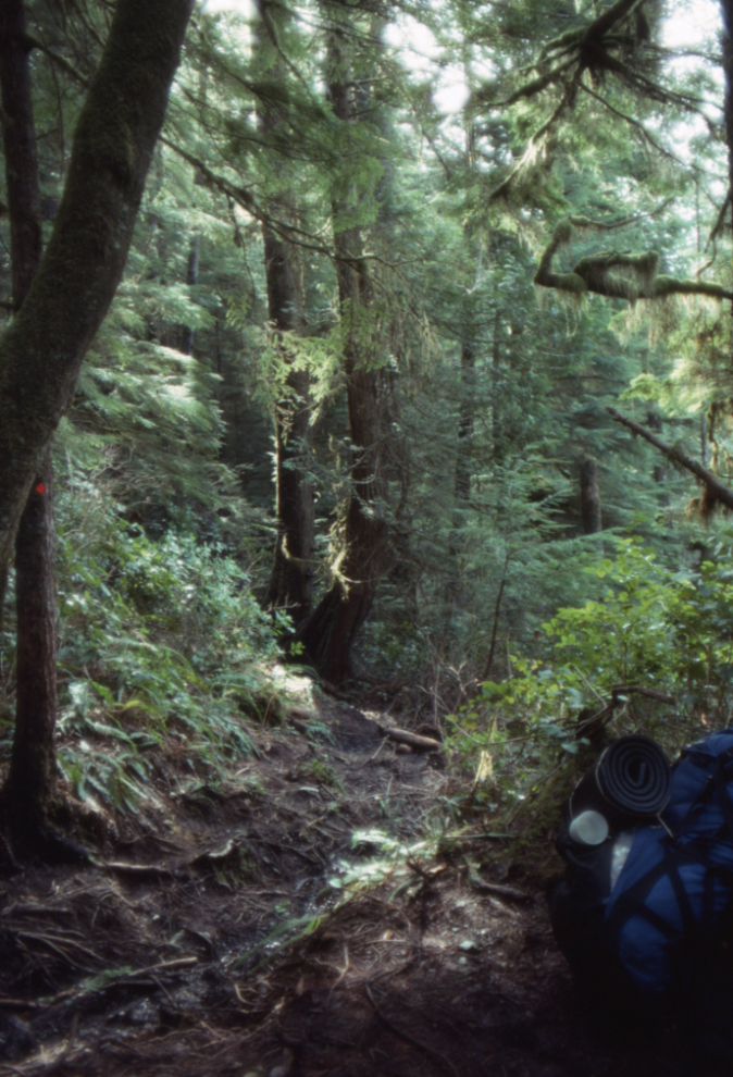
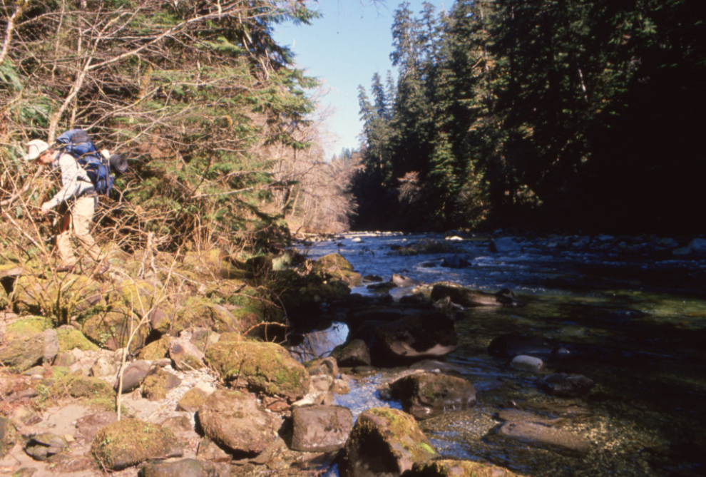
The trail builders did an amazing job. This section is noted as being “west of Emerald Pool.”
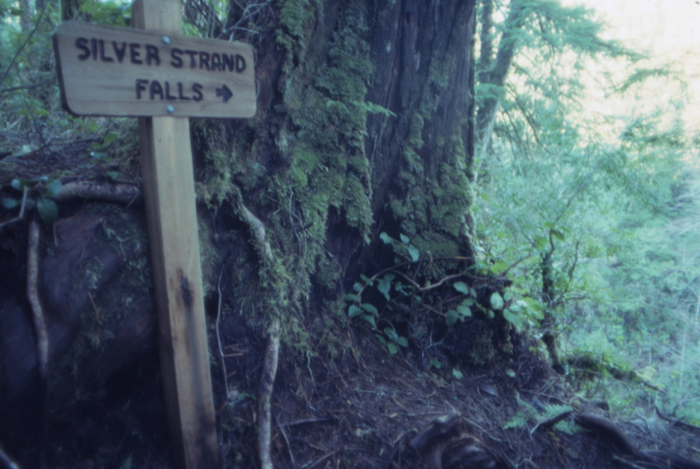
A carved sign pointed to Silver Strand Falls dropping into Carmanah Creek. It is no longer accessible.
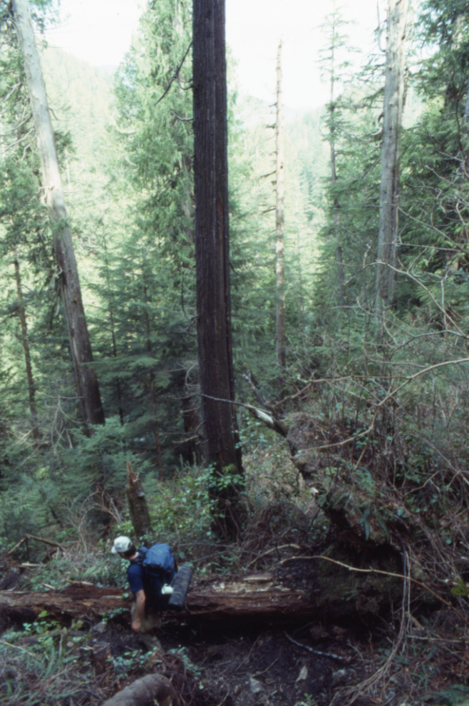
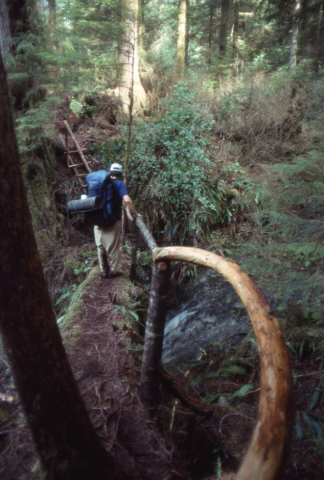
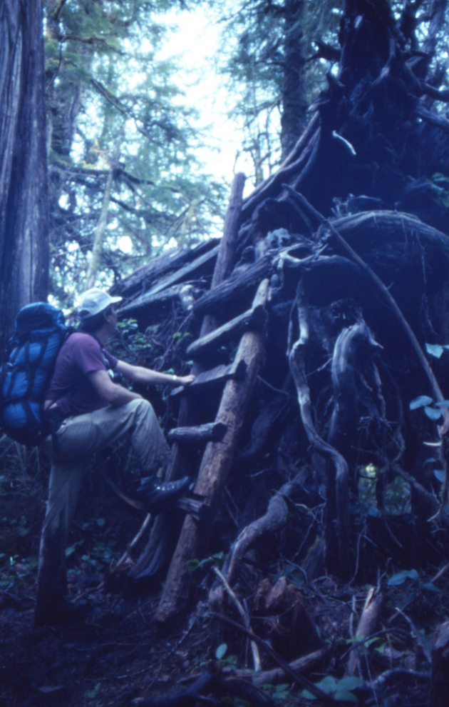
Fallen trees became the trail in a few places – in this case a ladder got us up onto a substantial distance of easy walking. I think this tree led to another so we were walking on trees for at least 300 feet.
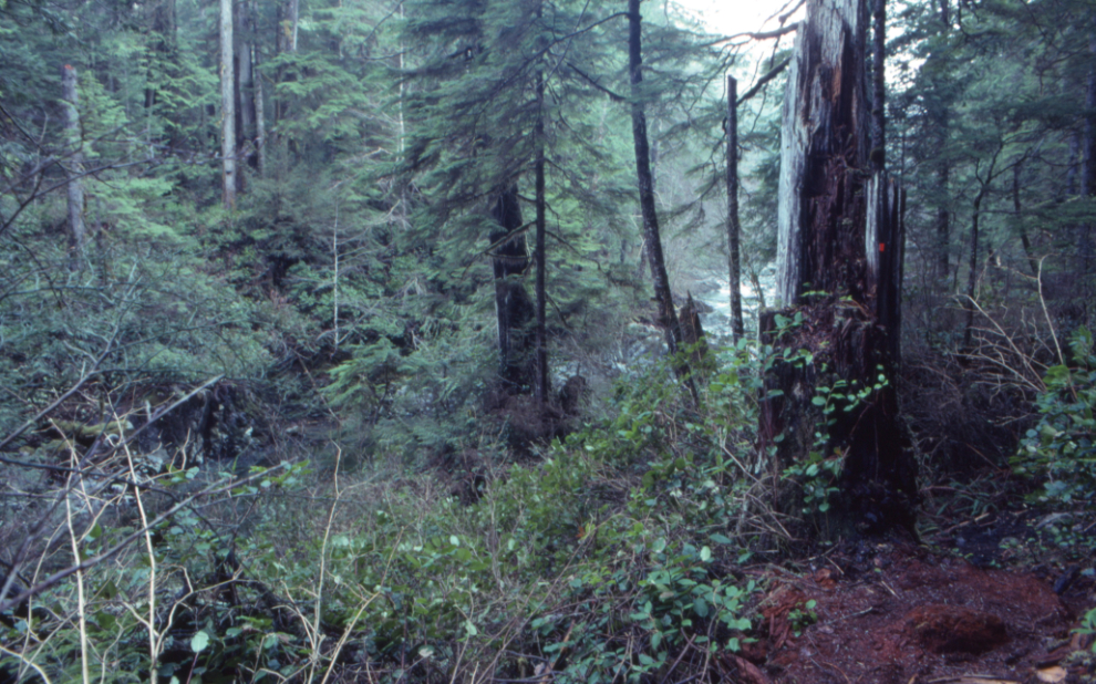
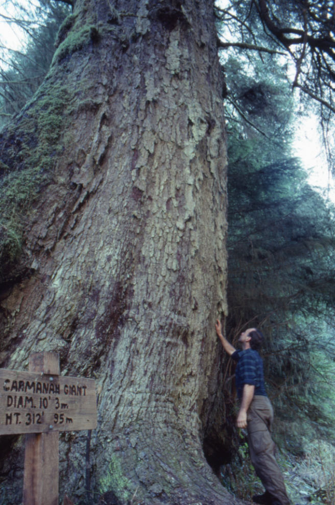
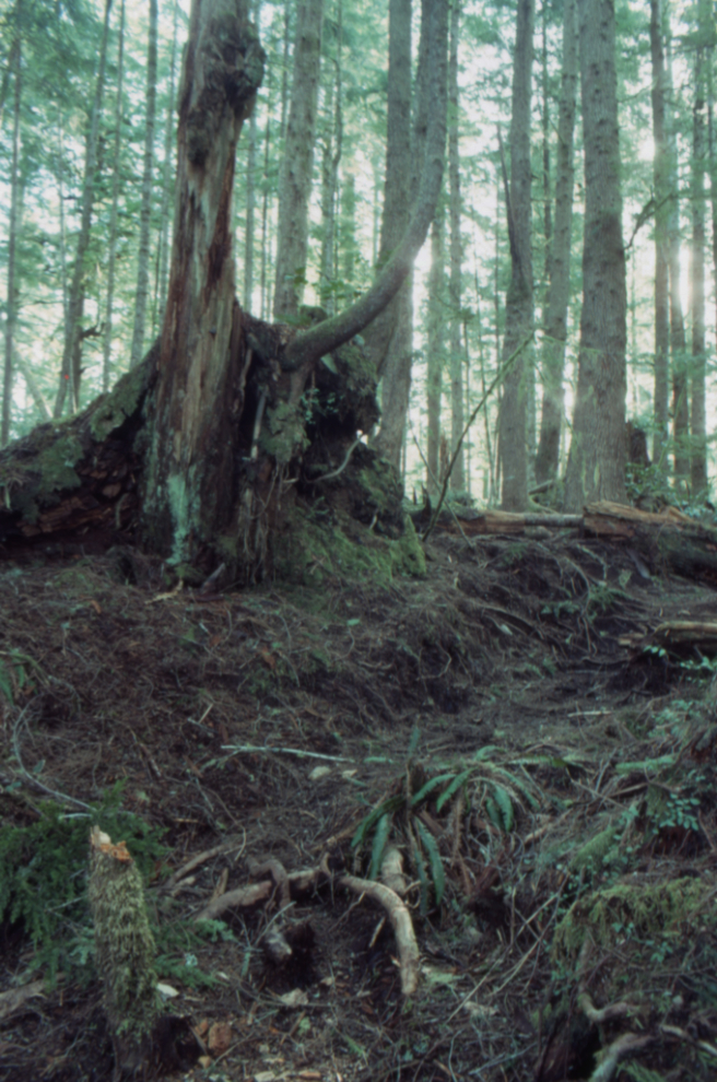
In the lower Carmanah Valley, the creek gets wide enough to allow some light in, which was welcome. The next photo shows an incredibly large tree on the opposite bank.
That tree turned out to be the Carmanah Giant, famous even then. The sign said it was 10 ft/3 meters in diameter and 312 ft/95 meters high. This Sitka spruce, estimated to be around 400 years old, is now recognized as the tallest tree in Canada.
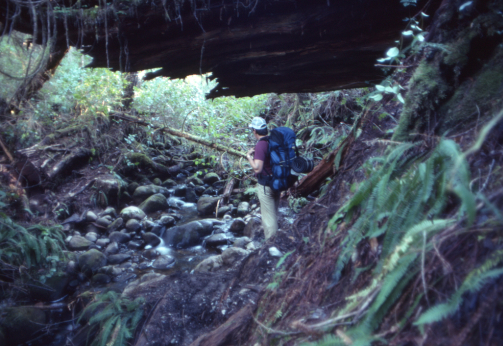
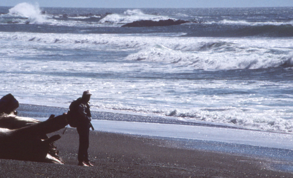
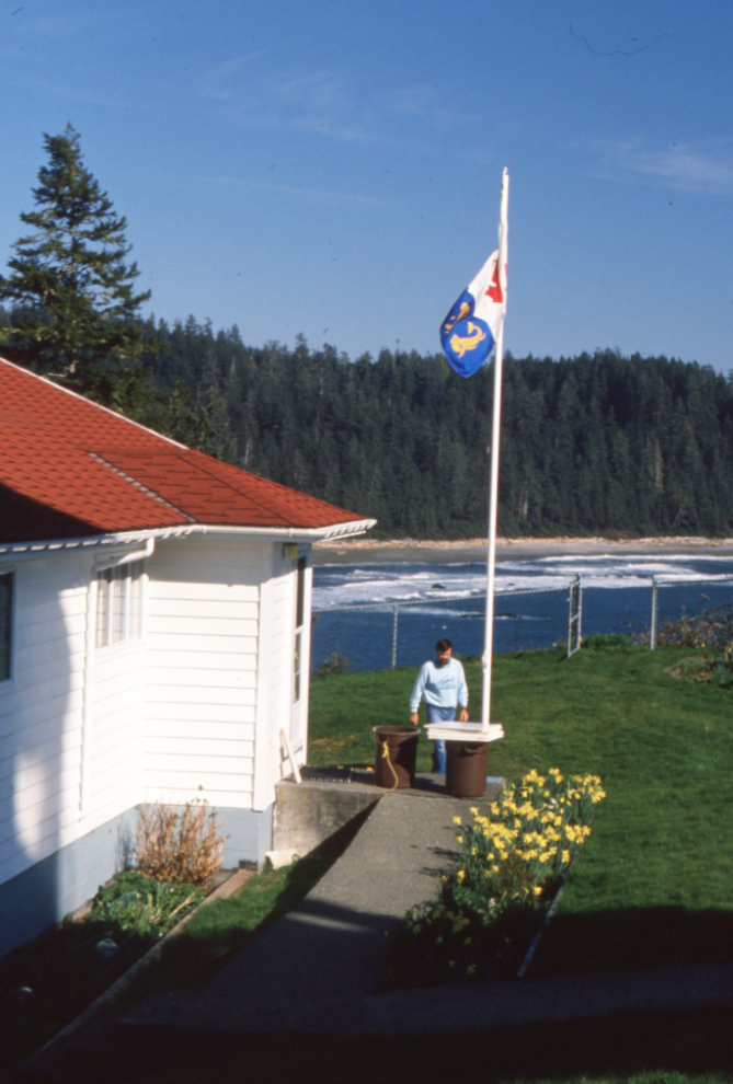
After crossing the creek several times, the creek became the trail. There we met lighthouse keeper Kurt Cehak, his girfriend (whose name I didn’t record), and their two dogs. Lorne had decided to try the creek barefoot but it wasn’t going well.
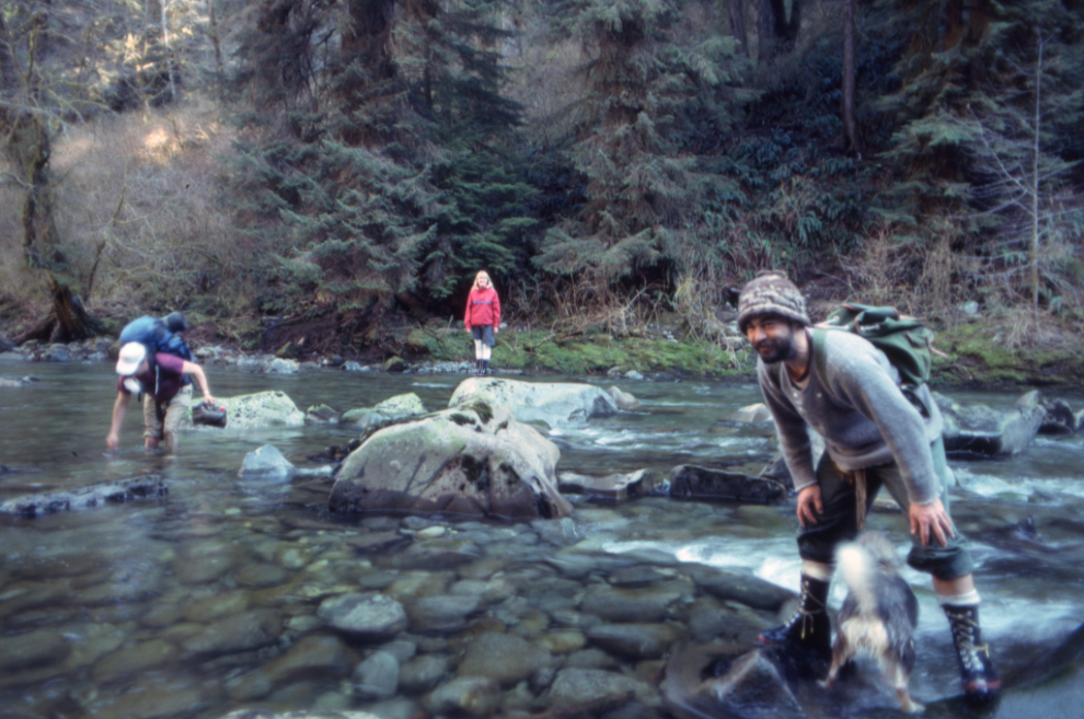
Lorne crashing through the brush along the creek.
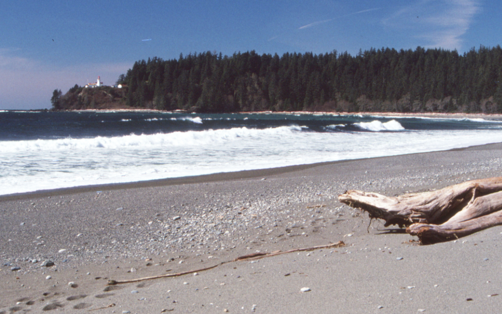
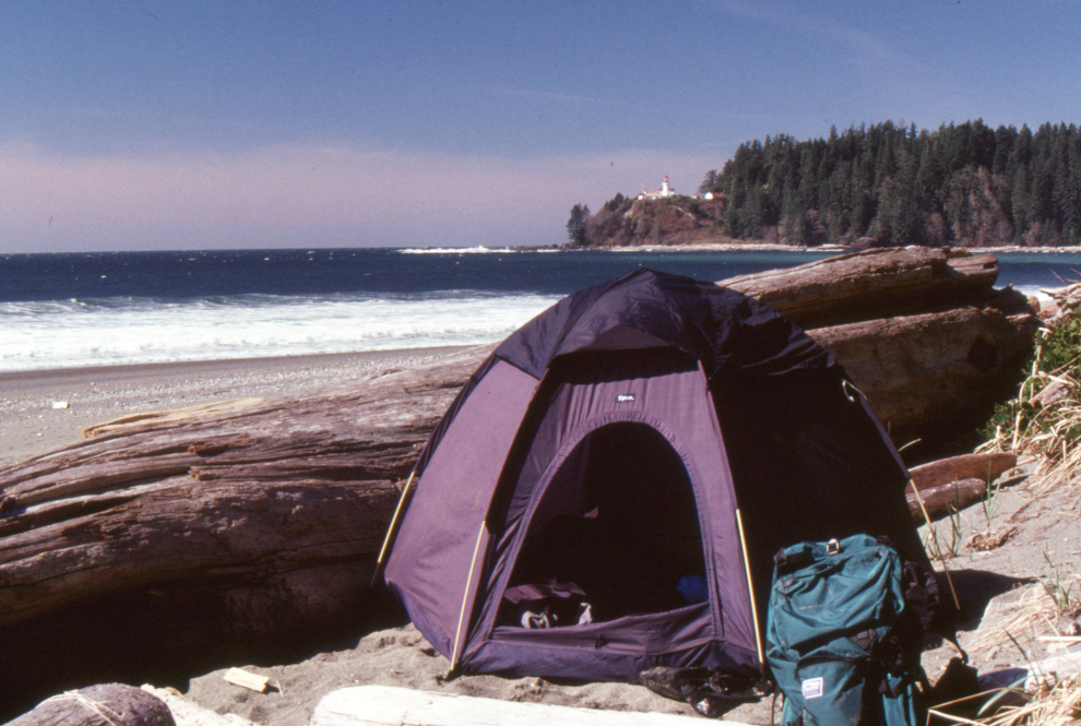
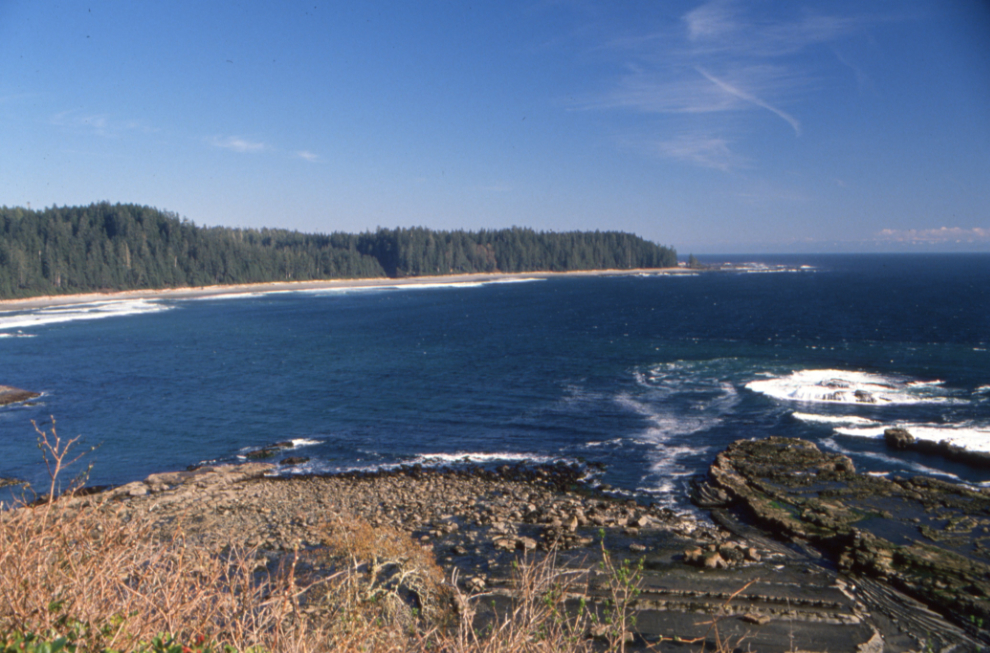
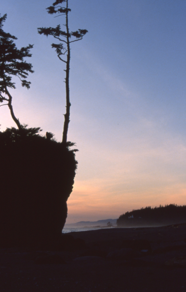
A memory that has come back is the incredible sense of relief at seeing the ocean after a difficult day. At this point we seem to have walked about 18 km from the truck.
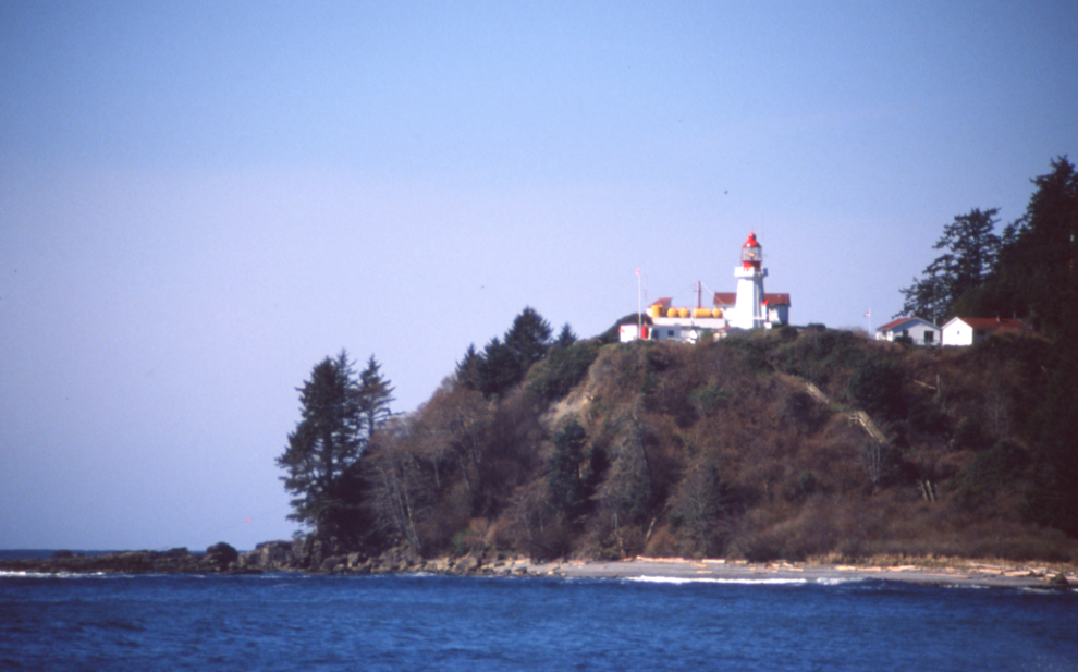
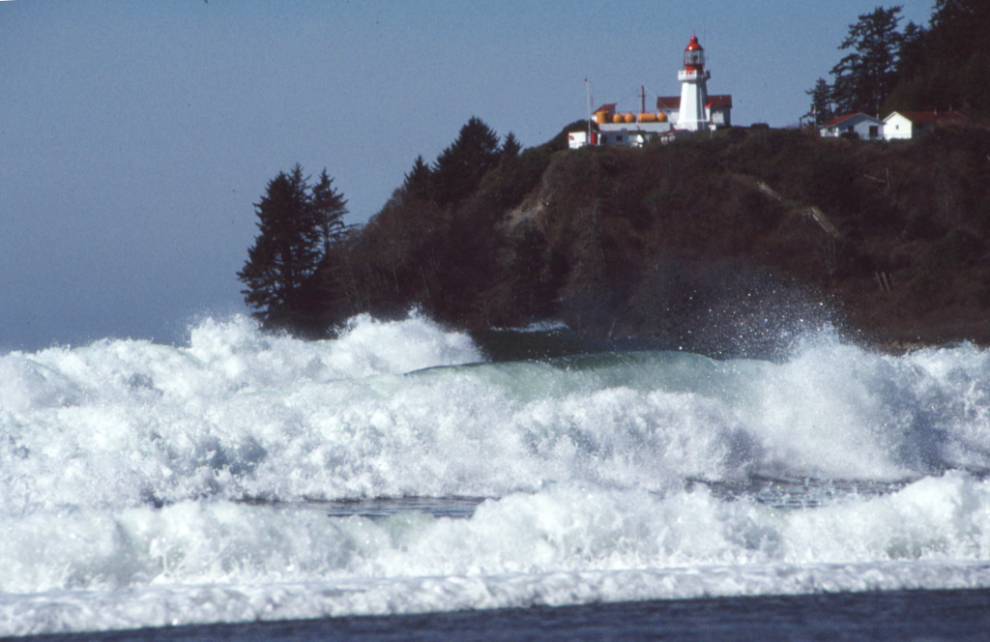
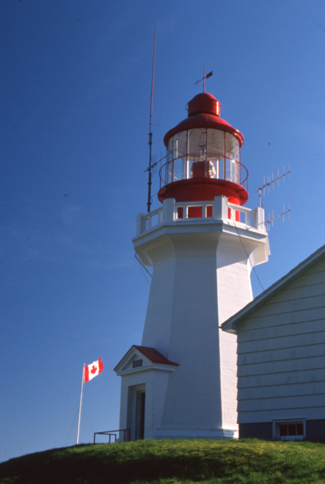
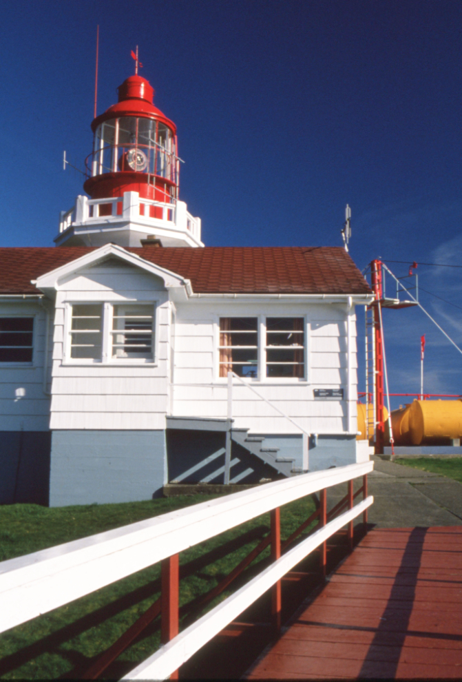
The beauty of the vast beach was greatly enhanced by the historic Carmanah Point Lighthouse.
We set up our tents then just enjoyed the beach for a while.
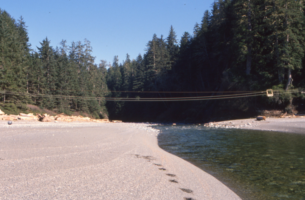
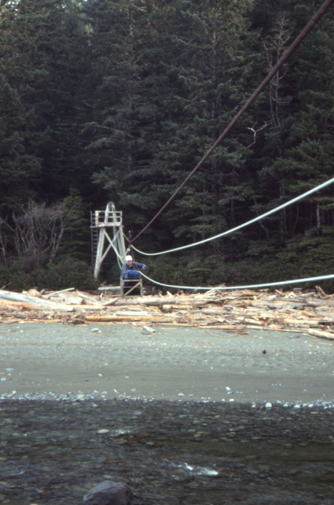
A cablecar takes hikers on the legendary 75 kilometre (47 mile) West Coast Trail across Carmanah Creek. It was built in 1907 to facilitate the rescue of shipwreck survivors along the coast, and was known then as the Dominion Lifesaving Trail.
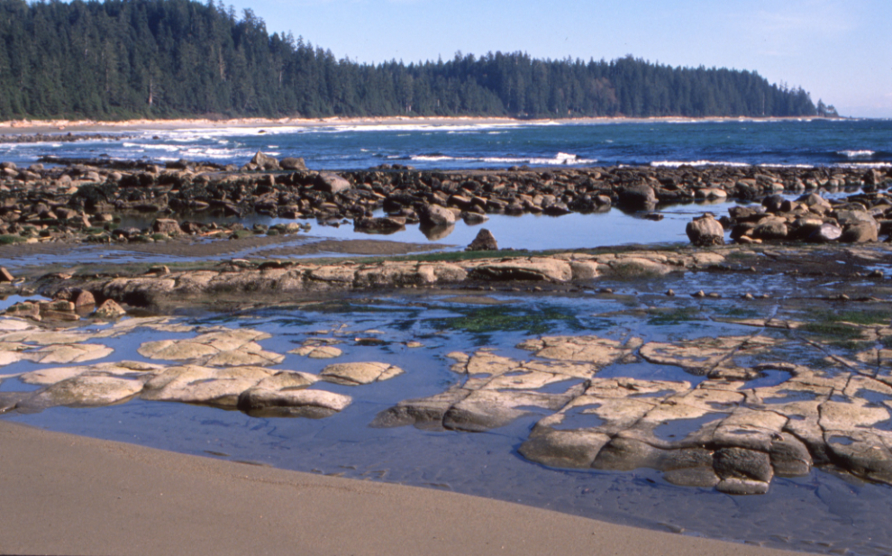
There are some fascinating outcroppings of rock along the beach.
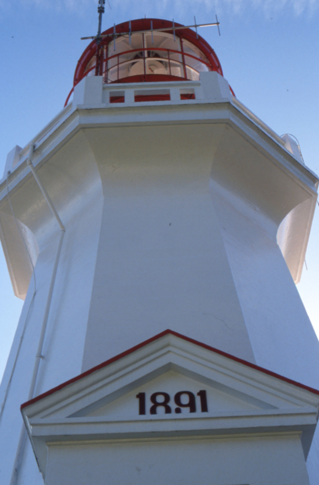
We then went to have a good look at the lighthouse. Parks Canada describes it: “Built in 1922, the Carmanah Point Lighthouse is a landfall light on the west coast of Vancouver Island that also marks the entrance to the Juan de Fuca Strait. Erected to replace the original 1891 combined lighthouse and dwelling, the lighthouse tower expresses the classically-inspired tripartite division of a column into base, shaft, and capital. The crisp pediment over the doorway and the heavy concrete balustrade designed to simulate those found on some of the more ornate wooden towers create additional visual interest in the otherwise uncluttered design. There are several structures on the site, including four related buildings that contribute to the heritage character of the lighthouse: (1) the 1957 spare dwelling, (2) the 1967 senior dwelling, (3) the 1967 junior dwelling, and (4) the 1978 engine, fog alarm, and radio building.”
On July 31, 2024, the Canadian Coast Guard announced that they were going to cease light keeper functions at Carmanah Point and Pachena Point light stations due to safety concerns (primarily instability of the soil on the point – the winch building and helipad had already been condemned. The site is now closed and visitors are not permitted on the property.
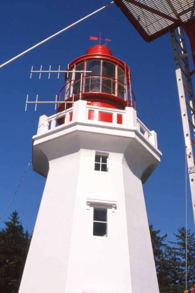
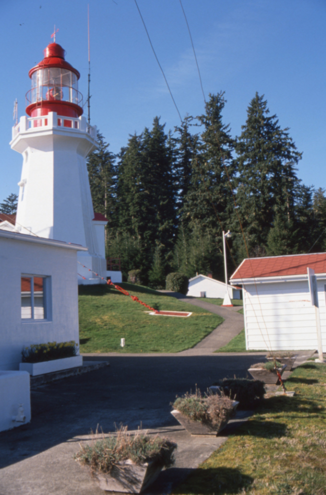
The final lighthouse photo shows the view back towards Carmanah Creek.
That night on the beach was spectacular – truly the West Coast at its finest.
The next day, because lower Carmanah Creek had be so difficult, we decided to take the cablecar across the creek and then find our own route through the forest.
It turned out to be worse than the creek. The forest is incredibly thick and tangled. Our clothes got badly torn and photography was all but impossible. We eventually met up with the WCWC trail, though.
Getting near the trailhead, we were reminded of the threat to this incredible place, with an active cut block right across the creek. The slide notes that this was on the Bonilla Main logging road.
A final photo of Lorne in the forest.
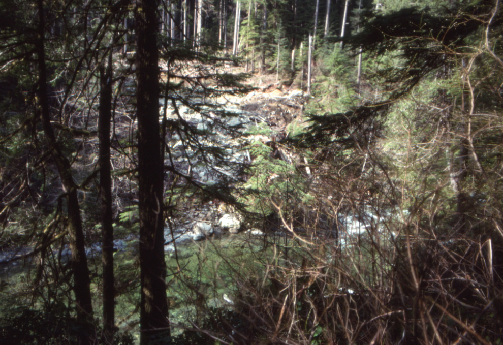
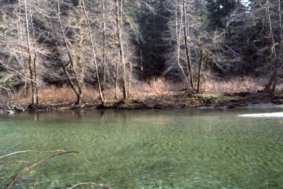
This lovely pool on Carmanah Creek is noted as being “west of Heaven Camp.”
The end. Loading up the truck again after an adventure that was both very difficult and very successful.
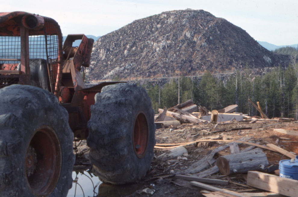
Back into many miles of logged country.
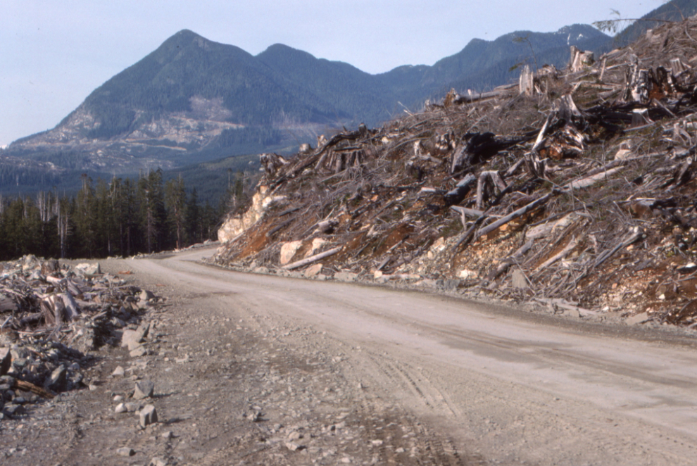
The final two photos of an area being actively logged were shot in the Nitinat Lake area west of Carmanah.
This has turned out to be a much more significant historical document than I had expected, with most of what we saw no longer being accessible. If you know of any group or museum that might be interested, I’d appreciate it if you would let them know. I would be happy to send a museum all 138 scans.
This is post #1,650 since I started the blog on April 25, 2006, and there are now a total of 26,466 photos.
Just finished scouting out the northern trailhead. We found overgrown logging road – lots of alders and devil’s club – hiked it for about 4 km, then came to a Y and veered left to stay close to the west side of Carmanah Creek. After about a km it got too thick and we turned around (we had some visitors from NS who weren’t that thrilled with this type of hiking 🙂 ) I was trying to find the ravine to cross to pick up the old trail, to come back and tackle it later. Yes, I’m aware of how overgrown and slow-going it would likely be. At what point does one get on the river’s east side? I note the trailhead probably looks different today. Cheers!
Hi Mike. I’m rather surprised that you can even get near the northern trailhead now, from the rare reports I’ve seen. It’s not the sort of hiking that many people are into! I’m currently in Greenland, where crashing through heavy brush is never a problem! I would love to get back to the Carmanah, but that’s unlikely to ever happen now.
Hi Murray, thanks for posting this story and photos.
My girlfriend and I did that trek around the same time and I still remember some details. We were very fit mountain bikers and actually took our bikes with us. The first night we camped near the trail head. I had the WCWC trail map with all the highlights and a note about the trail to the ocean. Day two we wanted to see the Carmanah Giant, after the initial creek crossing the trail became unusable for bikes. We ditched them and set off on foot. After the Carmanah Giant the trail became very sparse but had the orange diamond trail markers (though they were very far apart). We made it to the Pacific (I still remember hearing it long before we actually saw it)! Sat and took in the place, snapped a couple photos, then started heading back. It was pretty sketchy and became dark by the time we got to the bikes. Thankfully they had lights and we made our way out. Crazy shit you do in your twenties!
Hey Dean, I apologize for taking so long to reply. I had to read the first part of your comment twice just now – the Carmanah on bikes!?!? Yes, that’s wild. Quite an adventure – thanks for sharing it 🙂