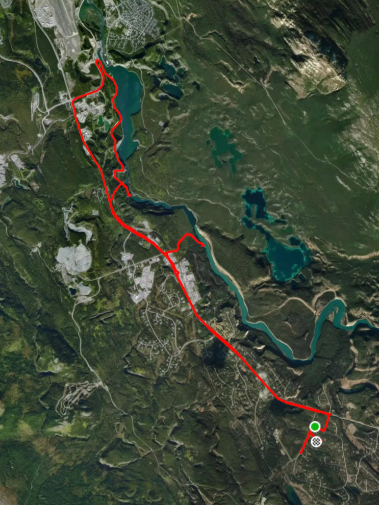
90 km wandering around Whitehorse and south by e-bike
I have to begin by making a comment or two about yesterday’s election. I’m extremely pleased by the results generally. The two big wins for me are seeing Mark Carney remain as our Prime Minister, and seeing Bruce Fanjoy soundly beat Conservative leader Pierre Poilievre in the Carleton riding. For the average Canadian there are advantages to having a minority government, so I’m also okay with that. The only disappointment is seeing the NDP take such a big loss, due primarily to strategic voting to get rid of Poilievre.
Now, with politics out of the way, we can enjoy the approach of Spring 🙂
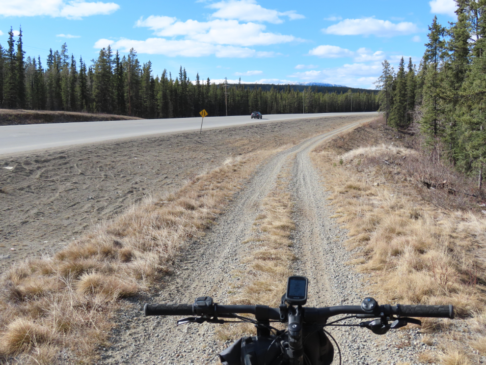
On Saturday and Sunday (April 26th and 27th), I took the e-bike out, and rode just over 40 km on Saturday and then just over 50 km on Sunday. The forest trails are still mostly impassible due to snow, so these were on roads and open road-side trails, but in this post I want to show you the huge variety of places available even with those limitations.
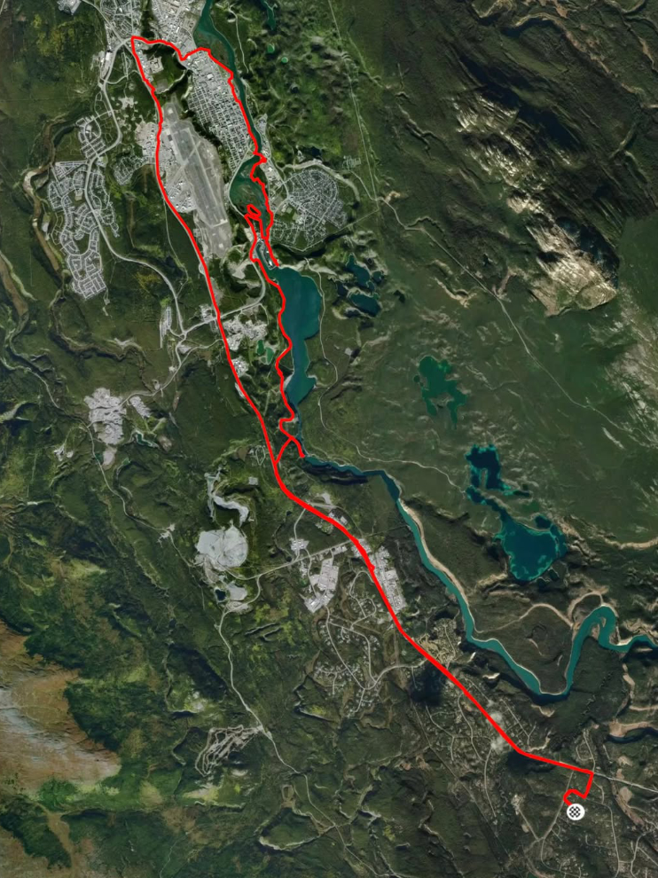
First, here’s a map of the 40-km ride. You can see details on my Strava page.
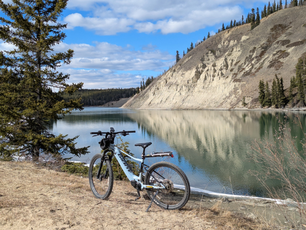
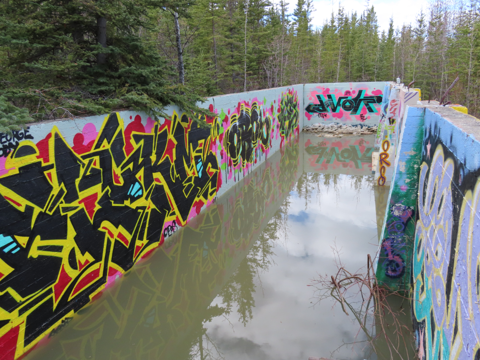
My first detour off the Alaska Highway as I rode towards Whitehorse was down the narrow gravel road to “the American laundry” on the shore of the Yukon River. When the highway was being built, the U.S. Army built a laundry here, and the concrete shells of two buildings remain.
It’s a popular place to party, and the ashes of a large bonfire were still warm, but there was none of the garbage that can often be expected at such places. A large pile of heavy wooden shipping pallets stacked close by will provide fuel for a few more bonfires.
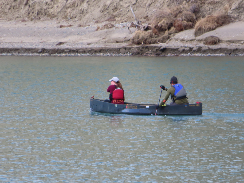
A canoe passed by just after I arrived. A marathon racing canoe like that, made by the H2O Canoe Company of Tavistock, Ontario, costs $5-6,000, so they are almost certainly training to run the Yukon River Quest in June.
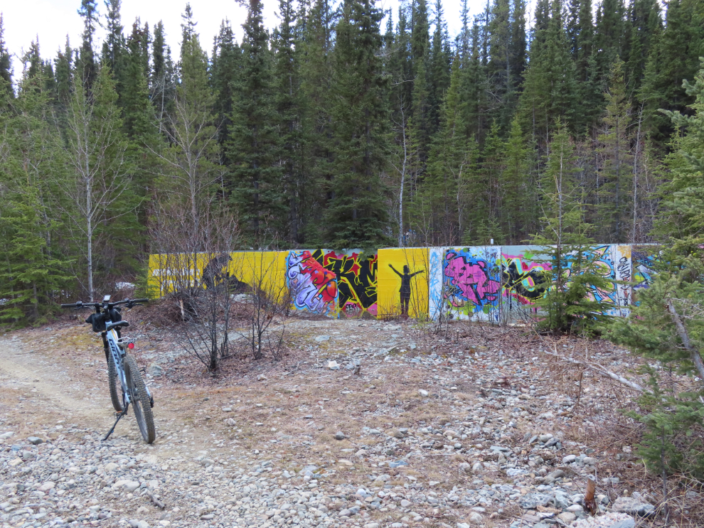
The historic incinerator by the airport is probably the best-known graffiti gallery in Whitehorse, but “the American laundry” is much better.
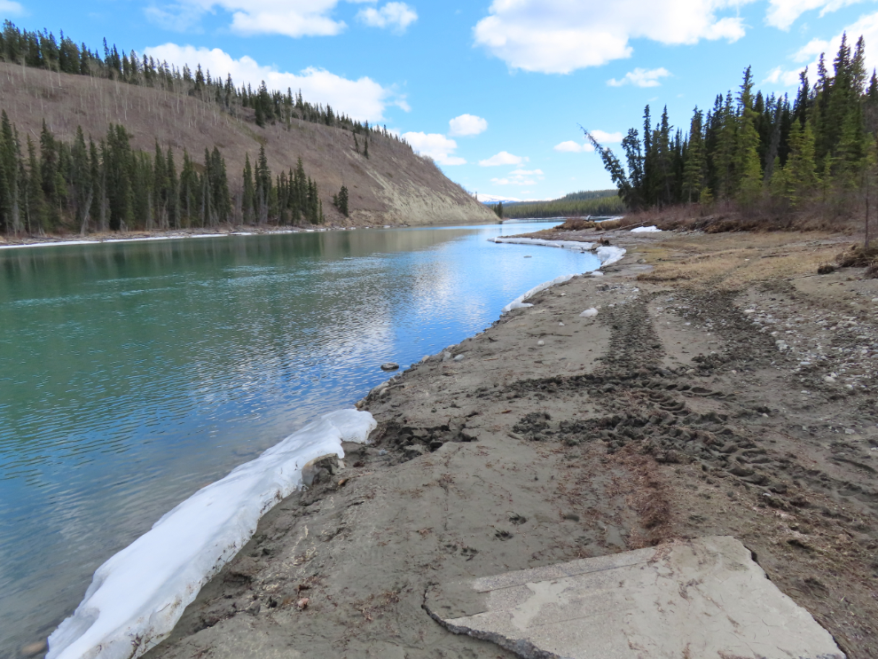
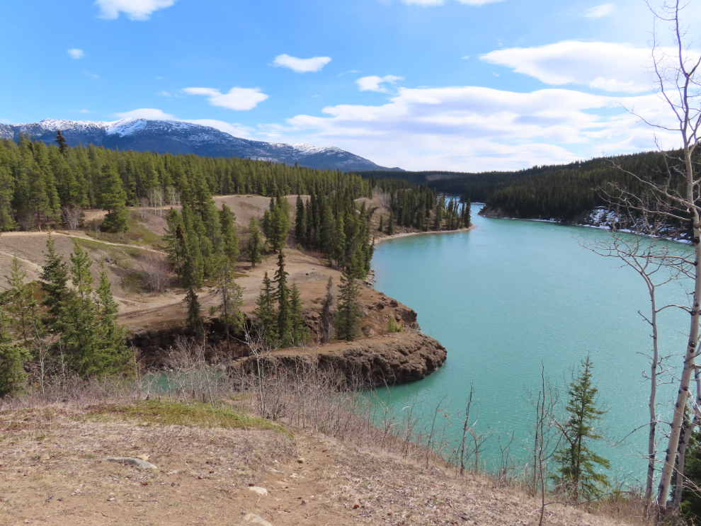
The view up the river.
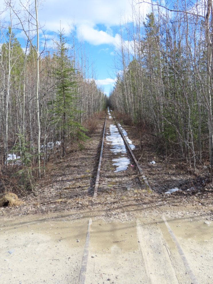
The road crosses the White Pass & Yukon Route railway line just before reaching the highway. Though not used for 20 years or so, this section of the line was cleared some 25 years ago – I never have figured out why, as there was certainly no plan to re-open the line.
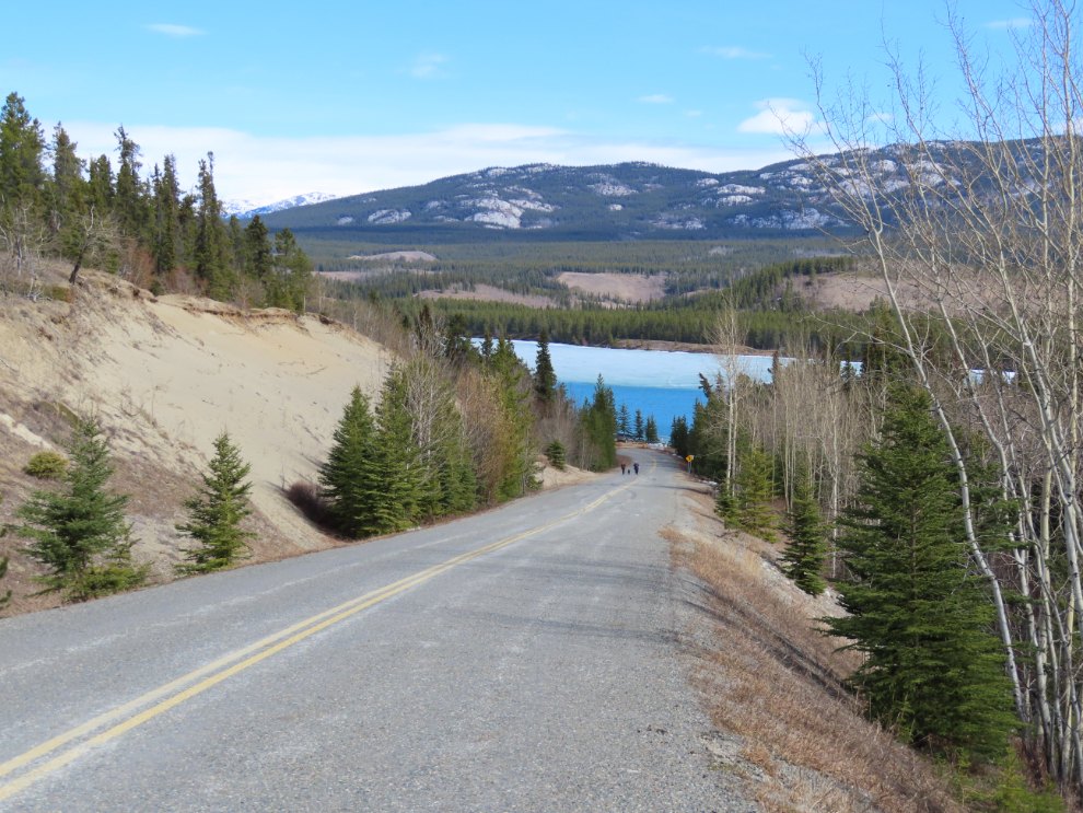
Starting at the road to the American laundry, there’s a good trail beside the highway almost all the way into town. I really hate riding on the highway shoulder, even though it’s wide and paved.
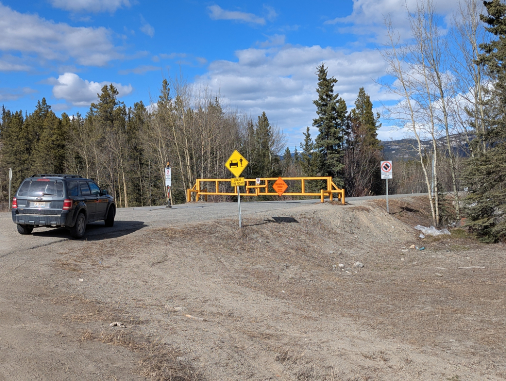
The best detour is the Miles Canyon Road, especially now when it’s closed to vehicles (the seasonal closure ends May 1st). I wish the City would make it a one-way road, with one lane for vehicles and one for walkers and bikes, as it’s a very popular route.
A side road off the main Miles Canyon Road leads to the canyon, but views of the canyon from the road are limited.
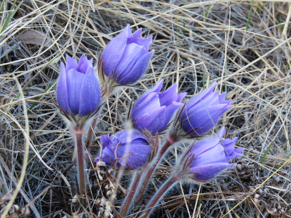
Continuing on, I stopped and walked up a trail that I know is a good place to find crocuses, our first Spring flowers. They are Prairie crocuses (Pulsatilla patens).
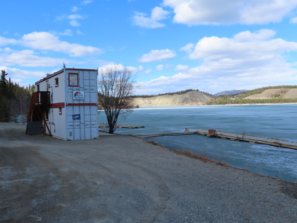
Alpine Aviation has moved their mobile office back down to the Schwatka Lake float plane base, but it will be a while yet before the ice leaves that shaded part of the lake.
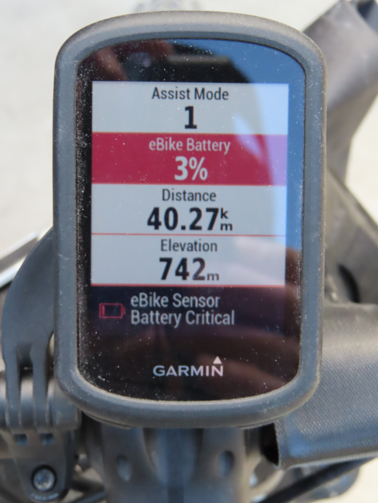
From there I rode up Robert Service Way (the South Access) to the highway, and returned home. I rode around close to home to get the 3 km or so needed to bust 40 km 🙂 (the battery was only at 65% when I headed out).
Next, a map of Sunday’s 50-km ride – details here.
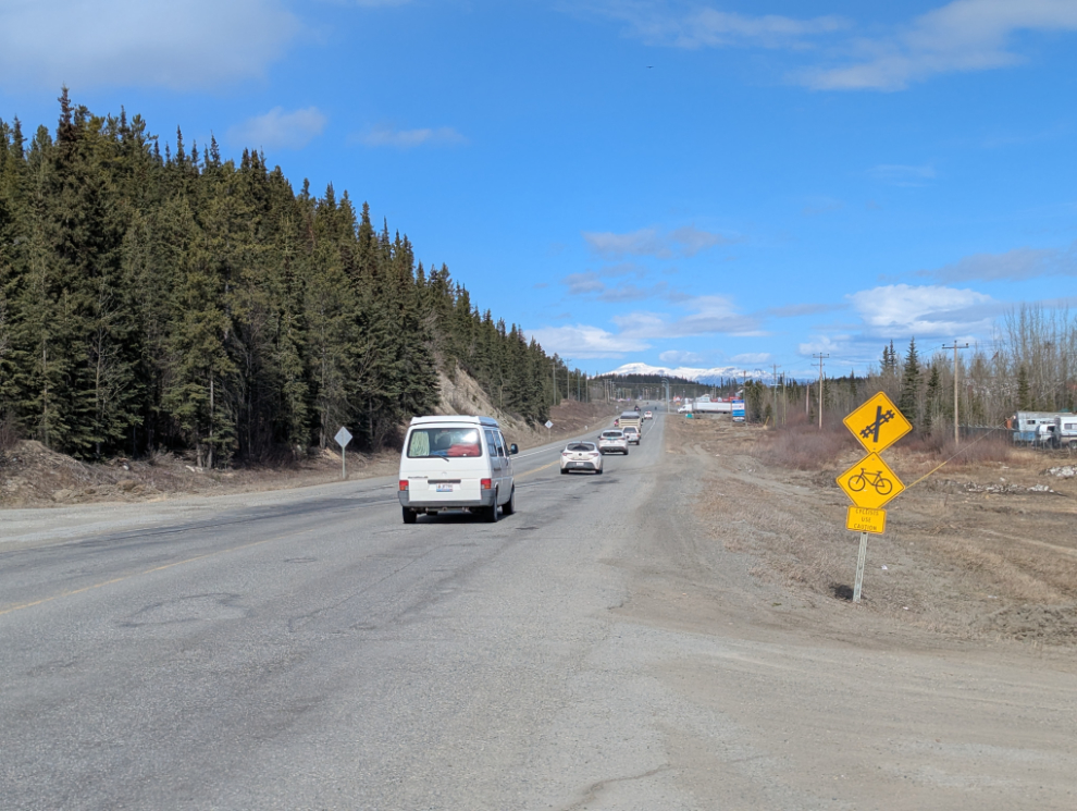
I had the bike battery at 100% this time, and told Cathy that my goal was 42 km. The first photo was shot where the Alaska Highway crosses the rail line at McRae.
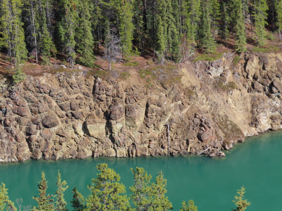
I rode down Miles Canyon Road and the side road to the canyon again. This view of the head of the canyon is hidden from the road by a ridge about 8 feet high, but I walk up here often because it’s such a lovely view, especially when the trees have their Fall colours.
The view down to Schwatka Lake on Miles Canyon Road. The hill is very steep.
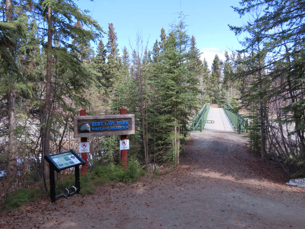
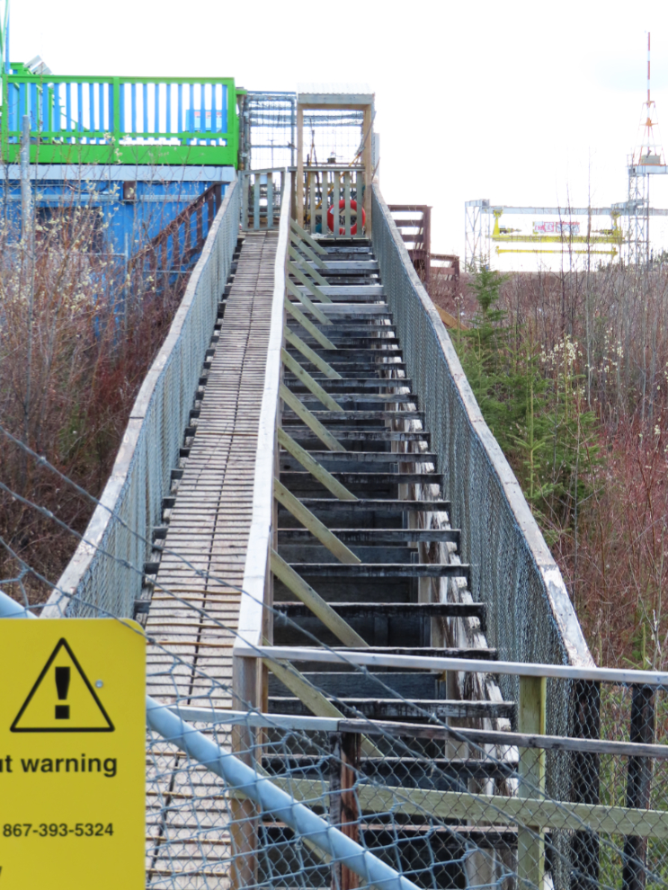
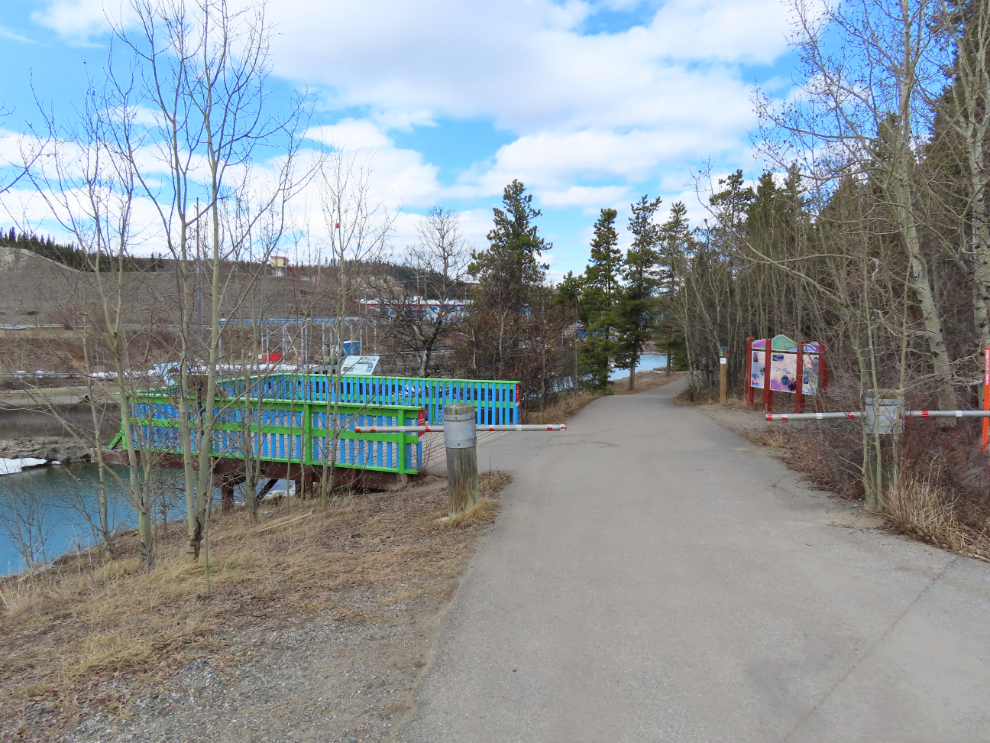
Next, I decided to ride around the paved 5-km Millennium Trail. The bridge to Bert Law Park, a small island in the Yukon River, prompted a detour.
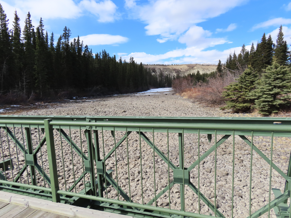
A narrow dirt trail circles the island – this is the best view along it. The river is extremely low, and two people were out there walking their huskies.
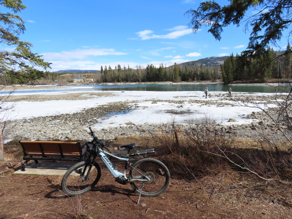
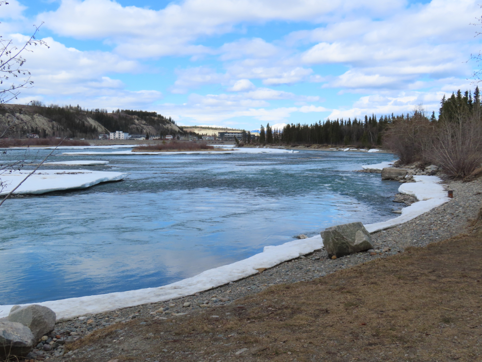
The river is actually so low right now that the park isn’t an island.This will be a river again in a month or so.
Back on the Millennium Trail, riding upriver. Some very wide cracks are developing in the pavement as the ground slips toward the river – wide enough to cause a crash if you hit one with a bike tire, and a warning sign has been posted.
After crossing the river on the Millennium Bridge, I rode up towards the power dam. This is the view down the river from a viewing platform with a few interpretive signs.
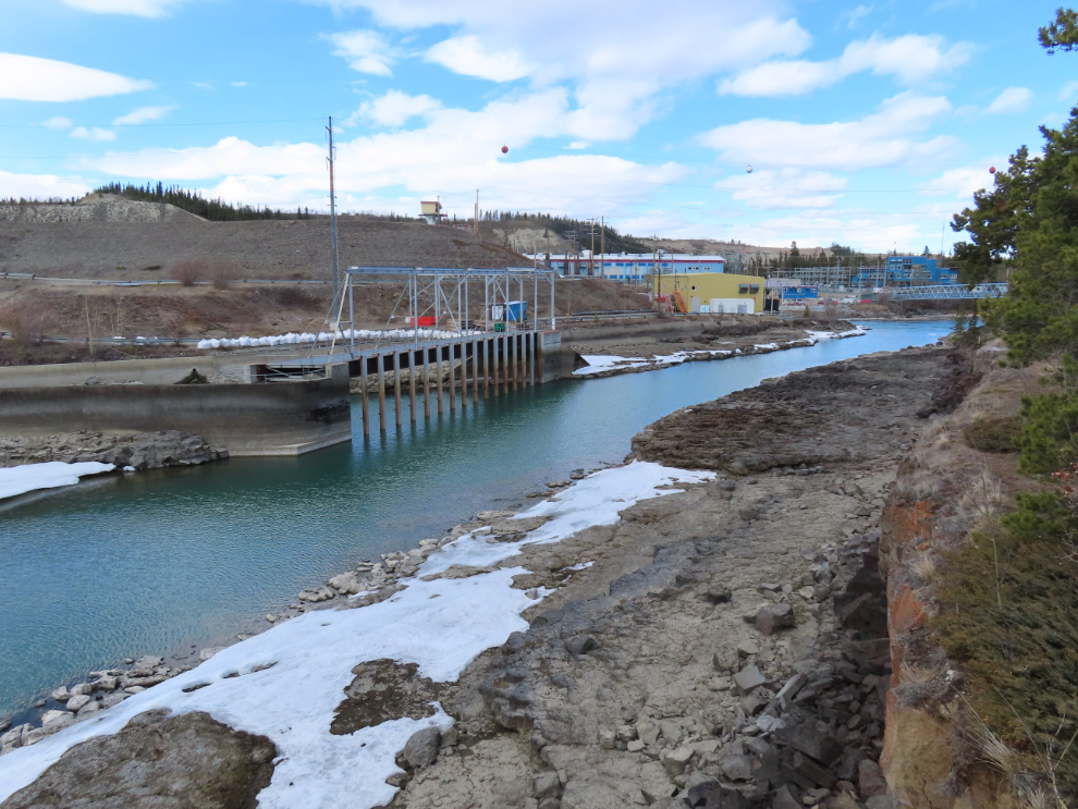
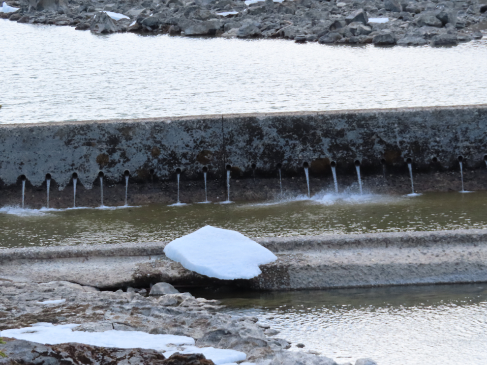
There’s not much water coming through the concrete weir that directs fish into the fish ladder that allows them to get around the dam.
This is a small section of the world’s longest wooden fish ladder. In the summer, you can watch salmon and other fish go up it, with windows at an interpretive centre along it.
This is the total flow over the dam, though there’s much more in a bypass channel. The diesel and natural gas generators are supplying most of our electricity now – that area was very noisy as I rode by.
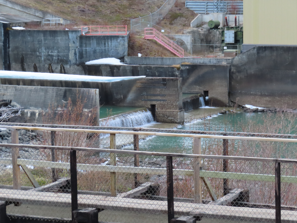
This is the viewing platform I mentioned, as I headed downriver towards town.
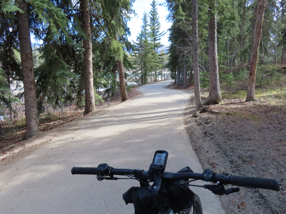
Most of the Millennium Trail is close to the river, but it does go off into the forest for a while.
As I passed the fancy skateboard park, I was very surprised to see a lot of little kids on scooters and bikes using it. I ask a much older fellow if the littles got special hours or days to use it, and he replied that “they just appear.” He said he goes early in the mornings now.
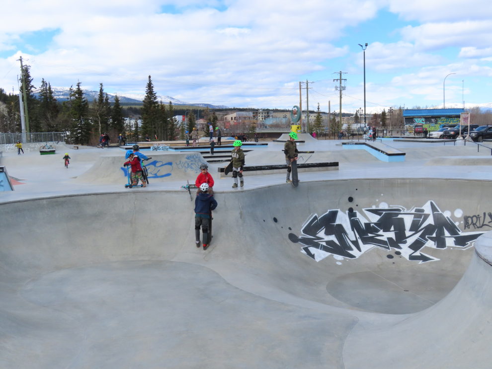
At many points along my ride, there were a lot of people out walking or riding bikes, and dogs were also common.
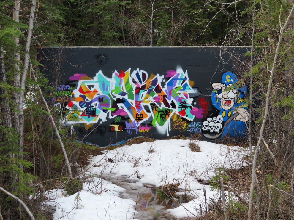
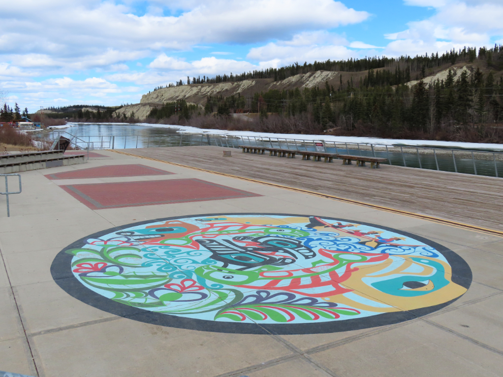
Along the Waterfront Trail at The Wharf, I noticed a painting I don’t recall seeing or hearing about before.
I’ve found riding through town to be very challenging in the past, but this ride was much easier, and I feel that a session with my osteopath last week has got me to a new level in my brain injury healing. In particular, finding the correct route and dealing with intersections caused little stress this time. I shot the next photo as I was about to climb Two Mile Hill, the northern access to downtown from the Alaska Highway.
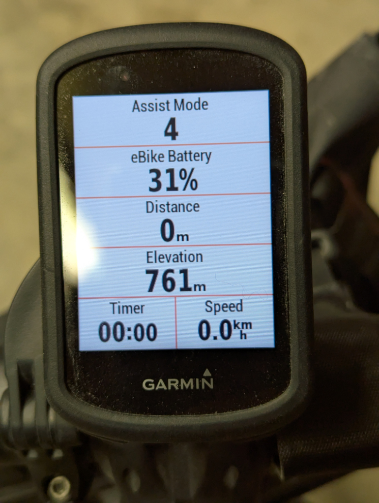
When I got to the top of Two Mile, I noted that I had used 1.1% of my battery power per kilometer, riding most of the time at the lowest power setting. Riding towards home on the Alaska Highway, though, I had a strong headwind and had to boost the power assist. I got home just 10 minutes before I had to drive into town for a brain injury support group meeting, with 31% battery left. I’m very pleased with that.
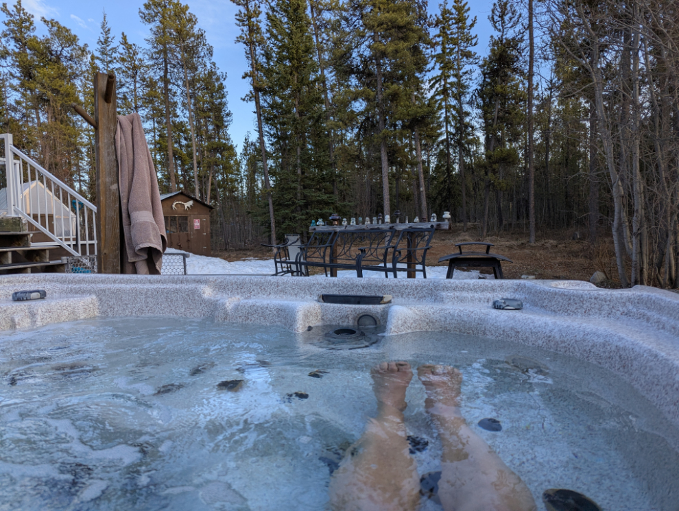
After an extremely busy day, this was a fine way to end it 🙂
I really enjoyed this post — it’s amazing how much history and natural beauty can be packed into a couple of e-bike rides! Your note about the “American laundry” is especially interesting — I hadn’t heard of it before, but now I’m keen to check it out next time I’m in the area. I recently ran into some quiet corners of Yukon history too. Always inspiring to see how much can be explored with just two wheels and some battery power. Also — great to hear about the progress with your brain injury recovery; that’s encouraging on so many levels.
Thanks for your photos and commentary, always a pleasure to relive some of that country vicariously. In ’84 I did a bike tour of YK/AK, island hopping from Seattle to Skagway, on to Fairbanks, with a few side trips on trains and planes, then back via Denali Hwy. I had to hop on a bus to get from Tok to Haines because both my knees and wheel bearings were worn out. My cousin was married to the Murdoch clan, who ran the Frantic Follies Vaudeville Show in Whitehorse, and I happened to be there for the season opening performance. Very fond memories.
It’s always nice to hear that something I’ve posted has brought back some good memories – and I expect there are many from a trip like that! Thanks for sharing a bit of it, Steve 🙂