Exploring Atlin, inc. the historic Boulder Creek dam
Atlin has been on my mind a lot lately, and I’ve just spent another 3 nights there, from Friday, August 6th to Monday the 9th. I had two offers of accommodations, but it took me a while to give up the idea of taking the motorhome with Bella and Tucker. This was my most productive visit ever to Atlin, and I have 385 photos and a lot of information to process in various ways. As I start writing this post, I have only the vaguest idea of how the 3 or 4 posts will go.
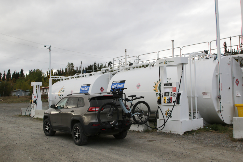
I had a meeting Friday afternoon so didn’t get away until late. It was 6:10 when I stopped at Jake’s Corner to top up the tank on Cathy’s Jeep, to hopefully avoid the extremely high fuel prices in Atlin.
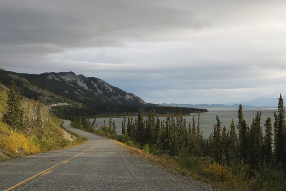
The weather forecast was for mixed cloud and sun all weekend, with highs of 13-15°C and lows of 2-6, right at the seasonal norms. The view to the distant south along Little Atlin Lake, though, made me glad I had at least brought the raincover for the e-bike.
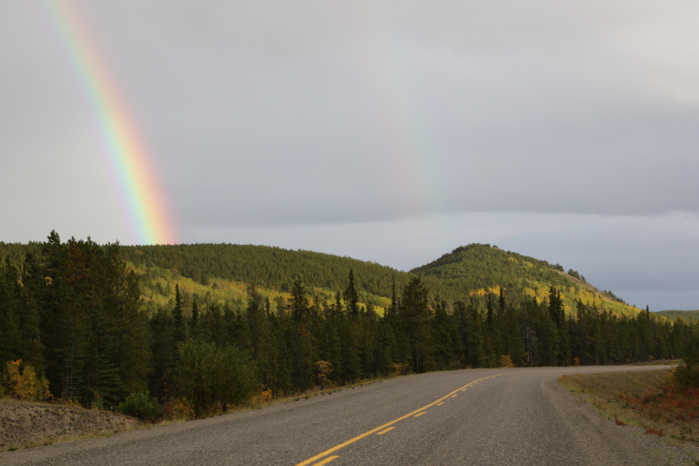
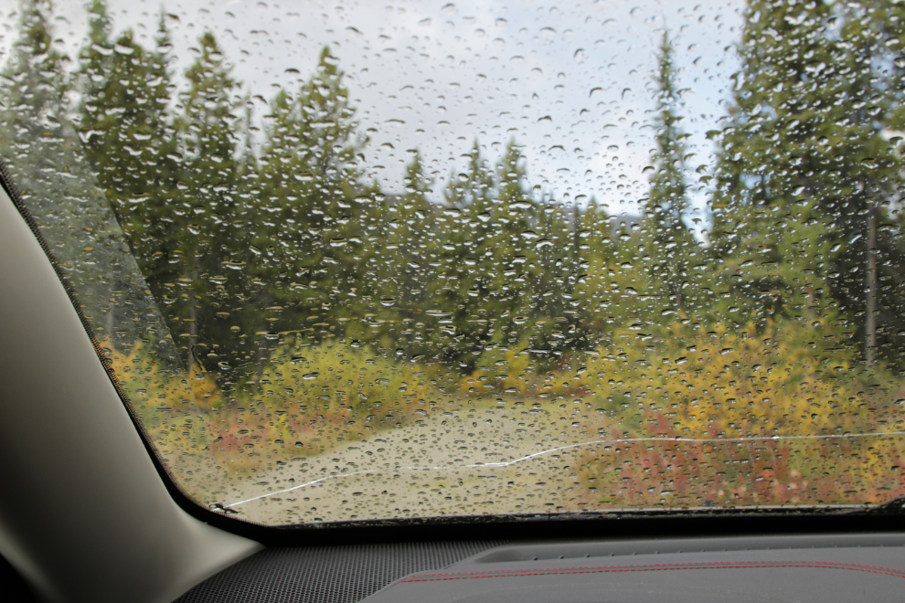
I hit some rain in a few spots as I got closer to Atlin. Enough to stress me out about the bike but not enough to try to figure out how to put the raincover on, and it did produce some nice rainbows, this one at 6:30.
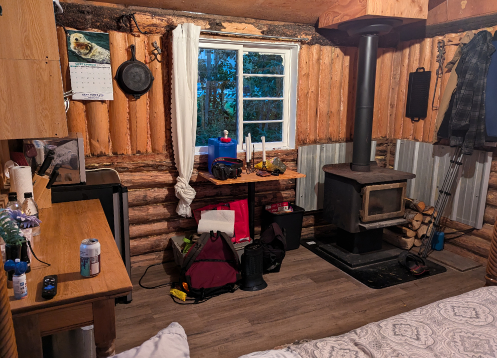
I had to decided to accept an offer from a couple I had only met online, to use one of the cabins on their large property that they’re turning into a nudist-friendly place. They were in Whitehorse and wouldn’t be home into midnight, but I settled into the lower cabin.
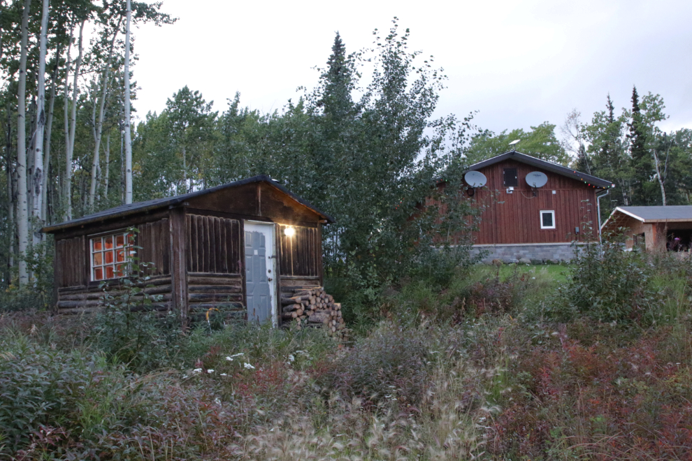
As I had expected, this cabin was perfect for me. It had been a long day – I went to bed, and would meet my hosts in the morning.
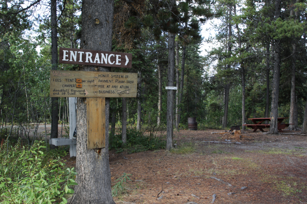
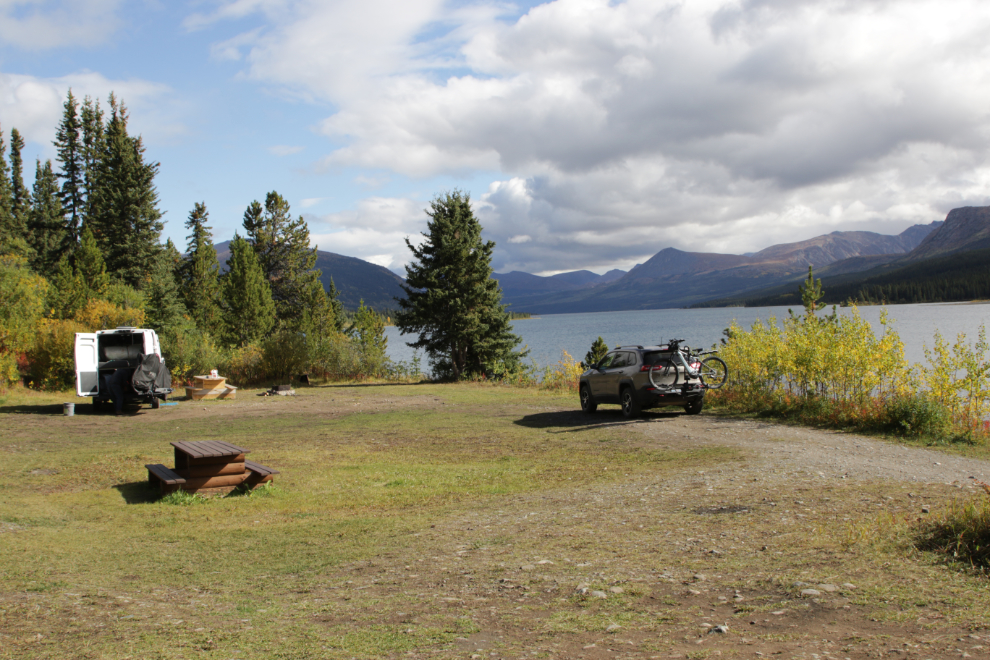
I had a lengthy chat with Rick Cowan and his wife Tina St. Cyr the next morning, and it was clear this was going to be an excellent trip. Then I headed out exploring, with the community’s Pine Creek Campground, a few miles further down the Warm Bay Road, my first stop, mostly just to get some current photos of it.
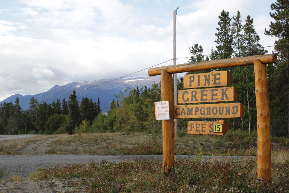
The campground has been there for many years, and was designed for tents and smaller RVs, but is very pleasant and well maintained. The $15 fee per night is on the honour system, and can be dropped off at any Atlin merchant.
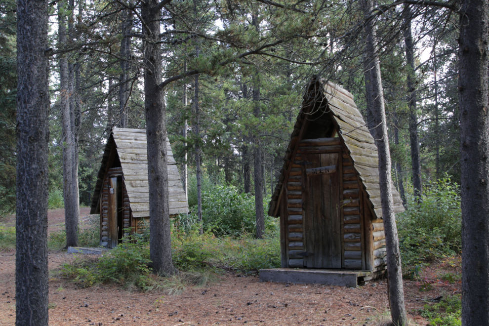
One of the outhouse pairs.
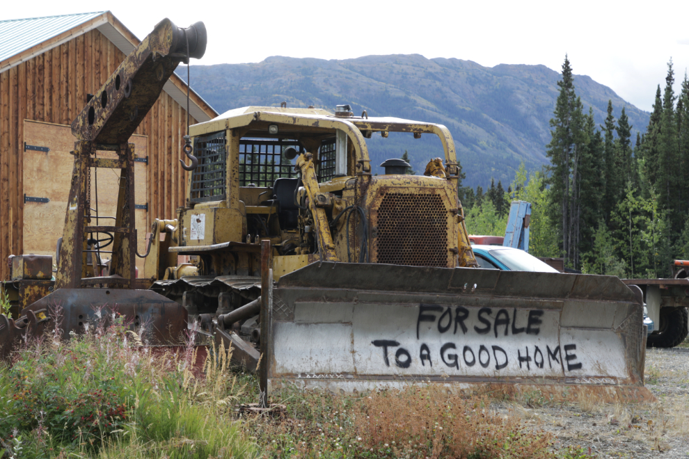
Note to Cat lovers – an Atlin Cat lover has a mature one with the usual markings for sale to a good home 🙂
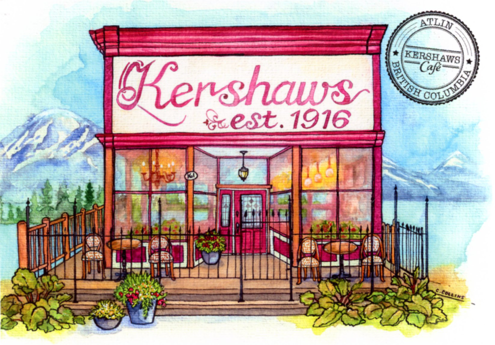
One of the 3 must-visit places on my list for this visit to Atlin was Kershaws Café, so I next went into town for a coffee and muffin. I had been chatting with the owner when I arrived, and as I was enjoying my morning treat she brought this postcard out to me, featuring a painting by Atlin artist Cass Collins.
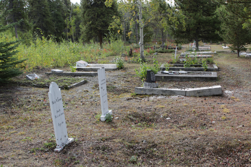
Spotting a sign pointing to the Atlin Cemetery resulted in a spur-of-the-moment detour to get started on adding photos to my Atlin Cemetery page at ExploreNorth. I shot 79 of the 130+ graves this time.
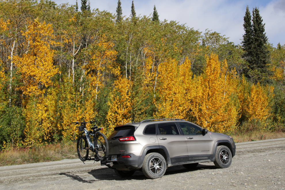
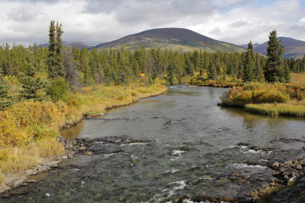
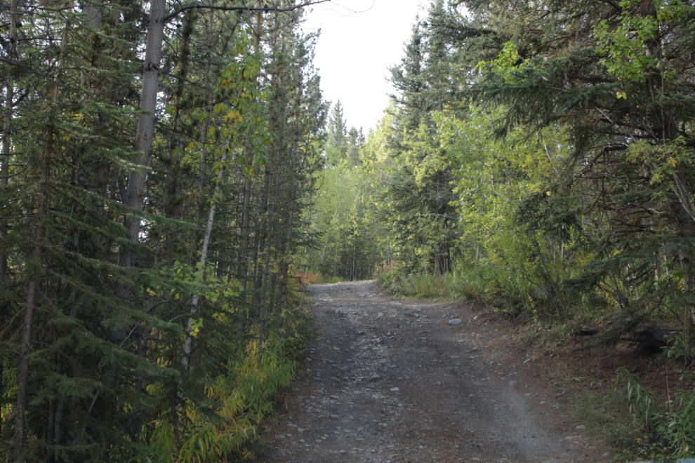
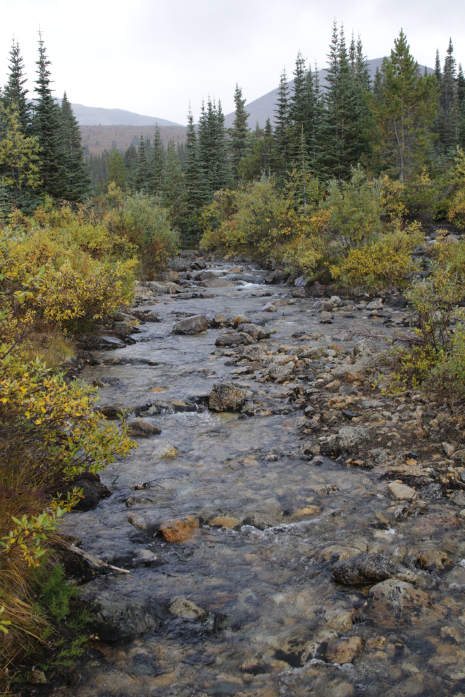
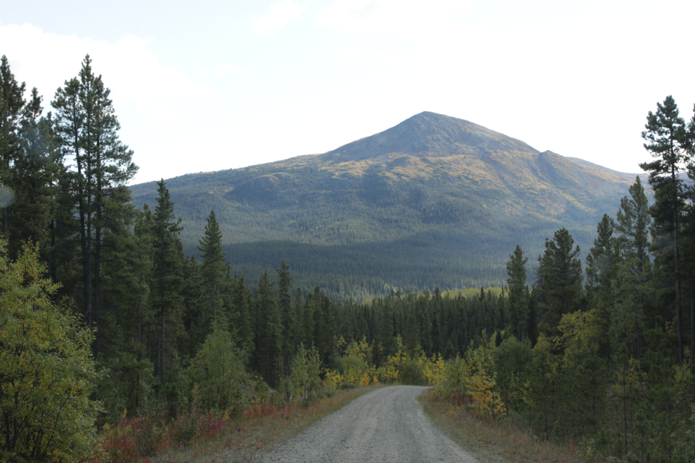
Heading out the Surprise Lake Road just before 11:00, I found Fall colours to just be getting started, with the occasional pocket of brilliant colour.
Looking back at the Birch Creek Bridge after crossing over it.
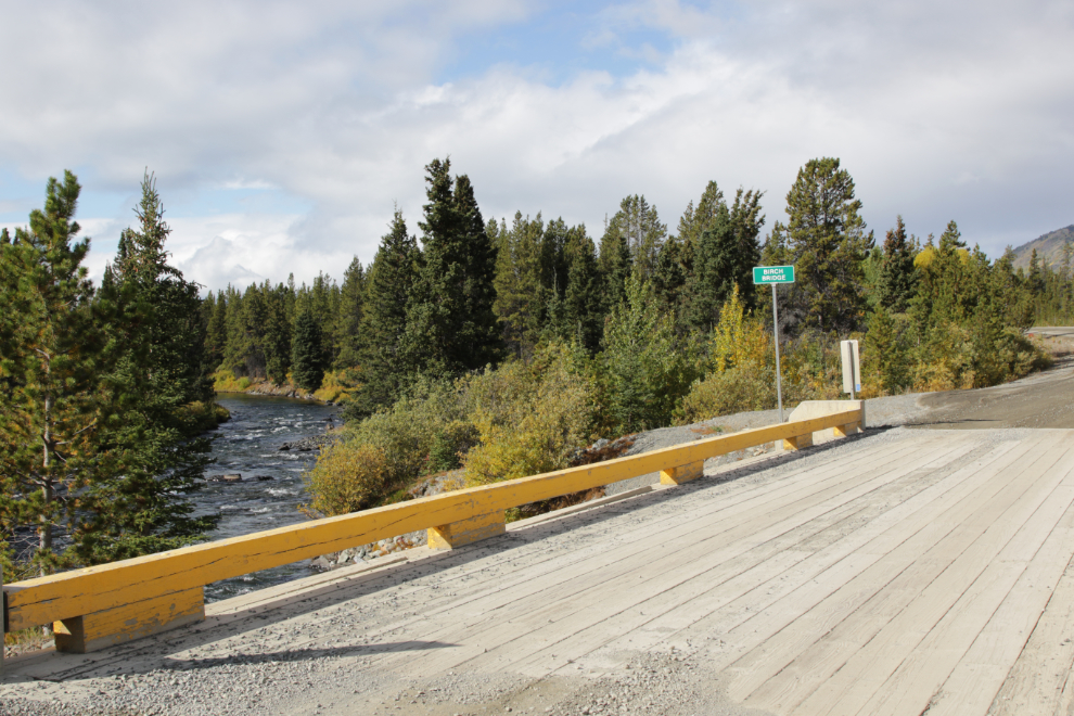
Looking up Birch Creek.
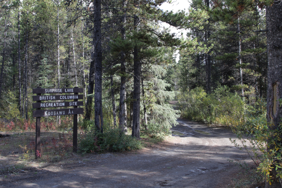
At 11:20 I made another detour, planned to just be a quick one to get a photo record of the Surprise Lake Recreation Site.
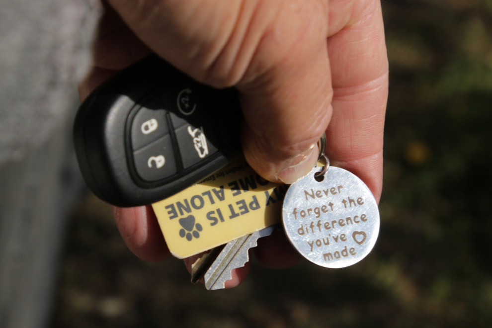
Getting out of the Jeep, I noticed the tag on Cathy’s keychain, a gift from her staff when she retired in May. Sometimes the smallest gift can be the most meaningful.
There were 2 RVs down at the lakeshore. The owner of the van on the left was busy getting ready to leave. I walked over and asked if he was going to take his bike out – he said no, it was more of a city bike, and then we got into quite a conversation about his trip. He’s from Georgia, about my age, and was on a very lengthy wander, with no plans – might end up in Mexico eventually. He had gone up the Dempster Highway a little way, but decided that continuing that drive made no sense at all, because “there’s nothing up there.” We discussed that idea for a bit, and my thoughts about how incredible the Dempster is also made no sense to him. Different strokes…
Climbing back up to the Surprise Lake Road.
Although there are lots of signs of mining activity, mostly along the creeks, they are relatively small in the vastness of the country, considering the huge sums of money that have been spent in the Atlin area over the past 126 years.
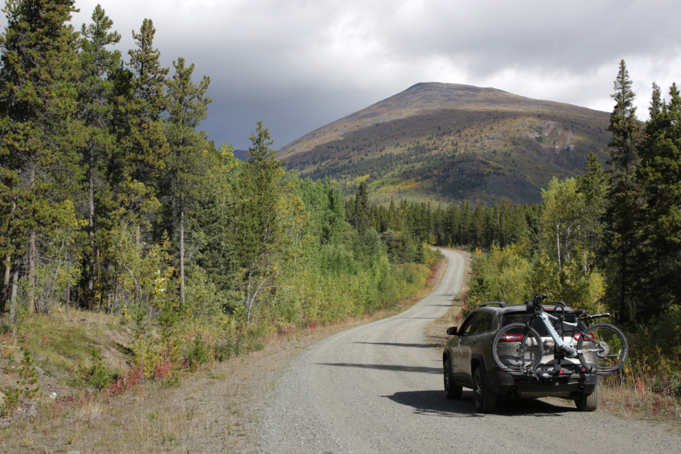
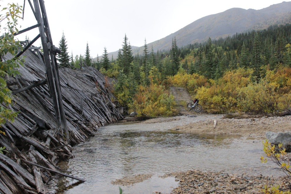
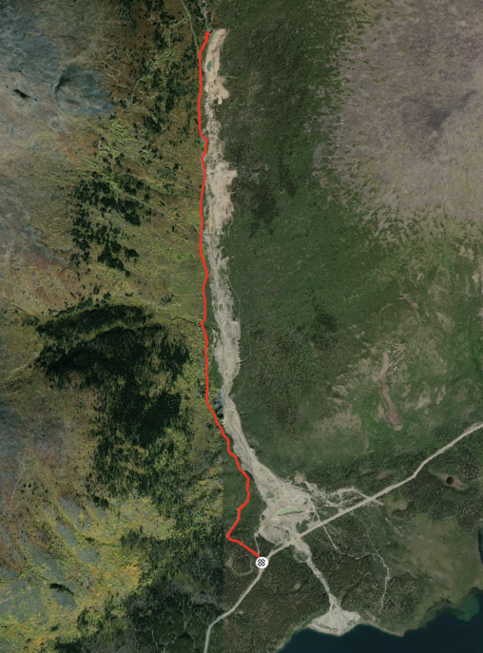
At 11:45 I reached my primary destination of the day, Boulder Creek.
I drove past the Boulder Creek Road, down to the bridge over the creek, to start my photo-record there.
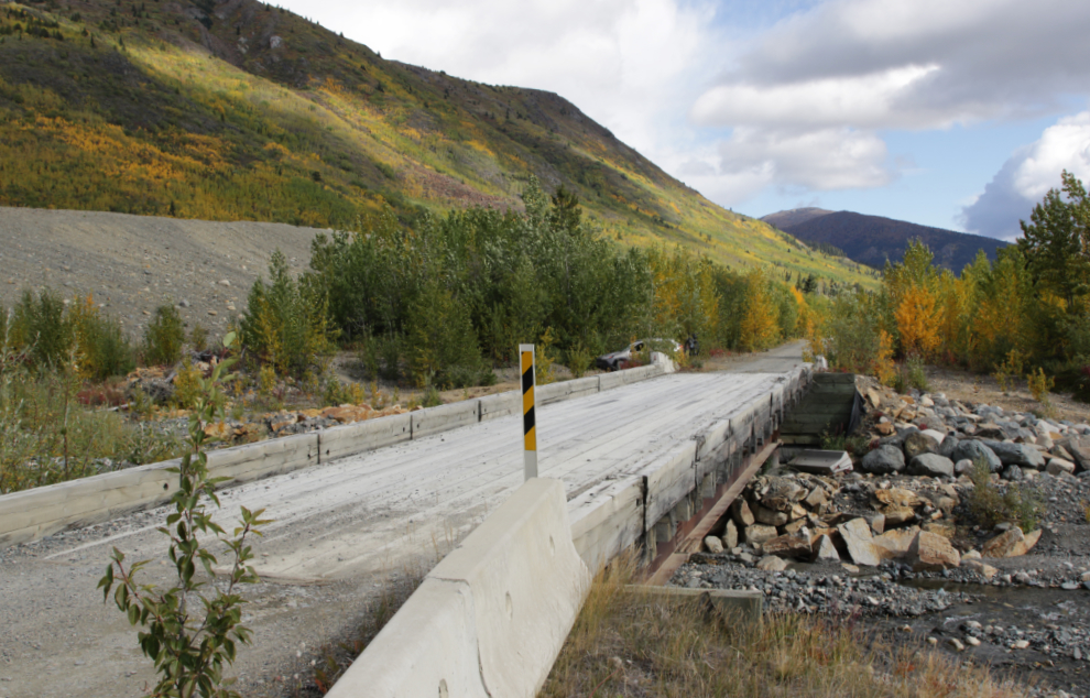
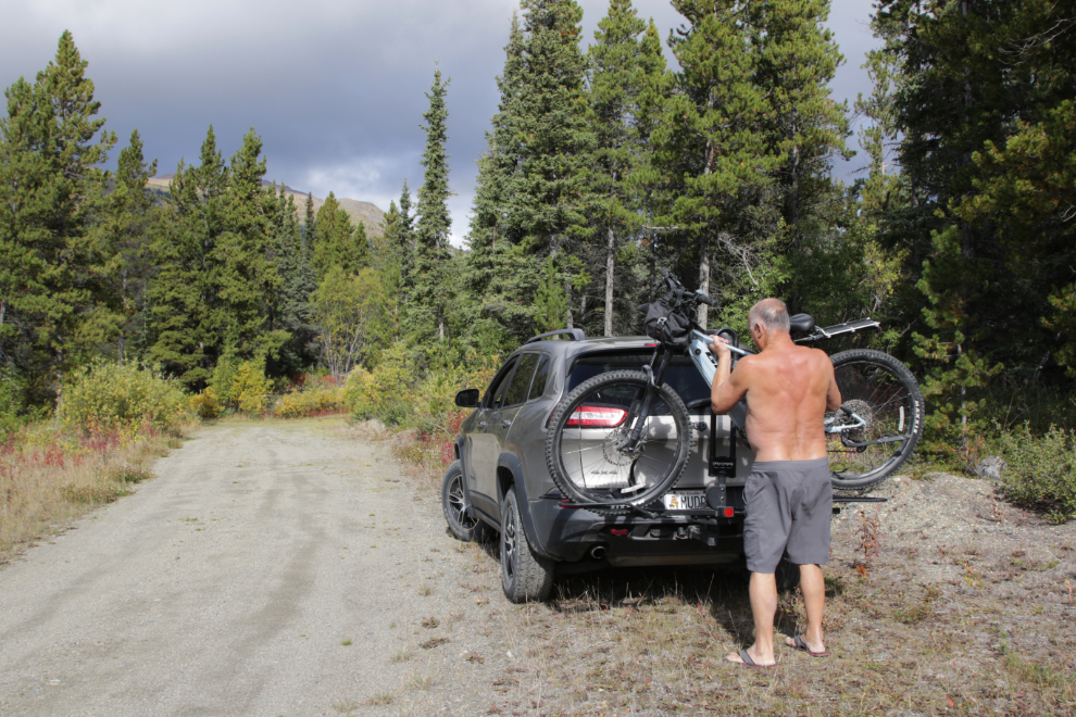
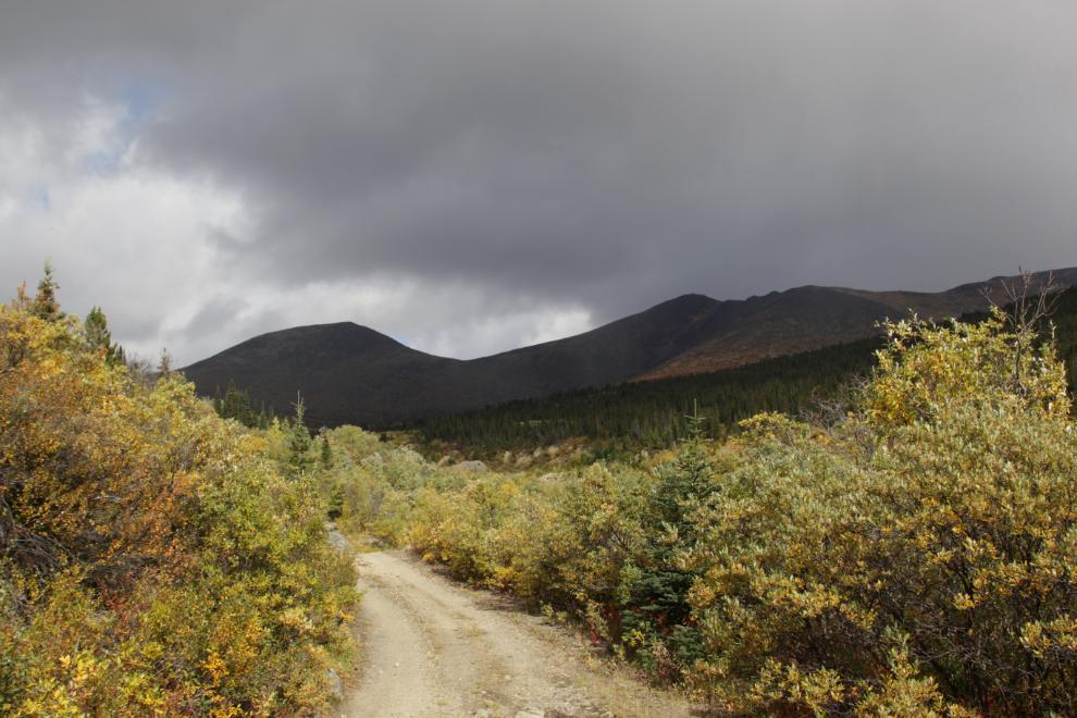
Right at noon I unloaded my bike. Although I could have driven the Jeep to my actual destination, the historic Boulder Creek dam, it looked like a great bike road. The temperature was 14°C, but there were threatening clouds up in the mountains ahead.
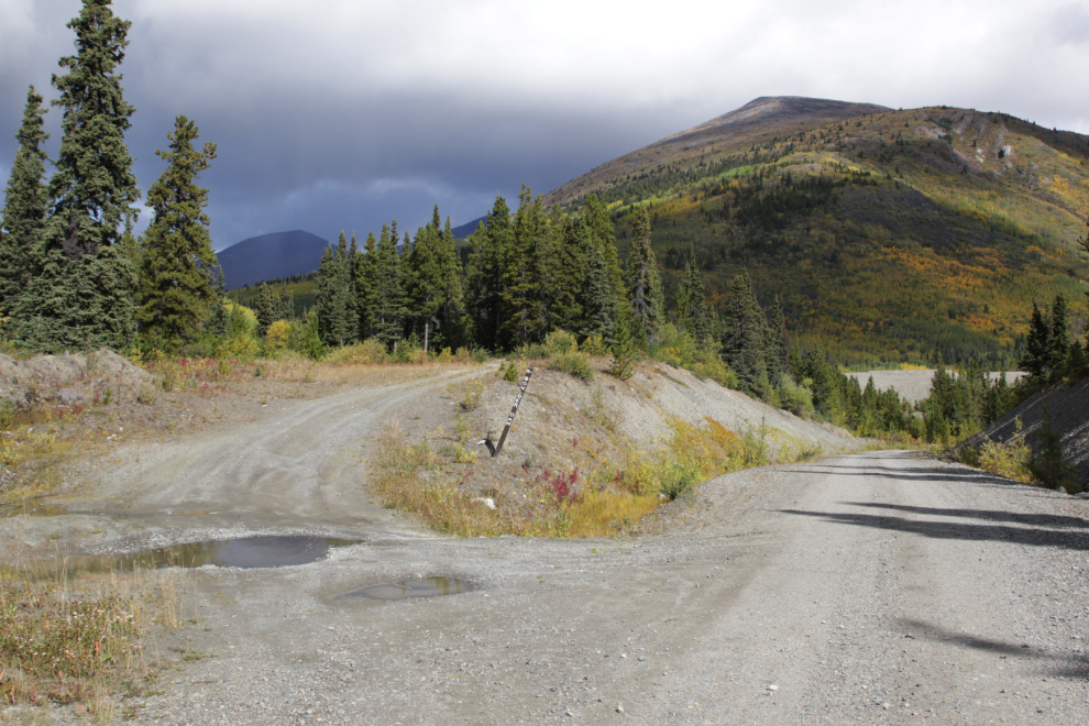
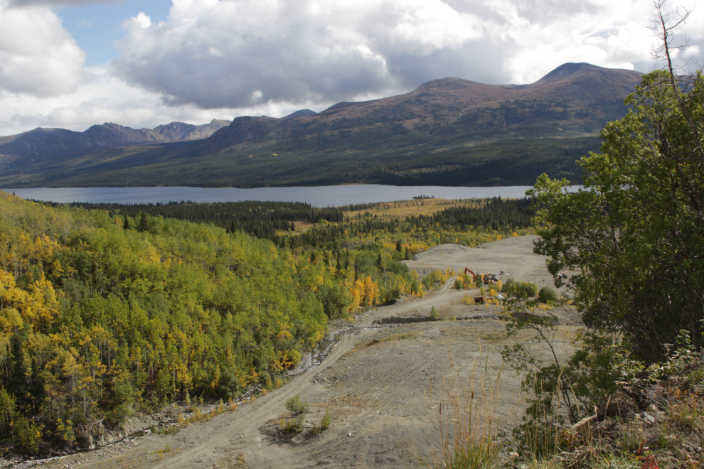
The road proved to be an excelllnt ride, and I was soon overlooking extensive placer gold workings.
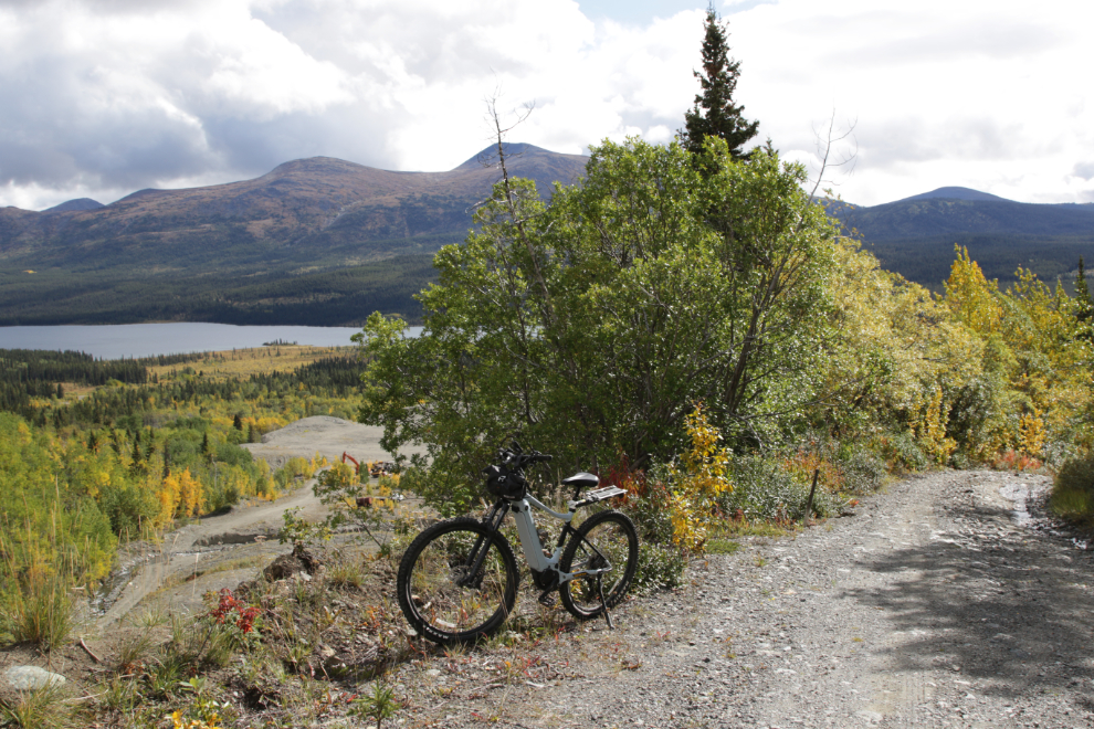
There appears to be a very small operation at work now, probably just 1 or 2 people.
By 12:40 it looked highly likely that I would be getting into rain if I continued. My planning skills are not very good anymore, and I wasn’t prepared for rain, but I really wanted to see the dam again, so pushed on.
It started raining as I reached the Boulder Dam Recreation Site, at 12:46.
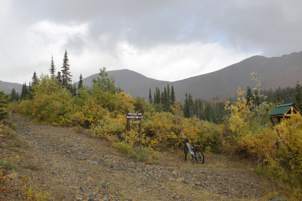
The interpretive sign has a tiny roof, but not enough to get me out of the rain.
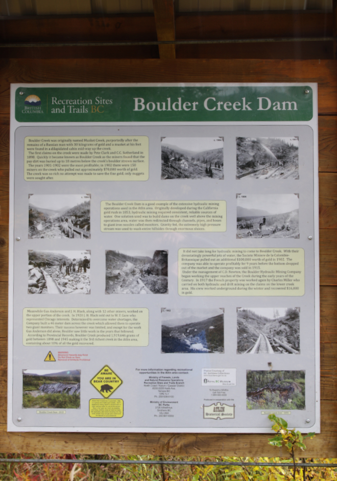
The interpretive panel provides a summary of mining operations on Boulder Creek, but very little about the dam itself:
“Boulder Creek was originally named Musket Creek, purportedly after the remains of a Russian man with 30 kilograms of gold and a musket at his feet were found in a dilapidated cabin mid-way up the creek.
The first claims on the creek were made by Pete Clark and C.C. Sutherland in 1898. Quickly it became known as Boulder Creek as the miners found that the pay dirt was buried up to 18 metres below the creek’s boulder strewn surface.
The years 1901-1902 were the most profitable; in 1902 there were 150 miners on the creek who pulled out approximately $70,000 worth of gold.
The creek was so rich no attempt was made to save the fine gold, only nuggets were sought after.
The Boulder Creek Dam is a good example of the extensive hydraulic mining operations used in the Atlin area. Originally developed during the California gold rush in 1853, hydraulic mining required consistent, reliable sources of water. One solution used was to build dams on the creek well above the mining operations area. Water was then redirected through channels, pipes, and hoses to giant iron nozzles called monitors. Gravity fed, the extremely high pressure stream was used to wash entire hillsides through enormous sluices.
It did not take long for hydraulic mining to come to Boulder Creek. With their devastatingly powerful jets of water, the Societe Miniere de la Colombie-Britannique pulled out an additional $100,000 worth of gold in 1902. The company was able to operate profitably for 9 years before the bottom dropped out of the market and the company was sold in 1915.
Under the management of C.D. Newton, the Boulder Hydraulic Mining Company began working the upper reaches of the Creek during the early years of the Century. In 1917 the French property was worked again by Charles Miller who carried on both hydraulic and drift mining on the claims on the lower creek area. His crew worked underground during the winter and recovered $16,000 in gold.
Meanwhile Gus Anderson and J. H. Black, along with 12 other miners, worked on the upper portion of the creek. In 1920 J. H. Black sold out to W. F. Gore who represented Chicago interests. Determined to overcome water shortages, the Company built a 46 meter dam across the creek which allowed them to operate two giant monitors. Their success however was limited, and except for the work Gus Anderson did alone, Boulder saw little work in the years that followed.
According to Provincial Records, Boulder Creek produced 1,919,646 grams of gold between 1898 and 1945 making it the 3rd richest creek in the Atlin area, containing about 10% of all the gold recovered.”
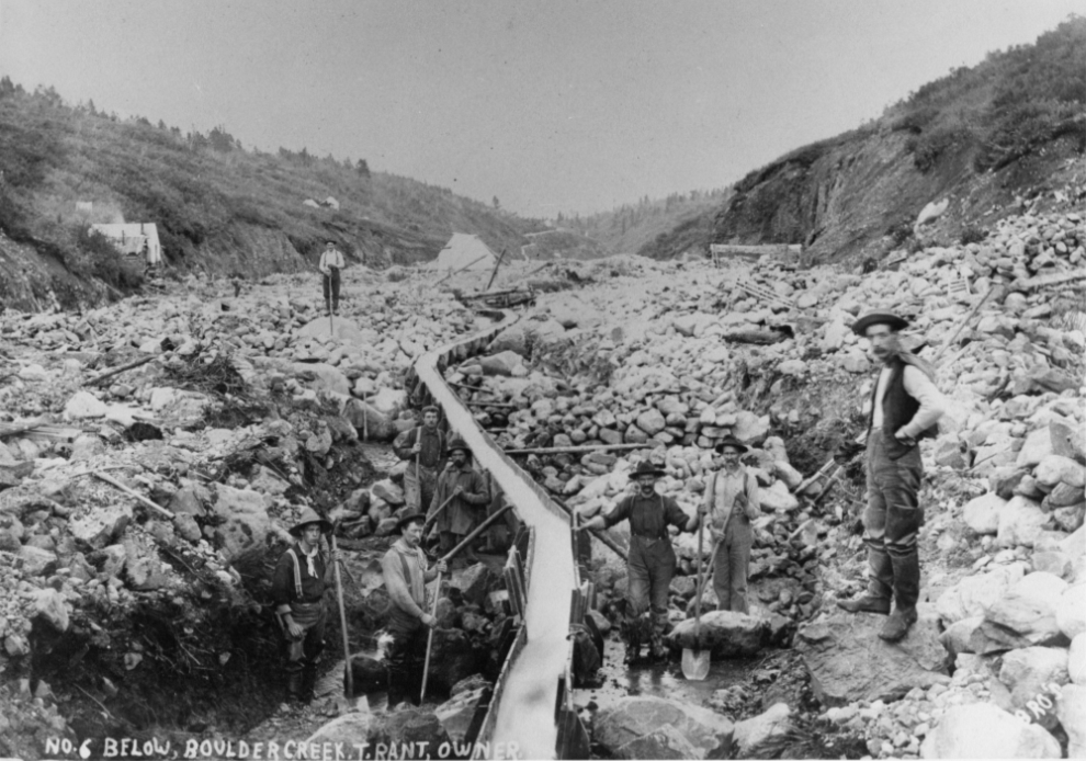
Next are 4 of the undated photos from the interpretive panel. First, “No. 6 Below, Boulder Creek. T. Rant, owner.”
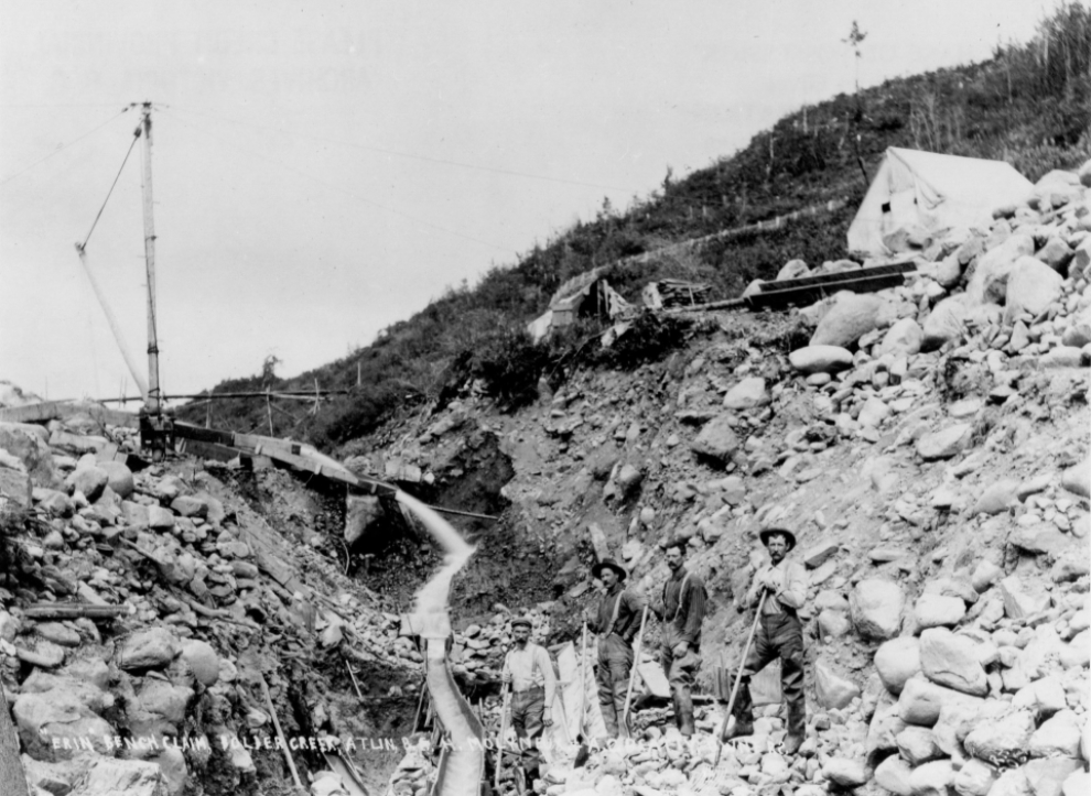
The next photo is by Alfred Cyril Hirschfeld, who was in Atlin by April 1899 and created an extensive record of the mines and communities.
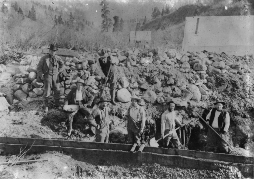
“Erin Bench Claim, Boulder Creek.”
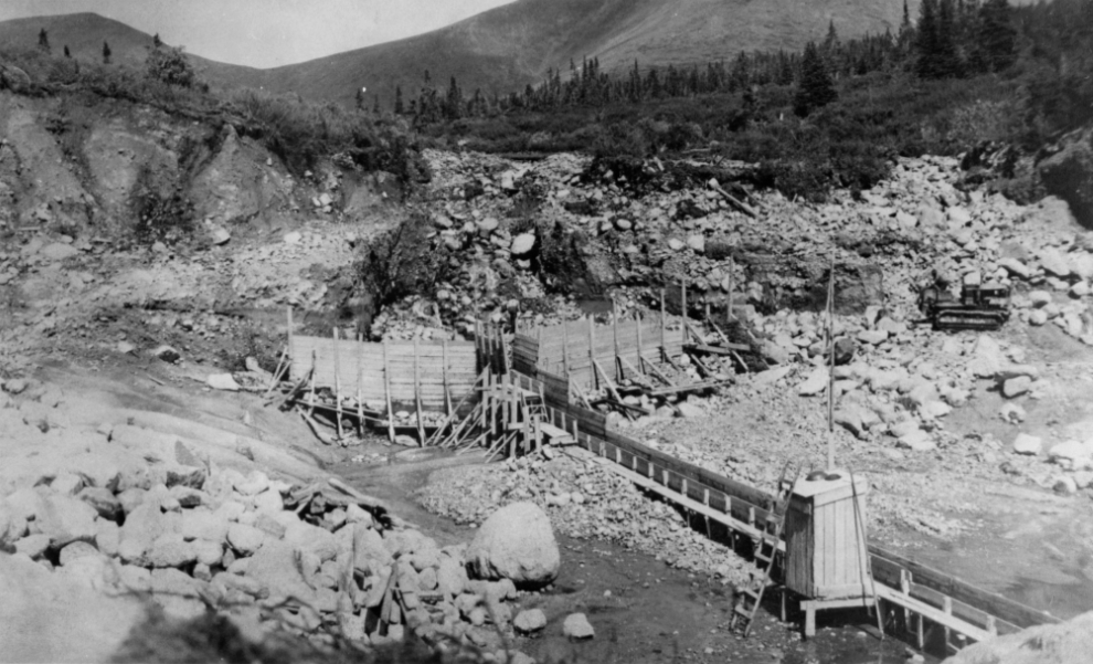
The Cat on the right side of the next photo shows it to be a much later image, and probably shows an early stage of construction of the dam.
When I got home and looked for more information about the dam, I found a 1906 newspaper article about the Societe Miniere de la Colombie Britannique sending an engineer up to study construction of a dam on Boulder Creek, but that project was apparently not pursued. You can read that article here.
Here is the report on the new dam from the Annual Report of the BC Minister of Mines for 1921:
The upper leases on Boulder creek are held by Chicago interests, with Mr. Gore in charge of operations. The great handicap on this creek has always been the lack of water. This year a new dam 150 feet long was built across the creek at an elevation of 4,100 feet. This forms a reservoir which when full will operate two giants about three hours, against twenty minutes for one giant before. The pressure-box is about half-way between the dam and the pit, from which there is a pipe-line from 40 inches at the box to 12 inches at the machine, with a head of 120 feet. A pipeline from the dam to the pit would give a 200-foot head. A clean-up was made from a small pit while I was there, yielding $1,000. Considerable dead-work has been done since that time in preparation for further operations.
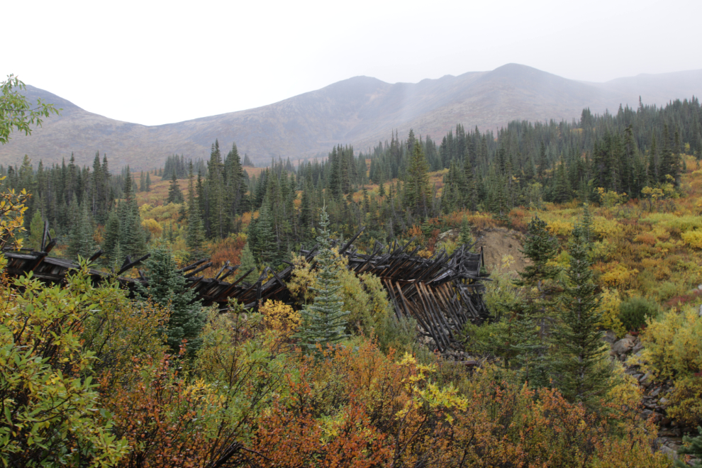
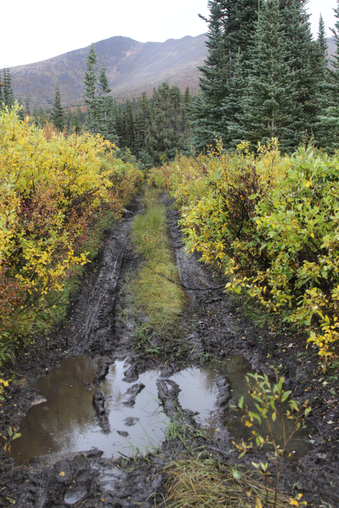
A muddy trail leads to the dam. The rain got heavier, and turned to hail briefly, so my visit was much briefer than it would have been on a nice day.
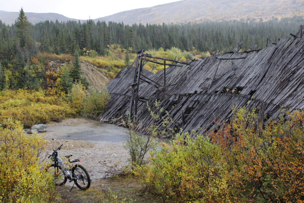
A look up peaceful Boulder Creek, the third richest placer gold creek in the Atlin area.
The view from the other side of the creek.
The downstream side of the dam.
Don’t I know how to have fun? 🙂
Looking back towards the dam at 1:06.
Soon after starting back down the mountain, the rain almost quit. Back at the Jeep at 1:30, though, I barely had time to lean the bike up against the rack and throw the cover over it when heavy rain arrived! I went to sleep for an hour, so don’t know how long it lasted.
The ride was only 8.66 km return – you can see the ride stats and an interactive map at my Stava account.
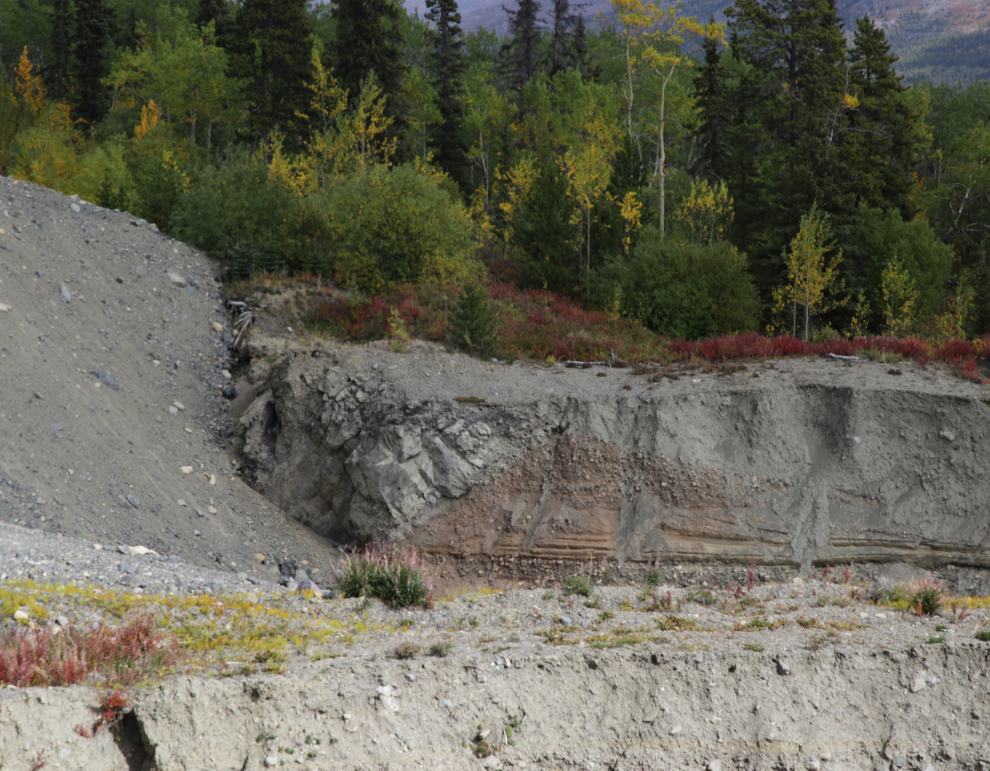
After my nap I drove further out, to Ruby Creek, and did some exploring. I didn’t find anything particularly interesting, but the layers along a lower section of the creek were intriguing.
I didn’t feel well at all, and had to have another nap before leaving Ruby Creek, but by 3:45 I was on the way back to Atlin, well pleased that I had made it to the dam. Sometimes I push too hard, but that’s the only way of living I know. Perhaps I’ll die on one of these poorly-planned Adventures, and that’s okay – “the cost of doing business.”
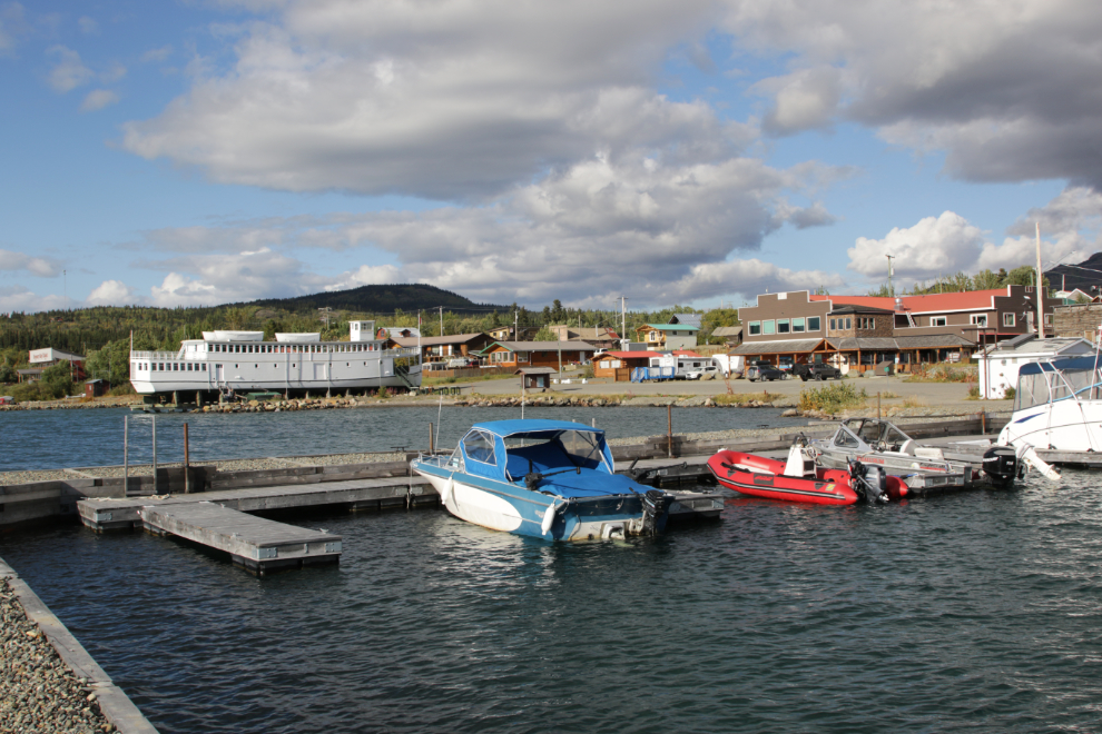
Back in Atlin, I spent over an hour wandering around downtown taking pictures, as dinner wouldn’t be available in the bar until 5:30 – Atlin really is a photographer’s dream. In this photo shot from one of the marinas, the iconic Tarahne, built here in 1917 by the British Yukon Navigation Company, is on the left, and the Atlin Mountain Inn on the right.
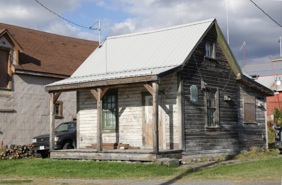
This building was constructed at Discovery in 1902. With walls of 2x6s stacked flat, it cost $800 to build. It was skidded to Atlin in the 1920s and was used as a residence for many years.
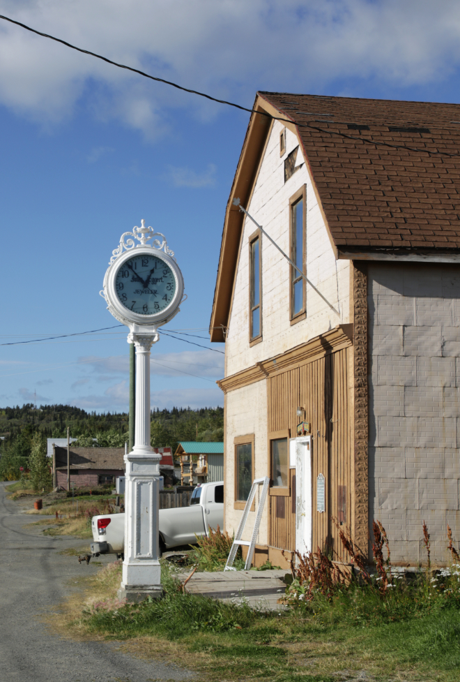
Jeweller Jules Eggert arrived in Atlin in 1899, and installed this clock outside his store in 1921.
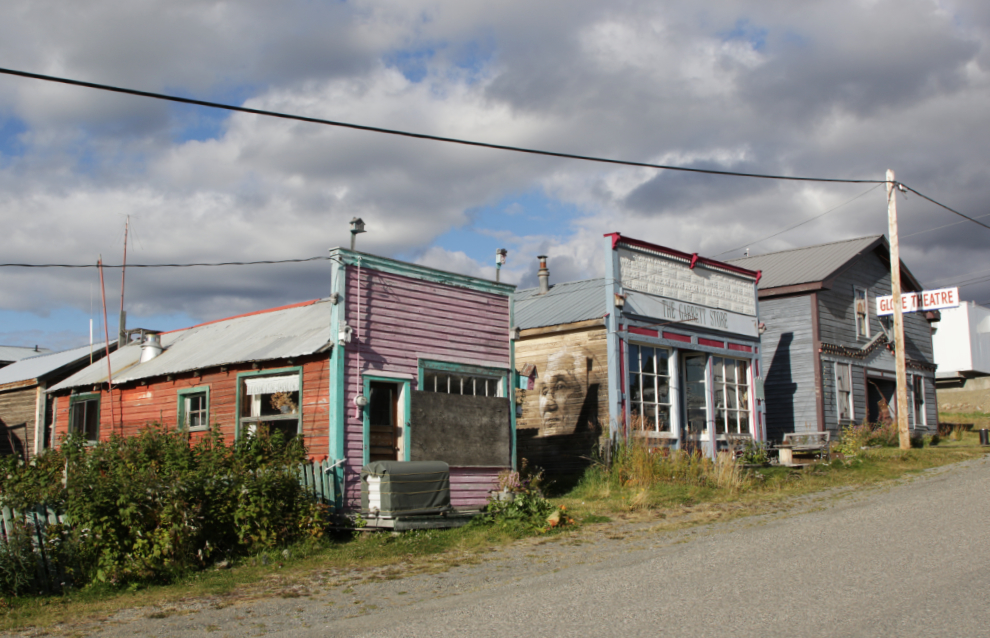
This row on Pearl Avenue used to be very attractive, but it’s looking quite tattered now. I started bringing tours to Atlin 34 years ago, and have seen a whole lot of ups and downs during that time. Overall I’d say this is an “up” period – perhaps as “up” as many residents want it to be (the community should have cell service in place by next Spring, after opponents successfully blocking it for decades).
The late Doc Branigan’s holistic healing centre from the 1960s is now residential.
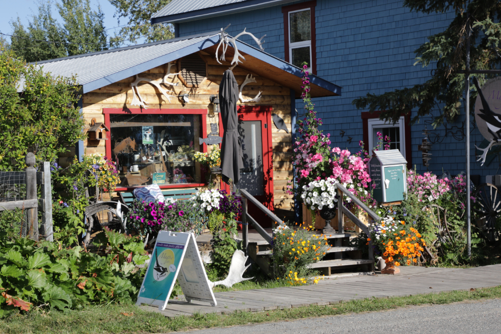
This lovely cabin is home to the “Magpie, etc” art shop, loaded with the creations of many talented locals as well as artists from further away.
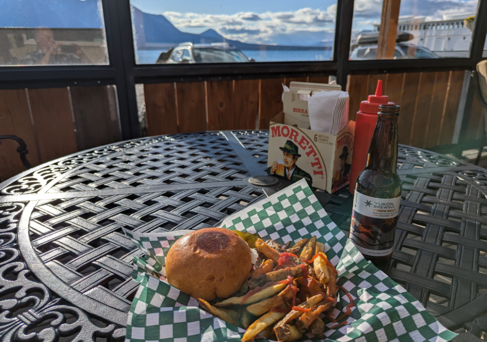
A burger and a couple of Yukon beer on the patio of the Atlin Mountain Inn’s bar was the perfect end to the busy part of my day 🙂
Back at Rick and Tina’s, I spent a very enjoyable evening chatting with them before retiring early to my cabin. The next day, Sunday, would be a day of Jeeping-hiking up Ruby Creek and Ruby Mountain.
Beautiful trip , Atlin has alittle bit of Dawson City running through its veins eh, Burger, beers and a cabin sleepyhead rest, that’s a great day Murrster 🇨🇦👍🦫
Yes, Atlin does have a Dawson flavour – at least the flavour of the Dawson of 30 or so years ago. It was indeed just what the doctor ordered.
Thanks for surviving another trip. We appreciate it. Goof 💚
My pleasure 😀