A glacier day at Stewart, BC
At Meziadin Lake Provincial Park, Cathy and I both felt that we were home – back in the North. It looked and smelled familiar, and we soon decided to stay for a third night. On Day 51 of the trip – Monday, June 13th – we’d drive into Stewart for a look, with the main focus for the day being the Salmon Glacier Road.
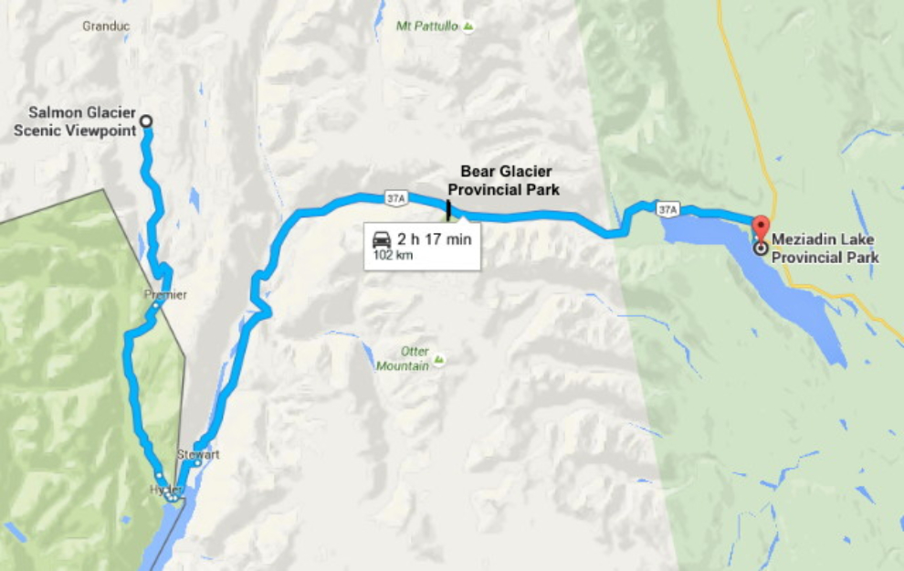
We put just over 200 km (124 mi) on the Tracker during the day. Click here to open an interactive version of the map below, in a new window.
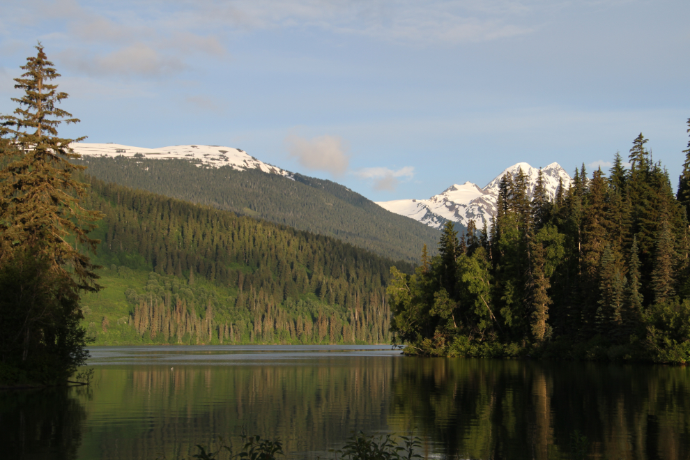
I was up early, and by 06:00 when I shot this photo from our campsite, the day was looking like it was going to be perfect for touring. It would have been a wonderful morning to have a canoe. While I hadn’t had many days when I’d wished that I’d brought mine, there were a few.
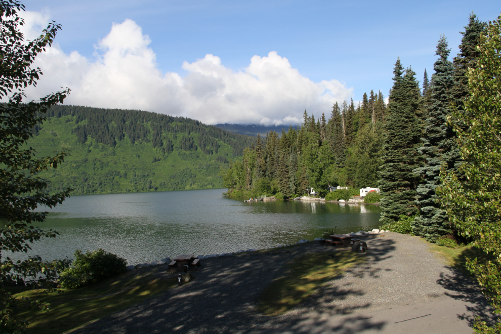
Looking over the campground from the day-use picnic shelter on a bench above the lake, at 08:35.
The Glacier Highway
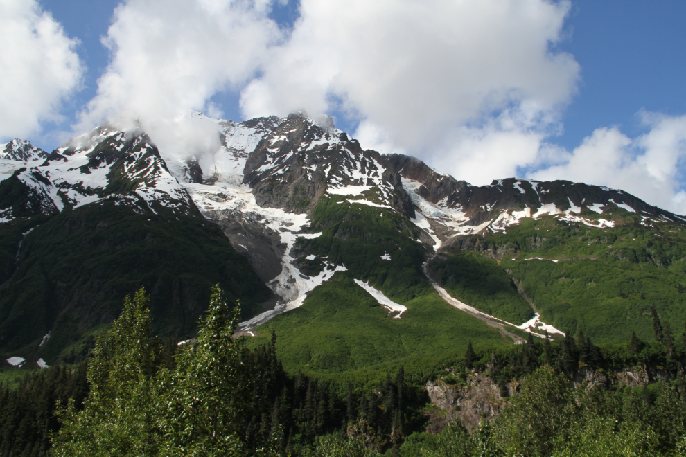
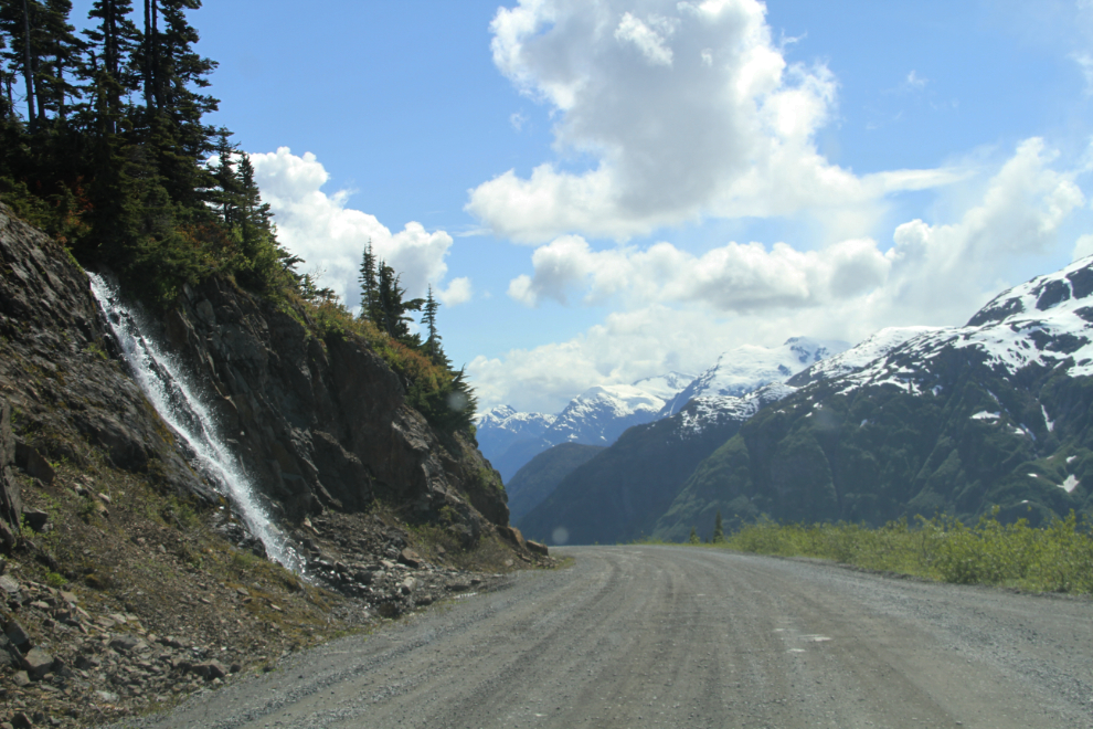
We started the 65 km drive into Stewart just after 10:00. BC Highway 37a is called “the Glacier Highway” because you pass by about 20 glaciers and icefields (most unnamed – see map). There are also apparently 72 avalanche paths, some of which cause the highway to be closed even now and then during the winter. Below all the ice, snow, and bare granite, the vegetation is lush, a vibrant green that almost glows. I love this country! I believe this is Entrance Peak (because it’s the entrance to Bear Pass, I expect).
There appears to be some superb glacier-access hiking until you get close and look at the vegetation – there are no trails, and this is very tough country to bushwhack through.
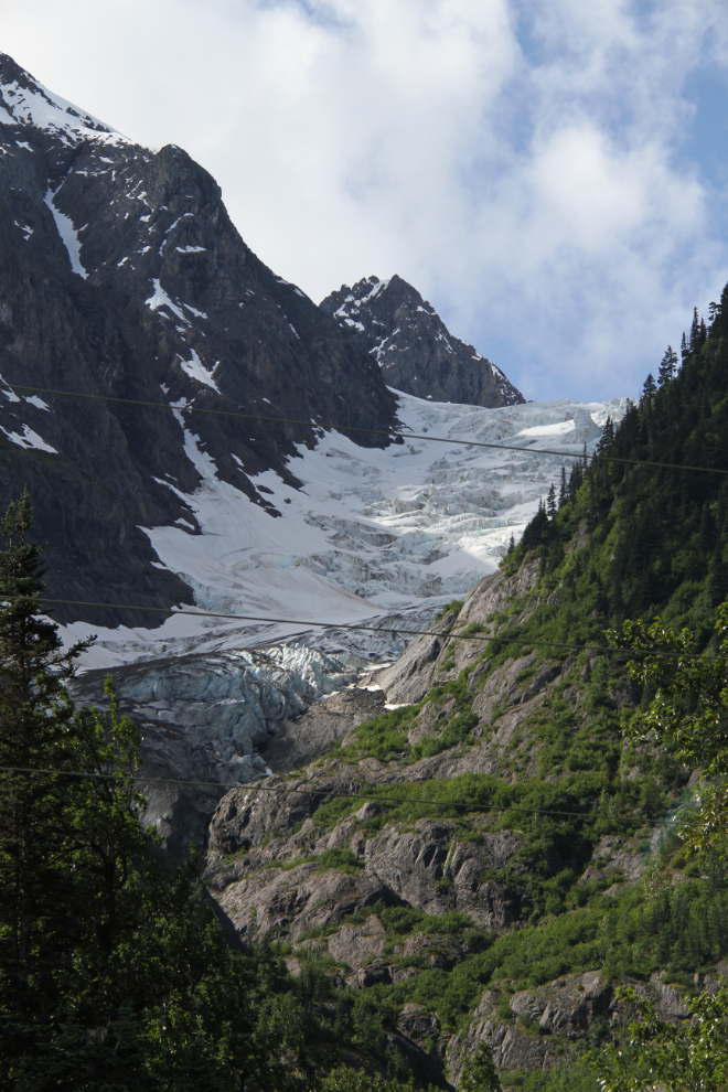
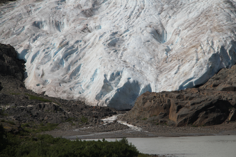
This tongue of the Bear Glacier (Bear River Glacier on the topographical maps) is the heart of Bear Glacier Provincial Park, which was just created in 2000. It flows from the massive Cambria Icefield east of Stewart. I’ve posted 5 photos that I shot between 1975 and 2015 to show the dramatic retreat of the Bear Glacier.
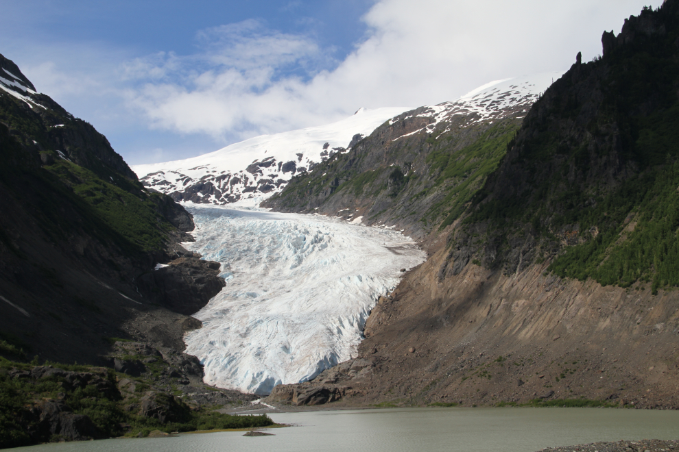
The tongue of the glacier. I really want to get over there, but haven’t seen an easy way across Strohn Lake or the Bear River yet. The names in this area add to the confusion caused by the topography – Strohn Creek doesn’t flow from Strohn Lake, the Bear River does.
Stewart
We didn’t spend much time stopping along the highway, and crossed the final Bear River bridge into Stewart at 11:00.
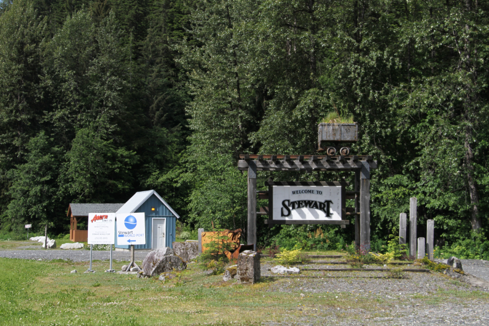
Our first stop in Stewart was the visitor information centre, to pick up a copy of the excellent Glacier Highway and Salmon Glacier Self Guided Auto Tour booklet (which can be downloaded at that link).
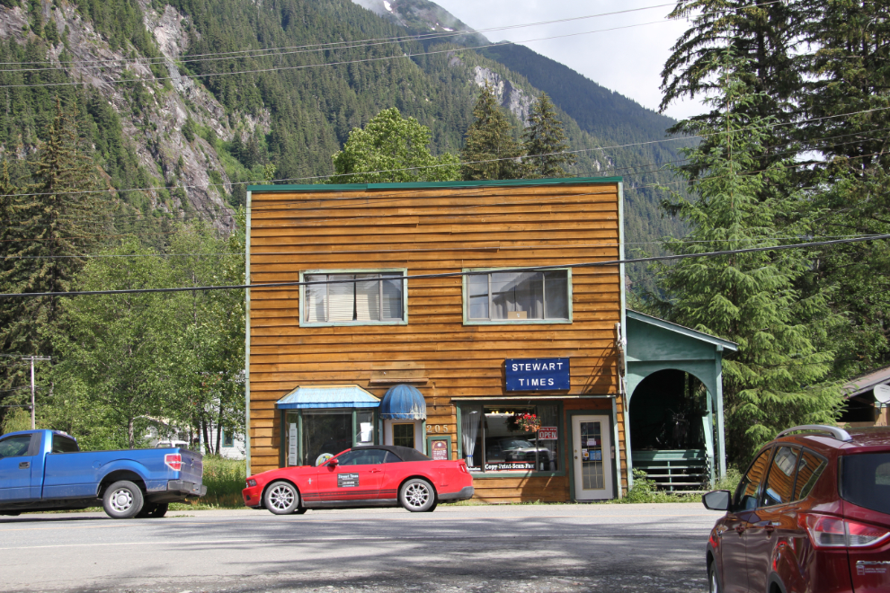
I was pleased to see across the street that Stewart once again has a newspaper, the Stewart Times, which was started a few weeks ago by Mary Mandelin.
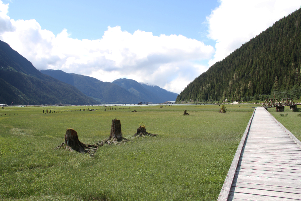
The constant “must” for me whenever I visit Stewart is the estuary boardwalk. It’s apparently 805 meters long (2,641 feet), and a recent extension connects it to the road to Hyder and beyond. There are many interpretive signs along its length, adding to the spectacular views over the estuary to the Portland Canal, the docks, and up to the peaks and glaciers.
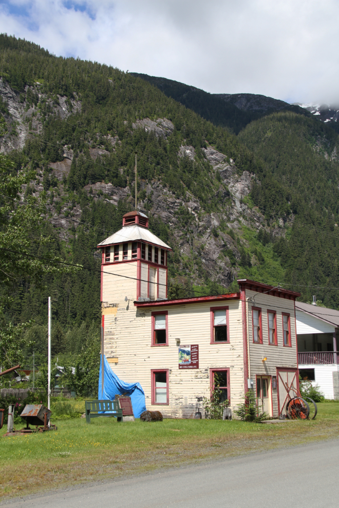
The poor old fire hall, afflicted with wet rot, looks worse each time I see it. It used to house the museum, but that’s now been moved to city hall, though the putside artifacts are still at the fire hall.
We stopped in at the “King Eddie” (the King Edward Hotel) for lunch, and just after 1:00 passed through Hyder on our way to the Salmon Glacier.
The Salmon Glacier Road
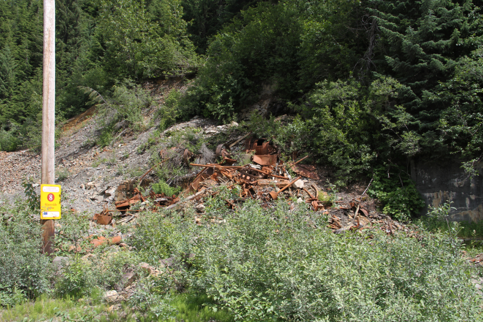
Stop #8 on the auto tour is the site of the Riverside Mine, where silver and copper were discovered in 1915. Development began 7 years later, and some 4,000 feet of tunnels were blasted out. In some years, it was the most productive mine in Alaska for silver and copper. It operated intermittently until 1961, but fires and floods had destroyed most of the mine structures by 1987. I recall there being a fair bit at the site when I lived in Stewart in 1975.
Looking down the Salmon River from the Riverside Mine site.
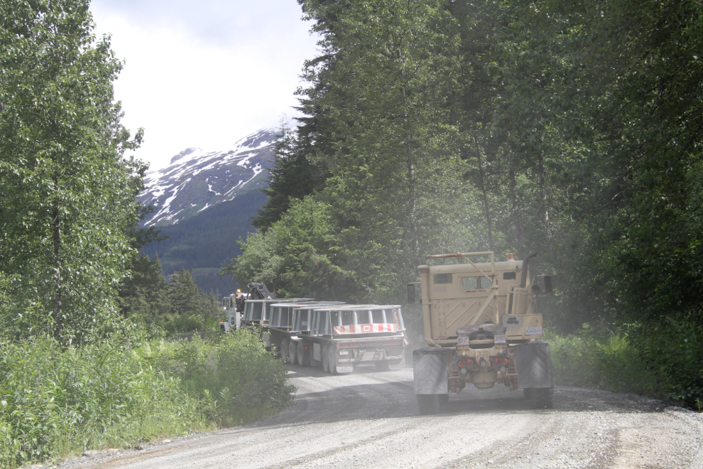
I pulled over to let a pilot car go by, and the large load of mining equipment that followed proved to be a good excuse to drive very slowly up the road.
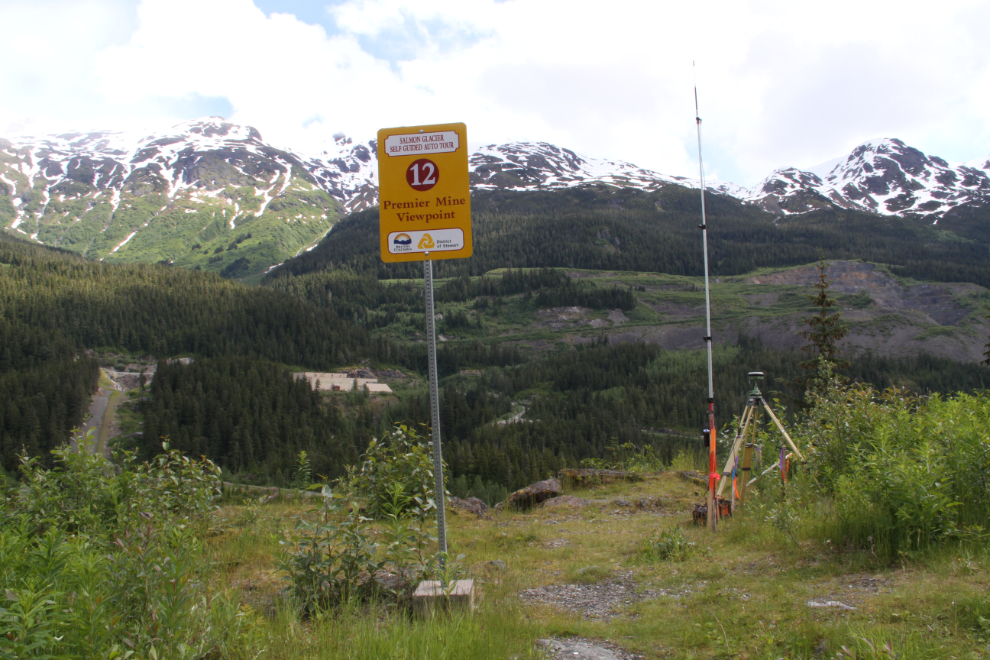
This view (Stop #12 – the Premier Mines Viewpoint) is the one that’s most changed since I travelled the road to work every day 41 years ago. On that hillside was the massive Premier Mine, with buildings dating back to about 1918 (see a 1975 photo). The truck full of equipment I was following went up the road behind the building to the left of centre in this photo, but I haven’t yet discovered where it went.
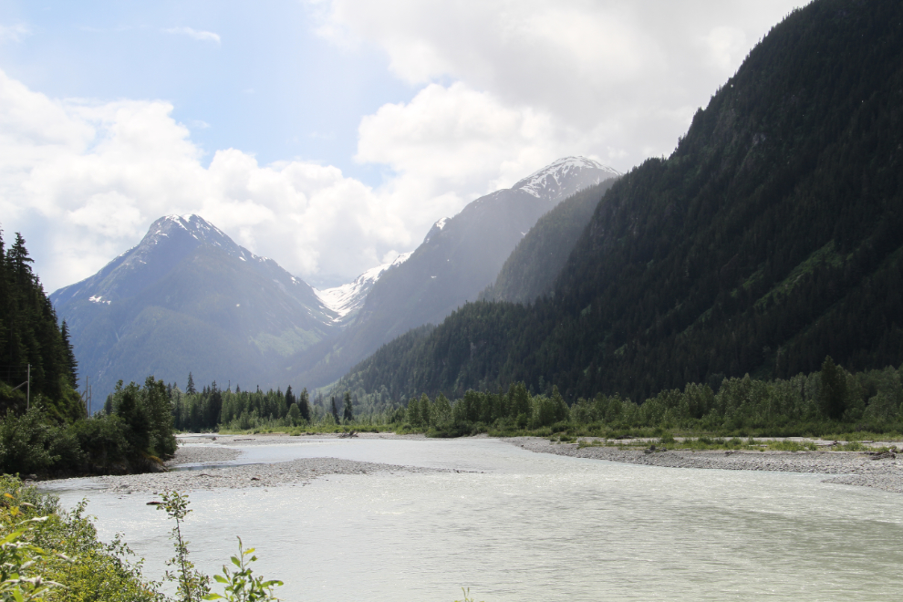
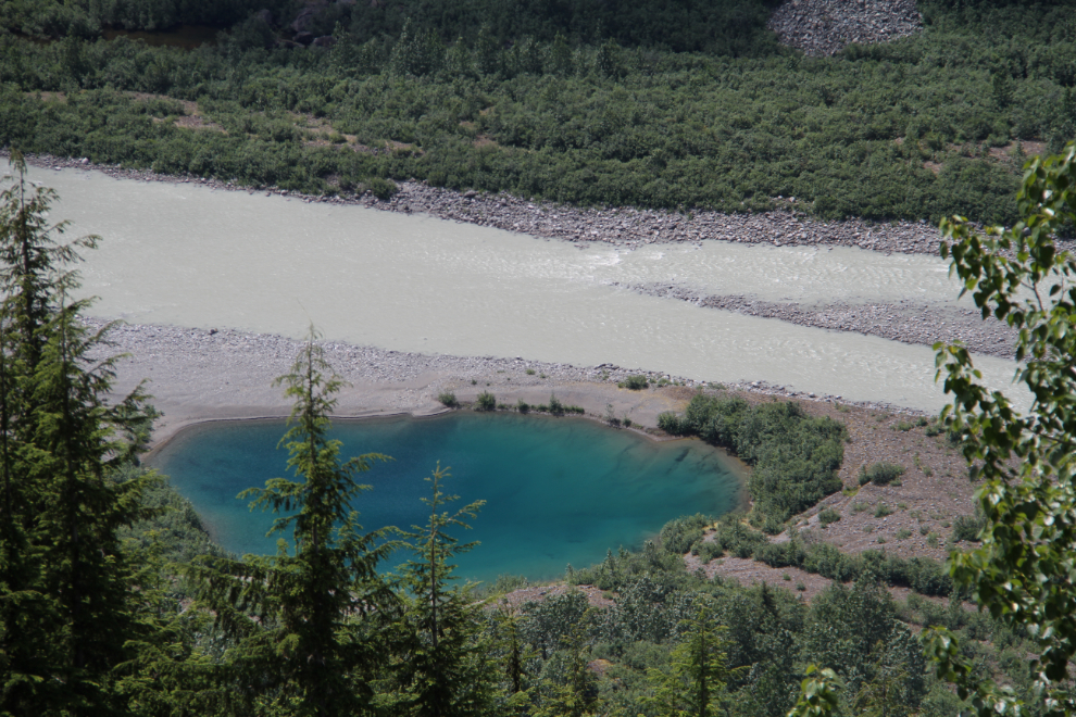
Looking down on the Salmon River. A very enticing view, but all but impossible to reach except by helicopter.
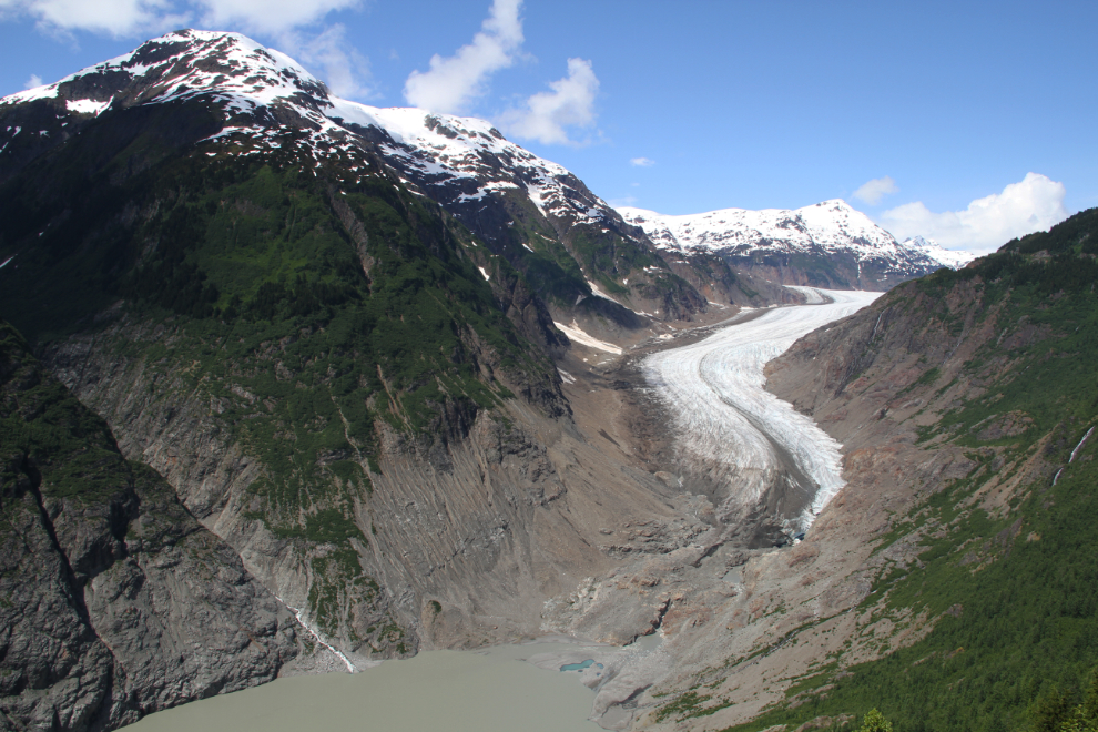
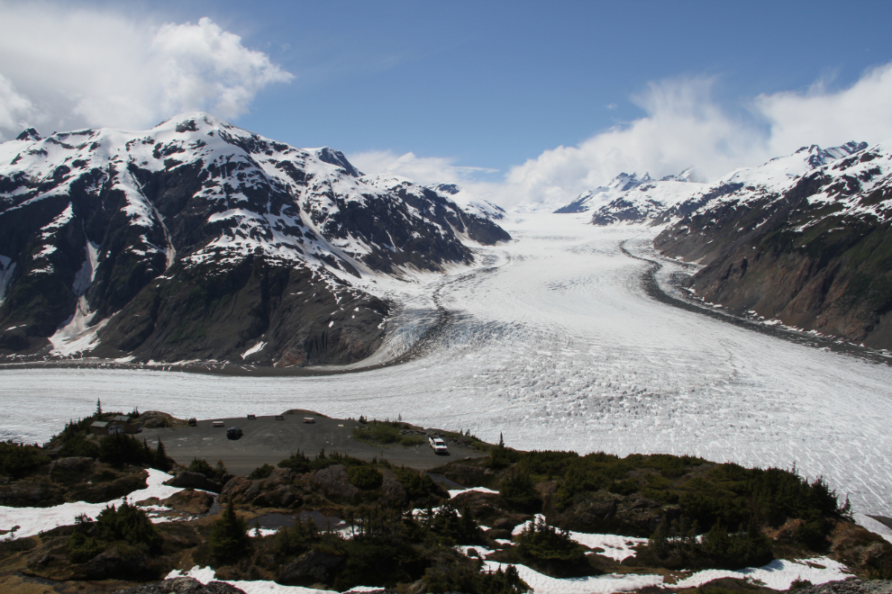
The toe of the incredible Salmon Glacier. As with the Bear Glacier, I’ve posted a series of photos showing the dramatic retreat of the Salmon Glacier. I was disappointed to discover at about this point that the road terrified Cathy – if you have a fear of heights, this is not a road you want to be on.
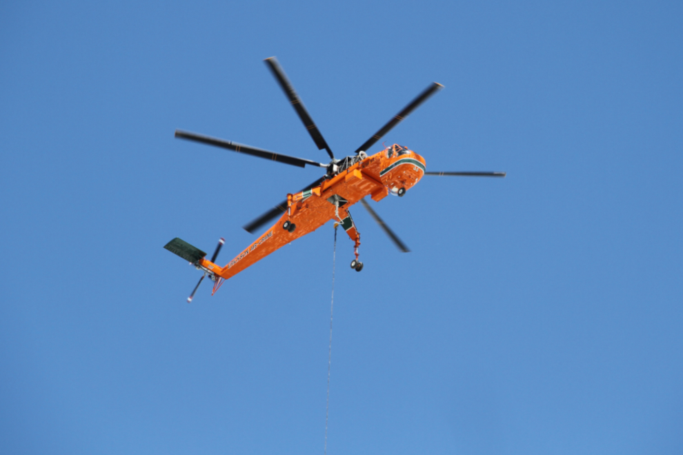
I was surprised to see a Sikorsky S-64F SkyCrane, N163AC, slinging loads to what appeared to be a new communications tower above the glacier viewpoint. A 1993 model, the helicopter is operated by Erickson Air-Crane from Oregon.
At Km 37.0 on the Salmon Glacier road, which is the main viewpoint, the road has now been closed by the mining company now working the former Tide Lake property of the Granduc Mine where I worked. Last October, I was able to drive a few miles further, but the last time I was able to get right to the Granduc site was 2002.
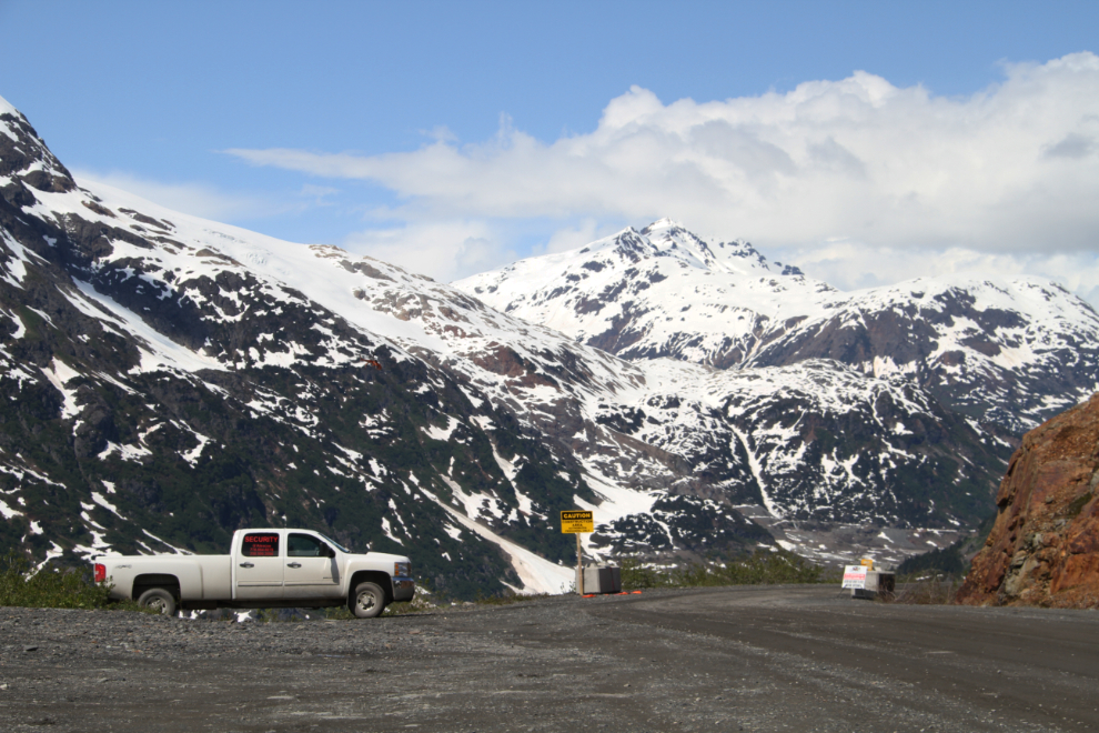
I was hoping to be able to hike the old Granduc road seen in this photo (it gets much closer to the glacier), but the access to it is now beyond the security gate.
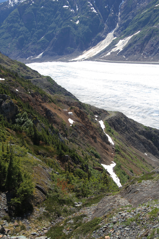
I hiked above the viewpoint to get this shot. There’s a vague trail to start but also lots of snow and bare granite to reach this point. I was tempted to keep going, but…
Starting back down at 2:50, after a much shorter day than I’d planned on.
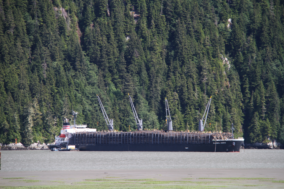
Back in Stewart, the Global Hero was loading a cargo of raw logs. Thanks to the Stewart Times, I know that the 179-meter-long ship is registered in Panama, has a crew of 20 under Captain Pangan Gelera, and that she loaded 31,000 tons of logs for China.
We were back to the campground by about 4:30, and had a quiet evening – there were enough periods with the right conditions to have a campfire for a while (mostly, that meant enough wind to keep the mosquitoes away but not enough to blow us away 🙂 ). For Tuesday, I decided to see if I could get to the toe of the Bear Glacier.