Whitehorse 1965
One more post about history then I have to get back to work! From the collection I got yesterday I’ve taken a piece from an article in the Yukon News Magazine of September 1965. It describes what’s along the Alaska Highway from Marsh Lake to Whitehorse. It’s different but perhaps not dramatically so from what’s there today.
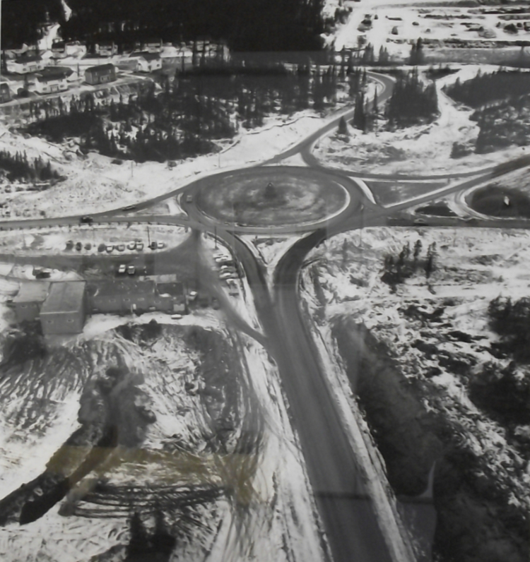
Did you notice the Traffic Circle noted at Mile 917.4? The aerial photo below shows it in about 1965. It was taken by Jimmy Quong, a highway engineer who has finally started to be recognized for his photograph collection, both for its quality and its subjects. The Alaska Highway runs horizontally across this photo, with what’s now called Two Mile Hill leading to downtown Whitehorse off the bottom of the photo, and the Valleyview subdivision at the upper left looking much as it does today.