To Carcross for the first train of the season – and much more
On Tuesday (May 27th), I drove to Carcross just to see the first train of the season, but it turned out to be a very full day.
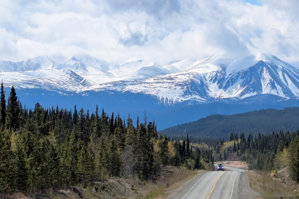
The weather was mixed sun and cloud, but I seemed to get sun almost everywhere I wanted it. This view of Montana Mountain was shot with my phone so I could post it to Facebook. I usually carry 3 cameras now – the phone, my DSLR (a Canon EOS 7D Mark II), and the new mini-Canon (a Powershot SX 740).
I had planned to get to Carcross early so I could visit my friends at the Matthew Watson store, but I was actually very early, having forgotten that the White Pass schedule lists Alaska times, so it wouldn’t be arriving until 1:15 instead of 12:15.
It was great to chat with Ron and Bonnie at the store. When I lived in Carcross and had free time 20-25 years ago, I would occasionally help them out, usually scooping ice cream but there were always plenty of other jobs to be done around the store as well. It was a fun way to meet people 🙂
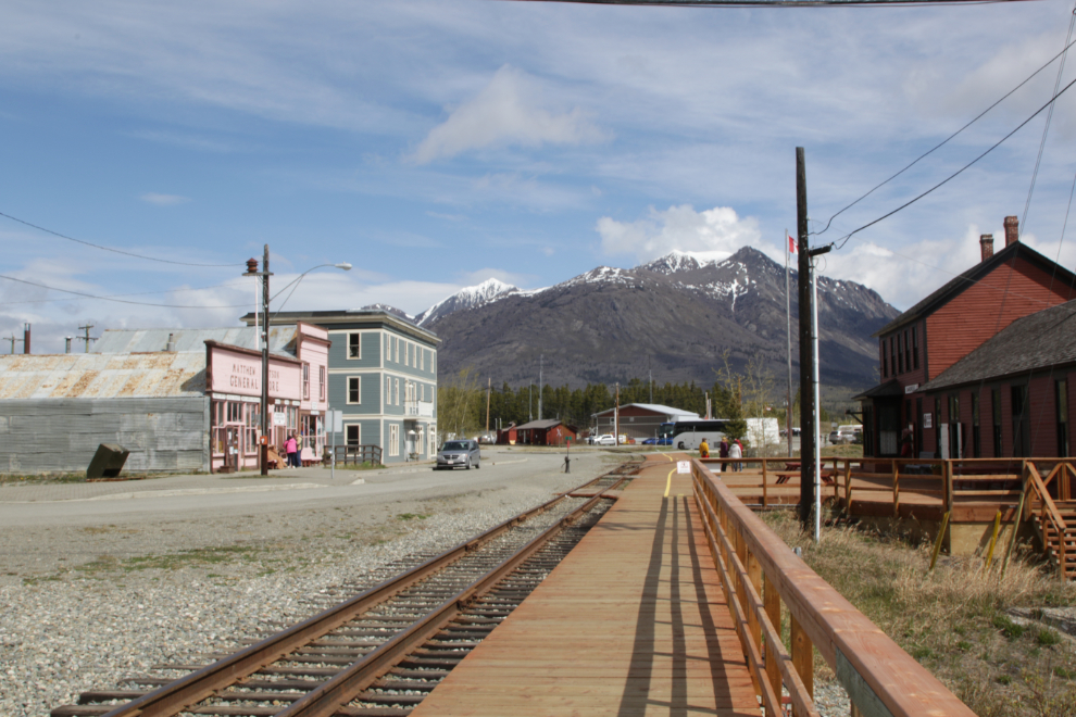
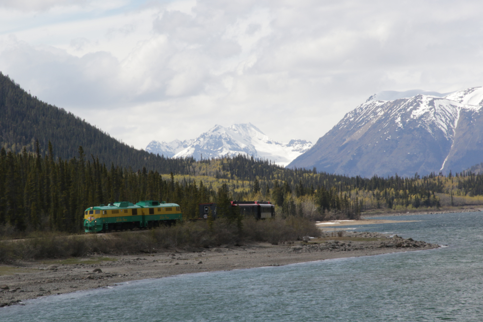
The next photo was the classic Carcross photo before the highway arrived, as this was most people’s first view of the community as they arrived on the train from Skagway.
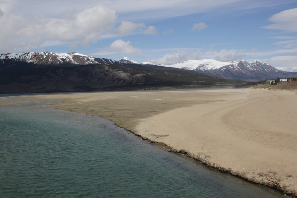
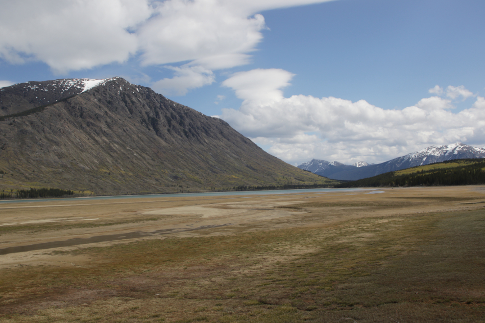
The beach of Lake Bennett is massive this time of year, but in a few weeks there will only be a sliver a sand left as the water rises. The wind was screaming, so it wasn’t a very pleasant place to be.
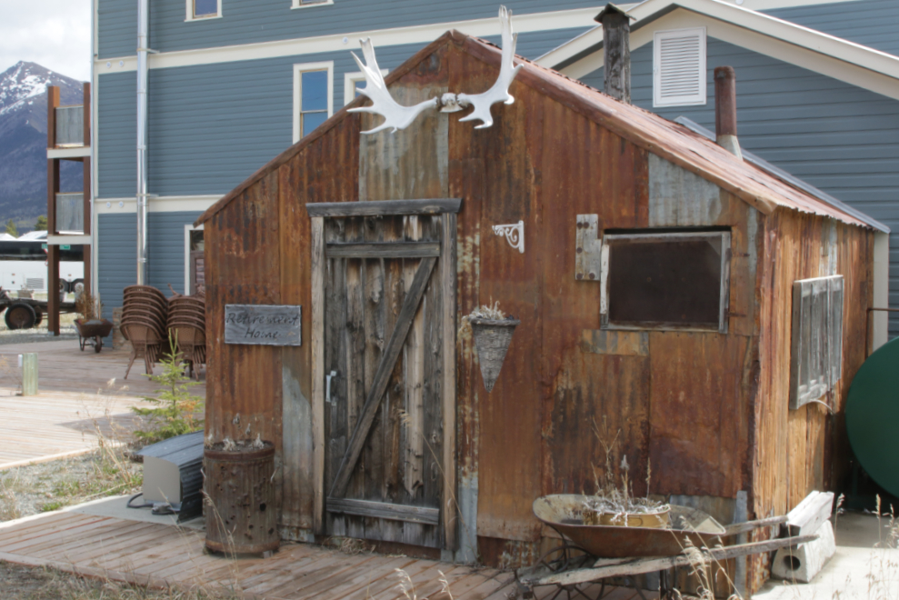
The owners of the Caribou Hotel have made this corrugated iron building into a great photo subject.
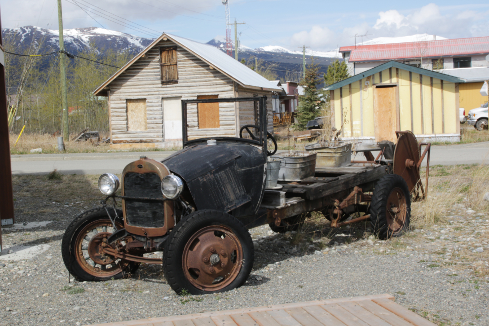
This century-old Ford that was made into a portable sawmill is another very popular photo subject.
With lots of time, I drove 11 kilometers south to the Bove Island viewpoint, and climbed up above for a more wilderness look at this rather busy spot.
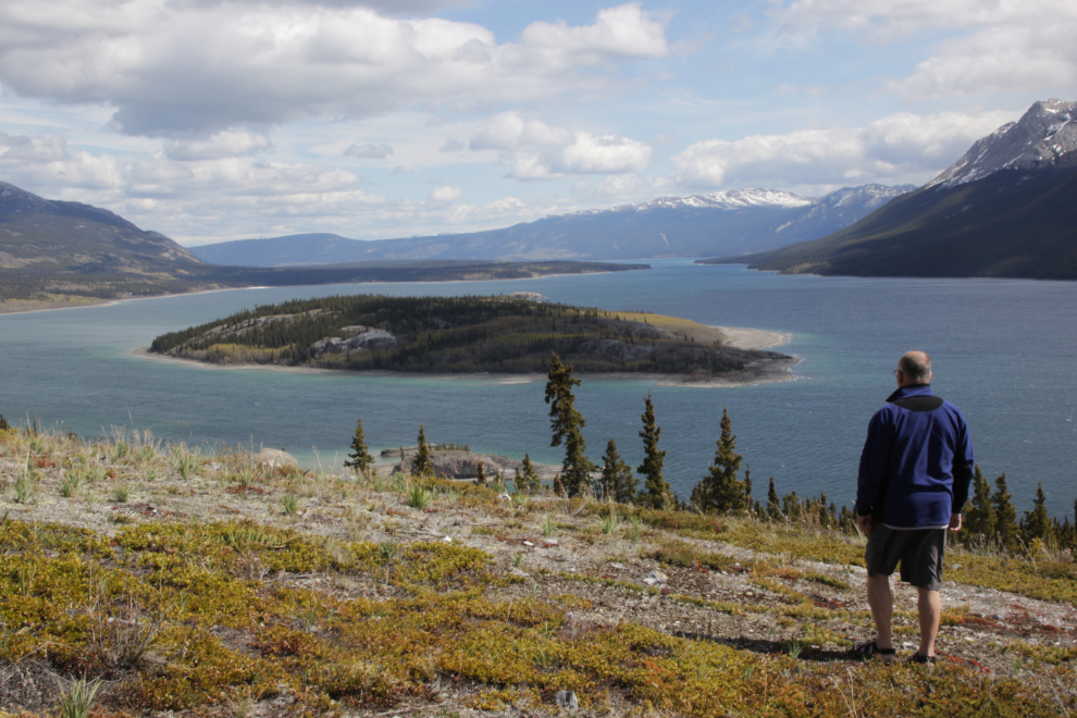
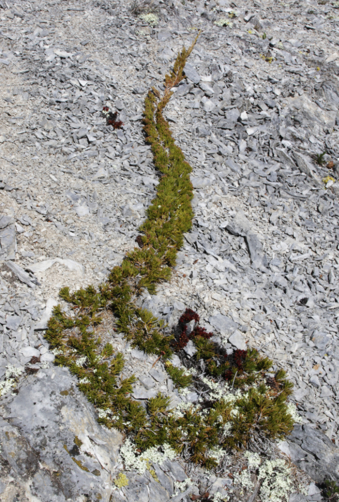
Creeping juniper (juniperus horozontalis) is so cool. I found a few of them above the Bove Island viewpoint. Growing/travelling across a particularly inhospitable landscape in search of fertile soil feels like a metaphor for a few things right now. Only the strong survive.
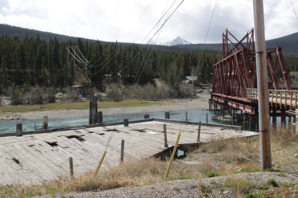
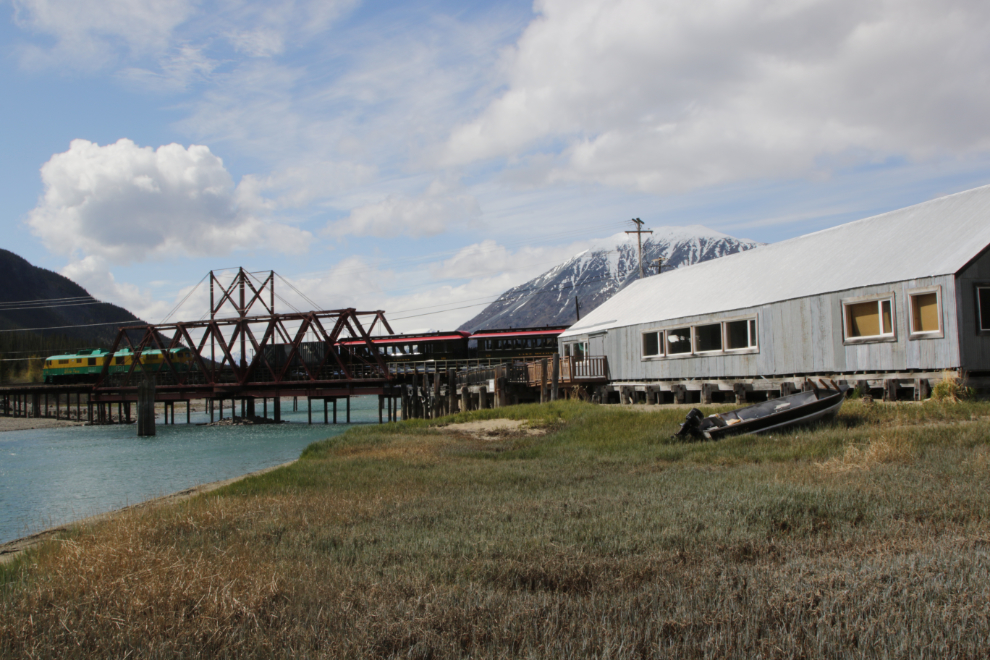
I was back in Carcross at 1:00, and went looking for the best photography location. The old British Yukon Navigation dock has buckled beyond repair over the past couple of decades. It used to be the best location to photograph trains.
I ended up on the footbridge, getting the full force of the wind. The train was a few minutes late, but by 1:21 had gotten close enough to start getting photos. My cabin was right beside the tracks, and I always enjoyed greeting the trains from my deck. My cabin was the first one train passengers saw up close as they arrived, and train guides called it “the fireweed cabin” because of the field of those flowers in front of it.
Yes, I miss seeing this every day…
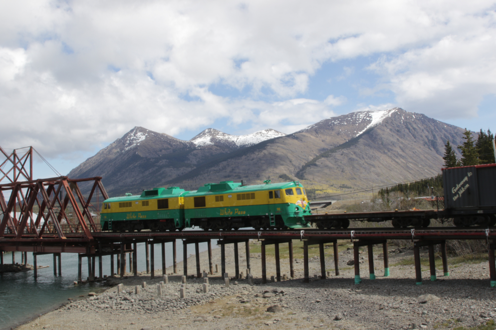
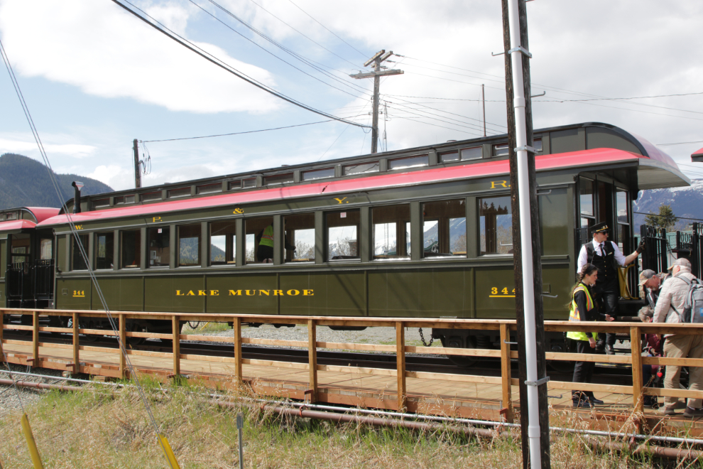
I was very pleased to see the old GE locomotives. Some of the new engines have been painted black and are just plain ugly. I think some of the curves along Lake Bennett are too tight for the new locomotives, which have a much longer wheelbase.
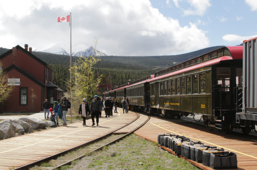
The historic station gets very busy when 250 or so people get off the train.
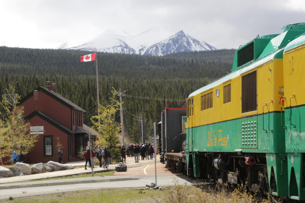
The White Pass & Yukon Route’s famous Thunderbird.
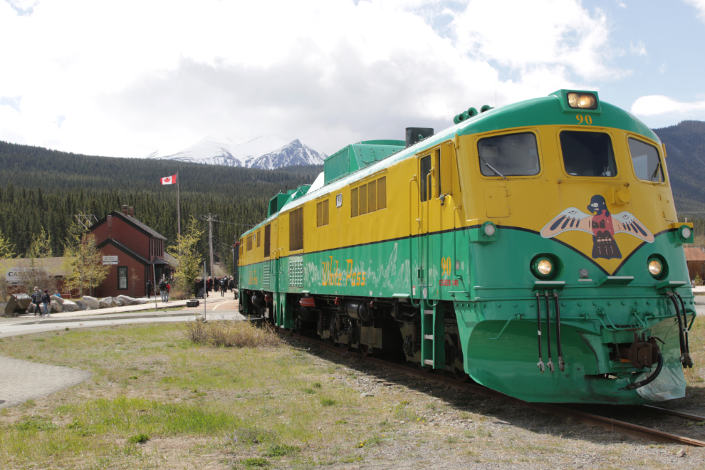
There were seven passenger coaches, all of them freshly rebuilt. A company in Whitehorse has been doing the rebuilds over the past couple of years, and they’re beautiful.
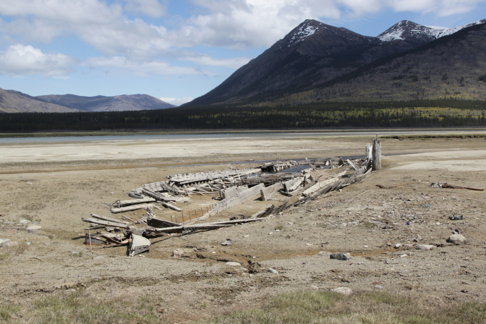
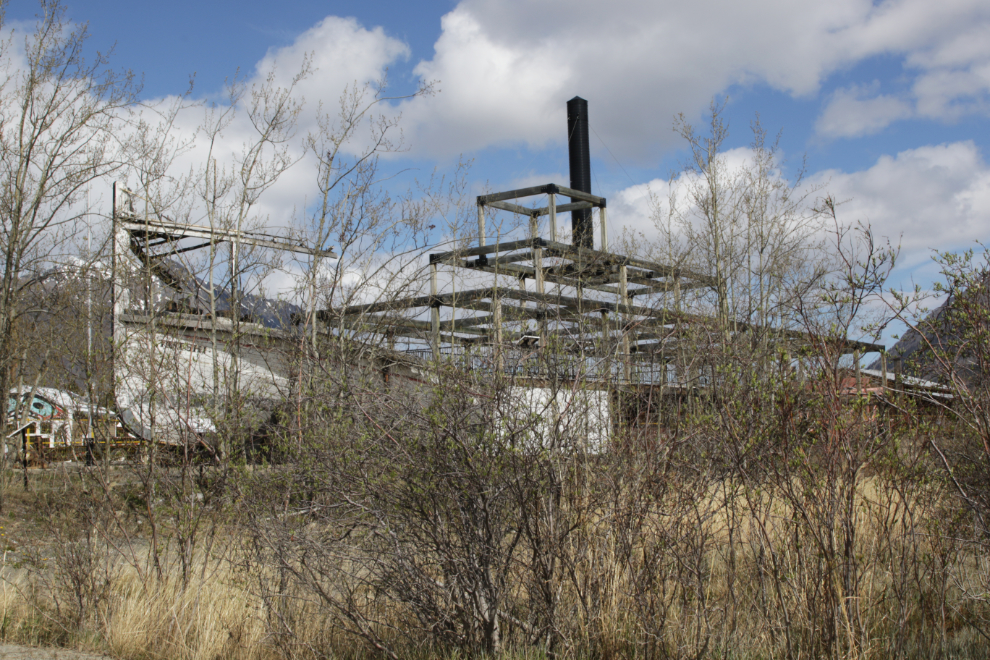
A couple of weeks ago, a friend sent me a bunch of photos that her son had taken of the wreckage of the sternwheeler Gleaner that sits along the Nares River a few hundred meters from the highway bridge. With over half an hour before the train would be leaving for the return to Skagway, I decided to upgrade my record of it – I see now that the photos of it I use online were shot in 2001. Time flies…
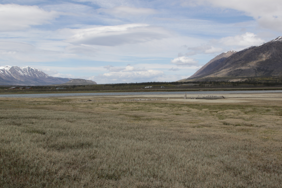
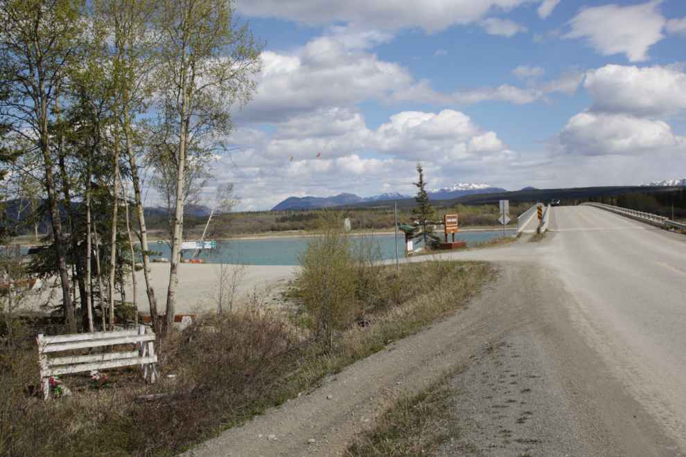
At Spring water levels, Nares Lake looks more like Nares Meadow, with a river over at the far side.
The sternwheeler wreckage can be seen in distance in this view looking north (the highway is to the left).
The Gleaner, 113 feet long, was built at the head of Lake Bennett in 1899 by the John Irving Navigation Company Ltd. She was bought by the Canadian Development Company, then in 1902 by the British Yukon Navigation Company, a White Pass subsidiary. After a busy career, she was removed from the company roster in 1932. She was eventually scuttled along the Nares River to act as a wingdam to channel the water for the sternwheeler Tutshi, which ran until 1955.
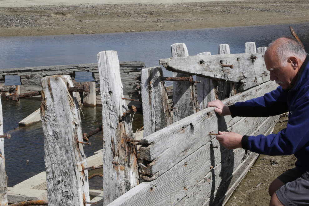
What stories those boards could tell…
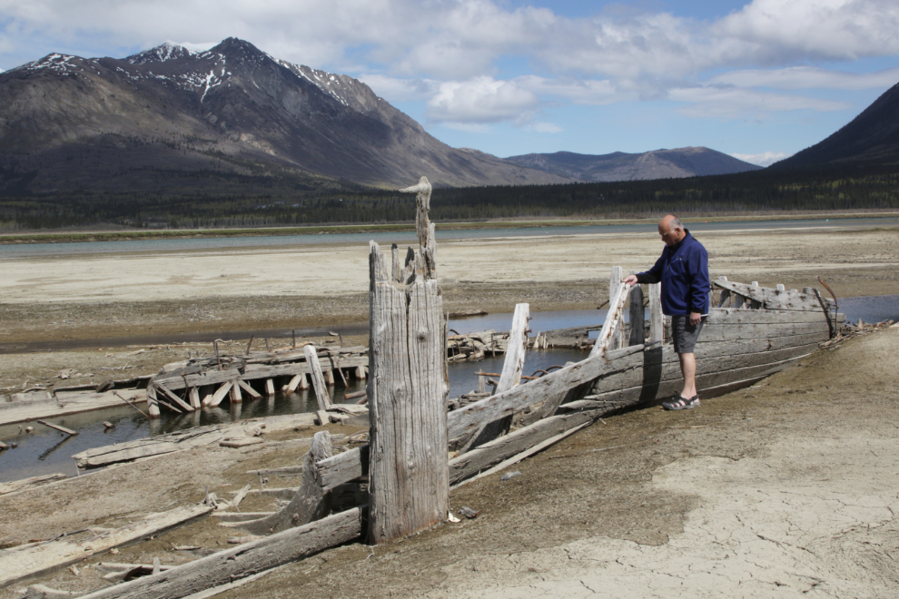
Looking at the construction details, with bolts for the various heavy pieces and hundreds of handmade nails for the planking.
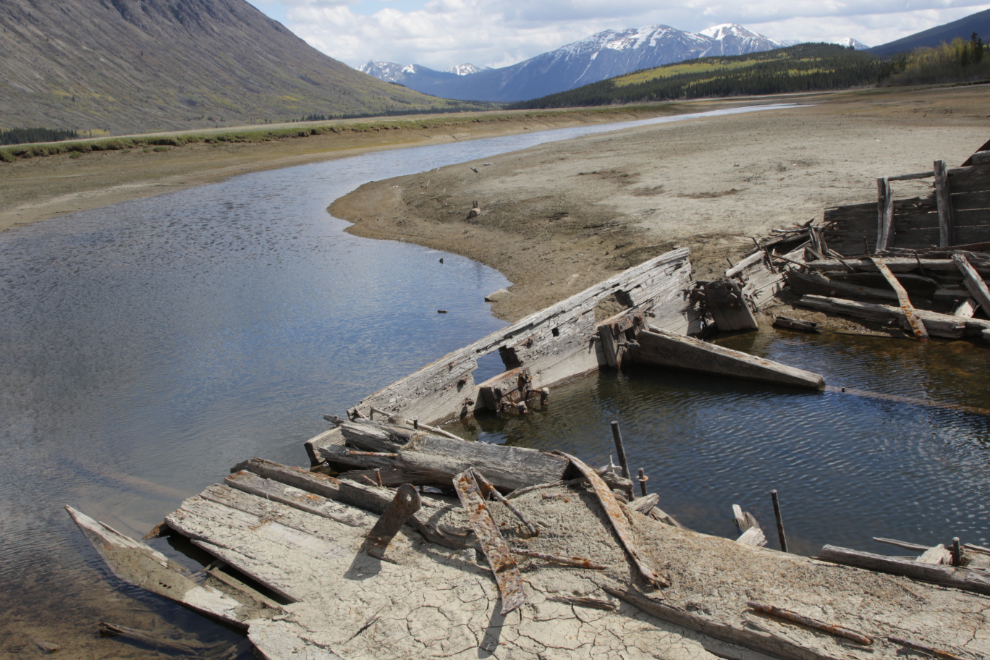
A final shot looking across the stern. I can update my page about her now.
I was back for the train’s departure, but only took a couple of photos from this spot.
The sternwheeler Tutshi looked rather ghostly through a screen of still-bare willows. The burned wreckage and viewing deck built over it is cordoned off for some reason.
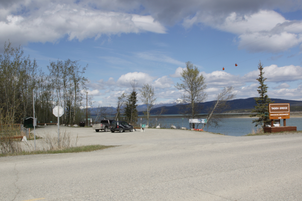
A friend recently told me about a grave he had seen right at the Tagish Bridge, so I took that roundabout way home.
Hiram David Good, 1856-1925. How intriguing. I have no information about him yet, but will be posting a query on my Yukon History & Abandoned Places group at Facebook shortly.
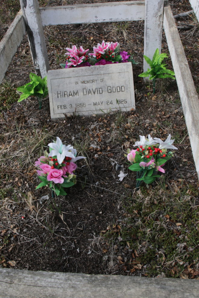
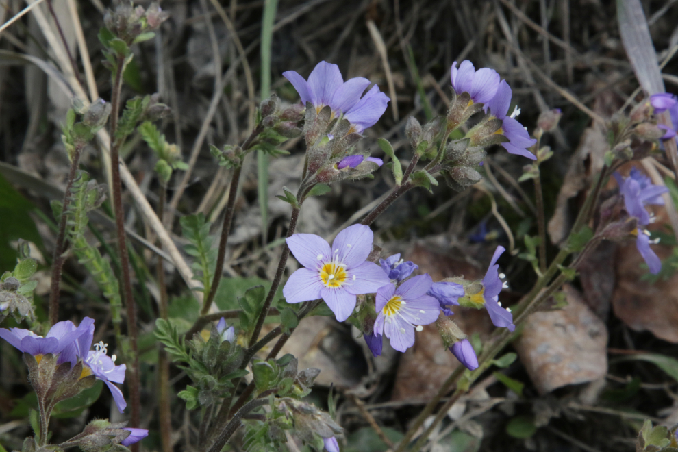
Jacob’s ladder (Polemonium reptans) in front of the grave.
It occurred to me that I needed more photos for both the recreation site and campground at Tagish for my Campgrounds & Rest Areas section, so that was the next project. My visits to the bridge recreation site are generally for swan viewing in the Spring, and aurora viewing in the winter.
I don’t think I’ve ever gone through the campground before.
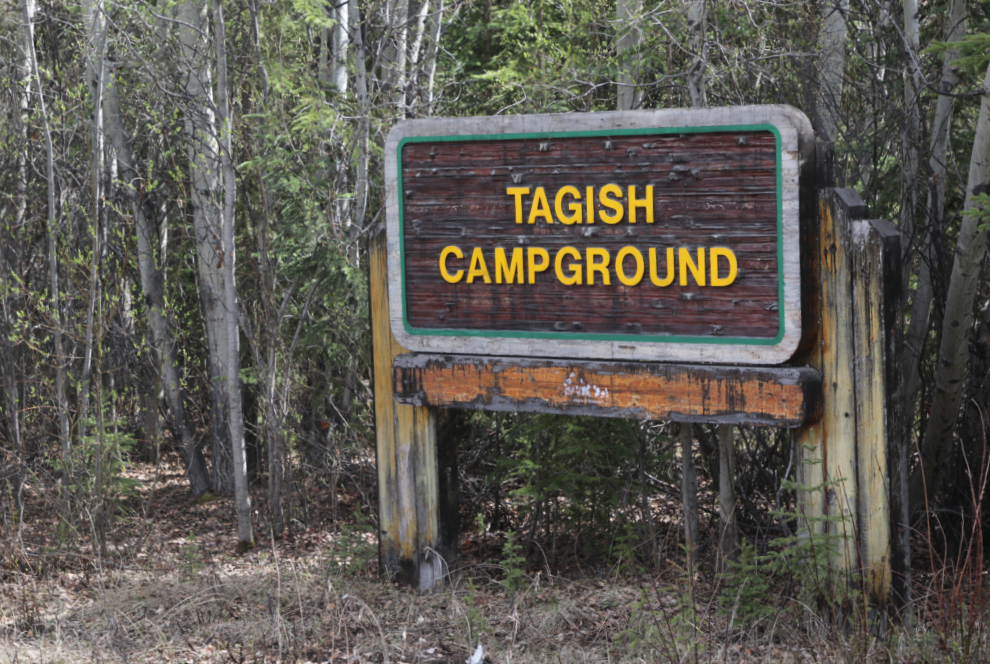
The campground is operated by the Carcross Tagish First Nation, but they’ve never really been into it and I think it’s about to be closed. The First Nation’s Final Agreement summary stated that “While the C/TFN will retain the area of the Tagish Campground as Settlement Land, it agrees to continue to operate the public campground for a period of 20 years following the date that the C/TFN Final Agreement is brought into legal effect.” That agreement to operate it expires on October 22, 2025.
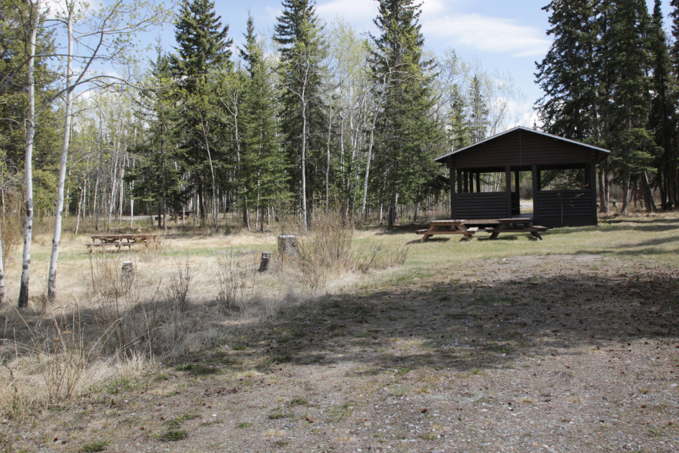
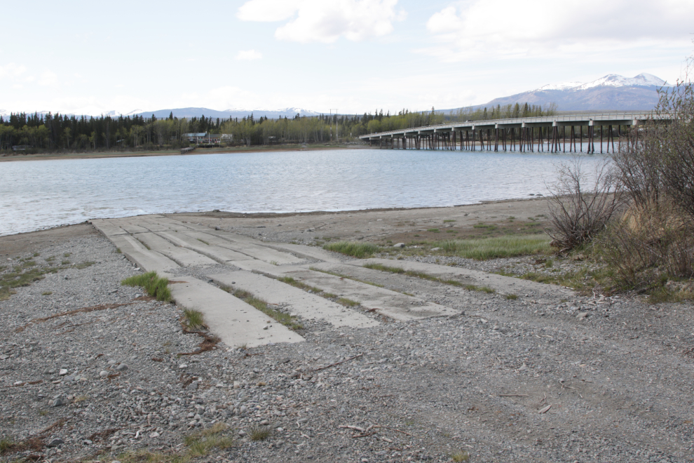
The boat launch may be what attracts the folks who do camp here.
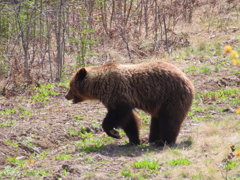
Contining on, I met a young grizzly, 10 km from Jake’s Corner where the Tagish Road meets the Alaska Highway. He/she wasn’t happy with my presence so I grabbed this quick shot and left – in my rearview mirror I saw him return to grazing.
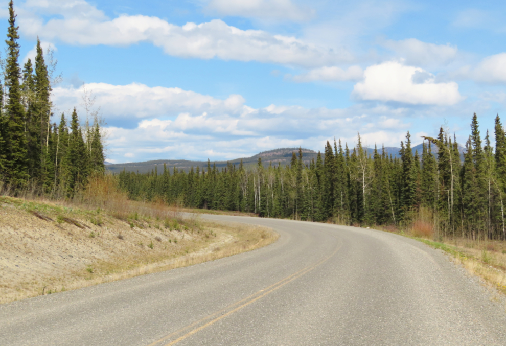
A final photo shot looking east right at the Km 10 milepost.
What a rich day — the kind of Yukon wander that layers history with the present.
I really appreciated the update on the Gleaner wreckage (those iron bolts and handmade nails!)
and the grave of Hiram David Good — such a poignant reminder of the individuals tucked into
this landscape. I’ve been compiling related threads of Yukon heritage and landscape myself,
with a few recent
photo
essays. It’s always inspiring to see your journeys bring it all together with such care.