Starting a 2-month road trip: Alaska Highway
As I start writing this, it’s the morning of our third day on the road, and I’m parked along the Alaska Highway in the middle of nowhere south of Fort Nelson, BC. It feels like it’s been longer than that – which I think is a good sign that the trip is going well. We’ll be travelling around BC and western Alberta for the next 8 weeks. For the first 3, it’s just me and the fur-family, then Cathy is flying to Kelowna to meet us.
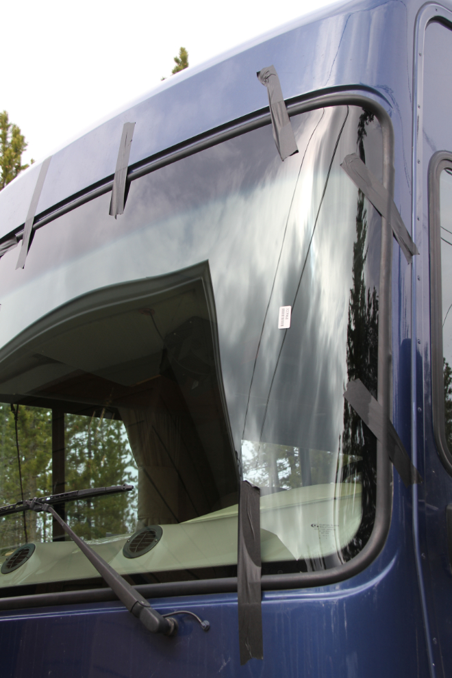
Getting the motorhome ready has been a financial “ouch”. The biggest hit, almost $4,000, was replacing both windshields, which were smashed by a guy with a handful of rocks at Kitwanga last Fall. Because it was vandalism, not road damage, most was covered by insurance.
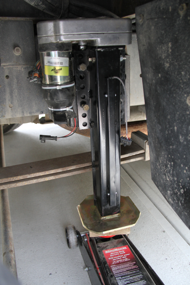
I finally bit the bullet and replaced the levelling jack that collapsed last year due to a combination of problems and conditions. Another $1,200, though that was less than half of the local quote I got. Strangely, I actually rather enjoyed doing this work, as heavy as it was. The rig really is quite easy to work on.
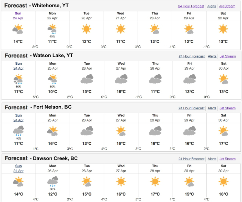
The weather was looking pretty decent for the 5 days I had planned between Whitehorse and Dawson Creek. That’s not at all the way it played out, though! 🙂
Sunday just before 11:00, we were well on the road and feeling good, at Jake’s Corner.
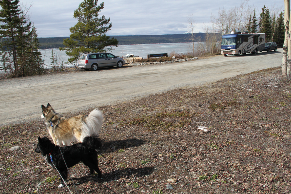
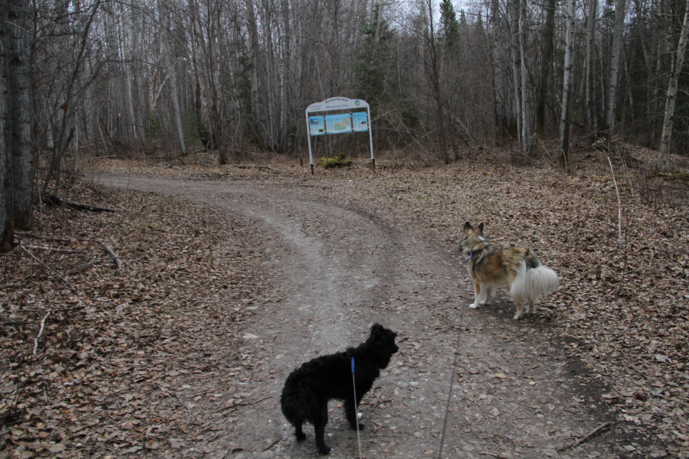
Having dogs is a great way to slow a trip down, although I know that they could do marathon miles if need be. Our first stop was at a viewpoint on Teslin Lake, less than 2 hours from home. They’re not going to be off-leash except in very controlled situations due to recent bad behaviour by both Tucker and Bella 🙁
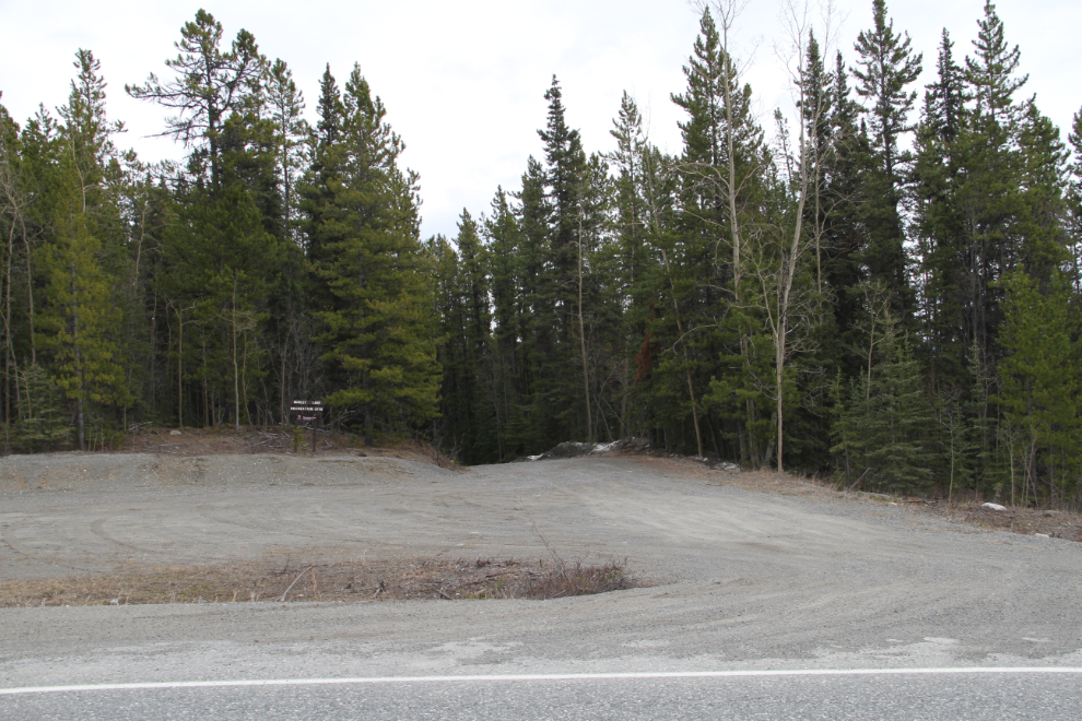
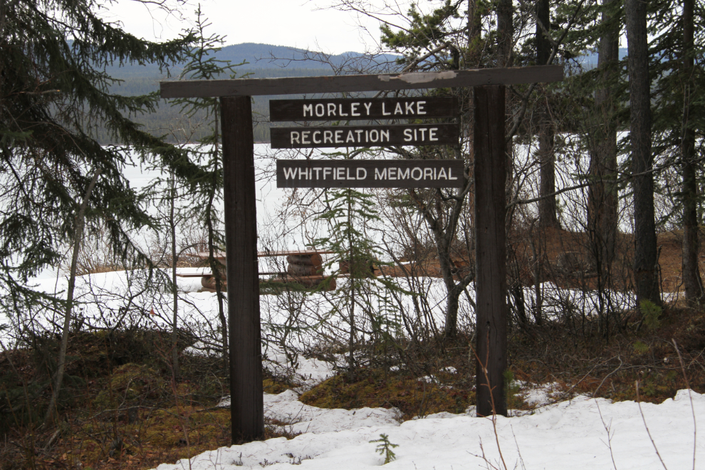
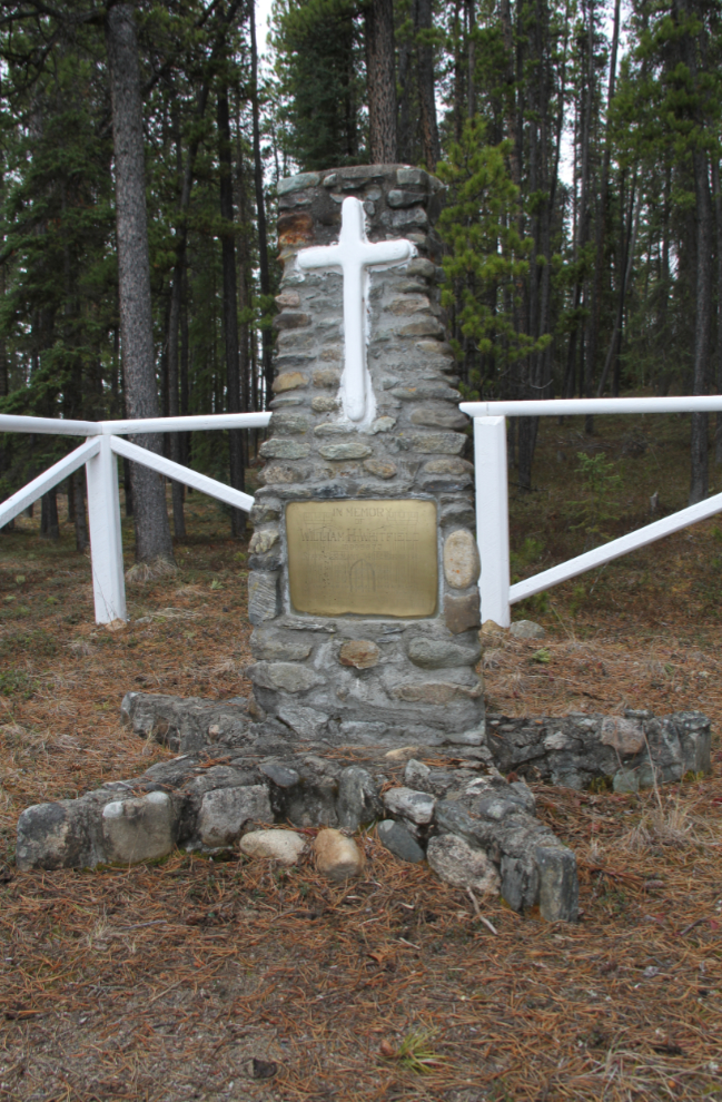
I was determined on this drive down the highway to find a cenotaph for a man killed during the construction of the highway. The access road for the Morley Lake Recreation Site is at Km 1202.1, and is very easy to miss – there is no signage announcing that it’s ahead and competing signage distracts attention from this road. As I had no idea what the road was like, I parked on the fairly wide shoulder of the highway – that turned out to be a very good decision.
There was lots of ice along the road, and up to 6 inches of snow. One truck had recently made an unsuccessful attempt to reach the lake.
Even in this weather, the site is gorgeous! There are a half-dozen rustic campsites along the shore, best suited to truck-and-camper type RVs. There are several well-defined trails leading to points unknown. Signs of a WWII camp are said to be in the forest, but I saw nothing on this quick look around.
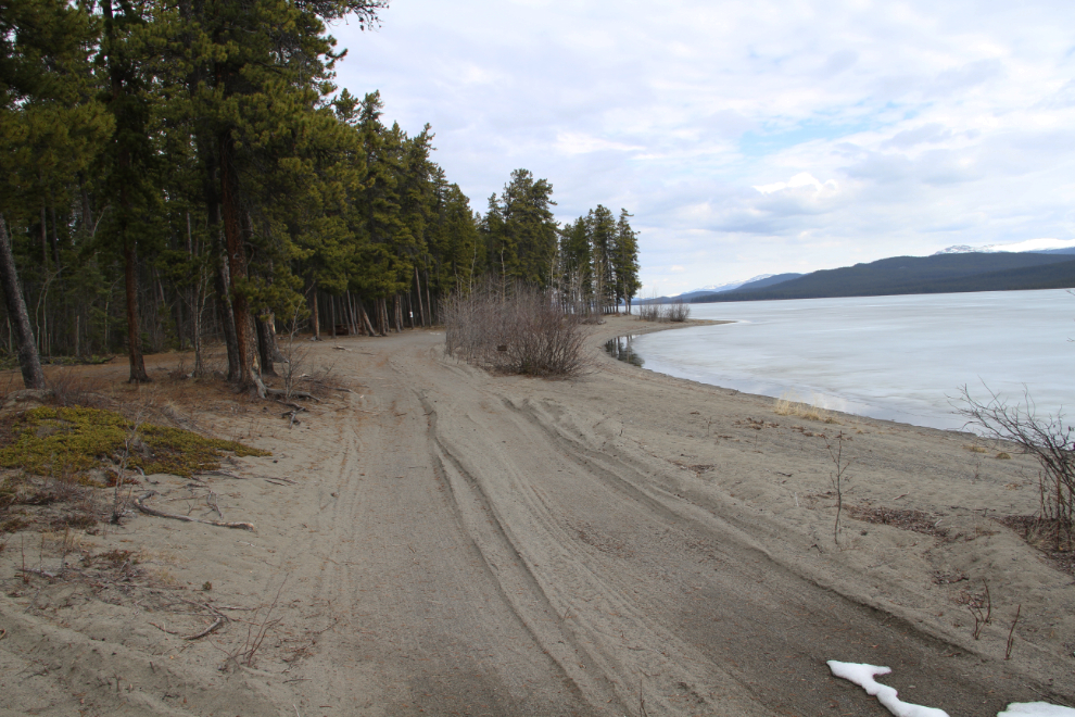
This lovely cenotaph is what I was looking for. It’s on the beach at the furthest-east part of the site. It honours William H. Whitfield, Staff Sergeant with the 340th Engineers, who died near here on December 18, 1942, of unstated causes.
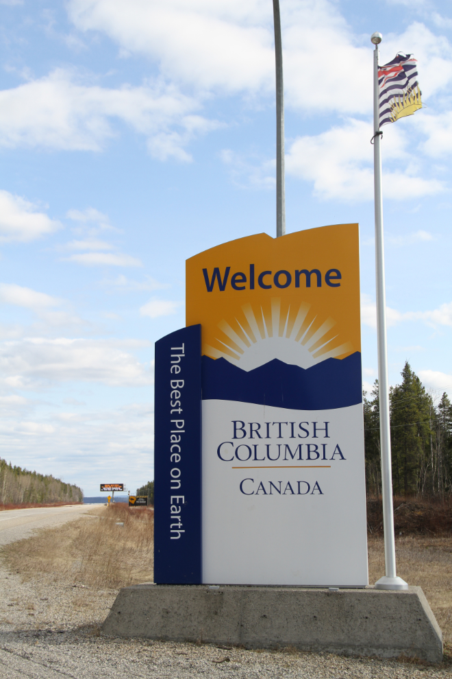
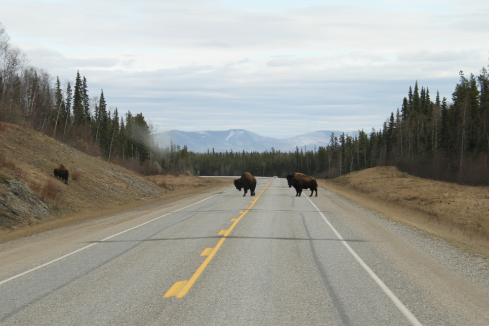
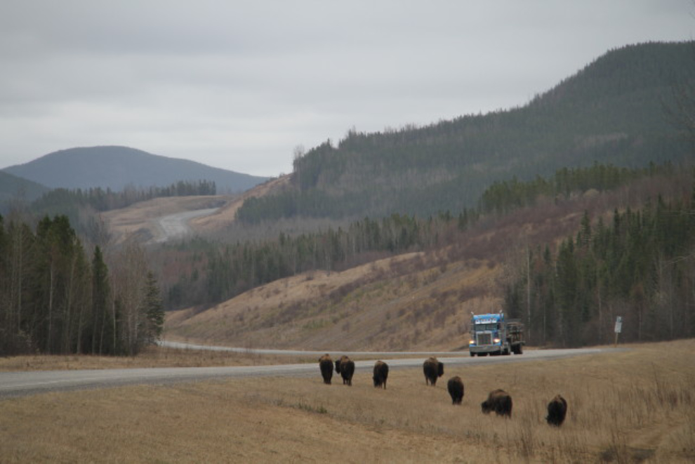
I fulled up at Watson Lake, and a few minutes later made the “official” crossing into British Columbia, though by that point the highway has wandered in and out of BC half a dozen times. The large signs just down the highway warn of bison on the highway all the way from Muncho Lake to the Yukon – the expansion of their range in recent years has been quite amazing.
About 10 minutes later, there were indeed bison on the highway, as advertised. They move off the road whenever they feel so inclined – these ones moved off in just a minute 🙂
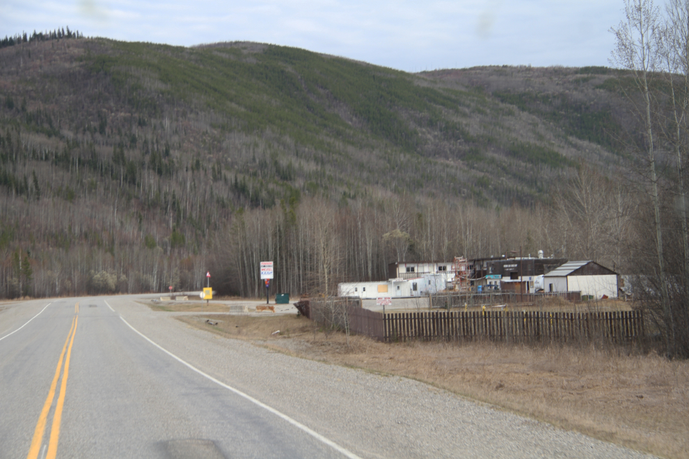
A couple from Alberta tried to get the Fireside Lodge going again, but when I saw an unsuccessful crowdfunding request a few months ago to buy a new generator, I expected to find it closed, and that, sadly, is the situation. It takes deep pockets, a good knowledge of the business, and infinite patience to get into that business.
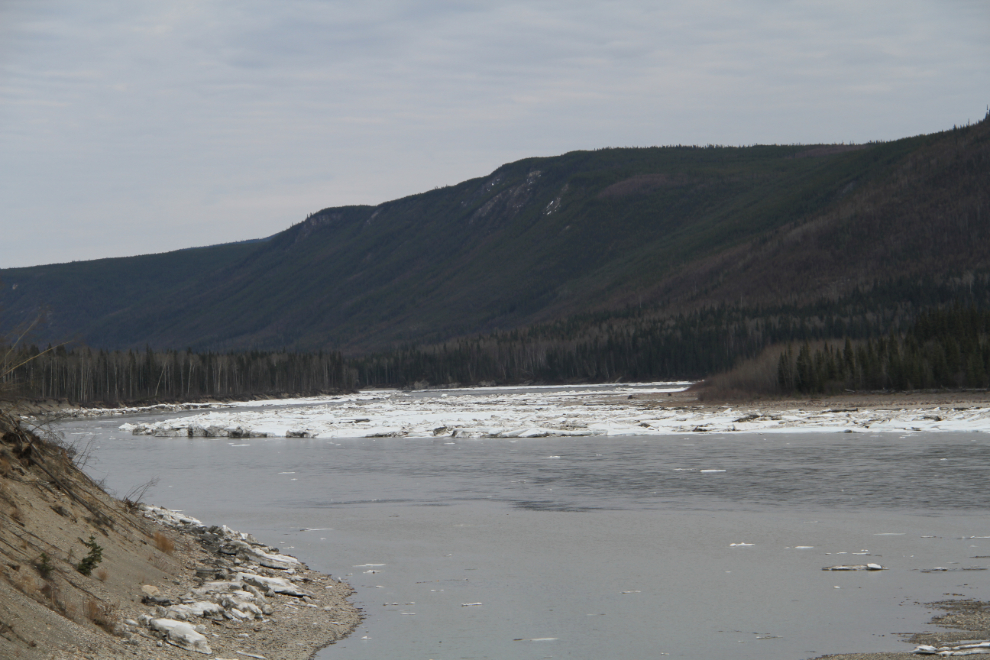
The ice on the Liard River was piled up in very impressive ways at a few locations – it looks like it hasn’t been open for many days.
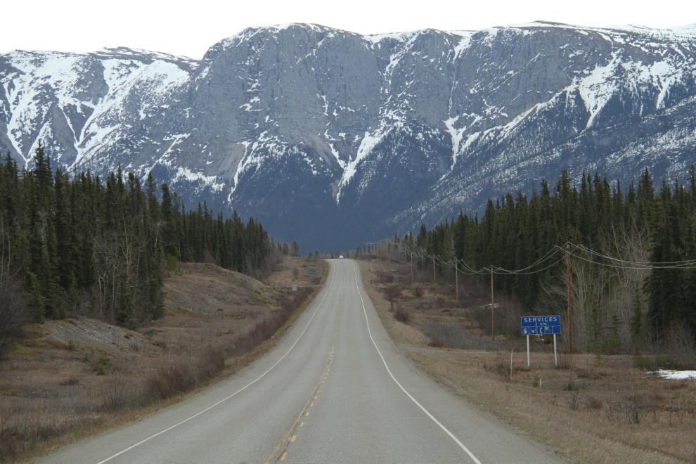
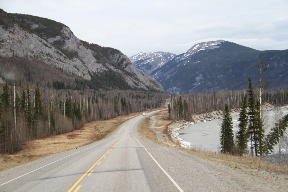
I really like this distinctive spot on the highway because I know that Liard River Hotsprings is only 20 minutes or so ahead. This was the longest driving day of the trip, at 628 km – I prefer to stay under 250 km.
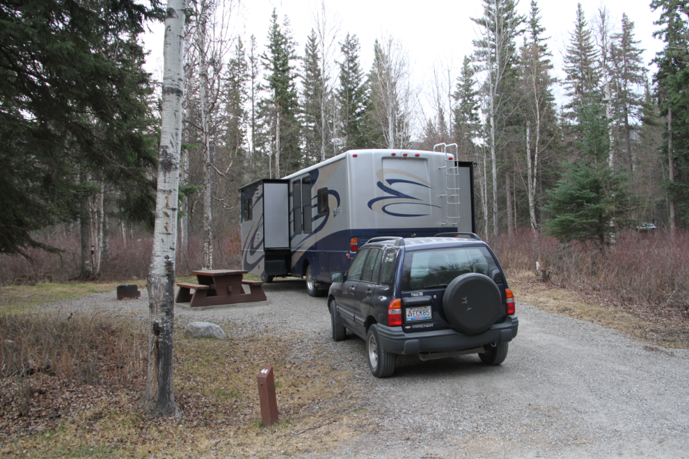
Our campsite in Liard River Hotsprings Provincial Park Campground. It’s beautiful, for $16 off-season (the summer rate is $26). The park attendant who came around the collect the fee said that the previous night the campground was half full, with lots of tourists headed for Alaska. This night, there were only a dozen or so RVs, half from the Yukon and most of the others with Alaska plates.
Ahhhhhh – the hot springs are such a wonderful way to end a day. A couple from Germany, on a short whirlwind tour from Vancouver, got lots of advice from me and other Yukoners in the pool about where to go next, but in the end, they were pretty much out of time and probably wouldn’t even reach Whitehorse 🙂

The next morning was exploring day, as I only planned on driving 166 km to Summit Lake, where I wanted to go hiking or snowshoeing for a day or two. First, while on a dog-walk, we found a road just east of the campground that proved to be the perfect dog-walk road. I don’t know yet where it leads, though I expect that it’s from highway construction days.
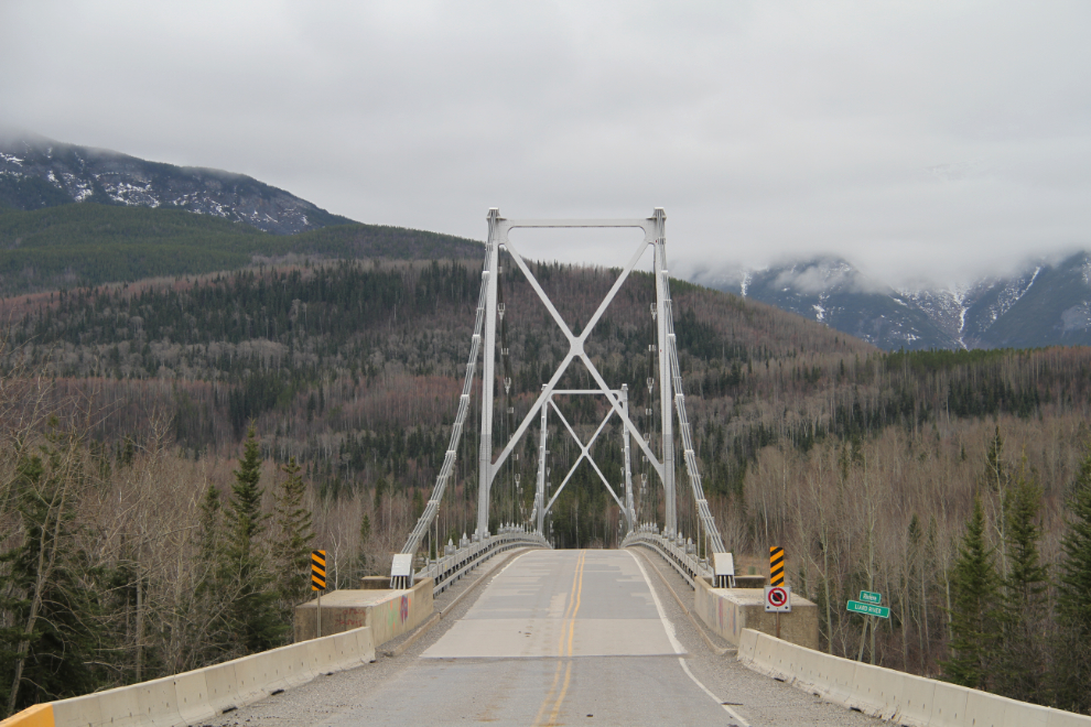
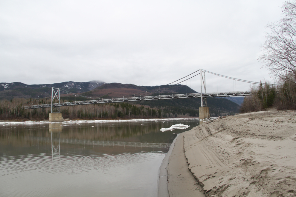
We then went back and got the Tracker to do some more distant exploring, specifically around the Liard River Bridge.
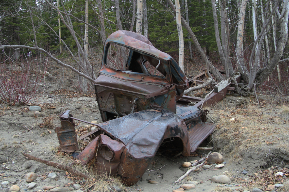
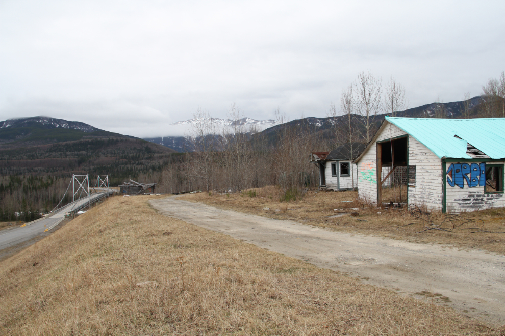
Walking out onto the bridge, I saw an old truck that I’ve been looking for, and it appeared to be easy to access. Sure enough, there was a rough road right to it.
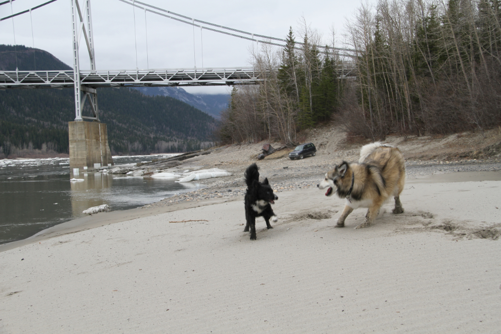
The beach there proved to be a great place for the kids to play off-leash. The beach is just a few feet outside the park so “leash only” rules don’t apply. They had a ball, in and out of the river, and got back in the car very wet and dirty 🙂
This is the last suspension bridge left on the Alaska Highway – truly one of the iconic structures along the highway now.
I went up to the Liard River Lodge site, but with the historic lodge having burned last year, there’s not much to see anymore.
We were back on the road with the motorhome by about 11:00, and encountered several more groups of bison over the next few kilometers.
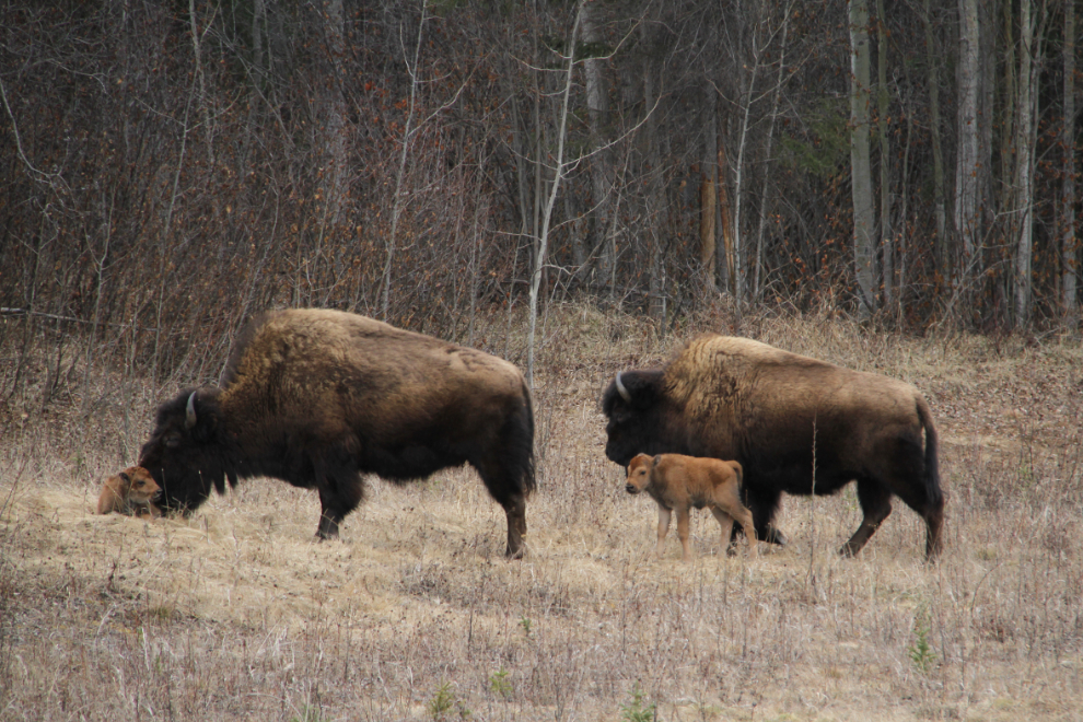
The bison have just started to drop their calves. I’d only seen one up to this point, and these ones appeared to be not more than a day or two old.
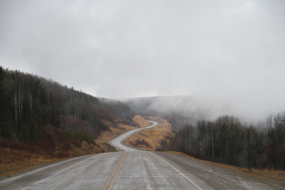
More curves are being removed along the highway every year, on sections about 5-10 km long at a time. I have lots of photos of this curve, because there were often Stone sheep on the road there.
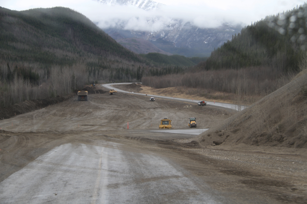
Last year’s curve-removal project, at Km 743, is ready for paving as soon as the weather allows.
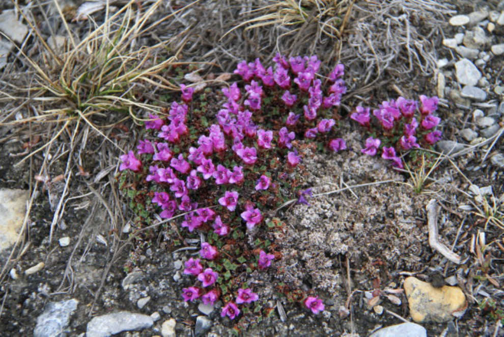
At a stop along Muncho Lake, where bitter cold and light rain removed thoughts of a hike from my mind, looking very closely was rewarded by seeing these tiny flowers – the entire group perhaps 3 inches across.
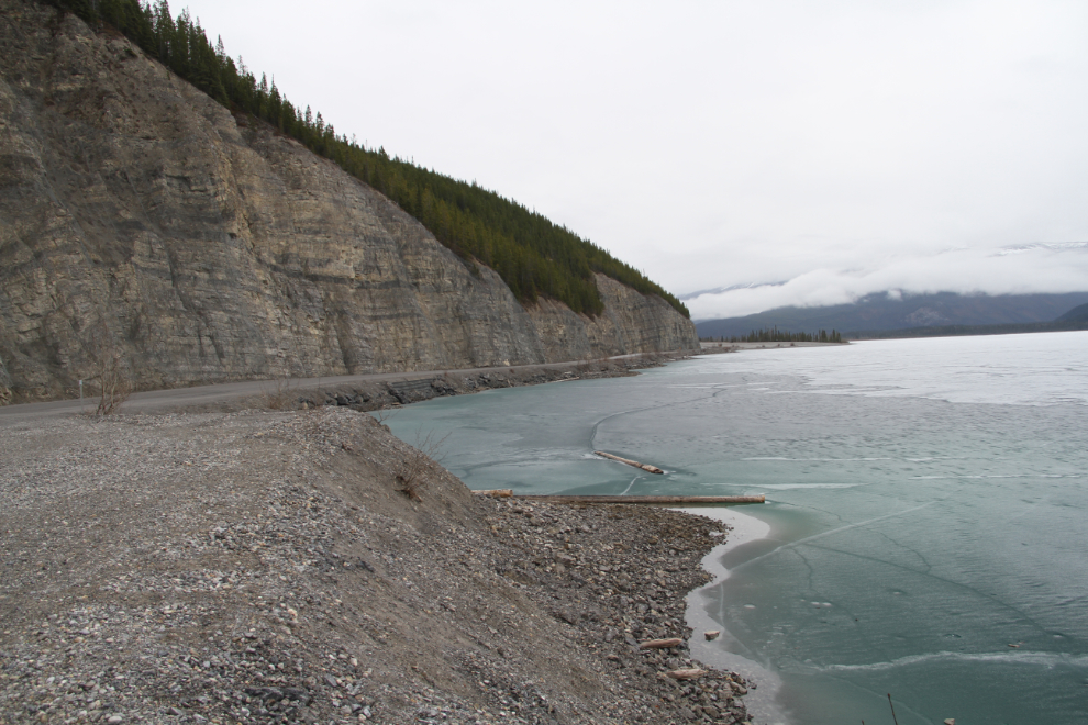
Muncho Lake is still completely frozen, and you can just get a hint of the gorgeous colour through the thin ice along the shore.
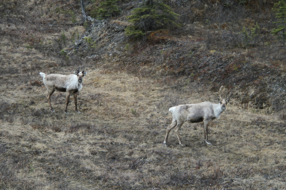
Caribou just east of Muncho Lake.
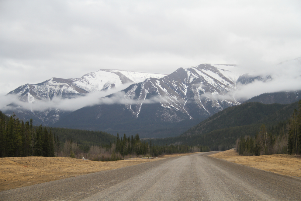
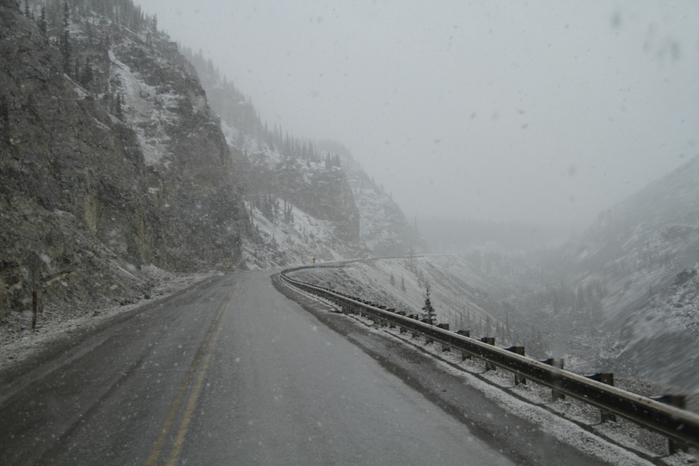
The rain had started to be accompanied by snow at Muncho Lake, and as I climbed “The Cut” up to Summit Lake, it turned to all snow, and started to stick on the road. This would be a really bad place to spin out with a “toad” (a towed vehicle) that makes it all but impossible to back up (the front wheels of the toad immediately go sideways).
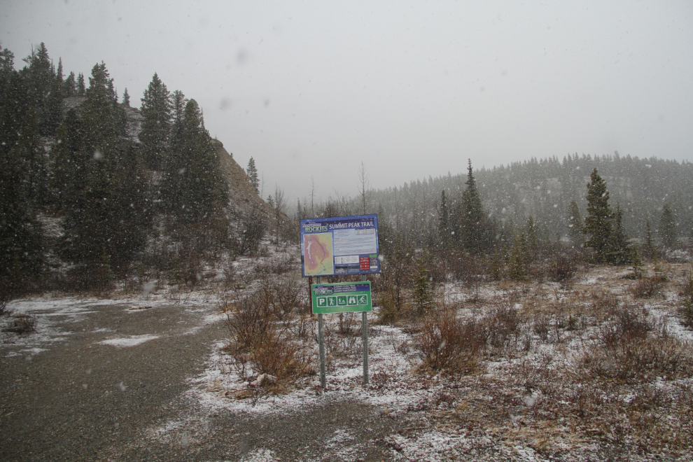
The view from my proposed camping spot and hiking base at Summit Lake. After lunch, an afternoon nap seemed like a good idea, and it turned into 3 hours!
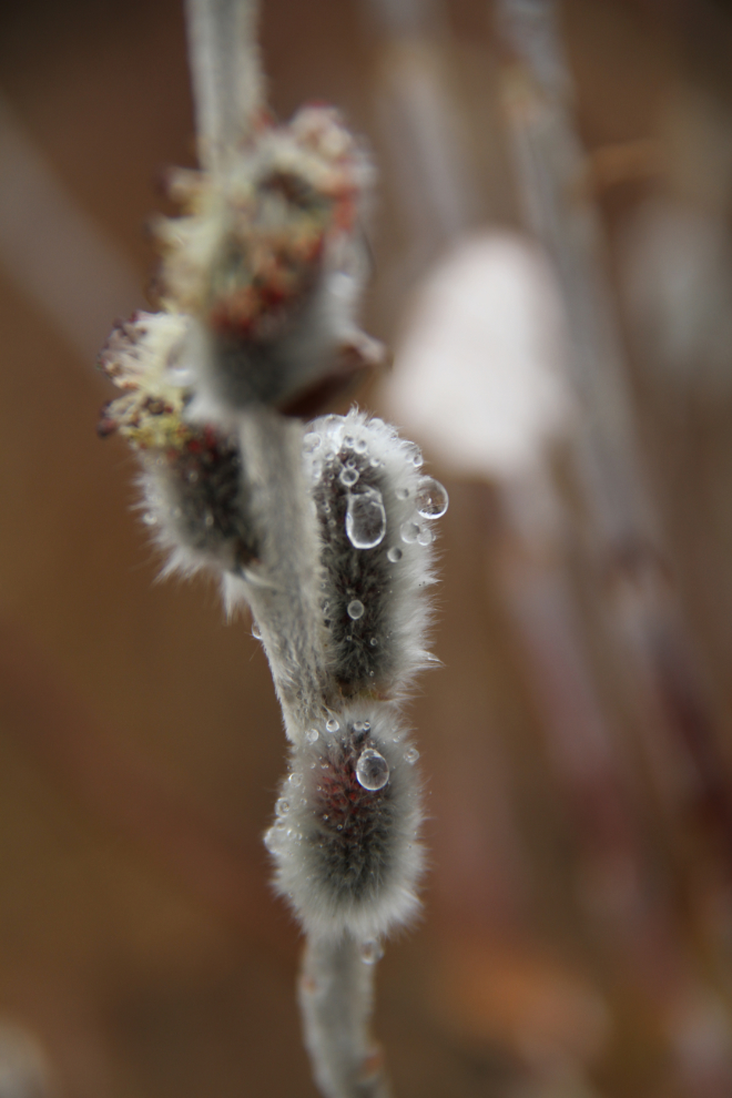
Before leaving Summit Lake for some place with better weather, I took the dogs for a walk from the campground, and was pleased to see that the pussywillows are arguing with Father Winter that it is indeed Spring.
Climbing up to Steamboat Summit. The notorious, very windy old road – the one that I drove many times – can be seen in many places along this stretch.
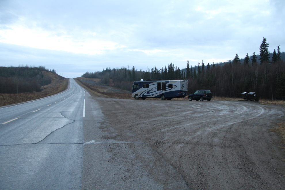
I stopped in Fort Nelson to make dinner, fuel up, and let Cathy know what I’m doing, then continued on to this pullout at Km 374. During the night, a semi and another RV joined me, but it was a pretty quiet night. The temperature dropped close to freezing, but the hghway looks good now as I finish writing just before 07:00. It’s time to get breakfasts made, then Dawson Creek is the next stop, a bit less than 4 hours away.