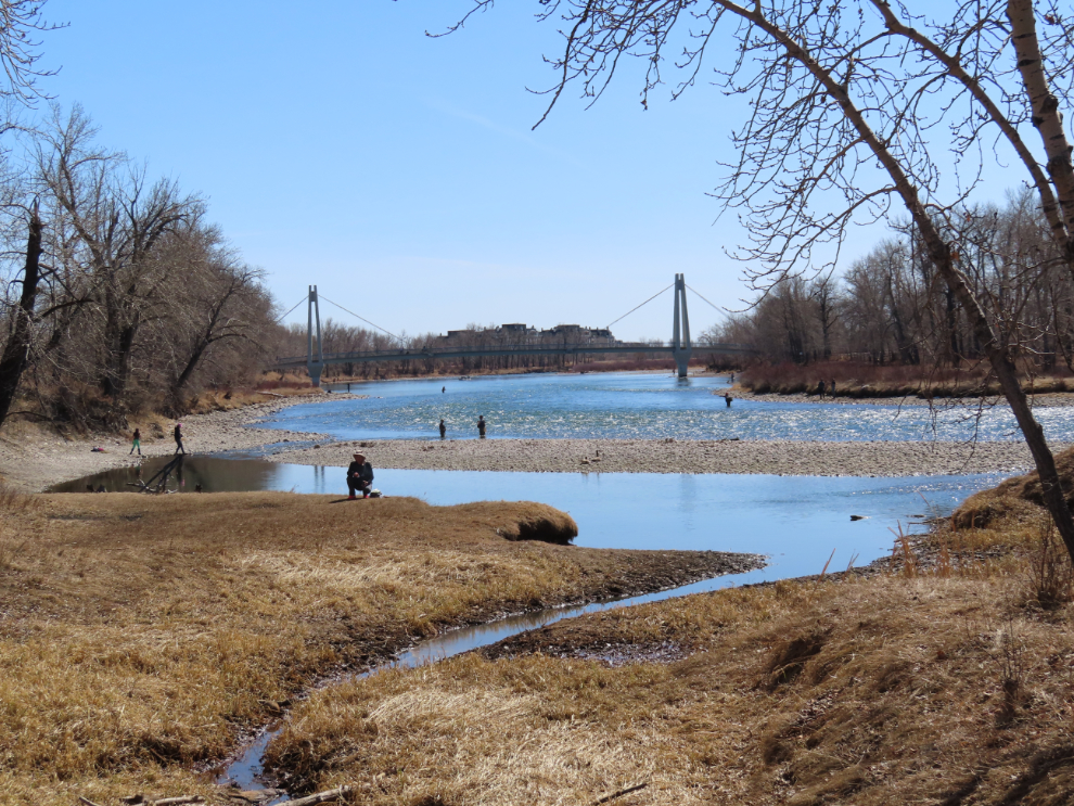
Carburn Park and other Calgary exploring
I normally limit my visits with family to 3 days, but this time I went for 5, and it worked out very well. I spent a lot of time exploring the nearby Carburn Park and Bow River Trail, and walked almost 20 km there. I was amazed by how...
Read More
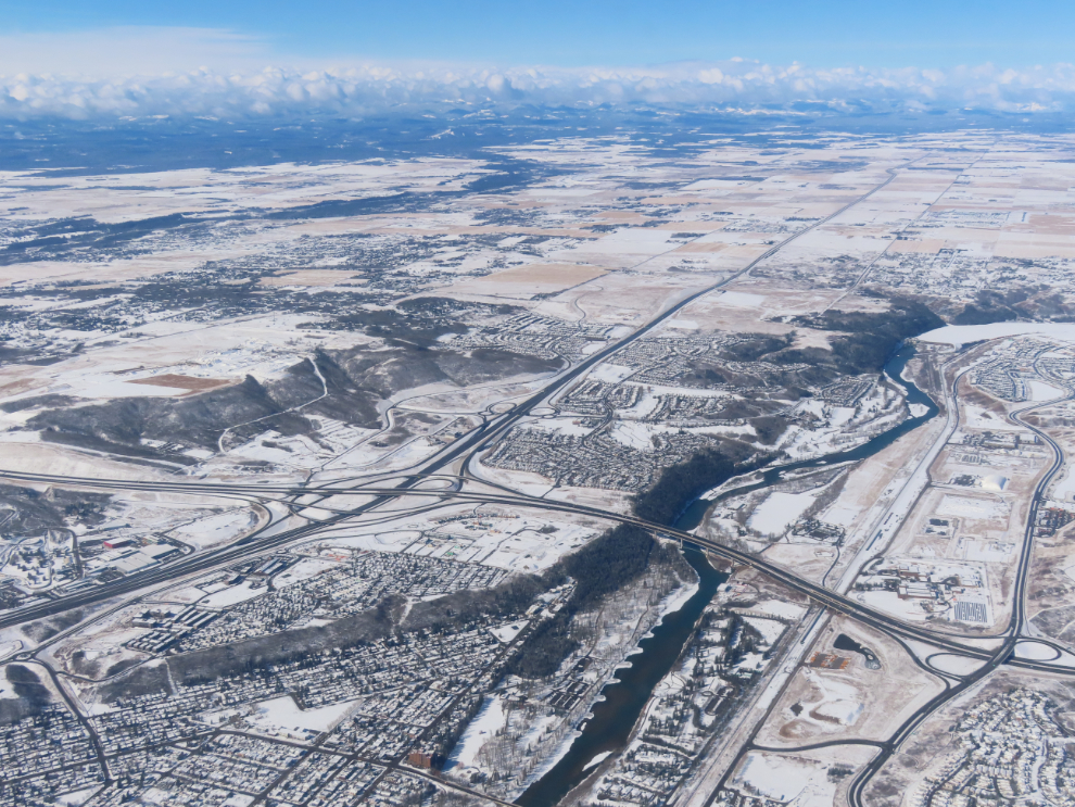
Flying to Calgary for a few days
I’m way behind now, but I still want to post about my trip to Calgary. I flew down to see my kids on April 3rd and returned on the 8th. Unfortunately I caught a cold my last day there, and the day after I got home I was down...
Read More
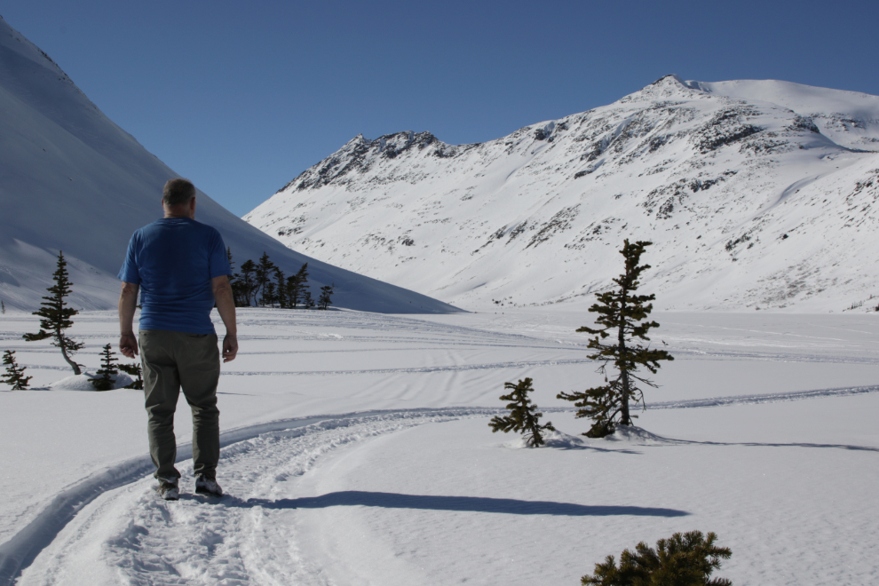
A Spring wander and hike to Bryant Lake
A friend posted a meme on Facebook yesterday morning that got me thinking (thanks, Sue!). It said “Turn off the news. Go outside. Breathe. We were not meant to carry the burden of the entire world.” I’ve been doing quite well in moving away from the nastiness of politics,...
Read More
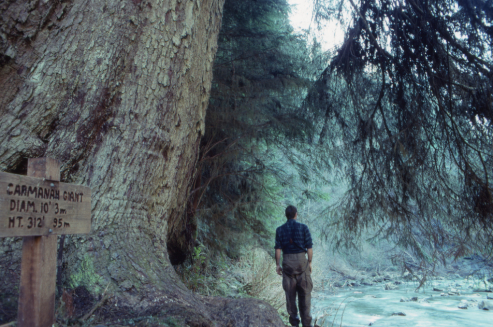
Hiking the entire Carmanah Valley to the sea in 1990
Last September I posted an article about “Paddling BC’s Bowron Lakes circuit in 1968,” a trip that I have many photos of but no memory of. That was an enjoyable way to recreate a significant adventure and it brought back some tiny fragments of memories of the trip. This...
Read More
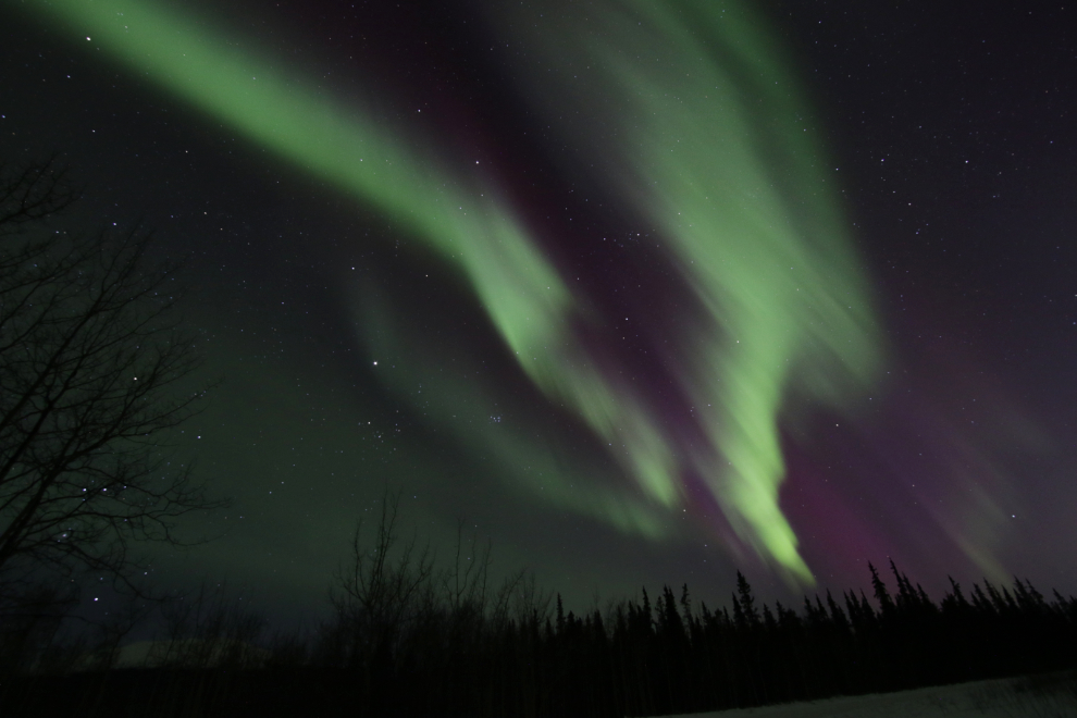
A brief but intense aurora show
As I went to bed Tuesday night, I looked outside and said to Cathy that it felt like an aurora night – “in a couple of hours.” An hour and a half later, she woke me up and said a display had started. I put my pyjamas on, got...
Read More
Review: KÜHL Revolvr hiking pants
It’s been many years since I’ve posted a product review. I get occasional requests by manufacturers to review various products but none have caught my attention since I did a couple of motorcycle jackets in 2014 and 2015. I’ve always been curious about high-end hiking pants, though, so when...
Read More
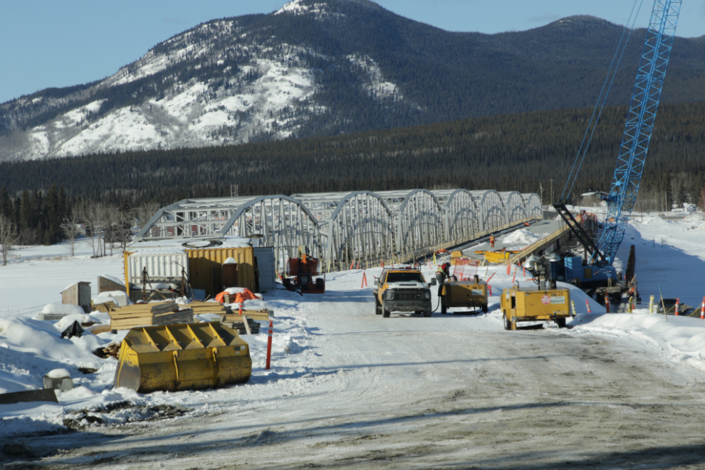
Checking on the progress of the new Nisutlin Bay Bridge at Teslin
I’ve been watching the planning and construction progress of the Nisutlin Bay Bridge at Teslin since it all began, and have been planning for many months to drive down for a look. With Spring approaching, I’m getting very itchy to hit the road in some form, so when I...
Read More
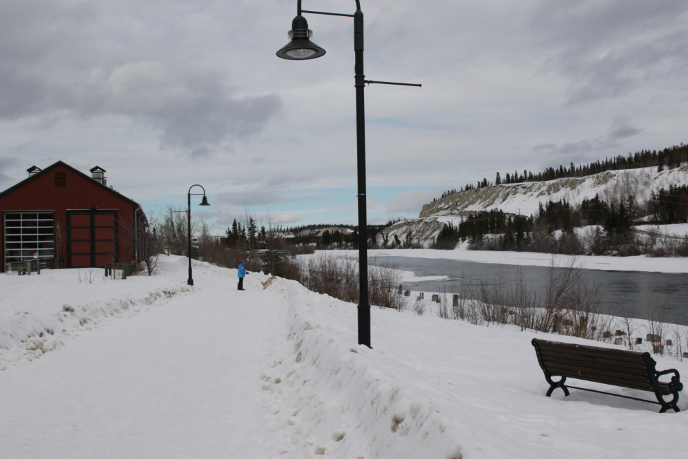
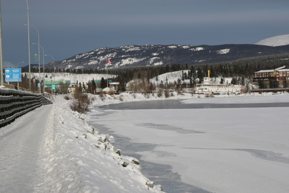
A detailed look at the Waterfront Trail in Whitehorse
My project yesterday (February 27th) was to document the entire Waterfront Trail, to show people what it looks like as a reply to some online complaints about how the new buildings in Whitehorse have ruined the views of the river we used to have. In actual fact, we now...
Read More
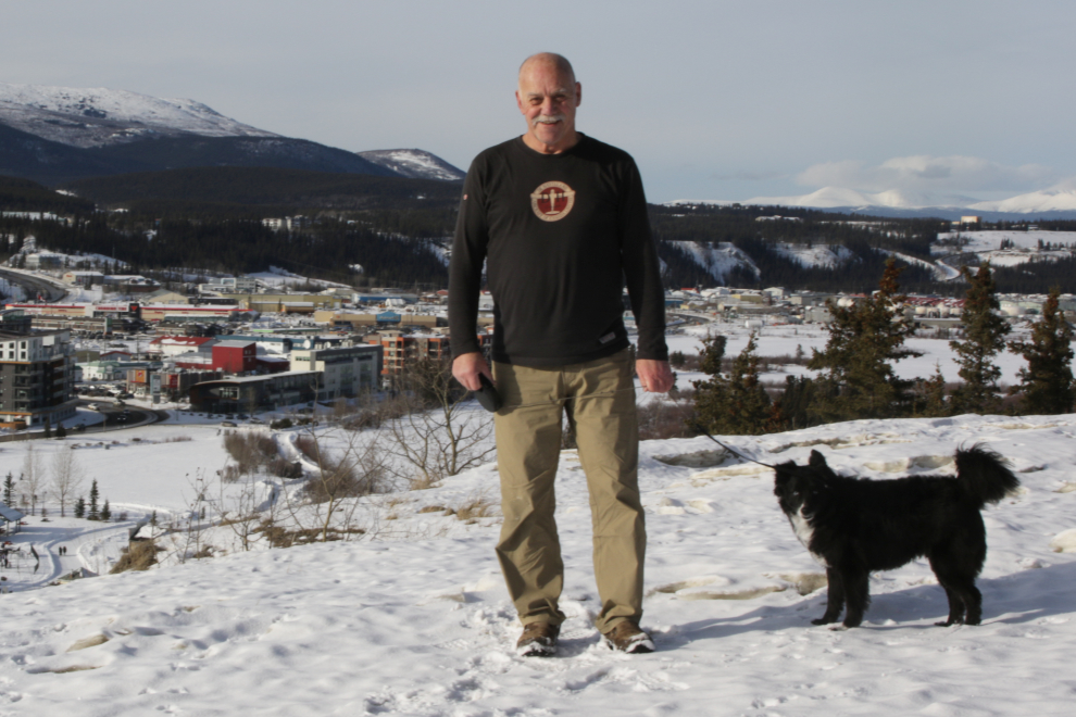
A winter walk on the Millennium Trail in Whitehorse
This post was written this morning for my page at The Outbound Collective, but I decided to post it here instead. The writing is a bit different than my normal because it’s written for people who know nothing about the Yukon – the articles are meant as a “first...
Read More
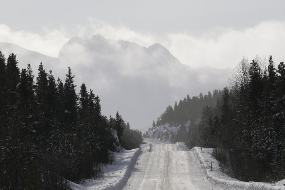
Driving from the beauty to the beast
A wonderful spell of warm weather has prompted me to get out a fair bit. I wanted to do two road trips – one to the White Pass and one to see the new bridge being built at Teslin. A storm warning about a system moving in with heavy...
Read More