On 2 wheels – outings with the e-bike and the gas-bike
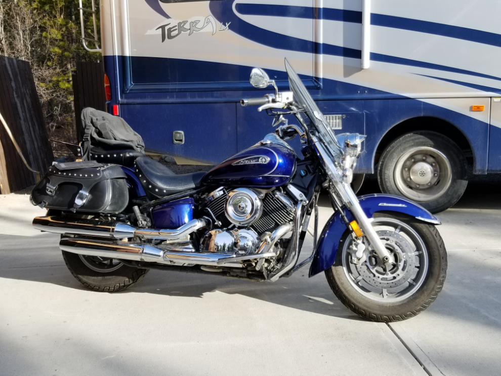
On Tuesday and Wednesday (May 4th and 5th), I made two rides that were significant in my life. On Tuesday I did the longest ride yet on my new e-bike, just over 30 kilometers. And yesterday I did a 504-km ride to Kluane Lake on the V-Star – it’s only 6 weeks ago that my brain injury symptoms were so bad enough that I thought I may never ride again.
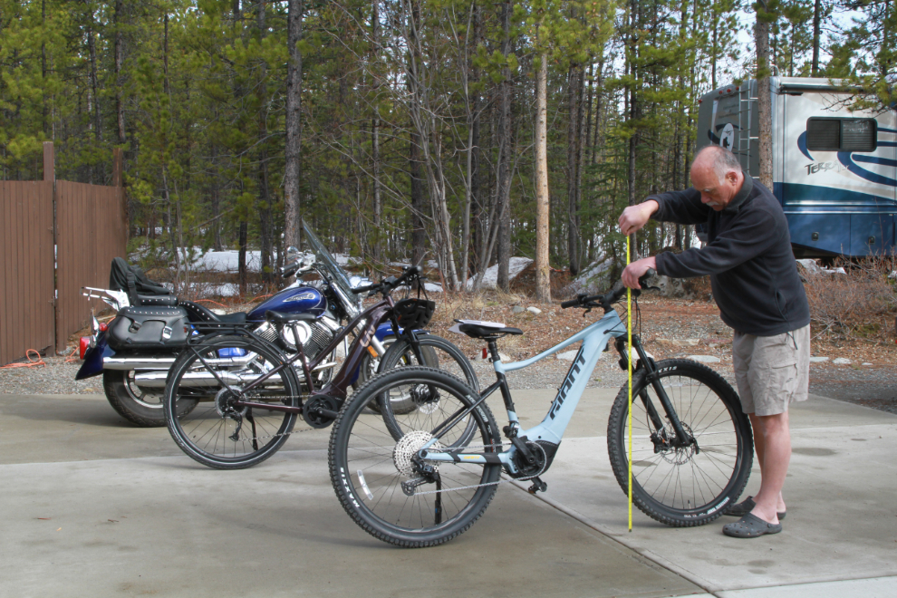
My e-bike (a 2021 Giant Fathom E+ Pro) sat in my office over the winter. My inaugural ride was on April 18th, but I hadn’t ridden it much since – the handlebars were too low for me and it was very uncomfortable. I finally bought an after-marker riser for it, and that 3 inches made the difference. In the first photo I was measuring my bike and 2 comfortable bikes to see how much of a rise I needed.
On my May 4th ride, I used a new app called Relive, which records the ride and produces a cool video with the GPS combined with photos you take along the route.
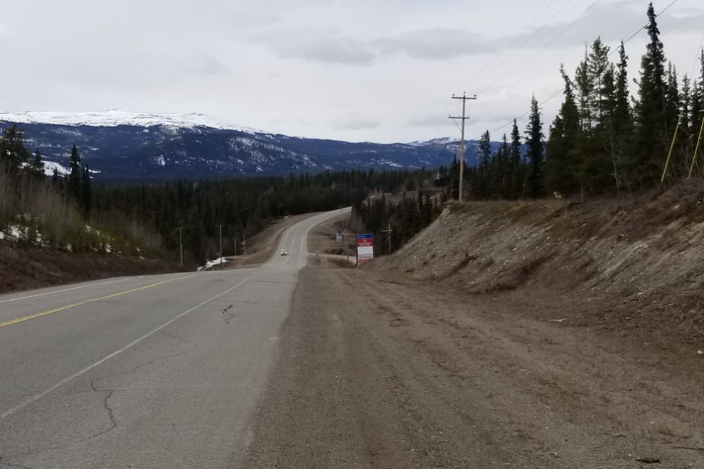
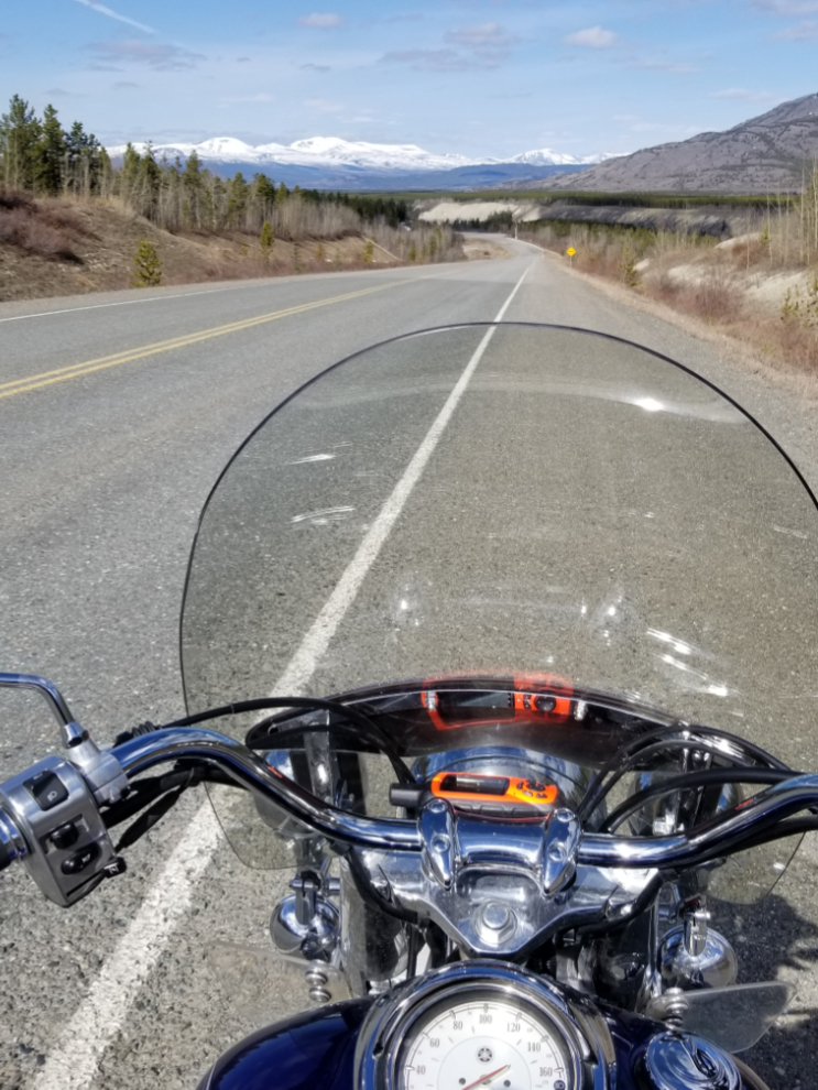
The first photo was shot on the Alaska Highway when I realized that I hadn’t turned the app on yet. On the right at the bottom of the dip is the Wolf Creek Campground.
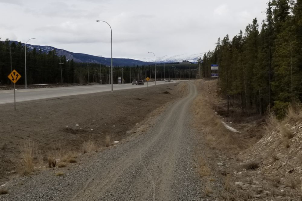
At Km 6.9 from where I turned it on, I moved over onto a new multi-use trail that was built 3-4 years ago. This isn’t a very inspiring route, but it will have to do until the snow is gone from the back-country roads and trails.
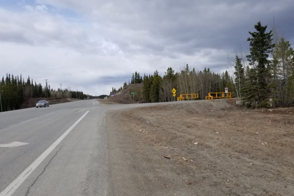
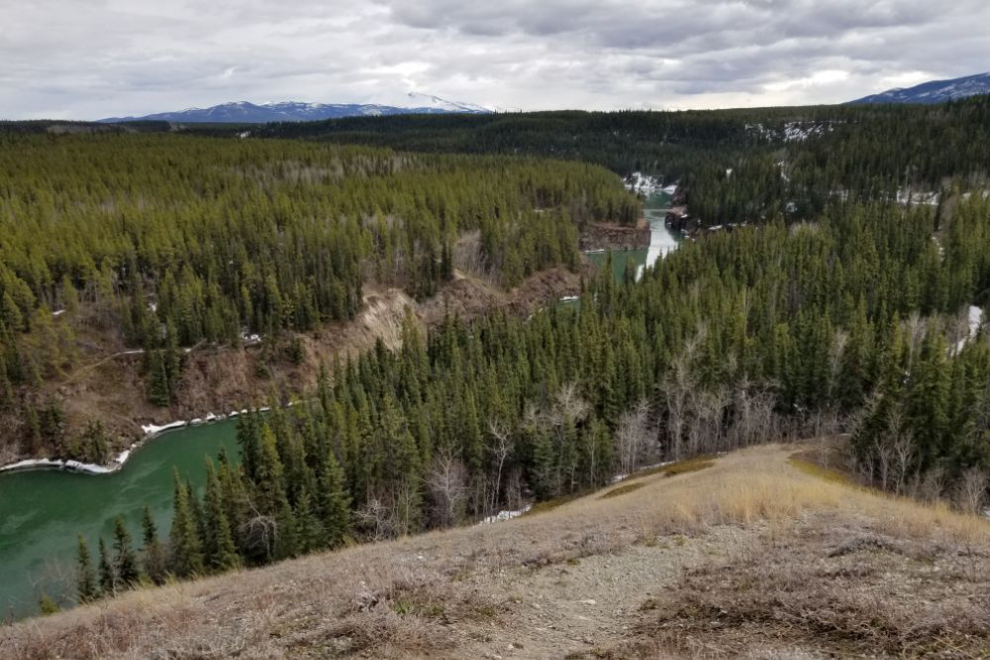
At Km 8.3 I turned down the Miles Canyon Road. The road starts with a steep down-hill where even with a fair bit of brake application I hit the top speed of the ride, 55 km/h.
The Miles Canyon Road then climbs steeply up to this view over the canyon, which is a narrowing of the Yukon River between walls of basalt. With the e-bike, hills barely exist beyond the need to gear down.
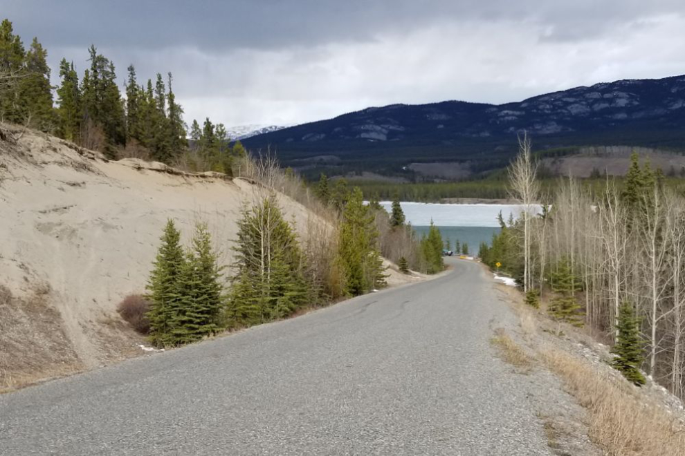
Another steep down-hill is followed by another climb, then a final very long, very steep down-hill to Schwatka Lake that got my brakes smoking.
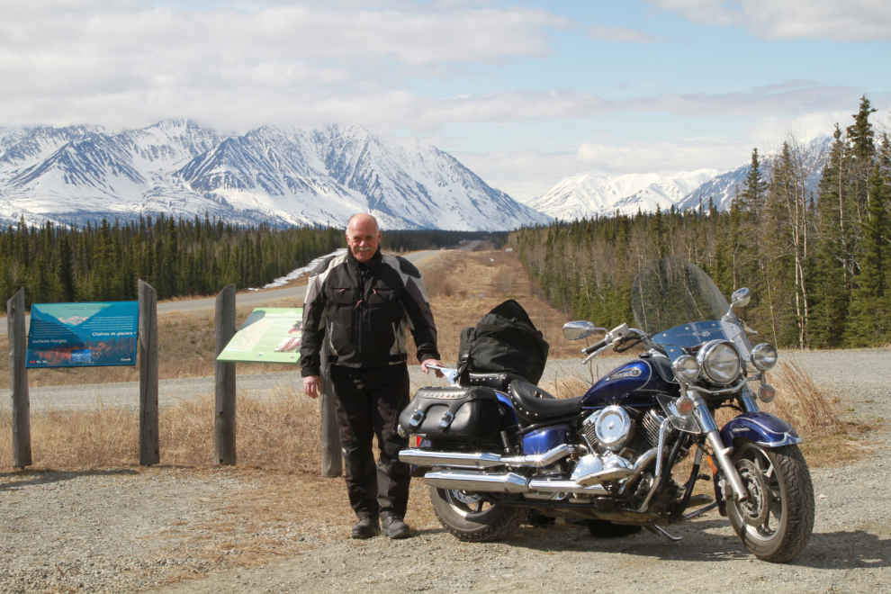
Over the past few weeks there has been a dramatic improvement in my brain injury symptoms, to the point where I knew I could pass the final hurdle on this long path – riding my motorcycle. Just 6 weeks ago I was still so dizzy that this was just not an option.
Yesterday morning a series of things online resulted in this Facebook post by me: “It’s only 08:45 and I have TOTALLY lost my patience with people. I’m heading into the mountains on the V-Star for the day…”
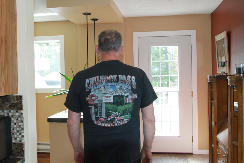
Proper attire was needed to set the correct vibe. It was only +4°C so Harley tshirt from the Skagway shop was the first of 5 layers required to start the ride in comfort 🙂
By about 10:30 I was on the Alaska Highway well west of Whitehorse. Sunshine, open road, and no people. Much better!
I often stop for a break at the Kluane Range Rest Area at Km 1566.
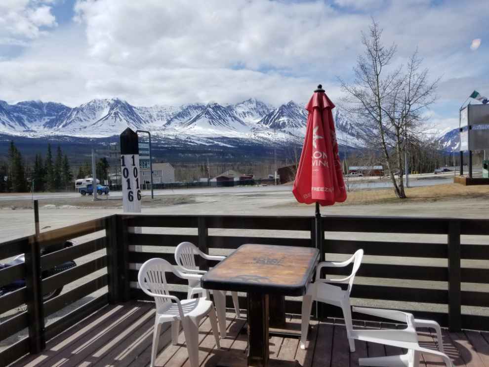
Until the last second, I hadn’t been sure whether I’d ride south to the White Pass or west to Kluane Lake. West was the right choice, because it allowed me to have a great lunch at the Mile 1016 Pub. It really is pretty tough to beat, for food, service, and ambiance. And the view doesn’t suck either 🙂
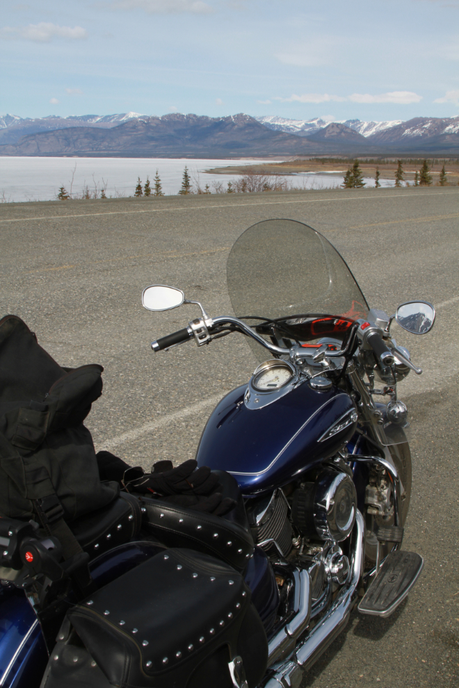
I almost headed back home after lunch, but decided that I really wanted to see Kluane Lake. At 2:20 I made a photo stop at Km 1602, just west of Creek Bear Summit, which at 1,004 m/3,294 ft is the highest point on the Alaska Highway between Whitehorse and Delta Junction.
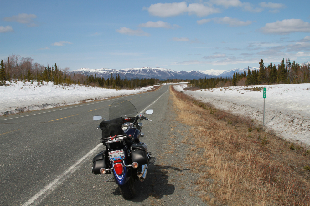
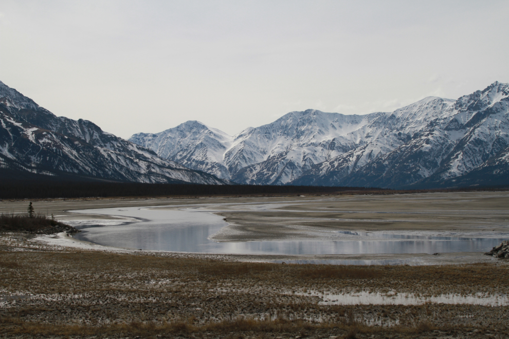
Past Christmas Creek at Km 1630.4, the highway climbs to Boutillier Summit, just 1 meter lower than Creek Bear Summit. Kluane Lake is just past that, in front of the mountains seen in the next photo.
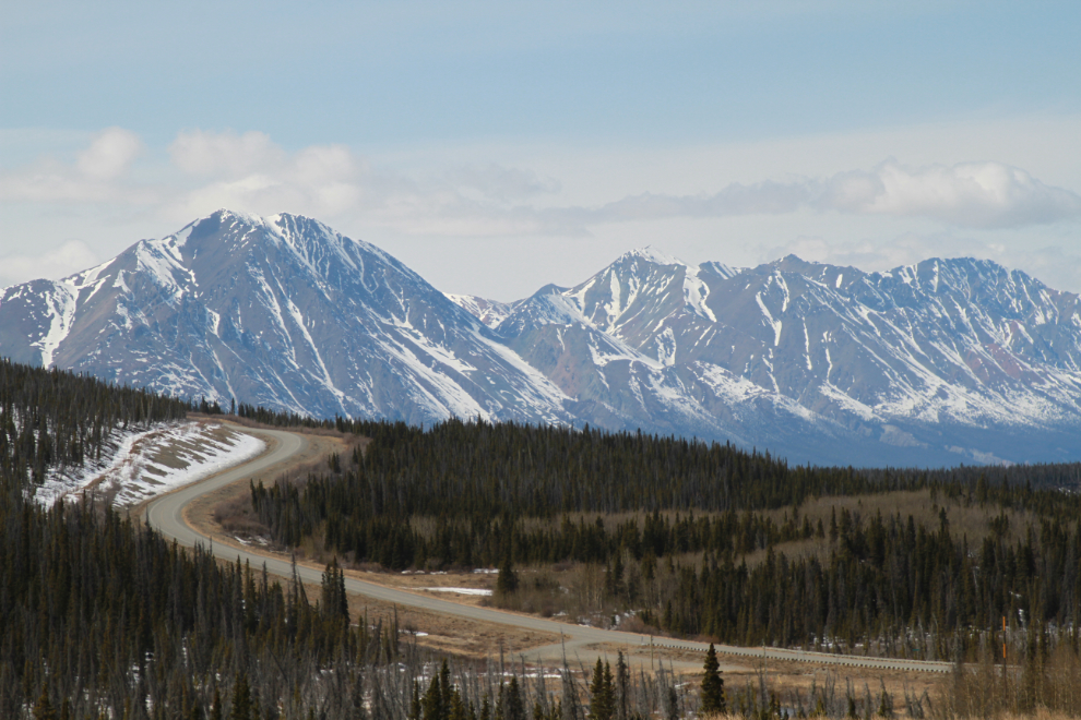
One of the reasons I wanted to see Kluane Lake was to check on the status of the large parking lot at Km 1642.1 that I call the Kluane Lake Viewpoint. This is my favourite place to park the motorhome, becase of the views and the great beach once the snow and ice melt.
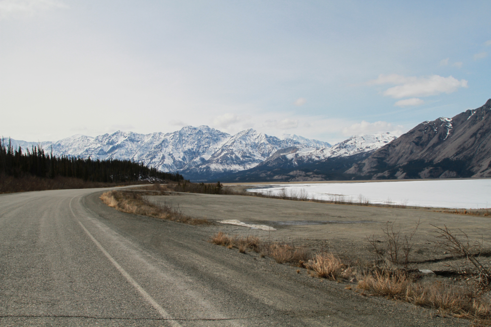
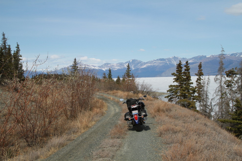
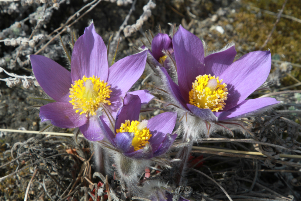
Just past Sheep Mountain, I turned off onto a long-abandoned section of the Alaska Highway. There I noticed that I couldn’t see any pressure ridges on the lake (some years they get to be very impressive), and I also found Spring!
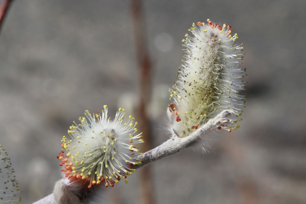
There were well-developed buds on the willows, lots of crocuses in full bloom, a beautiful little bird I didn’t recognize, and a surprising number of mosquitoes.
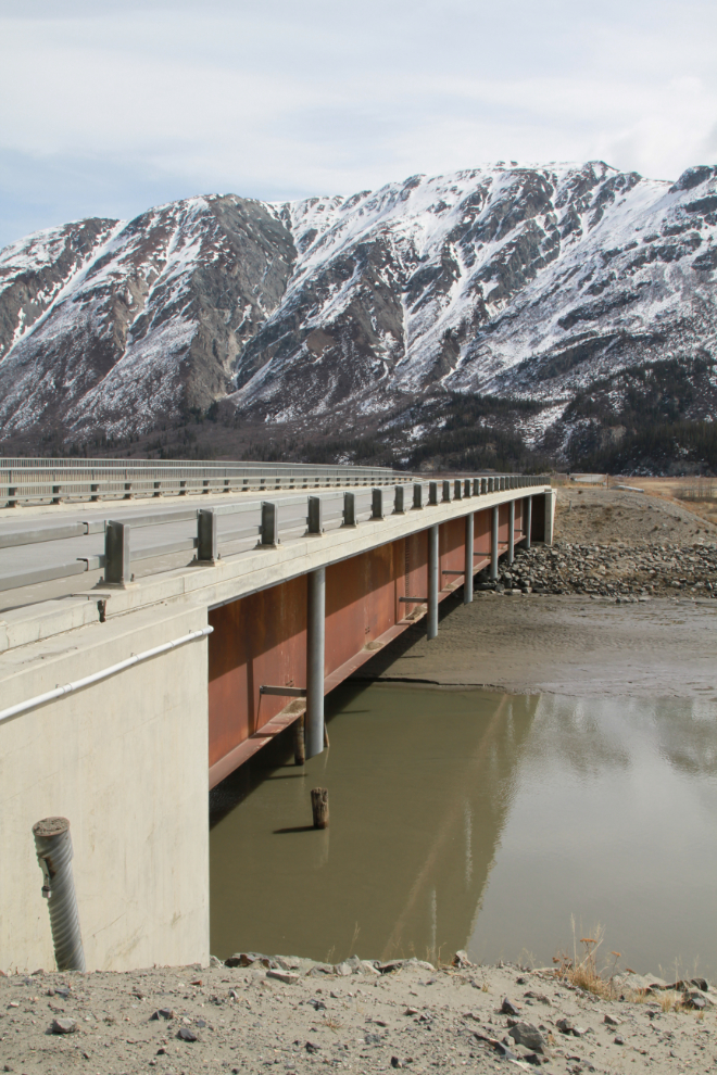
Now fully satisfied with this day, I started the long ride home at 3:10. But there was more to see, of course. I stopped at the Slims River Bridge to get a few photos of the exceptionally low water level.
I keep track of all my vehicles’ mileages by taking photos of the odometers at significant points, and the location. At the spot, the bike turned over 32,000 km. I bought the bike new in 2009, but my riding has slowed down substantially since I bought the motorhome.
While I was having lunch, I got great news that as of May 25th, anyone who is fully vaccinated against COVID-19 is welcome to come to the Yukon without a mandatory 14-day isolation. This feels like a gold star for people who have followed the rules and believed the science. We’ve done very well through the pandemic, going for multi-week periods with no active cases. The reality is that if no Yukoners had travelled outside the territory, and nobody from other places had come here, there would have been no covid. It’s really very simple – no travel = no covid.
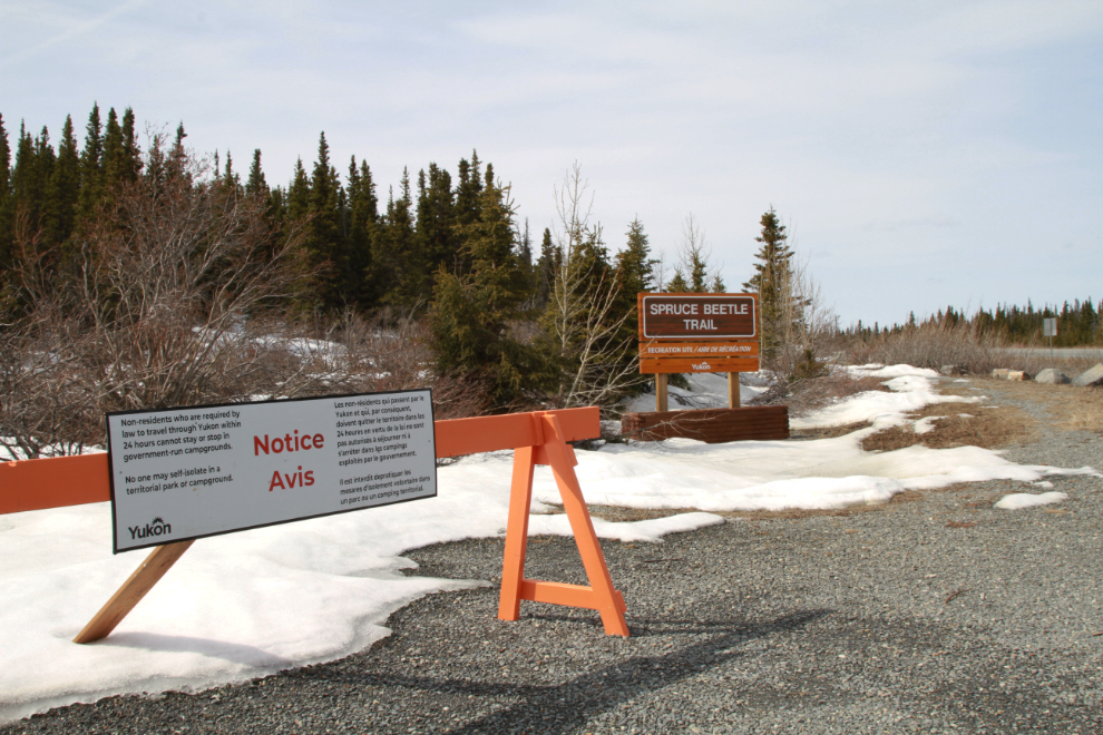
Anyway, with that news, I took a couple of photos on the way home of COVID-19 warning signs. Hopefully we are almost through this. The first one warns people travelling through to Alaska that they aren’t allowed in Yukon campgrounds, and my implication can’t got a for a walk here.
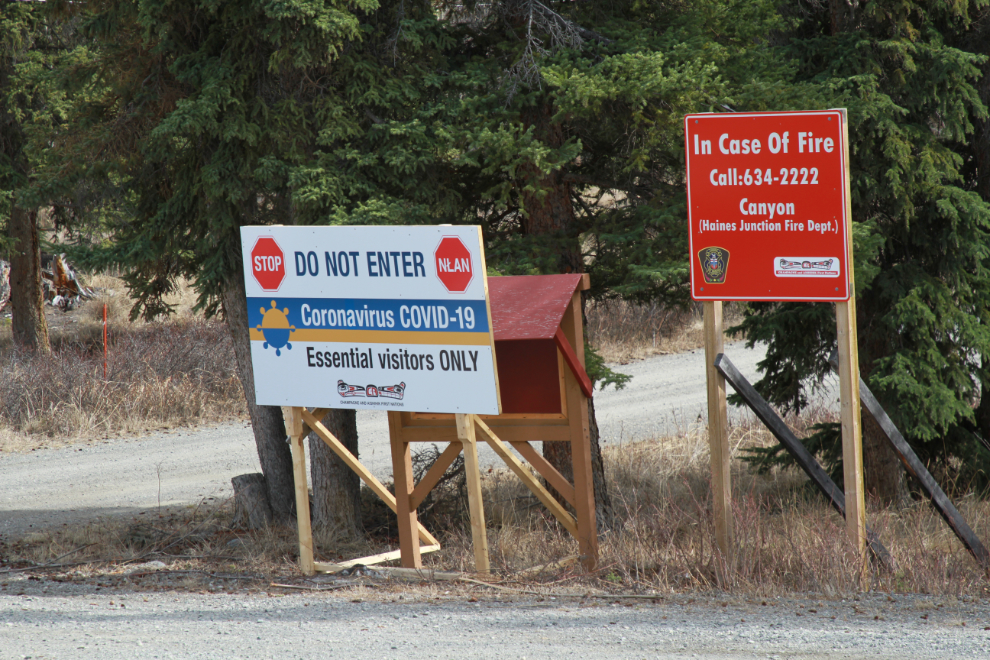
The final photo of the day shows a sign stating that only essental visitors are allowed at the First Nations community of Canyon. I saw a similar sign at Champagne earlier – it’s also a First Nations community.
Pushing myself too hard has been constant worry and problem since my injury during a hike on August 7, 2019. I don’t really know why I got better – perhaps the last therapist I added created the right combination. In very basic terms I now have an osteopath for nerves, a massage therapist for circulation, and a somatic yoga therapist for muscles. Whatever happened, I’m grateful beyonds words. It’s been a stressful, traumatic, depressing period but I can now get back to life, with lots more Adventures ahead to share with you 🙂
p.s. – I found some more blog text files, so this is now post #1,317 since April 25, 2006. Of those, I have 476 in the new format. The blog archives lists them all, and if you see anything that particularly interests you, you’re welcome to pop me a note and I’ll put it on top of the rebuild list (I’m rebuilding 3-7 posts most days).
Great to see you back on the road Murray. That ebike looks just fine for good exercise however making it easier on the hills. YEP, I WILL be back in the Yukon come August with all vaccination done. Stay safe and keep rolling.
Murray…. Hurray!, Wahoo!…. and all the rest, what great news for you, for Kathy, for your life, travel plans et al. So great to see this news and of course a great post on 2 wheels (and two more wheels w the e-bike). I might go have a drink to celebrate your turning that corner…. Congrats and best wishes for the coming travel season.