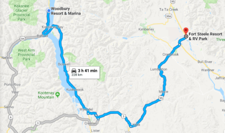
On to historic Fort Steele, via Kootenay Lake Ferry
More and more, we find that the slower we move and the more flexible we are, the better the trip is. But the reality is that there’s never enough time. At about 11:00 on Day 25 of the trip – Sunday, May 20th – we began the 228-km drive to Fort Steele.
Google says that it’s a 3 hour, 41 minute trip because of winding roads and a ferry crossing – and that ferry crossing has had some very long lineups to the highway closures in recent days. As always, click here to open an interactive version of the map in a new window.
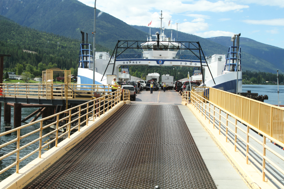
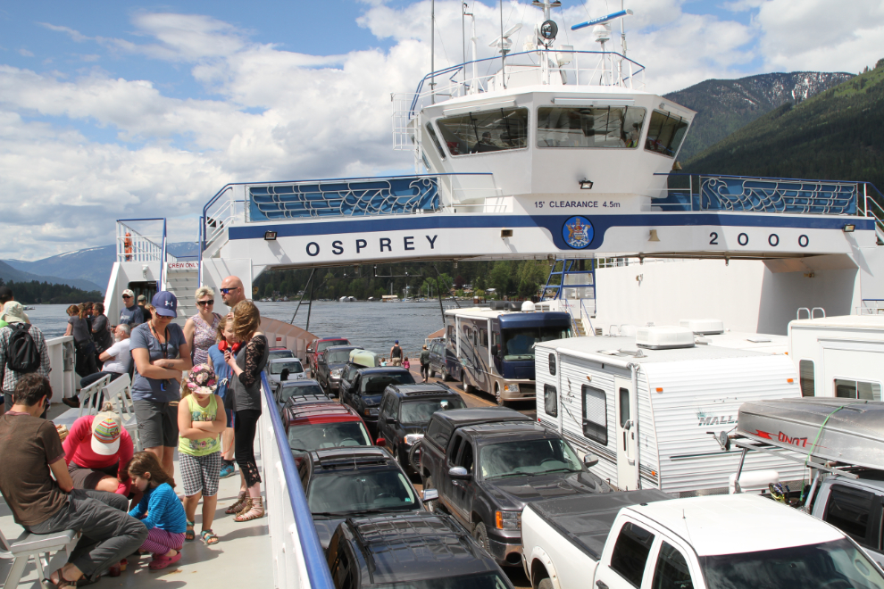
When we arrived at the Balfour ferry terminal, we were amazed to find the ferry loading, with nobody waiting. We were waved right onto the ferry, the M.V. Osprey 2000. The ferry is free, and at 35 minutes to cross Kootenay Lake, this is apparently the longest free ferry ride in the world.
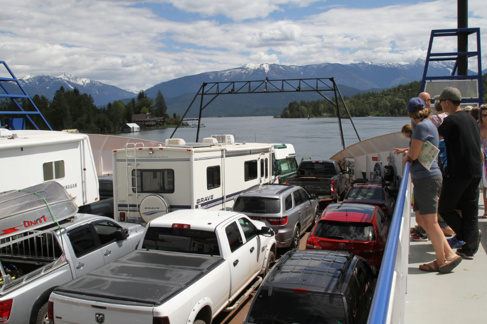
Looking back at Balfour at 11:39, with the ferry about 2/3 full. The capacity of the M.V. Osprey 2000 is 80 vehicles and 250 passengers. It was a perfect day for this crossing.
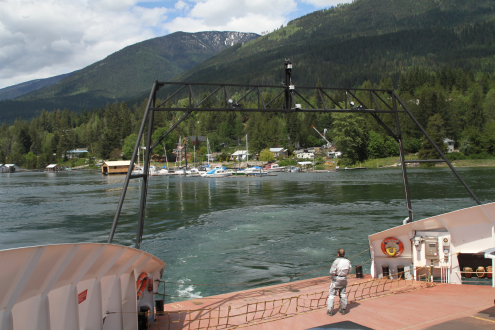
On a day like this (the temperature was already about 22°C/72°F), the large open viewing decks are wonderful. The small cafe downstairs was doing a good business.
Highway 3A down the east side of Kootenay Lake is hilly and winding – very scenic, and not a road you either can or want to make time on. We made a short stop in Cranbrook for a Dairy Queen treat (the fur-kids all love it when Cathy and I share our Peanut Buster Parfaits with them 🙂 ), and to get Cathy a pair of crutches – the knee she injured a few months ago is getting very bad.
At 3:45, we were on the ramp onto Highway 95, just 6 km from Fort Steele.
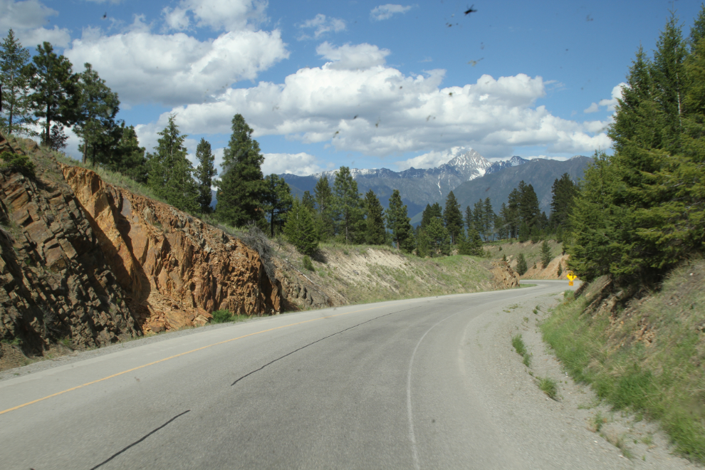
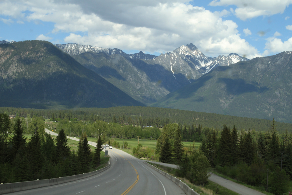
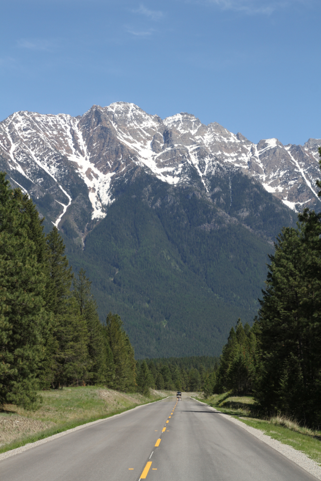
The Kootenay River is at the bottom of this hill, and Fort Steele is on the opposite shore. The dominant peak is Mount Fisher, 2,846 meters high (9,336 feet).
By 4:30, we were set up at the Fort Steele Resort & RV Park, where I’d made reservations for 2 nights. This is where we stayed 2 years ago, and we really like it. We got shaded, full-service site #100, for $84 including taxes. There are over 120 full service sites, almost all pull-throughs.
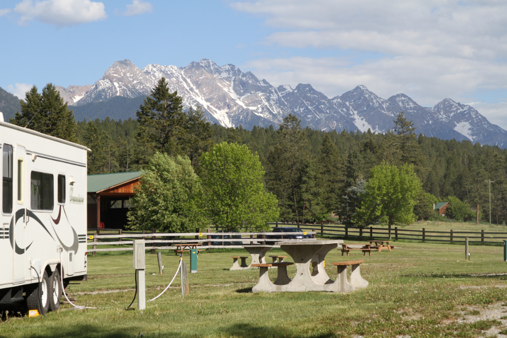
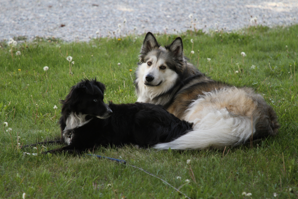
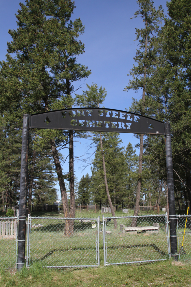
Tucker and Bella happily settled into the cool, soft grass. It had been a long day for them. This campground has great options for dog-walking – that evening, we walked a mile or so to the historic Fort Steele Cemetery.
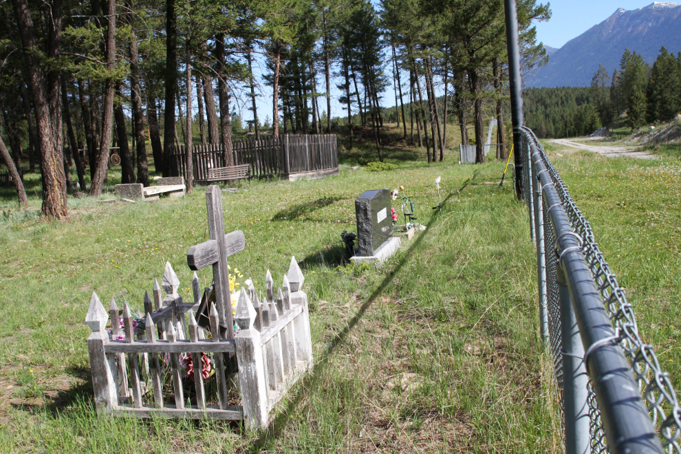
We began Monday by driving the Tracker up to the Fort Steele Cemetery. I’d had a good look through it on my previous visit, so didn’t go in this time. Findagrave reports 221 graves here, over 80% of them with markers.
My blog post from our May 2016 visit to the Fort Steele Heritage Town has 51 photos and a lot of information, so I won’t duplicate that here.
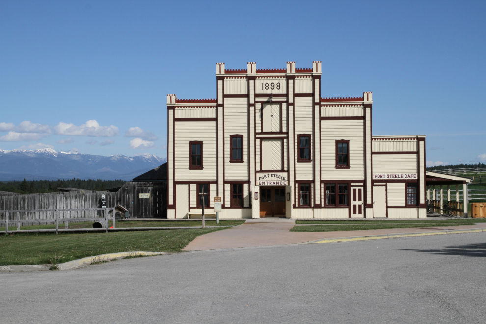
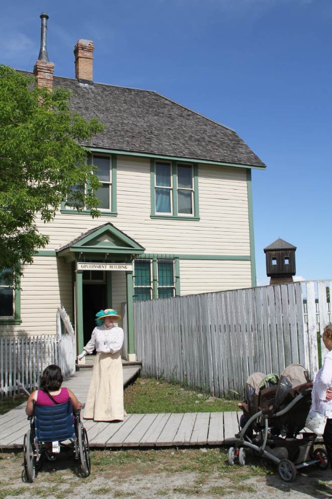
The huge difference in this visit was the weather. Two years ago we only got hints through the rain and low clouds that we were surrounded by mountains. Visitors enter the park through the building seen in the next photo – it has a cafe, gift shop, and washrooms. We had to borrow a wheelchair to get Cathy around the town, so went in very few buildings this time.
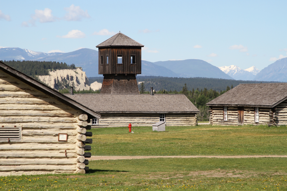
With the mountains visible, even the distant ones to the northwest, the scenes I shot in 2016 were quite different this year. The next photo shows the North West Mounted Police (NWMP) compound and the water tower.
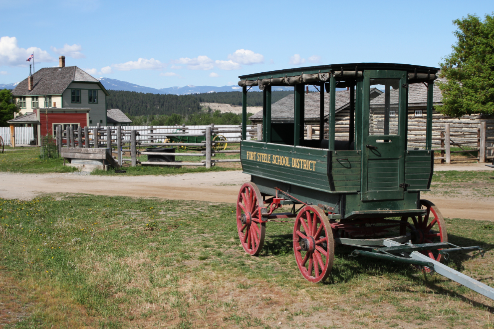
The school bus and government building. A school program was in progress, with all the kids in period costume.
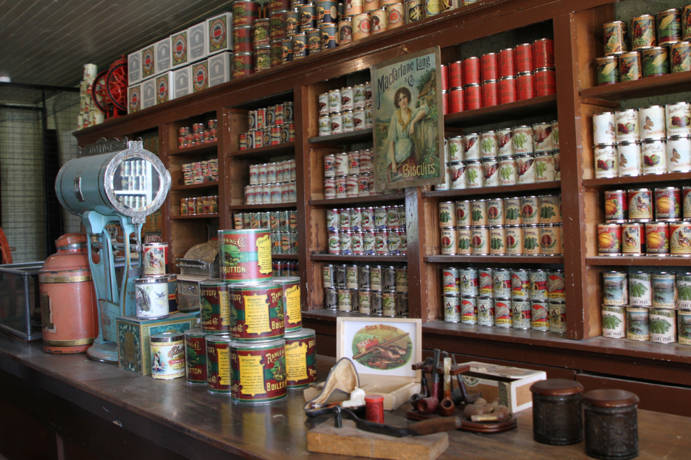
I don’t know how many different items have been reproduced to stock the Carlin & Durick General Store, but it’s a lot.
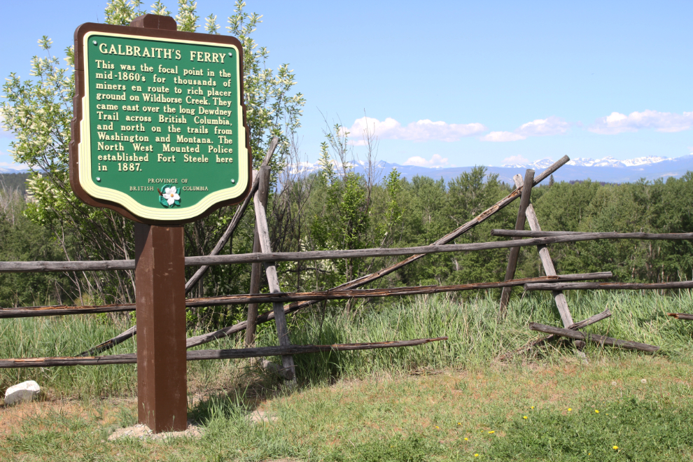
This Stop of Interest sign describes the start of Fort Steele, as Galbraith’s Ferry: “This was the focal point in the mid-1860’s for thousands of miners en route to rich placer ground on Wildhorse Creek. They came over the long Dewdney Trail across British Columbia, and north on the trails from Washington and Montana. The North West Mounted Police established Fort Steele here in 1887.” This is a new version of the sign, which two years ago said that “Indian trouble” brought the police here.
We decided to join the free guided Gossip Tour, described this way: “A wildly popular tongue-in-cheek walking tour of the town introduces you to Fort Steele’s colourful residents, helps you peek behind doors, and shows you all their foibles. It’s true, the line between historical and hysterical is sometimes blurred but you can count on a member of the Fort Steele Ladies Auxiliary to give you the goods, and the dirt, with a little ‘creative license’ of course!” The guide was immediately excellent, and never lost that – going on it was the right decision.
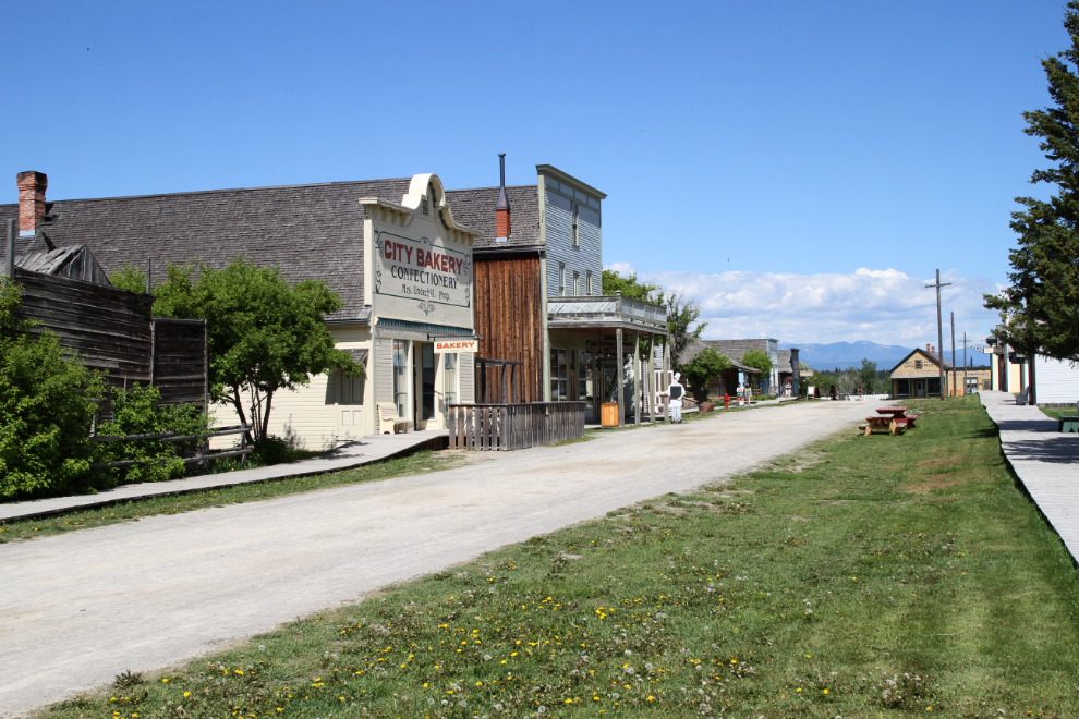
After the 45-minute tour, we headed for the City Bakery, on the left in the next photo, for a coffee break.
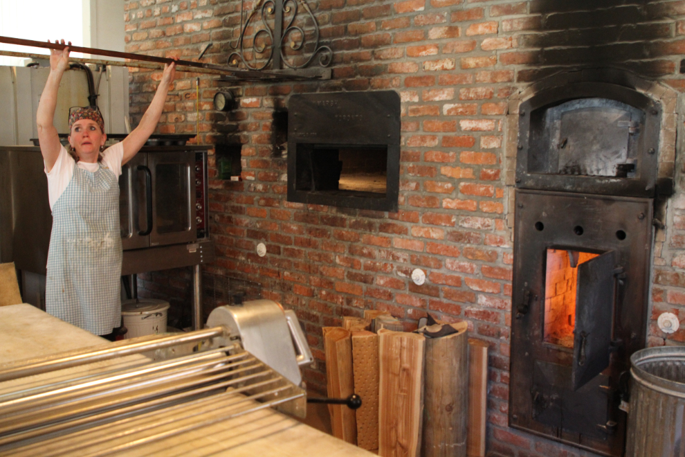
The Kootenay Roasting Company coffee was excellent, as were the large cinnamon buns that were irresistible. We also got a loaf a fresh-from-the-oven whole grain sourdough bread to take with us. One of the bakers invited me into the back to get photos of the process – she was just about to pull the last batch of bread for the day out of the wood-fired brick oven. The bakery is a year-round operation, and their bread and other creations can be bought in several Cranbrook stores.
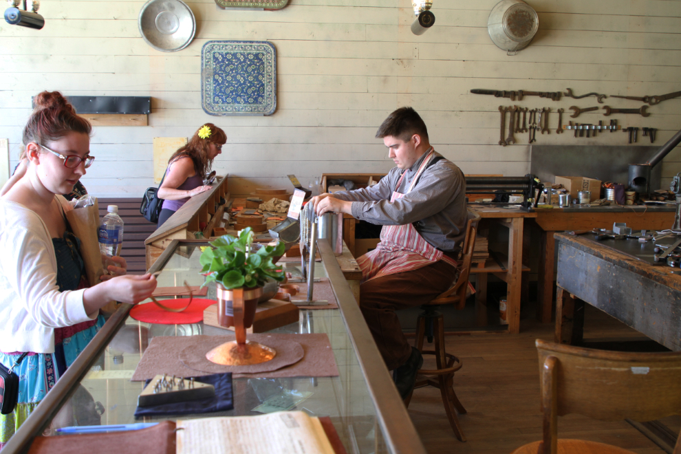
The last time we were at Fort Steele, the tinsmith shop was open. Cathy’s Dad and his family were tinsmiths going back several generations, so this was a must-see. The shop had a decent display of the sort of articles a tinsmith might make, but could be greatly expanded.
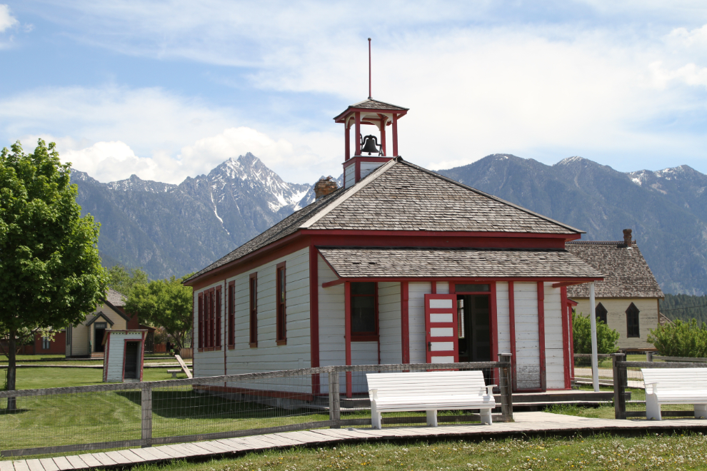
The shoolhouse, built in 1898, looks so much better with Mt. Fisher in view. Our guide had some good gossip about the first teacher in this building (this was Fort Steele’s second school), Miss Adelaide Bailey – her 80-90 students didn’t mess with her. At least they didn’t mess with her twice! 🙂
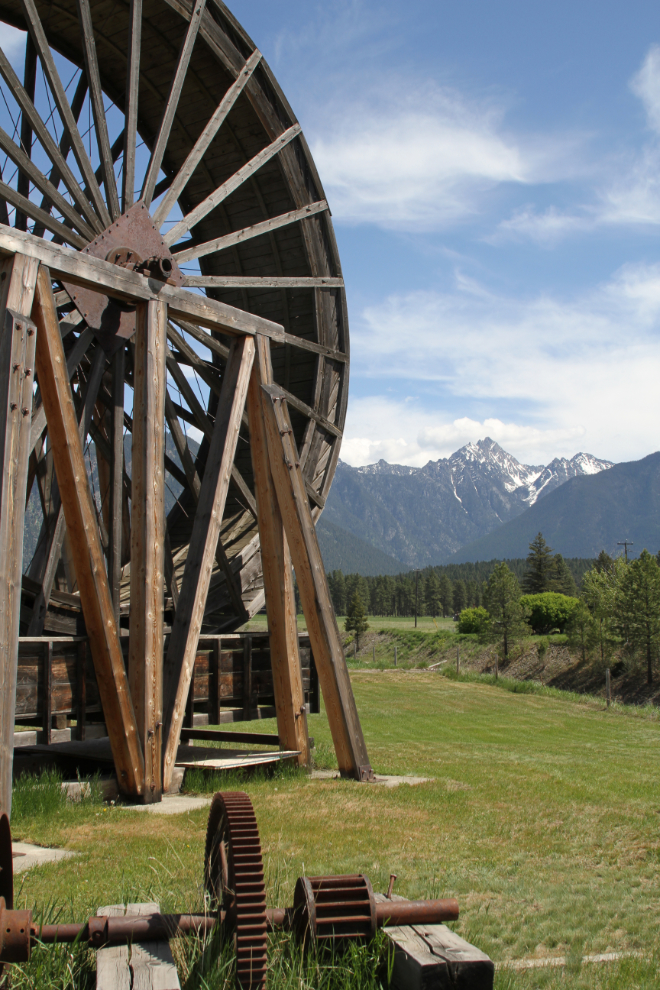
The Perry Creek water wheel was built in 1934 for a gold mine about 25 miles west of Fort Steele, and was brought here in 1965. It’s 32 feet in diameter and 7 feet wide, and could produce up to 68 horsepower to drive two pumps to remove water from the mine, where the gold-bearing gravels were 150 feet below the surface.
With the temperature up around 26°C (79°F) at 2:00 pm, shade was a valuable commodity – even the chickens were in hiding.
Back at the RV park, we lazed around in the shade for a while, then decided to see if we could find some water for Bella to play in to cool off. A couple of lakes along the Wardner – Fort Steele Road looked like possibilities, so we headed east.
Norbury Lake Park was much too busy and the lake was too far for Cathy to walk, but we found a quiet spot on the Bull River that was perfect. A side stream offered good stick-chasing opportunities that both Bella and Tucker enjoyed.
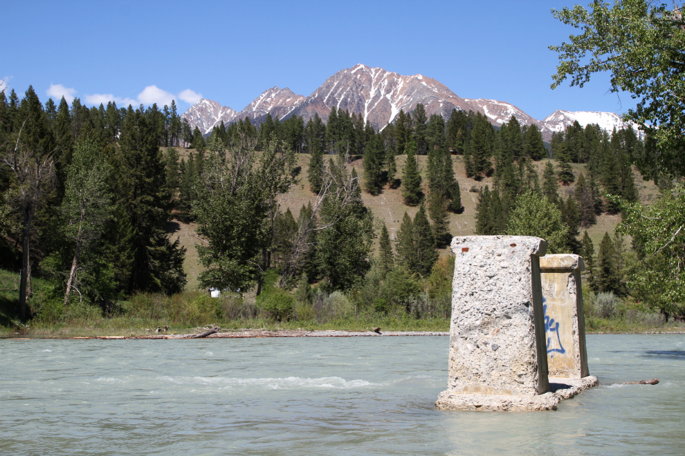
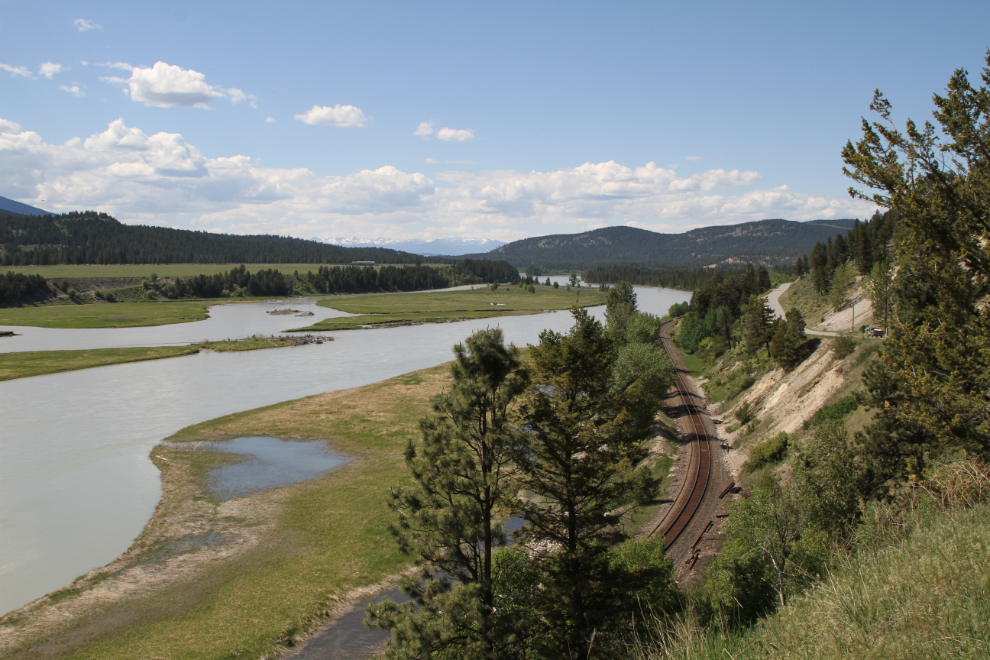
Continuing along the Wardner – Fort Steele Road, this was one of the views over the Kootenay River.
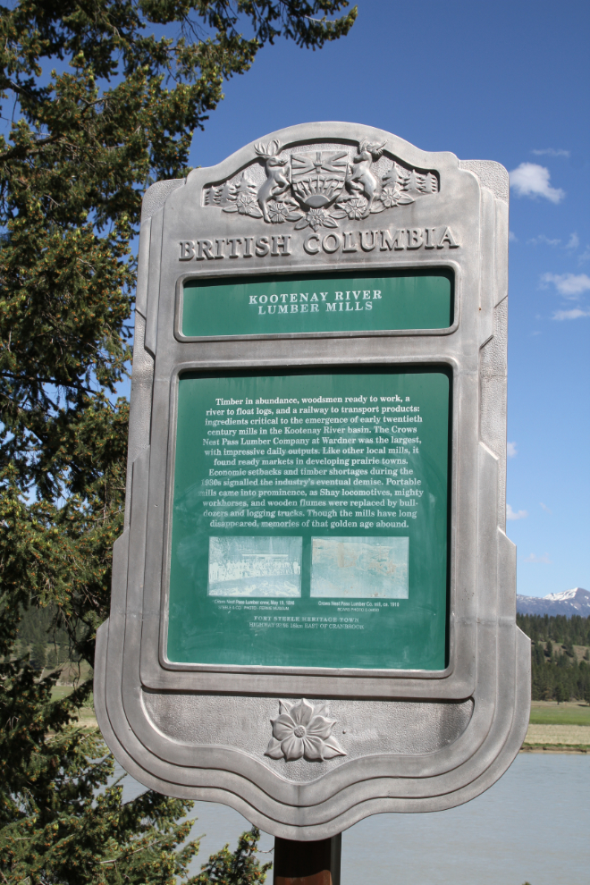
We decided to see what the community of Wardner looks like. There are no stores anymore, but there’s a community hall among the homes, most of them built overlooking the river. This Stop of Interest sign talks about Wardner’s Crows Nest Pass Lumber Company, the largest mill in the area, which closed in the 1930s.
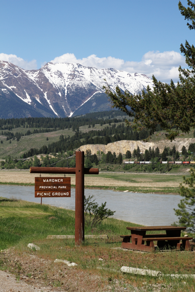
The picnic area at tiny (4 hectare) Wardner Provincial Park is lovely.
We were back at the motorhome by about 5:30. The plan for the next day was the see the train museum in Cranbrook, then make the short drive to Sparwood.