Hiking the International Falls trail and beyond
On August 2nd, our second day boondocking with the RV in the White Pass, I decided to take the dogs for a hike on the International Falls trail, and beyond to a pass overlooking the Chilkoot Trail. We’ve done it a few times, and it’s usually about a 5½-hour round trip.
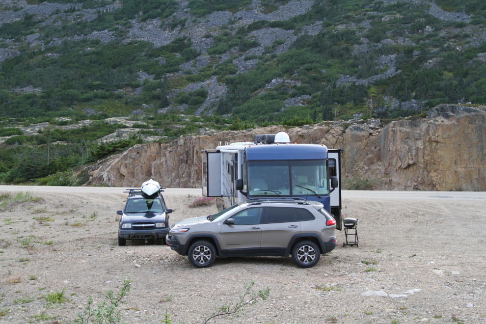
The trailhead is just a 5-minute drive from the spot near Summit Creek where I park the RV, and a couple of hundred meters north of the Canada-US border. There’s a large parking lot at the trailhead. We started down the trail at 10:20.
Part of the initial drop down from the highway is extremely steep, and about 5 years ago tour company from Skagway has installed some ropes to assist both getting down and back up.
The creek crossing at the bottom of that first drop varies greatly in depth – it was very shallow this time. We met another couple of hikers there – they were the only people we’d see for almost 4 hours.
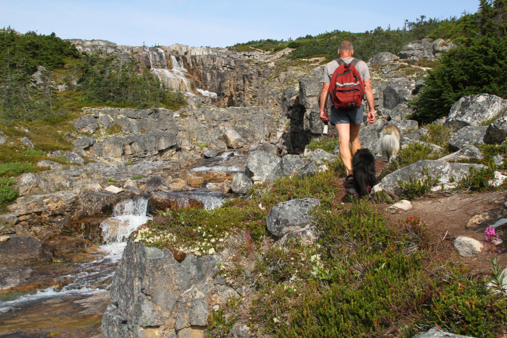
Ten minutes from the car, we were at the first waterfall, which is accessed by a side trail that’s easily missed.
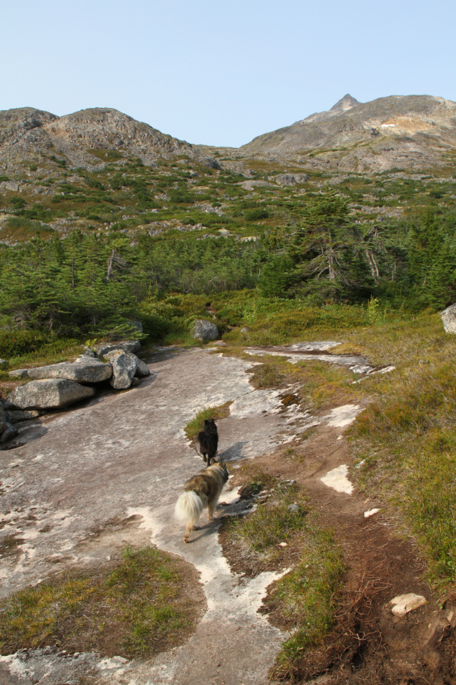
The geology along the trail is fascinating in many places. In the next photo, Bella and Tucker are crossing a huge slab of smooth granite.
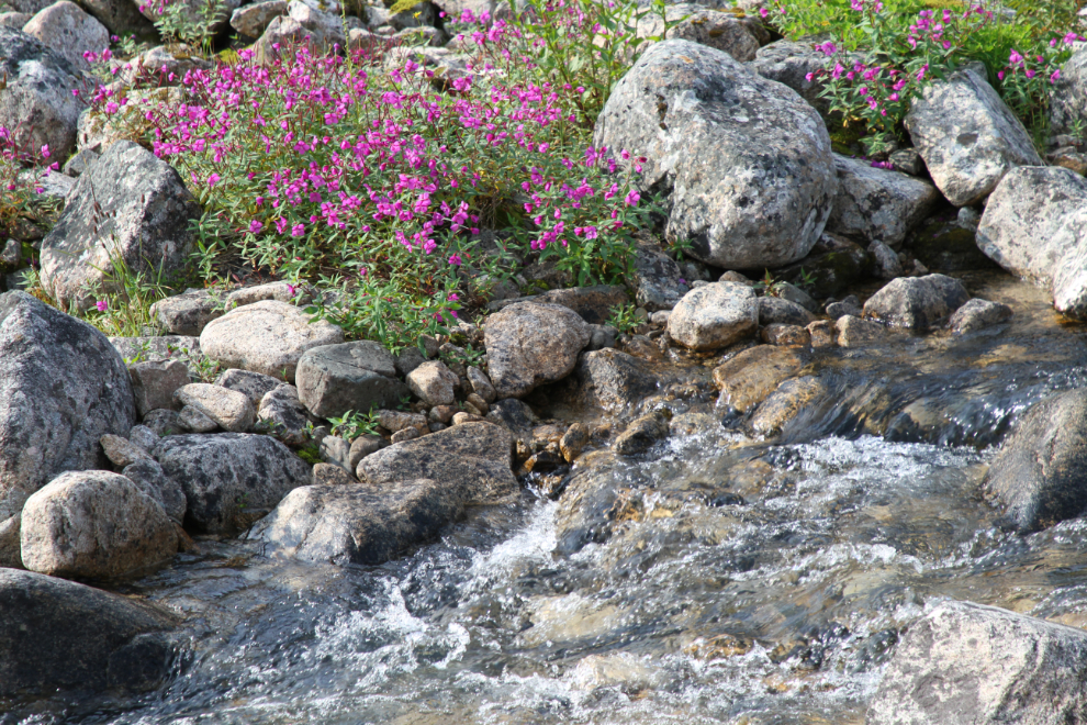
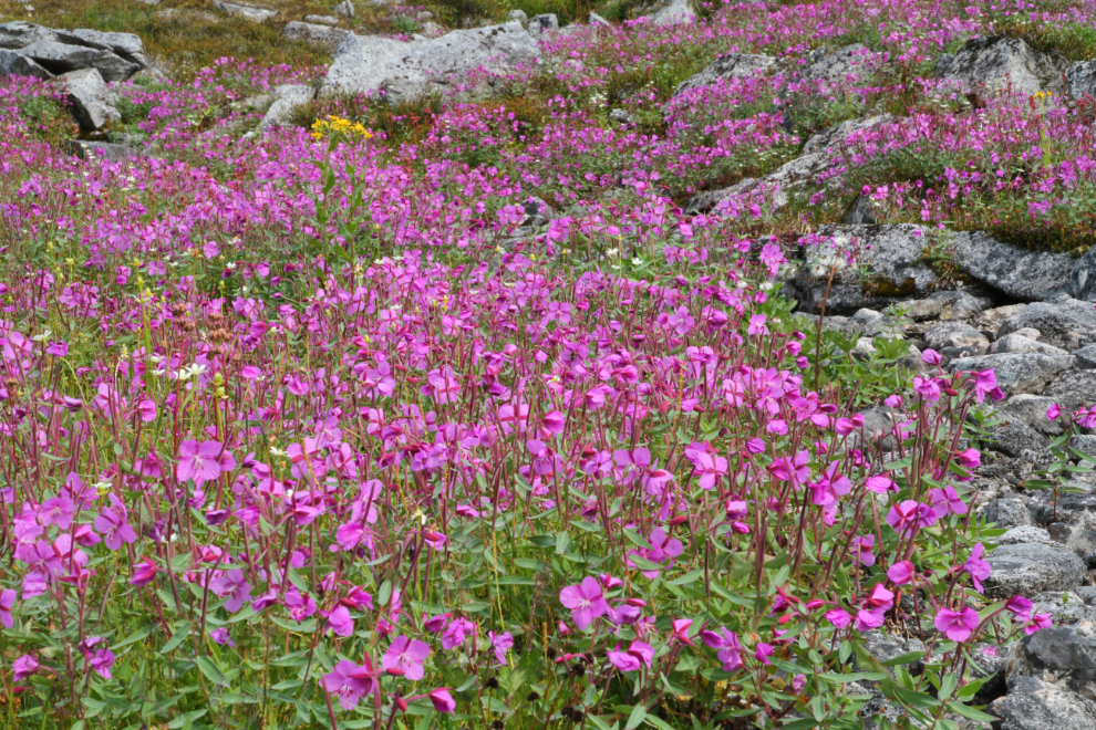
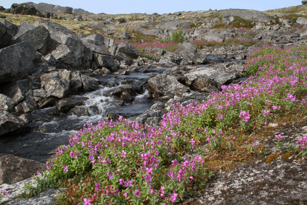
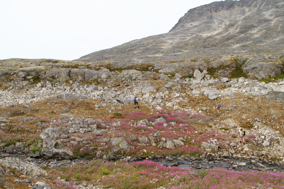
The dwarf fireweed or river beauty was at its peak, and during the day we would pass vast fields of it.
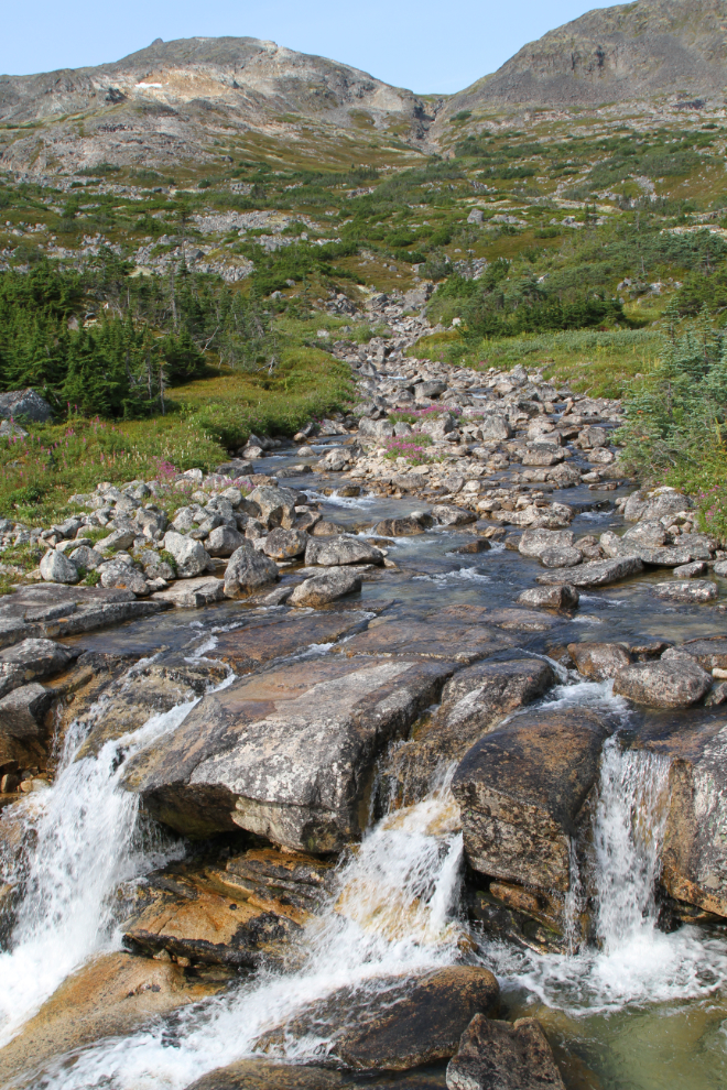
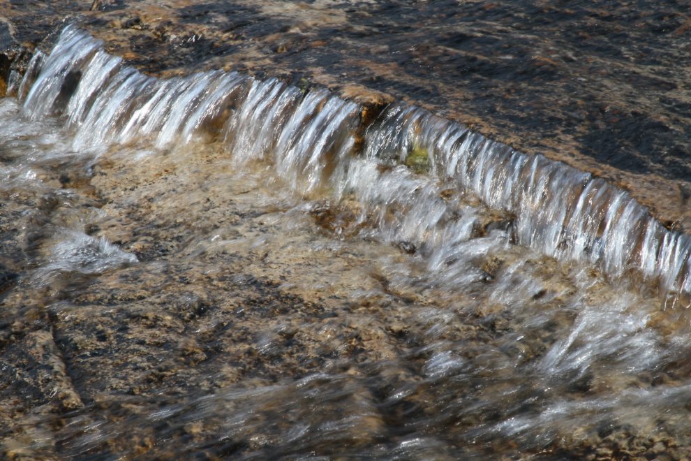
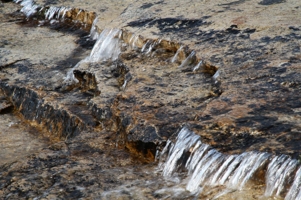
There are some tributary creeks, each with its own waterfalls. None of these creeks, even the main one, have been named.
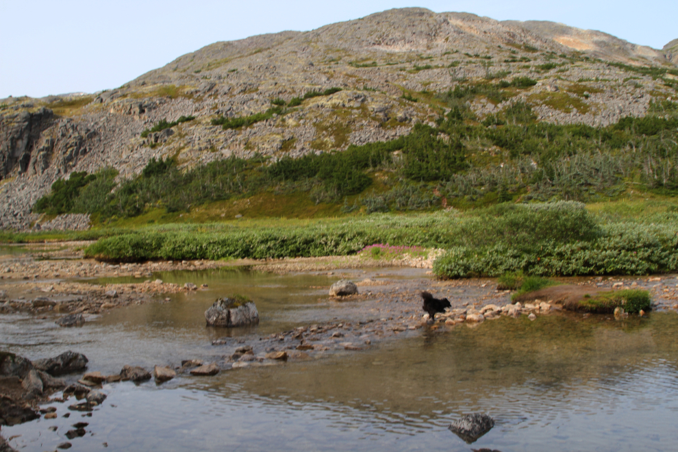
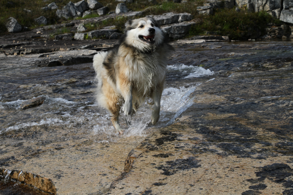
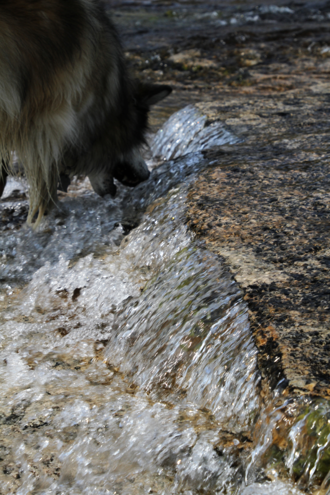
Bella rarely passes up an opportunity to get wet, and as a result, International Falls trail is one of her favourites 🙂
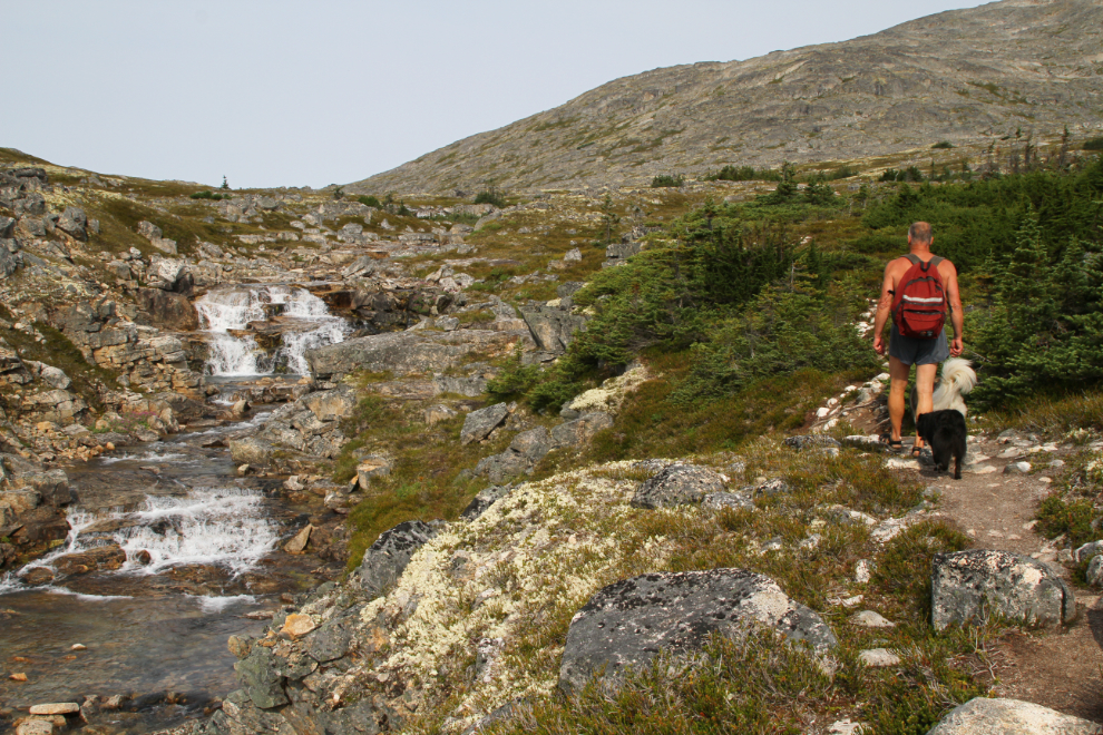
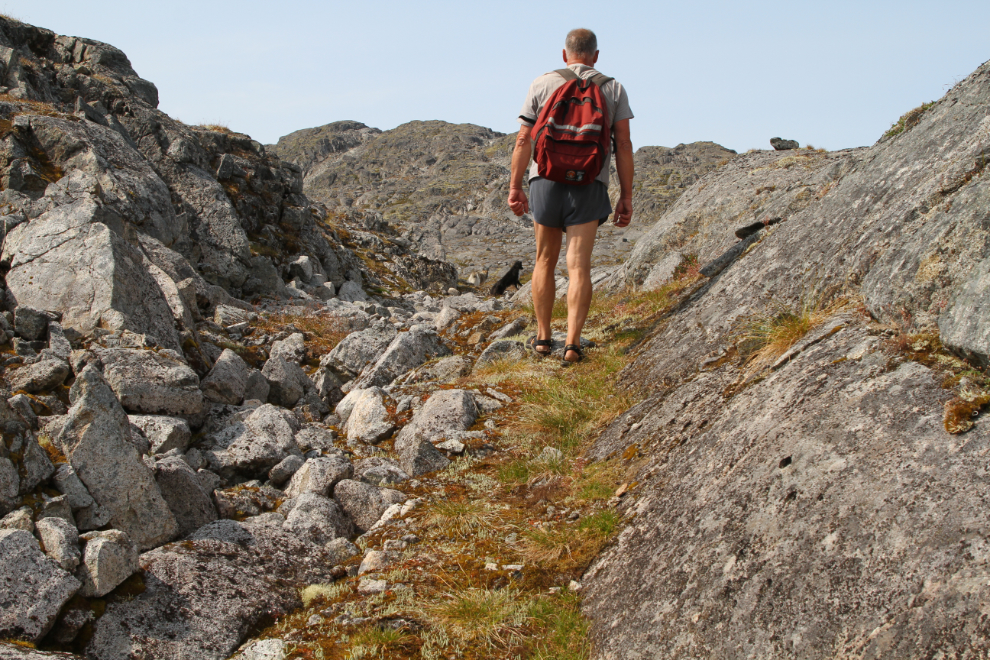
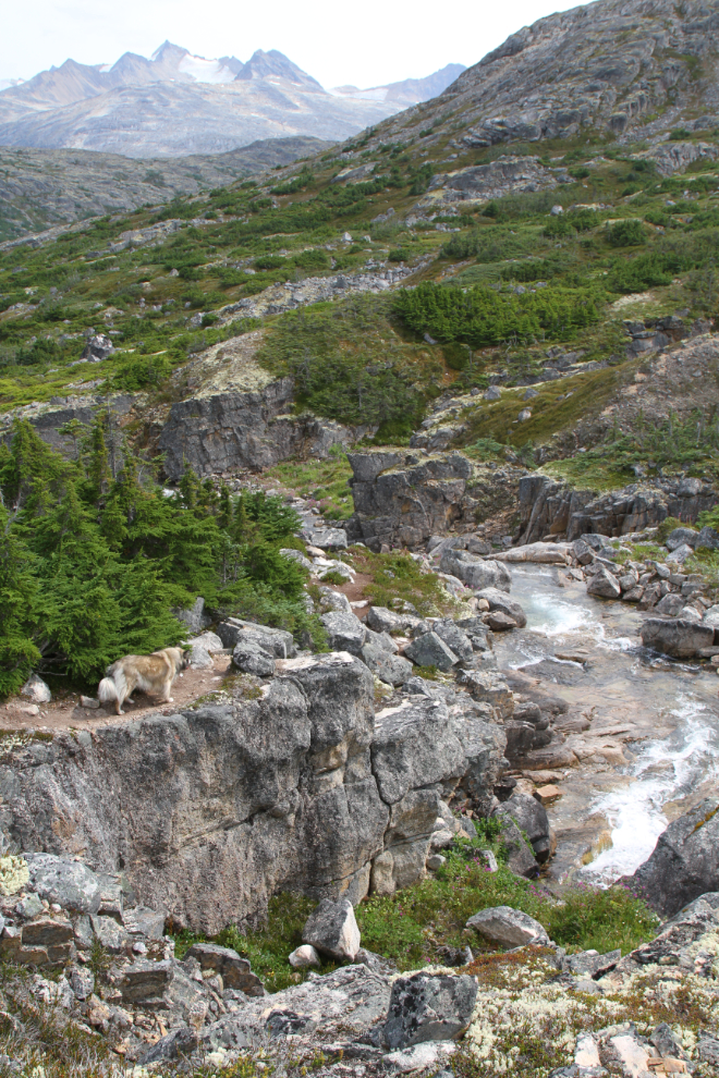
In some places there are 2 or 3 trails at varying distances from the creek. I think some new trail has been cut recently to get away from a couple of stretches of what could be considered treacherous cliff exposure. You might notice the can of bear spray in my left hand. I’ve never carried bear spray on this trail, but an attack a week ago that left a dog dead and a couple of people traumatized has me a bit spooked – it happened at the spot on Tutshi Lake that we regularly stop at for walks.
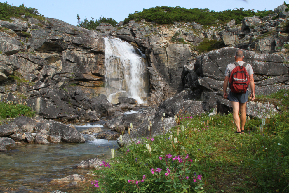
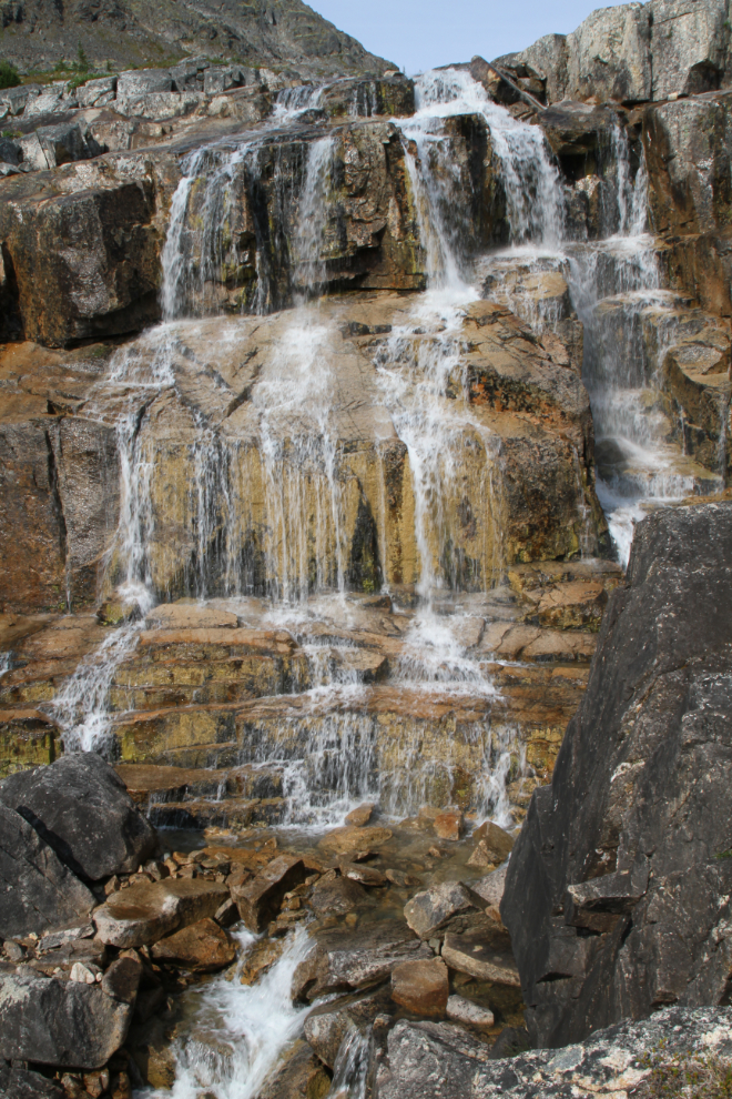
The flow was probably the lowest I’ve seen it yet – this waterfall, perhaps 60 feet high, is very impressive at higher flow levels. We were now 45 minutes from the car.
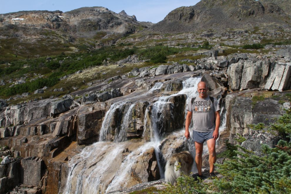
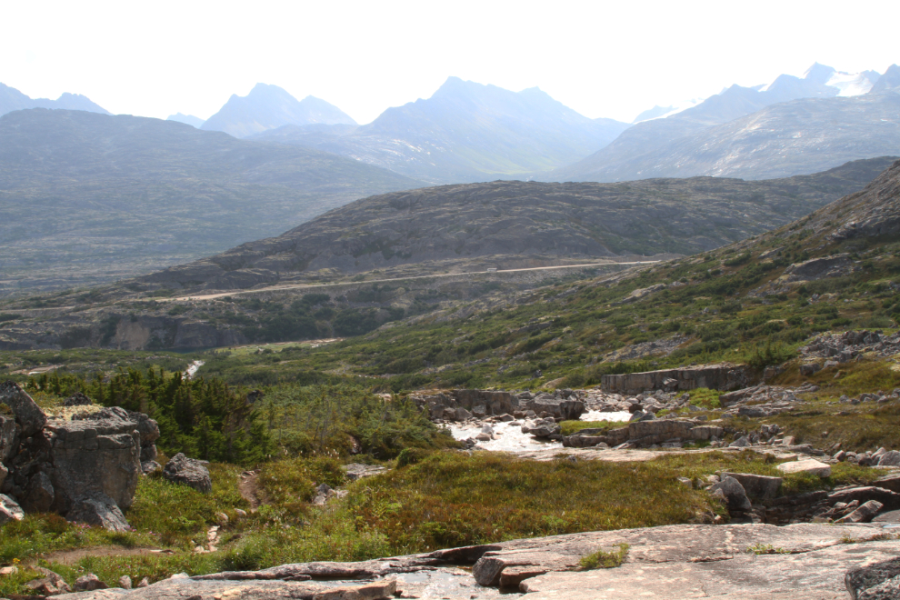
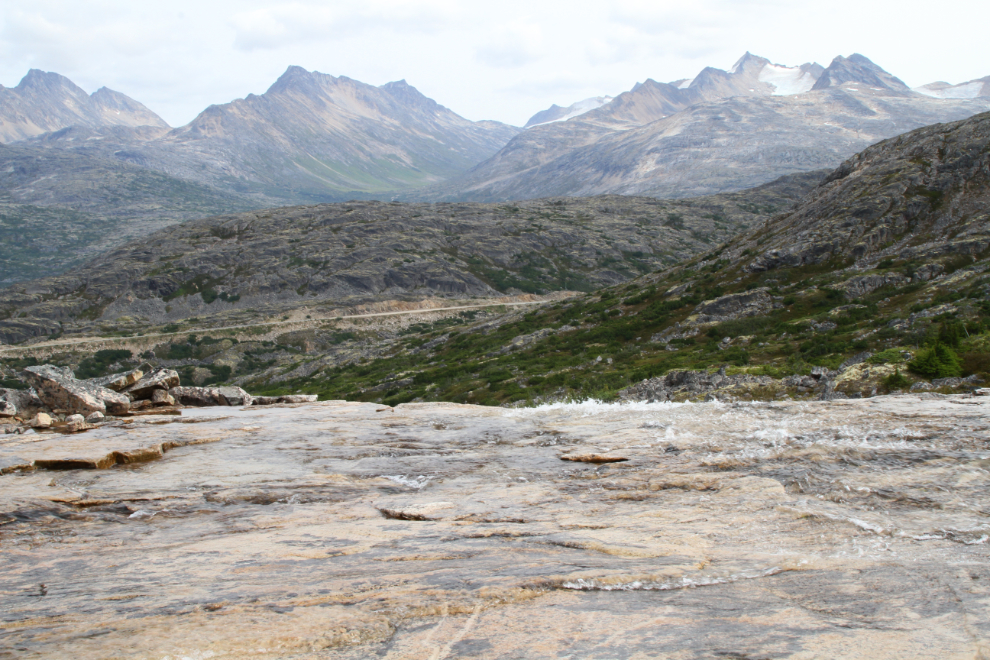
One of my favourite spots on the trail is a huge area of smooth granite, and as we often do, we spent a long time there this time, photographing and playing in the water. This was 55 minutes from the car. Somewhere in this area, the trail crosses into Alaska – there’s apparently a border monument off the trail, but I’ve never looked very hard for it.
The next photo shows the view from that spot looking east to the highway.
I can have as much photographing a “waterfall” that’s 3 inches high as one that’s 60 feet high 🙂
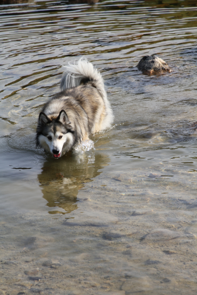
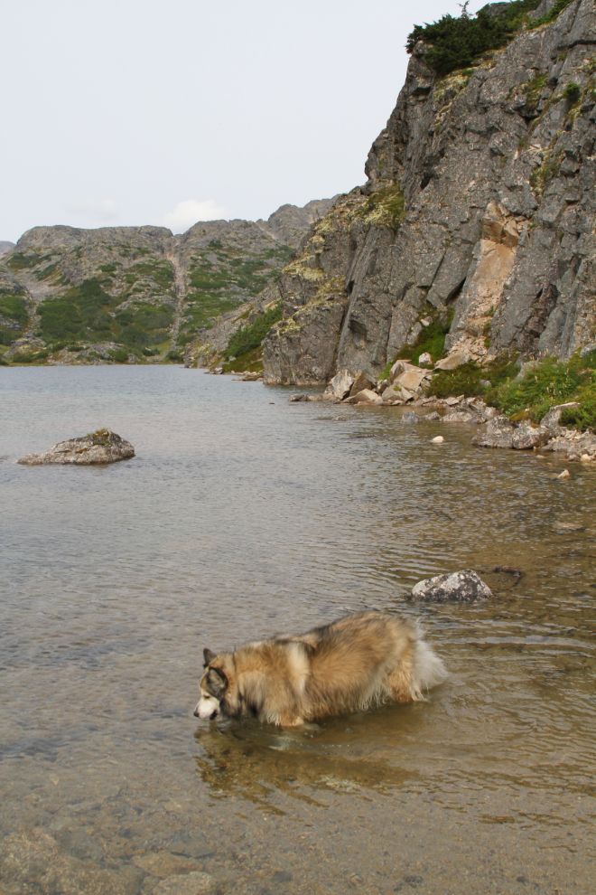
The depth of the water isn’t a big concern to Bella, either 🙂
Drinking from Mother Nature’s water fountain is much better than from still water, though!
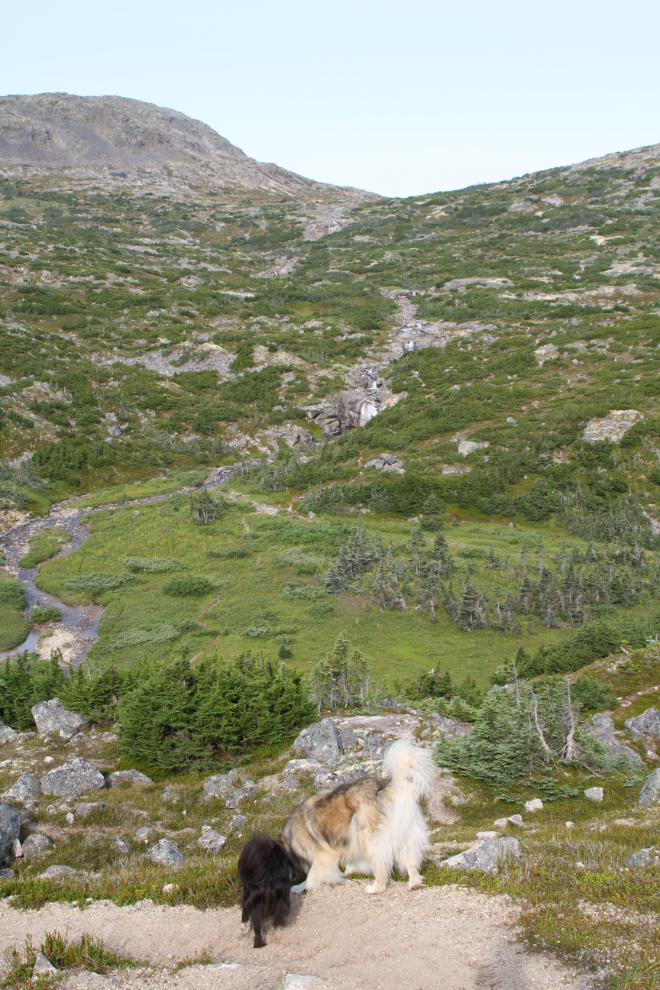
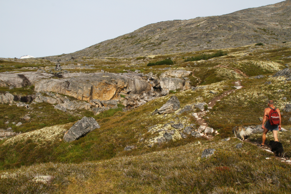
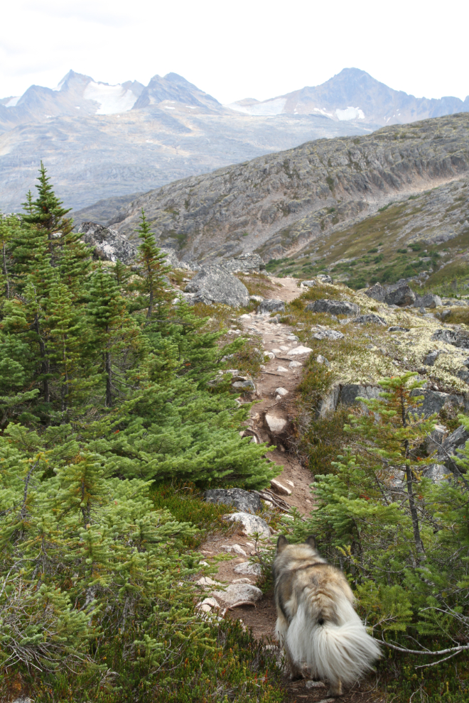
Treeline is reached about an hour and 20 minutes from the car. That’s probably about 50 minutes with no photo or play stops.
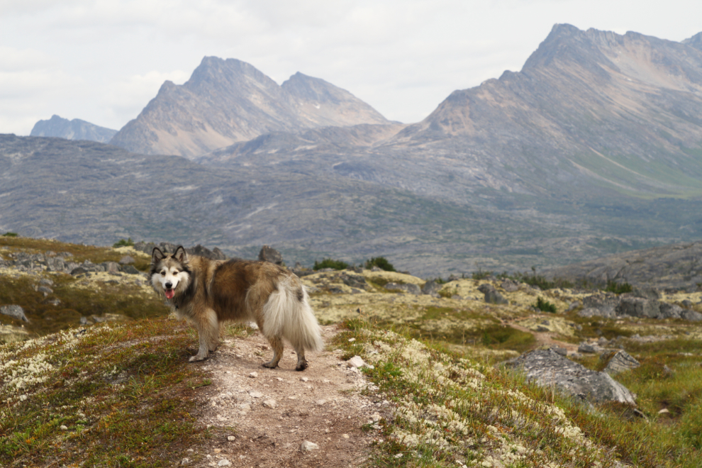
Even though there are no more large waterfalls, the higher the trail goes, the more I enjoy it. The temperature was about 20°C, and there were no bugs, but there was a breeze that had a chill to it as we got higher.
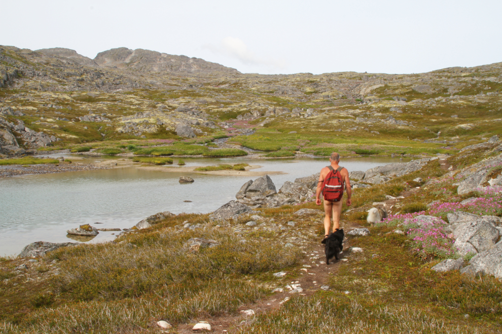
By 12:05, (an hour and 45 minutes from the car), the terrain was climbing in large steps, with lots of level and undulating trail. Shallow ponds become quite numerous.
As we climbed, the dwarf fireweed got more and more plentiful, and there was also more regular fireweed.
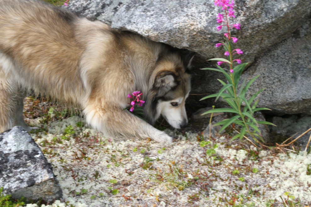
Bella and Tucker found many crevices that needed to be checked out, and twice they took off in hot pursuit of something. They’re both great at recall, though, even in situations like that.
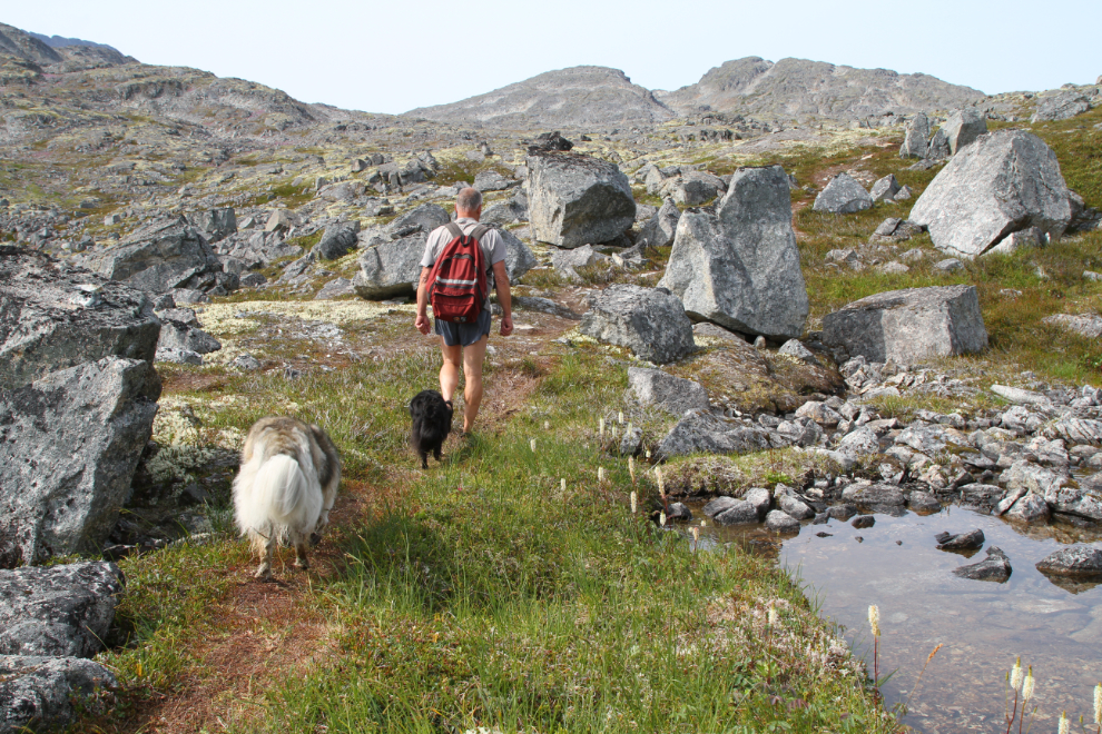
Two hours from the car, the trail gets less and less distinct, for 2 reasons – far fewer people hike this far, and much of the hiking earlier in the season is across patches of snow. If you lose the trail, though, it doesn’t matter – you can’t get lost in this tight valley. The breeze had gotten chilly enough that I had to put some clothes back on for a while.
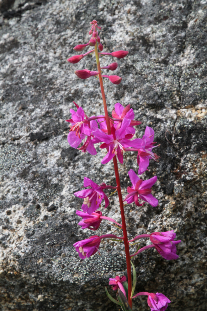
Yes, more dwarf fireweed.
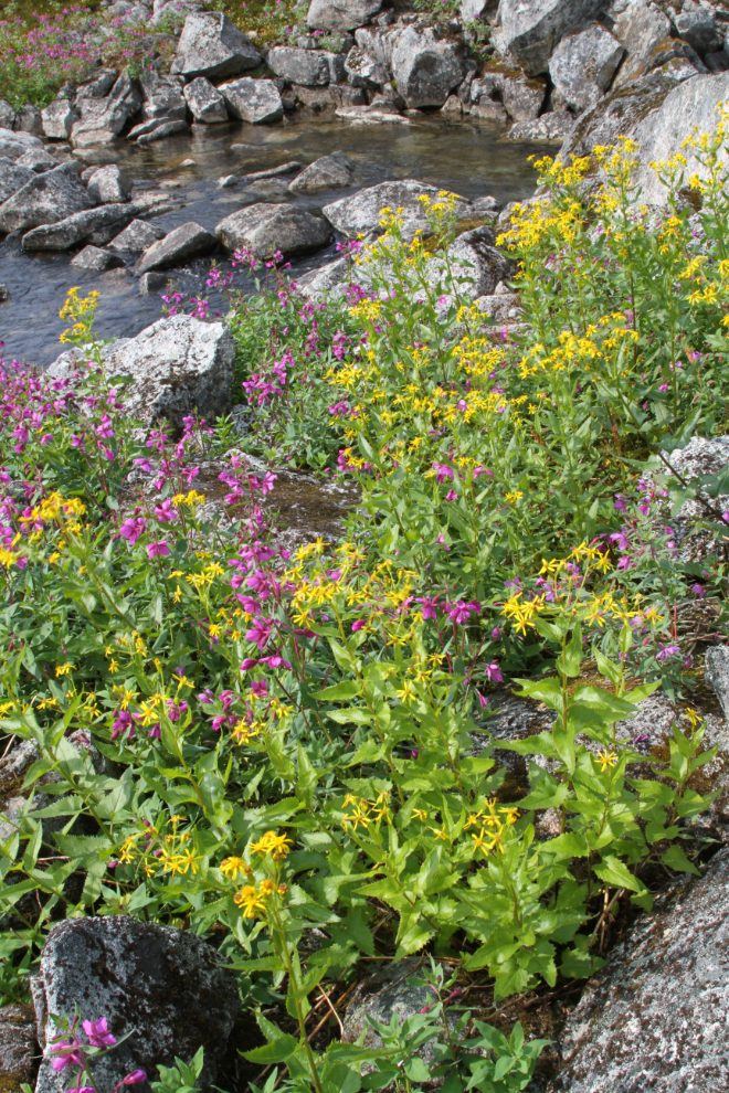
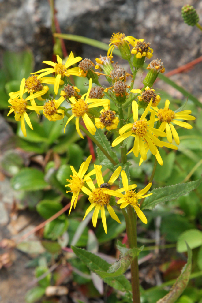
I don’t know yet what the yellow flowers were, but they sure brightened up this spot.
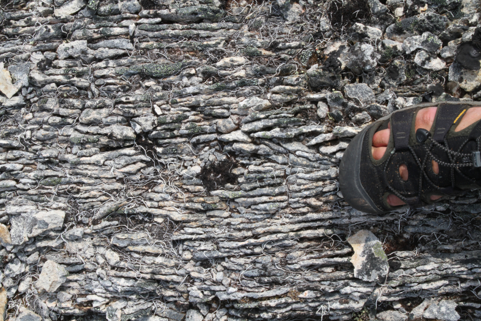
A narrow belt of curious rock runs across the valley, broken into narrow slices. Some of it protrudes and is particularly narrow and sharp (almost book pages), which other sections is flat and broader.
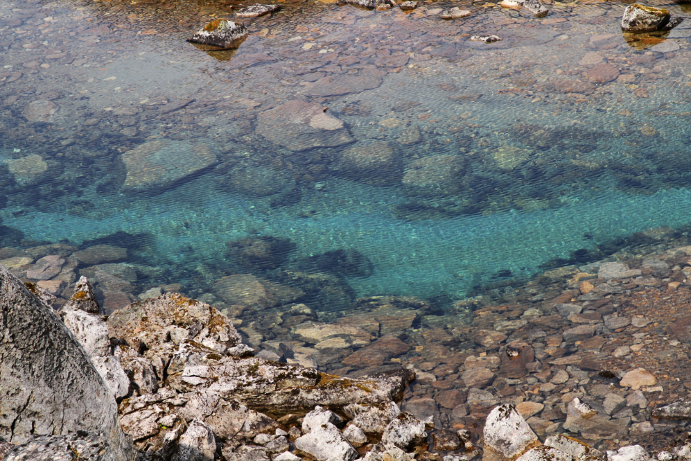
If the pond in the next photo would have been easier to get to, that amazing water would have had me in for a dip. It was at the bottom of a cliff, though.
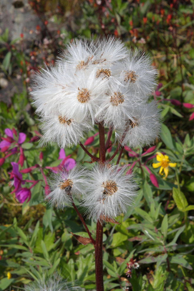
The seedheads of some of the plants are at least as impressive as the flowers.
Nearing the top of the pass, the trail disappears completely, and there are several possible routes up, depending on whether there is snow or not. This notch would have been full of snow into July normally.
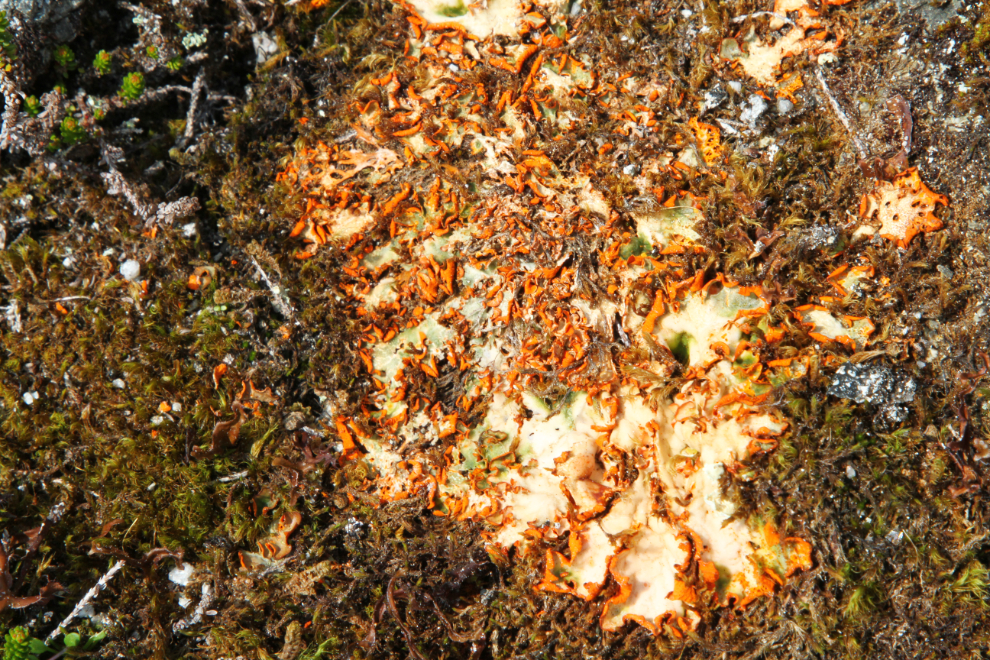
There were a few small patches of this bright lichen near the top of the pass, but nowhere else that I saw.
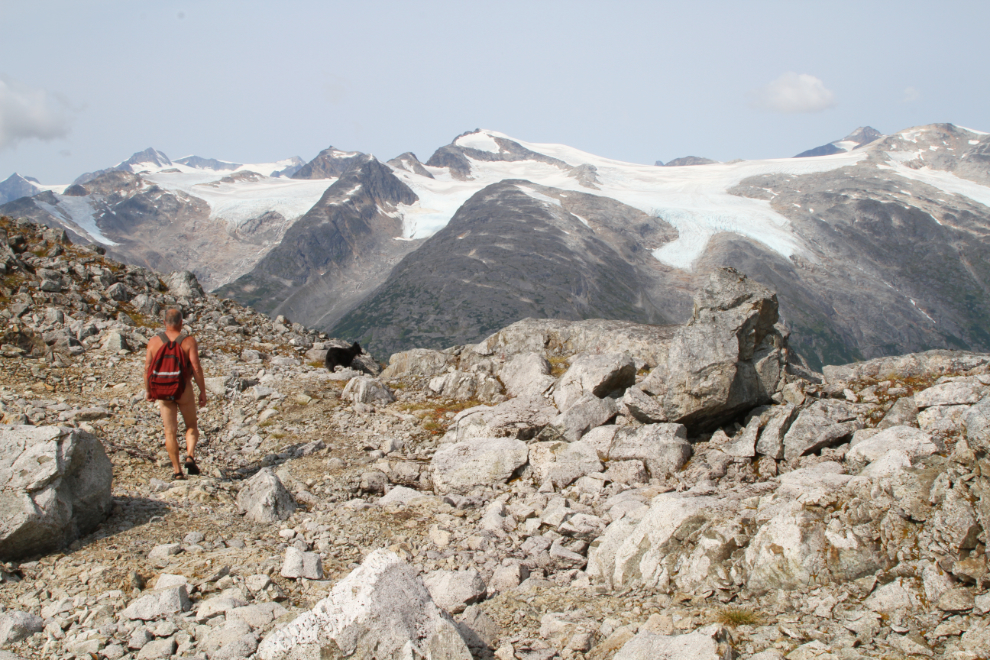
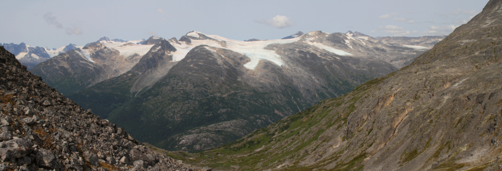
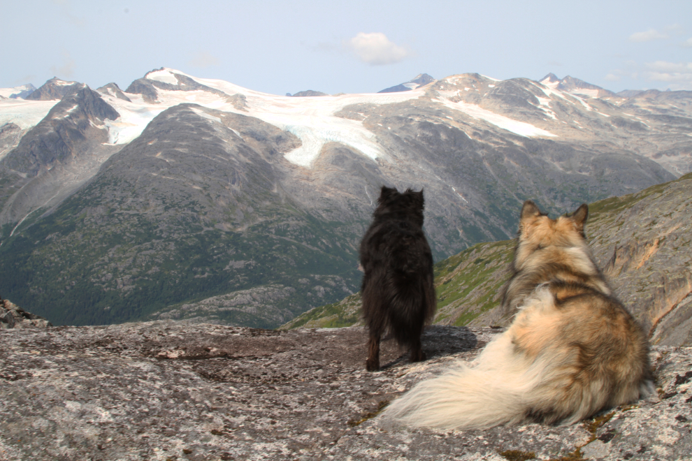
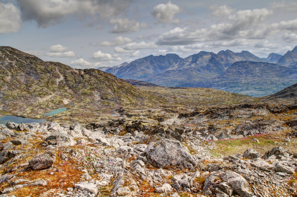
The top of the pass – actually a bit above it – at 1:15, 2 hours and 55 minutes from the car. While this spot often is wide open to the wide, it was sheltered from a south wind this day and was a glorious place to spend time.
The next panorama was created by stitching 3 photos shot at 24mm. The Taiya River and Chilkoot Trail are directly below.
Tucker and Bella spent a long time like this. I wonder what they were thinking. This is not a place to have chatter – it’s a place for serious conversation or none. It pretty much leaves me speechless every time, but I usually only have my dogs to talk to anyway, and they know what I’m thinking.
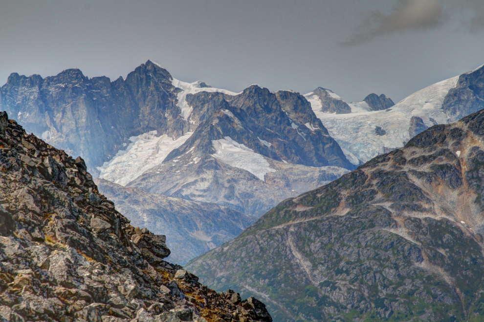
I shot some glacier detail photos with the heavy 400mm lens I’d carried, but the next one was shot at 105mm.
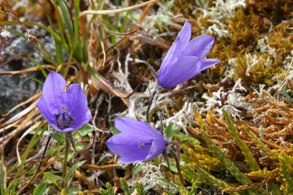
It’s not common to see these flowers except solitary, but there were lots of them at the top. Beautiful and tough.
At 1:50, we started back down.
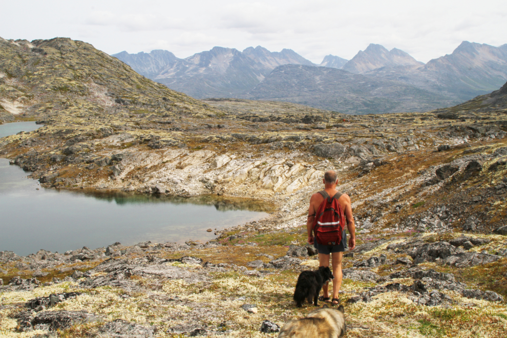
We went down a different route than we’d climbed, to visit some of the lakes on the north side of the valley.
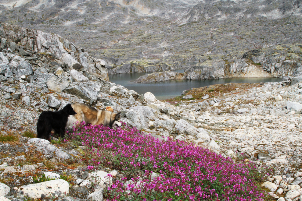
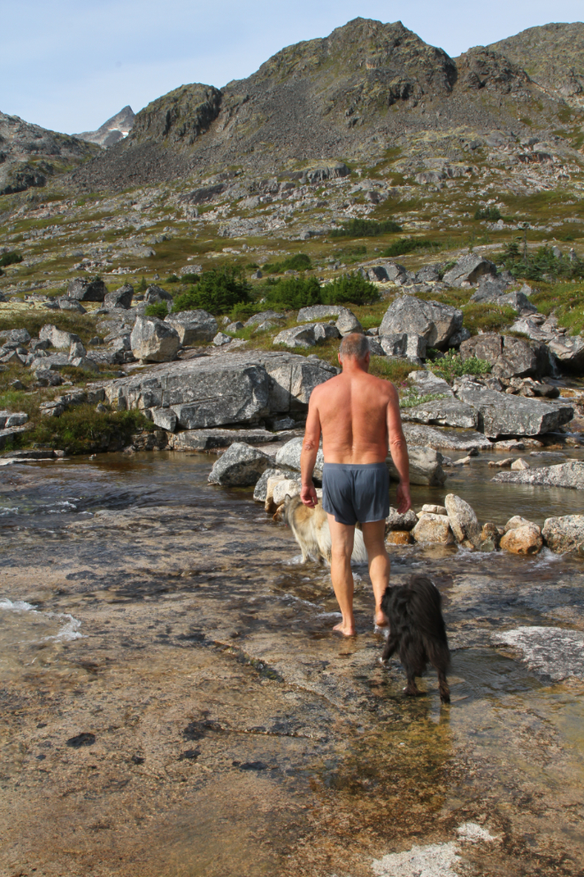
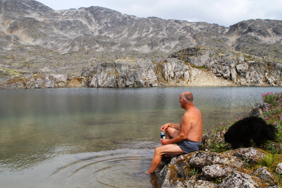
Fifteen minutes from the top, this lake seemed like a good spot to enjoy the single beer I often carry on hikes where a congratulatory drink seems appropriate. Rather strangely, it hadn’t occurred to me to have it at the top as I normally do. We also spent some time playing in the water – well, Bella and I did 🙂
Continuing down, at 2:30. Just before I shot the next photo, I saw the first people we’d seen since the couple right at the start.
A few minutes later we met 3 women from the hiking group I belong to, and chatted briefly. I had posted on our Facebook page that I’d be leaving the motorhome at 10:00 if anyone cared to join me. Whether anyone takes me up on such offers doesn’t alter my plans.
I rather expected that Bella would be tiring by 3:10 when I shot the next photo, but no, she was going strong and looking like she was having a ball.
We only made one brief stop on the hike down after the beer-and-play stop. Bella looked like she was on a mission.
This was the area of huge flat granite where we’d made a long stop on the way up. The bubbling water in the centre of the next photo is the top of a high waterfall.
Bella can be seen at the top of the cliff to the left. Shortly after this, she made a couple of errors in picking the trail – now, at 3:40 she was tiring.
Almost the end, right at 4:00 – Bella had one more wade in a creek before the very steep climb back to the car.
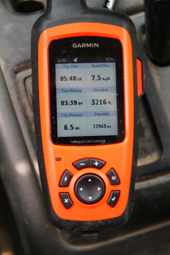
The final hike report by my Garmin inReach as we reached the car – a total of 6.5 miles in 5 hours and 49 minutes.
When we got back to the motorhome, we were all due for a nap. Cathy would be joining us at about 7:30, driving up from Whitehorse after getting off work.
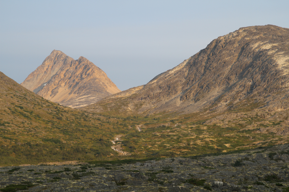
Looking back from my final dog walk, with my family back together again.
During that dog-walk at 9:10 pm, the warm light on the far side of the pass was spectacular. My buddy Greg and I canoed and hiked to that valley 2 years ago – I’d love to get back, possibly for an overnighter.