Hiking to Caribou Ridge, Yukon
After discovering during a flight on Saturday that the craggy cliffs overlooking Spirit Lake are topped with a huge almost-level plateau, I was determined to hike up for a look. I started up the trail twice many years ago but got stopped by a grizzly both times – on Tuesday, I tried again. This is usually called the Caribou Mountain trail, but Caribou Mountain is actually a couple of peaks further southeast and would be quite difficult to access from this trail , so I’ve changed the name to “Caribou Ridge”.
The weather forecast was for mixed clouds and sun, but I hoped for one more day of Summer hiking. I got off to a fairly early start, at 8:40, with the temperature sitting at 6°C (43°F). Forty minutes later, I had parked the car along the South Klondike Highway just north of Dry Creek and was started up towards the trail. The top of the ridge was blanketed with clouds but I was quite sure that they would lift or burn off.
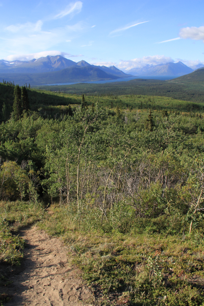
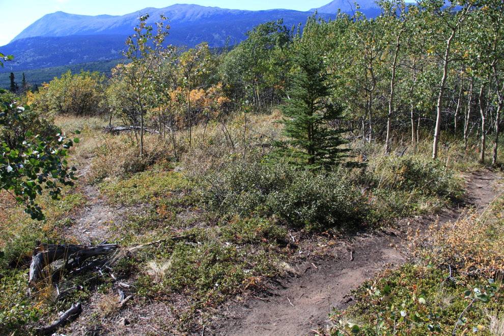
I took the wrong trail initially and it petered out, but I knew the direction of the trail so just continued through the open aspen forest until I ran into it. By 9:20, I could already look back down the trail at Lake Bennett. There was a cold wind blowing from the south, but the sun was trying hard to warm the world up. I was dressed lightly for the climb but had more clothes in my pack in case I needed them.
I remembered some very steep sections on the trail, and by 9:45 I’d reached one of them. It was steep enough that I had to walk on my toes rather than flat-footed. The view ahead was a bit intimidating, but having the plateau I’d seen from the plane in my mind was all the incentive I needed to keep going.
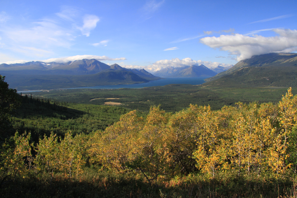
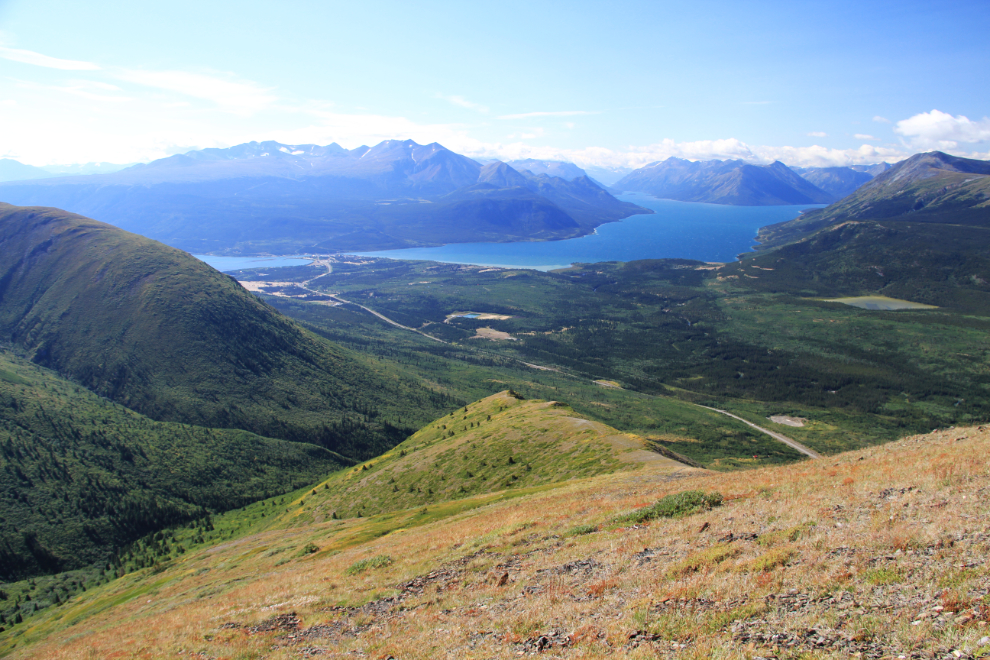
The view back over the valley kept getting better and better, and Fall colours got more and more common – this was shot at 10:05.
Ten minutes later, I reached the highest point I’d been to on the trail previously. It was right here, on my first attempt at the trail, that I’d come face-to-face with the bear we called “the Dry Creek grizzly”, and he made it clear that he wasn’t leaving.
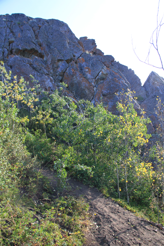
The trail around that rocky bluff was the steepest and loosest yet.
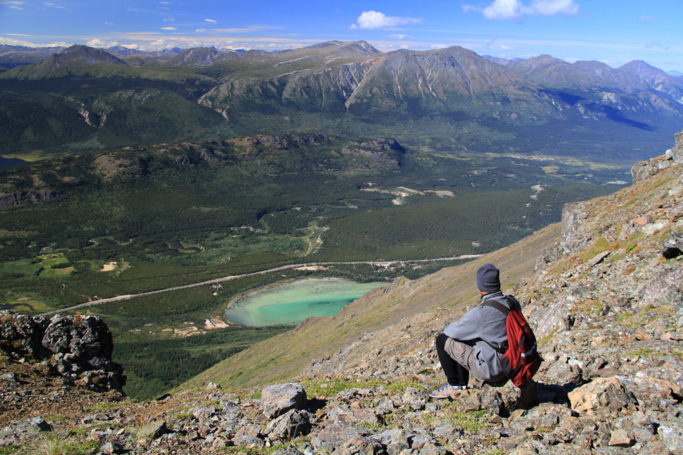
At 10:25, I got this shot by walking about 100 meters up a trail that branched off the main one. Sometimes these side trails seem to go nowhere, and sometimes I get rewarded.
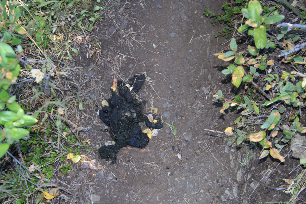
Damn, one of the Dry Creek grizzly’s descendants is still using the trail. I don’t recall hearing anyone else mention seeing a bear on this trail, though – maybe I just attract them 🙂 I actually would like to see him – as long as we’re on opposite sides of the valley!
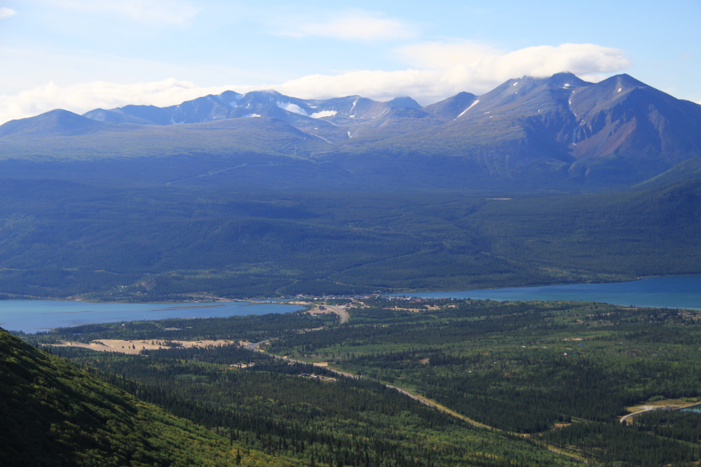
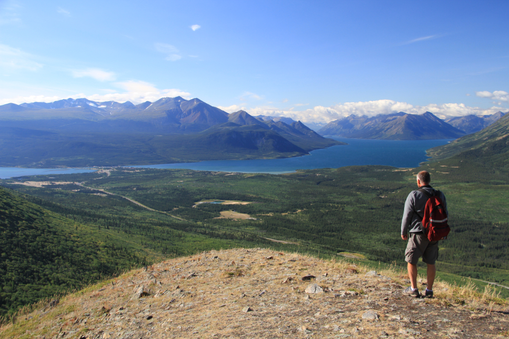
Looking south to Montana Mountain, the village of Carcross, and the Carcross Desert.
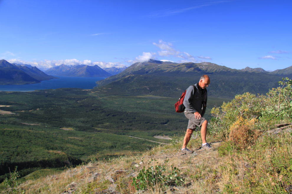
Climbing one of the moderately-steep sections where I could actually set up my tripod, at 10:45.
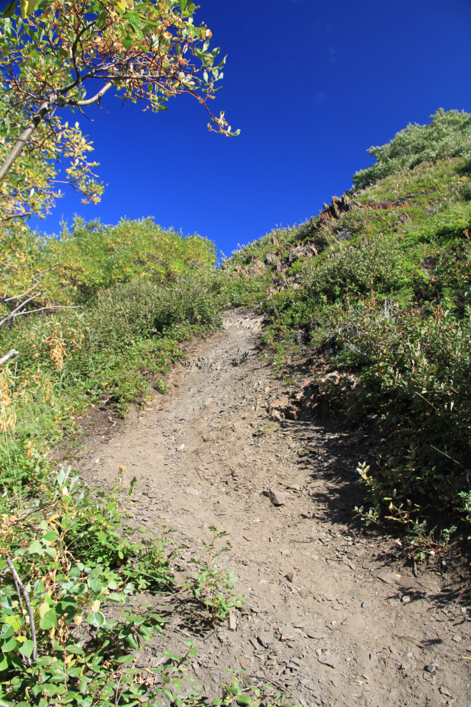
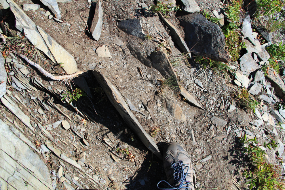
Much of the centre section of the trail is on sharp shale – you don’t have to worry about running into mountain bikers on this trail!
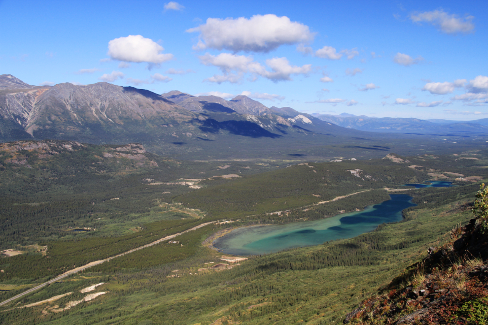
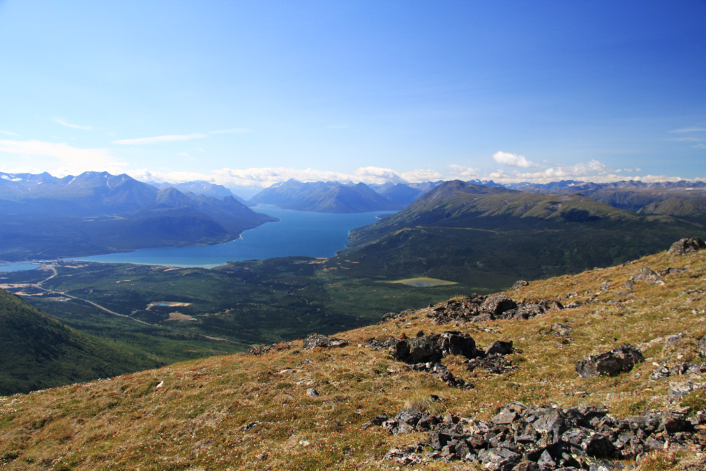
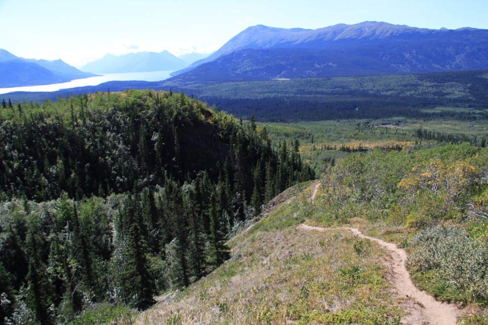
By 10:50 the ridge that the trail climbs had narrowed enough that hikers can see to the north, over Spirit Lake and Emerald Lake. The low ridge to the left is Watson Ridge, the dominant one is Gray Ridge.
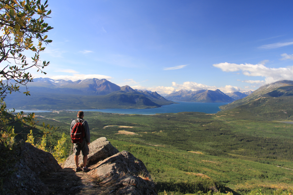
Now that’s a view worth working for! This was shot at 10:53. Hikers who don’t have a camera with them can obviously make much quicker progress than I do on trails like this 🙂
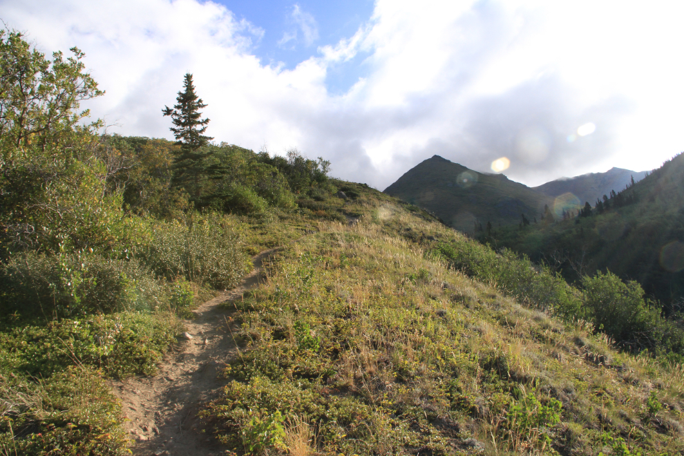
Passing the last stand of trees at 11:07. I like trees, but they sure block some great views, so I’m always very happy to get above them!
Many people apparently stop on the flat section of ridge where the last trees are, as the trail gets noticeably less distinct past that point. Some of the trail condition can be explained by the fact that many people are hiking on snow by this point, but I’m quite sure that it also gets less use – that spot by the trees would make a great destination.
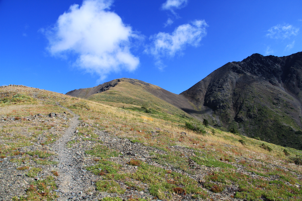
By noon, the trail had pretty much disappeared – you just follow the ridgeline up. The elevation here is about 1,500 meters, or 5,000 feet (Lake Bennett is at 655 meters, 2,150 feet). The higher I got, the stronger and colder the wind got. The winds were reported as being 40kmh or 25mph at both Skagway and Whitehorse that afternoon, but it felt much stronger at altitude, and the wind chill was probably not much above freezing.
Success! This is the view of the plateau from a small summit at its south end, which has an elevation of 1,757 meters (5,764 feet). My plan had been to spend the day wandering that plateau, but the wind was just nasty. With all the extra clothes I brought, I was warm enough, but the screaming wind made me change my plans – I don’t like wind, so just had a quick lunch and headed back down. The plateau exploration was put off for another day.
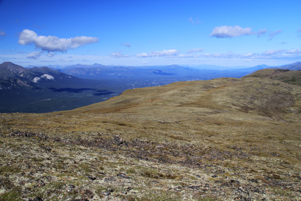
The view to the northeast from the summit.
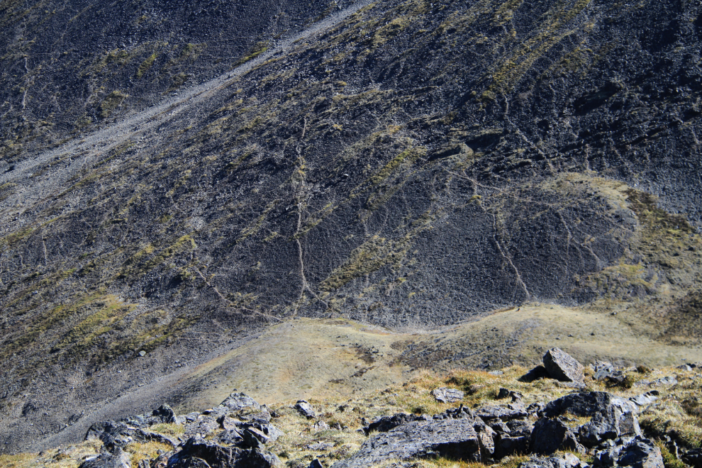
Directly below the summit, to the east, is a meadow that’s obviously very popular with Dall sheep. I used to be able to watch the sheep in that area from my cabin with a spotting scope. The slope that those sheep trails go up rises to a craggy, unnamed summit about 700 feet higher than my position, which blocks easy access to the Caribou Mountain summit.
One final shot of Lake Bennett from the summit at 12:50 before I started down.
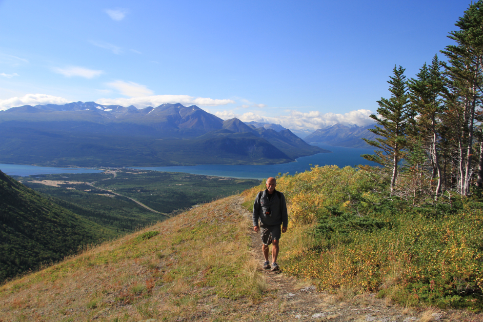
On the way up the trail, I was warm at this spot without all the extra fleece on 🙂
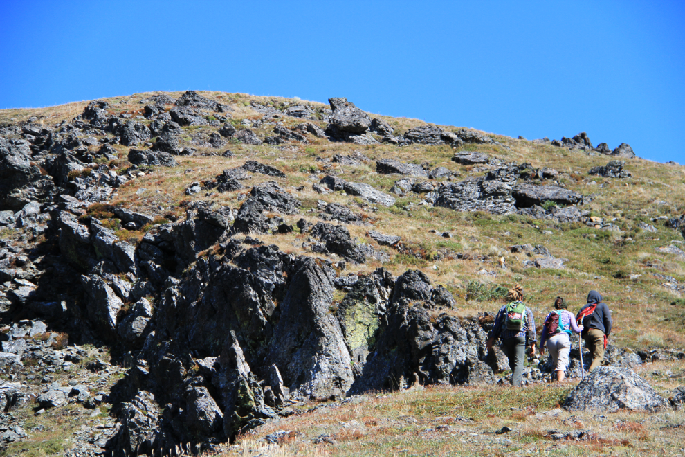
Just 10 minutes from the top, I met the first other hikers I’d met all summer, and we chatted for a bit. They’d hoped to reach the craggy, unnamed summit, but I explained that they were already well past the easiest access to it (along a sheep trail on the south side of the ridge), and that it was a pretty tough climb from the summit they were almost at.
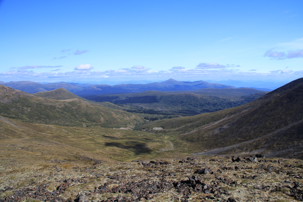
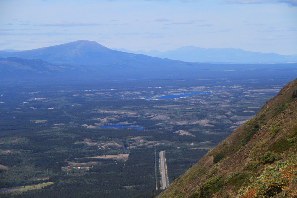
The view to the north, with Lewes Lake in the centre.
An hour and 20 minutes from the summit, almost at the bottom. A few minutes before this, I’d met another couple of hikers with their dogs. Six people on a single trail – now that’s a popular trail by Yukon standards!
To the left is the old trail that I would have hiked on the last couple of times. It went very close to someone’s home, so a new trail was cut. Some hikers report that a couple of aggressive dogs from that home are still bothering people on the new trail, but I didn’t see them.
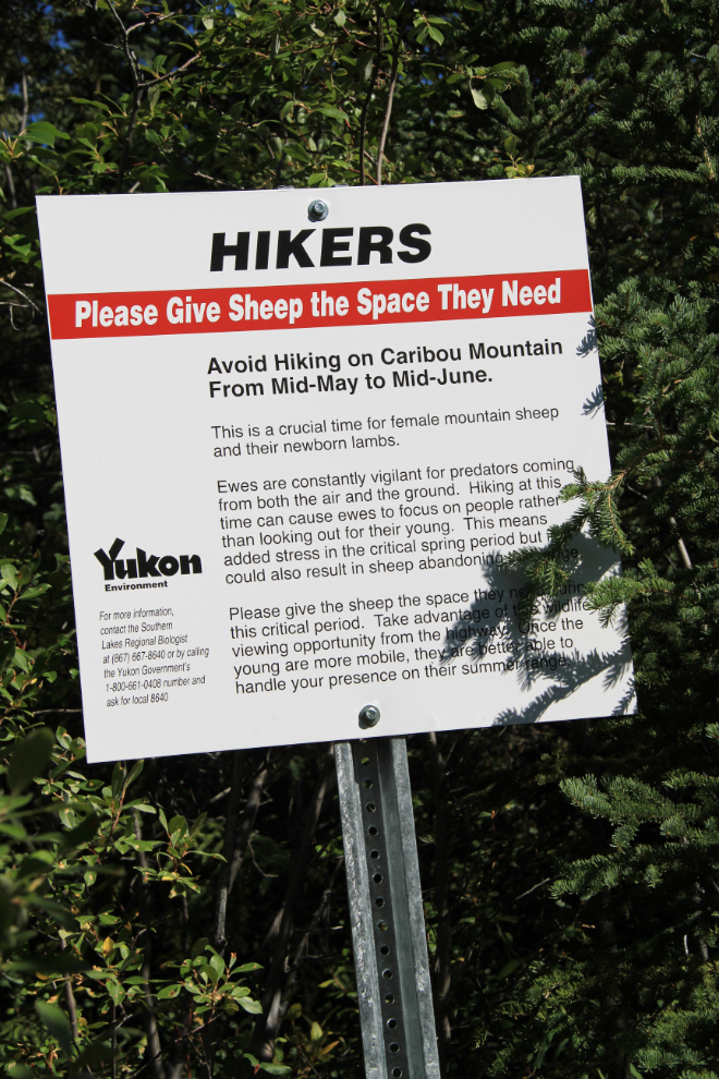
The start of the new trail is well marked by this sign asking people to not use the trail from mid-May to mid-June to avoid stressing the Dall sheep while their lambs are very young.
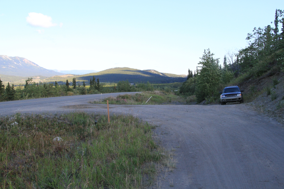
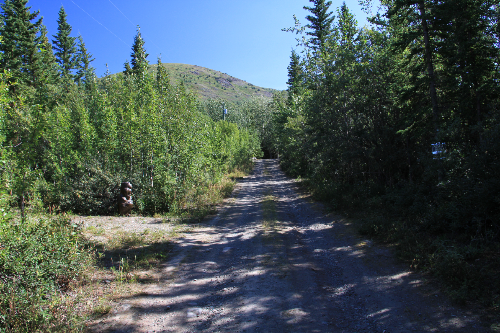
This large sculpture marks an old road that leads off the driveway to the actual trail.
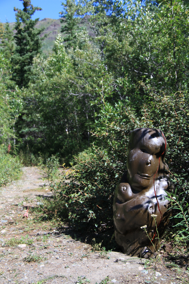
With a “Private Drive” sign on the right and the sculpture on the left, the start of the trail is very clear, unlike the description on the most-used Yukon hiking Web site.
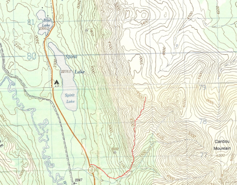
And here’s the topo with the trail added in red. Although it was a much shorter day than I’d planned on, it was still a great day.