Helicopter tour of Whitehorse, Yukon
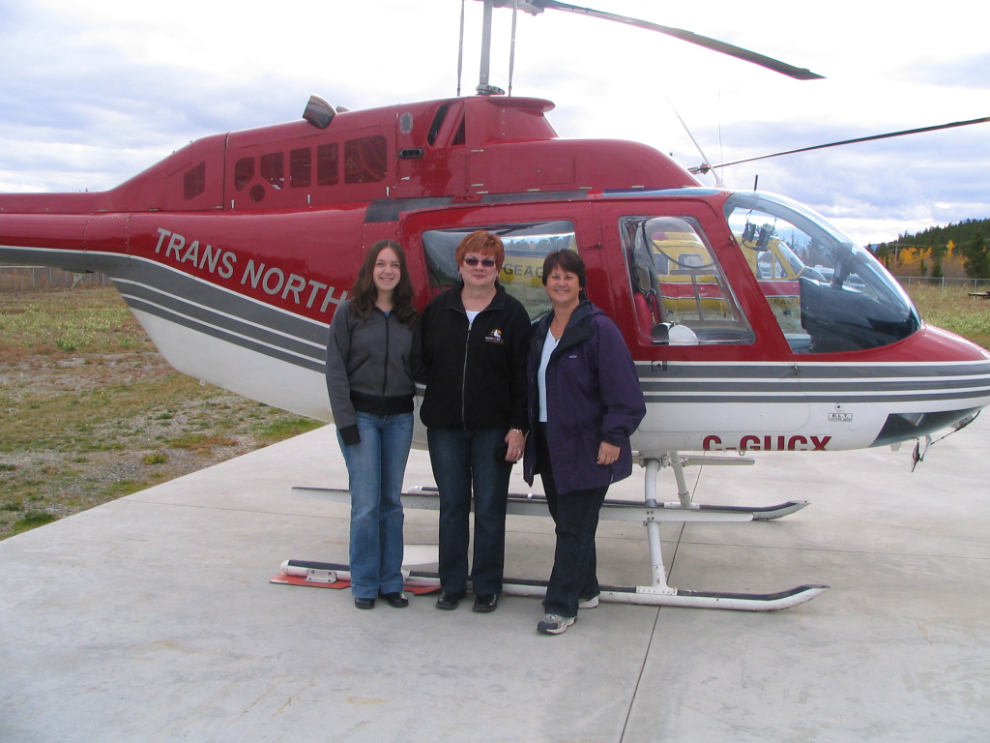
While I was down in BC, Cathy got an opportunity to join a short helicopter tour of Whitehorse with Trans North (thanks, MJ!), and of course jumped at it. I had to remind her to take her camera (!!), but the photos below are some of the ones she shot.
First is the group ready to take off in the 1975 Bell 206B, C-GUCX.
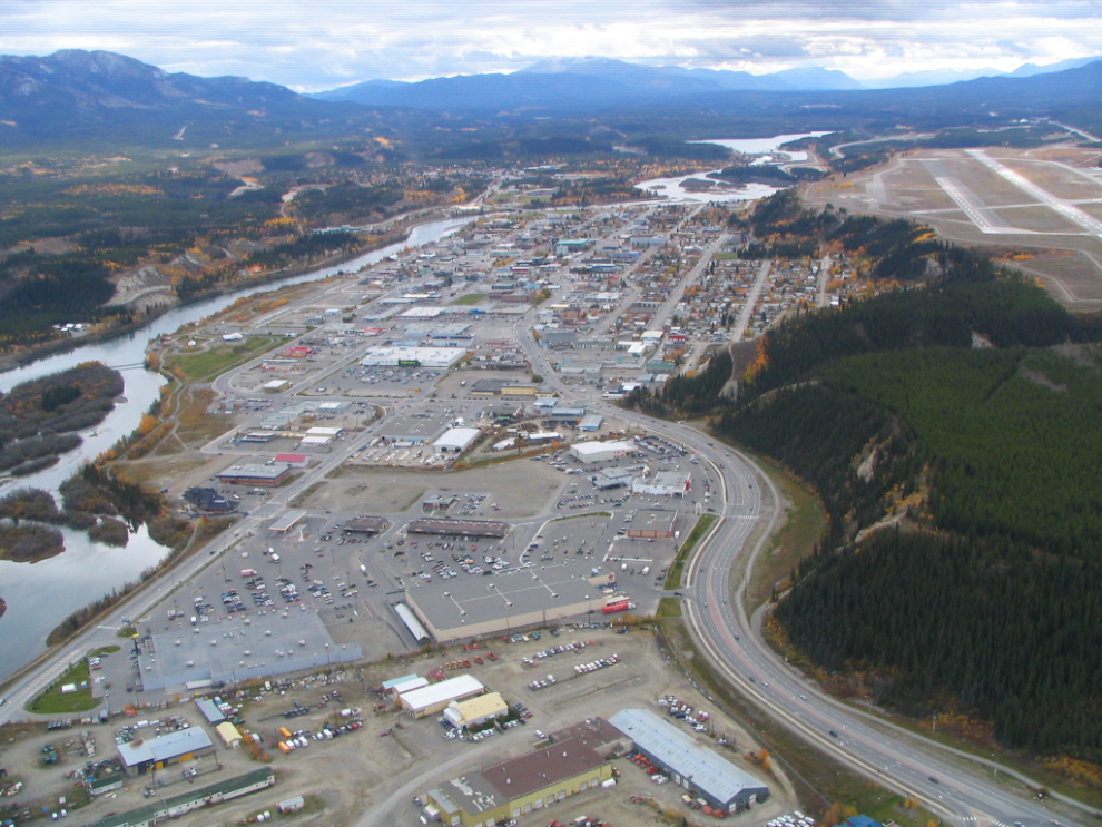
Below is downtown Whitehorse as seen from above the Marwell industrial area. The 2 large buildings side-by-side near the bottom of the photo are the WalMart and Canadian Tire department stores. The Yukon River is to the left, the curving Two Mile Hill road (the northern access from the Alaska Highway) to the right.
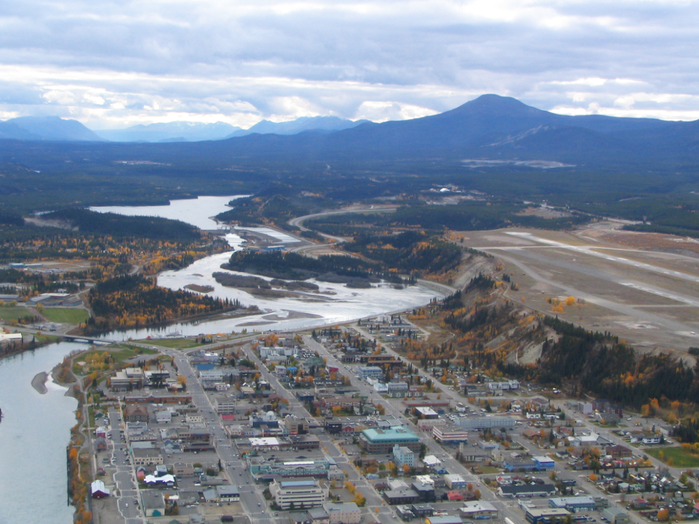
At the bottom of this photo is the historic part of downtown Whitehorse (though there’s little “historic” left). The bridge to the left goes to the Riverdale residential area. The mountain to the right is Golden Horn, a volcano that last erupted a couple of million years ago (Cathy and I live near the base of it).
The highway on the right side of the photo below is the Alaska Highway, the one to the left is the Hamilton Boulevard extension that’s currently under construction. It will be the second access route to the rapidly-growing hillside residential area that includes McIntyre, Granger, Copper Ridge and Arkell. Centre left is Lobird, a small residential area that includes an apartment building (Radar Apartments) that was originally built during the Cold War to intercept radio transmissions from Russian aircraft in the Arctic. I lived on the top floor of that building for a year or so – it’s a very cool place.
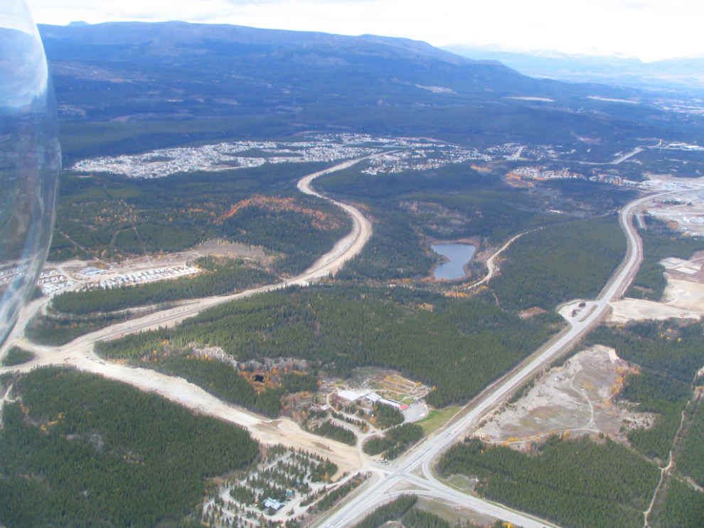
The next photo shows you why the residential area on the hill is so popular – it’s very close to downtown (and even closer to the airport). The most expensive subdivisions to buy a home in are there, and rental vacancy rates are always zero or very close to it.
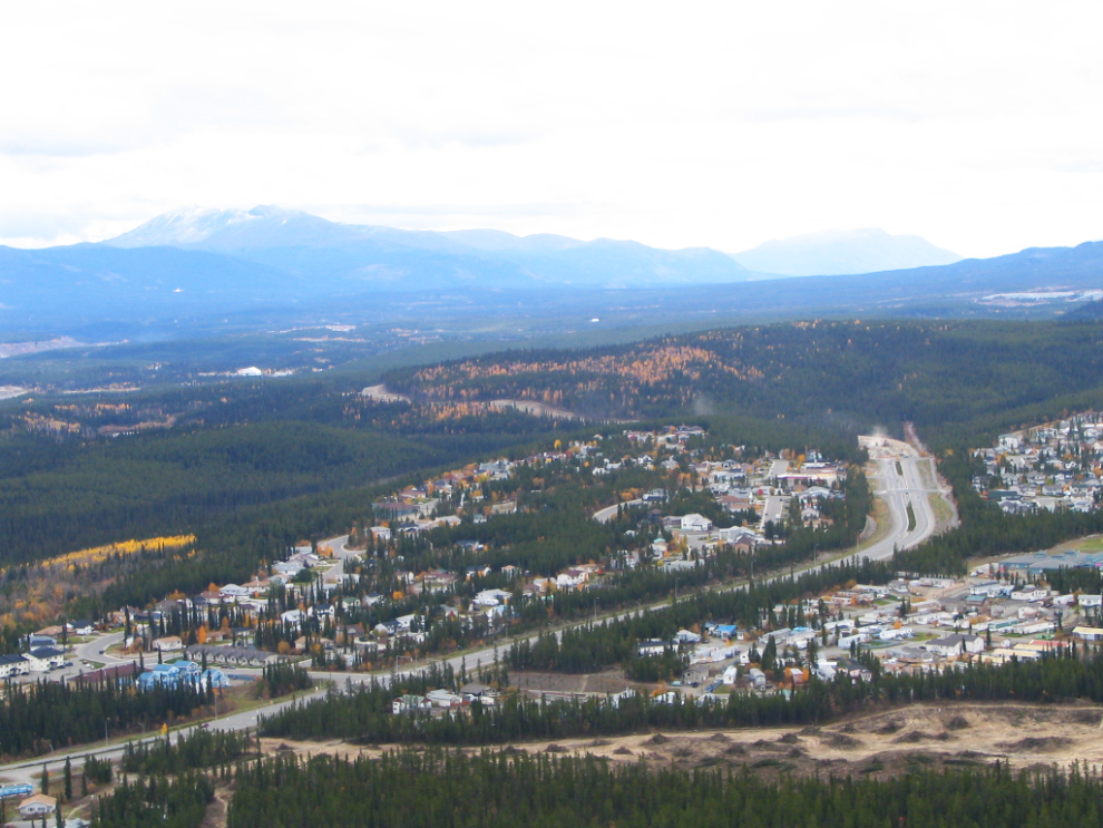
Below is a closer look at the residential area on the hill. Granger is in the center, Arkell to the lower right. Granger is mainly upper-end homes, Arkell is mainly mobile/modular homes – or at least formerly-mobile homes (“It ain’t home till you take the wheels off” 🙂 ).
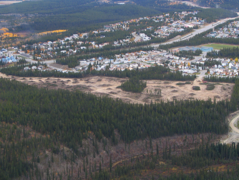
The area being cleared is the recently-authorized Ingram subdivision.
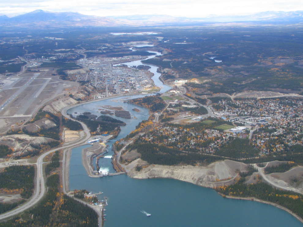
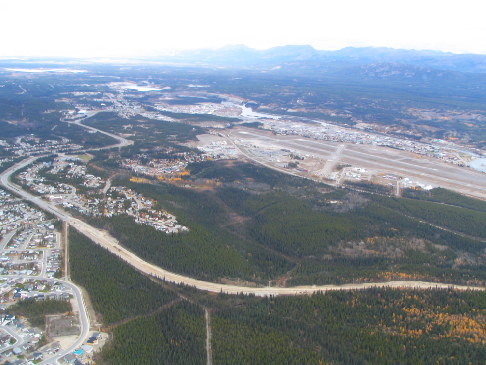
The final photo shows Schwatka Lake (the city’s float plane base and a fairly popular recreation spot), the power dam, Riverdale to the right and downtown straight ahead. On a clear day, Lake Laberge can be seen in the distance – that’s one of the top places to go for great fishing close to town.