Forty Mile ghost town and wild weather on the Top of the World Highway
Thursday didn’t go quite as planned, but I finally made it to Forty Mile, and it ended with a truly incredible experience out in the middle of nowhere on the Top of the World Highway. This is another very long post, with 39 photos.
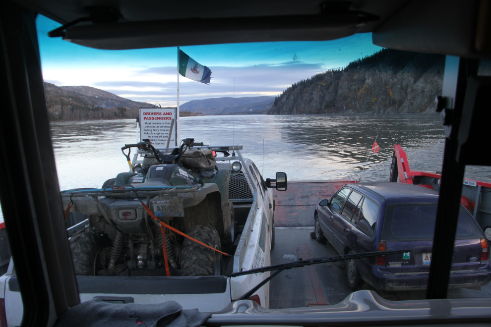
We got off to a fairly early start, and after breakfast and a good walk from our camping spot in downtown Dawson City, were on the ferry George Black across the Yukon River at 09:40, an hour and a half after sunrise. This short crossing is free.
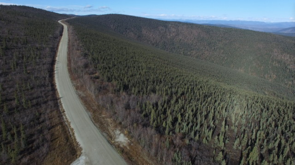
At 10:10, I stopped at the Fortymile rest area, mostly so I could take the drone for a short flight.
A shot from the drone. The video that I also shot needs some editing yet.
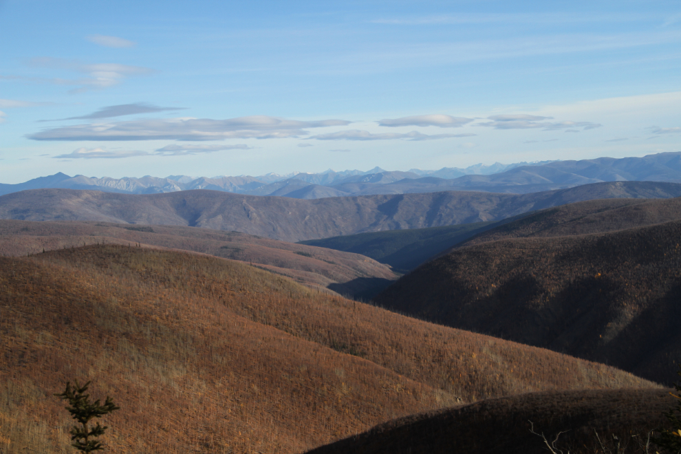
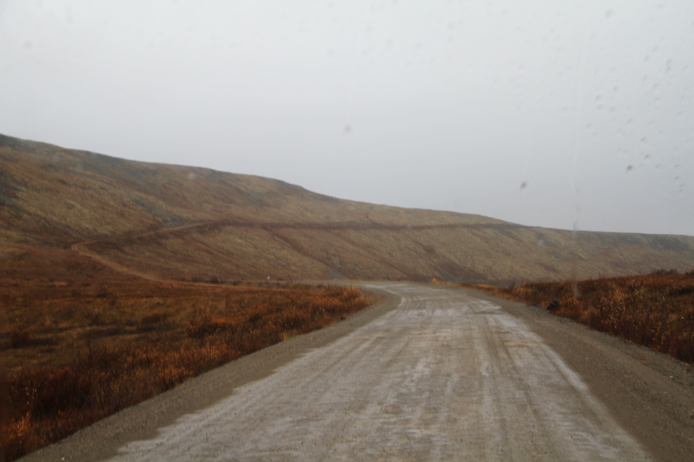
Up, up we go – Km 28 from Dawson, at 10:35.
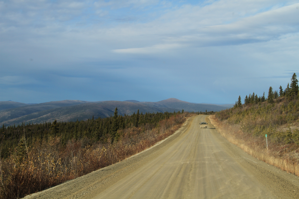
The view from near Km 58, just east of the junction of the Top of the World Highway and the Clinton Creek Road (it’s signed as the “Clinton Road”).
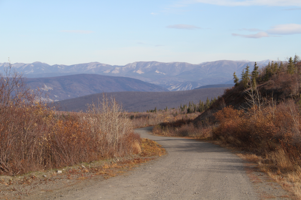
At 11:55, I was 14.4 km (8.9 mi) down the Clinton Creek Road in the Tracker, in country I’d never been in before and had virtually no information about. It was a safe bet, though, that the motorhome needed to be left up on the Top of the World Highway.
Ten minutes past noon, at km 23.9 (mile 14.9), the abandoned Clinton Creek asbestos mine came into sight (the whitish spot at the far right). Owned by the Cassiar Asbestos Corporation, it operated from 1967 until 1978. There aren’t actually any mileposts along the Clinton Road, I kept track of the mileages.
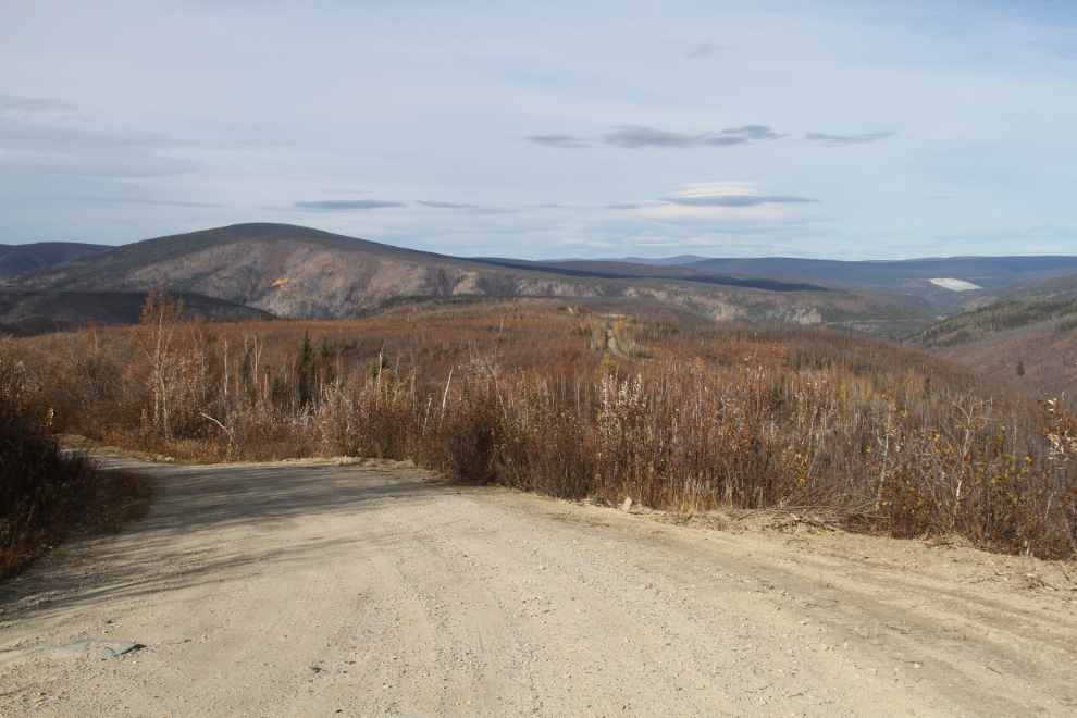
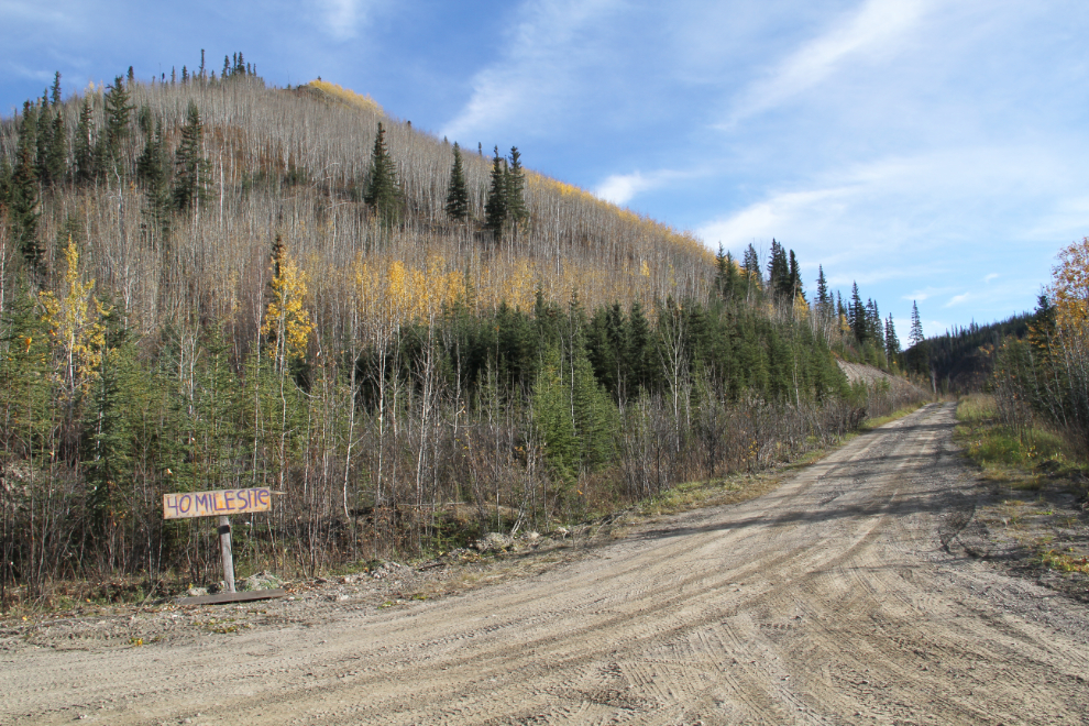
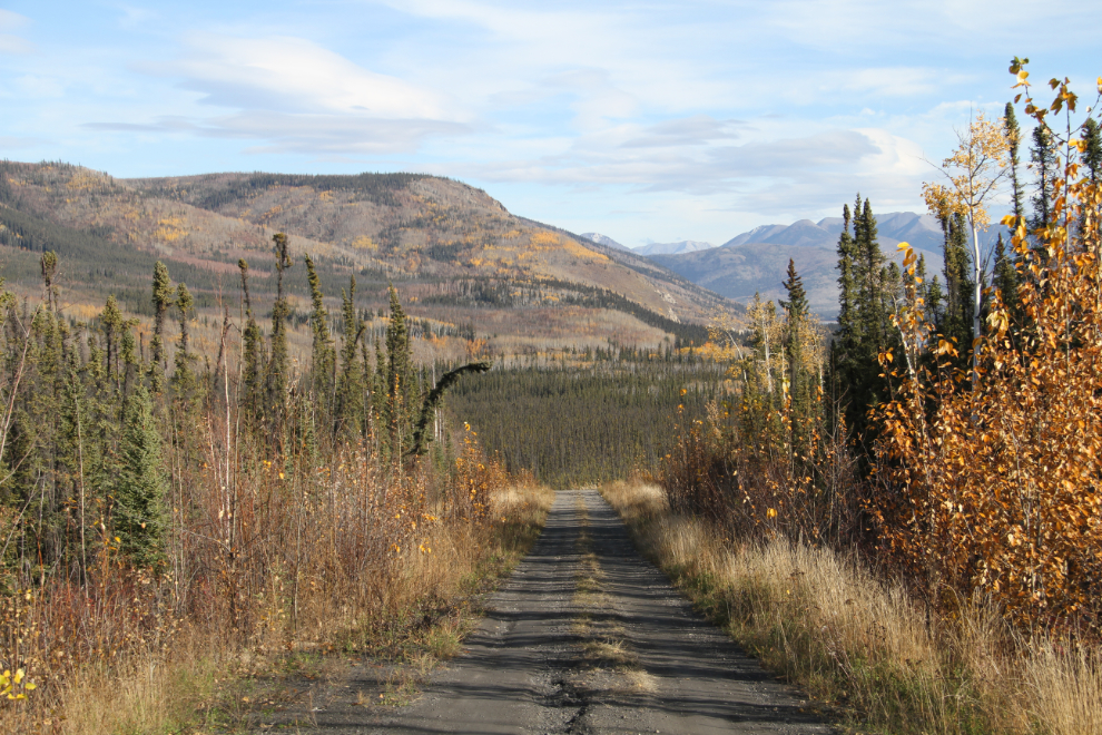
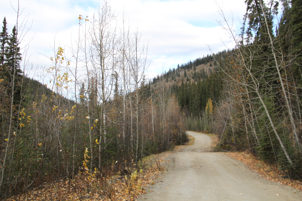
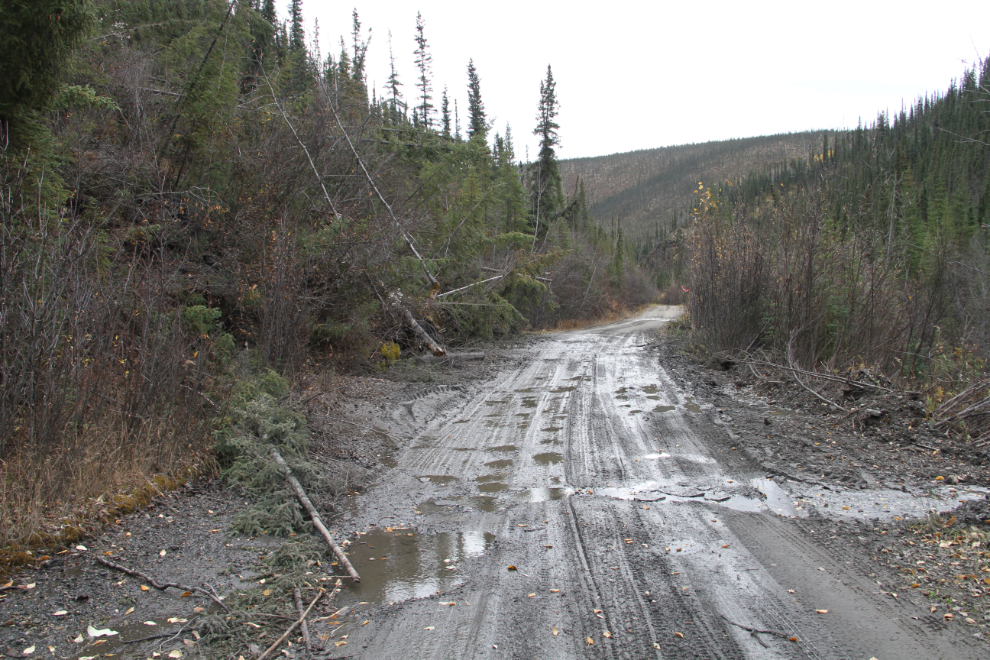
At Km 33.3, an informal sign notes the side road to the Forty Mile townsite (at least I expected that that’s what “40 Mile Site” meant). The road up to this point had been very good, but neither road from here on was big-rig friendly.
Km 1.6 of the Forty Mile Road. This is exceptionally pretty country.
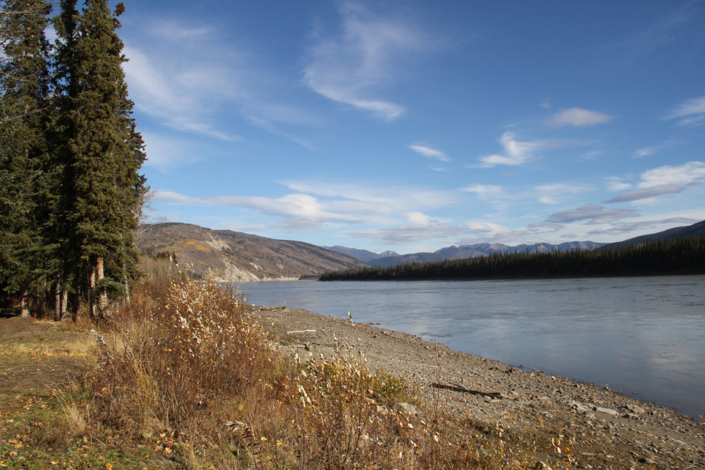
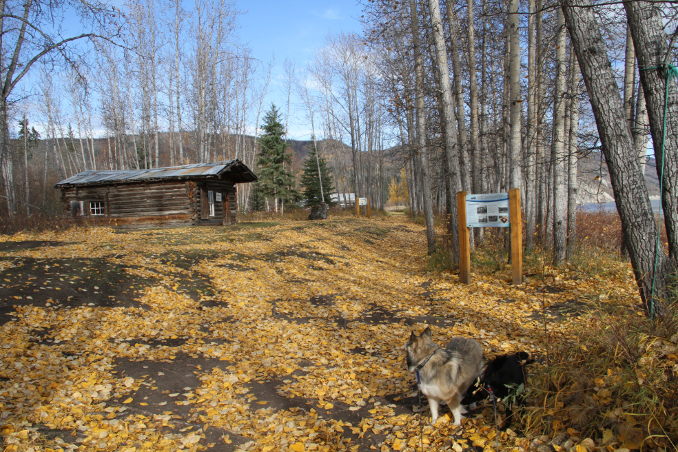
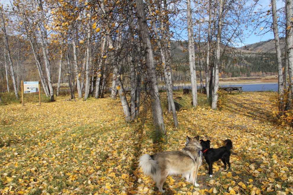
At Km 3.5, the Forty Mile Road ends at the Yukon River. There were several pickups parked here, and there’s an outhouse, a garbage bin, and a couple of interpretive signs at the start of an ATV trail that leads to the townsite, which is part of the Forty Mile, Fort Cudahy and Fort Constantine Historic Site, co-managed by the Yukon and Tr’ondëk Hwëch’in governments.
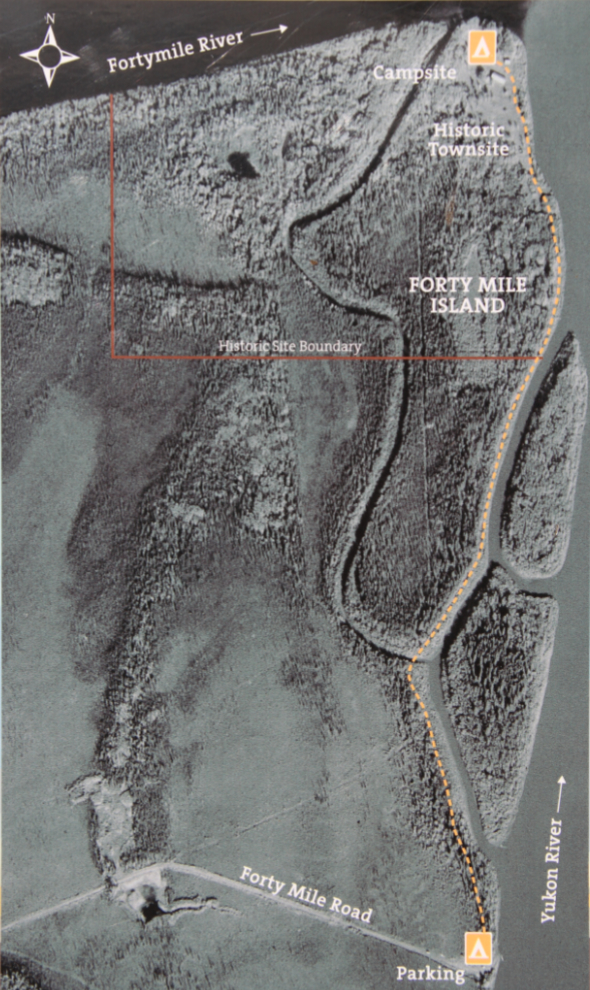
This aerial photo on the sign hints that it’s a fairly short walk to the townsite (it tured out to be about 15 minutes). I started off with the copy of the 32-page brochure I picked up in Dawson, Forty Mile, Chëdë Dëk, in my pocket (Chëdë Dëk – “river of leaves – is the Tr’ondëk Hwëch’in name for the Fortymile River).
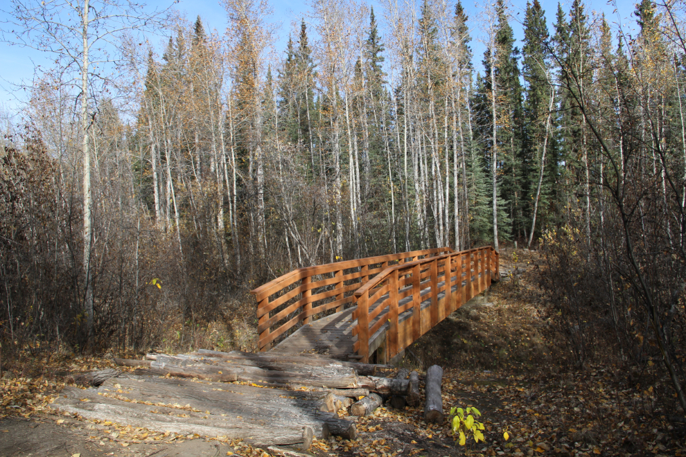
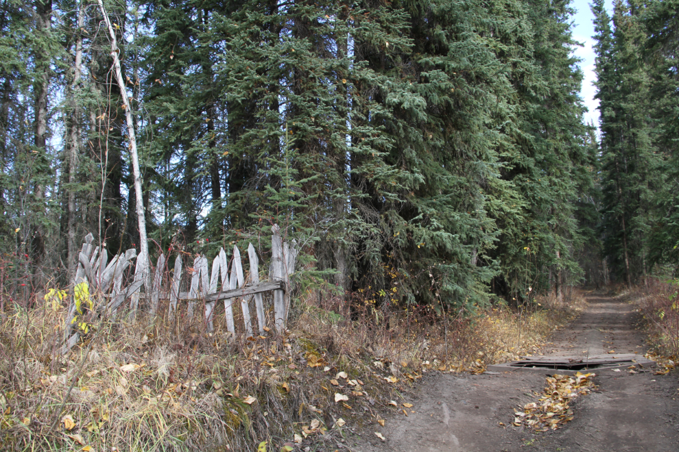
It’s funny to see logs as the approaches to this substantial bridge on the trail – I guess no gravel/dirt was available. A fellow on an ATV stopped here to warn me that my dogs weren’t safe ahead, because a guy building a cabin at Forty Mile had two dogs that are large, aggressive, and loose. I stopped and stewed about that for a while, but decided to continue on.
This grave beside the trail isn’t mentioned in the brochure. The cemetery shown in the brochure is far from here, with no direct trail from this point.
When I saw a pair of new log cabins being built, I picked Tucker up and carried him, and shortened Bella’s leash, but no dogs came out.
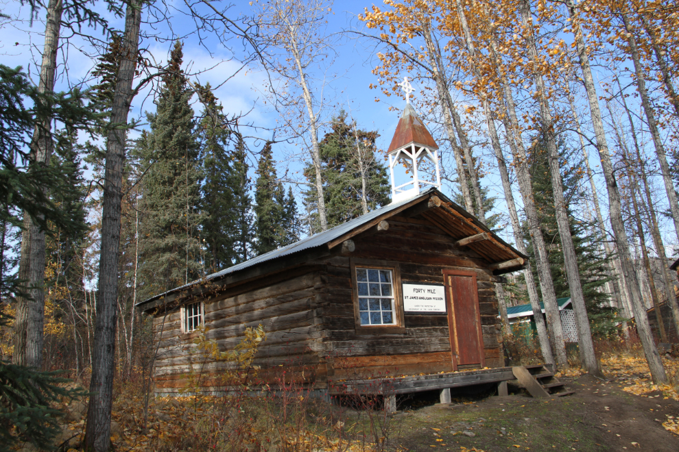
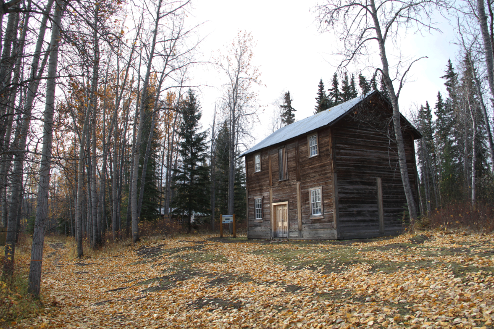
The first of the 12 buildings left in Forty Mile is St. James Anglican church. It was built of round logs in 1895 by Rev. Richard J. Bowen. Some of the logs may have come from the original 1887 Buxton mission. The church was officially closed in 1935, but in the 1970s residents of Clinton Creek used it for occasional weddings, and some restoration work was done during those years.
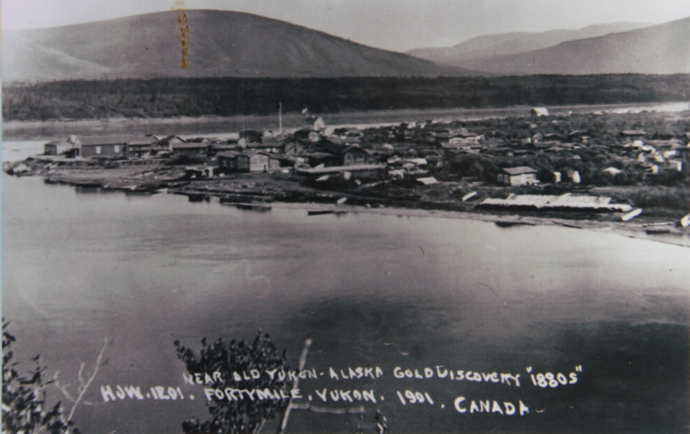
In 1889, government surveyor William Ogilvie was in Forty Mile, and described it as a rough jumble of buildings taking up an area of about 60 acres. This photo, shot from the opposite side of the Fortymile River, is from 1901.
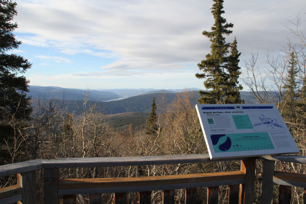
Interpretive signage at the site is very good.
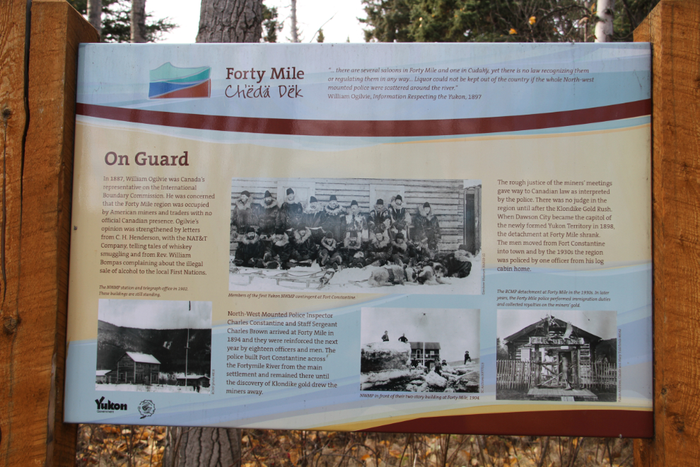
The size of the North-West Mounted Police (NWMP) post was surprising. It was built in 1901, 3 years before the force became the Royal Northwest Mounted Police (RNWMP), but the brochure and signs use that latter name.
The townsite, much of which is on a bench above the Yukon and Fortymile Rivers, is lovely, and the weather was perfect, with the temperature probably hitting about 15°C (59°F). This is the telegraph station. Built in around 1893, it also served as the post office, and the RCMP post when Corporal Claude Tidd was stationed here in 1939.
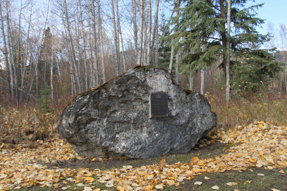
This monument commemorates the found of the Yukon Order of Pioneers (YOOP) at Forty Mile in 1894. The stated purposes of the benevolent organization were “the advancement of the great Yukon Valley, the mutual protection and benefit of its members, to unite members by the strong ties of brotherhood and to prove to the outside world that the Yukon Order of Pioneers are men of truth, honour and integrity.” Initially members were required to have come into the country before 1888. Still in existence, YOOP now requires members to have lived “within the watershed of the Yukon River, and/or the Territorial Boundaries of the Yukon Territory” for at least 20 years.
The Fortymile River is on the left, the Yukon River on the right, flowing into the distance. This view is from in front of Swanson’s Store.

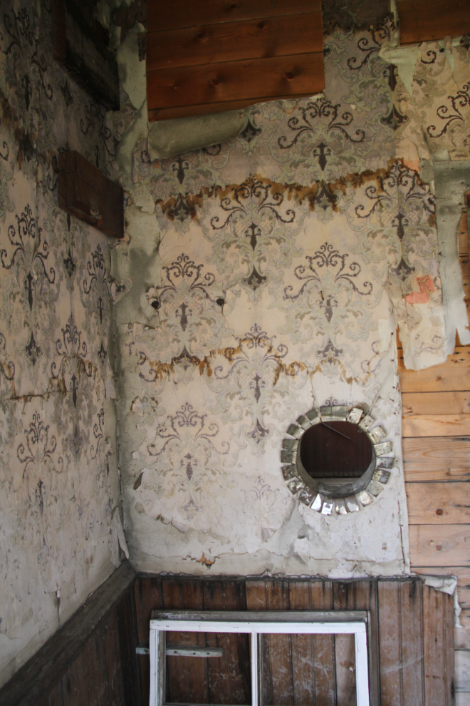
Wallpaper on the walls of the Alaska Commercial Company (the AC Co) warehouse. It was built between 1895 and 1901, and because it needed to be built close to the Fortymile River for business reasons, has been damaged and even moved by floods at least twice.
Many of the visitors to Forty Mile arrive by canoe, and the small campground for them at the north end of the site is very nice, with fire pits, picnic tables, and outhouses.
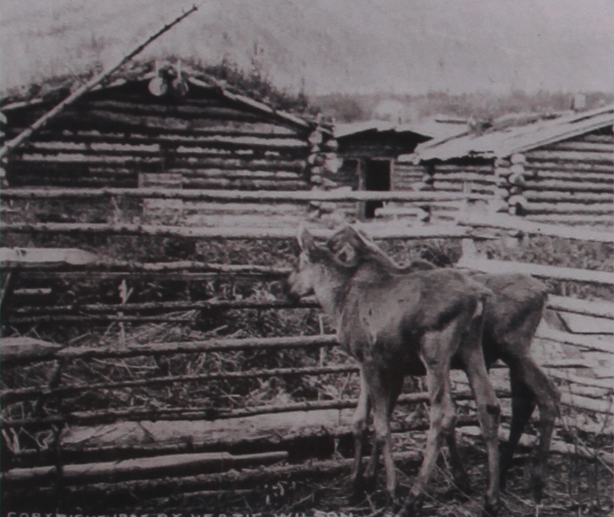
One of the early residents. Jack McQuesten, tried to plough his 4-acre potato and turnip farm using two young moose. The plan wasn’t successful 🙂
I only spent about an hour at Forty Mile, but it could easily have been much longer. On the way back to the car, we did get hassled by the cabin-builder’s dogs. I was carrying Tucker again, but they appeared suddenly and scared Bella. Yelling and kicking at the damn things only resulted in a half-hearted call by the owner – one left, but the other followed us at a distance for a long time. If I would have brought my bear spray, I probably would have used it on them. Asshole…
Anyway, it was mostly a very good visit, and I’m very pleased that I finally got there. At 1:50, we were almost back to the Clinton Road.
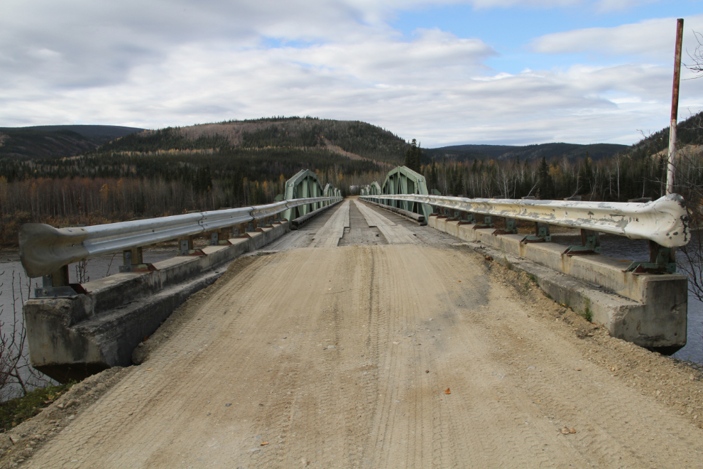
Heading north on the Clinton Road, this one-lane bridge crosses the Fortymile River just a couple of hundred meters/yards from the Forty Mile Road junction.
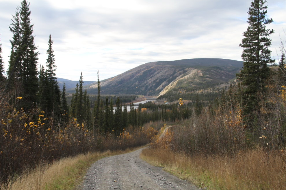
After the bridge, the road narrows substantially, and it becomes hard to imagine that it once served a substantial mine and community. I even wondered if I had somehow missed the road to Clinton Creek.
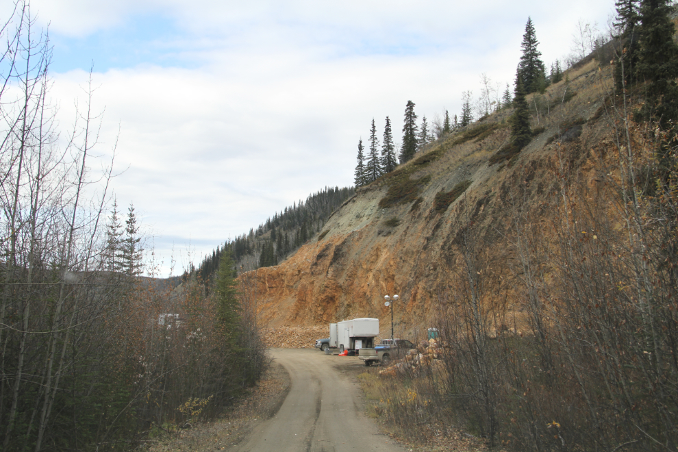
I was extremely surprised to come to an active mining area blocking the road as I neared Clinton Creek. This is 8.1 km from the south end of the Fortymile River bridge. I haven’t found out yet who is doing what (Midnight Sun Drilling from Whitehorse is doing the work), but that’s as close to the old mine as I could get.
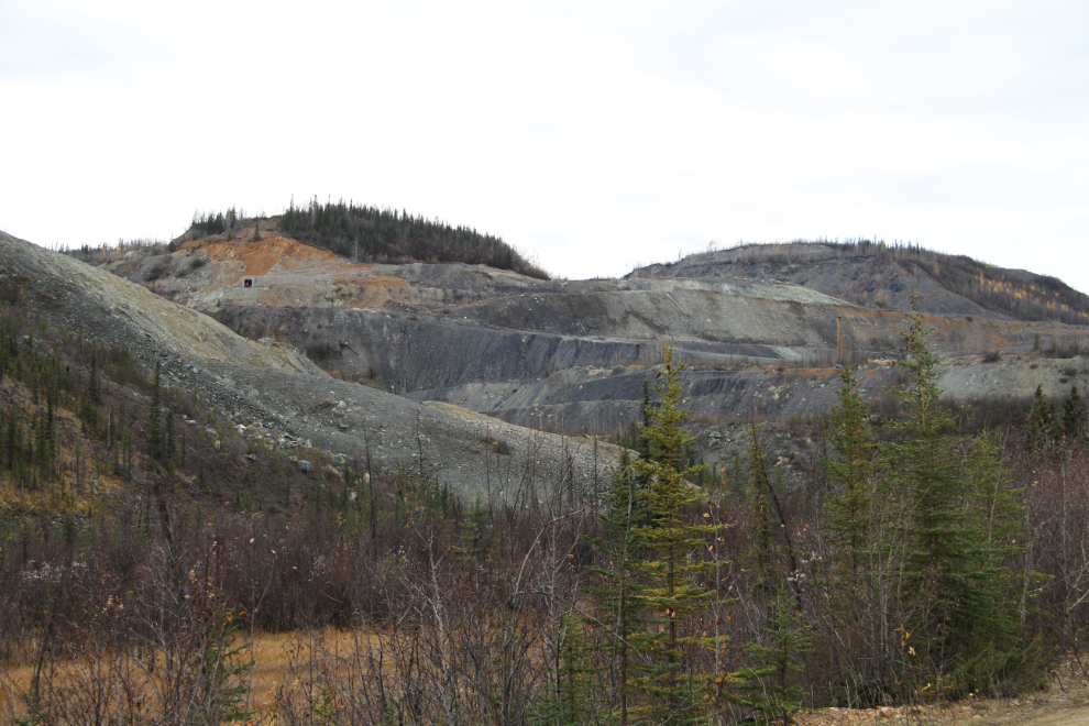
Seen from the effective end of the road, an old adit from the asbestos-mining days can be seen at the upper left.
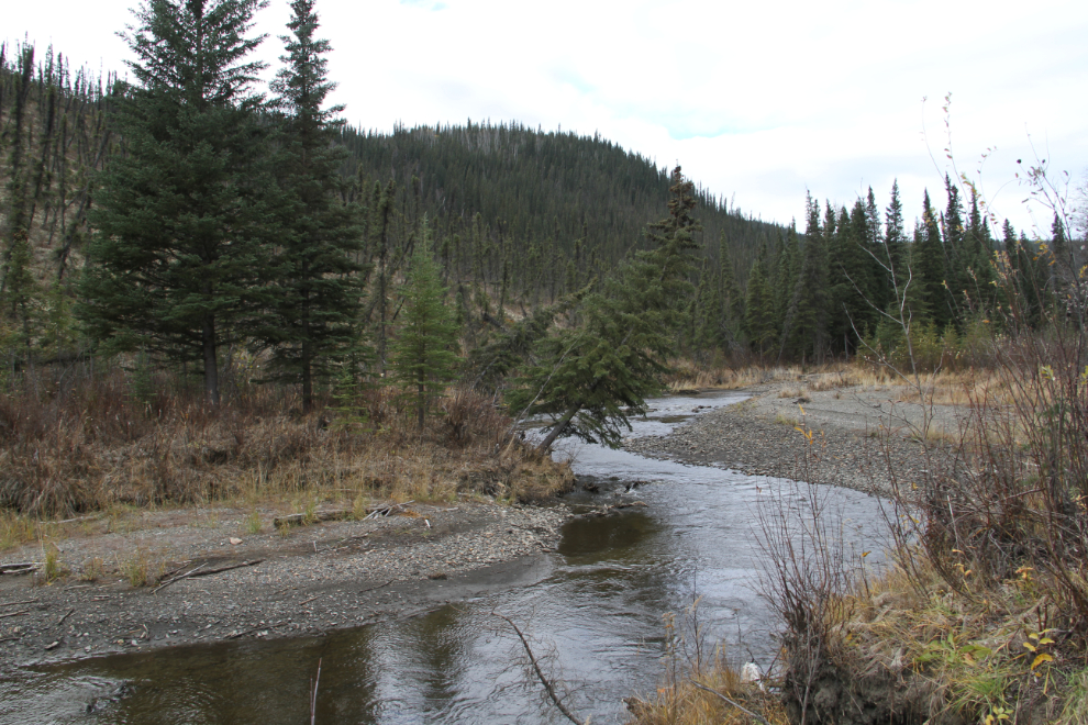
Clinton Creek, back down the road.
Even if the active mining hadn’t stopped me, this very recent large slide clearly would have if the miners hadn’t re-opened the road.
Back at the motorhome at 3:20 pm, it was time to chill and then have a nap before driving another 45 km (28 mi) up the Top of the World Highway to the summit to camp for the night.
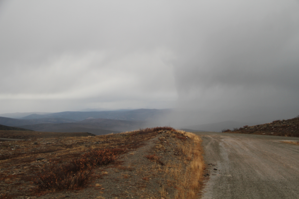
As I drove to the summit at 6:30, the weather turned quite nasty, with an icy rain driven by high winds. I thought a few times about cancelling my high-country camp, and developed a Plan B, and then Plans C and D, in my head. Plan D, for very heavy overnight snow, involved winterizing the motorhome and abandoning it until Spring, escaping with whatever we could carry in the Tracker. The Adventures on early-winter travel in the North! 🙂
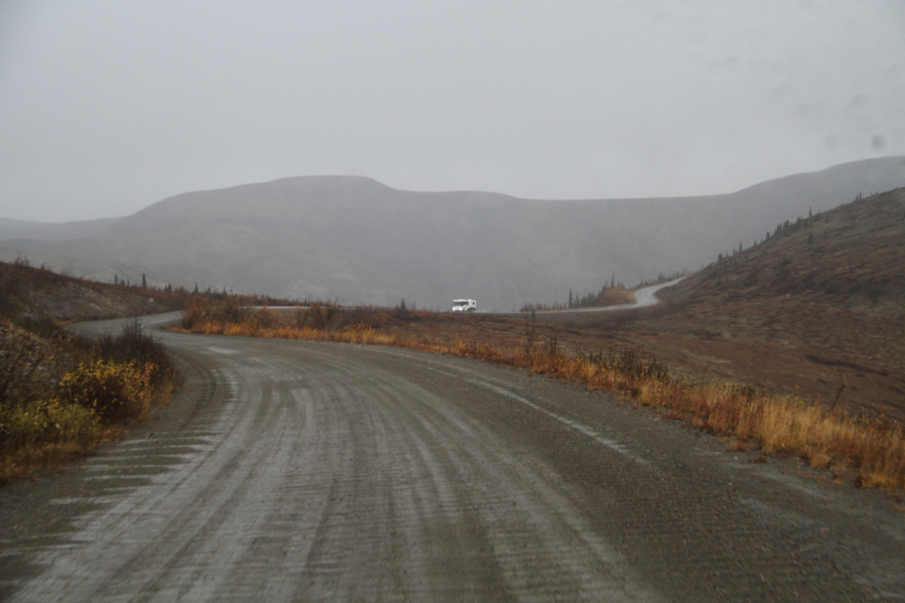
I was very surprised to meet another Class A motorhome – at least he was going in a more sensible direction (down!).
At 6:45, we reached the summit and were soon set up, with wind shaking the rig and whistling through any openings, and with storm after storm passing by and over us. Wild!
We had dinner, went for a short walk in the rain and wind, then as I was reading at 7:50 pm, the sky started to change to the west. With some clearing that way, a good sunset could be coming. That turned out to be an understatement.
I started taking photos, and the sky to the west kept getting more and more dramatic. The extreme contrasts in light got me to start shooting bursts for later HDR image processing. This HDRI was created from a series I shot at 7:55.
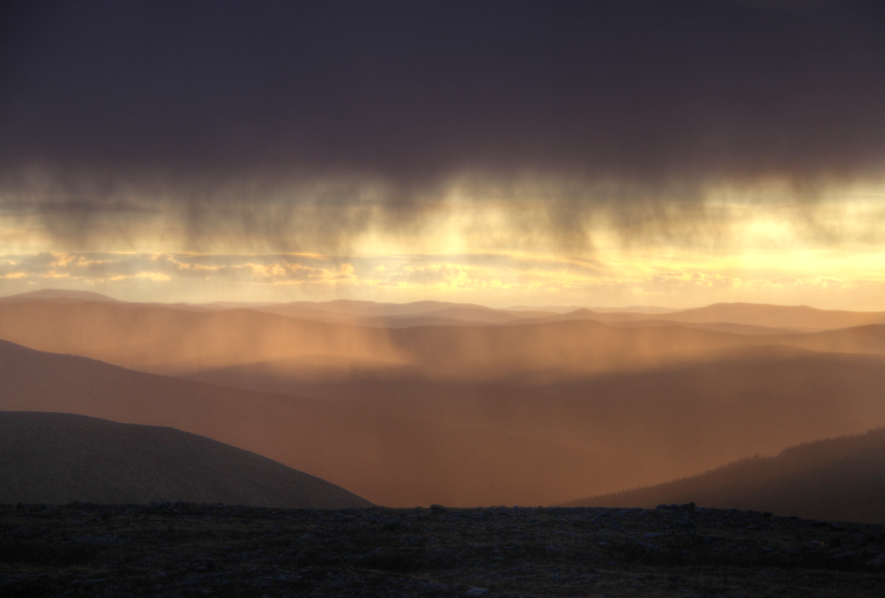
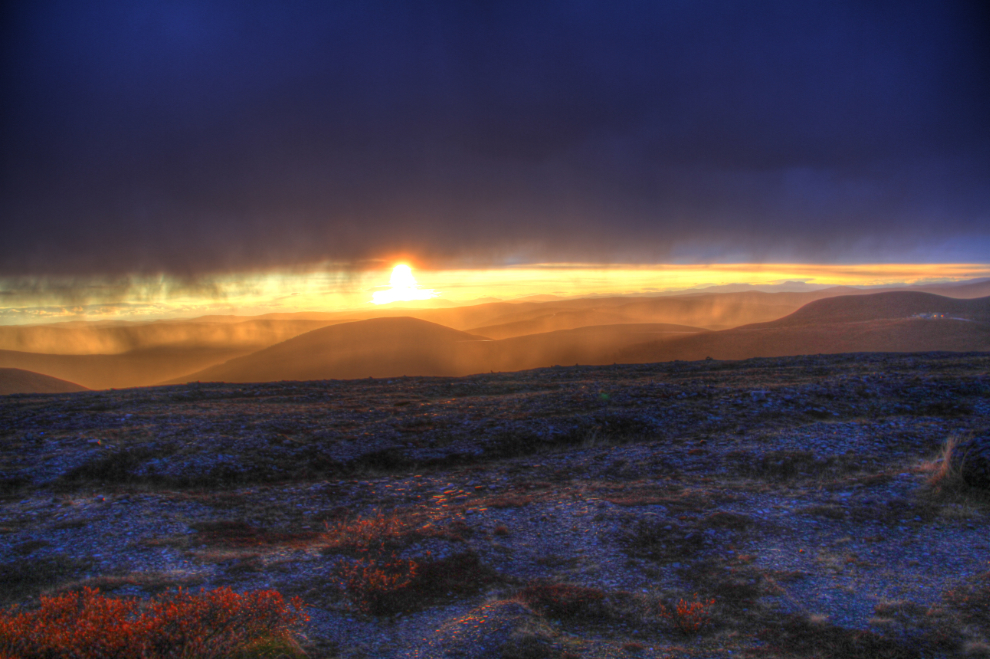
Changes in the sky were rapid, and I was shooting almost constantly – this is from a series shot at 7:57. At the extreme right of the photo, the Canada/USA border posts of Little Gold Creek, Yukon, and Poker Creek, Alaska, can be seen. They were set to close for the season 3 days later, on September 25th.
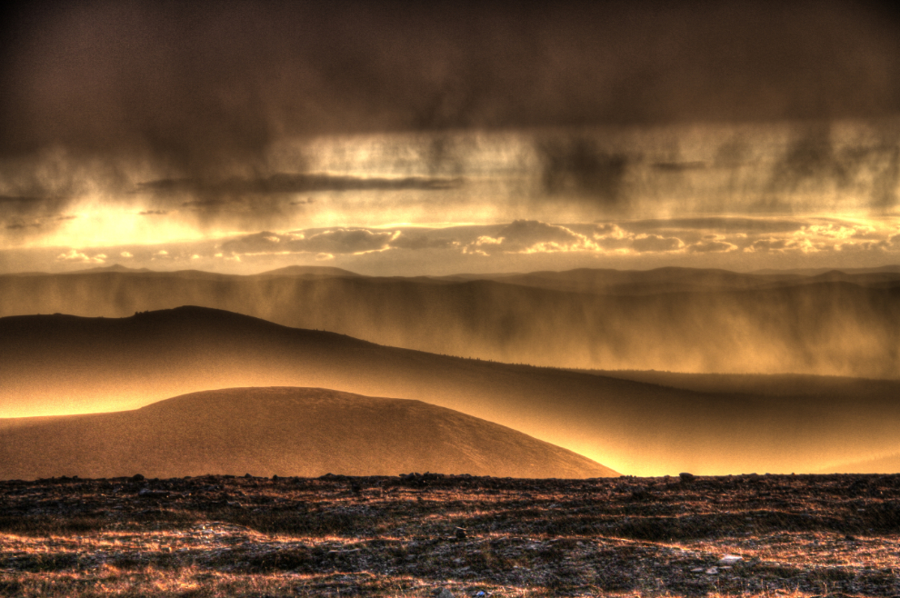
I very seldom ever create extreme HDR images, but really like this one from a series shot at 7:59.
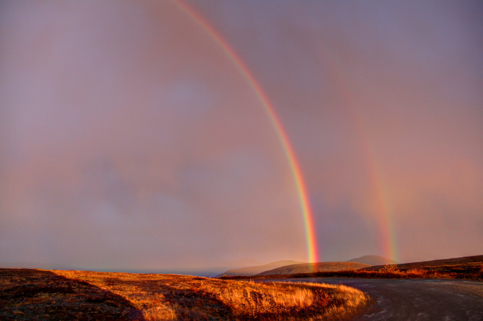
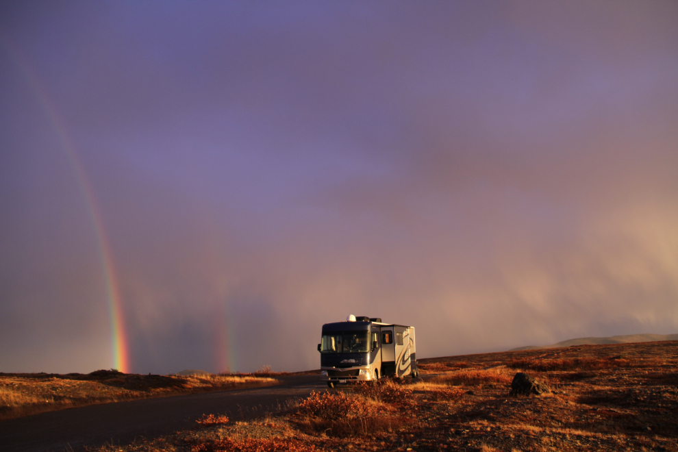
At 8:03, I turned around to see if anything else was going on, and OMG, there was a double rainbow!
The Top of the World Highway is an incredible place, and the summit is especially so. As I write this days later, I’m still quite blown away by the experience of this evening. This photo was shot at 8:07.
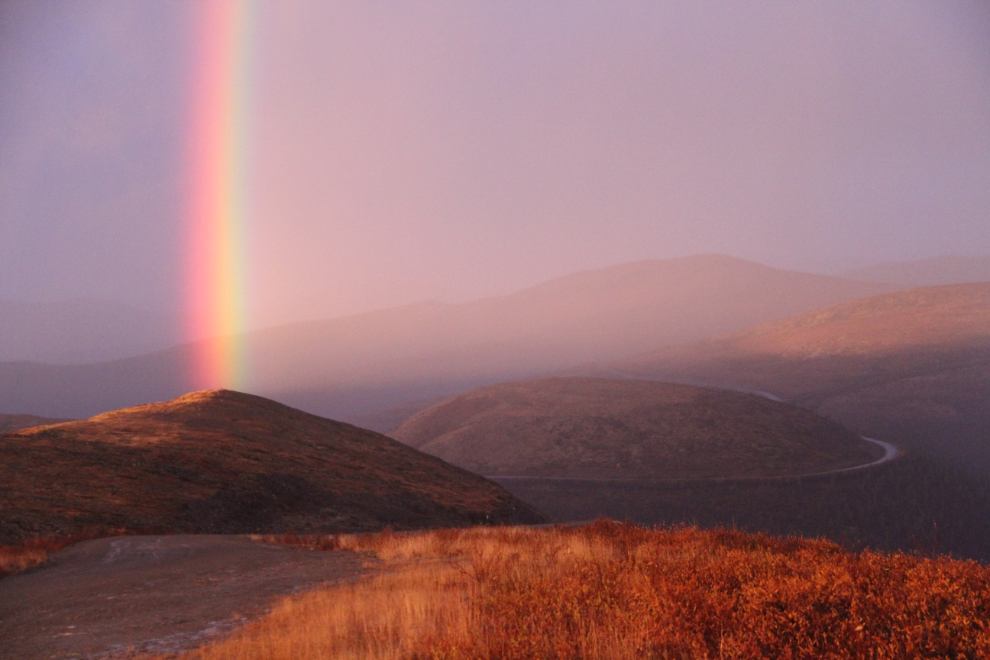
Looking back down the Top of the World Highway at 8:10.
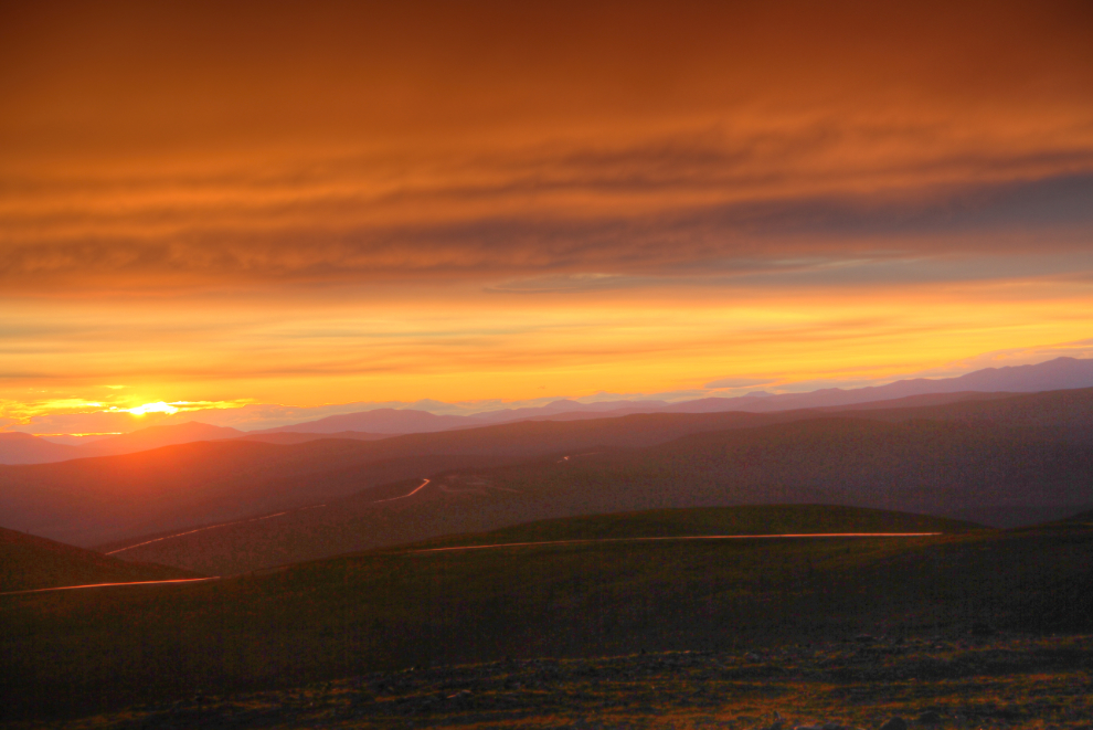
By 8:19, when the series that I created the next HDR from was shot, the show was almost over, though I got a few more shots I like.
The wild weather continued through the night, with the motorhome rocking and rolling and whistling. In the morning, it was very cold – everything was frozen, but there was no snow. Life was good. Very, very good! We’d do a bit of exploring up top with the Tracker, then drive 104 km (65 mi) back to Dawson.