Exploring Hawai’i Volcanoes National Park
For our stop in Hilo on Wednesday, Cathy and I hired a private guide to take us on an all-day tour of Hawai’i Volcanoes National Park. This is a lengthy post, but it was an amazing day, and it took 40 of the 250 photos I shot to share it properly.
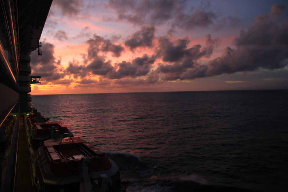
The first photos of the day, of the dawn light, were shot from our balcony for a change – this one at 05:59.
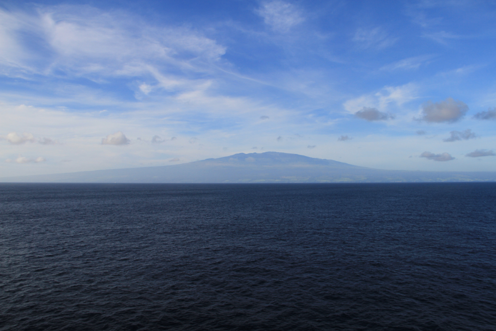
Mauna Kea, 4,205 meters (13,796 feet) high forms the island of Hawaii as you approach from the north-east along the Hamakua Coast.
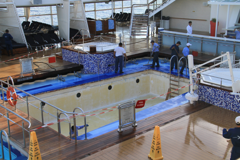
At 07:20, the crew was already hard at work rebuilding the second outdoor pool on the Celebrity Solstice.
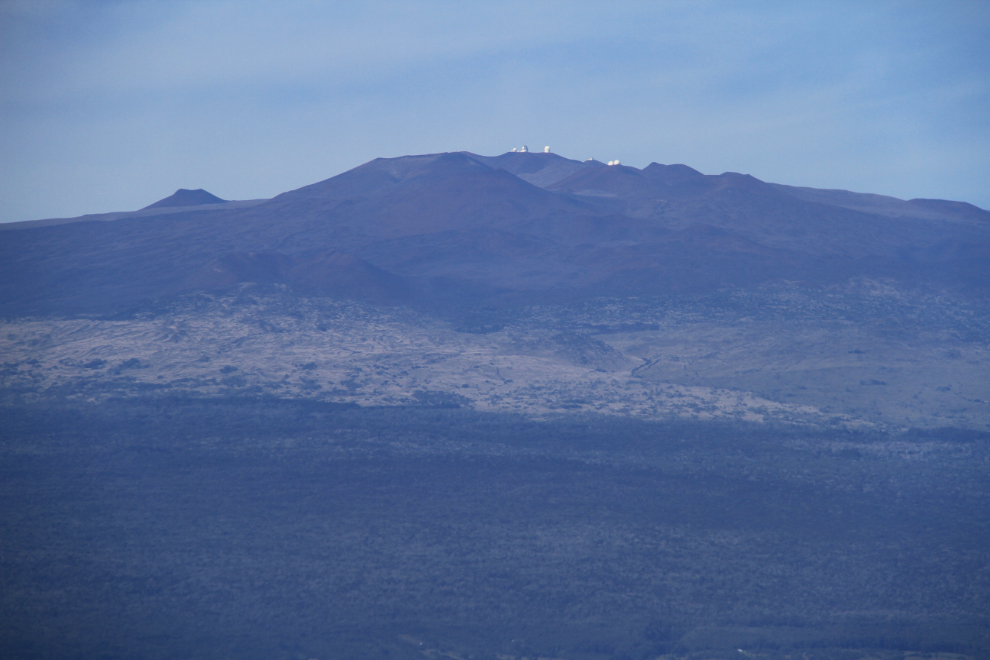
On top of Mauna Kea is an observatory complex operated by 11 nations including Canada, France and Japan. Among the telescopes is the largest one in the world, in the W. M. Keck Observatory. It has a 33-foot mirror which is made from 33 small hexagonal mirrors, rather like a fly’s eye.
The ruins of a sugar mill, seen as we neared Hilo. Beaches are rare along this coast, volcanic cliffs being the norm.

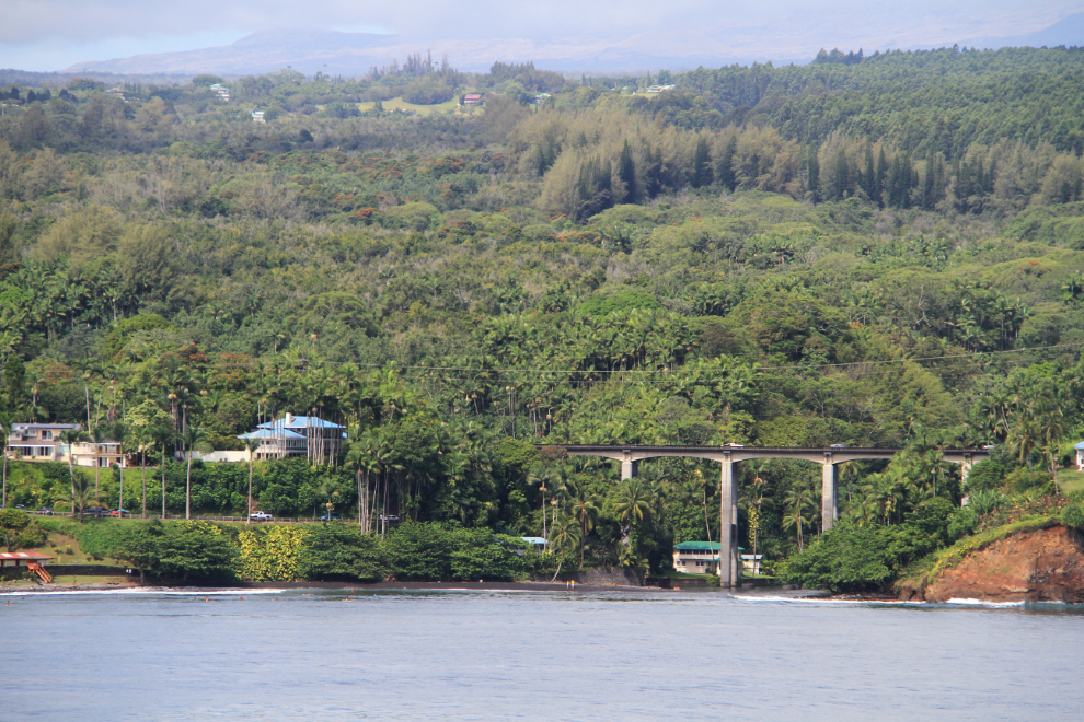
A bridge on Heritage Drive, Highway 19, a few miles northwest of Hilo.
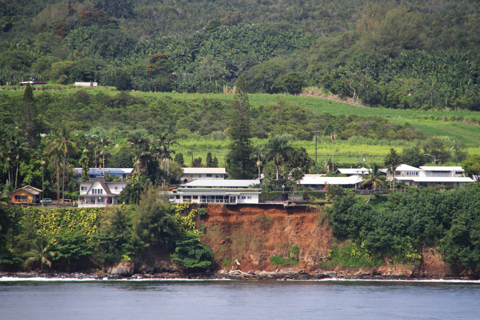
Although the volcanic cliffs look solid, that is apparently not the case, as this one has slid away to the point that the concrete slab foundation of this house is now hanging over the edge a few feet.
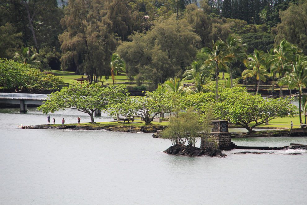
Moku Ola (Coconut Island), a beautiful park in Hilo Bay near the cruise port.
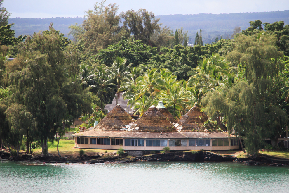
This restaurant, jutting many feet out over the water, appears to be abandoned.
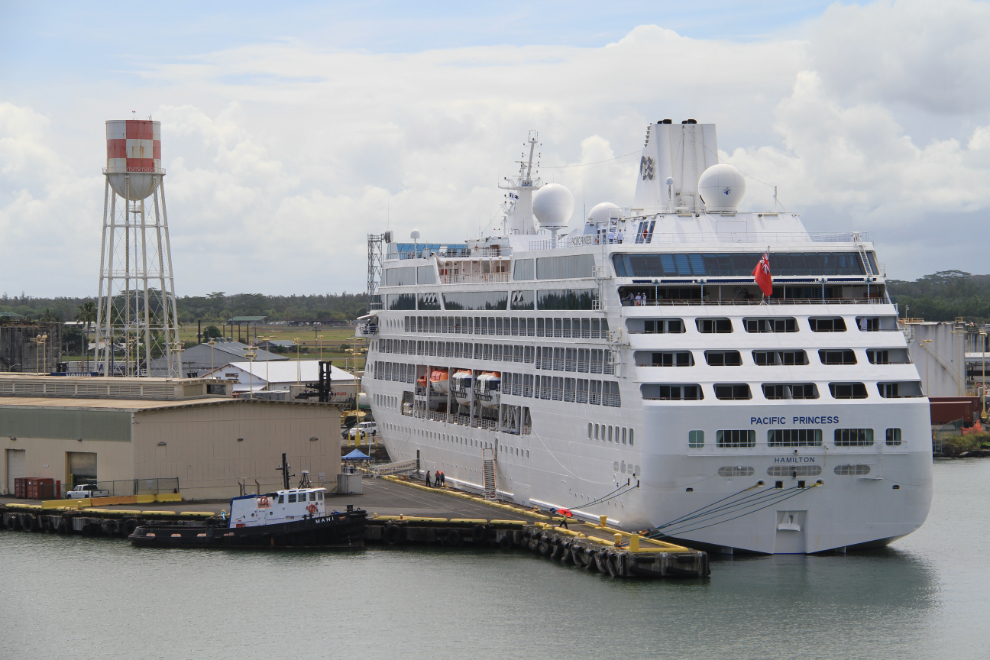
The Pacific Princess arrived a few hours before us, and would leave a few hours before us as well.
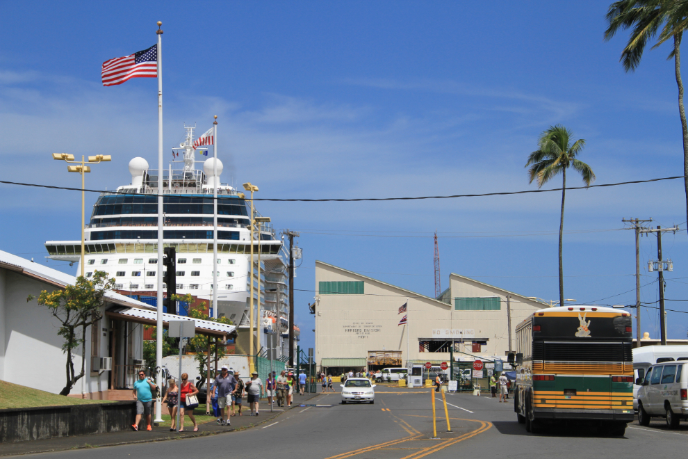
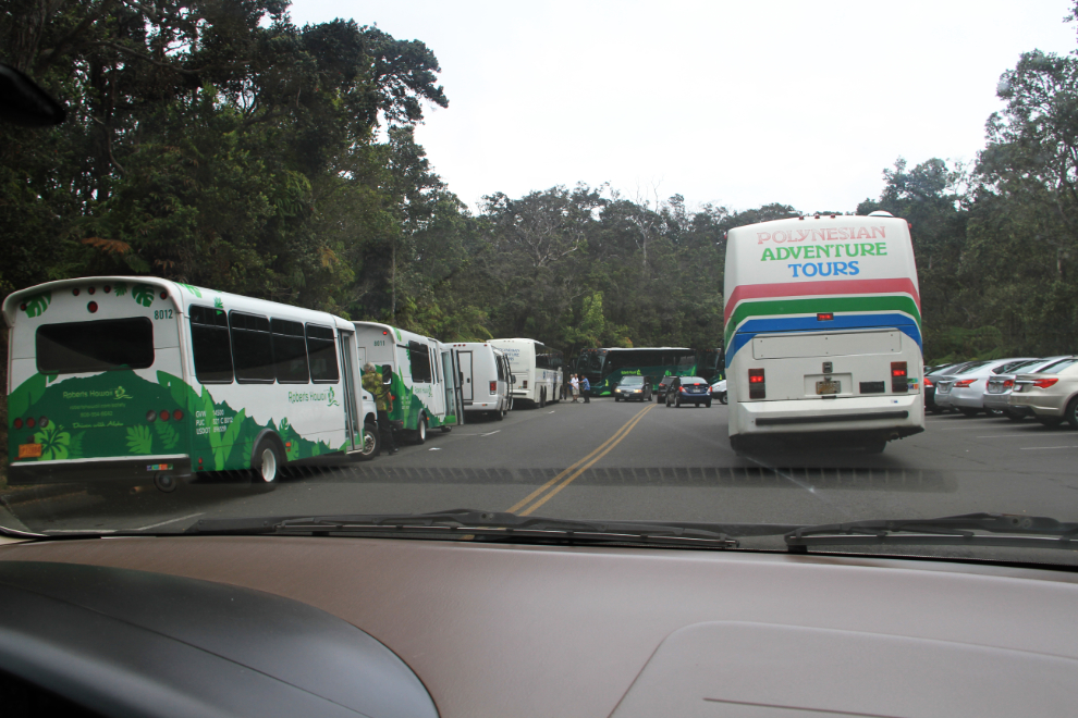
The Celebrity Solstice docked at Hilo at 10:30, and we were allowed to disembark at about 11:00. Our guide had us walk a couple of blocks to meet him away from the very busy terminal area.
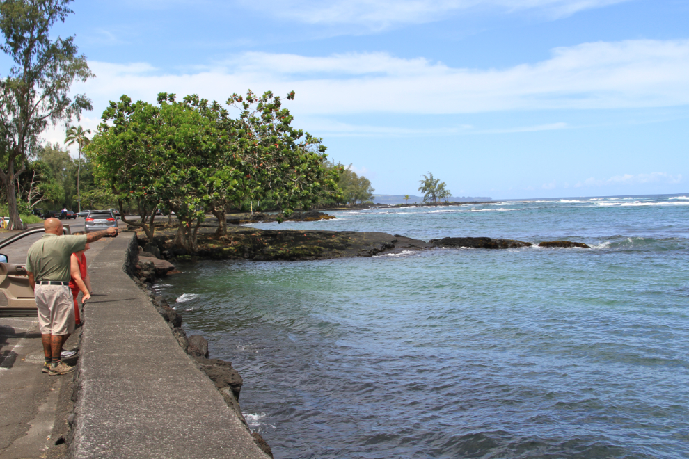
Cathy had found Warren Costa online while trying to find the highest possible quality tour of the volcanic area. He operates as Native Guide Hawaii, was born in Hilo, and among other skills, has worked for the National Park Service. He first took us to an area of beautiful beaches along the Keaukaha coast (that can be reached by Hilo city bus).
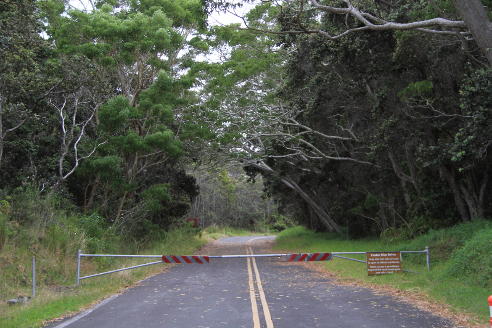
Once the most popular driving route around the Kilauea volcanic region, a few miles of Crater Rim Road is now closed due to volcanic activity.
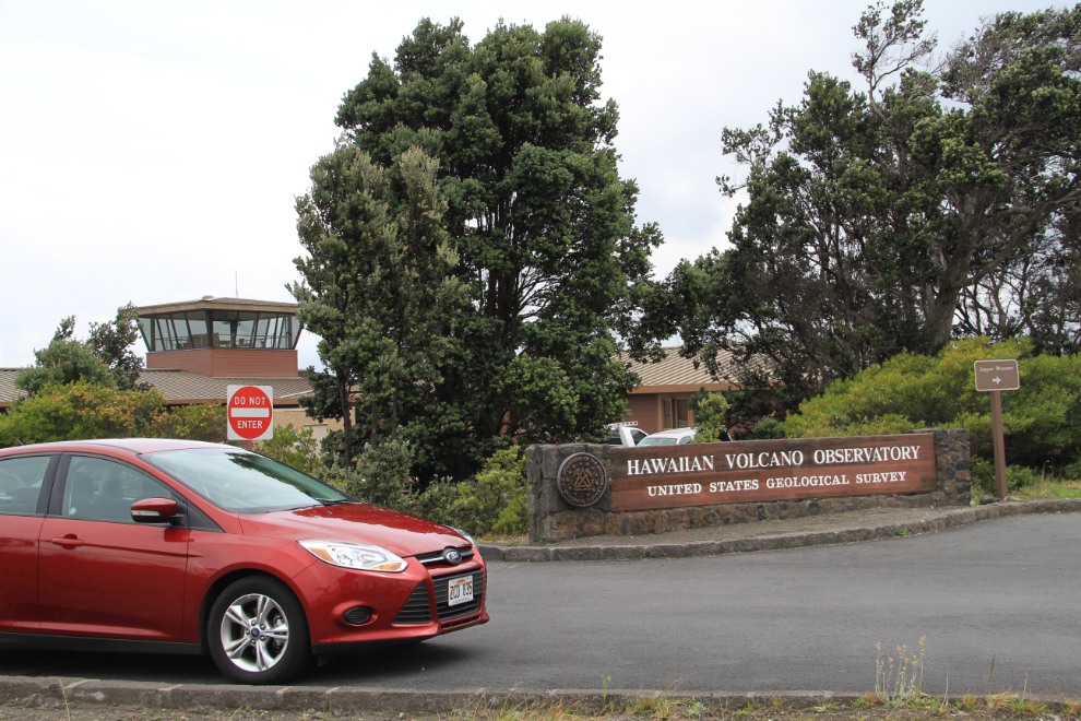
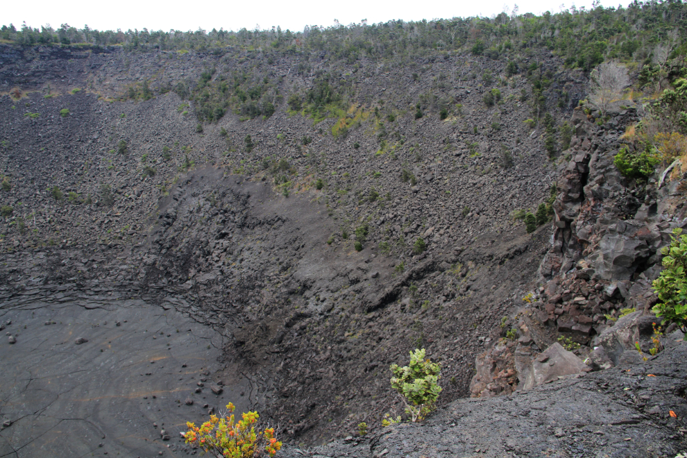
It was 1:00 pm when we reached our first volcano-related stop, at the Hawaiian Volcano Observatory overlooking the Kilauea Caldera.
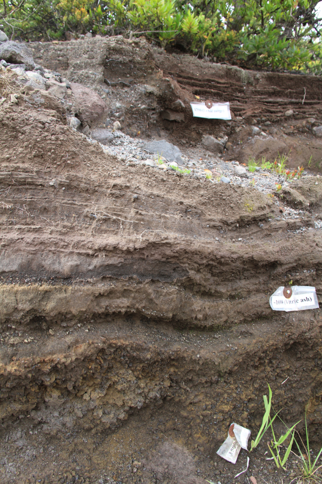
On the drive up to about 4,000 feet elevation, Warren had given us a lot of information about the volcanoes, and tucked away behind some water tanks, now showed us a cross-section of volcanic layers going back to AD 1500. This was certainly not a site that many people would see. At the 1500 layer was a substance called reticulite, which is mostly air and crumbles like dry foam.
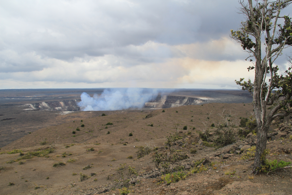
The size of the Kilauea Caldera is staggering, and would clearly take days to properly explore. Most of the roads and trails around it are closed due to the activity, particularly the poisonous gases including sulphur dioxide that are sometimes being expelled along with steam from the many vents that are visible everywhere for several miles, even along Highway 11.
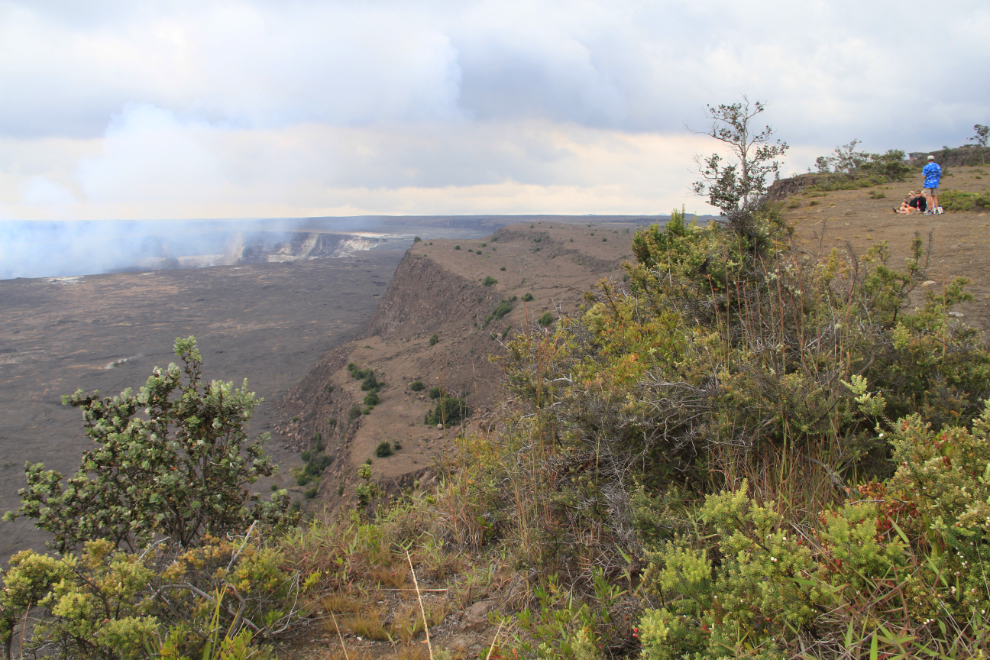
We stopped for an excellent lunch at a picnic site at the Kilauea Overlook, which offers a somewhat different view that the one from the observatory area. This is an incredibly powerful area – not only the obvious physical power of the earth, but spiritual power as well, and Warren feels that power deeply. Traditional Hawaiian beliefs hold Mauna Loa and Kilauea as wahi pana (sacred areas) – this is the home of Pelehonomea, the deity of volcanic power (her name is usually shortened to Pele).
The crowd of tourists at the parking lot for the Thurston Lava Tube literally made my stomach churn, and I was very pleased when we didn’t stop. A single day can only give visitors a very brief look at the park, and Warren knows how to give people who want to really understand it the best experience. Within a couple of hours, Cathy and I were extremely pleased with our choice for this day.
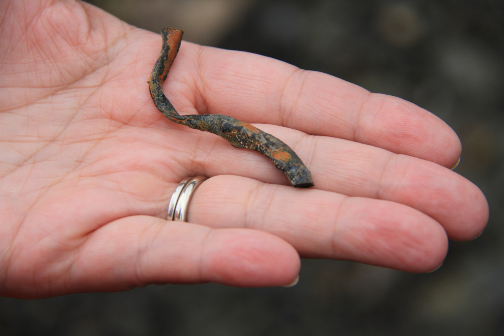
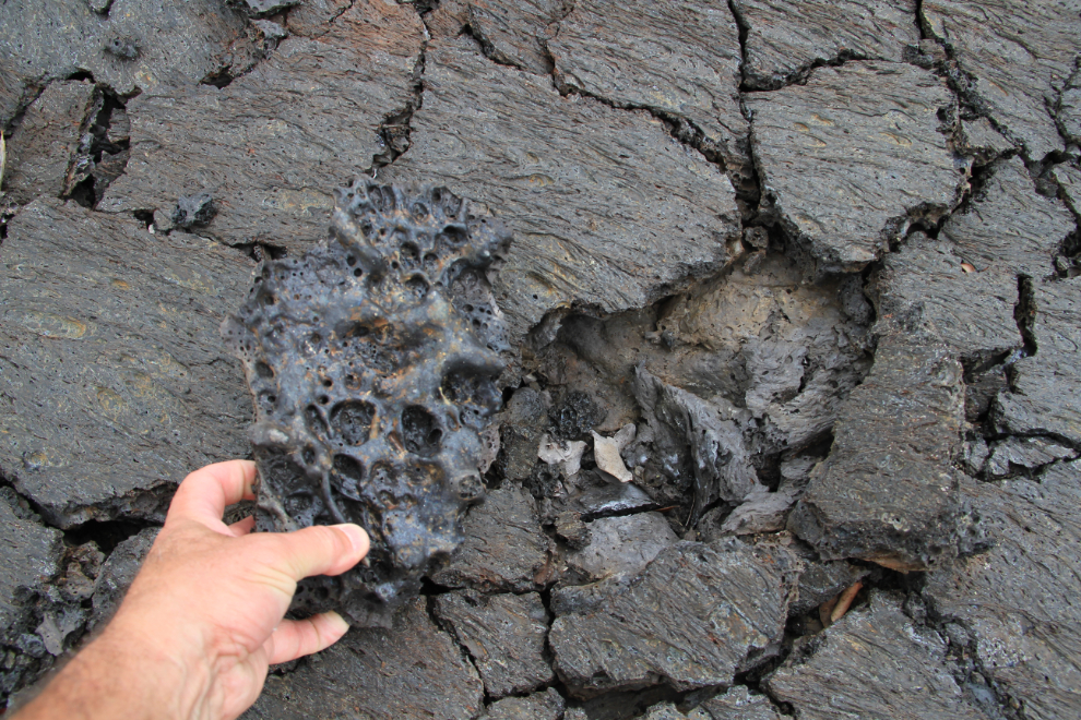
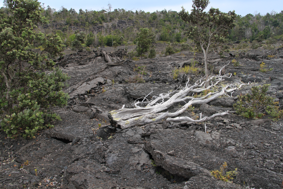
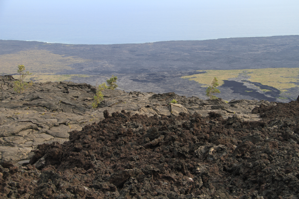
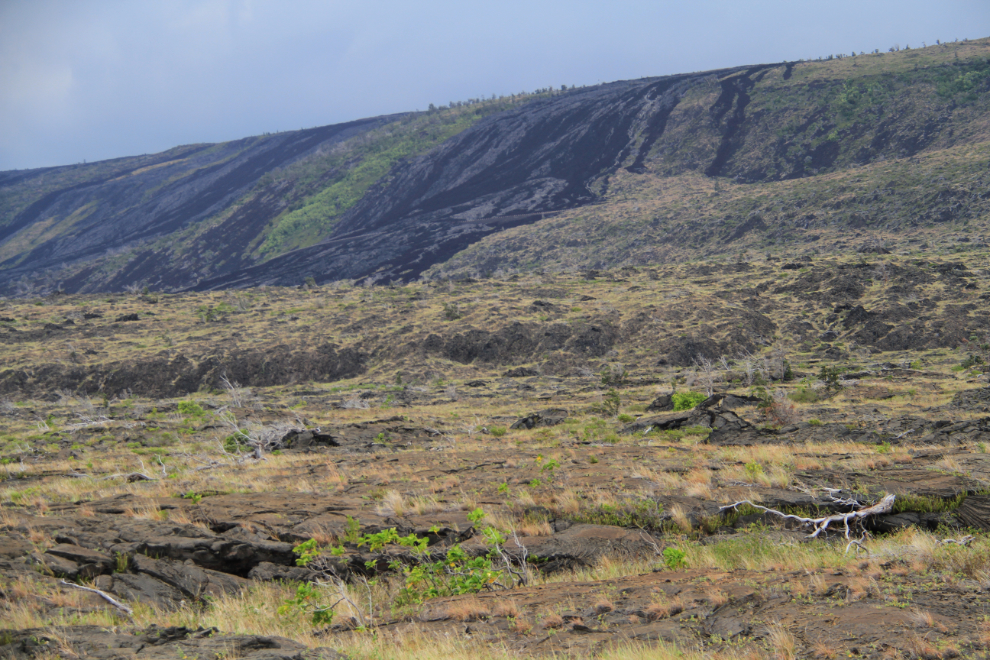
Heading down the Chain of Craters Road, a 19-mile dead-end road that drops 3,700 feet to the coast, we next stopped beside the road near Hi’iaka Crater, and walked down a barely visible trail towards the crater to get a close-up look at a recent lava flow (1973) as well as older formations. This sliver that Cathy is holding is lava that was spit out by a vent.
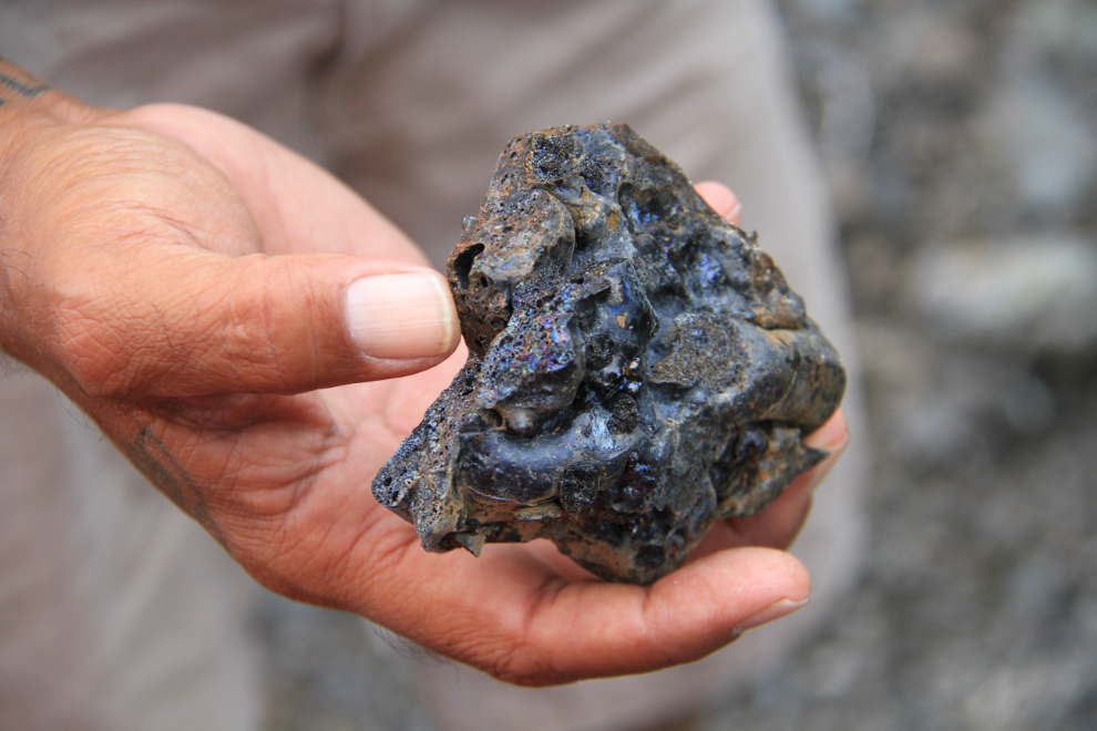
The colour and texture variations of the lava are endless, depending on the mineral content, the temperature, the pressure that the lava was expelled with, and other conditions.
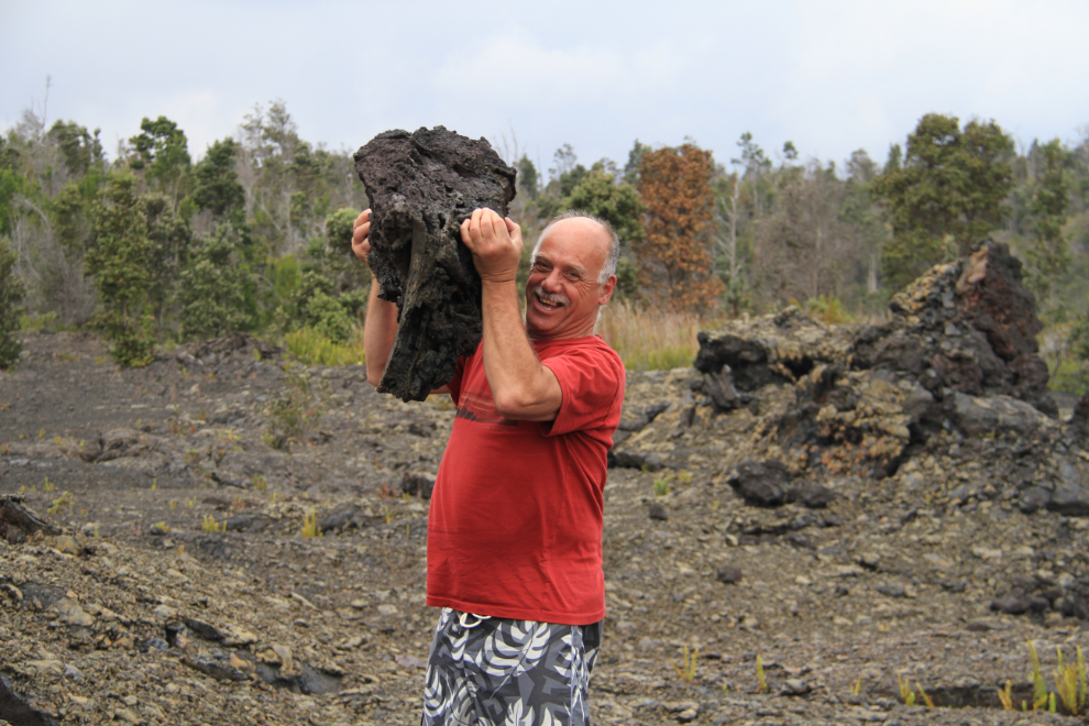
Some of the lava has so much air in it that it is quite light – I don’t do this with Yukon granite! 🙂 That chunk probably weighed about 50 pounds.
We were often walking on thin layers of lava, but it only became obvious where someone had broken through (none of us did, but I can see how a hiker could be injured this way). The layer shown in this photo is less than 2 inches thick.
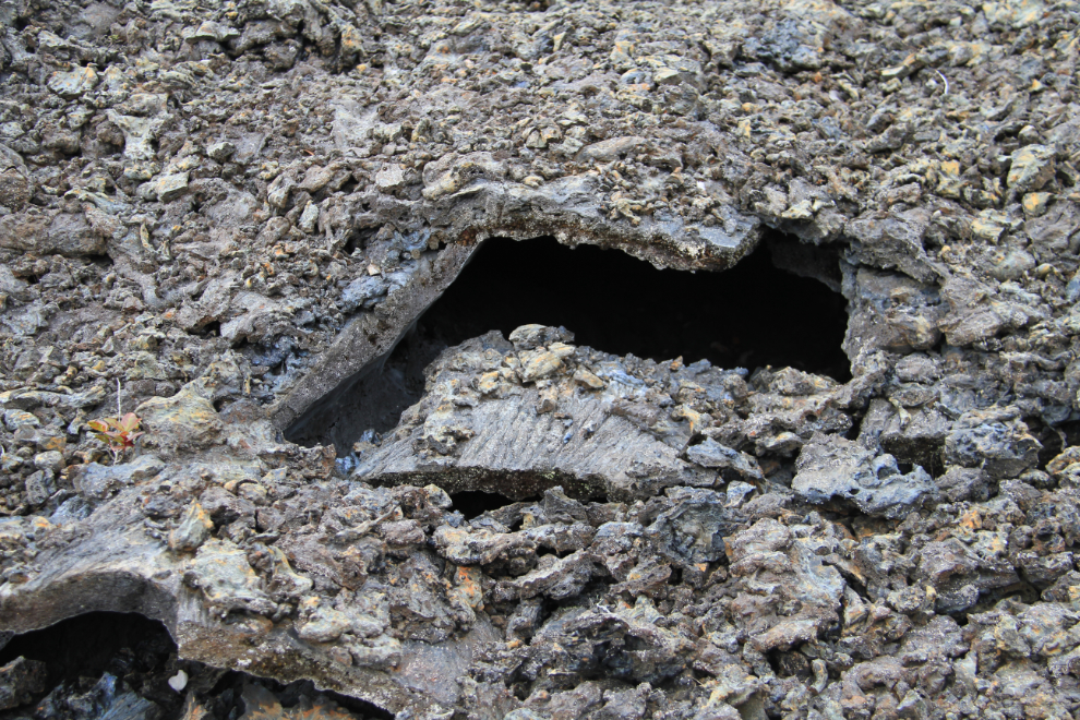
The texture of the lava can be very different on the bottom side of a layer.
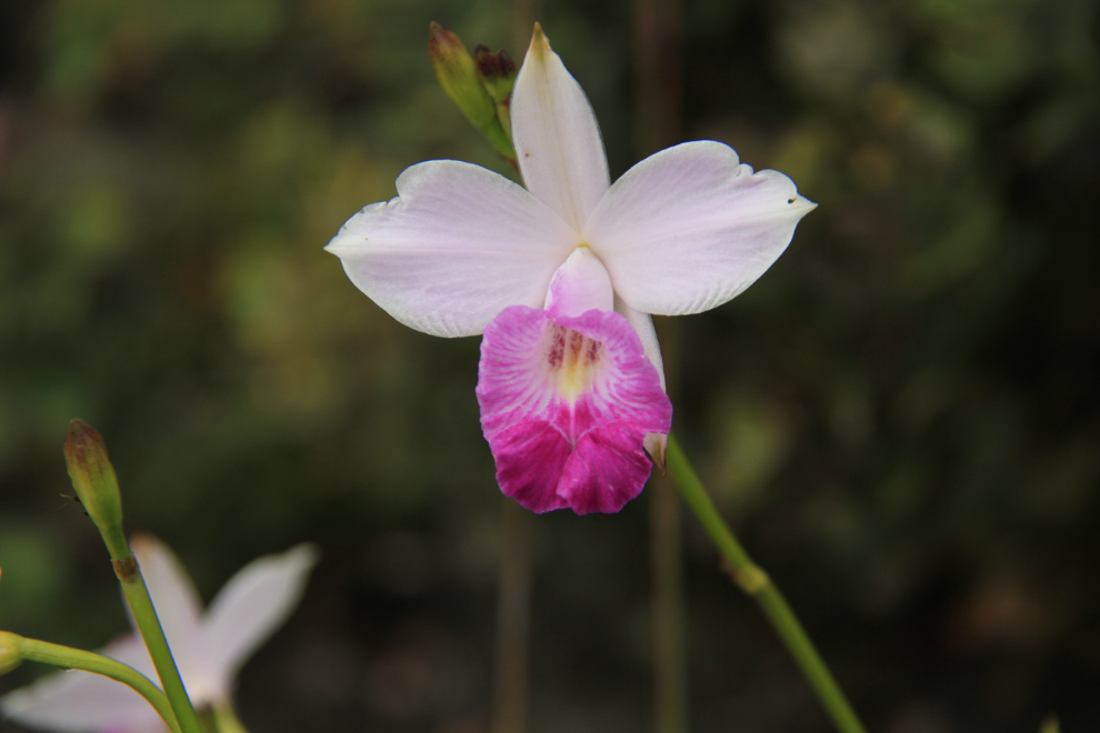
Among the lava flows, many of these orchids were growing.
How incredible it would be to see this flowing! At several points through the day, we could smell forest fire smoke, from the area about 30 miles away where lava is currently flowing.
We reached the Hi’iaka Crater a few minutes after 3:00 pm, and I was very conscious of the fact that sunset was only 3 hours away. I’m still rather at a loss for the right words to describe the experience of seeing these signs of Pele’s power.
We were surprised to hear that it can take hours for a tree to burn. When the hot lava reaches a cool, damp tree, a bit of the lava is cooled enough to slightly insulate the tree, and by the time the trunk burns through, the lava around it has sometimes cooled enough that the rest of the tree doesn’t get burned. When the trunk is completely consumed, a hole remains forever in the cooled lava.
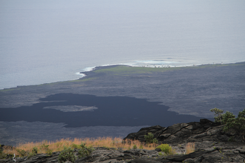
The views from a mile of the Chain of Craters Road down to the coast is superb. Warren was mostly excited about the great waves, and a forecast for very good surfing the next day 🙂
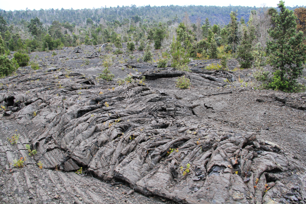
I could spend days taking pictures of the infinite variety of lava forms and shapes, especially when various types of vegetation are colonizing it.
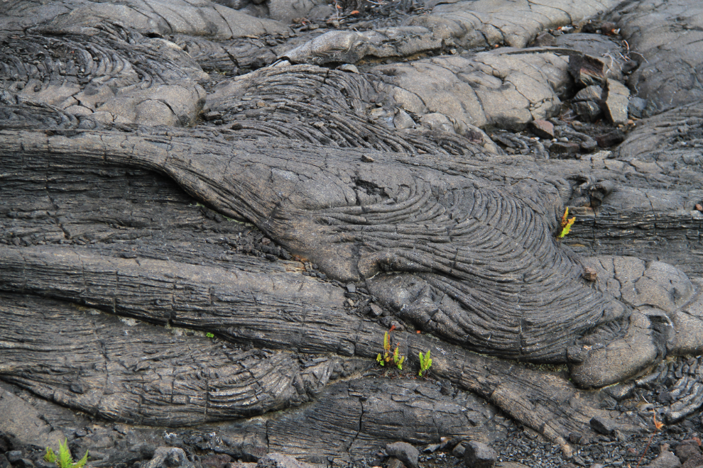
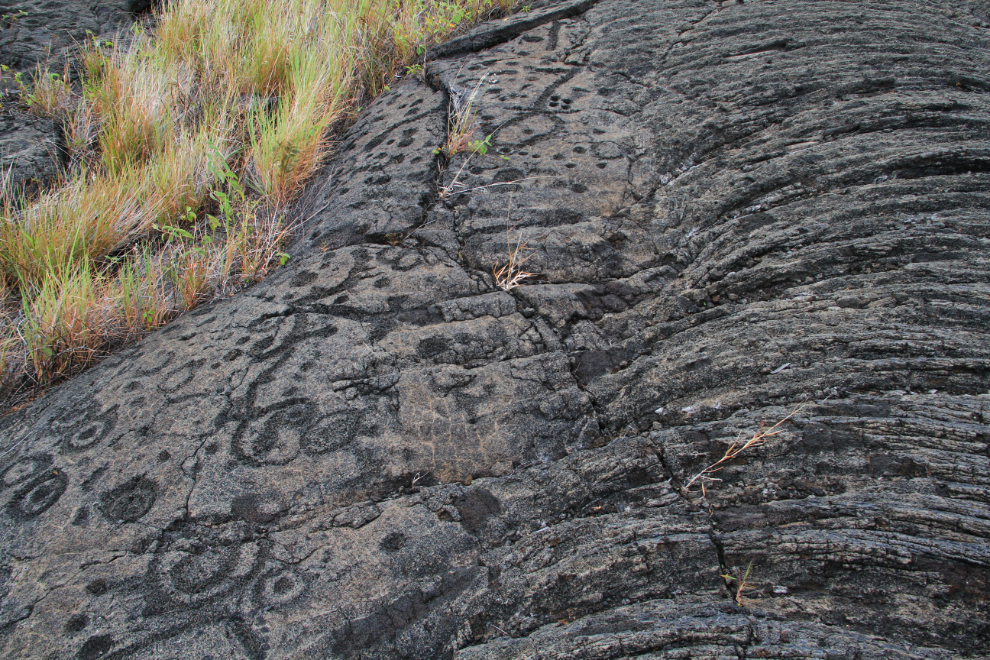
At several spots along the top of the slope, two dramatically different lava forms can be seen side by side. The smooth flow is known as pahoehoe, the rough one ‘a’a. The most significant factor in the creation of the two types is the temperature of the lava – pahoehoe is hotter so flows more smoothly.
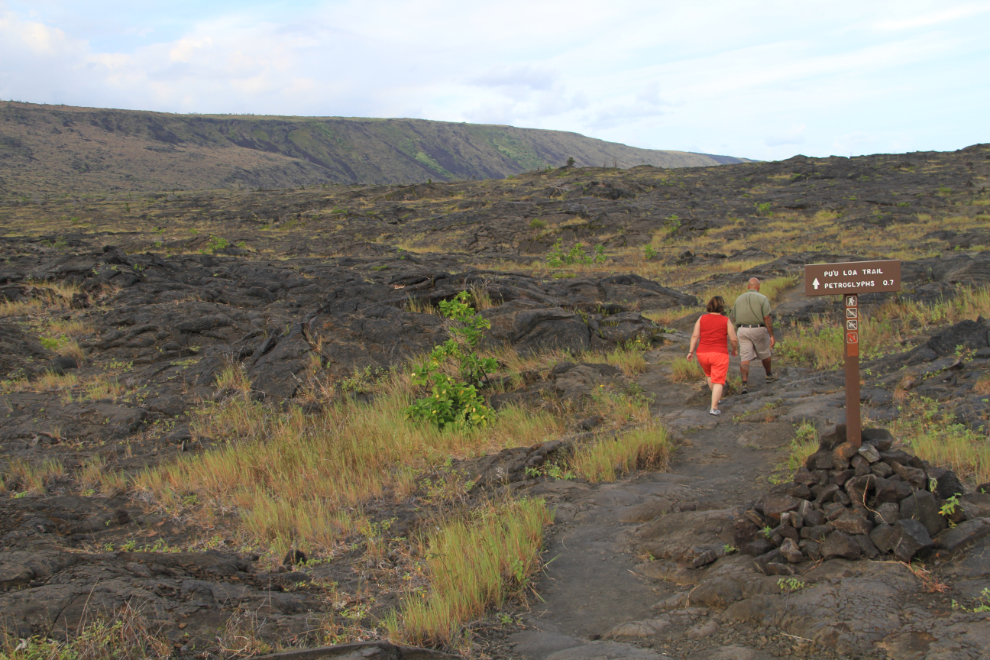
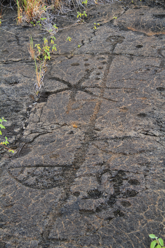
Warren asked if we wanted to go on a hike, and when we answered in the affirmative, he stopped at the trail to Pu’uloa, one of the most revered cultural sites in Hawai’i. Ke ala kahiko (the path of the old ones) is now a 1.4 mile (2.3 km) route from the Chain of Craters Road, marked by cairns. Pu’uloa is home to the largest array of petroglyphs in the state, carved into lava flows from 400-700 years ago, and to us, is a “must-experience”, though relatively few people do.
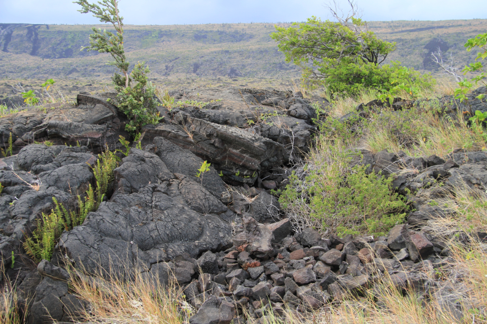
Untrained eyes would be unlikely to see this spot beside the trail as anything of cultural significance, but the bush at lower right marks a pit created by mahi’ai (farmers) by piling rocks. In such pits, enough soil and moisture could be gathered to grow ‘uala, a small sweet potato. One of things that we really enjoyed about listening to Warren is hearing Hawaiian names and terminology pronounced correctly – although there aren’t many letters in the written language, pronunciation of them is often quite different than English speakers expect.
At Pu’uloa, a boardwalk protects the petroglyphs by keeping visitors to a specific route, and above the ground. The area where the petroglyphs have been carved is very much larger than what can be seen from here – there are a total of over 23,000 carvings, some in shapes such as human forms that are easy to recognize, others more abstract.
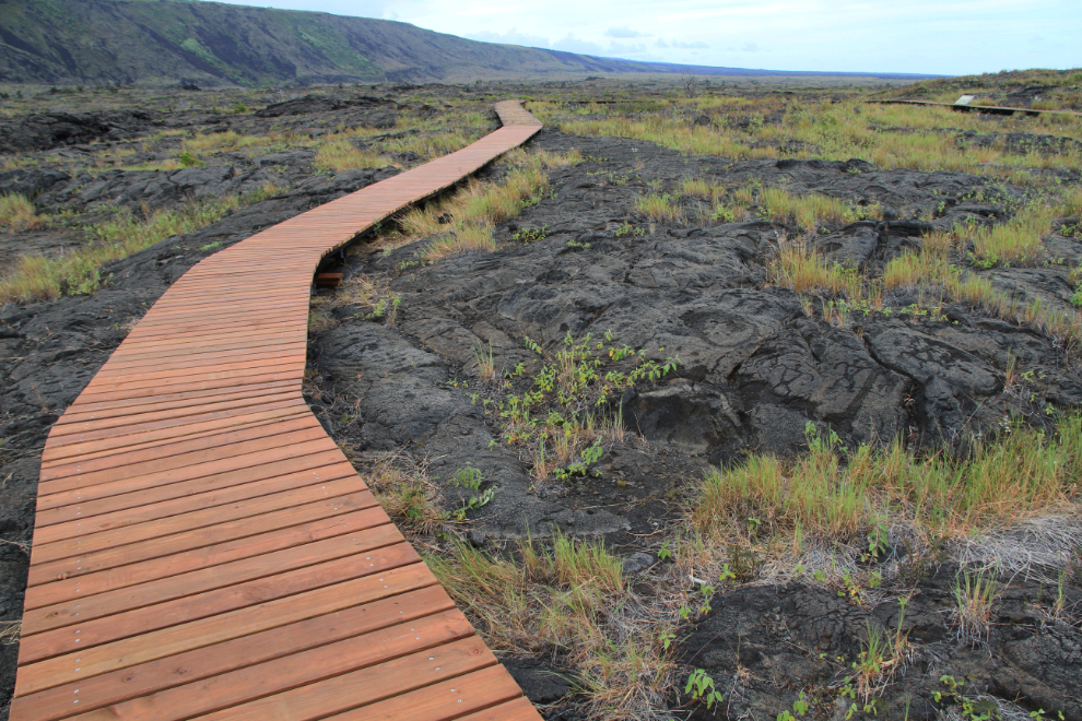
The name Pu’uloa (large hill) carries a kaona (hidden meaning) – hill of long life. Families with genealogical ties to this land have come here to place the piko (umbilical cord) of their child, in the hope that the mana (spiritual power) of Pu’uloa would bless that child with a long and prosperous life, and root them to their ancestral lands. Each puka (hole) is made for a single piko – of the 23,000 petroglyphs at Pu’uloa, about 16,000 are piko related.
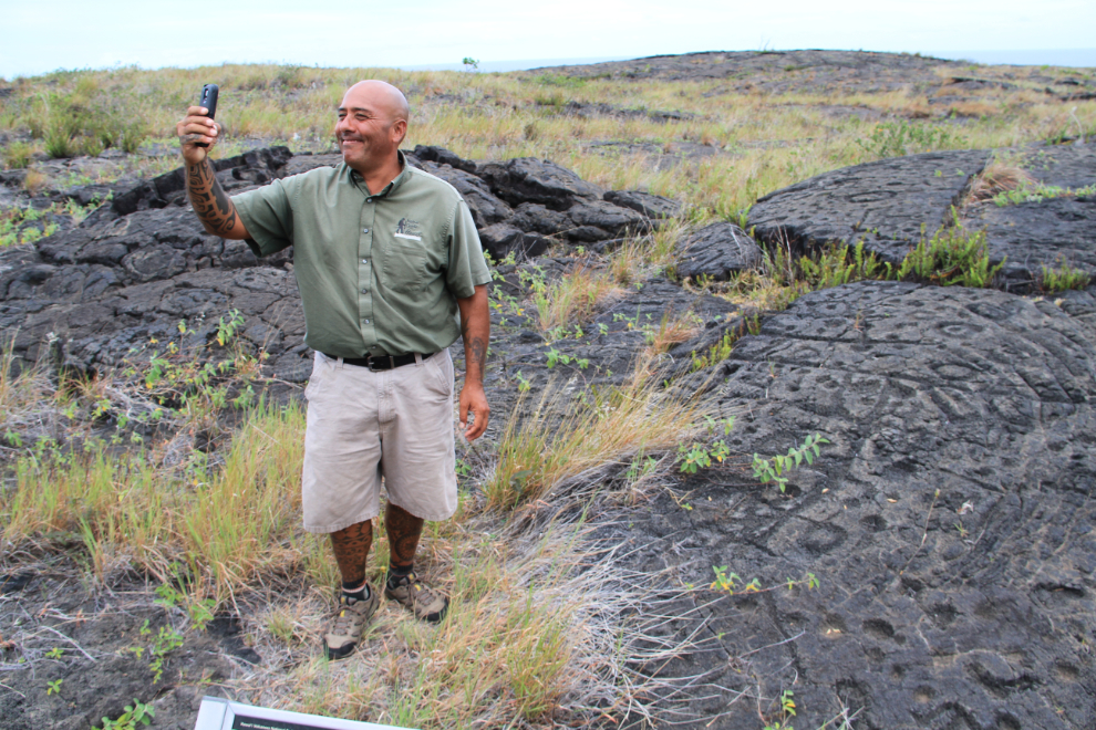
The best photo I got of Warren is this one of him taking a selfie among the pictographs for his Facebook page.
Looking back up at the slope we drove down, I tried to imagine what that would look like with molten lava flowing down it. “Incredible” is a word that I used a lot this day.
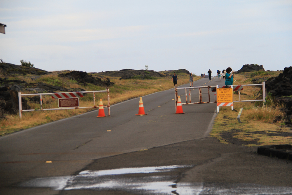
Chain of Craters Road is now gated about half a mile from where it ends at one of the lava flows that has come across the road in recent years. Work started a few days ago to re-open it, initially just as an emergency access road for residents of Lower Puna who may be cut off if a flow that started in late June crosses Highway 130 at Pahoa.
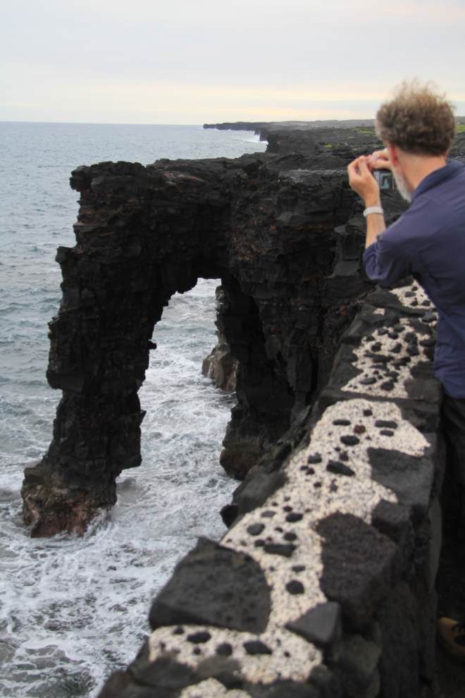
At the end of the Chain of Craters Road, a very short walk takes you to the impressive cliff edge – there are several signs warning of the dangers.
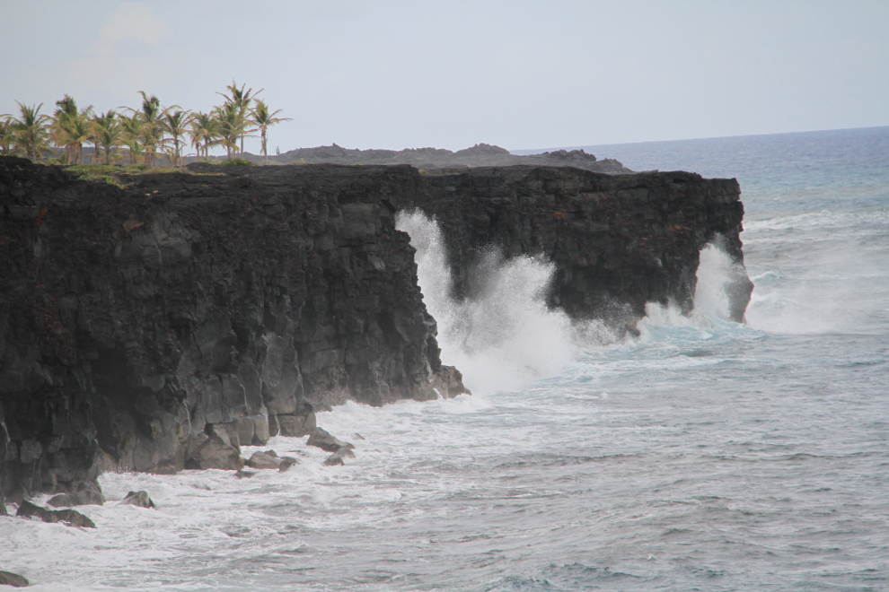
The main feature there is the Holei Sea Arch. A photographer there was waiting for what he called “the perfect wave” – one whose spray would hit the top of the arch. Although it could come, I wasn’t nearly that patient 🙂
From there, Warren drove us back to the pier – we arrived well after sunset, and it was pitch dark. This had been the day that both Cathy and I had been looking forward to, and it was even better than we expected.
At 8:00 pm, we sailed for Kona.