Driving from Hinton to Smithers
I got home from my 18-day adventure at noon yesterday, and today is catch-up day in many ways. To start with, some photos of the first day of the drive home – from Hinton to Smithers along Highway 16.
This was the planned route home. As you’ll see in the next post, though, it didn’t work out that way.
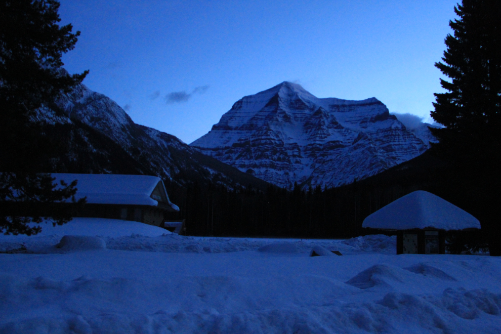
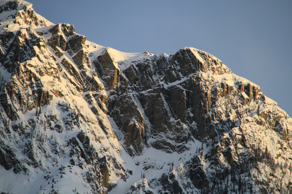
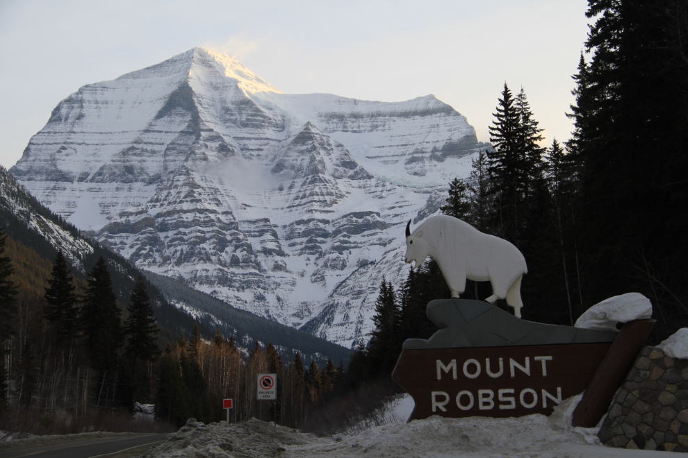
I got away from Hinton just after 05:00, hours before sunrise. As I drove along there were times I regretted not being able to see much of the mountain scenery that was passing by, but it was a necessary trade-off to get home fairly quickly. When I reached Mount Robson at 06:35 and saw this, however, there’s no way I could continue without seeing what dawn light did to this amazing peak.
To kill some time and because I knew that there were some great dawn scenes behind me, I backtracked to this point. Further east, extensive fog over Moose Lake blotted out any views.
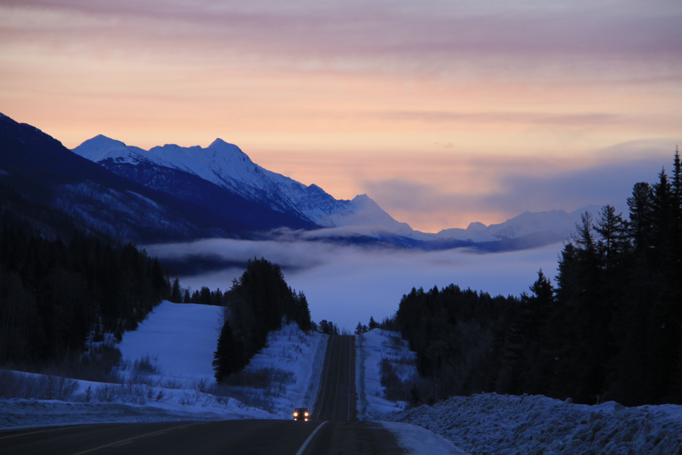
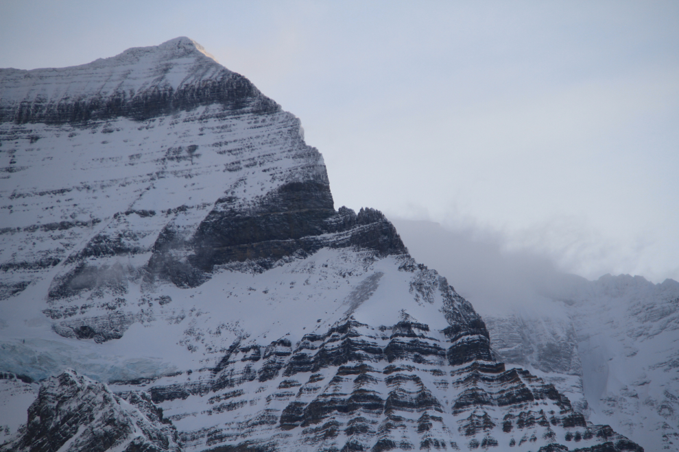
This is a fairly radical HDR image created from a series of photos shot back towards Mount Robson. I’m trashing most of the HDRs I create, but some of them quite intrigue me for a variety of reasons.
The first light of dawn hits the summit of Mount Robson at 07:37, diffused a bit by some fog or cloud. The peak is 3,954 meters (12,972 feet) high, the highest mountain in the Canadian Rockies.
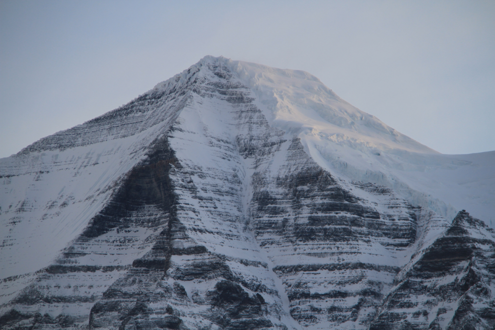
The top of the northeast ridge on Mount Robson – my god that’s an impressive rock!
Although dwarfed by Mount Robson, the next mountain to the west, Cinnamon Peak, is no slouch at 2,727 meters (8,946 feet).
At 07:00 I finally managed to pull myself away, and shot this looking back from the southwest.
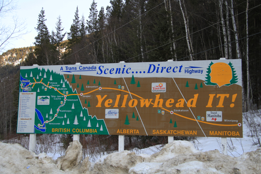
I’d forgotten that the Yellowhead Highway (Highway 16) is a multi-provincial route. What a great RV trip that would make 🙂
West of Tete Jaune Cache (“Yellow Head Cache” in French), a reminder of the heart-breaking aspect of this highway. For those who don’t know the history, I’m going to write a separate post on BC’s “Highway of Tears” in the near future, as it’s a story that can’t be told too many times. 🙁
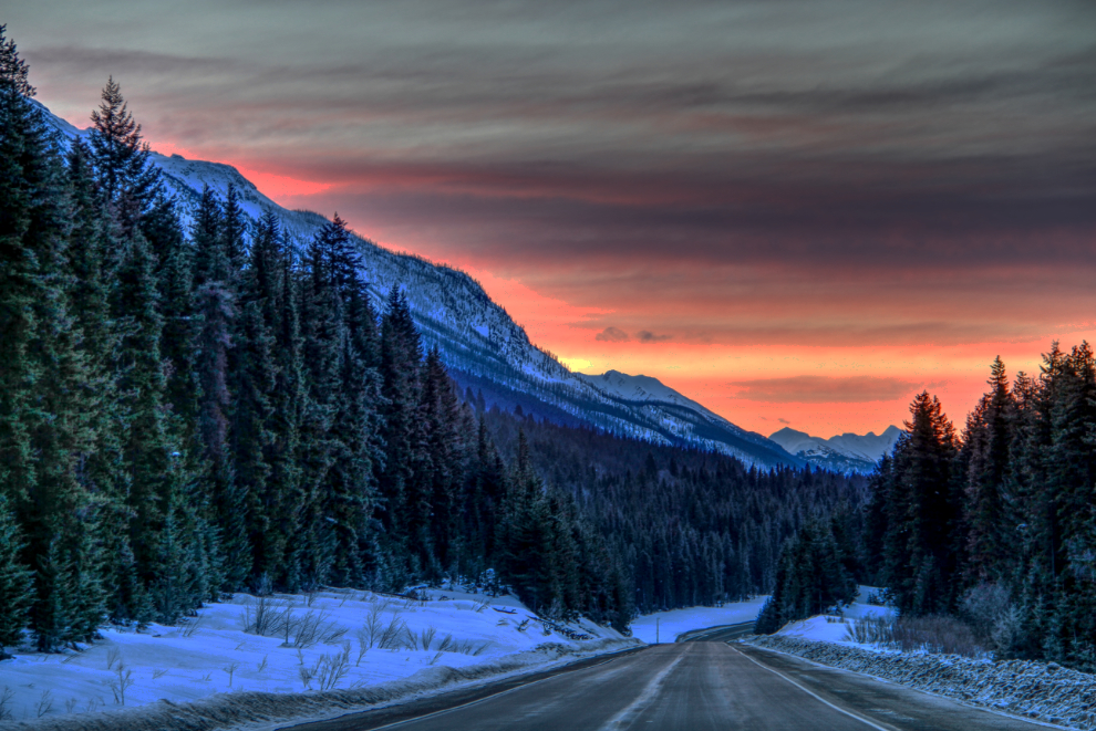
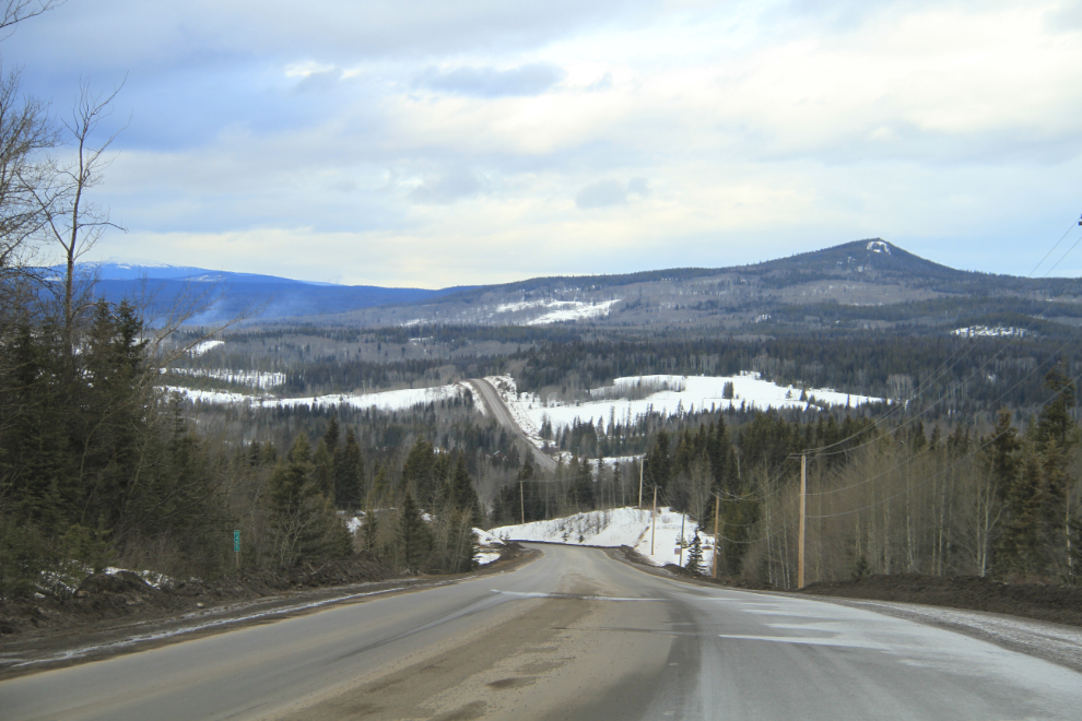
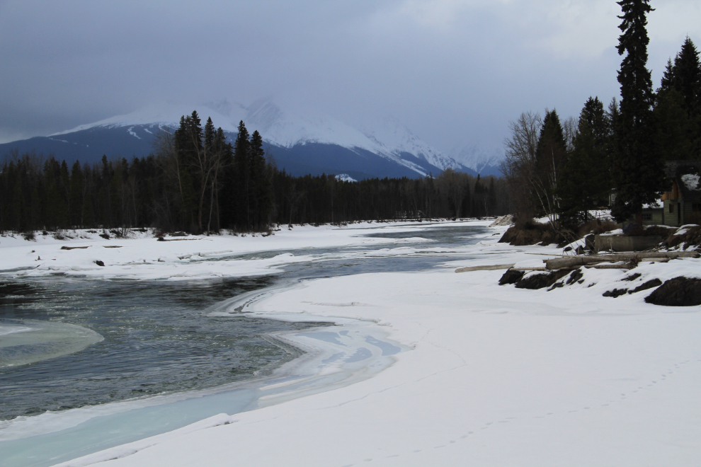
Nearing the western edge of the Rockies. With the highway running along the broad valley of the Fraser River, flanked by mountains of ever-lower heights, it’s an easy yet extremely scenic drive.
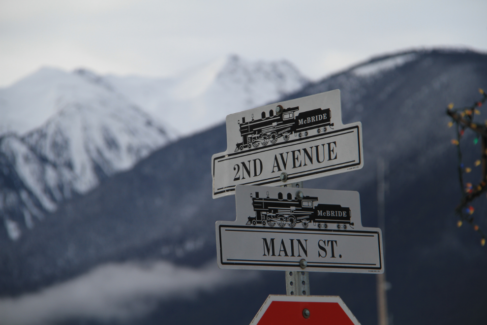
I’ve never had a look at McBride before, but decided to take some time for a look, despite a notably poor breakfast at the Heartland Restaurant on the highway (food was mediocre, the service almost non-existent despite the fact that the place was almost empty).
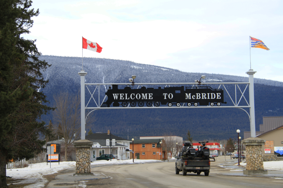
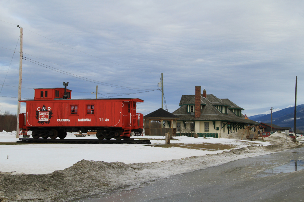
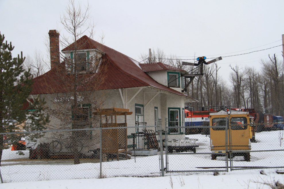
From the highway it looked like the only thing that mattered in McBride are snowmobiles, but in town, it’s all about trains.
This is a particularly photogenic setup – the station is beautifully restored.
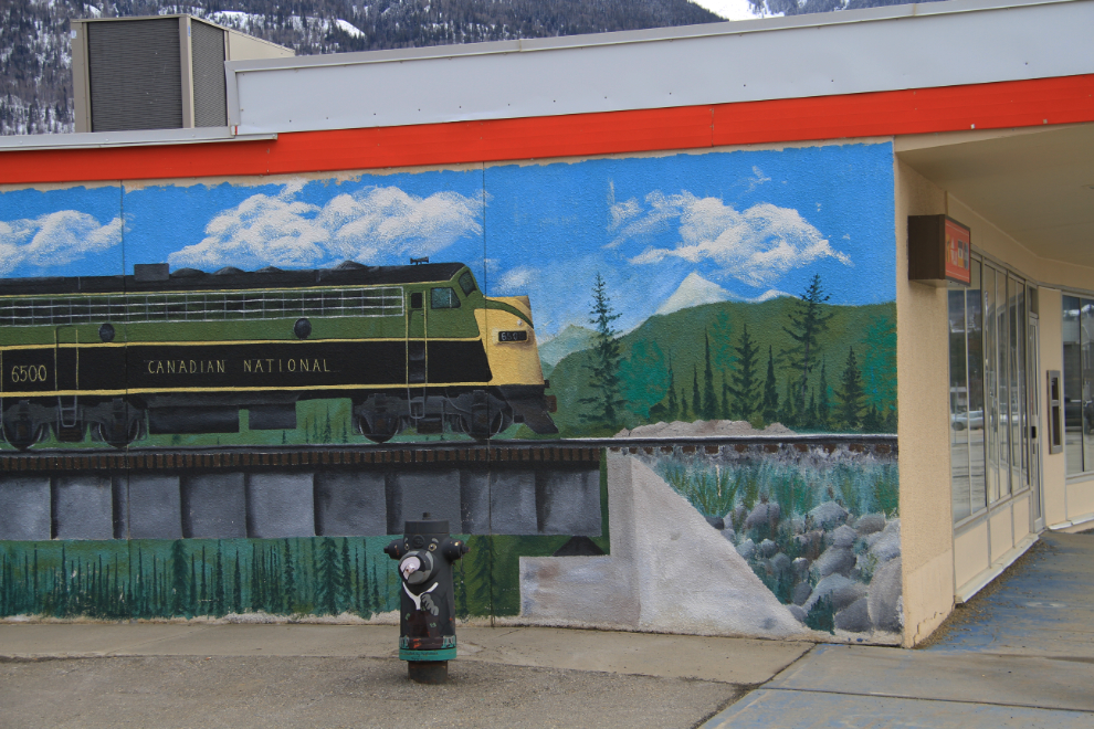
This train mural went the full length of the side of the building, perhaps 80 feet.
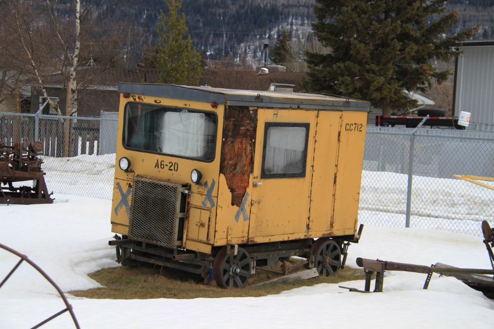
Even some back alleys are interesting. I don’t normally cruise alleys, but am glad that I did this time – I love old speeders. I could definitely spend more time in McBride.
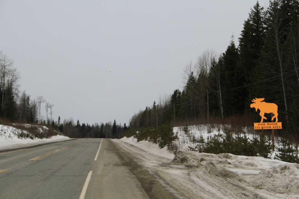
West of McBride there were a very large number of moose warning signs, and then this one – “High Moose Collision Area”. 🙁
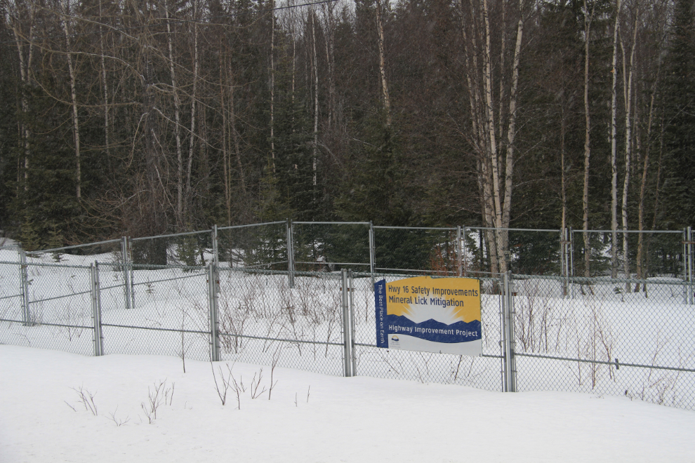
Just west of the depressing sign above was this fenced-off area with the sign “”Hwy 16 Safety Improvements – Mineral Lick Mitigation”. Although I guessed what that meant, I Googled it this morning to be sure. Under the Mineral Lick Mitigation program, mineral licks are being fenced off to direct animals away from the roadside and encourage them to find safer areas to get the nutrition they need. Great to see!
I hadn’t planned on stopping in Prince George, but McBride got me in a train mood so I made a bit of a detour to the Central British Columbia Railway & Forestry Museum. Although the “Open” sign was lit, I just didn’t have that much time to spare – the yard is huge and loaded with all manner of railway and logging equipment so it could take me hours to have a good look.
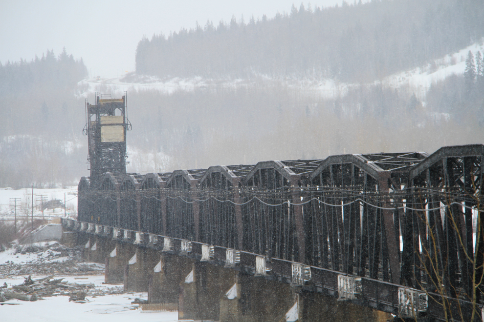
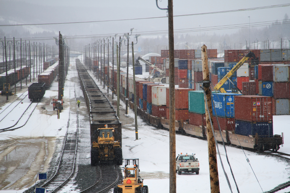
Heading back to the highway, I stopped on the side of the road and went for a short walk to get some photos of the very cool railway bridge over the Fraser River…
…and from the opposite side of the overpass, some of the action in the huge rail yard.
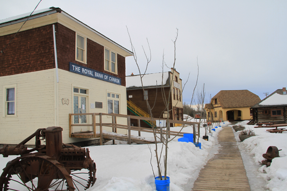
I fueled up in Prince George at $1.399 per liter, but in the small town of Vanderhoof, 100 km west, it was 11 cents cheaper. Vanderhoof also has an excellent little museum. While I was there, I noticed that Spot had died, and it took me 2 stops to find a set of AAA lithium batteries to get it going again.
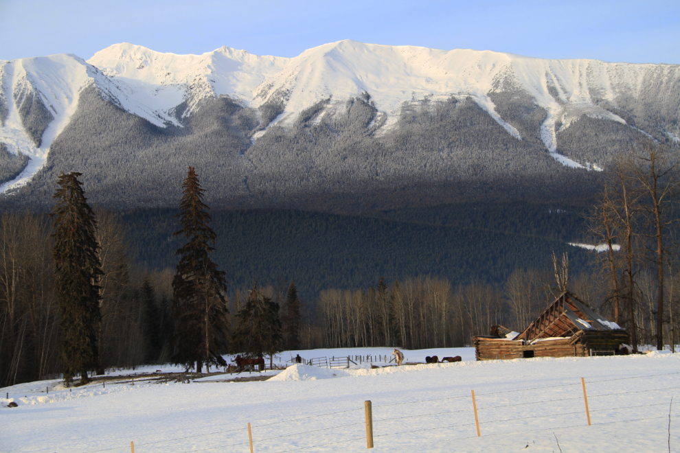
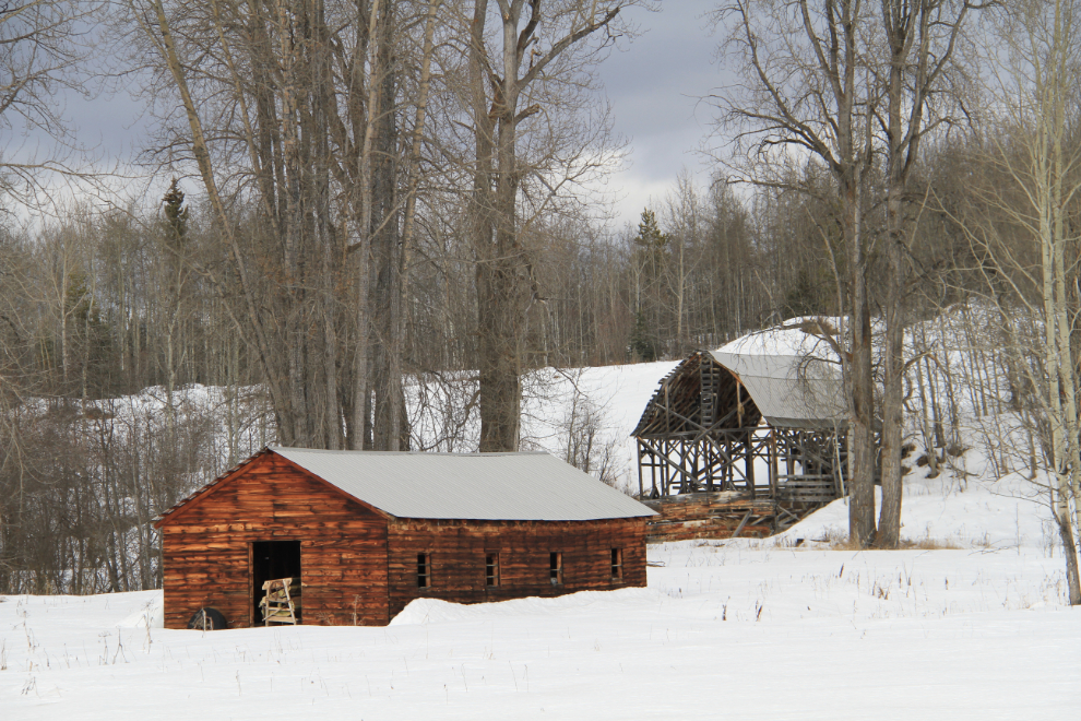
The entire highway, really right from Tete Jaune Cache west, is a gem for anyone who likes old farms and ranches. If there isn’t yet a book of photos of some of these places, there should be. No, I’m not offering 🙂
By far the most expensive fuel I saw along the Yellowhead was at this place. I guess the extra 25 cents per liter is to pay for the renovations they did. Okay… 🙂
There are a couple of particularly good views to the west along the highway. It really is lovely country in any season, with rolling hills and lakes everywhere.
I seldom go by Eddy Park at Telkwa without stopping. It just has a good vibe for me.
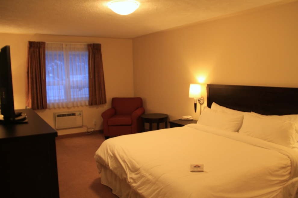
On arriving in Smithers, I went to the Chamber of Commerce office, which was closed but where accommodations listings in the window made it easy to find what I wanted. I chose the newest hotel in town, the Sunshine Inn. I had a long chat with the desk clerk, who among other things suggested a dinner venue I’d enjoy. The room was very nice – basic but attractive and spotlessly clean, on the 3rd floor as I asked, with a view of Hudson’s Bay Mountain (or would have if the clouds cleared).
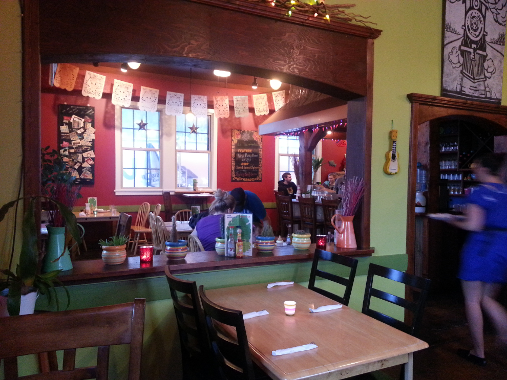
Oh, another heritage railway station! And also the site of the dinner suggestion.
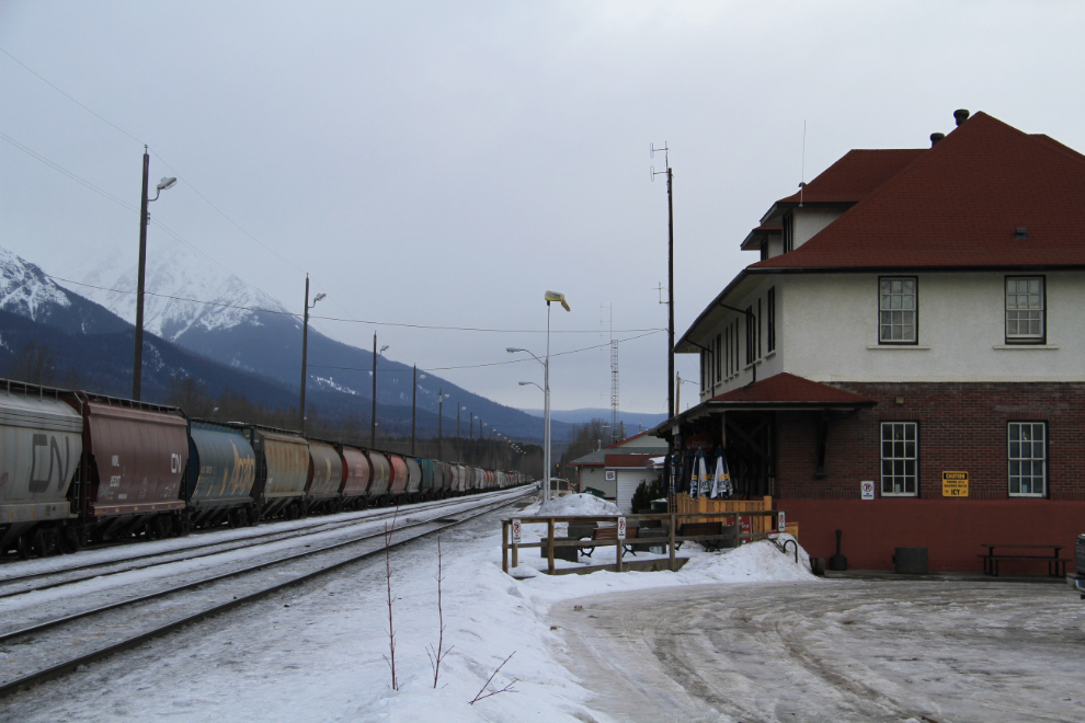
This is the aptly-named Trackside Cantina (permanently closed as of July 26, 2022). Bright and cheerful, with good service and lots of choices on the menu at good prices.
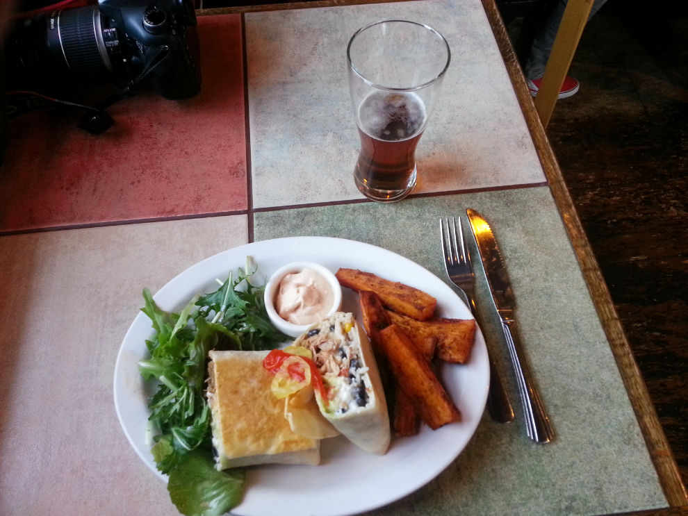
The Ultimate Burrito was the best I’ve ever had, though I admit to not being an expert on Mexican food. The Adobe Pie dessert, may have been even better, though 🙂 When I left I felt like I wouldn’t need to eat for a couple of days.
After putting on over 900 km since my 05:00 wakeup I went to bed early, planning to explore Smithers in the morning after talking to the folks at tourism, then make the easy drive to Stewart, where I had reservations at the lovely Ripley Creek Inn for the night. Ah yes, the best laid plans…